A hike along the Hornstrandir peninsula in Iceland will blow your mind © Jan Jerman/Shutterstock
Hiking is about so much more than exercise, pleasant scenery or getting from A to B.
Putting one foot in front of the other for hours, days or even weeks on end creates a special sense of connection to a place and its landscapes.
At Lonely Planet, we’ve chronicled the world’s most unforgettable hiking journeys in our Epic Hikes series, covering Epic Hikes of the World, Epic Hikes of the Americas, Epic Hikes of Europe and Epic Hikes of Australia & New Zealand. In case you haven’t noticed, we love an epic journey, and this selection of 12 globe-spanning hikes should get you in the mood to dust off those hiking boots and hit a trail – wherever you find yourself on the globe.

Hornstrandir, Iceland
Iceland at its best
Start/end at Bolungarvík or Ísafjörður; variable distance; more info
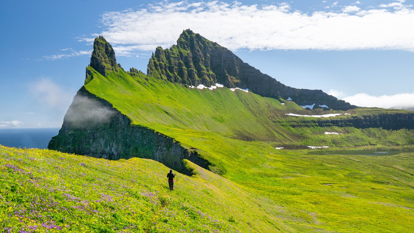
If it weren’t so hard to get to, the protected reserve of Hornstrandir would be Iceland’s most popular hiking expanse. Like little lobster claws nipping at the Arctic Circle, the northernmost peninsulas of Iceland’s Westfjords are brutally lonely – save for colonies of cawing guillemots and the occasional Arctic fox. In summer (early July to mid-August) the preserve is blanketed in a glittering green carpet as travelers walk from cairn to cairn. For the full experience, take the ferry from the townships of Bolungarvík or Ísafjörður up to the glacially carved fjord Veiðileysufjörður, and spend four or five days hiking up to Hornvík and the bird cliffs at Hornbjarg before venturing down the mountain pass to Hloduvík and on to the cluster of abandoned cottages at Hesteyri to wait for the return ferry.

Cyprus, from coast to coast
A coastal journey
Start at Cape Greco, finish at Akamas Peninsula; 250km (155 miles); more info
Forming part of the much longer (think 10,000km/6214-mile) European Long Distance Route E4, the Cyprus Coast-to-Coast offers a more digestible slice of adventure – and is the perfect way to take in the best of the country. You can walk in either direction, but going east to west means you start with a sunrise gazing over the Mediterranean Sea at Cape Greco, and end with a blistering sunset on the Akamas Peninsula. The walking takes in yawning bays, harbor towns – replete with freshly caught seafood to snack on along the way – as well as traditional villages. At Troödos National Forest Park, look out for the Cypriot golden oak tree; Mt Olympus stands at the heart of the volcanic center of the Troödos Mountains. Birdlife along the way is a real highlight, as is reaching the lighthouse at the end of this unforgettable hike.
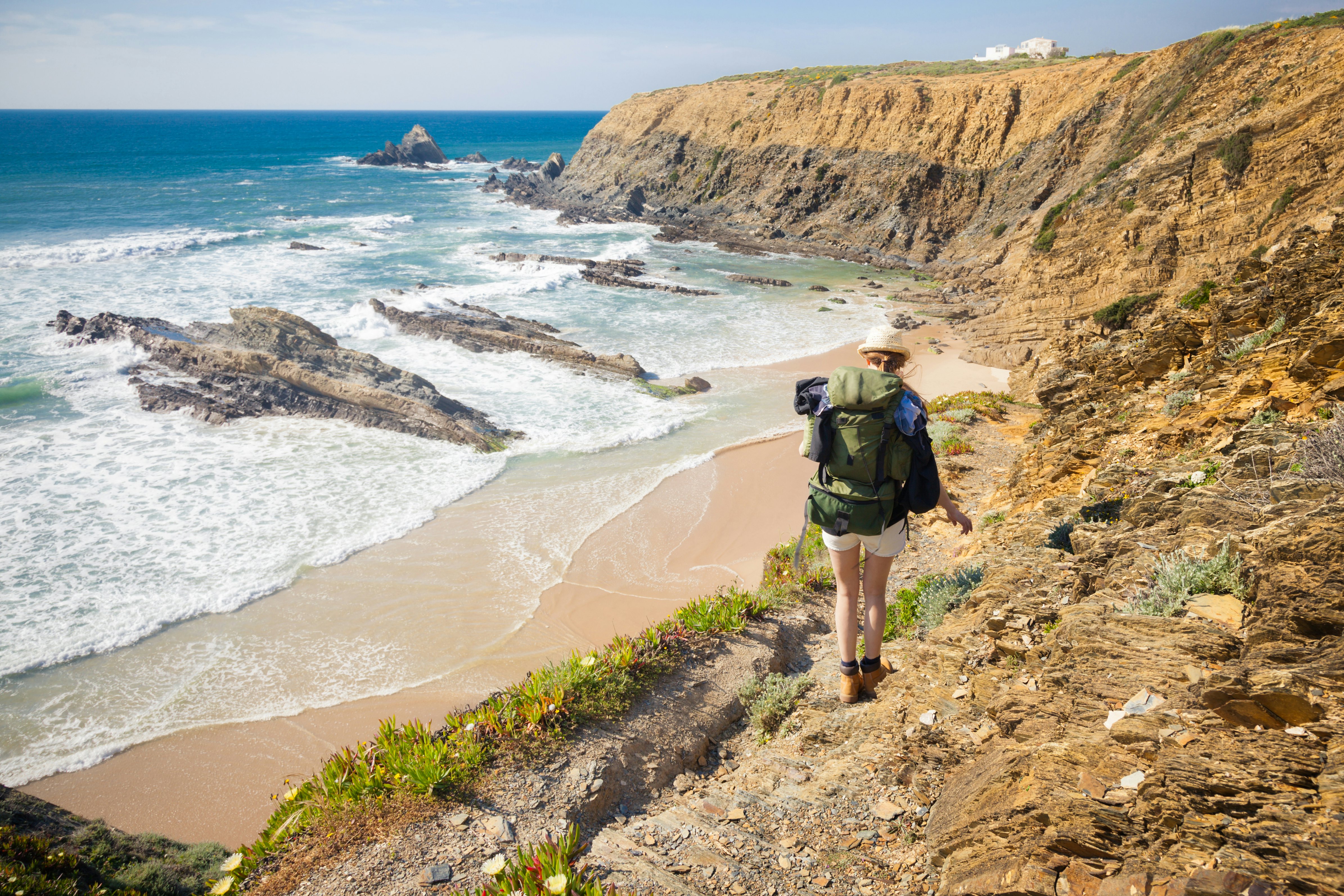
Fisherman’s Trail, Portugal
See the “End of the World”
Start at São Torpes, finish at Lagos; 226km (140 miles); more info
The Atlantic is your constant companion on the Rota Vicentina, a 13-stage trail that teeters along the cliff tops of Portugal’s wild southwest coast. Bookended by the coastal towns of Sines (in the north) and Lagos (in the south), the trail dives straight into the Parque Natural do Sudoeste Alentejano e Costa Vicentina, a nature park protecting the secluded dune-backed beaches, cork-oak forests, jagged, stratified cliffs and rock formations that define this remote, little-visited swathe of the Algarve. Sleepy fishing villages, castle-topped towns and surf resorts dish up a mix of respite, culture and action en route. The highlight? Watching the sunset from the vertiginous cliffs of Cabo de São Vicente, Portugal’s southwesternmost point, nicknamed the “End of the World” by the great explorers that once set sail from its shores.

Laguna de los Tres, Los Glaciares, Argentina
A Patagonian epic
Start/end at El Chaltén; 14 miles (22km); more info
Hikers visiting Patagonia’s Torres del Paine often add on an expedition to the national park of Los Glaciares, which offers equally stunning scenery, not to mention a wealth of day hikes and multi-day treks. This 14-mile (22km) hike is one of the classics, carrying you deep into the mountains of the Fitz Roy range.
The trail’s name – the Lagoon of Three – refers to the trio of mountains that lie in wait at the end of the trail: Cerro Fitz Roy, Aguja Poincenot and Torre, all rising like rocky guardians around the lakeshore. It’s a long but rewarding day hike, with the added bonus that you get to sleep in a proper bed and get a good meal at the end of the day: the town of El Chaltén has plenty of accommodation options for hikers.

Adam’s Peak, Sri Lanka
Stairs leading to sunrise magic
Start/end at Dalhousie; 9 miles (14km) round trip; more info
In world terms, this conical Sri Lankan mountain isn’t all that high at only 7360ft (2243m) – but don’t let its size fool you. It’s a punishing climb, favored by pilgrims who come to see the Sri Pada, or sacred footprint, said to have been left by either Buddha, Shiva or Adam, depending on which religion you happen to belong to.
There are six possible routes to the top, and the one most often used by trekkers is the Hatton Trail, a steep uphill slog involving numerous stairs cut into the mountain. To get there in time for sunrise requires both an early start and a hand from the weather gods: Sri Lanka’s jungly terrain means the peak is (unfortunately) often enveloped in clouds. Yet with luck, at the top you’ll have a memorable view encompassing the island’s west, south and east coasts.

Tateyama-Kamikōchi hike, Japan
A Japanese classic
Start at Murodo, end at Kamikōchi; 40 miles (65km); more info
The classic hike covering the length of Japan’s North Alps takes around seven days in the most spectacular alpine scenery the country has to offer. This hike starts at Murodo (8040ft/2450m), the high point on the enthralling Tateyama-Kurobe Alpine Route, which links the western and eastern sides of the North Alps with a series of cable cars, buses, trolley buses through tunnels and a walk over the Kurobe Dam.
Climb the sacred peak of Tateyama (9890ft/3015m), then head south to climb spear-like Yarigatake (10,430ft/3180m) and Oku-Hotaka-dake (10,470ft/3190m), before dropping into the remote resort village of Kamikōchi (4920ft/1500m). Mountain huts with bedding and meals along the way mean you can take minimal gear; you’ll also find a number of camping areas. In the four days between Tateyama and Yarigatake you’ll likely see fewer people than on one Tokyo rush-hour subway carriage.
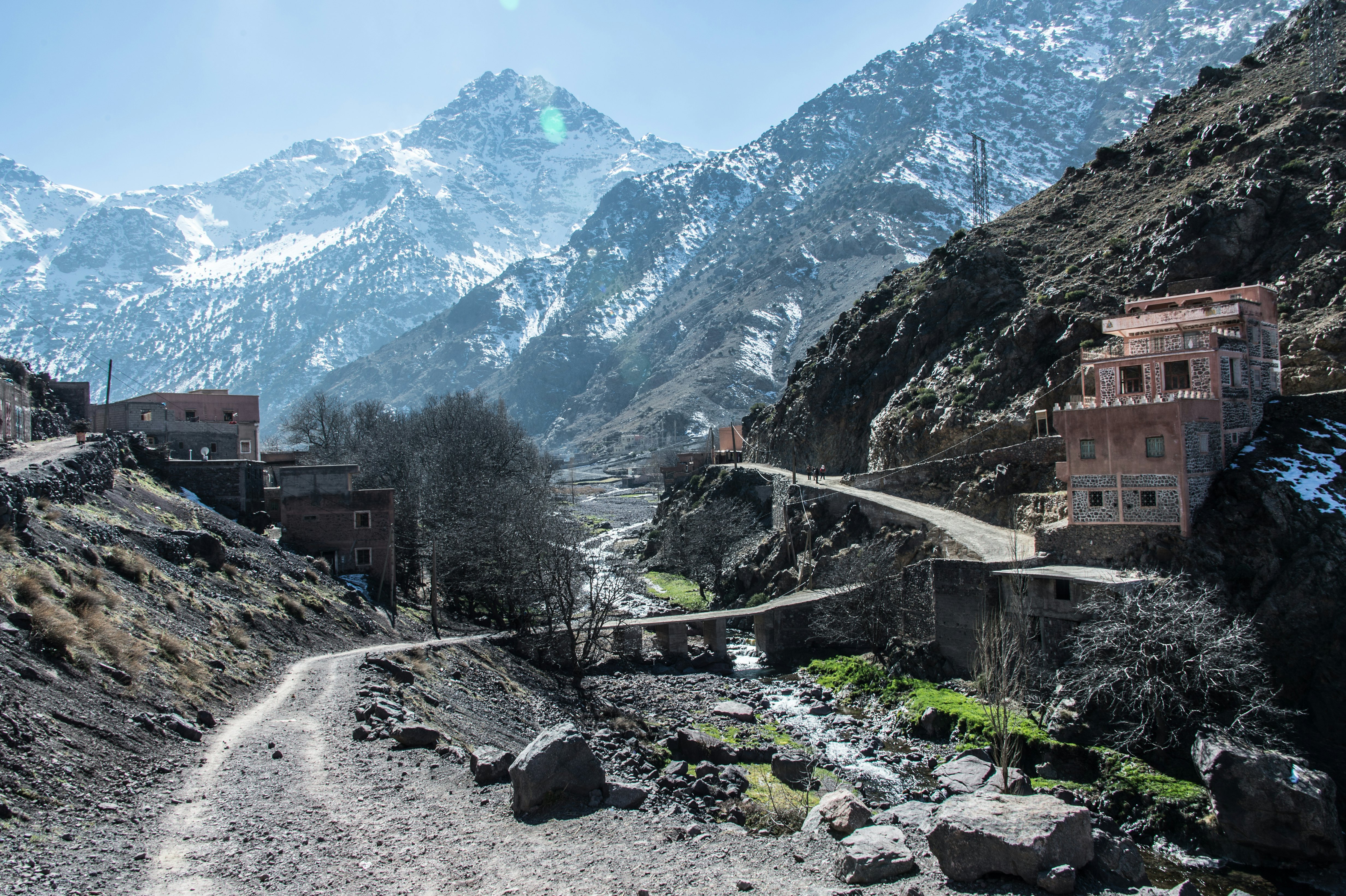
Mt Toubkal, Morocco
Explore North Africa’s highest peak
Start/end at Imlil; 45 miles (72km)
The apex of the Atlas range, 13,671ft (4167m) Mt Toubkal is also the highest peak in all of North Africa. You can get up and down the mountain in two days if summiting is all that matters – though making a longer circuit not only helps with acclimatization, but also offers a greater insight into local Berber culture.
From the Imlil valley, you’ll make a clockwise loop via walnut groves and cherry orchards, high passes and boulder fields, mud-brick houses and neat green terraces, wandering shepherds and wind-wizened juniper trees. The final ascent from the Neltner refuge is a stiff but steady clamber up scree, rewarded by views across a starkly spectacular landscape that the hardy Berber have made their own.

Gorilla tracking in Bwindi, Uganda
A hike in search of incredible creatures
Start/end depends on the gorilla family being tracked, but treks usually depart from park headquarters; various distances; habituation-experience permits cost $1500 per person; more info
The total population of mountain gorillas is tiny: fewer than 900 are believed to survive in the Virunga Mountains straddling DR Congo, Rwanda and Uganda, and in the last country’s Bwindi Impenetrable Forest. Whacking up through the lush, dense vegetation of Bwindi to locate one of the habituated family groups is not for softies: it’s steep, it’s muddy, it’s overgrown, and it can be wet, cold, hot – or all three in one day. Until recently, limited numbers of permits costing $600 per person allowed visitors to spend up to one hour with a family (if you can find them). But you can now join rangers habituating new groups, and enjoy gorilla company for several hours.

Rakiura Track, Stewart Island, New Zealand
A Great Walk to see birdlife
Start at Lee Bay, end at Fern Gully (or the reverse); 20 miles (32 km); more info
Stewart Island’s kiwis (the southern brown kiwi) may be extra large, but that doesn’t mean that they’re any easier to spot. You’ll have to wait until dusk, then head for Ocean Beach in the Glory Cove Scenic Reserve, giving the protected sea lions a wide berth. Since you’ll need a permit to be there after 6pm, it’s worth joining a guided tour.
Yet the Rakiura Great Walk on Stewart Island offers almost-certain sightings of lots of New Zealand birdlife, including kaka parrots, bellbirds, tui, fantails, little blue penguins and an abundance of wading birds. The 20-mile (32 km) circuit starts near the Rakiura National Park visitor center on the east coast of this island, which sits just below the South Island. The walk typically takes three days; you’ll need to book huts in advance.

Arctic Circle Trail, Greenland
An Arctic journey
Start at Kangerlussuaq, finish at Sisimiut; 100 miles (160km); seven to 10 days; more info
At the northern edge of the planet, Greenland’s Arctic Circle Trail reaches across a landscape devoid of towns and cars: this is the domain of reindeer, musk oxen and Arctic foxes. Hikers will find nine free-to-use huts along the way; between each stop, you’ll take in solitary views of serene lakes, rushing streams and domed mountains. While most hikers tackle the trail in the summer to take advantage of the midnight sun, a winter excursion has its own charms: uninterrupted views of the ethereal Northern Lights and the chance to travel by dogsled. If you’d like to add a little extra adventure, continue past Kangerlussuaq to Russell Glacier, which flows from the Greenland ice sheet.
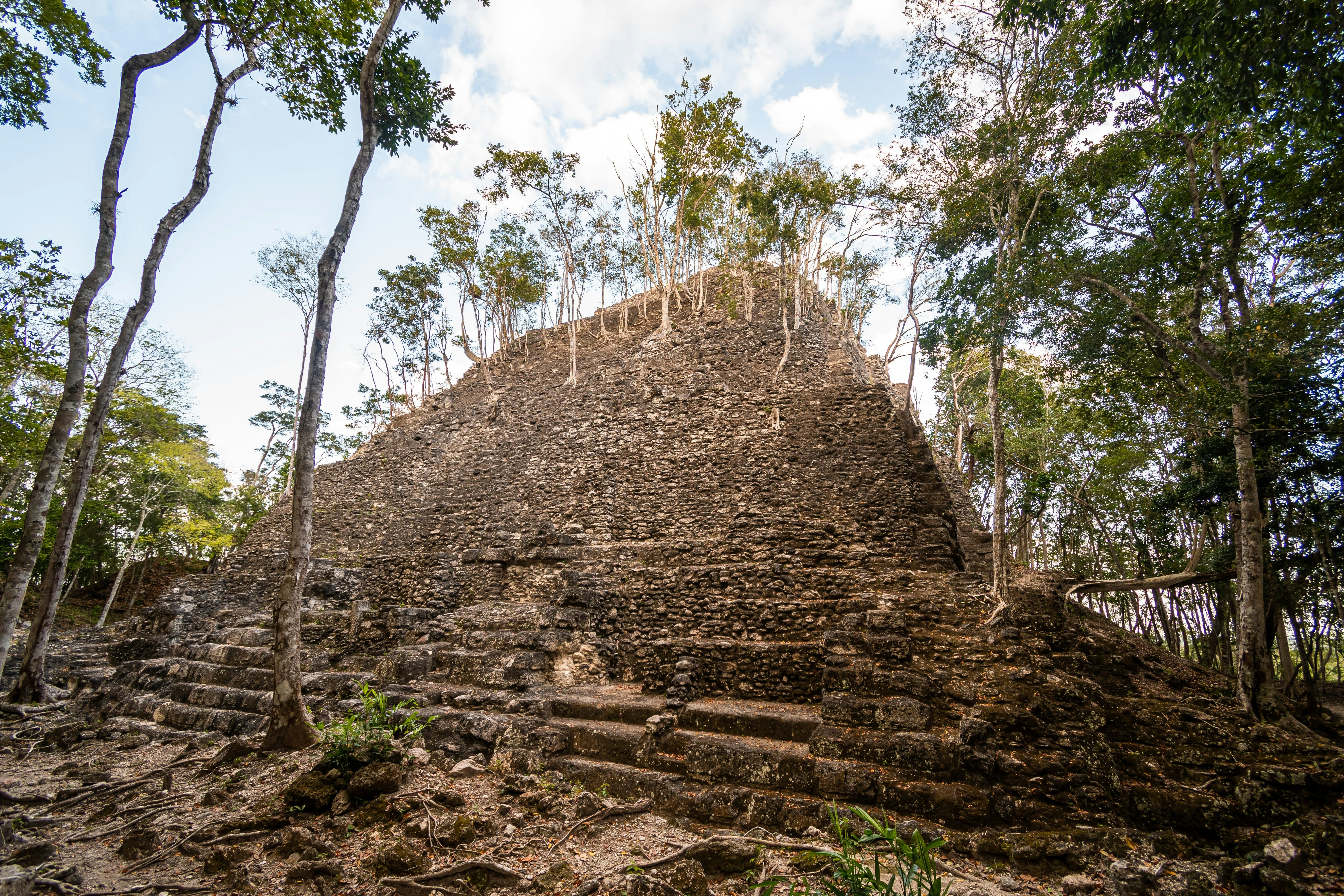
El Mirador, Guatemala
Find ancient history in the jungle
Start/finish at Carmelita; 25 miles (40km); five to six days; guided tours only
The dense jungles in Guatemala are filled with overgrown Mayan ruins and archaeological sites. During a five- or six-day guided trek through this region, hikers will be challenged when tackling the unique rainforest terrain and camping beneath the canopy. Howler monkeys, tropical birds and possibly jaguars can be spotted as hikers explore sites including El Mirador as they learn more about the Maya civilization. While the hiking is relatively flat and the trails are well maintained, the jungle always presents unexpected obstacles to overcome. Hiking can last for upward of eight hours each day, not including climbing up and down all the stone ruins – so only those in excellent shape should attempt this tough but thrilling expedition.

Florida National Scenic Trail, Florida, USA
See Florida’s wild side
Start/end at either Big Cypress National Preserve or Fort Pickens, Gulf Islands National Seashore; 1300 miles (2090km)
Far from fairy-tale castles or friendly mice, explore the alternative Sunshine State: that is, its estimable wild side. The Florida National Scenic Trail (about three-quarters complete) begins in the Panhandle, on the crunchy-white, turquoise-lapped beaches of the Gulf Islands National Seashore near Pensacola. From here, it wiggles east and south, via salt marshes, crystal-clear springs, lakes, prairies, old-growth forests and historic urban areas. It finishes in Big Cypress National Preserve, bordering the Everglades, amid a lush swampland of bright bromeliads and giant ferns. This semi-tropical state is incredibly bio-diverse, and most of the trail is also a wildlife corridor, protecting both common and rare species. Possible sightings include black bears, deer, otters, alligators, gopher tortoises and sea turtles. A plethora of birds, too: the crested caracara and red-cockaded woodpecker are particularly sought-after species.


