Oct 25, 20265 min read
5 Reasons to Visit ZanzibarSponsored by
This article was paid for and produced with AllTrails. Paid content is produced separately from Lonely Planet's editorial coverage. Product availability and terms are subject to change; please verify details directly with service providers.
Jul 6, 2026
24 MIN READ
Contributors
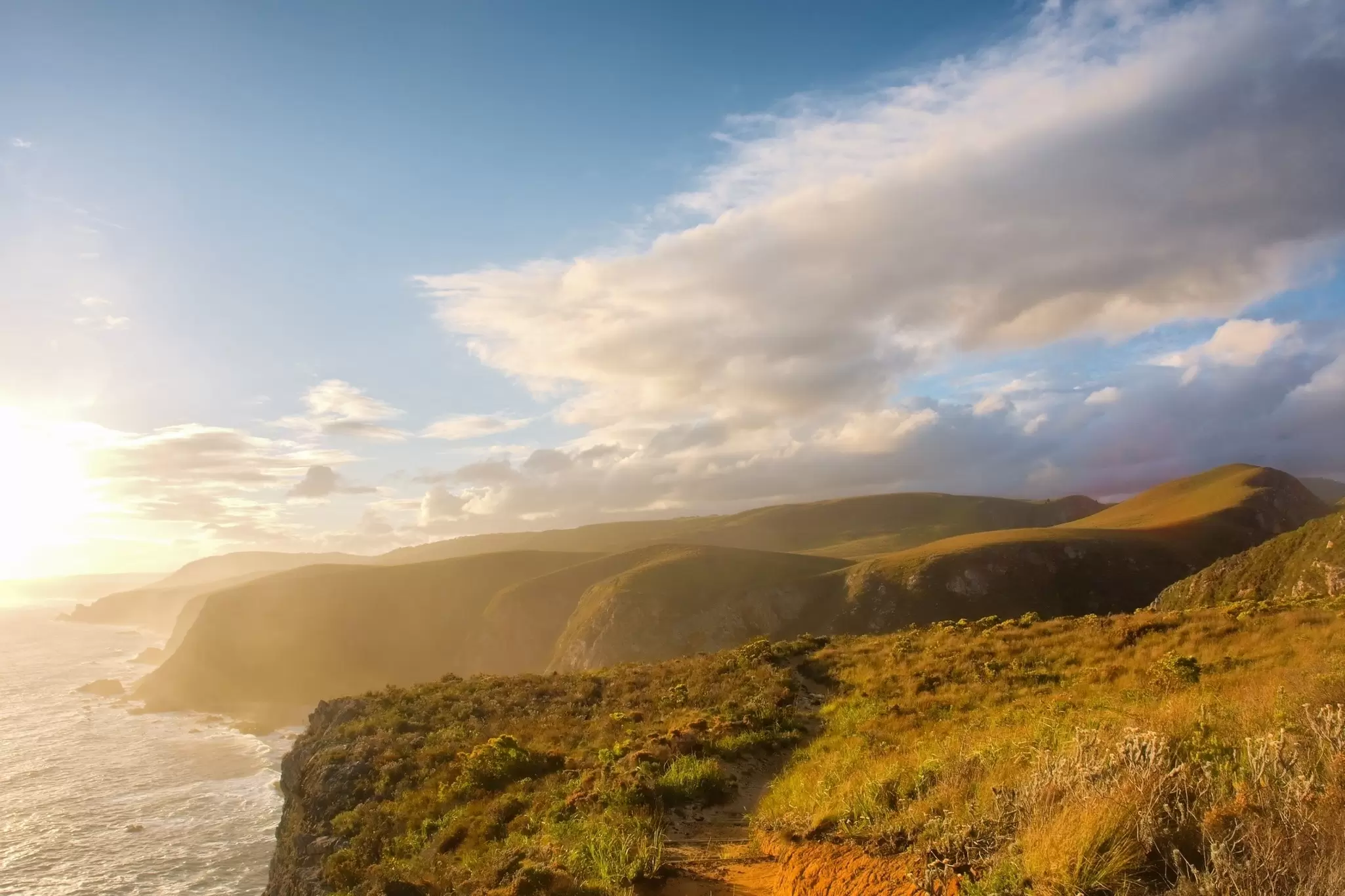
The Otter trail in the Tsitsikamma National Park, Western Cape, South Africa. PhotoSky/Shutterstock
Contributors


Sarah Stocking, Lonely Planet Editors
Highlights
Writer Sarah Stocking rounds up spectacular multi-day treks, from Croatia to Canada.
Head to New Zealand's Routeburn Track or Croatia's Premužić Trail through North Velebit karst.
South Africa's Otter Trail winds along the Tsitsikamma coast through ancient forest for five days.
Alta Via 1 crosses Italy's Dolomites; Canada's West Coast Trail is properly remote.
Recently, I was having coffee with a friend who was just back from France. She was floating. Absolutely, in every way, excited and eager to share every moment of her trip with me. She spent her days hiking outside the small villages in the mountains between Nice and Marseille — every morning a croissant at the local bakery, every evening dinner at a village café and a bed in a sweet inn. She'd open AllTrails each day and let it lead her somewhere new. Then our Director of Content, Brekke Fletcher, came home from a week of walking through the Douro Valley in Portugal. Never having done a big outdoorsy trip before, the experience left her feeling not just more grounded, but capable of anything. I loved hearing about how transcendent it really was.
Now I'm inspired. I can't think of a better way to explore a country than by hiking through it. My kids are getting older, and while they may not be ready for some of these trails yet, I think we're ready to start adding this kind of adventure to our ten-year travel plan — yes, we have one.
These are the trips where the trail shapes the destination rather than the other way around. AllTrails helps you find them — browsing by region, filtering by distance and difficulty, planning every segment down to the water stops. Lonely Planet gets you the rest: where to stock up before you set off, where to sleep at the end of a long day, and where to find the meal your legs have earned.
The hardest part used to be the planning. It isn't anymore.
Multi-day treks like the ones on this list once felt impossible to plan. AllTrails Peak changes that. Designed for backpackers and long-distance hikers, Peak gives you the tools to build, customize and navigate a multi-day route — all in one place.
The brand new route assistant feature allows members to describe their trip and the planning tool will structure it into a day-by-day itinerary, suggesting elevation gains and daily mileage based on the member's preference. While this feature is currently in beta and only available on desktop, the app version is coming soon.
In addition to this planning feature, Peak also allows members to map a full route in segments, adding campsites and tracking daily mileage so that every part of the trip is accounted for before you set off. With the waypoints feature (maybe my favorite) members can drop markers for water sources, resupply points and bail-out options, so the map you download reflects an actual plan. And I always need to know where the bail-out point is.
For safety and true on-trail knowledge, AllTrails offers advanced map layers so members can toggle slope angle overlays and US public lands layers to better understand the terrain.
All routes can be saved, downloaded for offline navigation, and printed as a backup for when cell service disappears — which, on trails like these, it will. That's the whole point.
Length: 57km
Time commitment: 3 days
Difficulty: Moderate
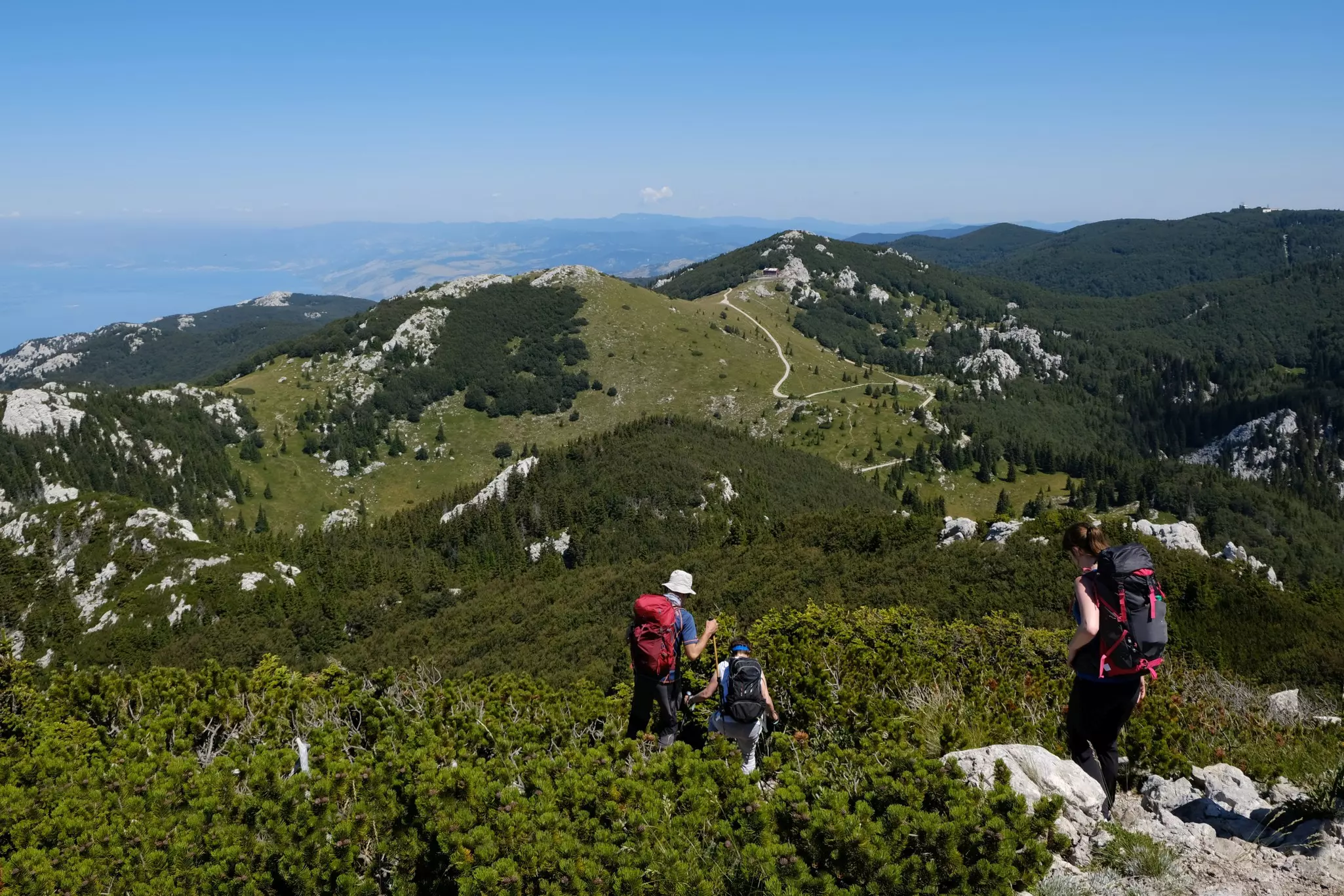
This trail through Croatia's North Velebit Mountains is named for its creator, Ante Premužić, and it is a masterpiece of trail-building. Nearly a century ago, a relatively easy path – with no big ascents or descents – was blazed through rugged, difficult, otherwise inaccessible karst terrain. To make it, forestry engineer and keen mountaineer Premužić employed the suhozid (dry-stone wall) technique, a skill bestowed with Intangible Cultural Heritage status by UNESCO. It took Premužić and his team four years to create the trail, which finally opened in 1933.
The route, much of which runs through the Northern Velebit National Park, has weathered the rigors of time and use to become a Croatian classic, packing a huge variety into its compact length. Intricate stone pathways weave between old shepherds' huts and mighty rock formations, cross wildflower meadows, and enter forests of beech and fir, holly, fern, saxifrage and speedwell. These mountains are rich in plant-life, home to more than 950 species and subspecies; on day one, you'll pass the Velebit Botanical Garden, a great spot to see a host of endemics. And, this being a coastal mountain range, there are panoramic views across the sparkling Adriatic, too.
AllTrails' community rates the first segment alone at 4.9 stars – one hiker summed it up simply: "something that should be done once in a lifetime." Late spring and autumn bring mild, pleasant hiking conditions. In September, expect temperatures ranging from 15°C to 25°C, plus snow-free trails, and balmy waters for post-walk soaks.
AllTrails tip: The trail is well-maintained with no difficult climbs, making it suitable for hikers of varying experience. Buy your national park ticket at the Babić Siča entrance or Alan Hut before setting out, and carry plenty of water – sources are limited between overnight stops. The best time to visit is April through October.
Getting there and away: Fly into the Zadar International Airport and get around the region via the connected bus network.
Where to recover: The beautiful old town of Zadar has both the most spectacular sunsets in Croatia as well as a bustling Roman old town populated by a thriving local community. With a nascent gastronomy scene, history at your fingertips and sailing companies just waiting to whisk you away to the islands of the straits after your hike.
Length: 32km
Time commitment: 2 to 4 days
Difficulty: Moderate
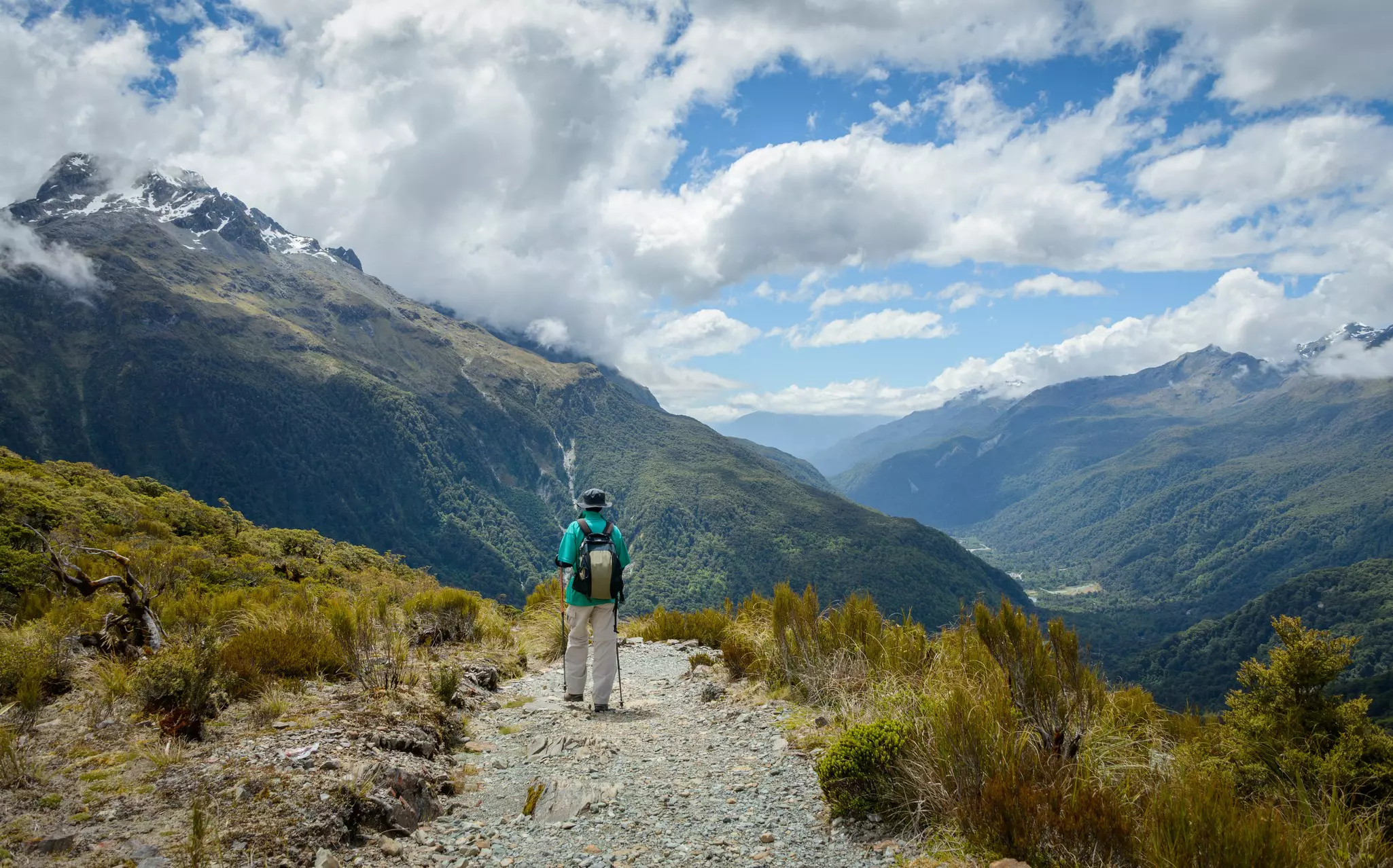
What makes one hike better than another? Is it widescreen views, well-maintained paths, rich cultural interactions, varied wildlife encounters, a challenging summit, and unforgettable food? Or maybe it's simply reputation and bragging rights?
If the idea of ranking treks seems faintly absurd, there's no denying that New Zealand's 11 Great Walks deserve the label. Certainly, that's the opinion of the avid trampers who rush to snag hen's-teeth places in huts and campsites as soon as bookings open (usually in late May) for the November–April Great Walks Season. At the start of that season, forests are lush and mountainsides green, summits are still snowcapped, and paths, campsites and huts are a little less busy than at the height of summer.
The Routeburn Track is one of the most aspirational Great Walks, an alpine epic that – appropriately enough – straddles Mt Aspiring and Fiordland National Parks in the far southwest of the South Island. True, it's not so very long – in fact, a fit hiker could complete it in one long day – but its varied ecosystems, rock formations and grand mountain vistas mean that taking it slowly, and tackling the trek over three days (with time for worthwhile side trips to nearby peaks and cascades, check your AllTrails app for recommendations), is the way to go. The trail can be hiked in either direction; the views down towards Lake Mackenzie from Harris Saddle are arguably the most impressive, though the Routeburn is sensational whichever way you walk it. AllTrails' community agrees; with a 4.9-star rating from nearly 1000 reviews, it is, as one hiker put it, "one of my favourite Great Walks in Aotearoa – can't beat it."
AllTrails tip: Bookings are required in advance for all huts and campsites during the Great Walks season — reservations open in late May and sell out fast, so set a reminder. The track can be walked in either direction; most guided tours go south to north, so going the opposite way means fewer crowds. Hiking poles are useful on the rocky final section before The Divide.
Getting there and away: Fly in and out of Queenstown. You can either rest from travel there or head to Te Anau, the frontier-esque gateway town to Fjordland National Park. If you spend time in Te Anau don't miss taking a boat ride with RealNZ to see the glowworm grotto in the 12,000 year old caves on the western side of Lake Te Anau.
Need to know: Most hikers book a transport package that handles your transport to The Divide and then back to Queensland from Glenorchy where you'll finish. Glenorchy is about 45 minutes from Queenstown on a stunning lakeside road. We recommend getting into contact with the Queenstown i-SITE Information Centre. Its a great hub for help if you're looking for some deep guidance.
Where to recover: While Queenstown has everything you might need. You might enjoy recovering in Glenorchy. Surrounded by magestic mountains at the head of Lake Wakatipu Glenorchy is ground zero for quintessential Kiwi landscapes. But even if you just want a wonderful meal after your long trek stop in at the Kinloch Lodge Restaurant for wholesome dishes with an emphasis on garden-to-plate dining where you can eat on the deck. In Glenorchy or Te Anau you can use the AllTrails app to keep exploring this region. It is of course the setting for the Lord of the Rings movies, might as well get to know Middle Earth while you're there.
Length: 45km
Time commitment: 5 days
Difficulty: Moderate
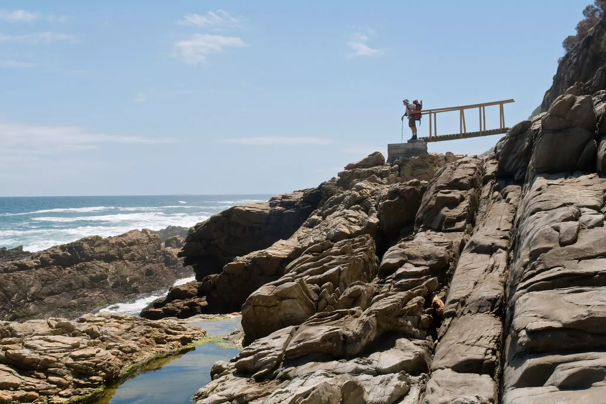
Ancient indigenous forests, dramatic coastal cliffs and pristine river crossings define the Otter Trail – South Africa's most iconic multi-day hike and one of the oldest in the country. This world-renowned route winds along the rugged Tsitsikamma coastline within the Garden Route National Park, stretching from the Storms River Mouth to the quiet shores of Nature's Valley. It is a journey packed with raw natural beauty where the crashing waves of the Indian Ocean meet the emerald canopy of the forest, creating a landscape utterly unlike anywhere else on the African continent.
Each day brings something new: rocky coastal scrambles, river crossings that demand careful timing with the tides, and stretches of silent Afromontane forest where Knysna loeries flash crimson through the canopy. The highlight for most hikers is the Bloukrans River crossing on day four – a challenge that depends heavily on tides and teamwork, and which delivers a surge of satisfaction when done right. As AllTrails hikers put it: you'll end each day tired, salty and happy, reminded of how wild and beautiful South Africa truly is. The Otter Trail holds a 4.7-star rating on AllTrails, making it the highest-rated backpacking trail in the Garden Route.
AllTrails tip: Due to the physical demands of the trail, SANParks enforces age restrictions (minimum 12, maximum 65) and limits hikers to 12 per day – permits sell out up to a year in advance. The Bloukrans River crossing on day four is tide-dependent and is the highlight for most hikers; plan your timing carefully. Each of the five daily stages is mapped on AllTrails.
Getting there and away: Fly into George and make your way to Nature's Valley. A car rental makes getting to Nature's Valley and exploring beyond easier since there is no public transport until Storms River. However, most Nature's Valley accommodations can help with pick ups and once you're in town, you can easily get around and reach the major trailheads on foot.
Need to know: You can stock up on groceries and provisions at the Nature's Valley Trading Store which isn't far from the beach. Be prepared to get your feet wet on the river crossings. This region is full of absolutely stunning hikes. The AllTrails app can help you with shorter, day hikes to keep exploring before or after your trek.
Where to recover: Nature's Valley is in the borders of the Garden Route National Park's Tsitsikamma Section. This little resort village is in one of the most beautiful areas of the route. Book nights at the Nature's Valley Bed & Breakfast before and after the trek. Its the perfect base before and after the hike. If you want to experience the gorgeous nature from a different vantage point, rent a canoe from Rest Camp and paddle from there to the mouth of the Groot River.
Length: 120km
Time commitment: 8 to 12 days
Difficulty: Moderate to challenging
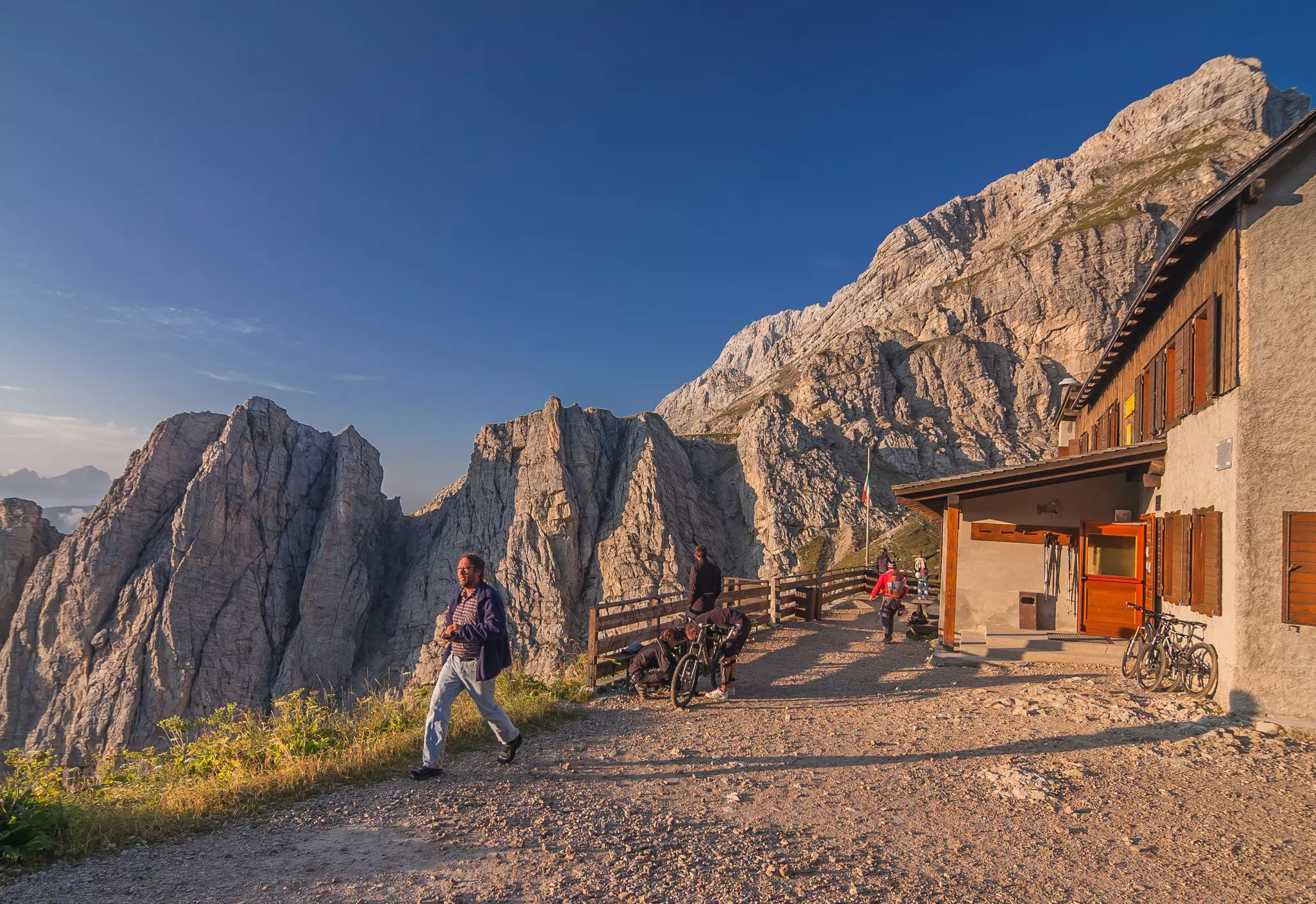
Alta Via 1 is very well named. It's an alta via – "high road" – both literally and metaphorically, offering soul-lifting trekking through the dazzling Dolomites. It's also an appropriate "number one" hike: rugged but not frighteningly tough, it's a good option for Alpine first-timers.
Over the course of ten or so days, the Alta Via 1 yields a bit of everything. There are dramatic ramparts of limestone and dolomitic rock, passes reaching up to 2752m, meadows festooned with wildflowers, welcoming rifugi (mountain huts) dishing up hearty portions of fine food and bonhomie, and even thrilling (but not too scary) sections where metal handrails help you negotiate the wild terrain.
There's also a wealth of history. During WWI, the fortress-like Dolomites became a bloody if beautiful front line where Italian and Austro-Hungarian forces battled for four years, fighting both each other and the forces of Mother Nature. In the process, they constructed via ferrata (iron roads; networks of fixed lines, ladders and steps that enabled troops to clamber across rock faces); they also built gun emplacements and billets; dug long, dark tunnels; and burrowed miles of trenches. The remains of these high-altitude skirmishes can still be seen along the trail – "stunning WW1 bunkers" appear again and again in AllTrails reviews alongside breathless descriptions of the peaks. Alpine summer, from mid-June to late September, is really the only time to walk this classic route.
AllTrails tip: The full route consists of 12 segments, all individually mapped on AllTrails, connecting Lake Braies to Belluno. Rifugi along the way serve hearty meals for lunch and dinner, but bookings are essential – the most popular huts fill months ahead in peak season. If using trekking poles, add rubber caps to avoid damaging the boardwalks.
Getting there and away: This is a tricky one to get to, but fly into Innsbruck — it's the closest major airport to the trailhead, about 2 hours by car or 4–5 hours by public transport. From Innsbruck, take the train to Villabassa, then hop on Bus 442 directly to Lago di Braies. The bus runs seasonally, June 20 to September 20, so your timing is set.
One important note on parking: if you're renting a car, don't drive to the lake. Park near Belluno at the finish line instead and bus to the start — you'll be grateful when you step off the trail 10 days later and your car is right there.
The trail ends at the La Pissa bus stop — unglamorous, but a quick 26-minute ride brings you into Belluno, where trains connect south to Venice or north back toward Cortina.
Need to know: This region is full of outdoor adventures and incredibly fun to explore if you have the time. Create a roadtrip through the Northern Dolomites and use the AllTrails app to find whichever trail suites your daily mood.
Where to recover: Head straight to Cortina. Italy's most celebrated mountain resort sits just an hour from Belluno and feels like a different world — stone church spires, cascading piazzas, and the Dolomites framing every view. Splurge on a gondola ride on the Cortina Skyline (€23 adult), eat well, and let your legs recover in style before heading onward. Treat yourself to a night (or two) at Rifugio Ospitale, a 10-minute drive from Cortina through shaded forest. Stylish and spacious, it has the spectacular mountain views your legs earned — without the resort noise. Have dinner there too; the cured charcuterie and canederli are highlights.
Length: 75km
Time commitment: 5 to 7 days
Difficulty: Challenging
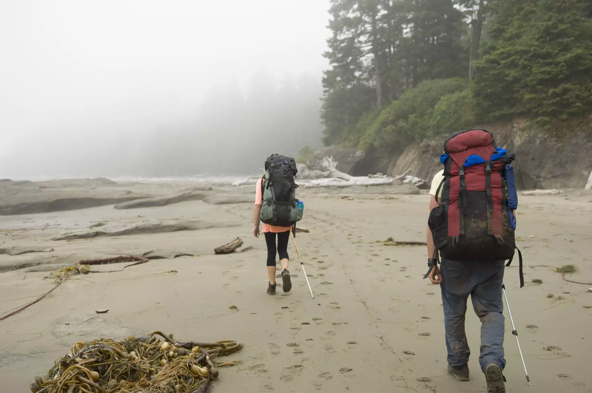
Don't underestimate the West Coast Trail. It's only 75km long, with relatively low elevation gain, but it's challenging. Tracing some of Vancouver Island's most ravishing Pacific-smashed shores, it's properly remote, with no settlements, shelters, shops or eateries (save for Nitinaht's beloved floating restaurant, Crabshack). There are also more than 100 ladders to climb and descend, angry rivers to ford, deep gullies to cross, fallen trees to hoist over, boulders to scramble, mud to slog through, and bears to avoid. But the rewards include a wonderland of old-growth rainforest, untouched beaches, caves, coves, cliffs, superlative sunsets and chances to spot sea lions, otters and whales.
The coastline between Pachena Bay and Gordon River lies within the traditional territories of Huu-ay-aht, Ditidaht, and Pacheedaht First Nations peoples, who traveled and traded here for millennia. Then, from the 19th century, foreign sailing ships started to arrive – and flounder in the region's treacherous currents, storms and fog, earning the "Graveyard of the Pacific" nickname. In response, lighthouses were built, a telegraph line constructed, and the Dominion Lifesaving Trail forged to enable rescuers to aid those wrecked offshore. It fell out of use but, in 1973, was included in the newly minted Pacific Rim National Park Reserve and became the West Coast Trail.
AllTrails hikers are unequivocal: this is "an amazing once-in-a-lifetime kind of hike – hard, but so worth it." The trail is open only from May 1 to September 30, with just 75 hikers permitted to start each day.
AllTrails tip: Reservations for the upcoming season open in January and sell out quickly; attending a pre-hike orientation briefing is mandatory for all hikers. The terrain is famously demanding: slippery boardwalks, deep mud, beach boulders and over 100 ladders require careful footing. Key highlights include the iconic Tsusiat Falls and the unique experience of crossing rivers via cable car.
Getting there and away: Fly into Victoria International Airport with a connection via Vancouver. Alternatively, hop a ferry from Vancouver for a 90-minute sailing to Victoria and then make your way to Sooke, the closest community to the trail head. A rental car is easiest to explore the region beyond Victoria but there are seasonal shuttles from Sooke to the Port Renfew Trailheadwhere the hike begins.
Need to know: All of Vancouver Island is worth roadtripping around. Tofino is a little surf town near the Pacific Rim National park where you can book surf lessons or rent a paddleboard to get out on the water in the quieter bays. For day hikes and other outdoor adventures the AllTrails app is a perfect companion to keep adding trails to your list.
Where to recover: Head back to Victoria, a stunning city filled with gardens and opportunities for high tea and spa days. The Fairmont Empress Hotel is known as Canada's Luxury Castle and overlooks Inner Harbor. Don't miss the famous afternoon tea.
Length: 46km
Time commitment: 4 days
Difficulty: Moderate
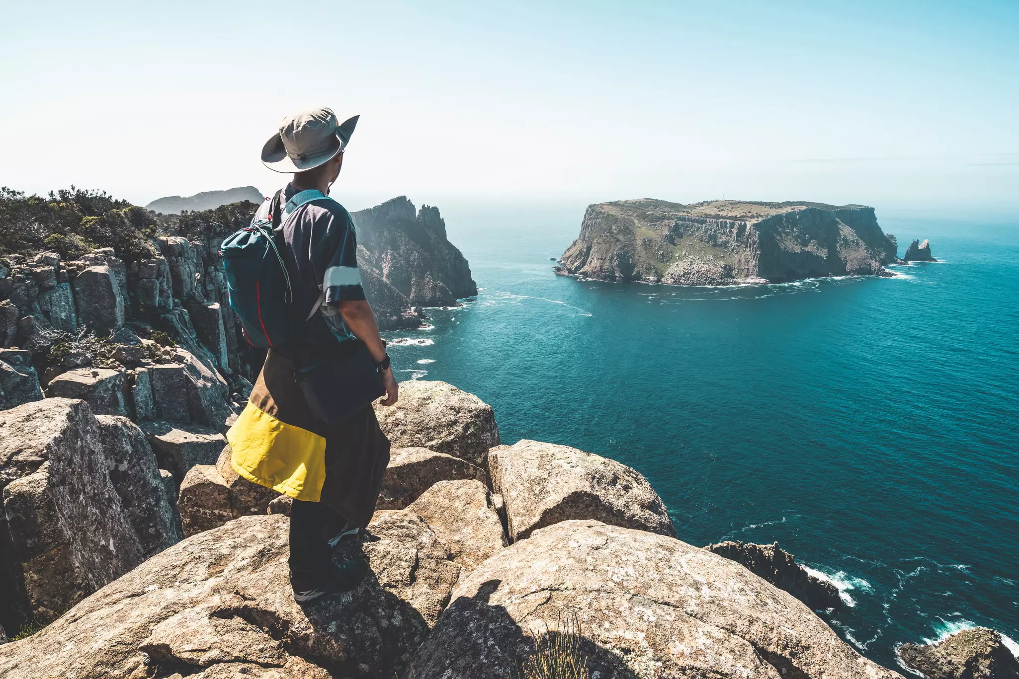
You'll board the boat at Port Arthur for an eco-cruise across Port Arthur Bay, spotting cormorants and white-bellied sea eagles on an amuse-bouche for one of the island's most accessible microadventures.
Taking in two dramatic capes, the Three Capes Track is a moderate hike that provides a taster menu of wild Tasmania: cliffs, forest, beaches and all the animals they harbor. Hikers stay in simple cabins and pass a series of "encounters" – alfresco sculptures that evoke the natural and historic aspects of the Tasman Peninsula. This gnarled southeastern promontory is exposed to the wildest wind and waves, so many tackle the track in summer (December through February). But autumn offers ample benefits: orchids flower and whales migrate past.
From Denmans Cove, the first leg is a gentle 4km intro, delving into dense gum forest and ending at Surveyors Cabin, for views across to Cape Raoul and possible sightings of grazing Bennett's wallabies. Day two kicks off with steep stone steps climbing Arthurs Peak, rewarded with spectacular vistas along the coast to the main destination on day three: Cape Pillar – an awesomely end-of-the-world meeting of rock, sky and roaring sea that AllTrails hikers consistently describe as the trip's unforgettable crescendo.
AllTrails tip: There are limited slots available each day, so book in advance via the Three Capes Track website. Hikers must stay one night at each designated overnight stop, and cabins are well-equipped with mattresses, gas stoves, heating and drinking water – no tent or sleeping mat required, which keeps pack weight down significantly. If using trekking poles, add rubber cups to the ends to protect the boardwalks.
Getting there and away: Fly into Hobart. For hikers, skip the rental car — Pennicott Wilderness Journeys runs a dedicated shuttle, to be booked in advance, between Hobart and Port Arthur timed around the Three Capes Track itinerary, with airport pickup available. The return shuttle connects straight from Fortescue Bay at the end of the trek. If you want a car for exploring the peninsula before or after, it's an easy hour's drive from Hobart.
Need to know: The region around Fortescue Bay is spectacular and there are many ways to explore. The AllTrails app can suggest other experiences to round out the trip. You should also book a three-hour cruise with Pennicott from Port Arthur to Eaglehawk Neck, taking in Cape Hauy, Australia's tallest sea cliffs, the entire coastline you just walked.
Where to recover: Don't rush back to Hobart. Book a night or two at Nautilus House — an off-grid timber sanctuary shaped like a nautilus shell, set on 20 hectares at Eaglehawk Neck. It's the perfect place to decompress after four days on the trail. If you'd rather stay closer to the water with dinner sorted, Stewarts Bay Lodge offers self-contained log cabins with bush or water views and an on-site restaurant.
Length: 70km core Nakahechi route
Time commitment: 4 to 7 days
Difficulty: Moderate
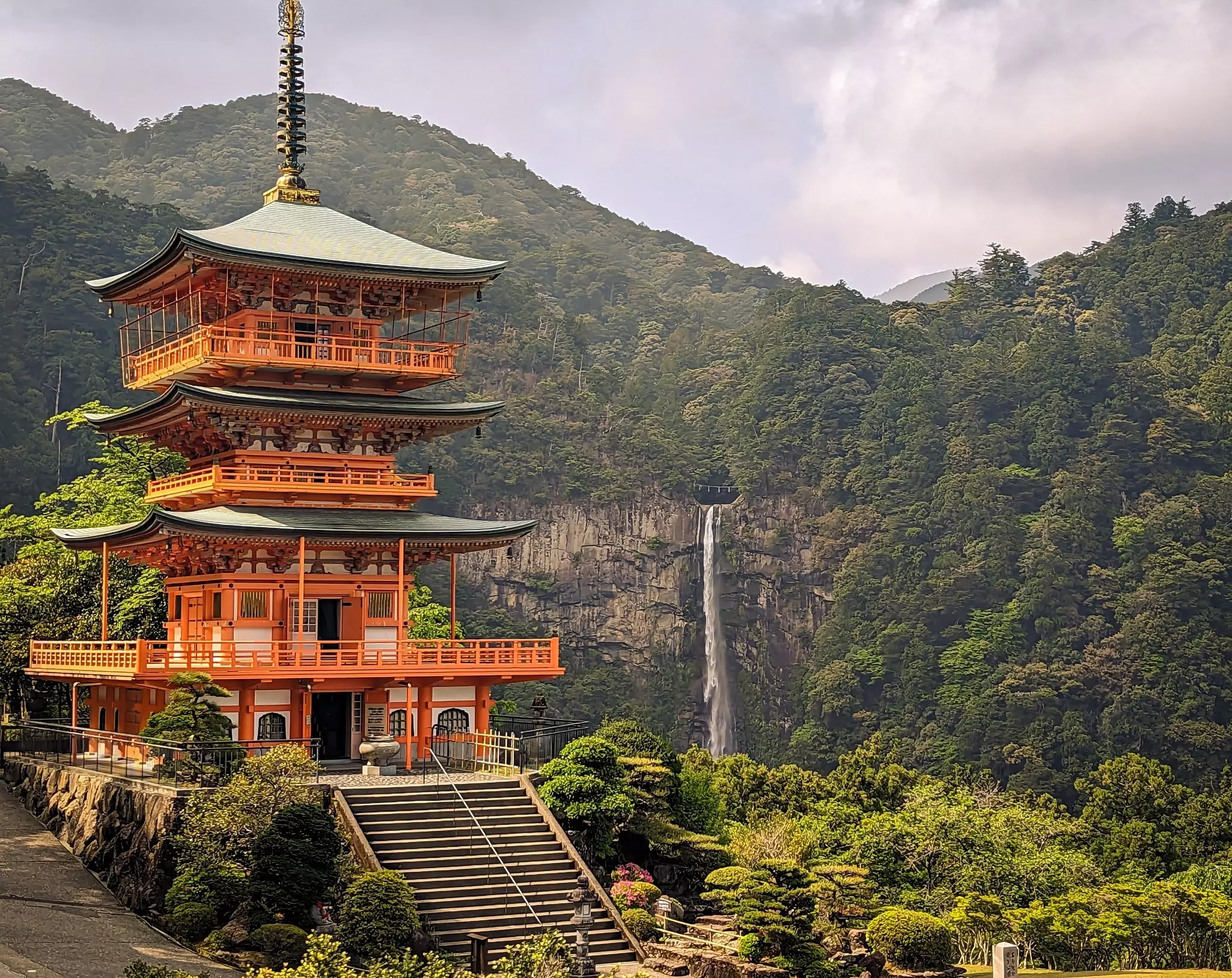
The Kumano Kodō is one of only two pilgrimage routes in the world designated a UNESCO World Heritage Site – the other being the Camino de Santiago. Pilgrims have been walking these ancient stone-paved paths through the Kii Peninsula's cedar and cypress forests for over a thousand years, bound for the three Grand Shrines of Kumano. Walking them today, the sense of continuity is palpable – every moss-covered step feels shared with the millions who came before.
The most popular of the several routes is the Nakahechi, known as the Imperial Route. With its start a short bus ride from Kii-Tanabe and its end close to Shingu, it's accessible, clearly waymarked and achievable for hikers of moderate fitness. The trail links a succession of grand shrines and remote mountain settlements where hikers can soak in onsen (natural hot springs) and sample local specialities – shishi-nabe (wild boar hotpot), river fish and mehari sushi. Each evening ends in a traditional minshuku or ryokan, where the hospitality is as restorative as the walking.
October is the finest month: autumn maples blaze crimson above the stone-paved paths, temple incense drifts through the forest, and the arrival at the Kumano Hongū Taisha feels like one of hiking's great emotional finales. AllTrails hikers – who have mapped each stage of the Nakahechi in detail – describe it as a trail that leaves you "discovering how ancient shrines and temples have shaped Japan's spiritual practices over centuries." Few hikes anywhere in the world offer that.
AllTrails tip: The Nakahechi route is clearly waymarked and made up of mostly well-maintained stone-paved paths – no permits are required, but lodging reservations at minshuku and ryokan guesthouses are essential, particularly in October. Camping is strictly prohibited along the trail. Each stage is individually mapped on AllTrails, making navigation straightforward.
Getting there and away: Most travelers access the Kumano Kodō via Kii-Tanabe Station on the western side of the peninsula, and finish their trek in Nachi-Katsuura (Kii-Katsuura Station) or Shingū on the eastern side. All are connected to Osaka via the JR Kinokuni line, which runs along the rim of the peninsula. From Kii-Tanabe Station, a 40-minute bus ride takes you to the trailhead at Takijiri-ōji. Frequent bus services also travel through the mountains inside the peninsula, linking together major stops along the Nakahechi route.
Need to know: Spring and autumn are the prettiest times to walk; rainy season is the worst due to slippery paths. Buses and riverboats are available along the route so it won't necessarily take the full six days to complete. The Tourist Information Center in Tanabe is a wealth of information once you're on the ground.
Where to recover: Don't rush to get back to Osaka. A short bus ride from the trail's midpoint at Hongū, the onsen villages of Yunomine and Kawayu have been soothing the tired limbs of pilgrims for centuries — soak in Tsubo-yu, a tiny bubbling pool hewn from natural rock, or in winter sink into Kawayu's Sennin Buro, a giant riverside rotemburo (outdoor bath) bulldozed from the geothermally heated riverbanks. For a bed, Fujiya is a well-regarded ryokan by the Kawayu river with tasteful rooms, river views and some en-suite rotemburo, while Ryokan Yoshinoya sits next to Tsuboyu Onsen with a rotemburo and pretty mountain views.
Length: 74km
Time commitment: Four to five days
Difficulty: Moderate
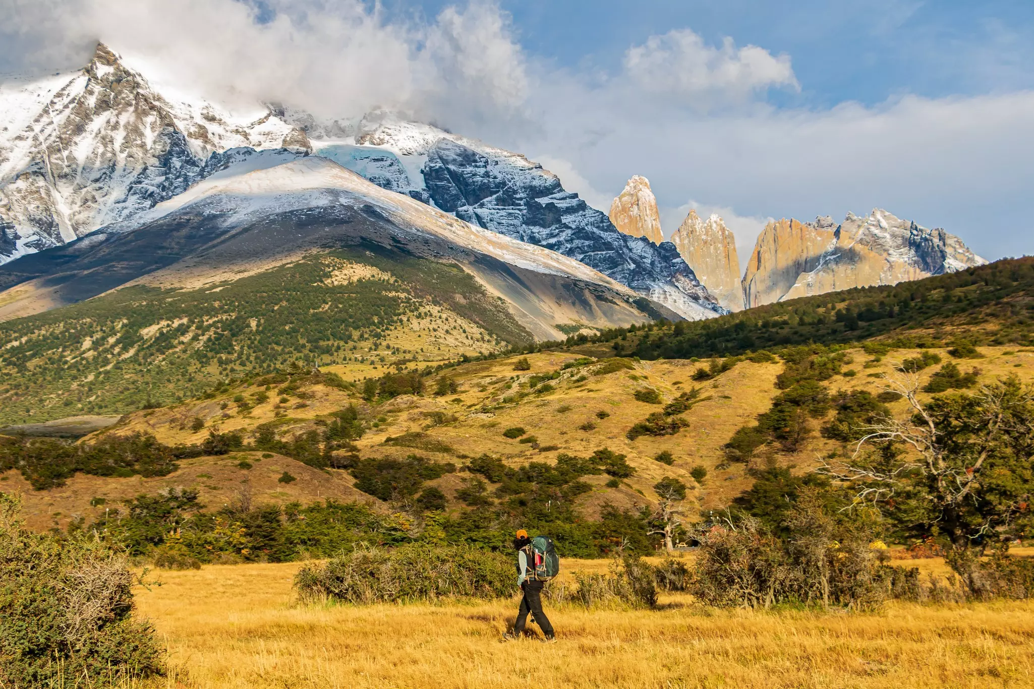
Patagonia isn't quite the end of the Earth — but boy, does it feel a long way from anywhere. And the epic rock pinnacles, glaciers and glimmering lakes and lagoons of Parque Nacional Torres del Paine are suitably out of this world. They form the backdrop to one of the world's finest short treks: the W.
That letter reflects its shape on a map — but arguably also the wind that buffets hikers as they tramp between the peaks for which the park is named. This region is renowned for weather that changes minute by minute, though the December–February austral summer brings the longest, warmest days. Starting from Laguna Amarga, the route veers northwest along the Valle Ascencio to the viewpoint for the famed 'blue towers' themselves, soaring pinnacles that glow gold at sunrise. Head southwest alongside milky-turquoise Lago Nordenskjöld and beneath the granite horns of the Cuernos del Paine to complete the W along the eastern shore of Lago Grey to vast Grey Glacier.
AllTrails hikers are unequivocal: this is one of the world's great multiday treks — hard, but absolutely worth it.
AllTrails tip: Book every campsite or refugio at least six months in advance — demand is fierce, especially December through February. Entrance tickets must be booked online at least 24 hours ahead; bring your passport. Pack for all four seasons regardless of when you visit — sun, wind, rain and snow can arrive in a single day. Trekking poles are a huge boon in any season.
Getting there and away: Fly into Puerto Natales from Santiago which is around 3.5 hours by air with no direct international flights. Bus Sur runs daily services from Puerto Natales to several destinations inside the park, with the first stop at Laguna Amarga for those starting the W Trek from the east, or Pudeto for those starting from Paine Grande via the Catamaran Lago Pehoé.
Need to know: The park has no ATMs — bring sufficient cash for tips and incidentals, though all hotels and refugios accept cards. Trekking poles and microspikes can be rented in Puerto Natales and may be mandatory for Base Torres in spring when conditions are still icy. There is so much to explore in Torres del Paine and it would be a shame to leave without getting your fill. Be sure to have the AllTrails app downloaded so you can explore more experiences while inside the park.
Where to recover: Head back to Puerto Natales and check into Vinnhaus — an elegant guesthouse with a swish vintage feel to its rooms and suites and great breakfasts — for a well-earned rest. For a celebratory post-trek drink, the Last Hope Distillery is unmissable: an Aussie-run bar and gin distillery with the finest cocktail list in Puerto Natales, founded by a couple who fell in love with Patagonia after hiking the W Trek themselves.
Explore related stories