Apr 8, 202615 min read
43 dos and don'ts for visiting US national parksThe Southwest is a rambler’s paradise, with scenery to satisfy every type of craving: mountain, riparian, desert and red rock. Here are the seven best hiking trails in Southwest, US.
Editor's note: Please check the latest travel restrictions before planning any trip and always follow government advice.
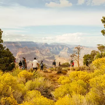
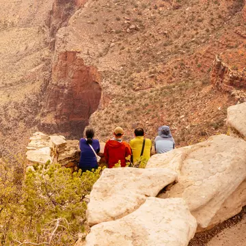
If you think the view from The Rim Trail is exhilarating, wait until you see how it looks while standing on top of the Redwall, or when you become one of those tiny specks walking the Tonto Trail. Hikes range from wheelchair-accessible paved paths to primitive, unmaintained treks that will challenge backcountry experts. All of these hiking options open up new windows into this complex landscape.
Even a short stroll along the edge gives you a better perspective on the canyon as you notice a tiny flower clinging to a cliff, or find a 450-million-year-old fossil embedded in the rocks. Relatively flat trails on the North Rim amble through meadows and pine forests offering glimpses into secluded canyons while the South Rim's Rim Trail provides great panoramas for a little challenge.
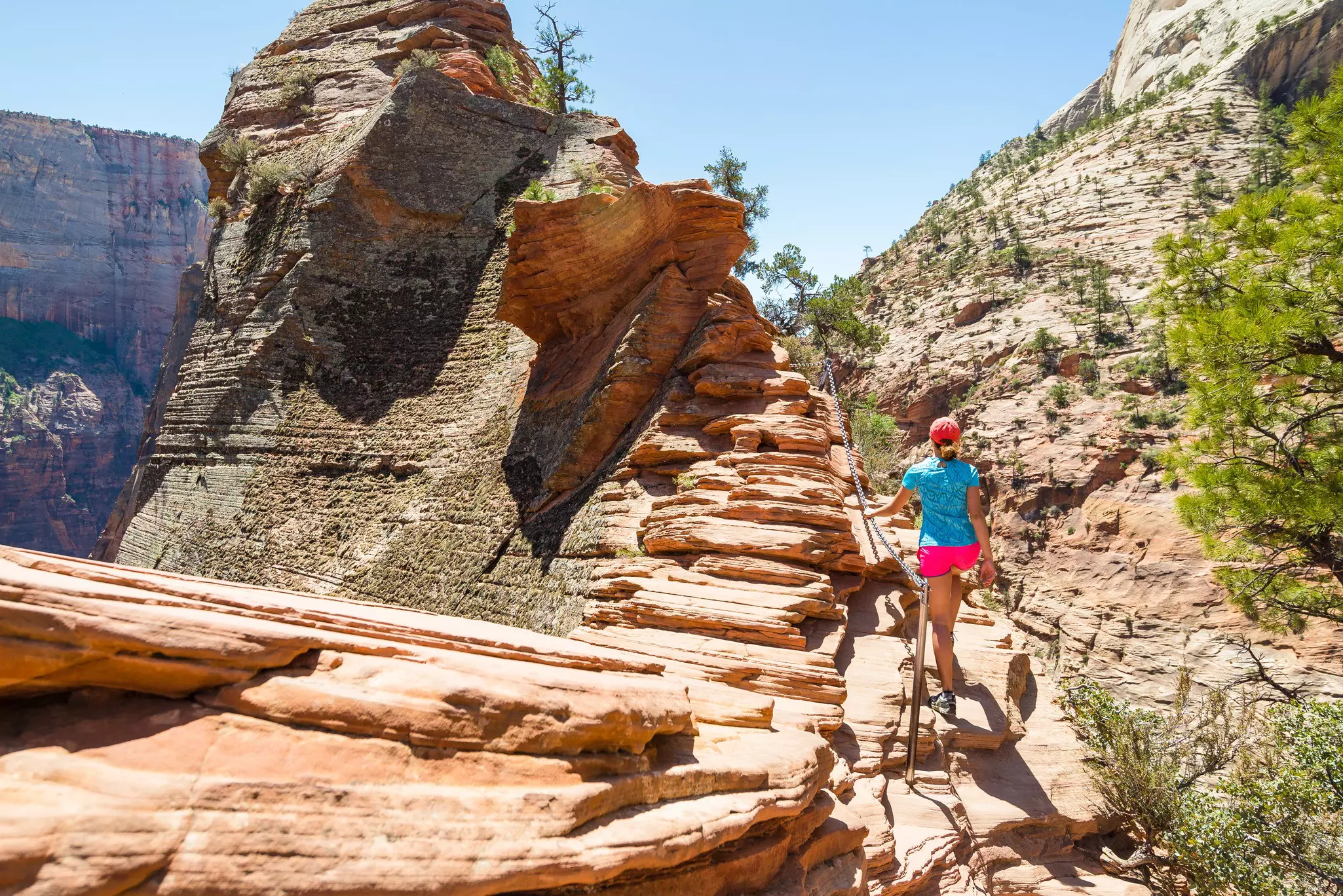
A bold desert beauty, this 230-sq-mile park is a highlight of southern Utah. Hikes range from trails traipsing the ridge lines to river wading under steep canyon walls. Many come for a canyoneering experience, but there are also family-friendly hikes and scenic drives.
If possible, enter Zion from the east, following Hwy 9 west from Hwy 89. The route is jaw-droppingly scenic as it rolls through colorful red rocks and a gallery-dotted tunnel before switchbacking 3.5 miles into the canyon.
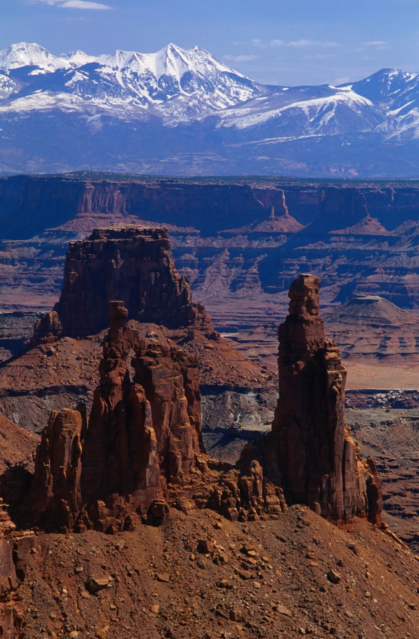
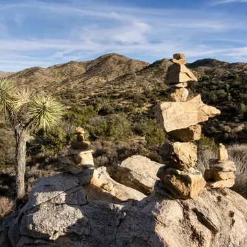
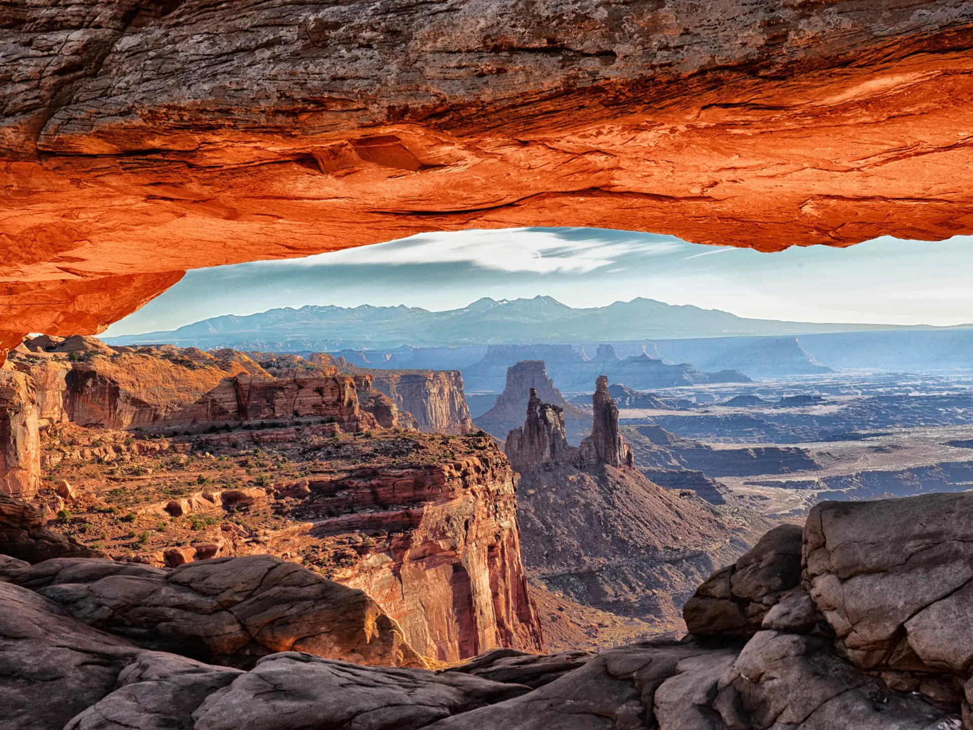
A 527-sq-mile vision of ancient earth, Canyonlands National Park is Utah's largest national park. Vast serpentine canyons tipped with white cliffs loom high over the Colorad o and Green Rivers, their waters 1000ft below the rim rock. Skyward-jutting needles and spires, deep craters, blue-hued mesas and majestic buttes dot the landscape.
The Colorado and Green Rivers form a Y dividing the park into four separate districts, inaccessible to one another from within the park. Cradled atop the Y, Island in the Sky (30 miles, 45 minutes from Moab) is the most developed and visited district due to its ease of access. Its viewpoints look down into the incredible canyons of The Needles and The Maze.
Hike to energy vortexes and red rocks at breathtaking Sedona and New Age pilgrimage site.
The Bell Rock vortex can be reached on a 1.5-mile trail (round trip); you can ascend as high as you feel safe. Alternatively, hike or mountain bike the Bell Rock Pathway, which passes in front of the formation (3.5 miles round trip).
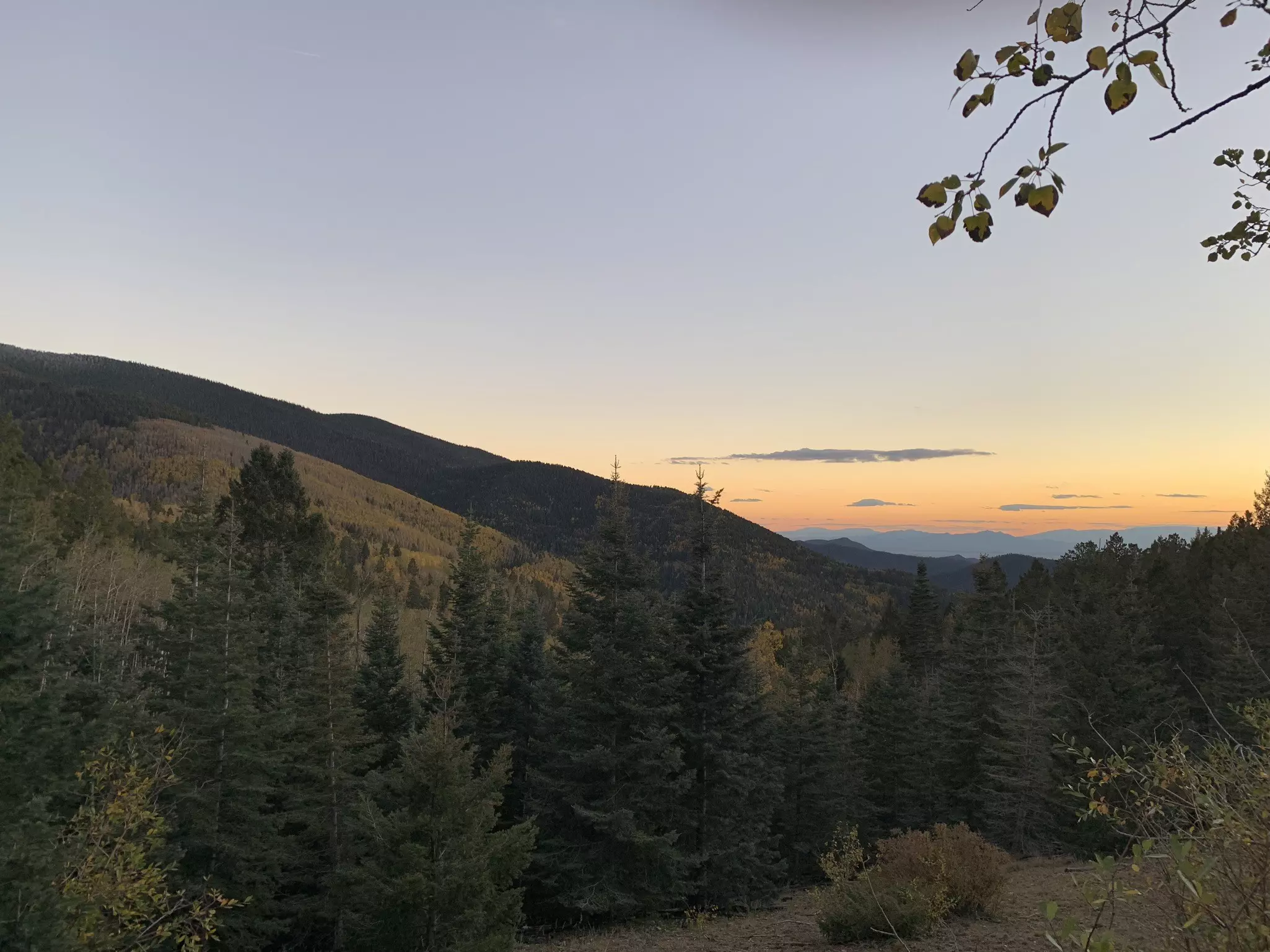
Some of the best hiking and backpacking in New Mexico is right outside of Santa Fe. The undeveloped Pecos Wilderness, in the heart of the Santa Fe National Forest, holds almost 1000 miles of trails that lead through spruce and aspen forest, across grassy alpine meadows, and up to several peaks surpassing 12,000ft.
The quickest way to get above the treeline is to drive to the ski basin, hop on the Winsor Trail and trudge up the switchbacks. The most immediately accessible hiking trails are on the Dale Ball Trail System, 3 miles east of downtown.
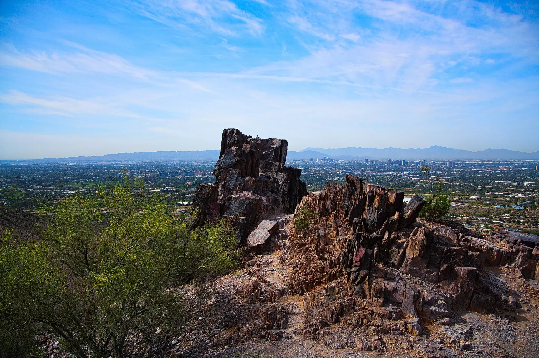
Dotted with saguaros, ocotillos and teddy bear cholla, this lovely summit in Phoenix was previously known as Squaw Peak. It was renamed for a local Native American soldier, Lori Piestewa, who was killed in Iraq in 2003. She was the first Native American woman to be killed in combat on foreign soil.
Be forewarned: the 1.1-mile trek to the 2608ft peak is very tough but hugely popular – the park can get jammed on winter weekends.
Parking lots northeast of Lincoln Dr between 22nd and 24th Sts fill early. The peak is bordered by two recreation areas, Phoenix Mountains (2701 E Squaw Peak), where the Summit Trail begins (dogs not allowed), and Dreamy Draw (2421 E Northern Ave).
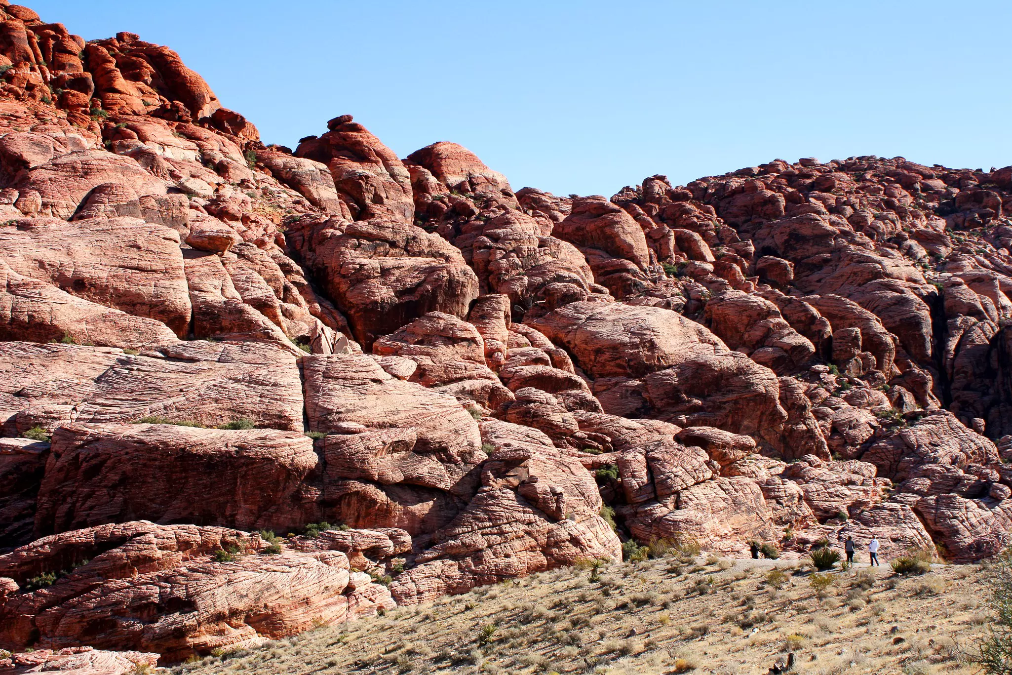
Red Rock's dramatic vistas are revered by Las Vegas locals and adored by visitors from around the world. Formed by extreme tectonic forces, it's thought the canyon, whose 3000ft red rock escarpment rises sharply from the valley floor, was formed around 65 million years ago.
A 13-mile, one-way scenic loop drive offers mesmerizing vistas of the canyon's most striking features. Hiking trails and rock-climbing routes radiate from roadside parking areas. The canyon is about 13 miles from the central Strip and just three miles from Summerlin.
You might also like:
The Grand Circle is the ultimate US Southwest road trip
Stellar views: stargazing in the Southwest USA
Don't overlook these magnificent outdoor destinations in the US Southwest