Jun 26, 202612 min read
14 top places to visit in ScotlandFeb 19, 2020
2 MIN READ

Writer
A plate of mondongo chuquisaqueño. Irra/Shutterstock

Writer
Lonely Planet may earn a commission from affiliate links on our site. All recommendations and reviews reflect our own independent opinions.
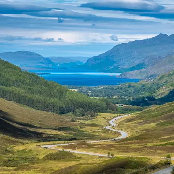
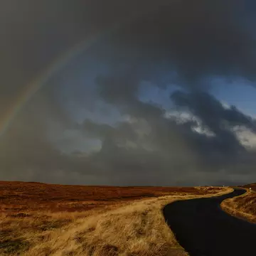
Shrouded in mist and surrounded by quaint lochans and lush valleys, Scotland’s highest mountain, Ben Nevis, attracts approximately 125, 000 walkers per year. There’s much to offer lovers of the outdoors, whether it’s a short Sunday ramble or a more serious hike. The summit stands at 1345m high and usually takes between seven and nine hours to reach the top by following the Mountain Track. It’s a serious undertaking. Recently, a group got stranded near the top in a blizzard, but were able to share their location with a mountain rescue team thanks to one very helpful mobile app.
According to CNN, the group of tourists became stranded near the top of Ben Nevis after a blizzard hit and they lost track of their route. To make the situation more worrying, they were not prepared for cold weather and were not wearing the appropriate gear. Miller Harris of Lochaber Mountain Rescue Team told Lonely Planet that they first heard about the hikers “Initially through Scottish Police, and this was how we managed to get the what3words app reference.”
The app, called what3words, works by dividing the globe into three-metre squares and assigning each one its own unique three-word address. Kite. chats. dine is a specific three-metre address in the word, for example, that leads to a precise spot in a field next to the River Ouse in York, England.
“In an emergency where a location is difficult to describe, callers are able to give their three-word address from the app. The three-word address format is also consistent anywhere in the world, and available in 40 languages,” Giles Rhys Jones, CMO at what3words told Lonely Planet. Alternatively, a link can be sent from the app that opens up a browser map site.
The group sent the mountain rescue team their three-word address, which helped them quickly pinpoint the hikers' exact location.
“We discovered it on Monday evening when it seemed to explode on social media. It is amazing to know that our app helped to save lives. It is, however, important to stress that [it is] not a replacement for being prepared and having map and compass skills when going off the beaten track. But it is a very useful tool to help communicate a location and is being used by emergency services across the UK,” Giles said.
Miller Harris shared the same sentiment, saying that it is highly recommended to have other skills when regularly hiking, especially on harder to reach routes.
Lochaber Mountain Rescue Team performs over 100 rescues per year on Ben Nevis.
What3words is free to download for both iOS and Android, or by browser, and works offline, making it helpful for use in areas with an unreliable data connection or poor weather.
Read more:
Take your Scotland trip with Lonely Planet Journeys
Time to book that trip to Scotland
Lonely Planet Journeys takes you there with fully customizable trips to top destinations – all crafted by our local experts.

Explore related stories