Jul 14, 202614 min read
How to experience football in England like a localFeb 20, 2026
17 MIN READ
Contributors
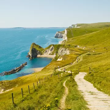
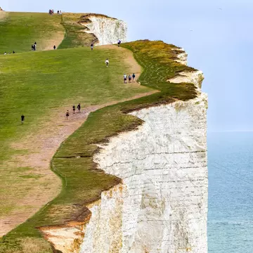
Walkers follow the towering chalk cliffs at Beachy Head in the South Downs. Richard Whitcombe/Shutterstock

Contributors

Joe Bindloss, Sam James
Lonely Planet may earn a commission from affiliate links on our site. All recommendations and reviews reflect our own independent opinions.
They don't call England the "green and pleasant land" for nothing. The best hikes in England will take you through towering hills and dramatic moorlands and along cliff-guarded shorelines that inspired some of the country's greatest writers, poets and painters. You'll soon realize how well the famous line from the country's favorite hymn fits the English landscape.
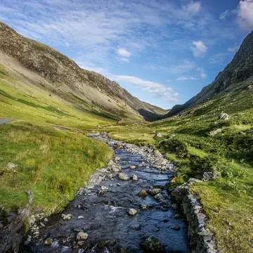
From the glacier-carved valleys of the Lake District and the empty and evocative Yorkshire Dales to the white cliffs of Dover and the beach-studded coves of Cornwall, the terrain here truly is lush and emerald green, except at higher elevations, where heather adds a paint swish of brown that morphs to vivid purple at the end of summer.
If you enjoy nature, photography and being active, taking a hike is one of the best things you can do in England. There are routes for hikers of all levels, and walking is the perfect antidote to the noise and crush of England's cities. With fast and frequent train connections to every corner of the country, it's easy to trade the urban sprawl for uplifting green countryside, even on a short break to London, Birmingham or Manchester.
With well-maintained and clearly marked trails, you don't need much more to get started than a good map, comfortable hiking boots and waterproofs that are up to the challenge of the English climate. From the Lake District and Yorkshire Dales to Cornwall, Norfolk and the South Downs, here is our pick of the very best hikes in England, broken down into national park hikes, long-distance trails and coastal hikes.
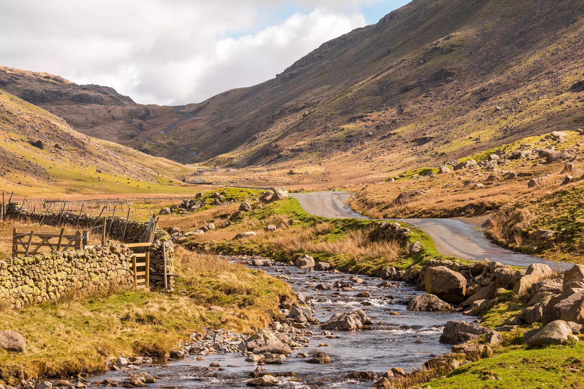
England is crisscrossed by a magnificent maze of walking trails, connecting gorgeous landscapes, historic sights, stunning national parks and charming country villages where hikers can look forward to a pint and a pie supper after a bracing day of walking in the hills. Even on a road trip around England, it's easy to park up and set off on foot into this marvelous landscape.
Walking isn't just a hobby in England – it's a legal right, enshrined in law as part of the Countryside and Rights of Way Act. Hikers have the right to roam almost everywhere without the need for entry fees or permits, including in England’s national parks. This includes large areas of working farmland and protected habitats for native wildlife, so you should always hike responsibly.
Stick to footpaths, close any gates that you open, carry out all your litter, only camp where it is permitted, and be sensitive to the needs of livestock and wildlife, particularly if you are walking with your dog – the Countryside Code gives a handy overview of how to enjoy the English countryside responsibly.
England's landscapes can seem modest in scale if you are used to the gigantic mountains of North America or the Alps, but it still pays to respect the climate. Every year, hikers end up being rescued after getting stranded in severe weather, particularly at higher elevations. Make sure you check the weather forecast, let someone know where you are going, and wear weather-appropriate gear.
Almost all of the best hikes in England feature well-maintained and clearly marked trails, particularly the country's impressive long-distance National Trails. Armed with sturdy footwear, wet-weather gear for emergencies, a compass and a good map (the Landranger and Explorer maps from the Ordnance Survey are some of the best), you can start a multi-day hiking adventure from almost anywhere in the country, camping or stopping in country pubs or B&Bs along the way.
Reaching the trailheads for most English hikes is easy – though not always quick – using a mix of trains and buses. No permits or entry fees are required to walk on any of England's many hiking trails, but if you come by car, you'll need to park, and trailhead car parks can be expensive and very busy in season, particularly inside national parks.
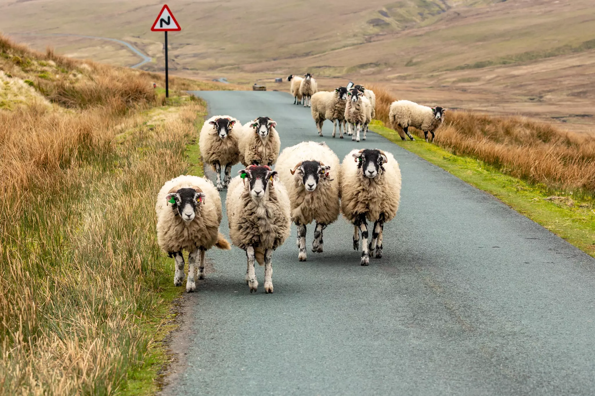
When driving on rural roads through the moorlands of northern England, watch your speed. Many roads are single-lane, and sheep wander freely across the carriageway. In winter, be wary of fog, ice and snow; keep a blanket, food, water and a mobile phone (and charger) handy for emergencies.
For good weather and dry ground underfoot, the summer (June to August) is the prime time to hike, but it's also the peak tourist season, and the trails can be swamped by hikers, pushing up prices for accommodation and filling car parks to bursting point. The spring and fall are a bit rainier, but also quieter, adding dramatic skies and seasonal wildflowers (or fall foliage) to the hiking experience.
Hiking in winter is a more serious undertaking and trails at higher elevations can become dangerous in windy, rainy or snowy conditions. Sensible trekkers hike with proper winter gear and pay close attention to the weather reports. Nevertheless, England's scenery is particularly stunning when dusted with snow.
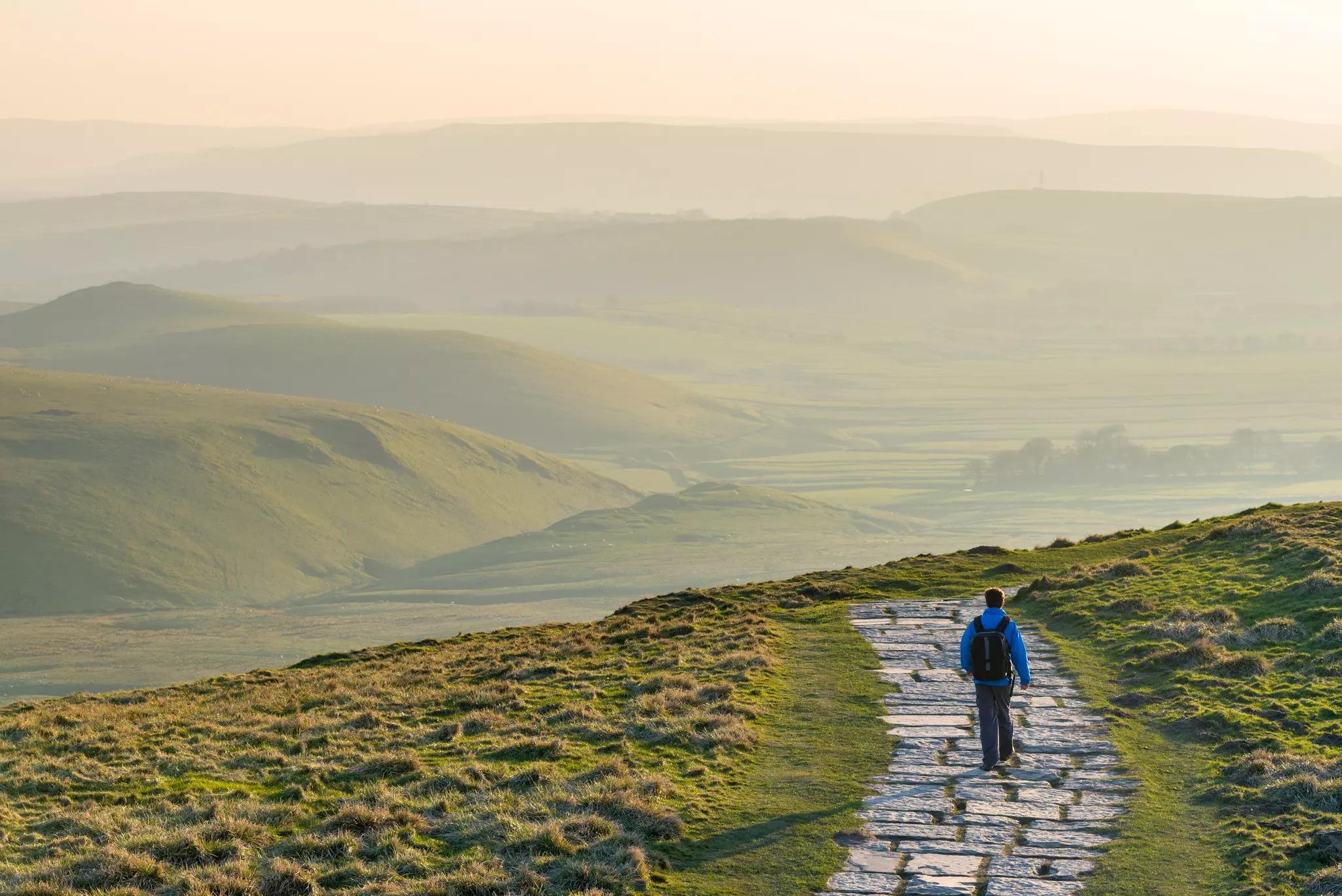
Many of the very best hikes in England pass through gorgeous national parks such as the Peak District and Lake District, where postcard-perfect stone villages nestle into green valleys divided by high moorland and some of England's loftiest peaks.
Best "jump off the train and start walking" route
Distance: 8 miles
Time commitment: 5 hours
Difficulty: moderate
Access: take the train to Edale via Sheffield or Manchester.
Peak District National Park – never "the Peaks," as locals will no doubt inform you – offers a sampling platter of classic English landscapes, from the moody, gritstone moors of the Dark Peak in the north to the tumbling limestone dales of the White Peak, running south into Derbyshire and Staffordshire. In summer, the green hills are spotted with legions of walkers in vivid Gore-Tex, but with excellent railway links, you can duck in for the day if you’d rather not compete for camping spots and B&Bs.
Topping the table of Peak District day walks is the climb up 517m Mam Tor, which rises handsomely above the village of Edale. Roll in by rail from London, Liverpool, Sheffield or Manchester and you can be out on the slopes within minutes of leaving Edale train station, following stone pathways to the summit and looping back via the villages of Castleton and Hope in around 5 hours.
For something more ambitious, extend the walk to exposed Kinder Scout (636m), where hundreds of earlier English walkers kicked off the fight for the "right to roam" that makes England such a great country for rambling. The great Kinder Trespass of 1932 still has legendary status today.
Best hike for bragging rights
Distance: 8 miles round-trip to either peak
Time commitment: 5–7 hours if you're fit
Difficulty: hard
Access: for Helvellyn, take the train to Penrith, then a bus to Glenridding; for Scafell Pike, drive from Keswick or Penrith, or take a train to Ravensdale, then the seasonal Wasdale Explorer bus to Wasdale Head.
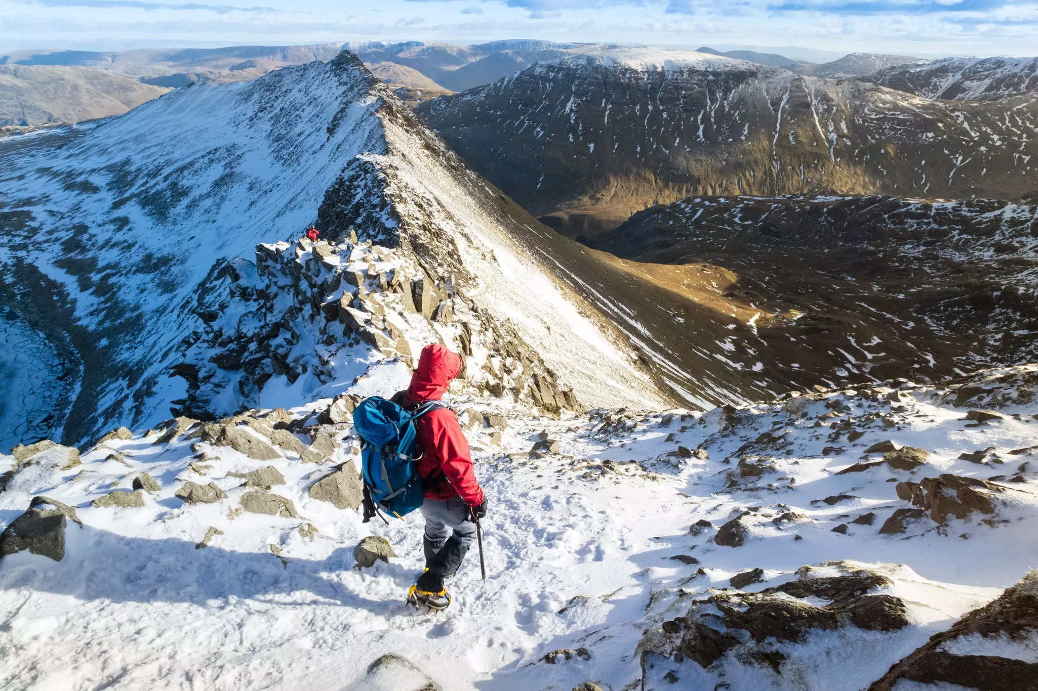
There’s stiff competition for the title of "best hike in Lake District National Park," but the trek up 950m Helvellyn comes top for untamed drama – particularly when scrambling along the scalpel-thin Striding Edge. However, nearby Scafell Pike (978m) comes with extra bragging rights you only get from climbing England’s highest mountain.
Either route can be achieved in a strenuous day, with 5 to 7 hours of hard trekking required to reach the top and get back down to a village pub to toast your success with a pint of Yorkshire bitter. The weather can make or break a Lake District hike; in rain, walking can be a joyless slog, but on dry days, the views can be transcendental.
At any time of year, bring waterproofs, food, water and a map and compass, check the weather forecast, and tell someone where you are going and when you plan to be back. The volunteers from Keswick Mountain Rescue are called out every year to rescue hikers who have misjudged the weather conditions.
For Scafell, the most popular ascent route starts at Wasdale Head near Santon Bridge, but there are four alternate routes that see slightly fewer trekking boots. For the classic route to Helvellyn via Striding Edge, pick up the trail at the Glenridding Tourist Information Centre on Ullswater.
Best hike for fitness fanatics and superheroes
Distance: 24 miles
Time commitment: 12 hours (or less)
Difficulty: hard
Access: ride the train to Horton-in-Ribblesdale from Carlisle or Leeds.
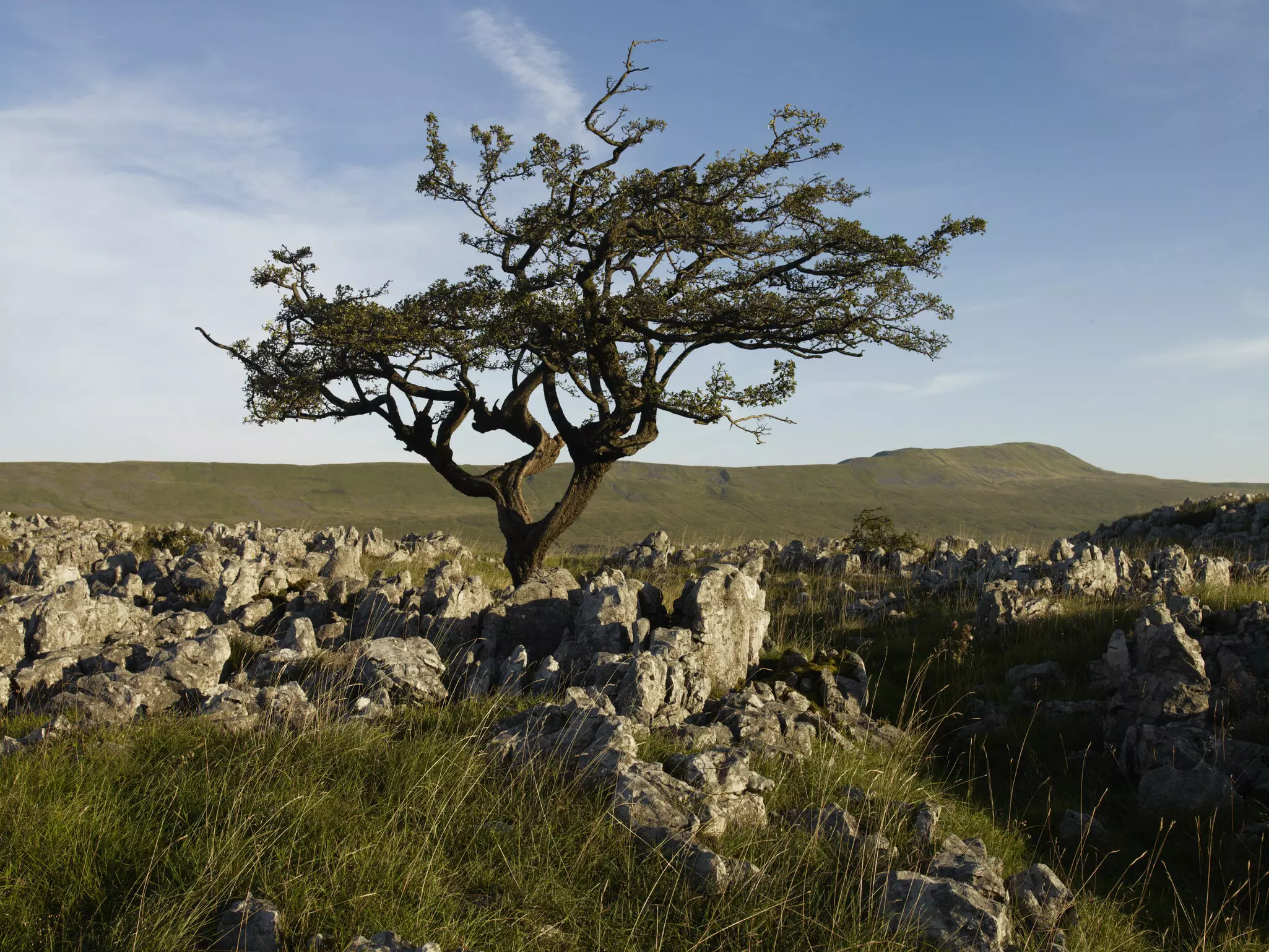
Nothing focuses the mind like a challenge, and the Yorkshire Dales National Park offers one of the best! Since 1968, more than 200,000 hikers have taken up the quest of climbing the summits of Pen-y-ghent (694m), Whernside (736m) and Ingleborough (723m) in less than 12 hours.
Known as the Three Peaks Challenge, the circular 24-mile route begins and ends at the Pen-y-Ghent Cafe in Horton-in-Ribblesdale (where you clock in and clock out to verify your time). Succeed, and you become an automatic member of the cafe's Three Peaks of Yorkshire Club.
Fancy a more grueling test of endurance in the Yorkshire Dales? Then join the fell-runners in the annual Three Peaks Race on the last Saturday in April, and run the route instead of walking it. Just six people entered (and only three finished) when the race was first held in 1954; today, it has a limit of 1000 entrants, and the impressive course record is 2 hours, 46 minutes and 3 seconds.
England's long-distance trails offer an epic sense of mission, spectacular scenery on all sides, and a great sense of camaraderie in the pubs and hostels along the way. If you don't feel up to the challenge of taking on the full routes, routes can be broken down into day-hike stages.
Best hike for fans of English history
Distance: 84 miles
Time commitment: 5–7 days (but it is possible to cover any section as a day walk)
Difficulty: moderate
Access: take the bus or metro from Newcastle-upon-Tyne to Wallsend; at the far end, buses connect Bowness-on-Solway to Carlisle.
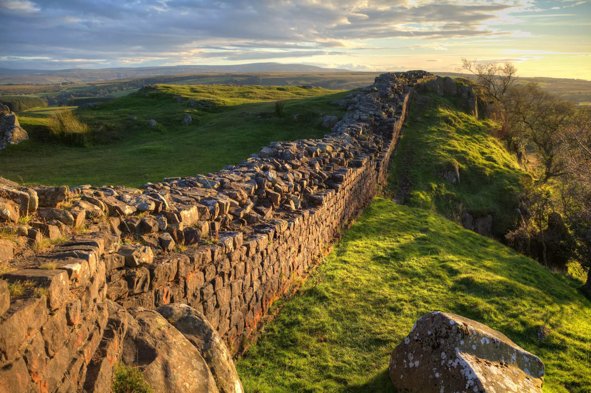
Tracing a broken line from Wallsend to Bowness-on-Solway, Hadrian's Wall may have been built to divide the English from the Scots, but it lies well south of the 21st-century border. The Romans erected this impressive military and psychological barrier between 122 CE and 128 CE, and a remarkable amount of Roman masonry remains today.
Needless to say, the 84-mile national trail that follows the wall is one of England’s top walks, attracting an army of hikers to rival the Roman legions once stationed here during the peak season from May to October. The entire route takes 5 to 7 days on foot, allowing plenty of time to explore the rich archaeological heritage dotted along the trail.
Essential stops include the impressively preserved Roman fort at Housesteads, the temple of Mithras at Brocolitia Fort, and the Vindolanda museum, which displays an original Roman sandal (you’ll appreciate your trekking boots all the more after seeing it). In between these pockets of Roman history, settle in and enjoy the undulating countryside and the sense of mission that comes from walking the entire length of England’s "great wall."
Planning tip: If time or fitness levels prevent you from doing the whole trek, you can hike many sections in a day using public transport; the AD122 bus connects with Hexham station on the railway line between Newcastle-upon-Tyne and Carlisle.
Best off-the-beaten-track hike
Distance: 202 miles round-trip
Time commitment: from 15 days
Difficulty: moderate
Access: reach Shrewsbury by train from Birmingham, Manchester, Swansea or Cardiff.
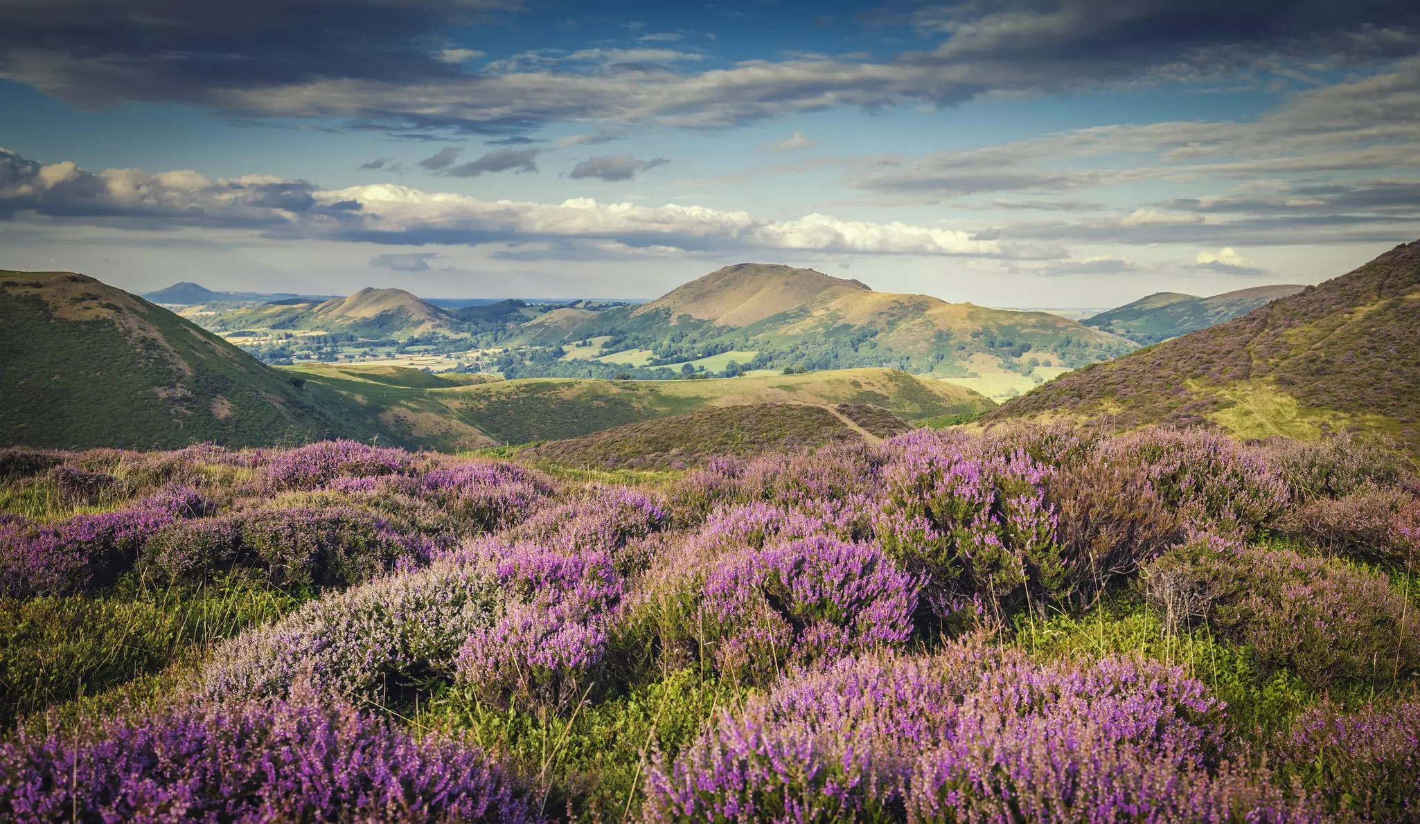
Scenic Shropshire is often overlooked by tourists rushing to the Peak District, but the hills here are just as dramatic and far less crowded. Tucked against the Welsh border, the county rises in a series of steep ridges, divided by winding rivers, ruined castles and slumbering villages where you can stop overnight and sample some of Shropshire’s famous real ales.
Walking trails run in every direction, but they’re rarely busy, so there's little competition for a bed or a table for dinner, even in summer. The 200-mile Shropshire Way is divided into two sections – a more dramatic southern loop, taking in the soul-restoring scenery around Ludlow, Church Stretton and the Clun Valley, and a gentler northern section. Both start and end in Shrewsbury (always "shrooz-bury", never "shrows-bury"), with its handsome abbey.
We recommend the southern leg, tracing the west side of the Long Mynd, a gorgeous heather-topped plateau inhabited by wild ponies, to the foodie town of Ludlow, with its stocky castle, gourmet restaurants and annual food festival each September. In the same area, you can detour to Iron Bridge for a taste of England's Industrial Revolution history.
Best hike for cultural interest
Distance: 109 miles
Time commitment: 9 days
Difficulty: moderate
Access: get to Helmsley by train (to York or Scarborough), then a local bus. At the end of the hike, trains link Filey to Scarborough.
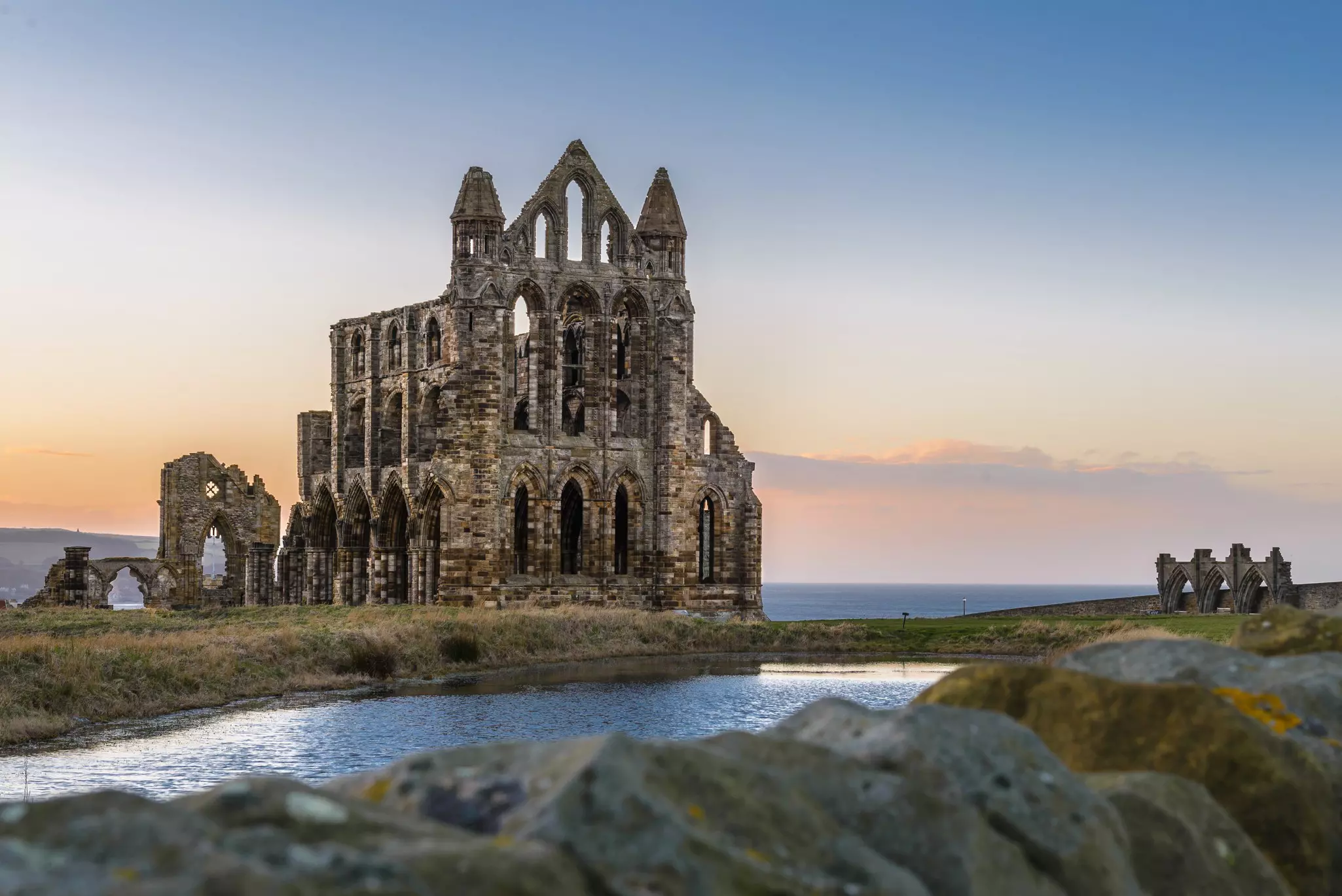
Offering up 109 miles of loveliness, the Cleveland Way is a thrilling sweep of exposed shoreline and lonely moorland, painted purple in season by flowering heather, strung along the east coast of Yorkshire. Plenty of England's best hikes pass through dramatic scenery, but how many hikes offer the chance to drop in on the spot where Dracula arrived in England?
Made famous by Bram Stoker's novel, the spooky ruins of Whitby Abbey are just one historic stop on a hike that also takes in the smugglers' haunt of Robin Hood's Bay – the start of the equally appealing Coast to Coast path – and the magnificent ruins of Rievaulx Abbey, destroyed by Henry VIII in 1538.
Most people walk the route from north to south, starting in Helmsley and finishing at Filey Brigg on the North Yorkshire coast. The first half of the walk is all majestic moorland; on day five, you'll reach Saltburn – associated with Captain James Cook – with heart-stopping coastal views for the rest of the hike. While the walk is considered moderate, there's still plenty of elevation change to keep you puffing.
There's more to walking in England than the rugged highlands. The best walks in the south of the country trace dramatic coastlines, from the white cliffs of Dover to the smugglers' bays of Cornwall and Norfolk's marsh-backed beaches.
The best hike for uplifting coastal views
Distance: 100 miles
Time commitment: 8-9 days (or plan a day walk along a section)
Difficulty: moderate
Access: trains link London to Winchester, Eastbourne and many other towns along the route.
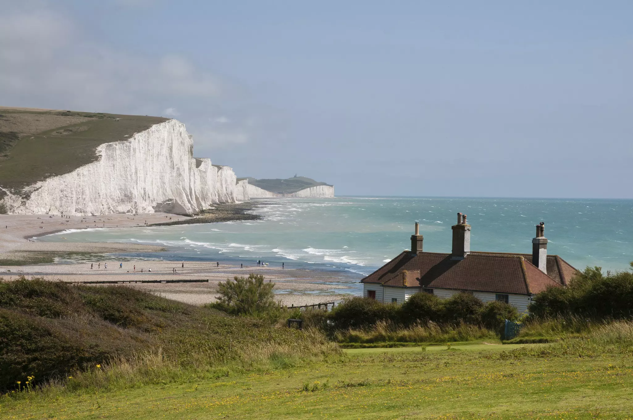
Epic walking country isn’t limited to the dramatic hills of northern England. The 100-mile South Downs Way rolls across a series of chalk ridges from Winchester to the legendary white cliffs of Dover, serving up stunning walking within easy reach of London by fast train.
There’s something quintessentially English about chalk grassland scenery. Watching kestrels hovering effortlessly overhead in perfect blue skies, it's easy to forget that these hills rattled with gunfire during the Battle of Britain in 1940, inspiring Dame Vera Lynn's morale-boosting wartime song, (There'll Be Bluebirds Over) The White Cliffs of Dover.
Fast trains from London Waterloo to Winchester – most frequent on weekdays – take just over an hour; the journey back to London takes 1.5 hours from Eastbourne, or an hour from Dover. If you tackle the whole route, expect to reach Eastbourne 9 days after leaving Winchester, tracing the top of the Seven Sisters, England’s most iconic sea cliffs.
If you are looking for a family-friendly walk in England, consider taking the train down to Eastbourne to walk the Seven Sisters section in reverse as a day walk, looping back to Eastbourne via bus or taxi. Or for an even gentler taste of the South Downs, head to Brighton, and take a local bus to the Devil's Dyke or the Ditchling Beacon.
There’s good value accommodation all along the trail – one essential stop is the Belle Tout Lighthouse on the way to Beachy Head, now one of England’s most nostalgic guesthouses. The route is as popular with mountain bikers as walkers and the dry weather in the south of England is an added bonus.
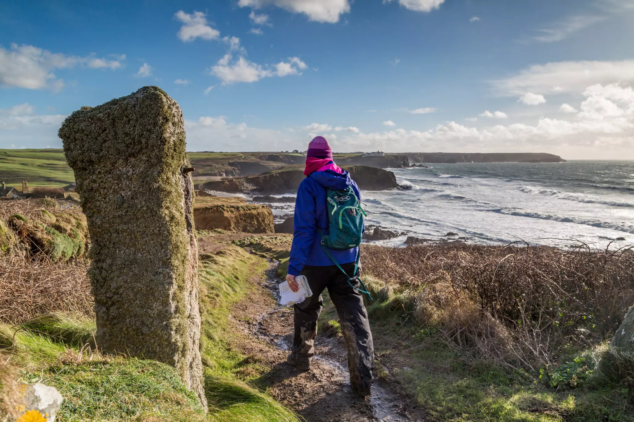
Best hike for escaping the Cornwall crowds
Distance: 630 miles
Time commitment: 40–50 days (or plan a day walk along a section)
Difficulty: moderate
Access: for the Minehead end of the trail, take a train to Taunton, then a bus; reach Poole Harbour on the Bournemouth train, then take the bus to South Haven Point.
Getting away from it all can be a challenge in the tourist-mobbed southwest of England, but the 630-mile South West Coast Path provides welcome moments of seclusion. The epic route kicks off in Minehead on the north side of the peninsula, and follows the shoreline through Devon and Cornwall all the way to Poole Harbour in Dorset, taking in dozens of fishing villages, peaceful coves, rocky headlands and holiday hangouts with gorgeous sandy beaches.
If you just want a taster of the trail, the section from Minehead to Westward Ho! serves up some of the most impressive sea cliffs, while the leg from St Ives to Penzance crosses two Areas of Outstanding Natural Beauty. To keep the kids on board, the stretch from Exmouth to Lyme Regis offers some of Britain’s best fossil-hunting along the Jurassic Coast.
As well as seascapes, sand and scenery, you’ll encounter plenty of wildlife: peregrine falcons, gannets, fulmars, kittiwakes and guillemots frequent the shoreline, Cornish choughs frequent abandoned mine workings, and seals, dolphins and basking sharks can be spotted in the waters offshore.
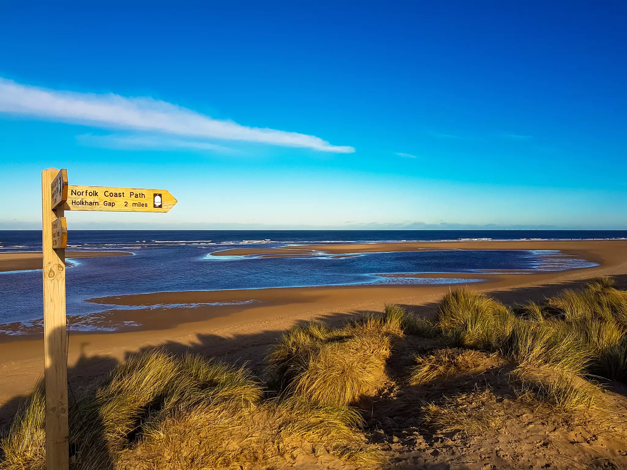
Best walk for peace and quiet (and birdlife)
Distance: 84 miles one way
Time commitment: 5–10 days (or plan a day walk along a section)
Difficulty: easy
Access: Get to Hunstanton on the King's Lynn train, then the Coastliner 36 bus; reach Hopton-on-Sea by bus from Great Yarmouth.
Not every walk has to go up hill and down dale. The Norfolk Coast Path rarely climbs much above sea level, but it passes through a meditative landscape of broad, sandy beaches, coastal forests and dense, reed-filled marshes that shelter some of Britain’s most iconic birdlife. With binoculars to hand, you can spot everything from bitterns, marsh harriers and reed warblers to grey seals as you cover the 84 miles between Hunstanton and Hopton-on-Sea.
Bring your swimming costume – this week-long walk through Norfolk links together a string of nostalgic beach resorts and the stunning sands in front of Holkham Hall, one of England’s finest Palladian mansions. Bring an appetite – north Norfolk is famous for its seafood, particularly Cromer crab, King's Lynn brown shrimp and Brancaster oysters, making every dinner stop a feast.
Take your England trip with Lonely Planet Journeys
Time to book that trip to England
Lonely Planet Journeys takes you there with fully customizable trips to top destinations – all crafted by our local experts.


Explore related stories