Jun 21, 20265 min read
11 of the best beaches in WalesJun 13, 2025
14 MIN READ

Writer
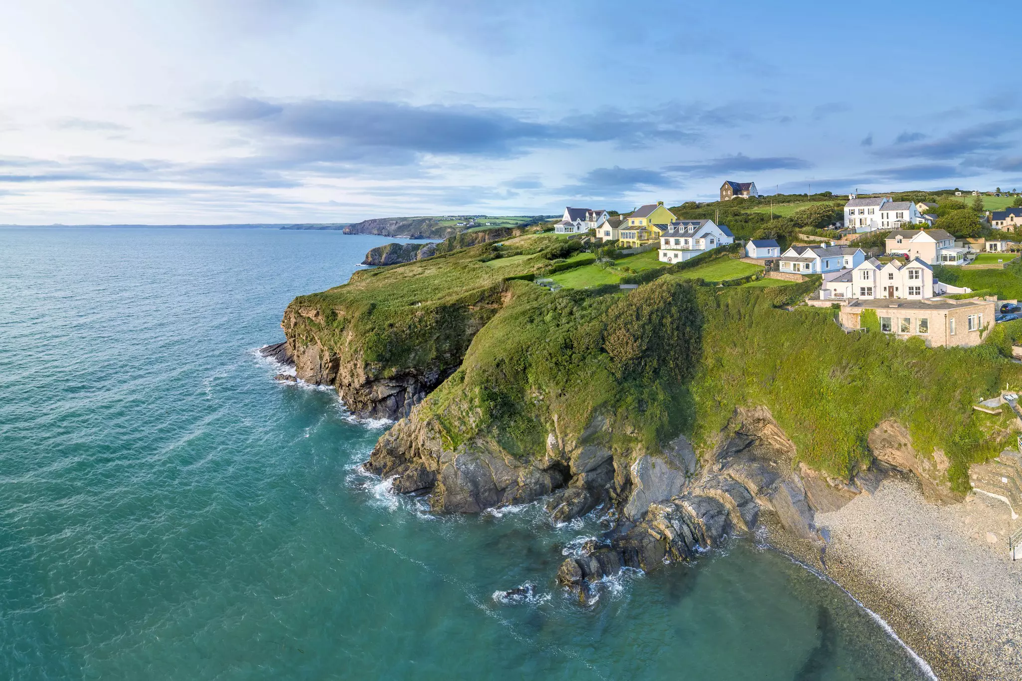
The Pembrokeshire Coast Path links sea cliffs, beaches and mellow Welsh villages. Michael Roberts/Getty Images

Writer
Lonely Planet may earn a commission from affiliate links on our site. All recommendations and reviews reflect our own independent opinions.
Looking for a walk with drama, bragging rights and epic coastal scenery? Look no further than the two-week tramp along the Pembrokeshire Coast Path, one of Britain’s finest walks, ticking off every mile of the coastline of Pembrokeshire in Wales.
Defined by the slanted sea cliffs and sandy bays of Pembrokeshire Coast National Park, this walk will take you through kissing gates and native woodlands, along gorse-clad cliffs, above secluded coves and mellow Welsh villages, past prehistoric ruins and WWII relics, beside dramatic rocky outcrops and raging seas, and across broad sandy beaches as it meanders south from St Dogmaels to Amroth.
Though a coastal walk sounds like a gentle adventure, make no mistake, this is a serious challenge. Over the course of 186 miles (300km), you’ll negotiate your way up and down 10,668m (35,000ft) of ascents and descents – the equivalent of climbing Mt Everest, so they say, even if the route is not quite so vertical. The full route takes two weeks, with more than 10 miles (16km) of walking most days.
The rewards of this jaw-dropping coastal hike, however, speak for themselves. Discover more on this day-by-day guide to hiking the Pembrokeshire Coast Path.
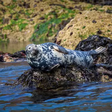
The best time to walk the Pembrokeshire Coast Path is from June to August, when the skies are mostly clear, sea breezes are light and the long hours of daylight are perfect for maximizing walking time. This is also a great season for camping out and making the most of the beaches, but the path can get very busy in summer. For less company on the trails, come in spring for wildflowers, or in autumn for colorful foliage livening up the hillsides and pupping seals gathering below the cliffs – just be ready for a bit more rain.
Theoretically, the route is open year-round, but walking in winter is not for the faint-hearted – storms, freezing rain and strong winds can make navigating cliff-top sections of the path a sometimes risky undertaking. On the plus side, the winter swell rolling in off the Atlantic adds a powerful sense of theater to the coastal scenery.
While you can walk the route in either direction, the most popular starting point for the Pembrokeshire Coast Path is the village of St Dogmaels near Cardigan, about 40 miles (64km) southwest of Aberystwyth. As the route ends far to the south at Amroth, driving to and from the trailheads isn’t really an option, but you can get to both the start and end of the path by public transport.
To reach St Dogmaels, trains run as far as Aberystwyth, from where you can take the T5 bus to Cardigan and then the 408 bus to St Dogmaels or Poppit Sands. From Amroth at the far end of the trail, the 351 bus runs to Kilgetty, where you can board the train to Carmarthen, connecting with trains to other destinations around the UK.
Local buses link the villages and towns along the route – handy if the weather turns bad or if you want to skip a section. See the “coastal buses” section on the Pembrokeshire County Council website for timetables.
The path weaves in and out of villages and towns as it hops from bay to bay, so you’re never truly far from civilization, but some sections are exposed to the elements, and there are steep climbs, uneven traverses and rocky descents to navigate, so you’ll need sturdy footwear with grippy soles and good ankle support.
Hiking poles can be helpful on the downhill sections, particularly when it’s muddy – which is often the case on this exposed section of coastline. Bring wet-weather gear at any time of year, particularly from October to February. Also bring a map and compass, and walk with snacks and plenty of water.
Accommodation-wise, there’s lots of choice along the trail – B&Bs, hotels, holiday lets and campgrounds dot towns and villages all along the route, and the next stop is never more than a day’s walk away. Many people break the walk down and tackle smaller sections, using St Dogmaels, Fishguard or St Davids as a base (all have plenty of places to stay).
Tent camping is a popular way to save money on accommodation while walking the Pembrokeshire Coast Path, but wild camping is not permitted, so you’ll need to pitch your tent at designated camping grounds along the route. Check out the listings on Pitchup. com or Campsites. co. uk. Note that many hostels and campgrounds close from October to Easter, and buses are far less frequent at this time.
The Pembrokeshire Coast Path is well marked, with the National Trails acorn symbol emblazoned on signposts, gates, stiles and even lamposts where the route passes through towns and villages. You’ll also see the logo of the Wales Coast Path – a blue and white seashell with a dragon’s tail – which follows the same route through Pembrokeshire.
Nevertheless, it’s worth bringing a map, both for general route planning and working out the alternative trails you may need to take due to high tides, bad weather or activity on military shooting ranges along the route.
Consider buying Cicerone’s 1: 25,000 Walking the Pembrokeshire Coast Path map or the Harvey XT40 1: 40,000 Pembrokeshire Coast Path map. If you’re more of a digital type, the Pembrokeshire Coast website has day-by-day route descriptions, or you can research the hikes on AllTrails.
15.5 miles (25.7km)
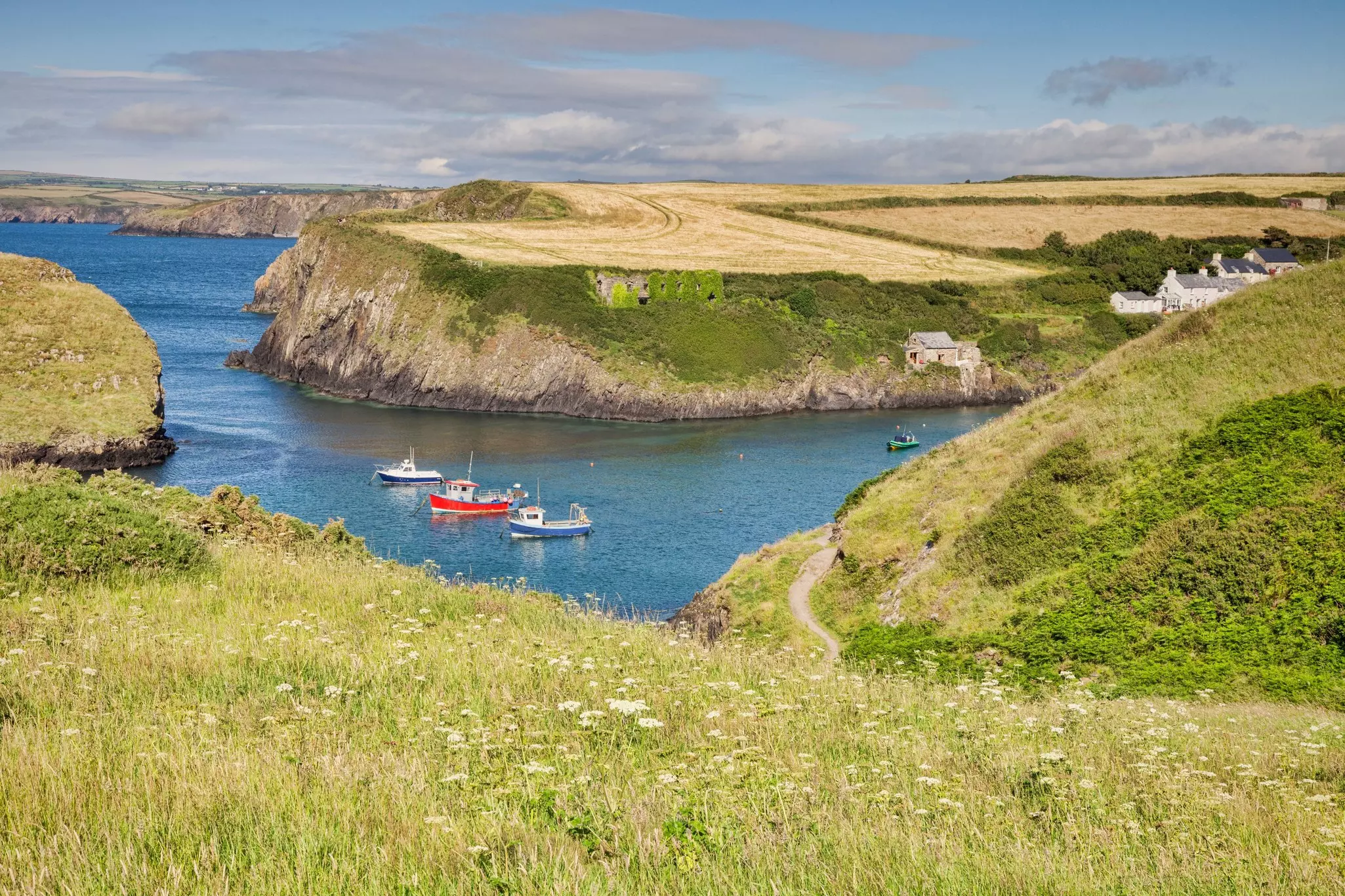
The walk starts with a long day involving lots of sustained climbs. After a gentle stroll down to Poppit Sands along the Afon Teifi River (look out for wildfowl as you go), you’ll pick up increasingly steep tracks along the clifftops, marking some of the most challenging walking on the route. Worry not – Newport town has creature comforts waiting at the end of the day.
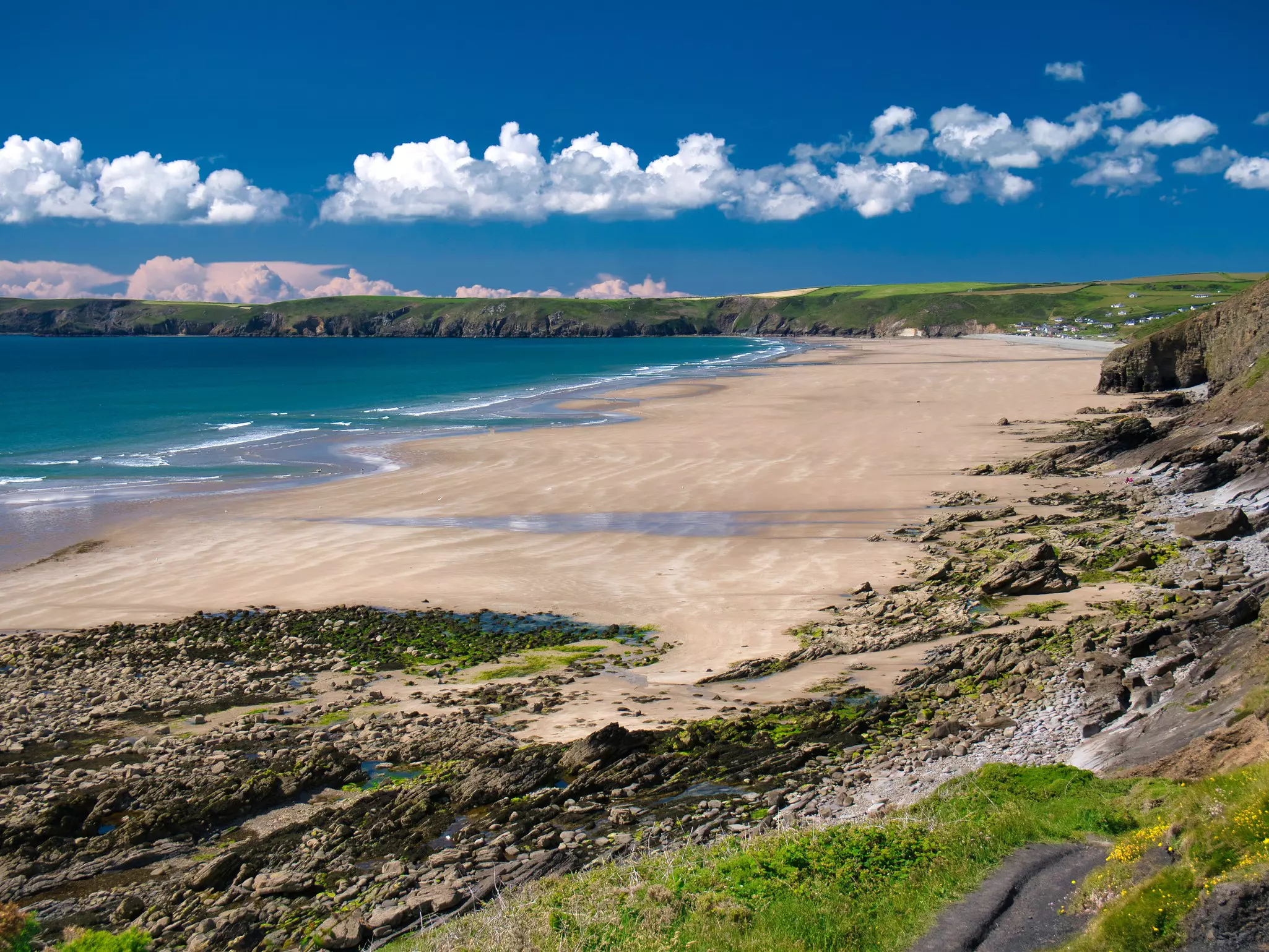
First, trace the shore to Cemaes Head, whose faulted cliffs offer views over the Teidi estuary towards Cardigan Island, then follow steep ascents and descents through Pwllygranant and Ceibwr Bay to the Pwll-y-Wrach (Witches’ Cauldron), a blowhole created by a collapsed sea cave. Seals are often seen on this stretch of coast from August to November. The day finishes with the descent to Newport Sands beach, before following the Nevern River into Newport town.
12 miles/19.3km
The cliffs are lower on day two, which your legs will be grateful for. Between Newport and Fishguard, you’ll climb up and down between coves, with some sections where you can cross the beach at low tide or take detours inland at high tide.
You’ll pass through pretty bays with gorgeous sea views such as Aberfforest and Aber Rhigian, where slate for Newport’s roofs was mined, before you come to the ruins of Fishguard Fort and the town of Fishguard – site of the “last invasion of Britain” by French troops in 1797.
9 miles/14.5km
It’s a gentler day today in terms of miles covered, but the scenery is as uplifting as ever. The walk follows cliffs made of volcanic rock covered in gorse and heather (with great fall colors in August and September). Leave Fishguard towards the harbor, then follow the indented coastline west to Strumble Head, passing grazing livestock and nine kissing gates. Look out for seabirds, seals and other marine life en route to Pwll Deri, where there’s a YHA hostel for the overnight stop.
12 miles/19.3km
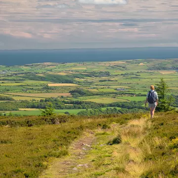
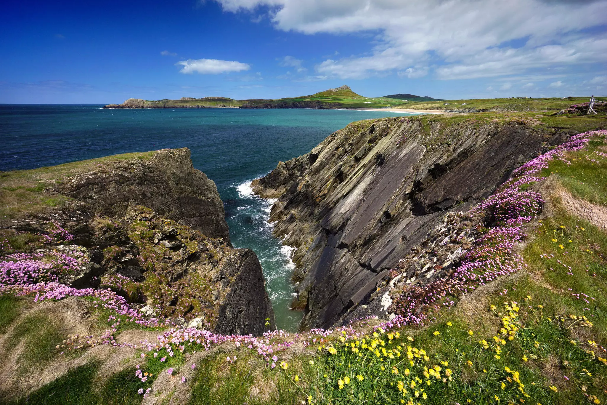
Erosion is nibbling away at the cliffs south of Pwll Deri, so minor tweaks to the route are common. Start the day by detouring to the trig point (and Iron Age fort) at 213m (699ft) Garn Fawr for lovely views back to Strumble Head, then track the shoreline through wild coastal scenery, with views on to St David’s Head, which you’ll reach on day five.
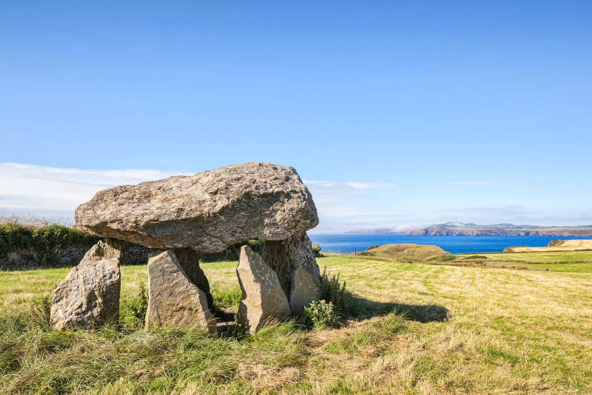
Drop in and out of lonely coves as you cover the distance to Porthgain, where fish and chips are available at the tiny, picturesque harbor. One rewarding stop on the way is the Carreg Samson dolmen at Abercastle, the remains of a Neolithic burial chamber.
10 miles/16km
Today, you’ll pass through thrilling scenery topped by the volcanic tors of Carn Penberry, Carn Lleithyr and Carn Llidi. Several alternative routes following paths or roads lead you along the coast, with some challenging sections where you may need to scramble. As you follow the cliffs, look out for seals, gannets and porpoises in the bay.
Consider detouring inland through a patchwork of fields to the top of one of the tors for a lofty lunch stop. Finally, you’ll come to St David’s Head, with traces of an Iron Age fort and neolithic burial chamber, before you reach the dune-backed beach at Whitesands and the cozy Whitesands Beach House cafe.
13 miles/21km
Day six skirts the coastline near the town of St Davids – a worthwhile detour if you fancy some time away from the shore. Swing by its magnificent cathedral, founded in the 12th century and later restored by Sir George Gilbert Scott, of London’s St Pancras Station fame. Otherwise, follow low cliffs with views towards Ramsey Island as you duck in and out of tiny coves containing harbors and a lifeboat station.
Summer boat trips run to the bird reserve on Ramsey Island – home to choughs and myriad seabirds – and you can check out traces of Neolithic history at Castell Heinif, above the Ogof Mary natural rock arch.
Look out for sealife as you gain the tip of the headland, the northern “pincer” of the claw of land enclosing St Brides Bay. Ruins at St Non’s mark an ancient pilgrimage site, reputedly the birthplace of St David, Wales’ patron saint. At Solva, the Harbour Inn waits with beer and food.
12 miles/19.3km
This long day will take you around the broad sweep of St Brides Bay, climbing steep hills on the way to Newgale, then following more level terrain. Traces of ancient and industrial revolution era history dot the landscape, but watch your footing on exposed sections of the path. Several beach detours are possible, including walking along the 2 miles (3.2km) of golden sand at Newgale Beach.
As the day wears on, there are more sheer cliffs to navigate, and some quintessentially Welsh place names to enjoy, such as Druidston Haven and Haroldston Chins. Hidden coves containing tiny beaches provide appealing rest stops before you close out the day at the tidy seaside village of Broad Haven, with its shallow strands and plentiful holiday accommodation.
11 miles/17.7km
Red sandstone cliffs and wildflowers in spring set the tone as you walk along the south side of St Brides Bay. At low tide, you can follow a chain of sandy beaches as far as Little Haven, before climbing Strawberry Hill, then following a path between farmed fields and shoreline hedges to Mill Haven.
At St Brides, you can drop into the Norman-era St Bridget’s Church – both are named for the same Irish saint who lent their name to the bay – and peek at St Brides Castle, a 19th-century baronial-style country house. There are lovely views across St Brides Bay as you follow a gently undulating clifftop path around the headland to Musselwick Sands and Martin’s Haven.
10 miles/16km
The landscape on this stretch was smoothed out by ice sheets during the last Ice Age, and there are sweeping views from the end of the headland toward the islands of Skomer, Skokholm and Grassholm. Seals are often spotted here, and boat trips run out from Martin’s Haven to Skomer, where you can see wildflowers, seals, and teeming seabirds, including puffins from April to July.
Evocative place names such as Deadman’s Bay, Raggle Rocks and Watery Bay set the scene as you curve past the tidal island of Gateholm to broad, rock-dotted Marloes Sands – a popular swimming stop. You’ll pass the remains of WWII airfields as you approach St Anne’s Head. Look out for shipping traffic in the Milford Haven Waterway – one of Britain’s most important deepwater harbors – before you drop into the sheltered bay at Dale.

16 miles/25.8km
It’s a long day today in distance terms, and there are two tidal crossings – at The Gann and Sandy Haven – where you’ll need to time your walk carefully, consulting a tide table, or face long detours inland. The scenery on this section is more built up and industrial than you’ve encountered so far, thanks to the Valero oil refinery, the South Hook liquid natural gas terminal and the Pembroke Docks.
Look out for big ships cruising the Milford Haven Waterway and the remains of 19th-century port defences out in the bay as you traverse busy Milford Haven to reach the small town of Neyland – formerly the terminus for Isambard Kingdom Brunel’s South Wales Railway.
16 miles/25.8km
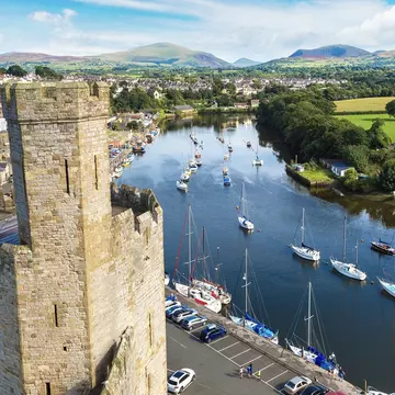
After crossing the water on the Cleddau Bridge, you’ll pass through the town of Pembroke. As compensation for the urban setting, you can visit Pembroke Castle, a grand 13th-century residence that was the birthplace of Henry VII, the first Tudor king.
Also check out historic Pembroke Dock, which played a vital role in WWII and many earlier British naval campaigns. You’ll return to open countryside as you head west from Pembroke and skirt the Valero refinery, where enormous oil tankers queue to load and unload, before finishing for the day in Angle.
10 miles/16km
The return to pristine countryside beyond Angle feels rather unexpected. There are few amenities along the route today, which takes you away from roads and most human habitation. Early on, you’ll pass the Chapel Bay Fort & Museum – good for history buffs – before looping past exposed, rugged cliff scenery on the south side of the headland. End the day by dropping down to the gorgeously broad, sandy beach at Freshwater West, a popular spot for surfers.
10 miles/16km
Today would be a gentle, flat stroll in the park, but for the fact that this section of the coast is an active military base and firing range for tanks and artillery. Restricted access has created a valuable haven for nature, but you’ll need to coordinate your walk around military activity at the Castlemartin Range, which will dictate the route you follow to reach the picturesque rock-framed beach at Broad Haven South.
11 miles/17.7km
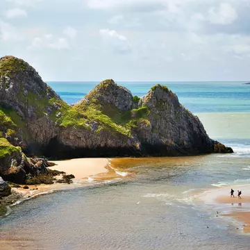
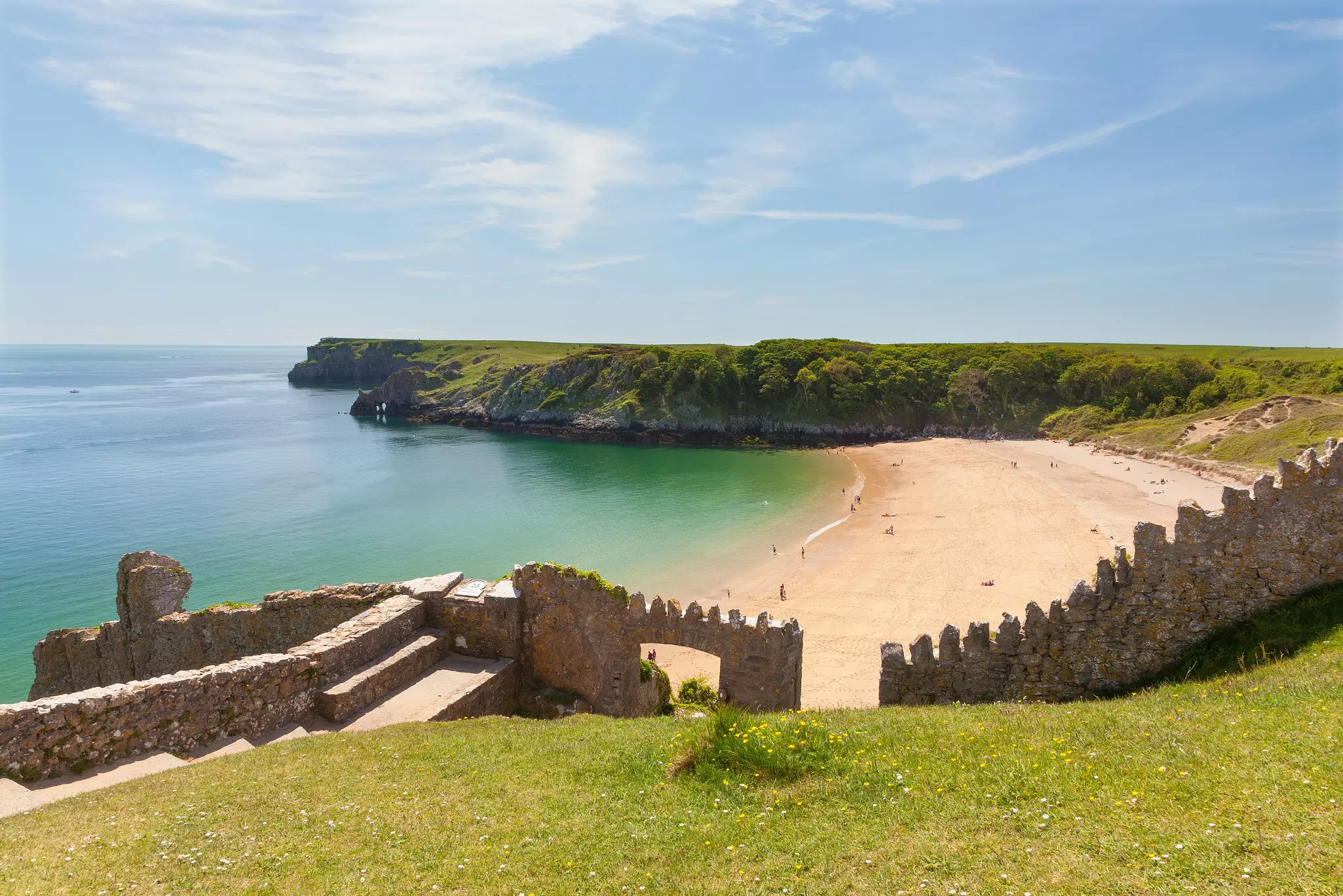
Leaving Broad Haven South’s sands behind, you’ll have an enjoyable day strolling the cliffs, dropping down to beaches, admiring the sea-carved rocks, and scanning the skies and cliffs for birdlife. Key stops include Stackpole Head – a breeding ground for kittiwakes, razorbills, fulmars and guillemots – and Barafundle Bay, voted one of the top ten beaches in the world.
The 18th-century Stackpole Quay is a worthy photo stop before you continue to the attractive beach at Freshwater East (walk on the sand if the tide is out). Weave in and out of small sandy coves and past Manorbier Castle – birthplace of 12th-century Welsh scholar Giraldus Cambrensis – to reach Skrinkle Haven.
14 miles/22.5km
You’re almost there! It’s a long last day, in mile terms, but the terrain is easy underfoot. As you daisy-chain between beaches, soak in the superb views of Caldey Island, the Gower Peninsula, and Exmoor – across the Bristol Channel in Devon. Check firing times at the Penally Gallery Range to plan your route for the day.
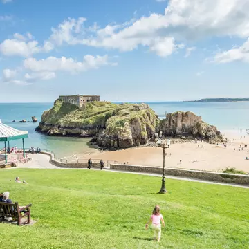
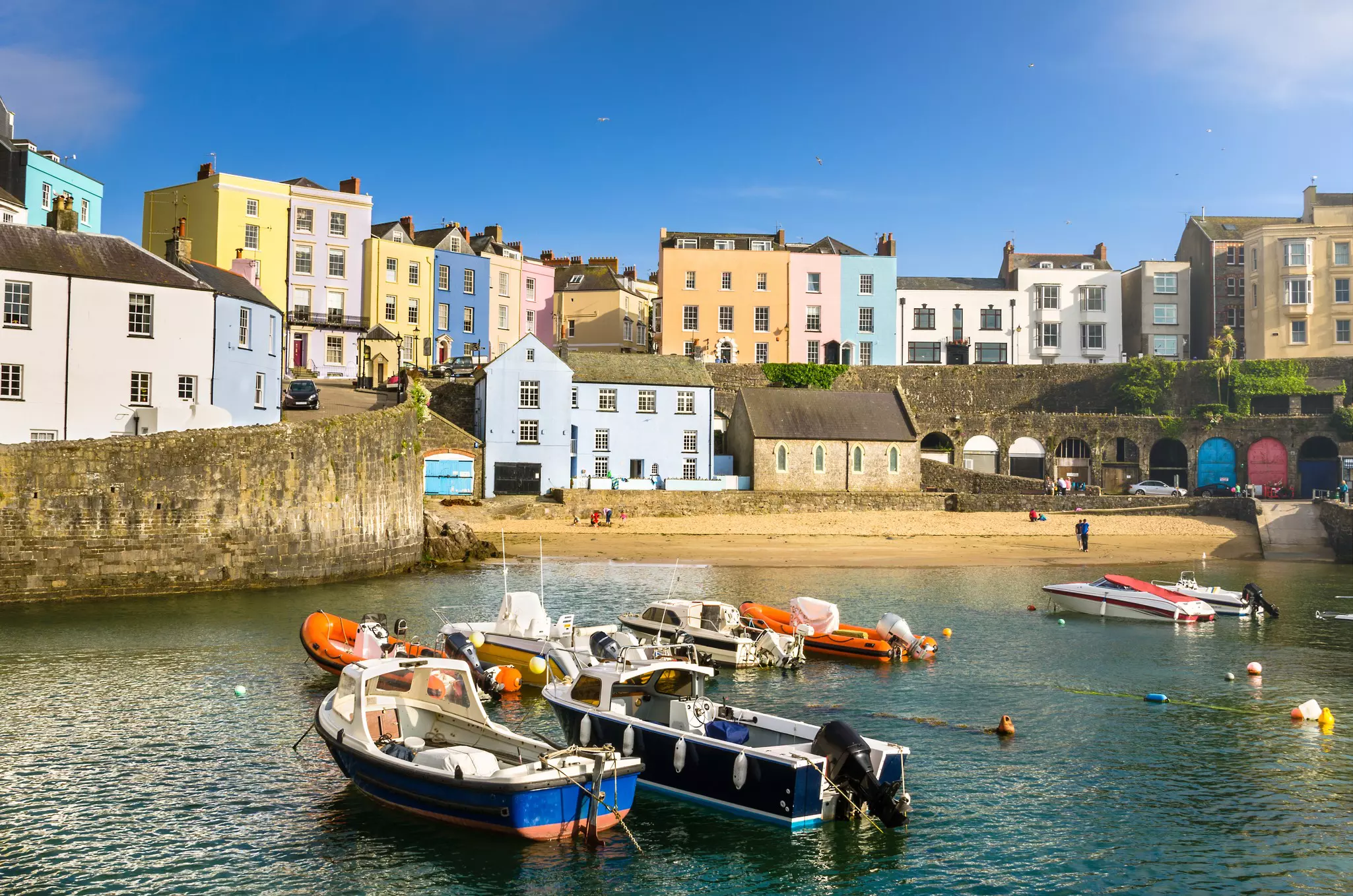
There are impressive coastal rock formations and caverns at Lydstep Head to admire before you reach the broad, sweeping beach at Tenby. Drop into Tenby’s castle-set museum, promenade along the harbor, then return to rugged clifftop walking to reach the old coal port of Saundersfoot and finally Amroth, where you can slurp an ice-cream on the beach or drop into the Amroth Arms to toast the end of the hike.
The steep climbs into and out of coves along the trail are not suitable for wheelchair users or people with limited mobility, but accessible sections of trail have been established within many of the bays, including easy-access pathways to beaches and viewpoints. See the Pembrokeshire Coast website for more information.
This article was adapted from Lonely Planet’s Wales guidebook, published in June 2025.
Explore related stories