Jul 14, 20268 min read
16 things to know before visiting Costa RicaMay 20, 2022
7 MIN READ
Contributors
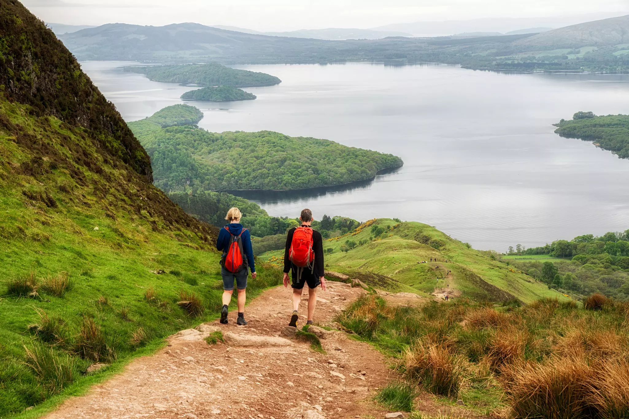
Finish a hike with a dive into Loch Lomond © Jaroslav Moravcik / Shutterstock

Contributors

Lonely Planet Editors, Joe Bindloss
Lonely Planet may earn a commission from affiliate links on our site. All recommendations and reviews reflect our own independent opinions.
Although Scotland has no shortage of protected areas, from national nature reserves to marine sanctuaries, only two reserves are designated as national parks – Loch Lomond and the Trossachs and the Cairngorms. But what national parks! Both are packed with jaw-dropping landscapes and overflowing with outdoor adventures.
From stargazing in one of the UK's first designated dark sky parks to hiking some of the country's best long-distance routes, here are the top things to do in Scotland's national parks.
Best for walking and cycling
Loch Lomond and the Trossachs was Scotland's first national park, created in 2002. The park extends over a huge area, from Balloch north to Tyndrum and Killin, and from Callander west to the forests of Cowal. The "bonnie banks" and "bonnie braes" of Loch Lomond – a scenic region of hills, lochs and healthy fresh air – have long been Glasgow's favorite rural retreat, while the picturesque Trossachs region is a sprawl of thickly forested hills and romantic lochs that is the definition of wild highland beauty.
There are walking routes throughout the national park, with trails that are suitable for walkers of all abilities and all levels of experience. All offer stunning highland views and endless miles of peaceful serenity. For a taster, the village of Rowardennan is the starting point for day ascents of Ben Lomond (974m), a popular and relatively straightforward (if strenuous) climb. Here's a guide to the best-loved long-distance hikes:
West Highland Way (96 miles/154km) A big walk for scenery, following Loch Lomond's eastern shore.
Rob Roy Way (80 miles/128km) An epic hike of five to eight days, heading from Drymen to Pitlochry via the Trossachs.
Three Lochs Way (34 miles/55km) A multi-day loop west from Balloch through Helensburgh and Arrochar before returning to Loch Lomond at Inveruglas.
Great Trossachs Path (30 miles/48km) A fine two- to three-day walk linking the loch with the Trossachs.
Many walking trails are suitable for mountain bikes and there are also dedicated cycle routes. Cyclists can bike the mostly traffic-free Clyde and Loch Lomond Cycle Way that links Glasgow to Balloch (20 miles/34km) in one day. Devote a second day to the West Loch Lomond Cycle Path, which continues from Balloch along the loch shore to Tarbet (10 miles/16km). Numerous shorter cycle routes are available for a leisurely morning or afternoon pedal.
How to get to Loch Lomond and the Trossachs: Loch Lomond is just 20 miles (34km) from Glasgow and easily accessible by bus or train, while the Trossachs can be reached from Edinburgh, either directly, or with a change in Stirling.
There are plenty of accommodations around Loch Lomond, from hotels aimed at tour groups to characterful traditional inns and Hostelling Scotland hostels for walkers on the West Highland Way. The Trossachs area is well stocked with quality B&Bs, with Callander in particular offering a wide selection, and Aberfoyle and Killin also make good overnight stops. Campsites book up fast in summer so book ahead; wild camping is permitted.
The natural barrier of Loch Lomond means that crossing between the western part of the park and the Trossachs in the east involves a long detour, either to the far north of the region via Crianlarich, or to the far south via Drymen. Walkers and cyclists can link the two more easily via the waterbuses that criss-cross Loch Lomond.
Best for high mountain hikes and skiing
Cairngorms National Park is the largest national park in the UK, more than twice the size of the Lake District, and it feels suitably epic. This vast expanse of wild country stretches from Aviemore in the north to the Angus Glens in the south, and from Dalwhinnie in the west to Ballater and Royal Deeside in the east. The royal family's holiday home, Balmoral Castle, is located within the national park, and is open to visitors from April to August.
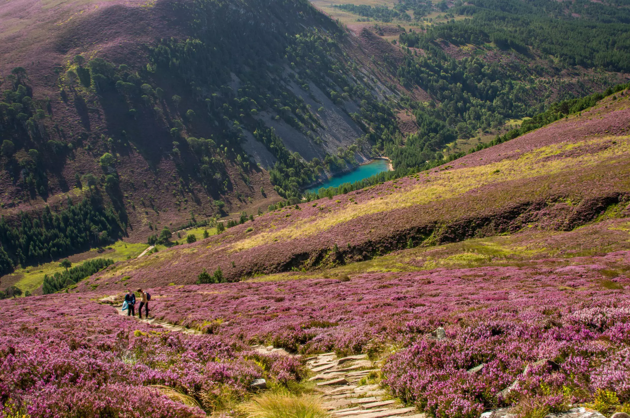
The park encompasses the highest landmass in Britain – a broad mountain plateau, riven only by the deep valleys of the Lairig Ghru and Loch Avon, with an average altitude of more than 1000m. The range includes five of the six highest summits in the country, and 55 peaks designated as Munros (summits over 3000ft/914m).
This wild mountain landscape of granite and heather has a sub-Arctic climate and supports rare alpine tundra vegetation and high-altitude bird species, such as snow bunting, ptarmigan and dotterel. There's also a chance of spotting Scottish wildcats, red squirrels and red deer, and feathered predators such as ospreys and golden eagles.
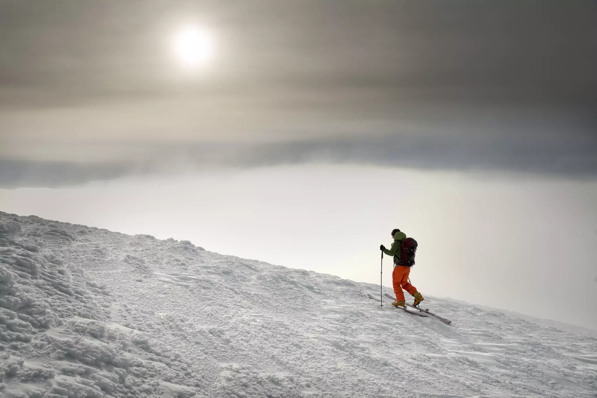
Cairngorm Mountain is Scotland’s most popular ski area and a popular winter destination for both downhill skiing and ski touring. The mountain resort offers more than 30km of managed runs, with 11 surface lifts and ski and snowboard rental on-site, and it sits just 11 miles (18km) from Aviemore, the park's main hub for accommodation, eating and nightlife. There's more family-friendly skiing at Glenshee and The Lecht.
Aviemore is easy to reach by car, bus or train, though winter conditions can affect schedules; shuttle Bus 31 runs from Aviemore up to the Cairngorm Mountain car park. Note that the snow in the Cairngorms can be variable – with winter temperatures in Scotland getting warmer due to climate change, the resorts sometimes have to spray manmade snow onto the lower slopes.
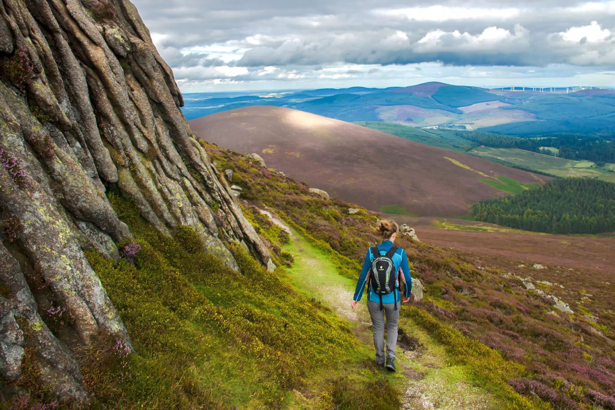
There are plenty of walking and cycling routes across the national park, and bike hire is widely available at tourist hubs. Hiking is possible year-round on the exposed summits of the Cairngorm range, but winter hiking can involves some serious weather conditions, and is only for the experienced and well-equipped. Popular long-distance routes include:
The Speyside Way (65 miles/105km) A challenging tramp from the Moray coast to the edge of the Grampian Mountains along the River Spey.
The Deeside Way (41 miles/66km) A hike along a vanished railway line from central Aberdeen into the national park to Ballater.
The Cateran Trail (64 miles/103km) One of Scotland’s Great Trails, traversing Perthshire and the Angus Glens in five stages.
The Dava Way (24 miles/39km) A rewarding muti-day trek from Forres in Moray to Grantown-on-Spey via the summit of 1052ft (320m) Dava.
Southwest of Aviemore, the Spey widens into Loch Insh, home of the Loch Insh Outdoor Centre, which offers canoeing, windsurfing, sailing, mountain biking and fishing. Grantown is another popular spot for anglers chasing sea trout and salmon on the River Spey.
Stargazing and astronomy events are held at least monthly from August to April in the Tomintoul and Glenlivet Cairngorms Dark Sky Park, one of the UK's first designated dark sky reserves.
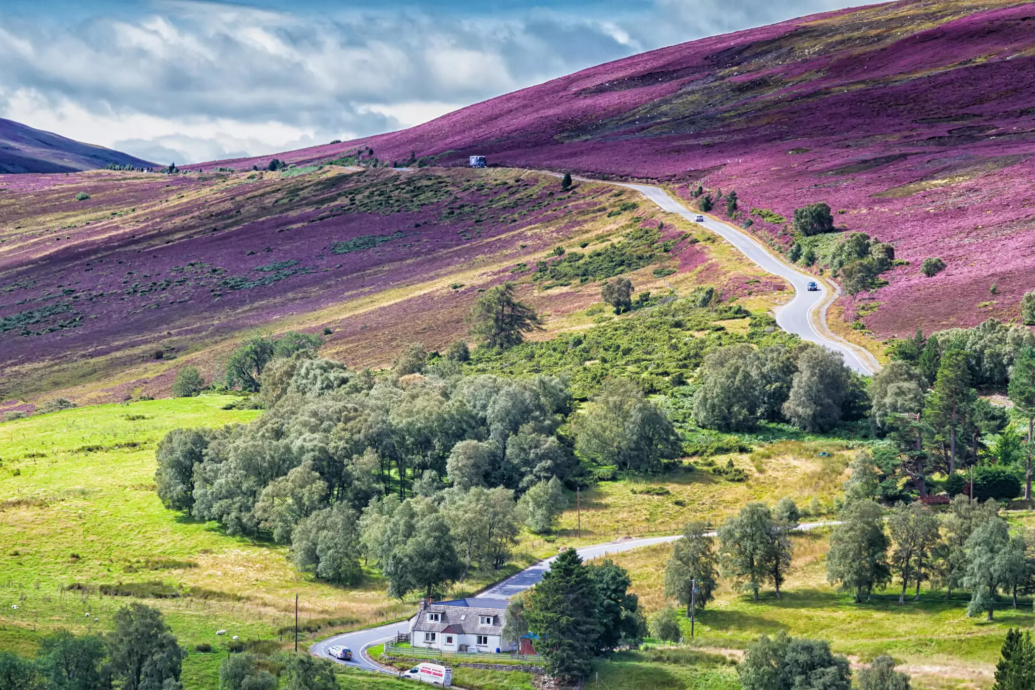
Visiting the Cairngorms: The main accommodation centers in the Cairngorms are at Aviemore, Newtonmore and Kingussie, Grantown-on-Spey, Ballater and Braemar, but wild camping is the best way to experience the remote glens and mountains of the national park. Trains and buses run regularly to Aviemore from Glasgow, Edinburgh and Inverness, and local buses connect the villages within the national park.
The main A9 Perth–Inverness road (and the railway line) run along the western and northern boundaries of the national park, while the A93 Aberdeen–Braemar road provides the main access to the eastern part. The Angus Glens in the south are reached along minor roads branching out from the small towns of Kirriemuir and Brechin, to the north of Dundee. The nearest airport is at Inverness, an hour's drive north of Aviemore.
Take your Scotland trip with Lonely Planet Journeys
Time to book that trip to Scotland
Lonely Planet Journeys takes you there with fully customizable trips to top destinations – all crafted by our local experts.

Explore related stories