Oct 1, 20266 min read
The Best Places to Celebrate Halloween in the USAug 24, 2026
9 MIN READ

Writer
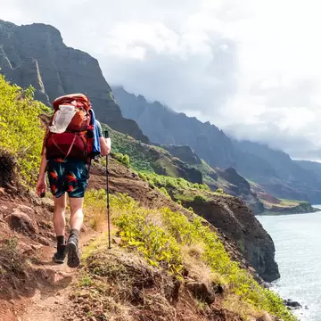
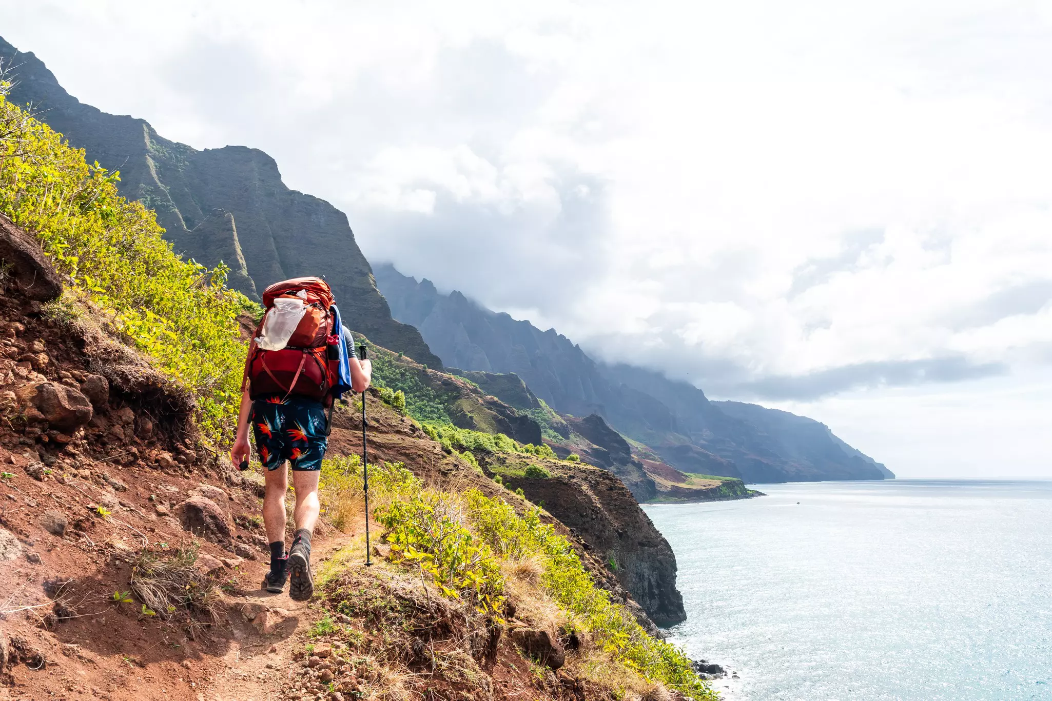
Hiking the Kalalau Trail in Kauaʻi, Hawaiʻi. Raphael Rivest/Shutterstock
Writer
Lonely Planet may earn a commission from affiliate links on our site. All recommendations and reviews reflect our own independent opinions.
Some of the United States' most spectacular hikes come with one major catch: you can't simply show up and hit the trail. Many of these coveted adventures, tucked into national parks, require permits that often sell out or are awarded through lotteries months in advance.
This guide covers some of the best permit-only hikes in the country, what makes them worthwhile, how to navigate each permitting system and strategies for improving your odds of securing a spot. Having completed several myself, I'll also share some firsthand planning tips and realistic expectations, including one important caveat: in most cases, these hikes are not for beginners.
Best for a winter adventure
Distance: 6.4 miles out and back – but there are tons of side quests (we did nearly 9 miles!)
Estimated time to complete: 3–5 hours
Level of difficulty: moderate to strenuous
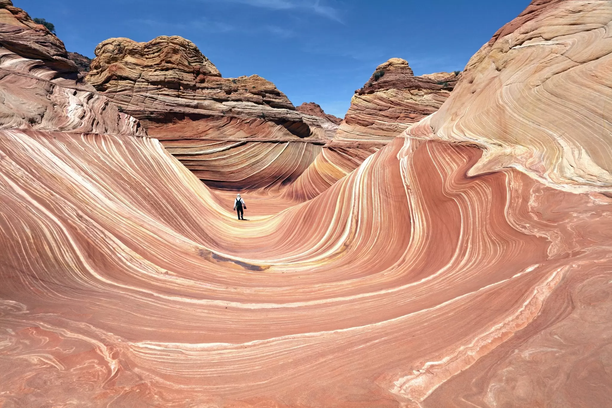
In rugged, remote far-northern Arizona, along the Utah border, The Wave is arguably one of the world’s most recognizable landscapes. Layered orange and pink sandstone swirls stand in stark contrast to the surrounding unforgiving desert, creating a hiker’s wonderland. You can be one of them – provided you secure one of 64 daily permits. I’ve had the privilege of hiking The Wave twice, and I assure you it’s worth the effort. Just avoid the summer, when the dry heat is genuinely dangerous.
How to get a spot: Recreation.gov hosts the advanced lottery, issuing 48 of the 64 daily permits 4 months ahead (to hike in May, apply in January). The remaining 16 are issued via the trickier daily lottery, requiring applicants to be inside a "geofence," a designated nearby area, both to apply 2 days out and pick up permits and attend a safety briefing the following day. You’ll need to be in the area for at least 2.5 days.
Getting there: Wire Pass Trailhead is 1 hour from Page, Arizona, and Kanab, Utah, both small towns with plenty of services and lodging. The closest major airport is Las Vegas, 4.5 hours away.
Planning tip: Arizona doesn’t observe daylight savings time, but Utah does. The daily lottery process, including application and permit pickup, operates on Utah time, which is 1 hour ahead of Arizona for half the year.
Best for hikers who aren’t afraid of heights
Distance: 5.4 miles round-trip
Estimated time to complete: 4–5 hours
Level of difficulty: moderate to strenuous
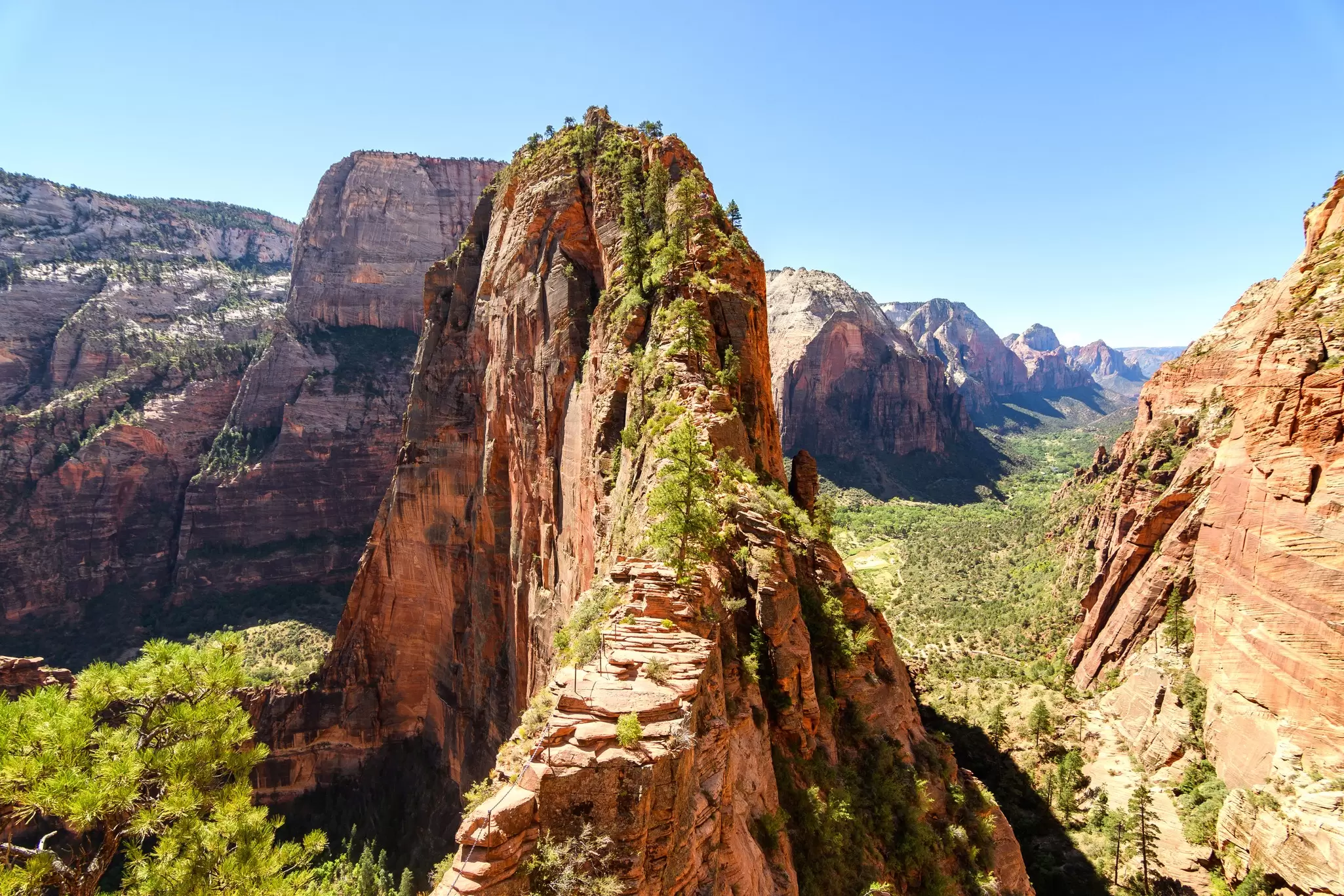
It lives up to the hype: Angels Landing is steep, narrow and nerve-wracking. I’m an experienced hiker and not particularly bothered by heights, but I still give myself mental high-fives for completing it. Most of the hike is relatively moderate, starting in the scenic Grotto area and passing through aptly-named Refrigerator Canyon and the famed Walter’s Wiggles switchbacks. The challenge comes in the final half-mile, when hikers use chains to traverse ridges as narrow as 2ft across, with sheer 1000ft drops on both sides. Enough people want to brave it that Zion implemented a permit system in 2022, limiting the trail to a few hundred to 800 hikers daily, depending on the season.
How to get a spot: The Angels Landing lottery is one of the most complex, but also easiest, permits to land. You choose both a date and timeframe (before 9am, 9am to 12pm or after 12pm). Advance permits are issued quarterly, and there’s also a year-round day-before lottery.
Getting there: Zion is a little over 2 hours from Las Vegas, and a popular destination on road trips visiting Utah’s Mighty 5 or other Southwest national parks. Start at The Grotto, stop 6 on the park shuttle.
Planning tip: Angels Landing is an extra-thrilling, extra-beautiful experience with a bit of snow (we hiked it in January) – just make sure the ground isn’t icy.
Best for expert hikers and backpackers
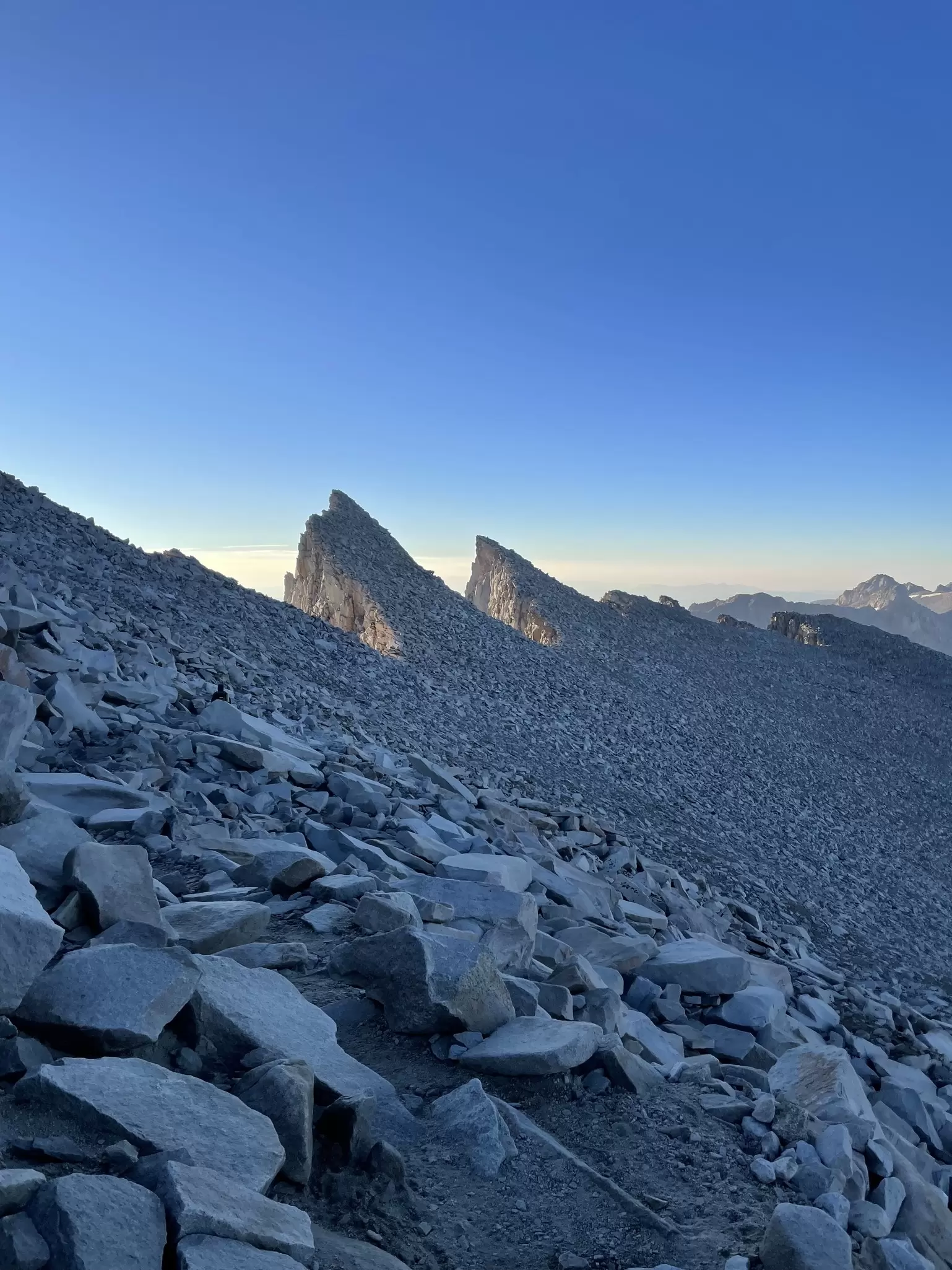
Distance: 10.7 miles one-way
Estimated time to complete: 12–16 hours
Level of difficulty: extremely strenuous
Soaring to 14,505ft, Mt Whitney is the tallest mountain in the Lower 48 – it’s no surprise thrillseekers come from all over to climb it. The Sierra Nevada peak straddles Sequoia National Park and Inyo National Forest, and hikers have two route options, starting from either side. Whitney Portal on the east is the most popular, a 10.7-mile trek compared to a minimum of 60 starting in Sequoia. Even the shorter hike is strenuous, climbing over 6200ft to the summit, much of the route is exposed. Wilderness permits are required year-round, but they’re limited to 100 in peak season, May 1 to November 1. When snow or ice is present (reliably through June, often into July), mountaineering gear and experience are non-negotiable for safety. Even in optimal conditions in August and September, watch for lightning and high wind.
How to get a spot: Enter the Mt Whitney lottery in February. Permit winners are notified in March and have about 1 month to confirm their reservation and pay fees.
Getting there: Whitney Portal is a 4-hour drive from Los Angeles and Las Vegas. The closest services are in tiny Lone Pine, California, 20 minutes away.
Planning tip: Acclimate to the elevation for a couple of days prior to your hike, and don’t miss visiting the underrated Alabama Hills nearby. Check out our comprehensive guide to hiking Mt Whitney for more planning advice.
Best for a weekend backpacking trip
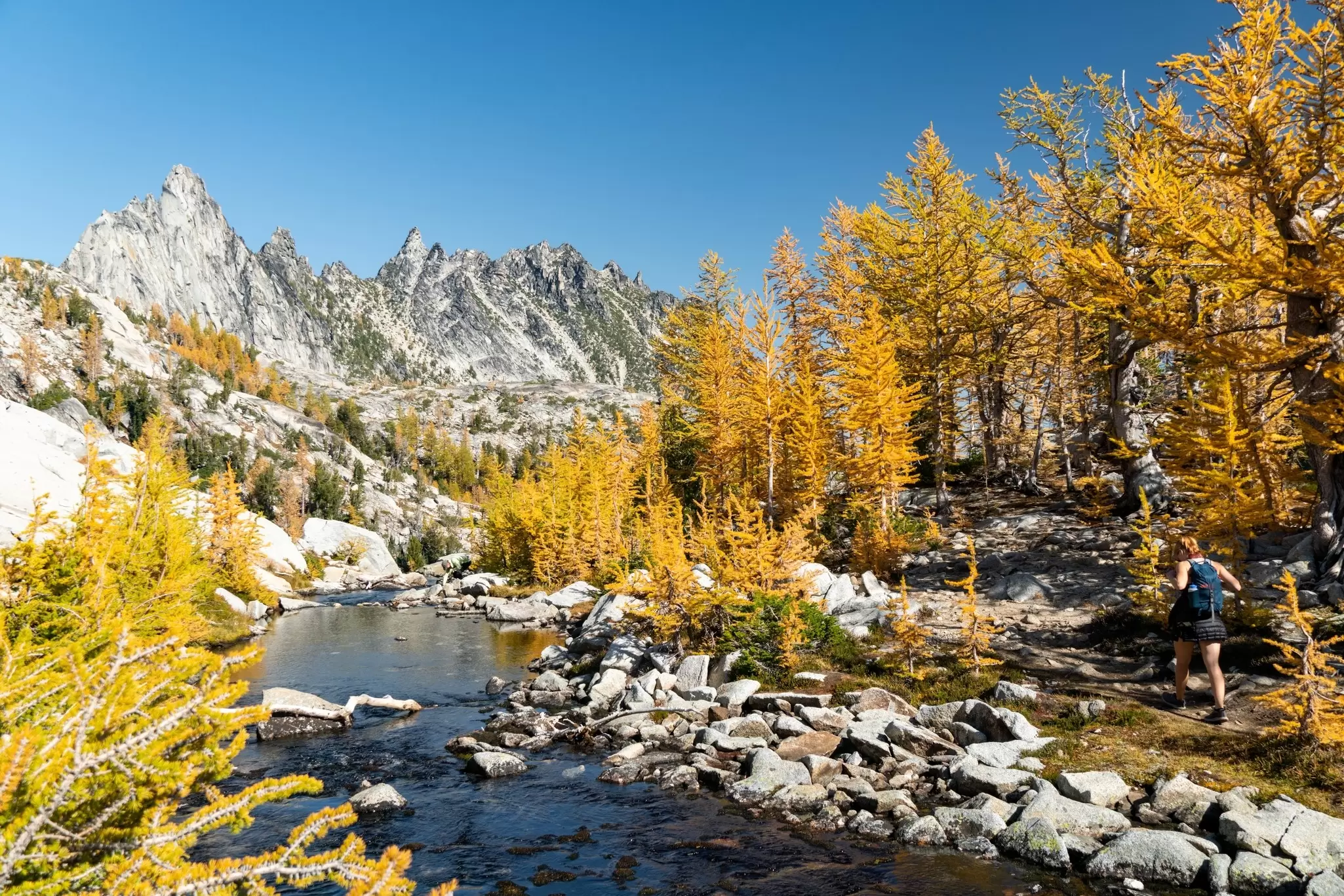
Distance: 18–22 miles, depending on exact route
Estimated time to complete: 12–18 hours
Level of difficulty: strenuous
Nestled in the Cascade Mountains’ Alpine Lakes Wilderness, the Enchantments are a level of unspoiled that’s increasingly rare. Craggy peaks, somehow more whimsical than menacing. Glassy, swimmable lakes. Glaciers. Carpets of wildflowers and abundant wildlife, from omnipresent mountain goats to elusive black bears. The primary hike is long and challenging, best done as an overnight or 2-night backpacking trip. Like Mt Whitney, August and September offer a sweet spot of favorable conditions. Double bonus: fall foliage is often near-peak at the end of September, and permits are slightly easier to come by.
How to get a spot: Permits are required year-round, but peak-season overnight (May 15 to October 31) are highly coveted. Only 24 are issued each day, 16 in the advanced lottery and 8 in the daily lottery. The advanced lottery runs February 15 to March 1, with winners notified by March 17. Like Coyote Buttes, the daily lottery requires applicants to be inside a 1-mile geofence of the Leavenworth Ranger Station. It opens one day before the intended hike.
Getting there: The Enchantments are 30 minutes outside Leavenworth, 2.5 hours from Seattle, and 3 hours from Spokane. Leavenworth is an adorable Bavarian town and a perfect basecamp.
Planning tip: You can start from Stuart Lake or Snow Lakes. Stuart Lake is more popular and sits higher than Snow Lakes, reducing total elevation gain. Because it’s a point-to-point hike, you’ll need to stage two vehicles at both trailheads or hire a shuttle like Leavenworth Shuttle or Loop Connector.
Best for cable climbing
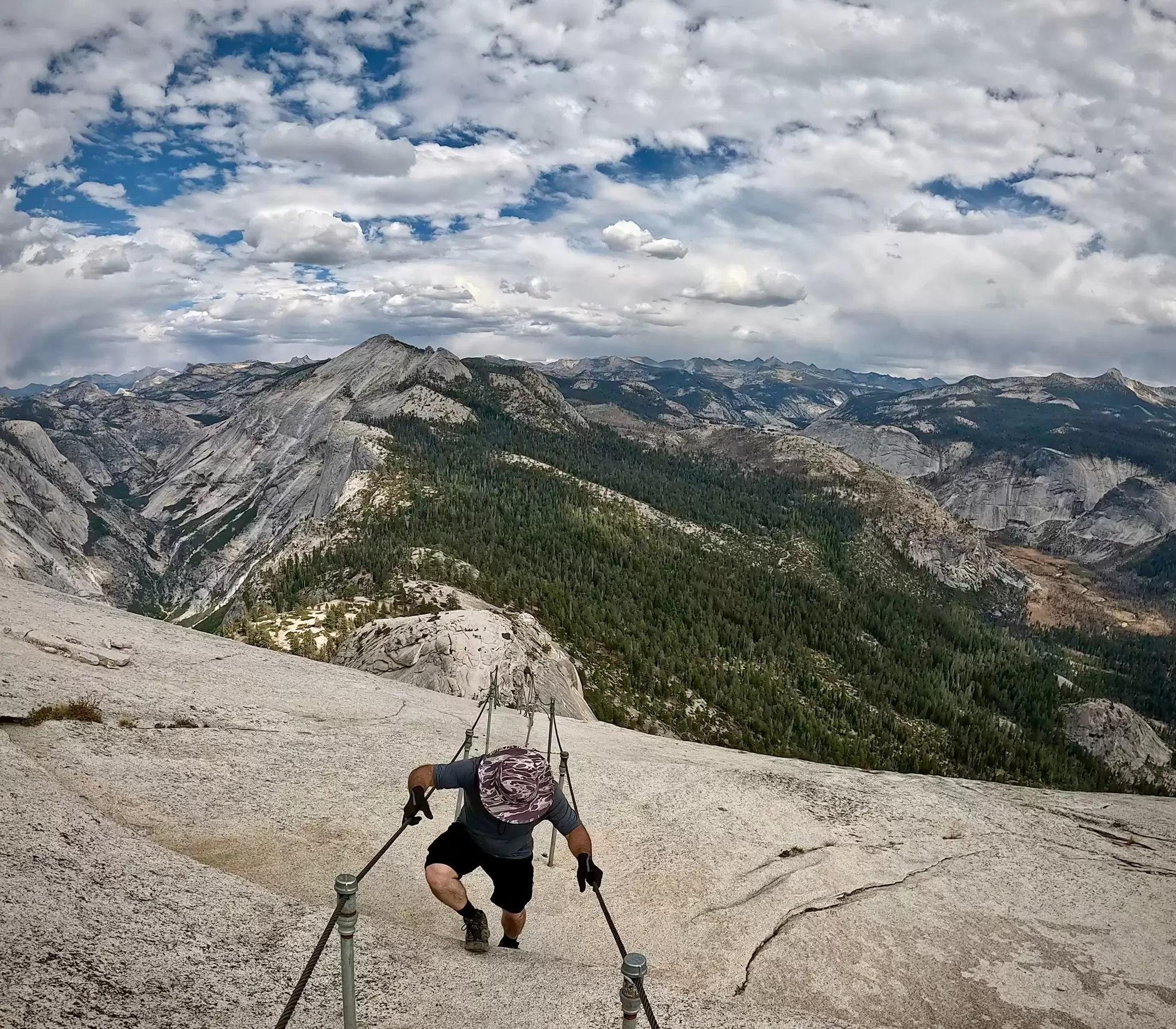
Distance: 14–17 miles, depending on exact route
Estimated time to complete: 10–14 hours
Level of difficulty: strenuous
I hiked Yosemite’s infamous Cables Route with friends a few Septembers ago, clocking 19 miles and 6000ft of elevation gain. The preseason lottery success rate hovers around 20% (significantly lower for first choice of days), but I won our group’s permit on the first try, and we got our first date choice. The park issues 300 permits daily – 225 for day hikers and 75 for backpackers – when the cables are up, typically the Friday before Memorial Day in May through the second Tuesday in October. Although you can technically summit Half Dome when the cables are down, the park expressly recommends against it, as it becomes a climbing route.
How to get a spot: Yosemite issues most permits through the preseason lottery every March, with winners notified in April. You can also enter the much smaller daily lottery 2 days in advance.
Getting there: Half Dome hikes start from the Mist Trail in Yosemite Valley, with Fresno (FAT) being the closest airport at 2.5 hours away. Sacramento is the next-best option at 4 hours.
Planning tip: Stay in Yosemite Valley the night before your hike to cut down on drive time. We stayed in the Curry Village tent cabins, an easy walk to the trailhead and next to the Pizza Deck.
Best for a bucket-list hike
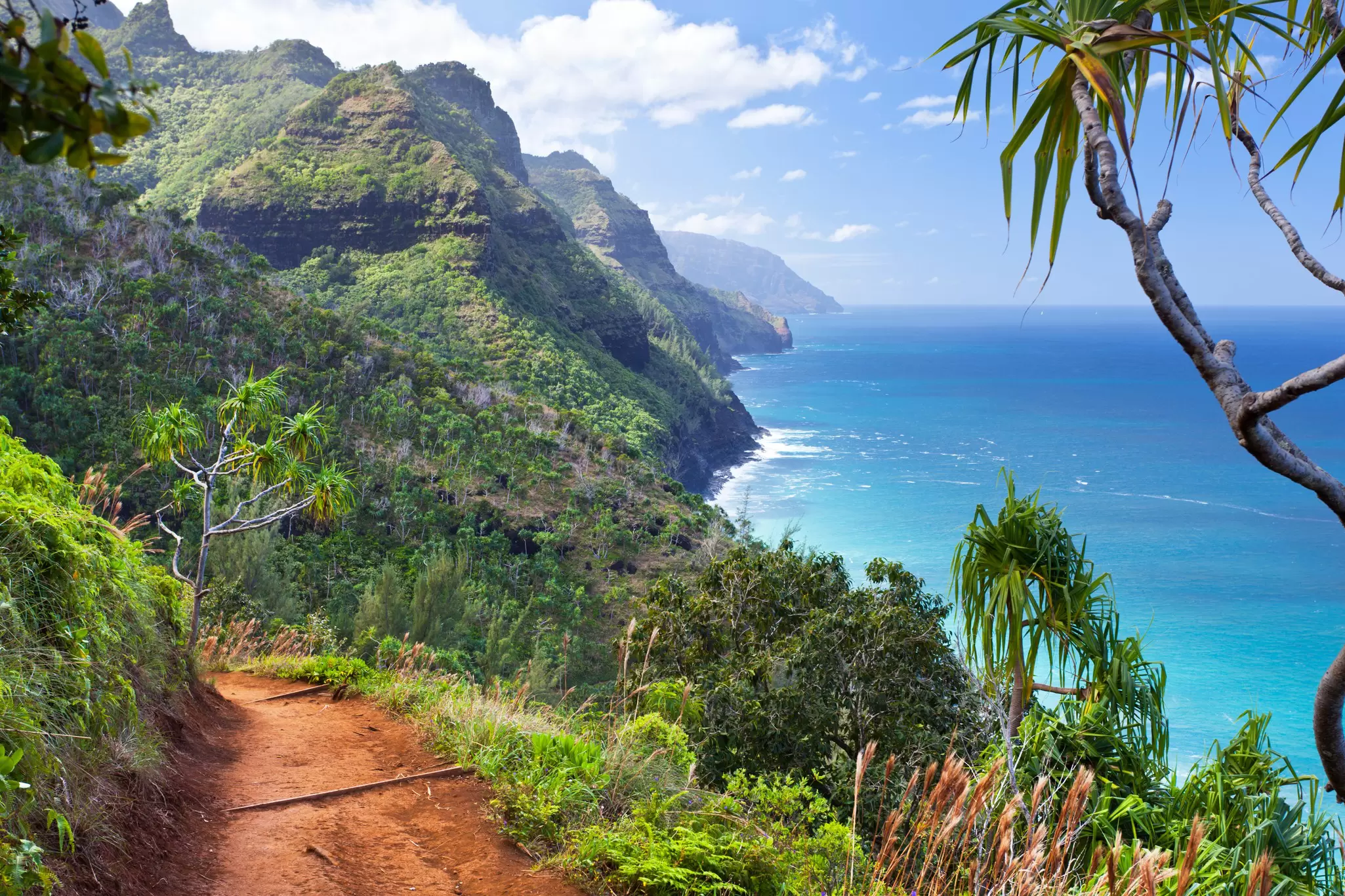
Distance: 11 miles one-way
Estimated time to complete: 6–10 hours, depending on conditions
Level of difficulty: moderate to strenuous (also depending on conditions)
Kauaʻi's Nāpali Coast tops many a bucket list, but access is limited to seeing it from a boat or helicopter – or exploring on foot, via the Kalalau Trail. The spectacularly rugged 11-mile trail leads to cliff-framed Kalalau Beach, undulating across lush valleys and sea cliffs along the way. The first 2 miles, from Hāʻena State Park to Hanakapi’ai Beach, is a wildly popular day hike, while continuing beyond the beach is a more ambitious challenge involving at least 1 night camping. Access to the Kalalau Trail requires reservations at Hāʻena; going beyond Hanakapi’ai requires a camping permit.
How to get a spot: Kalalau Trail access requires two permits. Start with the Nāpali Coast State Wilderness Park permit, released on a rolling 90-day basis at midnight Hawaiʻi time. During peak summer, permits sell out in literal seconds. Hāʻena State Park entry reservations release 30 days out, also at midnight. Kalalau Trail camping permit holders do not need separate Hāʻena reservations.
Getting there: Hāʻena State Park, 1.5 hours from Lihue Airport, offers three options: parking + entry (the most limited), shuttle + entry (which I recommend) and walk-in. The shuttle offers the best odds, with two pickup locations.
Planning tip: Even if you plan to camp multiple nights, enter only the first date initially, then add the others in checkout. This seems to be a bit of a magic trick for winning permits.
When applying for permits, have everyone in your group enter the lottery when the system allows multiple applications. Not all do, so check the rules carefully. Where possible, name other group members as alternate permit holders. That way, if something prevents the primary permit holder from going, others can still go. This came in handy when our group separated while hiking Half Dome: I was the lead permit holder, but a ranger stopped the other group to check permits. Luckily, one hiker was an alternate. Finally, if applying for multiple hikes, coordinate your dates carefully. It’s unlikely, but you could win more than one. You don’t want to have to choose between overlapping trips.
Book your United States trip with Lonely Planet Journeys
See United States how it's meant to be seen
Planned by local experts and tailored to you, Lonely Planet Journeys handles the logistics so you can just enjoy the trip. Tell us what you want and we'll build your United States itinerary from scratch, or browse our bookable trips to get inspired.

Explore related stories