Oct 1, 20266 min read
The Best Places to Celebrate Halloween in the USSponsored by
This article was paid for and produced with AllTrails. Paid content is produced separately from Lonely Planet's editorial coverage. Product availability and terms are subject to change; please verify details directly with service providers.
Jul 7, 2026
35 MIN READ

Writer
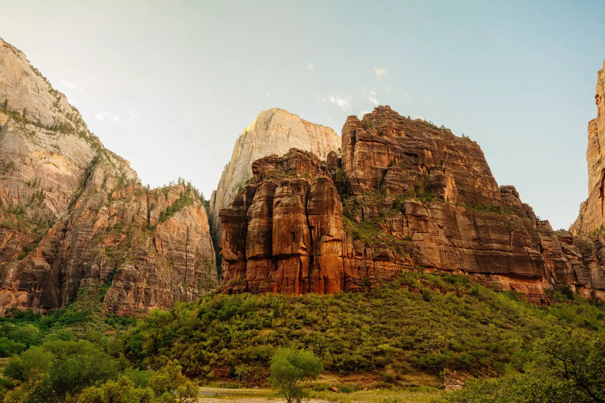
Zion National Park, Utah. Katelyn Perry/Lonely Planet
Writer
Highlights
Editors partner with AllTrails on 10 US national park hikes, California to Maine.
Clouds Rest in Yosemite offers Sierra Nevada panoramas – no permit, no lottery.
Jordan Pond Path in Acadia suits families; the Smokies' Oconaluftee trail welcomes dogs.
Dark Hollow Falls in Shenandoah packs 70ft cascades into an enchanting 1.4-mile walk.
Two of the most trusted names in outdoor exploration have come together to answer the question on every adventurer's mind: which trails should we hike in the USA's national parks?
I know firsthand how hard it is to answer this question sometimes. We were in Rocky Mountain National Park in mid-June and were completely overwhelmed by the possibilities. We wanted a bit of ease because we had a four-year-old with us, a stream to have a picnic by, some birds for my bird-watching son, and, of course, as crowd-free as possible. The AllTrails app surfaced some great recommendations for us, and we used Lonely Planet to find a sports bar to watch the US vs Panama World Cup game after the hike, so it was a win all around.
Lonely Planet has spent decades sending writers into the field to walk every trail, eat at every roadside diner, and sleep in every historic lodge — so that when you arrive, you already know where to go. AllTrails brings something equally essential: a platform of more than 500,000 trails worldwide, used by a community of 95 million members who share honest reviews, recent photos, and real-time trail conditions so you know exactly what you're walking into. Together, they're the ultimate resource for outdoor travel — pairing Lonely Planet's on-the-ground expertise with AllTrails' tools and community insight to help you explore with confidence, whatever your experience level.
The 10 hikes in this guide appear in Lonely Planet's guidebooks and on AllTrails — endorsed by our writers and rated by the members who've actually done them. But they aren't the only choices, and in a summer when several parks have dropped their reservation systems, having a plan B matters more than ever. AllTrails' dedicated park pages show you when trails are at their busiest, so you can time your visit or find a quieter alternative if a park is more crowded than expected. Download maps before you arrive — cell service in national parks is notoriously unreliable — and use the app to pivot in real time if your first choice isn't working out. Come prepared, and you'll always have somewhere worth going.
America's national parks are among the most visited places on earth, and the pressure shows. There are some tips you should know before you go. Several parks have recently removed timed-entry reservation systems; we've highlighted the details for each park below. But no reservation requirement doesn't mean no crowds. Arrive early, go on weekdays when you can, and come prepared: check the park's official alerts and operating hours before you leave, pack out everything you bring in, and be polite to the rangers and your fellow travelers; it makes a huge difference. Also, give serious thought to the trail just around the corner from the famous one. AllTrails is the right tool for finding it — search by park, filter by difficulty, and check real-time conditions before you set off.
Location: California
Length: 12.5 miles round-trip
Time commitment: 8-10 hours
Difficulty: Hard
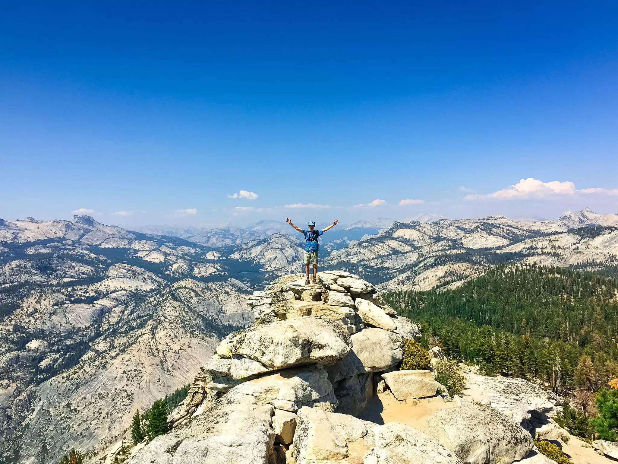
Pack your camera because Clouds Rest is Yosemite's largest expanse of granite and arguably its finest panoramic viewpoint. The 9926ft summit rises 4500ft above Tenaya Creek and stands more than 1000ft higher than nearby Half Dome. And unlike Half Dome, with its permit lottery and queuing hordes, Clouds Rest asks nothing of you but the will to climb. No permit. No lottery. Just one of the Sierra Nevada's most inspiring viewpoints, available to anyone willing to earn it.
The hike begins at the Sunrise Lakes Trailhead at the west end of Tenaya Lake off Tioga Road. Trailhead parking is limited and the lot fills early; if you're staying in Tuolumne Meadows, take the free shuttle bus to the trailhead.
Now follow the trail along Tenaya Creek for your first glimpse of Clouds Rest and Tenaya Canyon's shining granite walls. As you climb steadily up well-constructed switchbacks, the view expands to include prominent Mt Hoffmann and Tuolumne Peak to the north. Paintbrushes, lupines and wandering daisies bloom in the meadows alongside mats of pink heather. At approximately 5 miles, bear southwest and ascend the ridgeline. The trail soon narrows rather thrillingly in one spot – never less than 5ft wide, and taking only 5 to 10 seconds to cross – before opening onto a summit with breathtaking views of Half Dome and Yosemite Valley. The panorama stretches from Sawtooth Ridge and Matterhorn Peak to Mt Ritter and Banner Peak, dark and prominent to the southeast. This is one of the Sierra Nevada's most inspiring viewpoints. Savor it before retracing your steps.
AllTrails tip: Nearly 6000 reviews rate Clouds Rest as Yosemite's "ultimate day hike". And note: it's dramatically quieter than the Mist Trail corridor. Go on a weekday in September or October for the best light and fewest crowds. Fill up on water at the creek around mile 5 – it's the last source before the summit.
Where to stock up: Tuolumne Meadows Grill is a classic Yosemite dining experience with shared tables, hearty breakfasts and dinners, and box lunches perfect for the trail. For last-minute supplies, the Tuolumne Meadows Store stocks wine, beer, food, tofu dogs, dorky hats, camp cups and camping supplies. Both are on Tioga Road, less than 10 minutes from the trailhead.
Need to know: No permit is required to hike Clouds Rest as a day hike – a significant advantage over Half Dome. Yosemite no longer requires vehicle reservations, but summer traffic remains heavy and the park uses real-time traffic management, including temporary diversions when lots reach capacity. Trailhead parking is limited and fills early – take the free Tuolumne Meadows shuttle if you can.
Don't forget: The last water source on the trail is the creek at approximately the 5-mile mark – fill up and filter before the final push to the summit. UV exposure is intense at nearly 10,000 ft; bring serious sun protection. Stay off the exposed summit ridge if thunderstorms are building, and plan to be descending before early afternoon in summer.
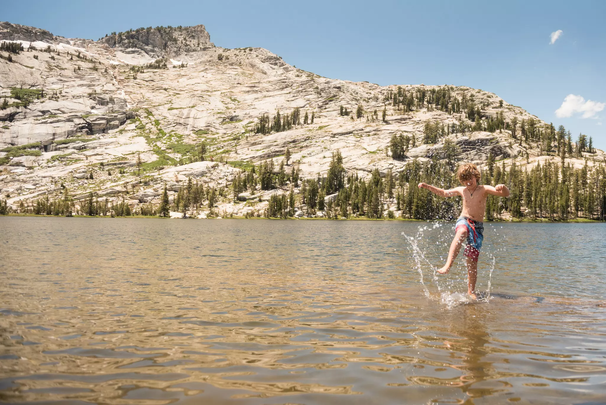
Wrapping it up: After a long day on the granite, the Tuolumne River is an excellent choice for high-country swimming, with many easy-to-reach sandy-bottomed pools and slightly warmer temperatures than other High Sierra rivers. From the pullout at the west end of Tuolumne Meadows, follow the trail along Pothole Dome and the river for about a mile to a gorgeous waterfall and hidden swimming spot. You'll also find good swimming holes at the twin bridges crossing the Lyell Fork. Elizabeth Lake can be a bit bone-chilling, but on a hot summer day, plenty of people take the plunge and love it.
Location: North Carolina
Length: 3.2 miles
Time commitment: 1-1.5 hours
Difficulty: Easy – relatively flat and partially paved
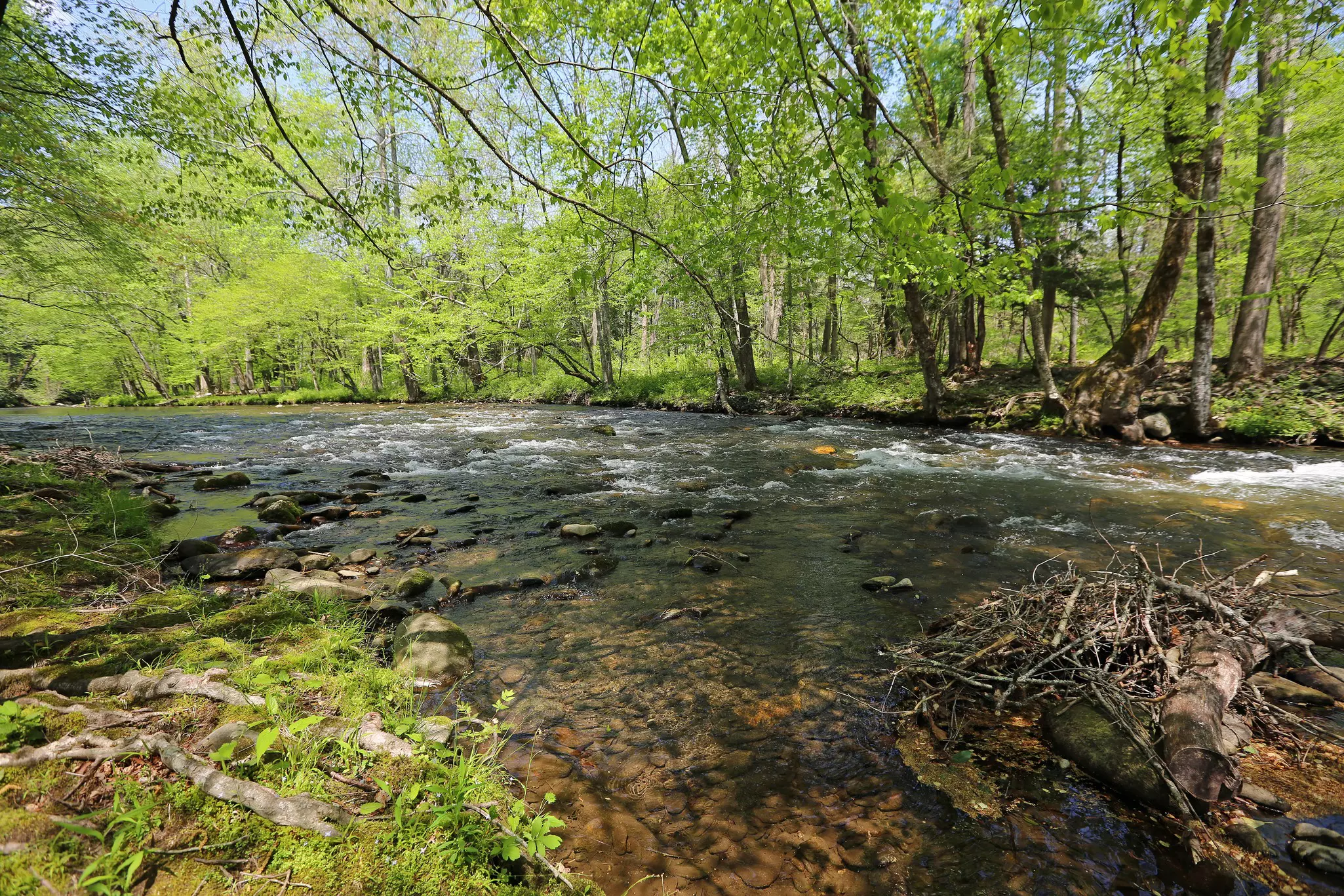
Few walks in the Smokies are as delightfully flat and easy to access as this riverside stroll between the Oconaluftee Visitor Center and Cherokee. Not only is the scenery gorgeous, but the entire route is signposted at regular intervals with plaques delving into Cherokee spirituality, artwork, traditions and lore — with all text written in English and in the beautifully flowing Cherokee script. That's Lonely Planet's description, and it captures what makes the Oconaluftee River Trail genuinely special: it's not just a pleasant walk, it's a living cultural document, winding through the ancestral lands of the Eastern Band of the Cherokee on the park's quiet North Carolina side.
The trail threads its way through an open meadow before joining the leafy green banks of the broad, tranquil Oconaluftee River. Arrive near dawn or dusk for the best chance of seeing elk grazing in the surrounding meadows — the Oconaluftee Valley is one of the park's top spots for wildlife watching, and the herd here has grown significantly since reintroduction. This is one of only three trails in the park also open to cyclists, and one of just two where dogs are welcome on leash — a genuinely rare thing in Great Smoky Mountains National Park. The Mountain Farm Museum adjacent to the Oconaluftee Visitor Center at the trailhead is worth an hour of your time before or after the walk, offering an extraordinary recreation of a 19th-century Smokies farmstead with furnished buildings, a working gristmill, and one of the park's finest cultural experiences.
AllTrails tip: 2,879 reviews and consistently rated as one of the best easy hikes in the Smokies. One of only two trails in the park allowing dogs on leash. Arrive near dawn or dusk for elk sightings in the meadows — this is the park's most reliable elk-viewing spot. The trail is partially paved and mostly flat with only a few small hills.
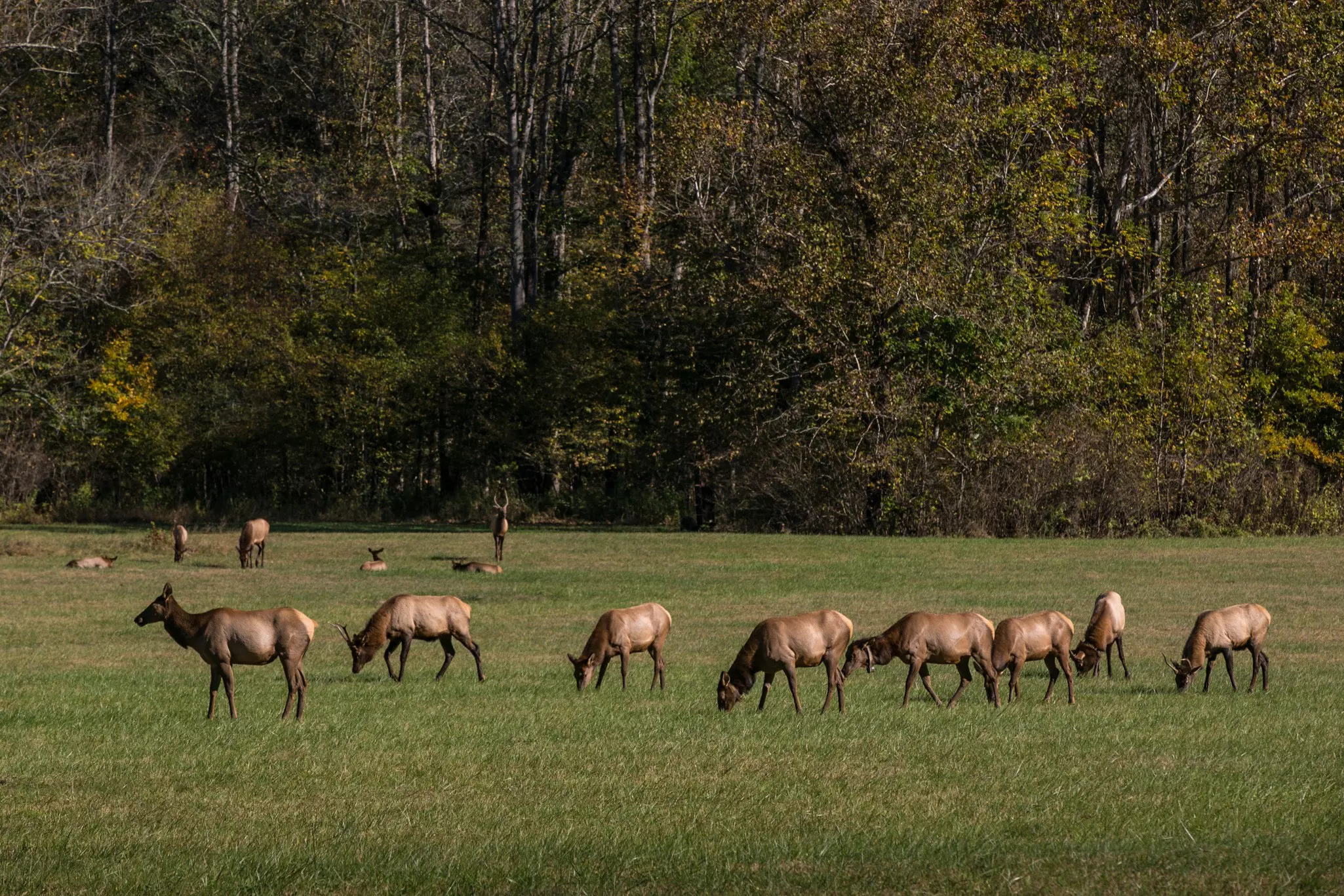
Where to stock up: The Oconaluftee Visitor Center at the trailhead is the park's best visitor center on the North Carolina side — well-stocked bookstore, interpretive displays, and helpful rangers. The town of Cherokee, immediately outside the park entrance, has grocery stores, cafes and restaurants covering all bases. For breakfast before the walk, the Oconaluftee area has several good options in Cherokee a short drive away.
Need to know: There is no entrance fee to Great Smoky Mountains National Park, but a parking tag is required for vehicles parking 15 minutes or longer — purchase online at recreation.gov or at the visitor center. Dogs are welcome on leash — one of only two trails in the park with this distinction. Bicycles are also permitted. The trail is open year-round and is one of the most accessible in the park.
Don't forget: This trail is on the North Carolina side of the park, accessed from Cherokee — a completely different entrance from the Tennessee/Gatlinburg side where most visitors arrive. Plan your approach accordingly. Arrive near dawn or dusk for the best elk viewing; midday visits are still pleasant but wildlife activity is lower. Download the AllTrails offline map before entering — cell service is inconsistent.
Wrapping it up: After the trail, spend time at the Mountain Farm Museum behind the visitor center — it is a work of remarkable detail, each building transported from a real farm elsewhere in the park, collectively painting a picture of what self-sufficient life in these mountains actually looked like. For lunch, the town of Cherokee immediately outside the park entrance has a growing food scene rooted in Eastern Band Cherokee culture. Bryson City, 15 minutes west, is the Smokies' most inviting gateway town with taprooms, restaurants and cafes. Checkout Everett Street Diner for breakfast and homemade pies, and the Bryson City Outdoors Taproom for local brews on historic Main Street.
Location: Maine
Length: 3.3 miles loop
Time commitment: 1–1.5 hours
Difficulty: Easy– mostly flat with some rocky sections on the northern end
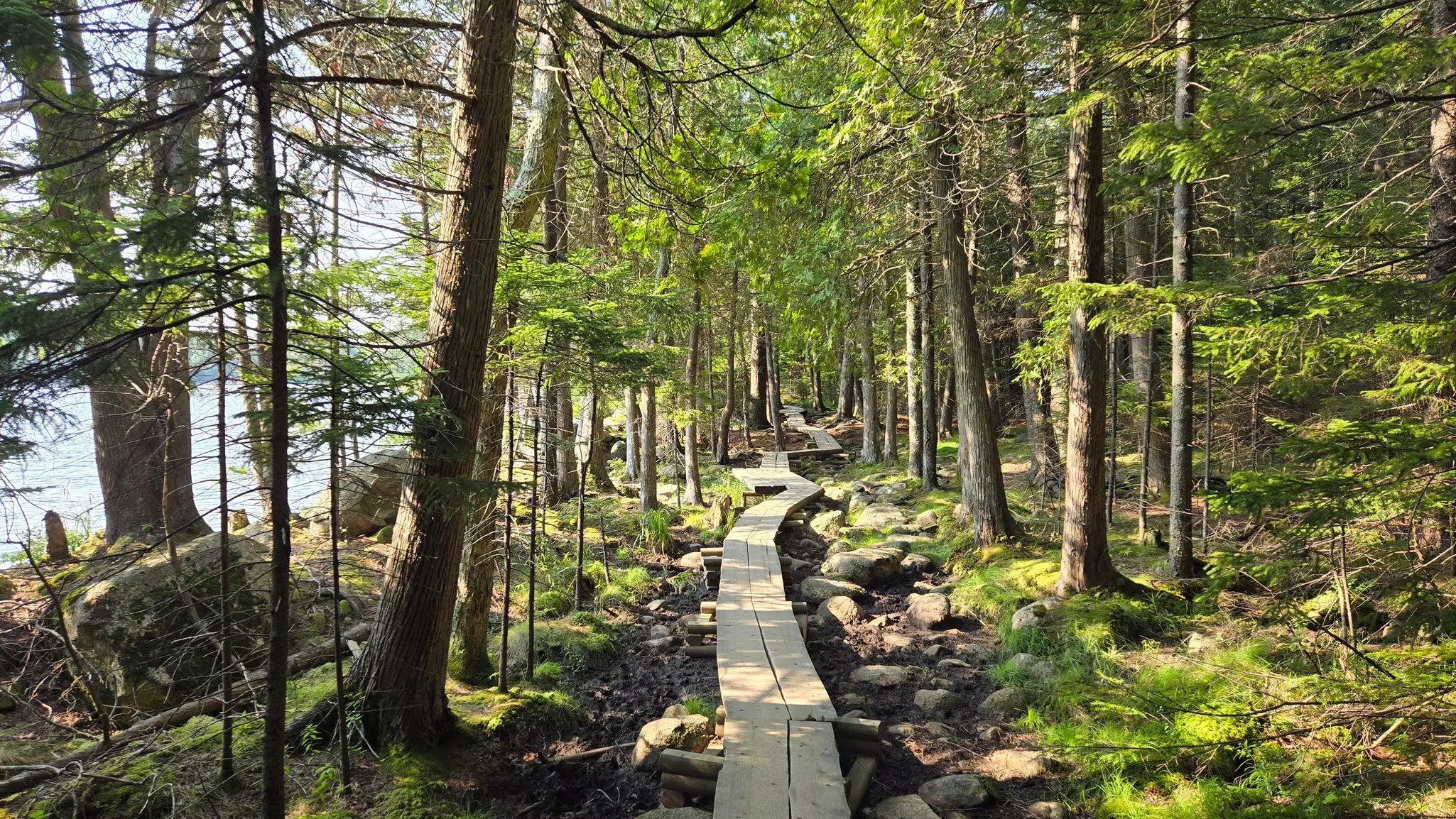
On clear days, the glassy waters of Jordan Pond reflect the image of Penobscot Mountain like a mirror — one of Acadia National Park's most photographed and most peaceful sights. A stroll around the pond and its surrounding forests and flower meadows is one of Acadia's most popular and family-friendly activities, and the 3.3-mile Jordan Pond Path is the ideal way to experience it. This is the gentler side of a park more famous for its iron-rung ladder trails: accessible, beautiful, and anchored by one of the most beloved afternoon tea traditions in any American national park.
The loop circles the shoreline through a mix of boardwalk, gravel path and occasional rocky sections on the northern end — the south side following the wide, flat western shore, the north becoming slightly more adventurous as it crosses the head of the pond with views of the rounded summits known as the Bubbles rising above. Several trails fan out from the pond for those wanting more — a short but challenging climb up to South Bubble offers a commanding view back over the water and is worth the extra 20 minutes. The pond itself is a water supply for the surrounding area, so swimming and motorized watercraft are not permitted, which keeps the surface perfectly still and the reflections perfectly intact. Come in the evening when the light turns golden on Penobscot Mountain and the surface of the water goes completely quiet.
AllTrails tip: 12,132 reviews on the Jordan Pond Path — one of Acadia's most popular easy walks. Go counterclockwise for the easiest footing — the south side boardwalk is smooth, while the north end has some rocky terrain. Parking fills quickly; use the Island Explorer shuttle from Bar Harbor to avoid the hassle. Dogs welcome on leash.

Where to stock up: The Jordan Pond House, right at the trailhead, has been serving afternoon tea since the late 1800s — steaming pots of Earl Grey with hot popovers and strawberry jam, eaten on the broad lawn overlooking the lake. It's one of Acadia's great traditions and the ideal way to bookend the walk. For a pre-hike breakfast, Bar Harbor's Main Street has numerous good options about 20 minutes away.
Need to know: A 7-day vehicle pass ($35) is required to enter Acadia National Park. The Jordan Pond House parking lot fills quickly in peak season — the Island Explorer shuttle from Bar Harbor is a reliable alternative and drops you right at the trailhead. Dogs are welcome on leash on the Jordan Pond Path. The trail is open year-round, though the northern rocky sections can be icy in winter.
Don't forget: Book afternoon tea at the Jordan Pond House in advance during peak season — it fills up quickly and walk-in waits can be long on summer weekends. The northern end of the loop has some rocky terrain; wear sturdy footwear rather than sandals even on this easy trail. Come in the evening for the finest light on the mountain reflections — and far fewer people.
Wrapping it up: Afternoon tea at the Jordan Pond House is one of New England's great traditions — hot popovers, strawberry jam, and Earl Grey on the broad lawn with Penobscot Mountain reflected in the still water in front of you.
Location: Virginia
Length: 1.4 miles round-trip
Time commitment: 1–1.5 hours
Difficulty: Moderate
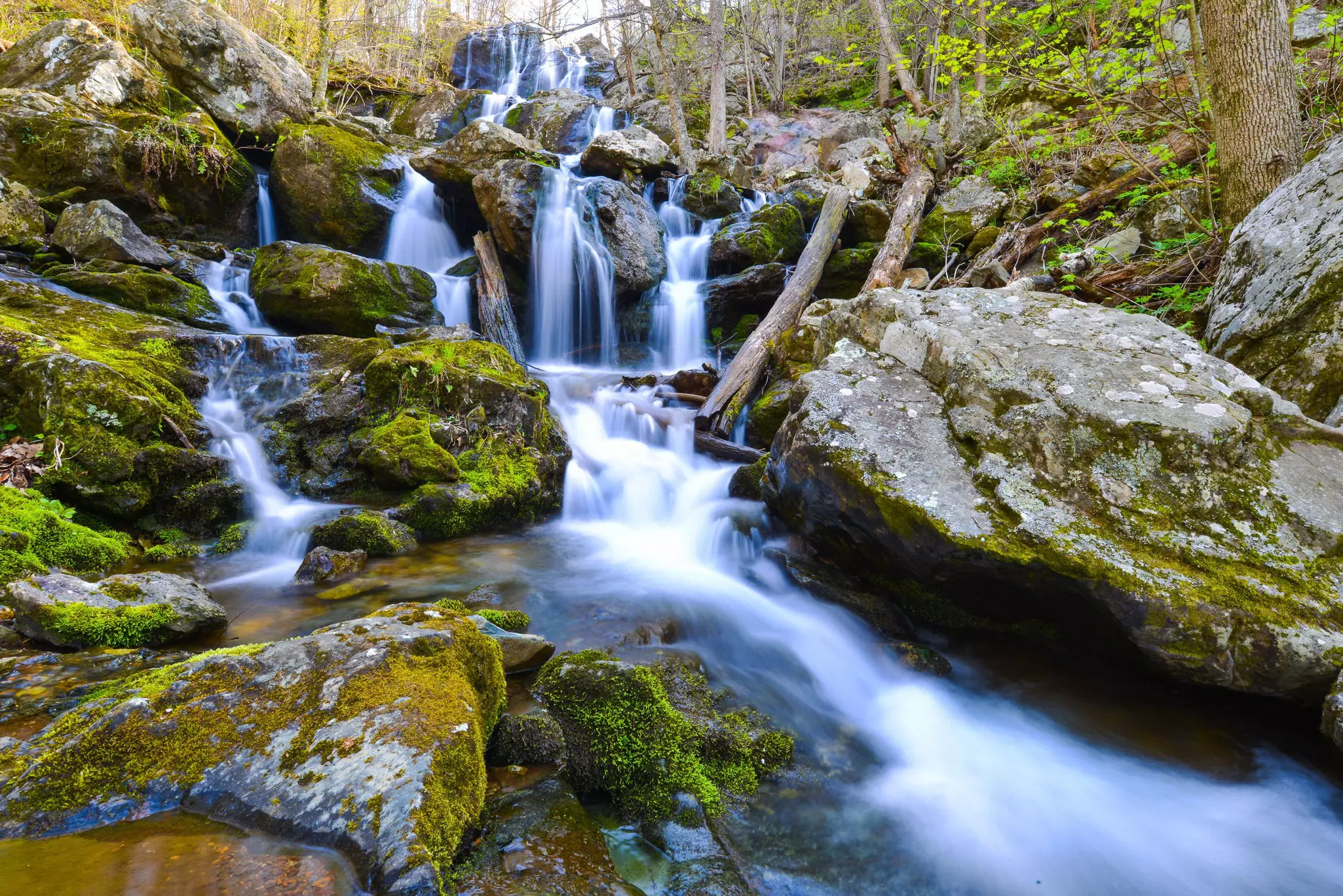
Anticipation builds as you drop through the forest to Dark Hollow Falls. Slick rocks and thick moss slowly overtake the scene and the sound of splashing cascades becomes your soundtrack. Even with the inevitable crowds – the trail is near the Byrd Visitor Center – the pathway feels like a place of enchantment. The hike is short, accessible and yet still manages to feel like a discovery. The creek-fed falls drop 70ft through layered rock into a pool below, and the forest that frames them is one of the finest examples of Blue Ridge woodland anywhere along the 105-mile Skyline Drive.
For waterfall fans, Shenandoah's Central District holds an impressive collection of cascades, and Dark Hollow is just the beginning. In spring, wildflowers line the path to Rose River Falls – a good alternative if Dark Hollow is busy, which expands into several parallel falls after a rainstorm. A steep, rocky trail behind Big Meadows Campground drops a mile to the 81ft Lewis Spring Falls. For solitude and a workout, Cedar Run Falls offers 34 ft of drama on a 4-mile round trip. And Whiteoak Canyon Falls, at 86ft, the second highest in the park, sits at the end of a 2.3-mile trail that's probably the park's most well-known waterfall hike. The Hike to Waterfalls booklet, available for $3 at wayside shops and visitor centers, covers all of them.
AllTrails tip Go early on summer weekends – parking at the Byrd Visitor Center fills quickly. Trekking poles help on the rocky sections, and remember: the climb back up to Skyline Drive will take longer than the descent down.
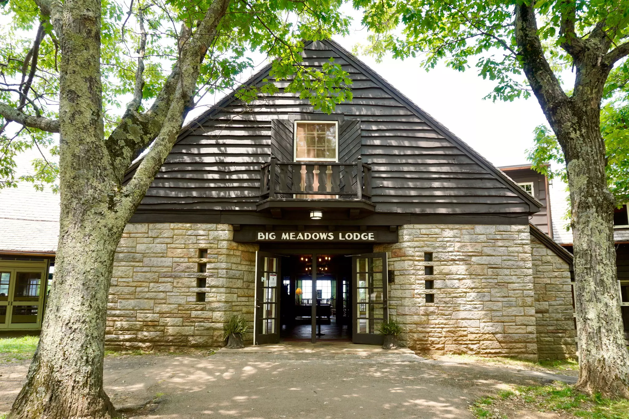
Where to stock up: Big Meadows, right at the trailhead at Mile 51 on Skyline Drive, is the epicenter of the park – here you'll find a gas station, campground, lodge and restaurants all in one place. Pick up picnic supplies here before heading down to the falls.
Need to know: A 7-day vehicle pass ($30 per car) is required to enter Shenandoah National Park. No permit is required for Dark Hollow Falls. Dogs are welcome on leash. The Byrd Visitor Center is open year-round and is the best place to get oriented to the Central District. There are no shuttles within the park – a car is essential.
Don't forget: Keep in mind that you'll be climbing back up to the parkway after viewing the falls – an endeavor that will likely take longer than your descent. Wear shoes with solid grip; the rocks near the falls are genuinely slick.
Wrapping it up: Big Meadows Lodge, steps from the trailhead, is one of Shenandoah's most atmospheric places to eat and stay – 29 lodge rooms and cabins in the woods near waterfalls, a visitor center and the namesake meadow where deer graze at dusk. The dining room is a fine spot for lunch or dinner after the hike. For a grander stay with premium rooms and grand views of the Shenandoah Valley, Skyland Resort sits 10 miles north at mileposts 39 through 42. AllTrails users consistently recommend the Big Meadows area for stargazing after dark – on clear nights, the meadow offers some of the finest skies on the East Coast.
Location: Utah
Length: Up to 9.4 miles round-trip to Big Spring; hike as far as you like
Time commitment: 4-8 hours, depending on distance
Difficulty: Hard
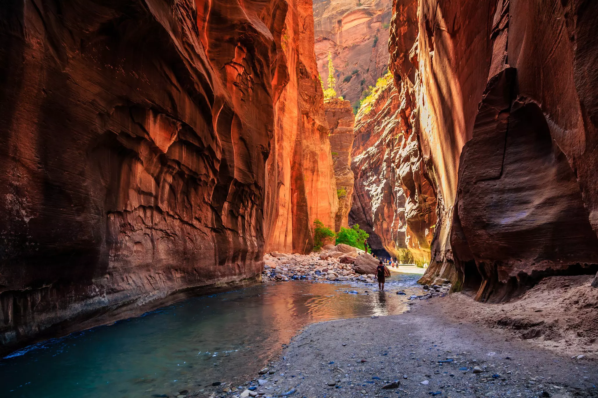
Hiking through a rocky river in ankle- to chest-deep water as the canyon walls rise up to 1000ft tall and press in to just 20ft in width: the Narrows is quintessential Zion. This wet and wild trail is actually the Virgin River, and there is nothing else like it in the national park system. At the end of the easy, paved Riverside Walk from the Temple of Sinawava shuttle stop, stairs descend to the water, and the adventure begins. Hordes of hikers visit the Narrows, but many don't walk more than a mile or two – and quieter sections await the further you trek. The best part is that you can walk for as little or as long as you'd like and still have a great time. This out-and-back route is not about reaching a specific spot, but simply soaking up the scene.
Around the first river bend, you might catch canyoneers on their final rappel from Mystery Canyon. About two miles in, the Orderville Canyon tributary flows from the east. Continue north through Wall Street, where the sheerness, nearness and height of the cliffs shatter whatever remains of your perspective. Day hikers are allowed as far as Big Spring – don't underestimate the distance or difficulty. It's 9.4 miles round-trip against the current, with about 8 hours of hiking. But every section of the Narrows rewards, and turning around at a mile or two is a completely valid and wonderful choice.
AllTrails tip Rent canyoneering shoes, neoprene socks and a wooden walking stick from outfitters in Springdale, the gateway town just outside Zion's south entrance before you go – what you wear will greatly influence your enjoyment. Download the AllTrails offline map before entering the canyon; there is no cell service.
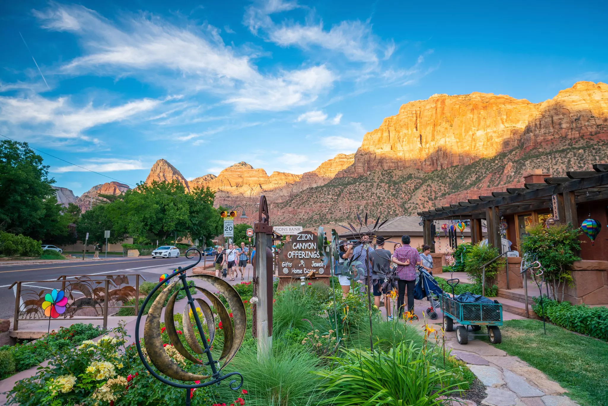
Where to stock up: Outfitters including Zion Guru and Zion Outfitter rent the full kit – canyoneering shoes, neoprene socks, walking sticks and dry bags – for $30 to $75 depending on the season. Pick up snacks and sunscreen at one of the town's well-stocked shops before boarding the free shuttle into the park.
Need to know: Always – and we mean always – check conditions and the flash-flood forecast with rangers at the Zion Canyon Visitor Center before setting off. A sudden rainstorm miles away can send a surge of rock- and log-filled water through the canyon. The Narrows closes when the Virgin River runs at more than 150 cubic feet per second, which can happen in April, May or June. Zion no longer requires timed-entry reservations, but the park remains one of the most visited in the country — expect crowds at peak times and plan accordingly. From mid-March through November, private vehicles are not permitted on Zion Canyon Scenic Drive – use the free park shuttle.
Don't forget: Getting the right gear is imperative for a safe and fun trek. The Narrows is cooler than elsewhere in Zion because of the tall canyon walls – pack a warm outer layer even on warm days. Never enter if there is any possibility of rain anywhere in the watershed. Bring dry bag for your phone and camera.
Wrapping it up: Southern Utah's first microbrewery is mere feet from the park entrance, and a pint of Zion Pale Ale at the Zion Canyon Brew Pub is just the reward for all that hiking. For something more substantial, Oscar's Cafe delivers big servings of Southwestern spice: heaping huevos rancheros, pork verde burritos, exactly what you want after wading nine miles upstream against a current.
Location: Colorado
Length: 15 miles round-trip
Time commitment: 10-15 hours – a full alpine day
Difficulty: Hard/strenuous
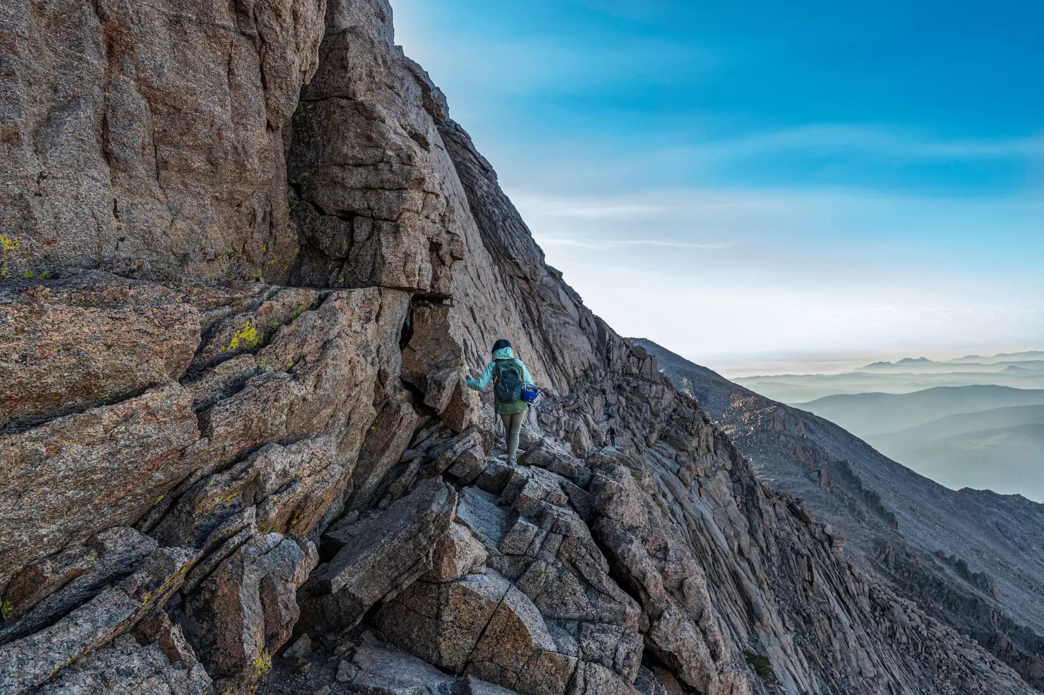
You need not worry about getting lonesome on the 15-mile round-trip to Longs Peak's 14,259ft summit. During summer, you're likely to find a line of parked cars snaking down the road from the Longs Peak trailhead. This is the pinnacle of Rocky Mountain National Park and one of Colorado's classic climbs, and it draws accordingly. But don't let the popularity fool you; it is technical and it's best to be prepared.
After the initial 6 miles of moderate trail to the Boulder Field at 12,760ft, the path steepens at the start of the Keyhole Route to the summit, marked with yellow-and-red bull's-eyes painted on the rock. Even superhuman athletes who are used to the thin air will be slowed by the route's ledge system, which resembles a narrow cliffside stairway without a handrail. After this, hikers scramble the final homestretch to the summit boulders. The view from the top – snow-kissed granite stretching out to the curved horizon – is incredible. For those not ready for the full commitment, Chasm Lake is a high-alpine wonder at 11,760ft, sitting below the jagged face of Longs Peak's signature Diamond, where serious rock climbers rope up to scale the 1,500ft wall. The lake hike is 8.4 miles round-trip and features all the spectacular scenery of the peak without the risk and arduous final ascent.
AllTrails tip: Standard start time is 2am to 3am for a summit attempt – the golden rule in Colorado is to be off exposed terrain before noon to avoid lightning. Microspikes or crampons are required in shoulder season. Acclimatize for a day or two in Estes Park before attempting this – altitude sickness is a genuine risk for visitors from low elevations.
Where to stock up: Estes Park, the gateway town on the park's eastern edge, has everything you need. Stock up the night before at one of the town's gear shops. For dinner before a big day, Bird & Jim – a foodie-driven kitchen serving local fare like pan-fried trout, on Hwy 36 just before the Beaver Meadows entrance – is an excellent choice. Rock Inn Mountain Tavern, a landmark serving steaks, bison meatballs and a side of live bluegrass, is the best place for stick-to-the-ribs fare ideal for hungry hikers.
Need to know: Overnighting at Longs Peak Campground on Longs Peak Road is recommended before an early start. Unlike several other parks, Rocky Mountain National Park still requires a timed-entry reservation during peak season — from Memorial Day weekend through mid-October. Book in advance at recreation.gov. The trailhead is separate from the main park entrance and has its own small parking area.
Don't forget: Have a non-negotiable turnaround time and honor it regardless of how close the summit feels. Pack more food and water than seems necessary, and bring full rain gear even in clear weather.
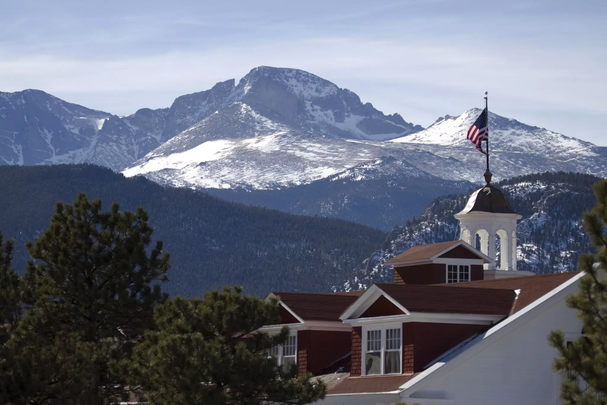
Wrapping it up: The white Georgian Colonial Revival hotel that rises against the Rocky Mountain skyline in Estes Park is not just a pretty landmark – it's the inspiration for Stephen King's Overlook Hotel in The Shining, and one of the great historic properties in the American West. The Stanley Hotel offers ghost tours for nonguests and the terrace bar is a fine place to sit with a drink and contemplate the mountains you just came down from. For something livelier, Rock Cut Brewing – which went from home brewing in a garage in 2015 to the premier brewery in Estes Park – has the pint you've earned.
Location: Washington
Length: 6.2 miles
Time commitment: 3.5 hours
Difficulty: Moderate
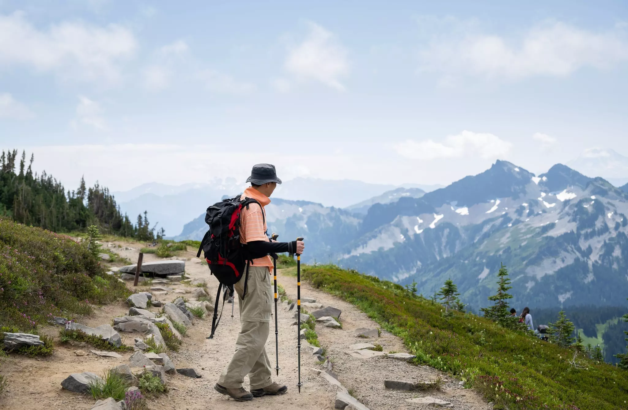
If you hear Seattleites talk reverently about "the Mountain," this is the one they mean. Mt Rainier dominates the landscape, both physically and emotionally – everyone's glacier-clad, wildflower-decorated favorite, laced with hiking trails and populated with abundant plants and wildlife. Starting behind the historic Paradise Inn perched at 5400ft on the southern slopes, the Skyline Loop climbs approximately 1900 ft, taking in the lofty lookout of Panorama Point – which provides some of the best views of Mt Rainier in close-up, as well as the more distant Tatoosh Range. It is, according to AllTrails' nearly 30,000 reviewers, the number-one rated hike in the state of Washington.
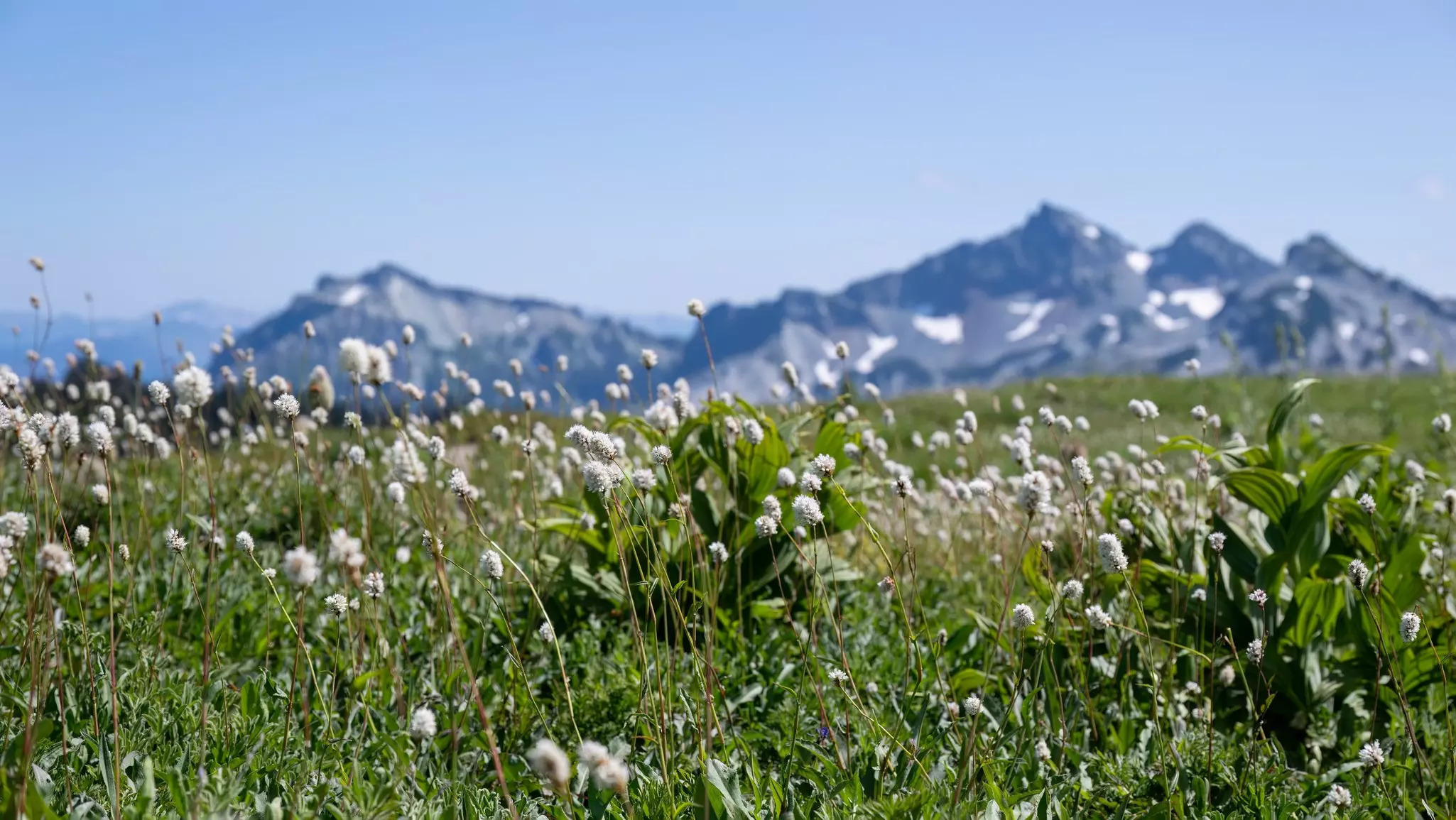
Best done clockwise, the circuit incorporates glacier views, above-the-treeline paths patrolled by whistling marmots and expansive flower meadows replete with lupine, paintbrush, asters and bistort. A short spur to Myrtle Falls – where the falls frame Mt Rainier in the background like a postcard – is unmissable and barely adds any time to the route. Due to its famed beauty, the trail is well-signposted and trafficked, but there are a couple of opportunities to cut corners and make the loop shorter if needed. Late July and early August are peak wildflower season and the best – but busiest – time to visit. Pick up a trail map at the Henry M Jackson Visitor Center next to Paradise Inn before setting out.
AllTrails tip Paradise parking fills completely by 7:45am on summer weekdays, earlier on weekends. Start before 7am or prepare for a long walk from overflow. Trekking poles and microspikes are strongly recommended when snow is present on the upper loop, which can persist well into July.
Where to stock up: The Henry M Jackson Visitor Center at Paradise has a cafe, gift shop, and a trail map we recommend you pick up before your hike. For a more substantial meal, the National Park Inn at Longmire – the only year-round dining inside the park – serves upscale comfort food from 7am. Or try the Wildberry Restaurant west of the Nisqually entrance: burgers, fries and traditional Himalayan fare like dumplings and thali – a genuinely unexpected and characterful option.
Need to know: A 7-day vehicle pass ($35) is required to enter Mount Rainier National Park. The Nisqually Entrance via State Route 706 is open year-round and provides access to Longmire and Paradise. Don't rely on GPS for the best route – cell service is inconsistent and mapping apps often suggest routes that lead to closed gates or washed-out back roads. Carry paper maps and download the AllTrails map to use offline. Mount Rainier no longer requires timed-entry reservations, but Paradise parking fills completely by 7:45am on summer weekdays — arrive early or use overflow parking.
Don't forget: Mountain weather at Rainier can change dramatically and rapidly – the park receives extraordinary precipitation and is frequently socked in cloud even when the surrounding lowlands are sunny. Bring full rain gear regardless of the forecast. Snow on the upper Skyline Loop requires microspikes or traction devices well into summer – without them the icy sections can be genuinely hazardous.
Wrapping it up: The Paradise Inn, a historic 1916 lodge at the trailhead, is one of the great mountain lodges in the national park system – its cathedral ceilings, massive stone fireplaces and hand-crafted furniture create an atmosphere entirely of this landscape. Lunch or a post-hike drink here is a ritual for Skyline Loop hikers. On the drive back down, stop at Reflection Lakes – on a calm evening, Mt Rainier's perfect cone reflects in the still water below in a view that stops you in your tracks every time.
Location: Washington
Length: 0.8 miles
Time commitment: 30-60 minutes (combine with Spruce Nature Trail for a fuller experience)
Difficulty: Easy
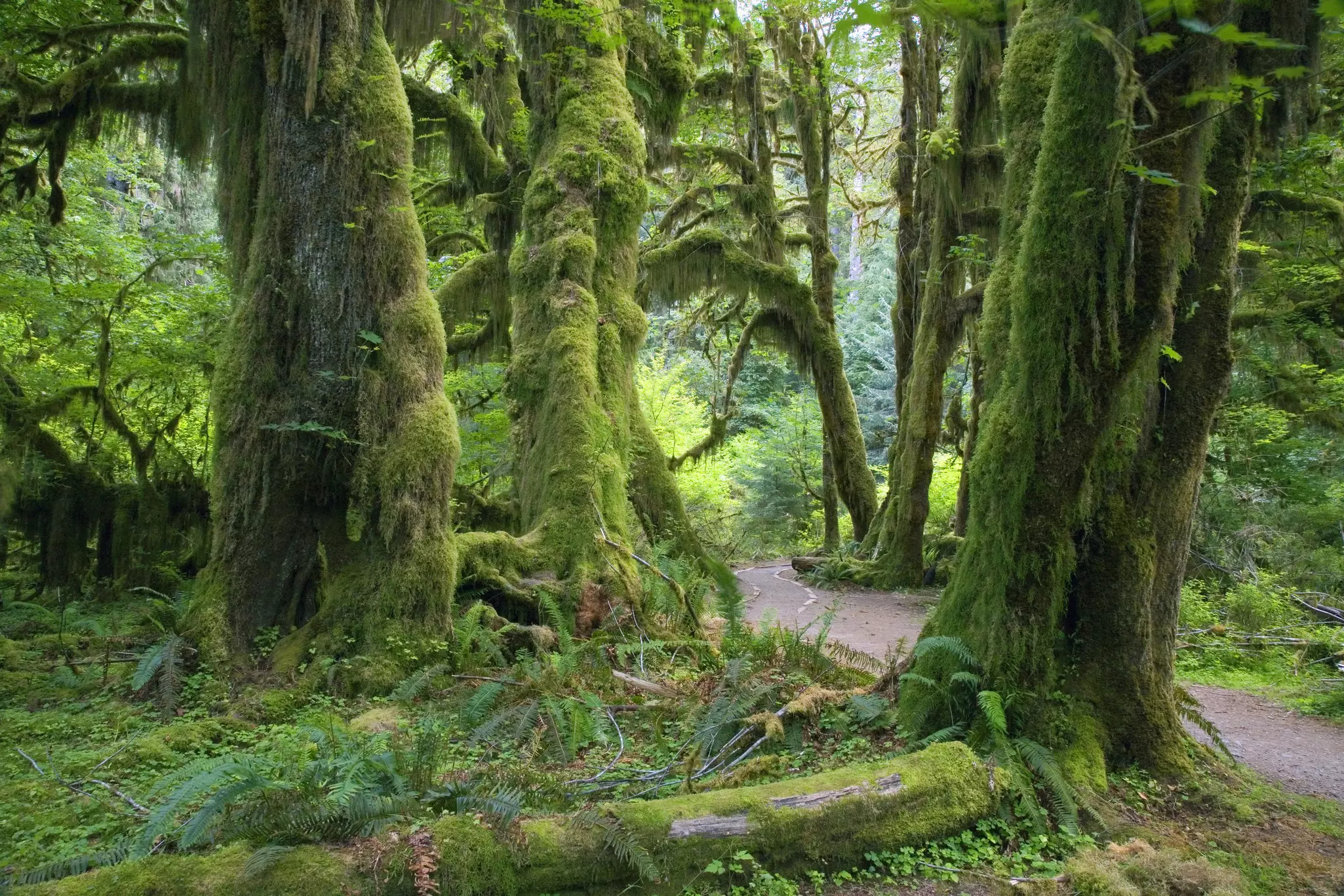
The Hoh Rain Forest in Olympic National Park is, according to sound recording expert Gordon Hempton, home to the quietest place in the continental US – a mossy log about 1.8 miles from the visitor center where he found one square inch of silence. The word is out, and the silence has been somewhat compromised by its own fame. But the magic of the 0.8-mile Hall of Mosses Trail remains undimmed. Look for beauty in the details: old-growth cedar and spruce, Jurassic ferns, and trees hosting up to 2000 pounds of epiphytes – the moss, lichens and fungi that swallow outside noise. The Hoh is at its best in the off-season; rainforests shine in misty gray when the sound of the world just drops away.
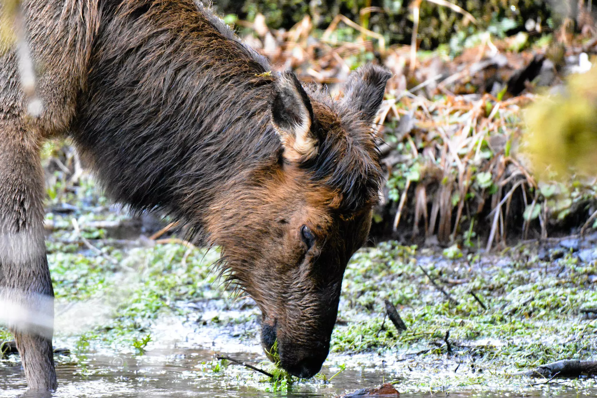
Epiphytic club moss, ferns and lichens completely overwhelm the massive trunks of maples and Sitka spruces in this misty forest – scenery that even Tolkien couldn't have invented. The loop is short and gentle, accessible to virtually everyone including families with young children. Nurse logs – fallen ancient trees serving as the biological foundation for new rows of young saplings – are everywhere, and interpretive signs explain the remarkable ecology. There is also a short wheelchair-accessible nature trail through a rainforest marsh. Keep an eye out for Roosevelt elk, which move through the understory with surprising quiet.
AllTrails tip: Arrive early on summer weekends – parking fills quickly. Waterproof footwear is strongly recommended year-round; the forest floor is almost always damp. The Visitor Center is closed January and February. Combine with the 1.2-mile Spruce Nature Trail for a more complete Hoh experience.
Where to stock up: The Hoh Rain Forest is remote – the visitor center is 19 miles from the nearest town of Forks on a winding road. Stock up before making the drive in. In Forks, the Longhouse Cafe serves up Native fare like fry bread, Rez apple sauté and Indian tacos – a locally grounded meal before or after the hike. There is a small gift shop at the visitor center but no food service.
Need to know: A 7-day vehicle pass ($35) is required for Olympic National Park. The drive to the Hoh Rain Forest from Port Angeles, the park's main gateway, takes approximately 1.5 hours – plan accordingly. Cell service is nonexistent in the Hoh Valley; download the AllTrails offline map and screenshot driving directions before you leave the highway. A large campground adjacent to the visitor center makes an excellent base for multi-day exploration.
Don't forget: The Hoh receives up to 14ft of rainfall annually – always have a waterproof jacket and waterproof footwear regardless of the season or the forecast. The rainforest shines in the mist; don't let gray skies put you off. This is genuinely one of the most otherworldly landscapes in the national park system, and it's at its most atmospheric when it's wet.
Wrapping it up: After the Hall of Mosses, consider extending your time in the valley with a walk on the Hoh River Trail – a wide, gentle path following the river upstream through old-growth forest, ideal for elk spotting. For those wanting to turn a great hike into a memorable overnight, Sol Duc Hot Springs Resort – about 1.5 hours north on Highway 101 – offers three mineral water pools and one conventional pool fed by a constant stream of natural hot springs. A soak after a day in the rainforest is one of the finer things Olympic National Park has to offer; go midweek to avoid the weekend crowds. The lodge, restaurant and hot springs are open from April to October.
Location: Montana
Length: 4.6 miles round-trip
Time commitment: 2.5-3 hours
Difficulty: Moderate
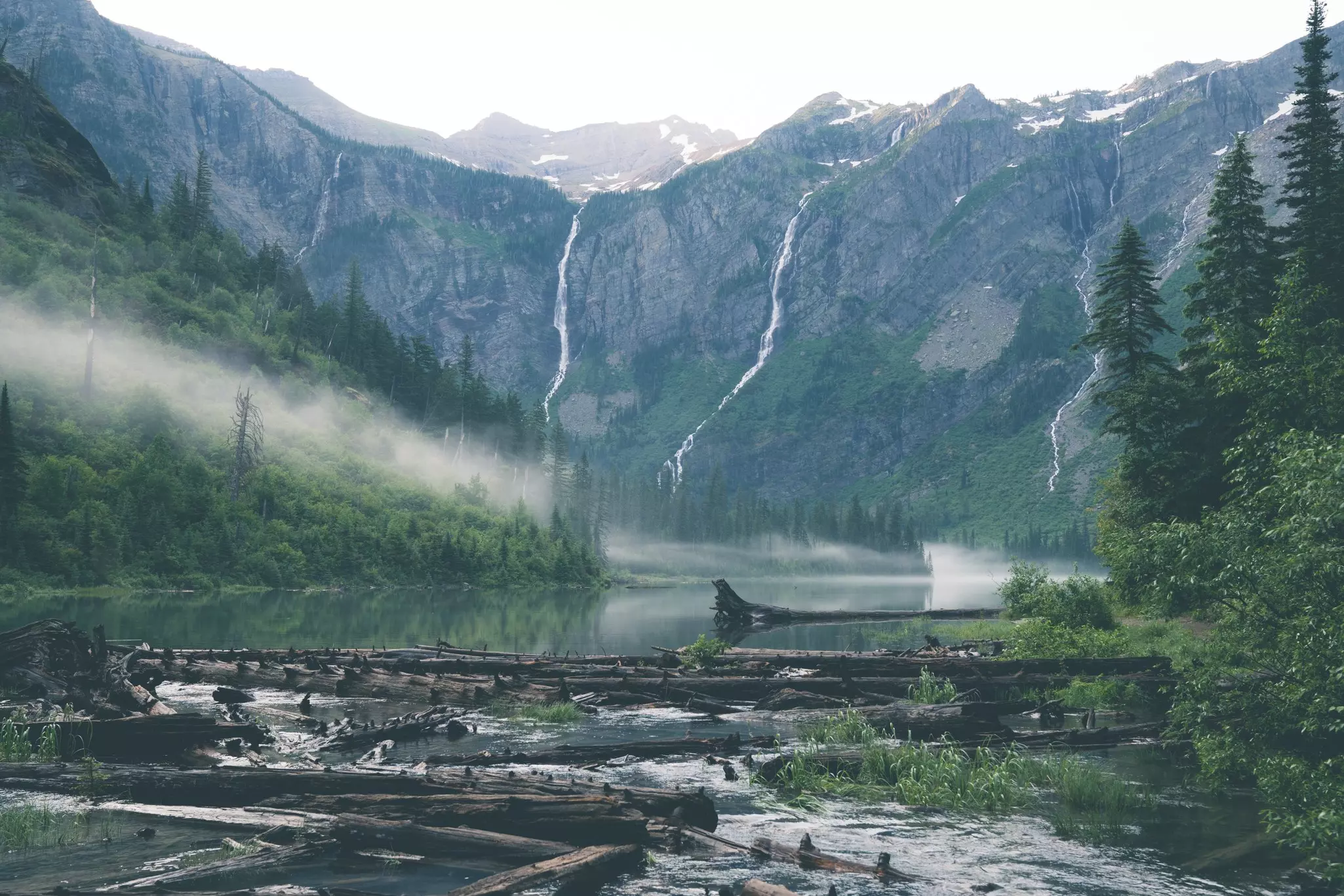
Just north of Lake McDonald Lodge, off Going-to-the-Sun Road, the awesome Avalanche Lake Trail hike offers ancient woods, a narrow gorge and a charming amphitheater lake at its finale. It's an ideal introduction to what the park has to offer. Glacier National Park is home to roughly 1000 bears, 700 miles of trails, 2000 lakes and an abundance of nature that converges in a seemingly endless wilderness. This trail is where most visitors properly begin to understand it.
The hike begins at the Trail of the Cedars, a remarkable 1-mile wheelchair-accessible boardwalk loop where half-a-century-old cedar trees rise to 100ft with trunks up to 7ft wide – great for children, with signs pointing out Rocky Mountain maple, western hemlock, Pacific yew and black cottonwood. From here, a short but steep climb through humid, fairy-tale-like woods with moss-covered boulders and bracken-fern-strewn floors leads to Avalanche Creek, where the banks of a smooth, narrow gorge appear like a scene from an Indiana Jones film. A bridge crossing the water offers the perfect vantage point to photograph the bubbling indigo-blue waters over purple argillite-layered bedrock. The lake itself, formed 12,000 years ago by glaciers, sits at the foot of looming Bearhat Mountain and is reflected in an emerald-green mirror of water below. Anglers come for the abundance of westslope trout – scientists found they're a genetic match to fish that existed here thousands of years ago. A mile-long path skirts the western shore with many entry points to the pebbled beach, where hikers can sit and picnic.
AllTrails tip: Researchers estimate roughly 1000 bears live within the park's boundaries. Hike in a group, make noise approaching blind bends, and carry bear spray – learn how to use it before you go, not on the trail.
Where to stock up: Bear spray can be rented and bought from all outdoor stores and some grocery stores in the area – Glacier Outfitters in Apgar stocks everything from waterproof bags to SPF lip balm to bear spray. The Camp Store next to Lake McDonald Lodge is the last shop before Logan Pass – stop here for last-minute groceries, drinks, gifts and books. In West Glacier near the park entrance, the West Glacier Camp Store carries camping supplies from camp stoves to sleeping bags and hiking boots, while the West Glacier Cafe – a canteen-style joint just outside the park entrance – serves burgers and Glacier's beloved huckleberry ice cream.
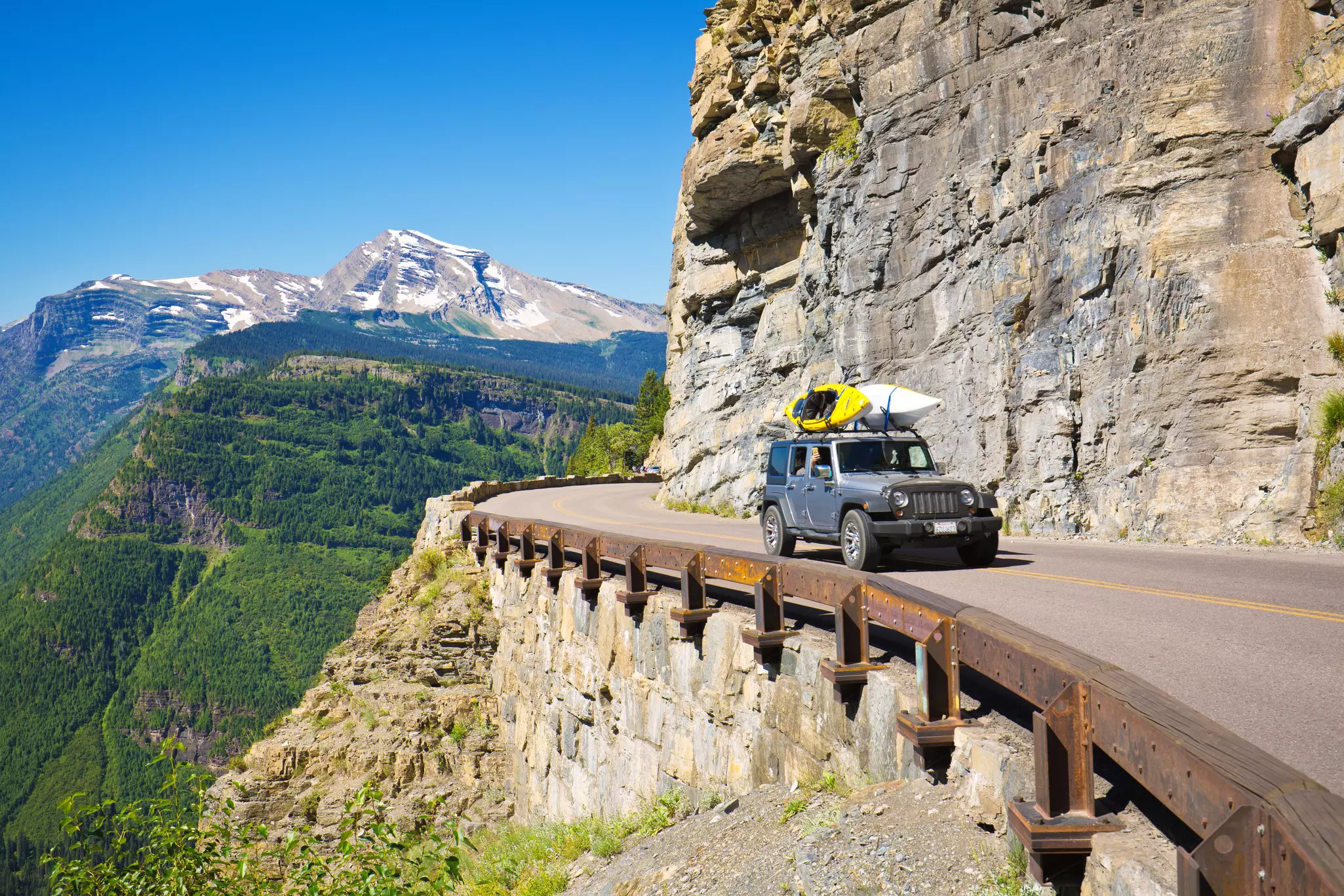
Need to know: A 7-day vehicle pass ($35) is required to enter Glacier National Park. Glacier no longer requires a parkwide vehicle reservation, but Going-to-the-Sun Road access has changed significantly for 2026 — visitors planning to spend more than three hours in the park must book a ticketed shuttle to access the alpine area. Tickets are first-come, first-served at recreation.gov. Logan Pass parking is capped at three hours. Book shuttle tickets as early as possible; they go quickly in peak season.
Don't forget: If you see a bear on the trail, stay calm, pick up any children you are with, and move out of the way. If it is unsettled, stop moving and speak to it in a calm voice. Do not drop your pack. Do not run. Huckleberries ripen in late summer along this trail and attract bears – make noise and stay particularly alert in late August and September. The Trail of the Cedars boardwalk can be slippery when wet.
Wrapping it up: After the hike, Russell's Fireside Dining Room at Lake McDonald Lodge is the atmospheric local choice – huckleberry-elk burgers, Rocky Mountain cheeses, and a setting that feels entirely of this place. For drinks, the Belton Chalet Grill & Taproom in West Glacier serves microbrews and craft cocktails inside a historic building opposite the train station, while the Glacier Distilling Company in nearby Coram offers flights of craft whiskey and cocktails in its tasting room. Pull over at any of the roadside turnouts on Lake McDonald on your way back – on calm evenings, the mountains reflect in the still water in one of the most photogenic views in the American West.
Location: Wyoming
Length: 14.4 miles round-trip with shuttle boat; 18.3 miles without
Time commitment: 6.5-8 hours
Difficulty: Hard
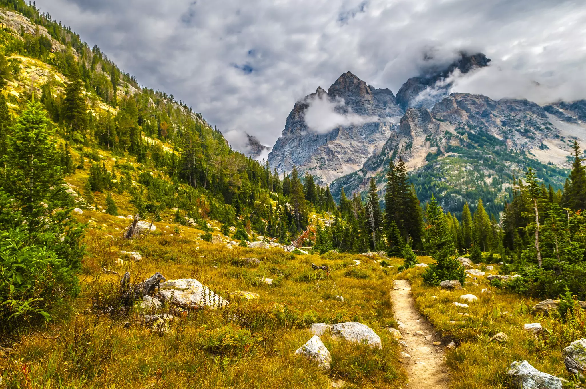
Thanks to wide patronage, this lovely trail – particularly its beginning – lacks the lake's namesake solitude, but still provides a rewarding challenge in Grand Teton National Park. Though long with a large elevation gain, it is not especially tough since the grade is quite gradual. What it is, consistently, is magnificent. Gear up for steep sections near Inspiration Point and just before Lake Solitude. Moose and bears frequent the area.
Take the Jenny Lake Boating shuttle from the east dock – it runs from 7am to 7pm and cuts down the mileage significantly (14.4 miles with the shuttle, 18.3 without). A small fee applies each way, well worth it for the distance saved. From the dock, head left for the uphill climb to Hidden Falls, about a half-mile ascent, then push another 0.3 miles along switchbacks to reach dramatic Inspiration Point, with sweeping views over Jenny Lake and its forested shores.
Catch your breath, then push on past the crowds of onlookers – the best part of the trail begins another half-mile further, entering Cascade Canyon proper. Here you'll find yourself walking beneath soaring peaks of the glacially carved U-shaped canyon, following Cascade Creek as it transforms from a trickling stream into a gushing waterfall. The aspen-lined banks are particularly striking in fall. At the Forks, 4.5 miles from the dock, turn right and climb gently for 30 minutes to enter the Cascade Camping Zone. From the zone's end, it's 10 minutes up to Lake Solitude at 9035ft – rimmed by fir and pine, sporting ice until midsummer, and backdropped by the diagonal slash of Paintbrush Divide above. A great spot to loll around, but probably not to swim.
AllTrails tip: Budget a full day and start early. Time your return to the west dock carefully. Crowds thin considerably past Inspiration Point, where most casual visitors turn around. Check with rangers on upper canyon snow conditions in early summer – this area can remain deep well into June.
Where to stock up: Dating back to 1922, Dornan's lies just across the Snake River from national park headquarters in the community of Moose – and it's the essential Grand Teton provisioning stop. Open year-round, with a Trading Post stocking snacks, baked goods and deli sandwiches, and Dornan's Pizza & Pasta Company serving pizzas, stromboli and craft beers with stunning views from the upper deck in summer. Stock up the evening before – you'll want an early start.
Need to know: A 7-day vehicle pass ($35) is required to enter Grand Teton National Park. Wilderness permits are required for backcountry camping in the Cascade Canyon area; camping is prohibited at Lake Solitude itself. Bears are active throughout the canyon – carry bear spray.
Don't forget: Moose and bears frequent the area – stay alert to avoid surprising wildlife, especially in the marshy sections along the creek. The upper canyon can remain quite snowy into early summer; check conditions with rangers at the Jenny Lake Visitor Center before setting out. Plan to be descending from the upper canyon by early afternoon to avoid afternoon thunderstorms, which are common in summer.
Wrapping it up: Make the 30-minute drive into Jackson for the evening. Snake River Brewing Company offers Jackson's finest craft brews at picnic tables on the lawn. For something more refined, Bin22 – hidden inside a wine store – has tasty tapas plates and first-rate wines. Grand Teton has given you a big day; Jackson will give you a proper night.
Book your United States trip with Lonely Planet Journeys
See United States how it's meant to be seen
Planned by local experts and tailored to you, Lonely Planet Journeys handles the logistics so you can just enjoy the trip. Tell us what you want and we'll build your United States itinerary from scratch, or browse our bookable trips to get inspired.

Explore related stories