Jul 10, 202611 min read
The top 20 things to do in SpainApr 25, 2018
6 MIN READ
Writer
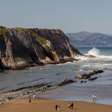
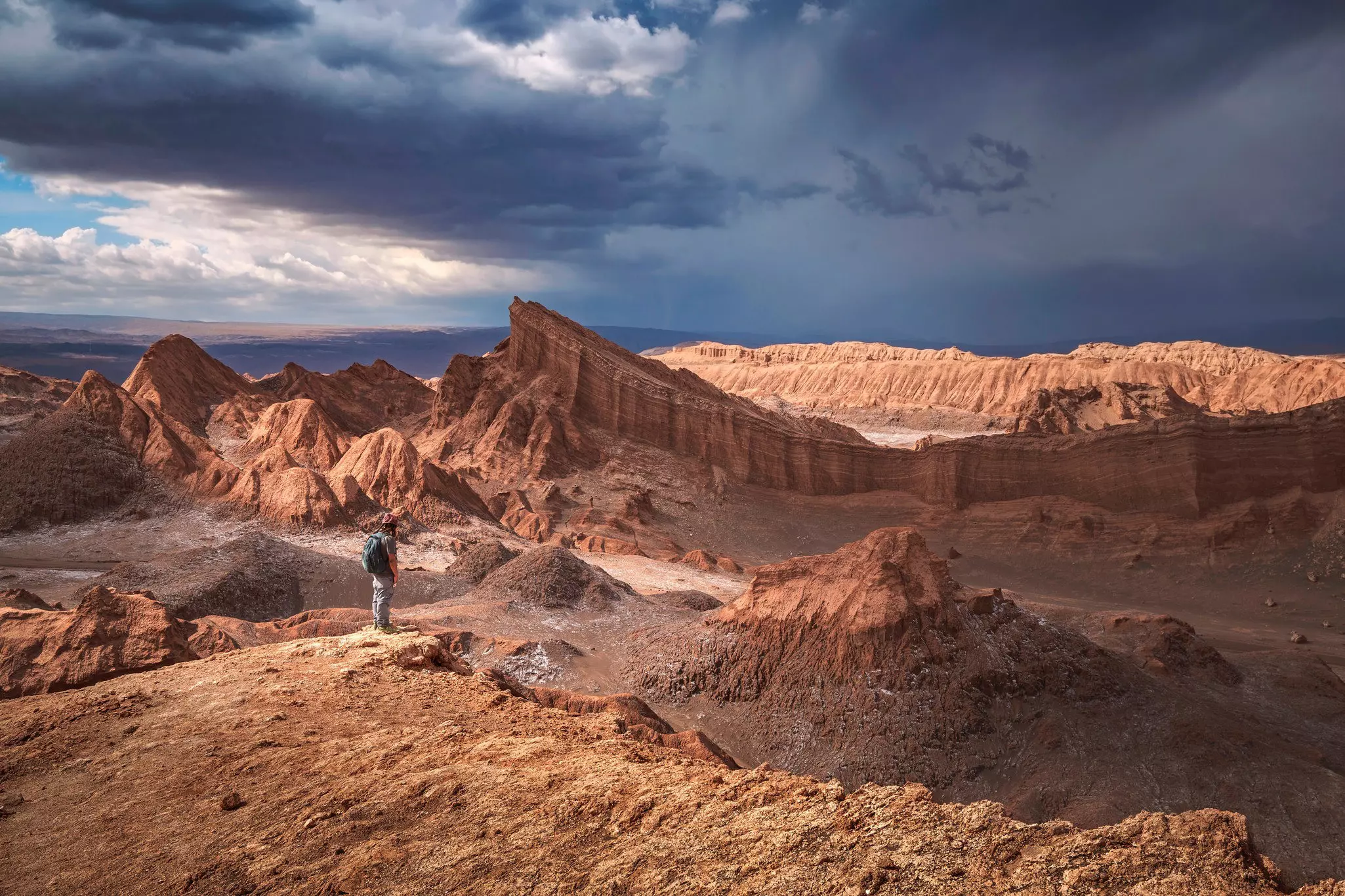
Looking out over the barren beauty of Gran Canaria's centre from the Ventana del Nublo © Gran Canaria Natural and Active

Writer
Lonely Planet may earn a commission from affiliate links on our site. All recommendations and reviews reflect our own independent opinions.
As on most of the Canary Islands, once you get away from Gran Canaria’s built-up south-coast beach resorts, you’ll find an astonishing landscape that combines barren outcrops with cool pine forests, and sunken calderas with sky-skimming ocean views. There’s no better way to discover this outdoor wonderland than to strap on your boots and get walking.
Gran Canaria is not as established a hiking destination as Tenerife, its rival Canary Island; yet it more than holds its own, with a fantastic network of trails that crisscross this diverse and mountainous island. Whet your appetite by trying one of these three top hikes.
Start: Degollada de La AldeFinish: Aldea de San NicolásLength: 10kmDuration: 4 hours 30 minutes
This route starts and finishes on the route of bus 38 between Puerto de Mogán and Aldea de San Nicolás, so if you're using public transport you could base yourself anywhere between these two towns.
Get off at the Cruce de Tasartico bus stop on Degollada de La Aldea, a stretch of road that winds up into the mountains through barren terrain. Follow the signpost for the Montaña del Viso; it’s a fairly strenuous but beautiful climb up, framed by ever more dramatic views of stark peaks across a valley dappled in sunlight. At the summit of Viso is a pine-speckled plateau where you can stop and catch your breath. You’re rewarded with the sight of the craggy sun-baked mountain ranges of the centre of Gran Canaria, as well as views over Aldea de San Nicolás (known as La Aldea), nestling in the valley below.
The route down from Viso towards La Aldea takes you through a lunar-like lava field, where the ground you tread is pockmarked with vivid patches of red, orange and green, telling the volcanic story of this island. Once you get to somnolent little La Aldea, head to the streets around its church San Nicolás de Tolentino to rest with a well-deserved cerveza.
Start: Llanos de La PezFinish: San Bartolomé de TirajanaLength: 10kmDuration: 3 hours 45 minutes
This route is known as the Camino de Santiago, and it's one of Gran Canaria’s historic caminos reales (king’s highways); it is still possible to cross the entire island along these routes. Your best bet for the walk might be basing yourself at the charming small town of San Bartolomé de Tirajana, stunningly located above the Tirajana Valley, then taking a half-hour taxi ride to the lush pine forest of Llanos de La Pez for the start of the route.
You’re right in the centre of the island here, and it doesn’t take long to emerge from the shade of the trees at the Ventana del Nublo, a huge natural rock arch occupying a dramatic location. There are views of the island’s highest peak, Pozo de las Nieves; and of the island’s extraordinary emblem, Roque Nublo, a volcanic monolith often enveloped in cloud as its name suggests.
After a couple of kilometres, the route joins the Paso de la Plata, an ancient paved farming route that winds steeply down the edge of a valley, with terrific views over an arid, pine-dotted landscape framed by mountains and sweeping ravines. Once you get to the Cruz Grande viewpoint, it’s a gentler, leafier descent along the final few kilometres into San Bartolomé de Tirajana, known locally as Tunte.
Start: Lomo de San PedroFinish: AgaeteLength: 10kmDuration: 4 hours 30 minutes
The verdant seaside town of Agaete makes a good base for this walk in the island’s northwest. From there, you can get a 102 bus further up the Valle de Agaete to the village of Lomo de San Pedro, where the walk starts.
It’s a punishing climb to the Era de Berbique plateau, but the rewards are ample: here in Gran Canaria’s fertile north, the views are of dramatic ravines and intensively tilled fields and terraces. Once at the plateau, you can look not only back inland but also far out to the distant blue of the Atlantic Ocean beyond Agaete.
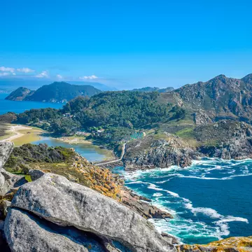
The route gently descends through the valley to the town, with some vertiginous drops from the side of the path into the valley below providing an extra thrill. If you look southwest, there are stunning views of the cliffs along this coastline, with each successive ridge marked out in an ever-darker shadowy mantle.
Once in Agaete, walk 1km further to Puerto de las Nieves, the town's small ferry port, with black pebble beaches, a fishing-village vibe and great seafood restaurants.
Both ascents and descents can be tough; they require at least a reasonable degree of fitness and in some cases a head for heights.
Make sure you wear well-fitting walking shoes or trainers.
Only hike in good weather, and bear in mind that you’re exploring mountainous terrain, so the weather is liable to change quickly. Wear layers and come prepared for rain or shine.
Take lots of food and water.
Check out informative websites such as the one run by Rambling Roger, who publishes his own guides to walking on the island; or buy a dedicated walking guide like Gran Canaria: The finest valley and mountain walks by Izabella Gawin.
Signposting along routes is good, but not ubiquitous, so you’ll need to plan your hikes.
Gran Canaria's tourism board provide details on other hiking routes around the island and has leaflets available for download. Nearly one third of Gran Canaria is a biosphere reserve, with the reserve area ideal for hiking; the biosphere website contains some useful maps.
There is a comprehensive network of buses around the island, with Las Palmas and to a lesser extent, Maspalomas, serving as hubs. All corners of the island are covered by Global, although smaller, more remote towns are often served by just one or two buses a day.
Car hire is good value: there are car-rental firms at the Las Palmas airport, ferry terminal and throughout the city's Santa Catalina district.
If you prefer organised expeditions, take a guided walk with an operator like Canarias On Foot or Vivelo Rural. Or the Gran Canaria Walking Festival held every autumn is a wonderful way to explore the island on foot, with various group hikes organised over the five-day event.
Tom travelled to Gran Canaria with support from One Foot Abroad and Gran Canaria Natural and Active. Lonely Planet contributors do not accept freebies in exchange for positive coverage.
Take your Spain trip with Lonely Planet Journeys
Time to book that trip to Spain
Lonely Planet Journeys takes you there with fully customizable trips to top destinations – all crafted by our local experts.


Explore related stories