Jun 21, 20265 min read
11 of the best beaches in WalesJun 3, 2026
10 MIN READ
Contributors
Hikers on the King Charles III England Coast Path in Dorset. John Harper/Getty Images

Contributors

Lucy Shrimpton, Rachel Ifans
Lonely Planet may earn a commission from affiliate links on our site. All recommendations and reviews reflect our own independent opinions.
The King Charles III England Coast Path – the longest managed coastal trail in the world – opened in 2026 and was met with serious fanfare. Connecting dinosaur fossils in Dorset, contemporary art near Liverpool and the wild Northumberland Coast, it’s one of the most epic walking trails in the world but, on an island whose coastline is at the heart of its story and its visitor appeal, is it even the best in Britain?
The Wales Coast Path is older and arguably denser with attractions, from castles and cliffs to rich literary connections. So which is the best coast path for you? Here, two passionate experts make the case for their favorite of these long-distance hiking trails.
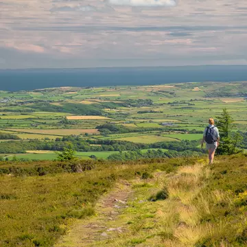
For our England writer, Lucy Shrimpton, the sea and walking are her two greatest passions. Having walked plenty of the England Coast Path already, Lucy plans to keep on going, slotting stretches together like pieces of track in a train set.
The 2700-mile-long King Charles III England Coast Path is the longest managed coastal route in the whole world. Bigger isn’t always better, granted, but "long" in this context does mean extraordinary variety. Don’t get me wrong, I also love Wales deeply, but when it comes to the breadth of experience up for grabs on England’s epic trail, this one is unmatchable.
For hiking historians, it’s the ultimate ticket to time travel. Whether its Roman ruins, William the Conqueror’s first footings or D-Day departures, can there be any country in the world that tells so many of its stories on its shores?
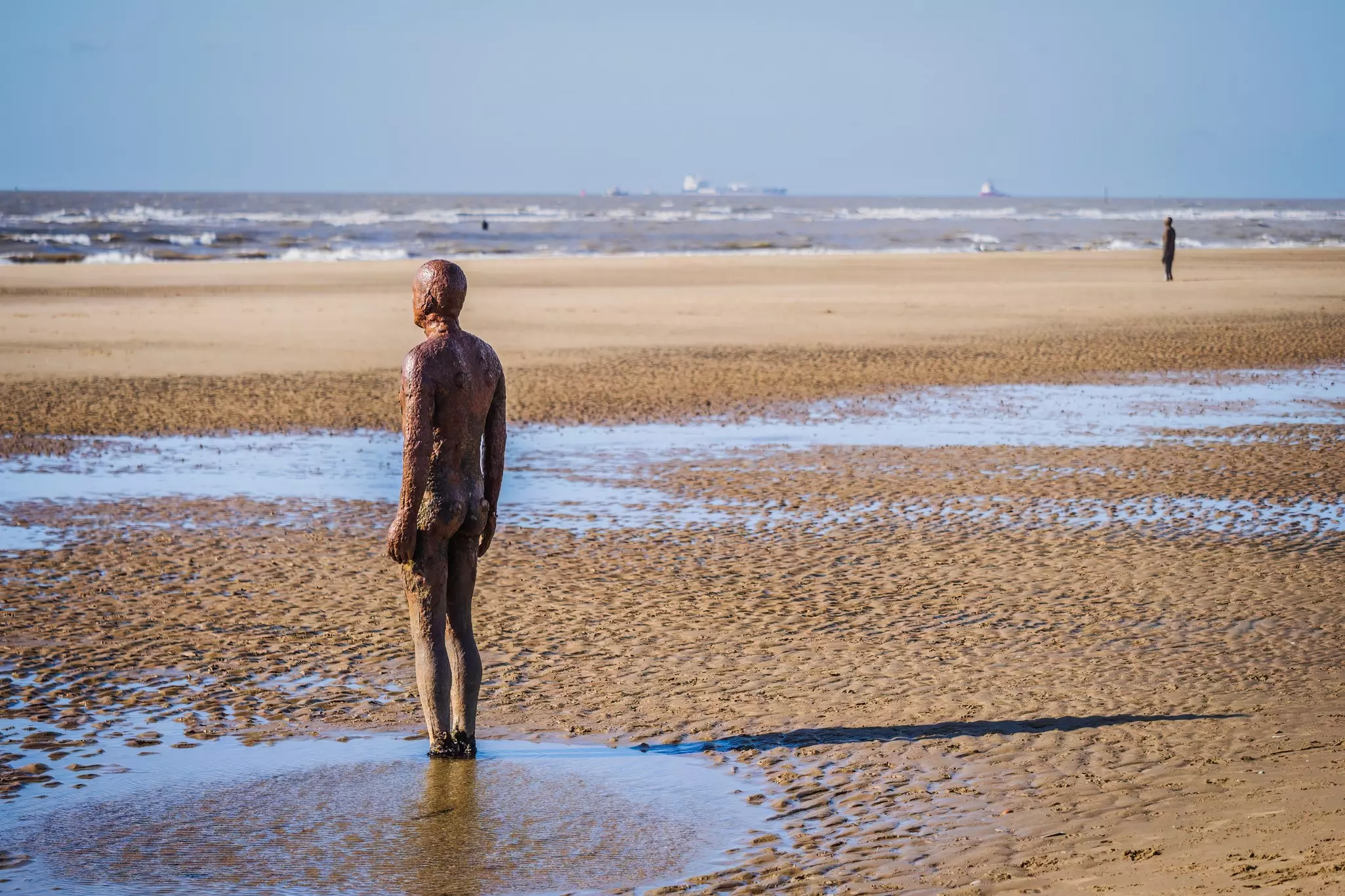
England’s coast is awash with cultural treasures too, from world-famous galleries in Liverpool, St Ives or Margate to incredible outdoor artistry, such as the 100 identical life-size Antony Gormley sculptures on the sand in Crosby. If you’ve not seen the Minack Theatre in Porthcurno, hand-carved into the cliff, take the spectacular 3-mile circular walk from there to Logan’s Rock and Treen. I’m envious you’ve got that wow moment still to come.
Beaches are knockout. Sure, Wales has them in spades, but so does England, from the rugged, remote and duned to those where a wander along the seafront promenade yields a Blue Flag beach, pier or lido. Combine a dip in Plymouth’s lido with a short stroll around the headland to the Barbican, the city’s historic heart. Wherever you are, you’ll never be far away from classic English coastal fare to fuel your steps, from afternoon teas and ice cream to pasties and seafood.
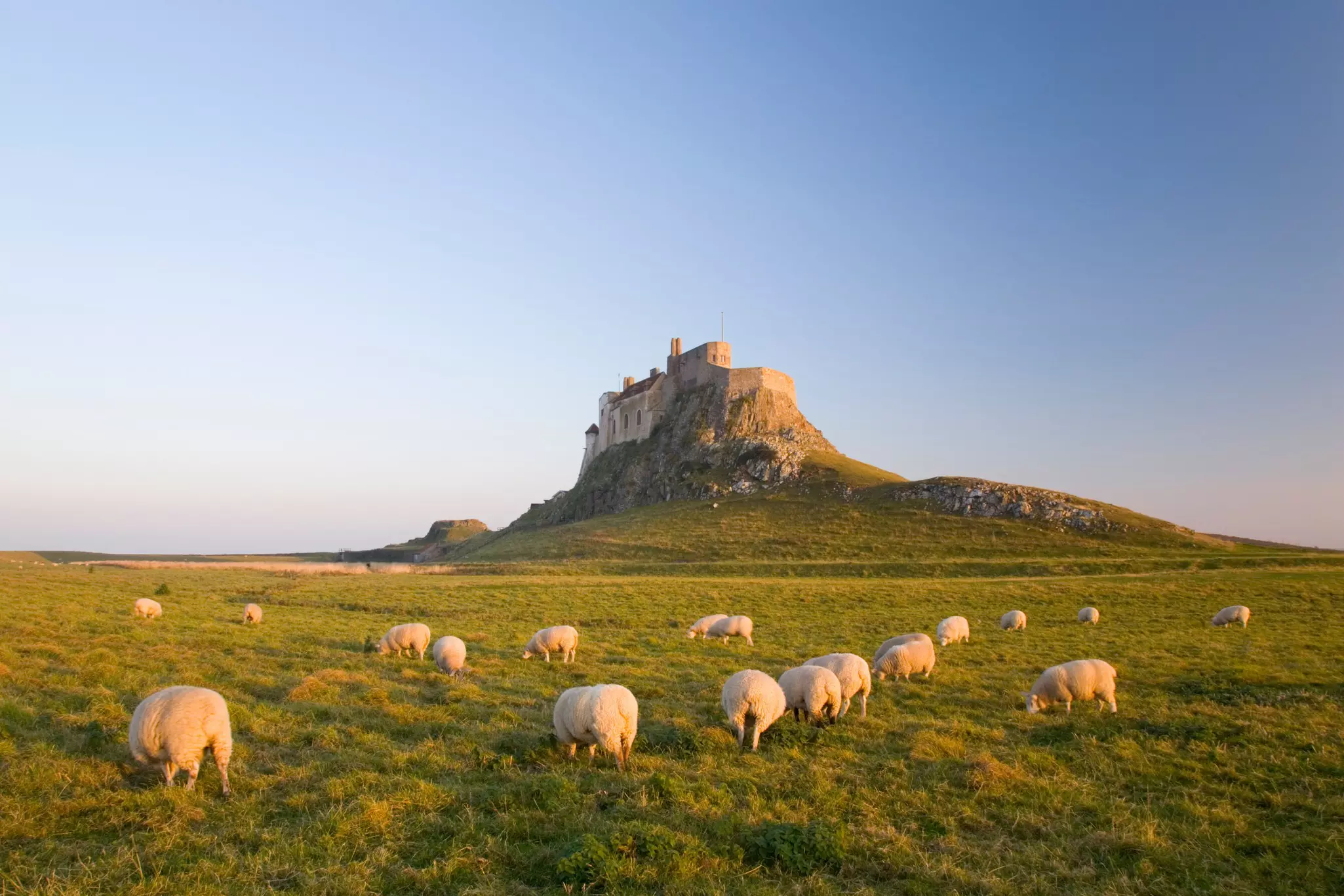
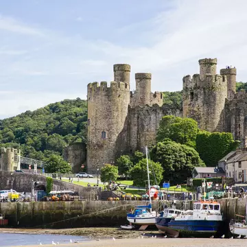
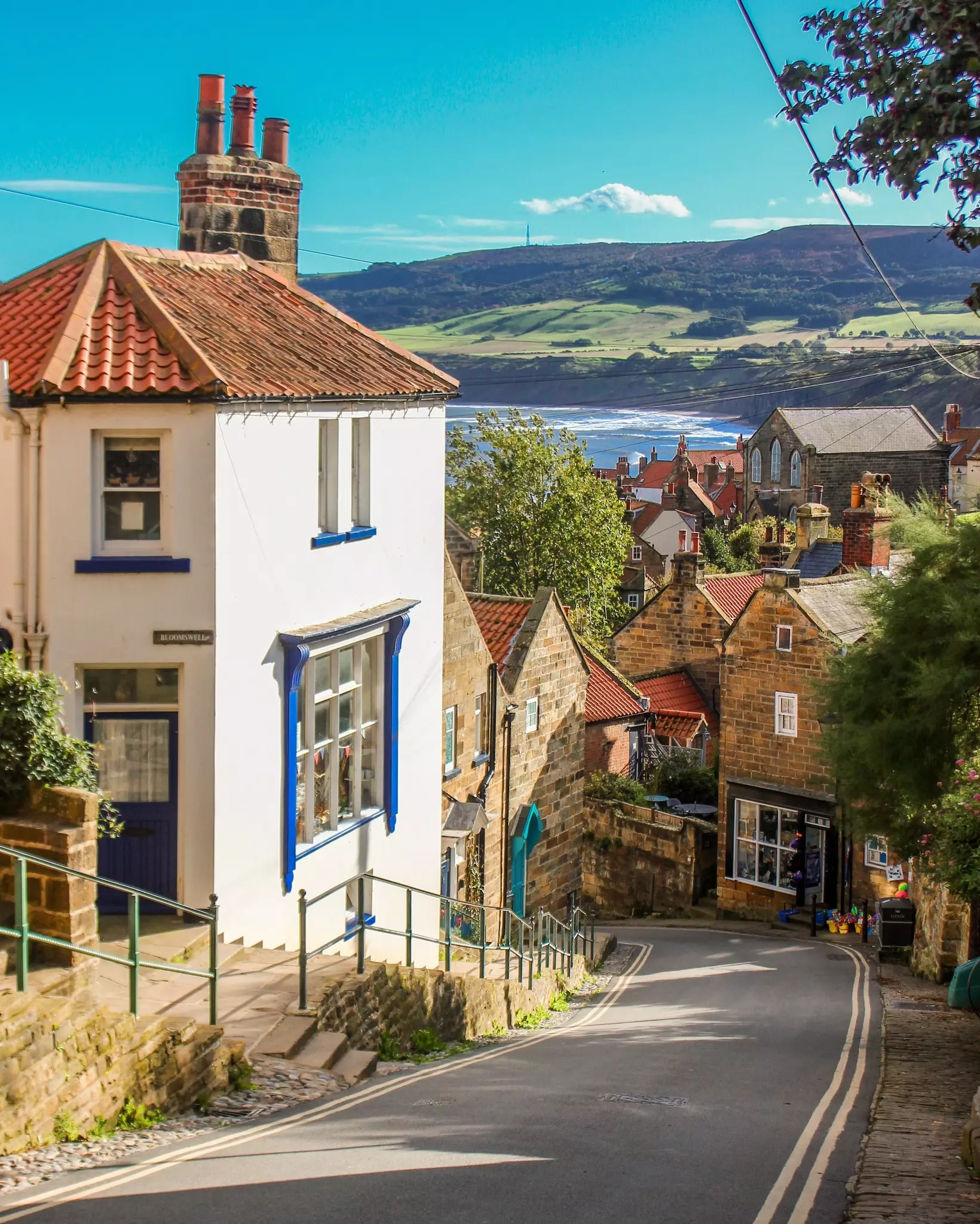
What else do I see when I close my eyes and think of the England Coast Path? There are the fossil foragers strolling the UNESCO-listed Jurassic Coast. There are faces to the wind on Kent’s iconic cliffs – marvel at their might on a 5-mile circular from the White Cliffs Visitor Centre to St Margaret’s Bay. I see stirring spiritual sights rising out of the mist at St Michael’s Mount or Lindisfarne and castles every inch as arresting as Conwy’s or Caernarfon’s. If you’re drawn to fishing villages – all cobbled streets, wee harbors, smuggler stories, rowdy gulls – there’s a route for every hiker around North Yorkshire’s Robin Hood’s Bay, be that a 6-mile circular to Maw Dyke, or the more serious undertaking of a 2-day walk from Whitby to Scarborough with a night at the Bay en route.
Wales got there first, but England’s trail was worth the wait. Named after King Charles who officially opened it in March 2026, it’s almost as if the monarch himself has waved his bejewelled scepter to connect it all up: 1700 miles of improvements on the existing parts, together with 1000 miles of new – all thanks to Natural England’s robust environmental and infrastructural measures so that walkers can get a fix of nature while wildlife can thrive. In many areas, it gifts hikers the right to explore not just the path but the coastal margin alongside it. It can also adapt to the coast’s changing shape as erosion and sea level issues arise. Happily, it’s all user-friendly too, from the planning stage to crystal-clear signage on the ground (look out for the acorns!).
All of which will help me to accomplish many more stretches in my lifetime with plenty of daydreaming about them in between. Even on a coast path on the other side of the world, I'd still be thinking about England’s.
If, like mine, your best walks combine coast path and history, you’ll love this 11-mile linear day hike from Bawdsey to Sutton Hoo, Suffolk. Park the car in Bawdsey at the mouth of the River Deben and head towards Woodbridge, for easy, estuary-hugging terrain through marshes, grassy banks, fields, nature reserves and woodland. Come with binoculars; the array of waders, wildfowl and birds of prey is beyond astonishing.
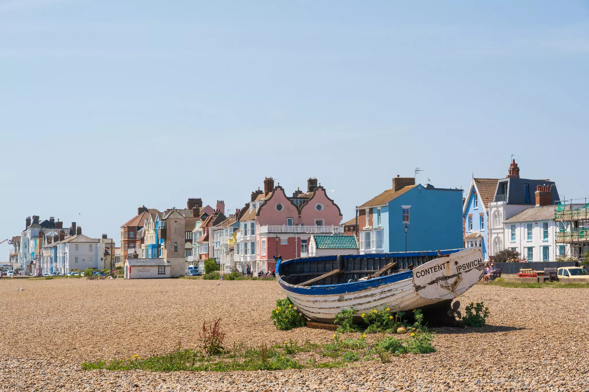
The walk’s finishing line is Sutton Hoo, just off the trail, where in 1939 a local self-taught archaeologist unearthed England’s greatest ever horde: a 1300-year-old burial chamber chock full of clues to Anglo Saxon living. Visit the National Trust property that tells the whole stirring story before relieving weary limbs with gastro fish and chips and a luxury bed for the night at the Crown at Woodbridge. For scenic contrast, pair it the next day with a lovely 6.5-mile circular walk from Aldeburgh to Thorpeness, where shingle paths lead to a boating lake, a windmill and beyond.
Length: 2700 miles
Total walking time: Around 2 years
Sections: Eight regions, each further split into subareas. Some connecting stretches of the trail were still being completed as we researched this piece – all should be finished by the end of 2026.
Accommodations: Places to stay located close to the coast path can be viewed on the National Trail’s interactive map or the Create Your Own Trip page. Map filters display different types of accommodations.
More information: Start with the National Trail Website. Resources include oven-ready routes (including circular walks, linear walks and accessible walks), filtering tools for practicalities, a distance calculator to help you customize your own route, and downloads.
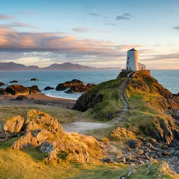
When freelance travel writer Rachel Ifans met her dark-haired, north-Walian beau, she fell in love at first sight. Yes, with him, but also with the sand dunes, the wild beaches and the epic mountainous backdrop of Eryri (Snowdon) . Since then, they have spent many years exploring his homeland’s beautiful coast.
Until this March, Wales had the only path in the UK that followed an entire country’s coastline. It won’t go unnoticed that England’s newly monikered King Charles III Coast Path is named after a man who used to be Prince of Wales. Yes, Wales. But, no matter. The Welsh are used to English whim and they don’t need royal approval to know that what they’ve got is special.
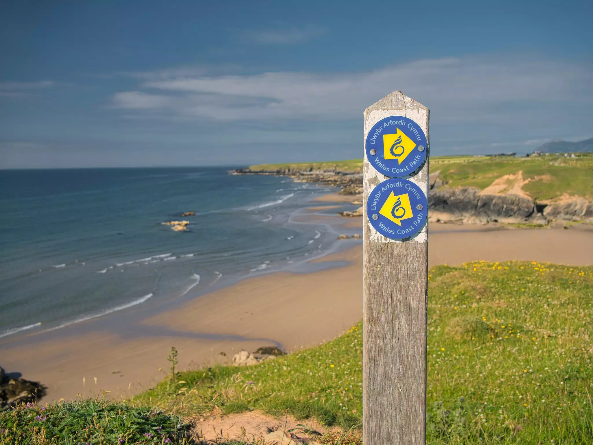
The Wales Coast Path has been delighting hikers since 2012, with its wild beauty, rugged landscapes and massive beaches. It interlaces history, heritage, wildlife, culture and language in one magical path and stands out because you get many crowd-pleasers in a relatively short distance (870 miles compared to the 2700-mile English coast path). It’s a Greatest Hits compared to England’s impenetrable double album.
The path runs from Chepstow in the south to Chester in…well, in England actually, but let’s brush over that. It’s divided into eight sections and its route takes in two National Parks and four Areas of Outstanding Beauty. You can tackle small sections like Llangrannog to New Quay in a weekend. Alternatively, pick a region to complete like the wild and beautiful Llŷn Peninsula in the north. It encapsulates Wales’ magic, with the mountains of Eryri as a backdrop and white sandy beaches alongside you; this multiday hike sees you start in Pwllheli and end in Aberdaron with just over 31 miles of walking in 3 days.
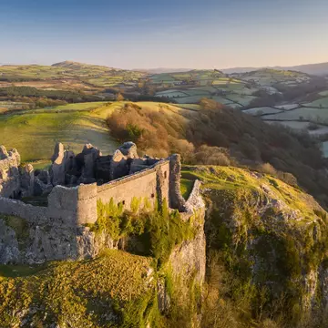
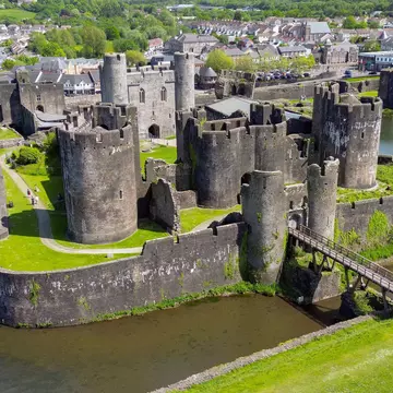
With over 600 castles, Wales’ dramatic history is always front and center. Castles, Neolithic burial chambers and Iron Age hill forts dot the cliffs, as well as sacred sights like St David’s Cathedral in Pembrokeshire.
The Welsh have long been industrialists, and fragments of the country’s mining past are visible on the coast. In the south, the path edges Port Talbot, whose atmospheric steelworks, with illuminated chimney fires that roar in the night sky, may have inspired the 1982 movie Blade Runner.
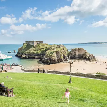
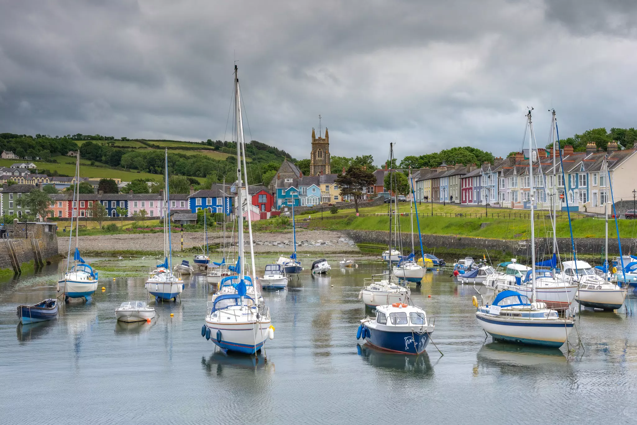
West of Swansea, towns become smaller and views larger, and I love the pastel facades on west-coast houses in bustling Tenby, idyllic Solva and Regency Aberaeron.
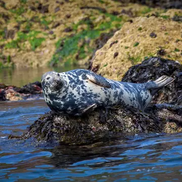
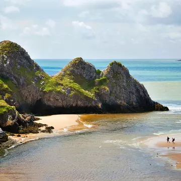
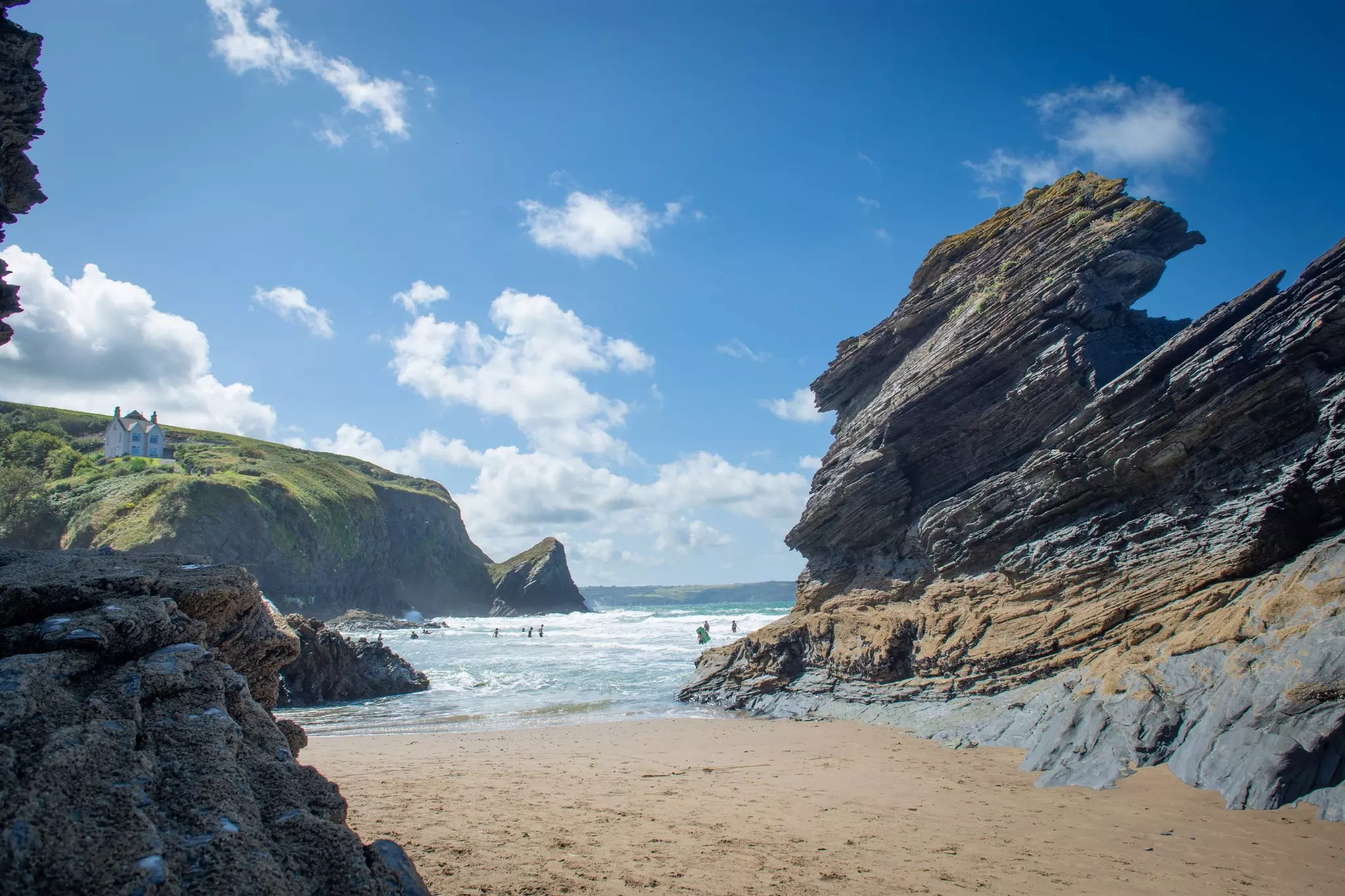
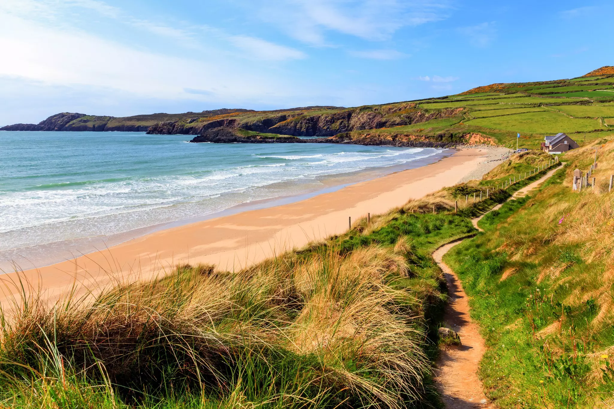
Both Gower and Pembrokeshire are lauded for their beautiful beaches and it’s wise to pack binoculars for spotting gray seals, cormorants, razorbills, guillemots and peregrine falcons in these parts. The magnificent Rhossili to Port Eynon section has a real wow factor, starting with a walk along the 3-mile-wide sandy beach to Worms Head peninsula. Ceredigion is great for spotting bottlenose dolphins, but should marine wildlife fail you, look out for Celtic long boats powering up and down the coastline; a popular sport that sees local teams competing against rivals from Irish shores.
Wales’ literary mite also shows up on the path, from the Norwegian Church in Cardiff Bay where Roald Dahl was baptized to poet RS Thomas’ roots in Llŷn and Anglesey. Perhaps the brightest jewel is Laugharne, where Dylan Thomas’s writing shed is a memorable diversion for hikers.
I love tracing Wales’ rich linguistic heritage and the coast path is a great way to record it. It evolves as you move through the country, from English to Welsh and back again, village by village, and from South Walian dialect to North – all with surprising rapidity and passion.
For me – an English woman married to a Welsh man – the Wales Coast Path bursts with history, myth and romance that the English one can never touch. As you walk past the Wales Millennium Centre in Cardiff, be sure to gaze up at its copper-domed roof. In these stones horizons sing, the inscription promises. It’s not wrong.
Llangrannog to New Quay in Ceredigion is a perfect mix of rugged, beautiful and challenging. The section starts with a lung-busting flight of steps to the clifftops. Make the most of the panoramic views of Ynys Lochtyn, an island that dots the grassy peninsula, before you dip down to Cwmtydu beach, a smuggler’s cove that keeps treasured memories of holidays when my kids were young, as well as a cafe and that rarest of spots on the Wales Coast Path…a public toilet!
The path continues to the wooded valley of Cwm Soden, Castell Bach’s iron age fort and Pen-y-Badell, a coastguard’s lookout that's great for spotting seabirds and dolphins. Finally, the descent to New Quay: picturesque, terraced seaside town with sheltered harbor and sandy beaches believed to be the inspiration for Dylan Thomas’ Under Milk Wood that leaves its tacky English counterpart unequivocally in the dust.
At 9 miles, you can do Llangrannog to New Quay in one day, but I’d advise making a weekend of it and carrying on to Aberaeron. The T5 bus combined with the railway station at nearby Aberystwyth make this stretch one of the coast path’s most accessible by public transport.
Length: 870 miles
Total walking time: 2–3 months
Sections: Eight regions, each split into sections of around 12–15 miles
Accommodations: Each region has its own tourism website with recommendations, and Visit Wales has accommodations across the country. For my favorite stretch, I stayed at the Ship Inn in Tresaith the night before and the Hotel Penwig in New Quay at the end. The Discover Ceredigion website has useful regional planning.
More information: The Wales Coast Path website has lots of information on routes, downloadable maps, water points, public toilets, tide times, public transport and things to do. A QR code history tour is available for points of interest along the path.
Take your Wales trip with Lonely Planet Journeys
Time to book that trip to Wales
Lonely Planet Journeys takes you there with fully customizable trips to top destinations – all crafted by our local experts.


Explore related stories