Jun 21, 20265 min read
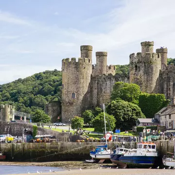
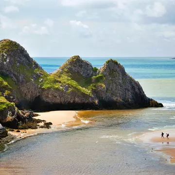
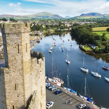
11 of the best beaches in WalesJun 26, 2025
12 MIN READ

Writer
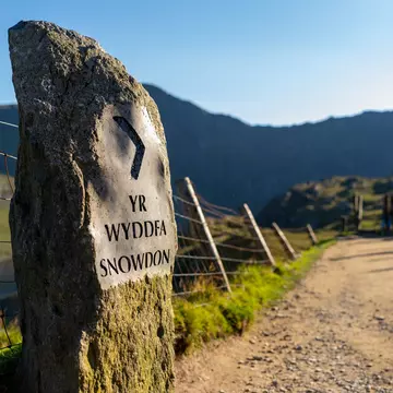
Yr Wyddfa (Snowdon) sign along the Pyg Track in Eryri (Snowdonia) National Park. Andrew T Bennett/Shutterstock

Writer
Lonely Planet may earn a commission from affiliate links on our site. All recommendations and reviews reflect our own independent opinions.
Imagine thunderous rivers, glacial mountain ranges and ancient forests folded into 823 glorious square miles (2132 sq km) of national park. Welcome to Snowdonia National Park (Parc Cenedlaethol Eryri), the mountainous core of Cymru (Wales), beloved by thrill seekers and hardcore hikers.
A stronghold of Welsh culture and language, Eryri is also chock-a-block with waymarked trails, swim spots and technical scrambles over rocky terrain. The park's nine mountains include Yr Wyddfa (Mt Snowdon) – Wales's highest mountain – which dominates the skyline at 1085m (3560ft).
Enterprising tourism operators have shrewdly utilized Eryri's landscapes and industrial heritage to create an adventure tourism hub. Former quarries, historic slate mines and a disused railway line have been reimagined as thrilling zipline zones, underground trampolines and biking routes. And as there are no cities, just towns and villages for miles around, this is a great spot for some stargazing after dark.
The best time to head to Snowdonia National Park (Parc Cenedlaethol Eryri) is in spring – the daffodil and lambing season – or autumn, when the forests are ablaze with color, although you’ll have to pack for showers and potential mud.
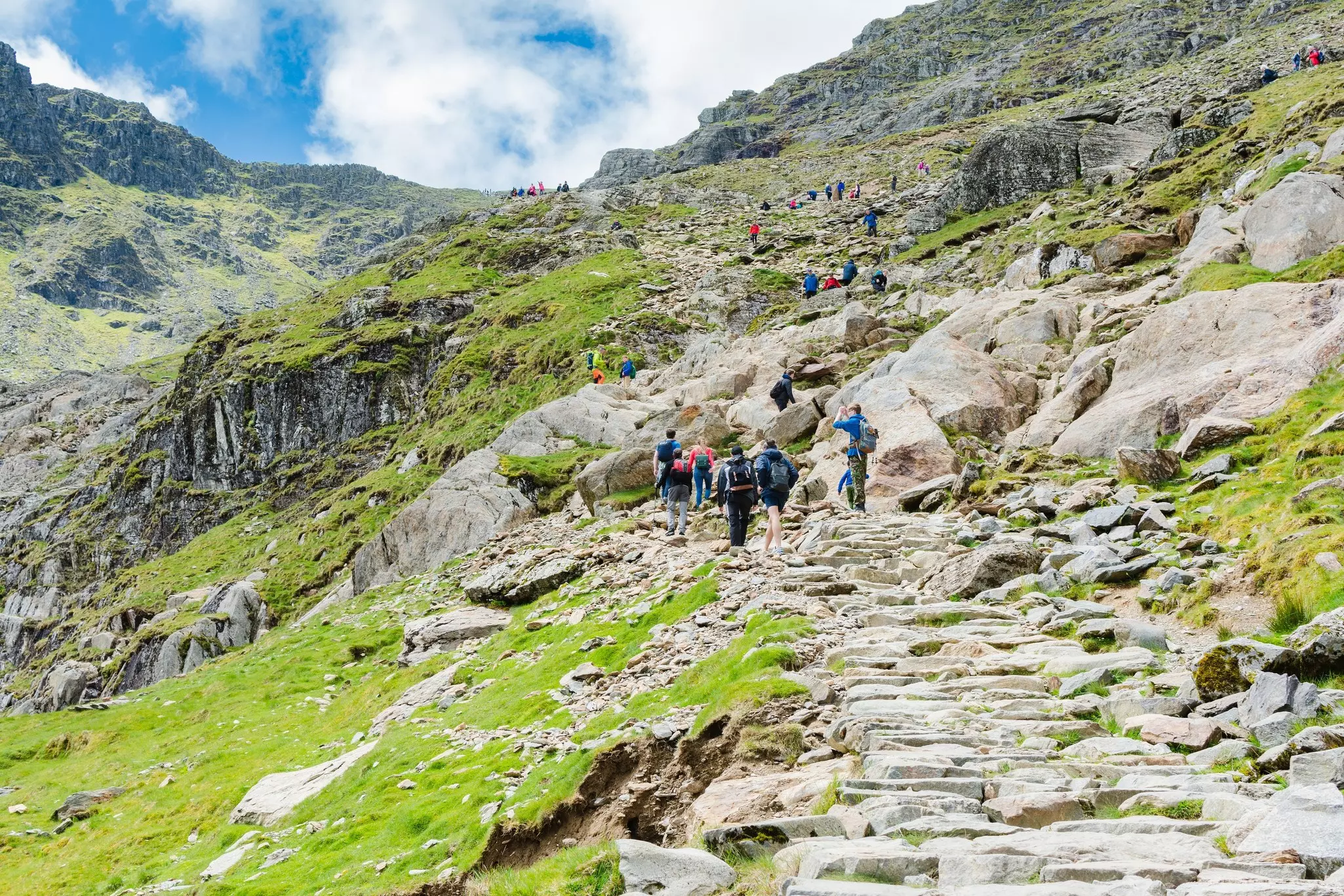
Summer brings warmer and drier conditions, but also plentiful holidaymakers during the school summer break. If it's a sunny day in summer, the summit of Yr Wyddfa (Mt Snowdon) will be as busy as Oxford Circus (600,000 people ascend to the top each year).
Thousands of experienced hikers, plus plenty of less prepared newbies, flock to the summit, some arriving on a mountain railway tour. As well as contending with congested trails, parking can present a problem, and there’s often a snaking queue of selfie-seekers at the 1085m (3560ft) marker.
Winter is an interesting time of year to visit. You’ll see snow on Eryri’s peaks, roads can be eerily foggy, and there are plenty of cozy historic pubs where you can sit by an open fire for a hearty meal or a Welsh ale. Limited daylight means the longer out-and-back walks are a challenge unless you’re fit, but there are many shorter walks to choose from.
Roads in Eryri vary from well-maintained A-roads to narrow B-roads and winding rural lanes. Having a car is helpful for exploring rugged spots and trails in Snowdonia National Park (Parc Cenedlaethol Eryri) but parking can be a nightmare in popular spots, particularly during peak seasons. Take plenty of cash to pay for private parking spots that spring up on farmers' fields. Bank on a minimum of £20 (US$27) for a day, and be ready to hand it over to enterprising locals.
The low-cost Sherpa'r Wyddfa bus service is a convenient way of travelling between Eryri's hotspots. It connects several villages and trailheads, including Llanberis, Betws-y-Coed and Porthmadog, and traveling by bus will help alleviate traffic and parking issues. TrawsCymru buses provide regional routes for broader travel.
There are six trails leading to the top of Cymru's crown jewel, and all are considered strenuous. Be fully prepared for a day on the mountain, with plenty of water, food and appropriate hiking gear. For people with mobility issues, those walking with small children, or if you just don’t think you’re fit enough, there’s the option to board the heritage Snowdon Mountain Railway at Llanberis for a chugging ascent to the roof of Wales through moorland and rocky outcrops.
The Llanberis Path (9 miles/14.5km) is the go-to summit route for most hikers. Starting from Llanberis village, this well-trodden trail is a more gradual ascent that follows the Snowdon Mountain Railway, making it a top choice for first-timers and less confident walkers. It's a steady climb, usually taking around three to four hours, depending on your fitness. If you summit on a clear day, the eye-popping views stretch as far as Ireland and the Isle of Man – pure Cymru magic!
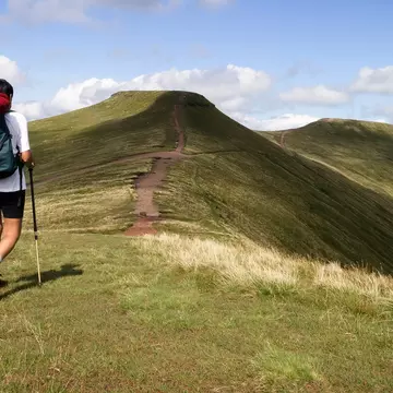
Kicking off from Pen-y-Pass, the Miners' Track (8 miles/13km) is where you can spot the remains of the Britannia Copper Mine. After a fairly gentle beginning to the shimmering Llyn Llydaw lake, the path cranks up the intensity with a steep, rocky uphill climb to meet the Llanberis Path to the summit.
Close by is the Pyg Track (7 miles/11km), another favourite walk from Pen-y-Pass. It’s shorter but steeper than the Miners’ Track, and the walk is pretty arduous and rocky from the outset, as you wind up Bwlch y Moch, but the views are worth it. Eventually, you'll join the Miner's Track as you all approach the summit.
The Rhyd Ddu Path (7.5 miles/12km) offers epic mountain vistas and it's a tough route to the busy summit. Starting from the village of Rhyd Ddu, the trail follows an old slate quarry track before reaching steep ridges. It's one of the best routes for panoramic views from Yr Wyddfa's slightly less crowded western side, but you will need a head for heights.
Another western ascent option is the Snowdon Ranger Path (8 miles/13km), considered one of the original routes to the top. Beginning at Llyn Cwellyn, this route starts with a gradual ascent before climbing steeply through rocky landscapes.
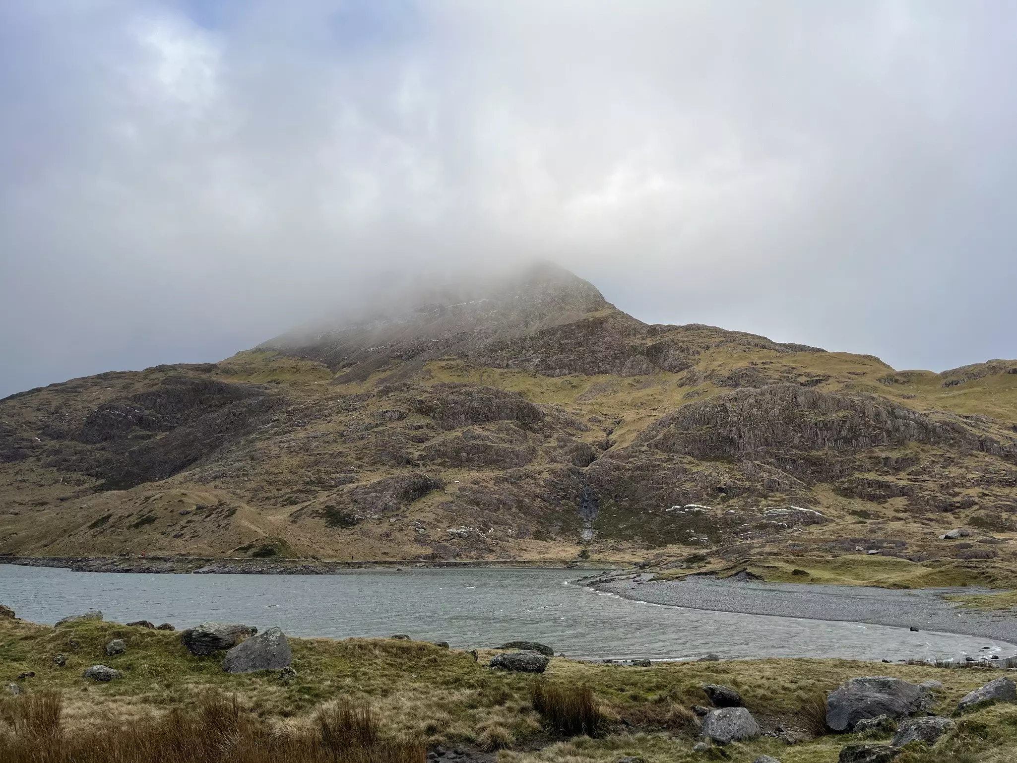
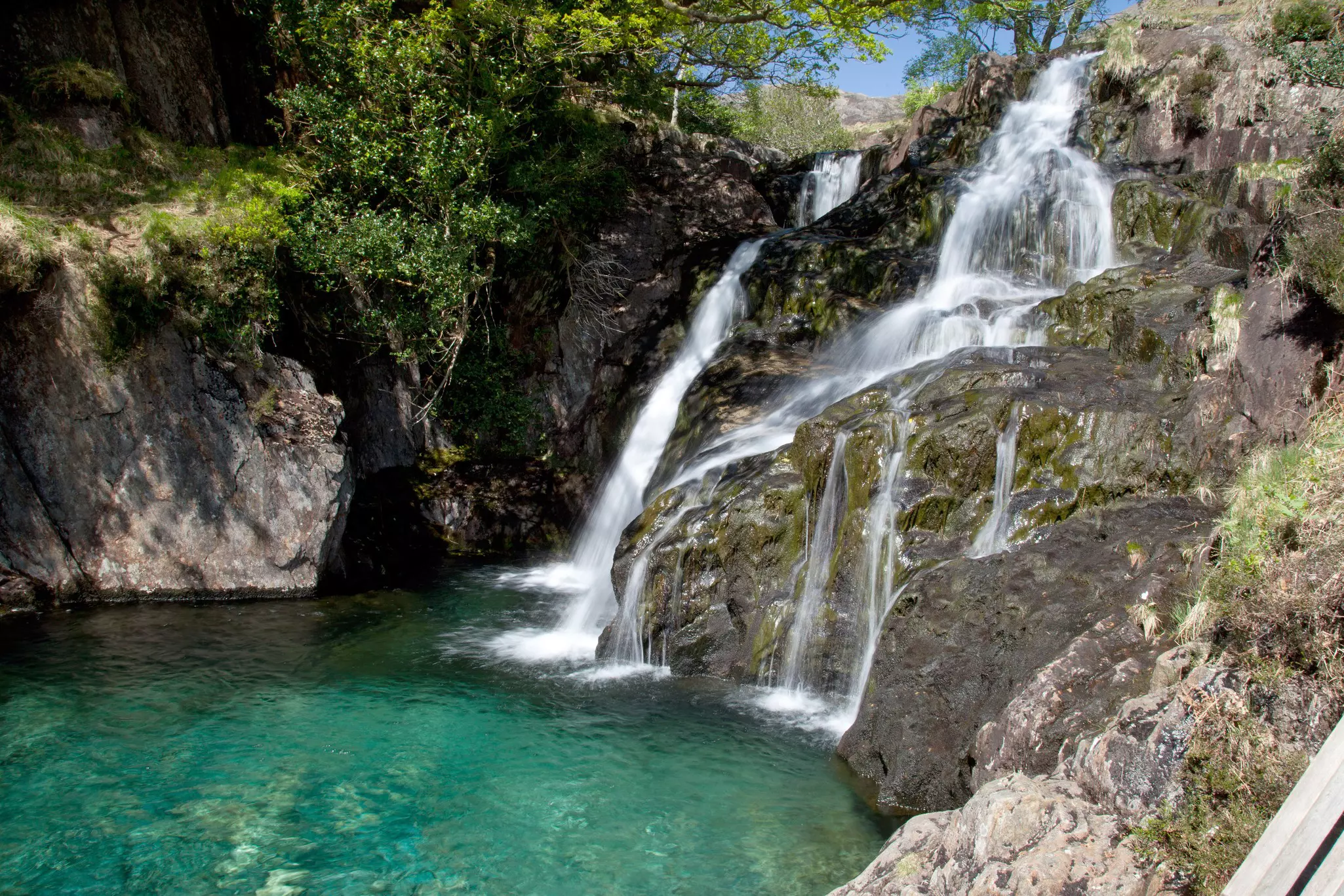
Starting at Nant Gwynant, the Watkin Path (8 miles/13km) offers dramatic scenery on the climb to the summit, plus the chance for a cold-water swim in waterfall plunge pools. The pools are not too far from the start of the track, making them popular as a destination in their own right. Tragically, a couple of women drowned in the pools after heavy rains in 2025 – a bleak reminder that cold water swimming in remote places is always risky.
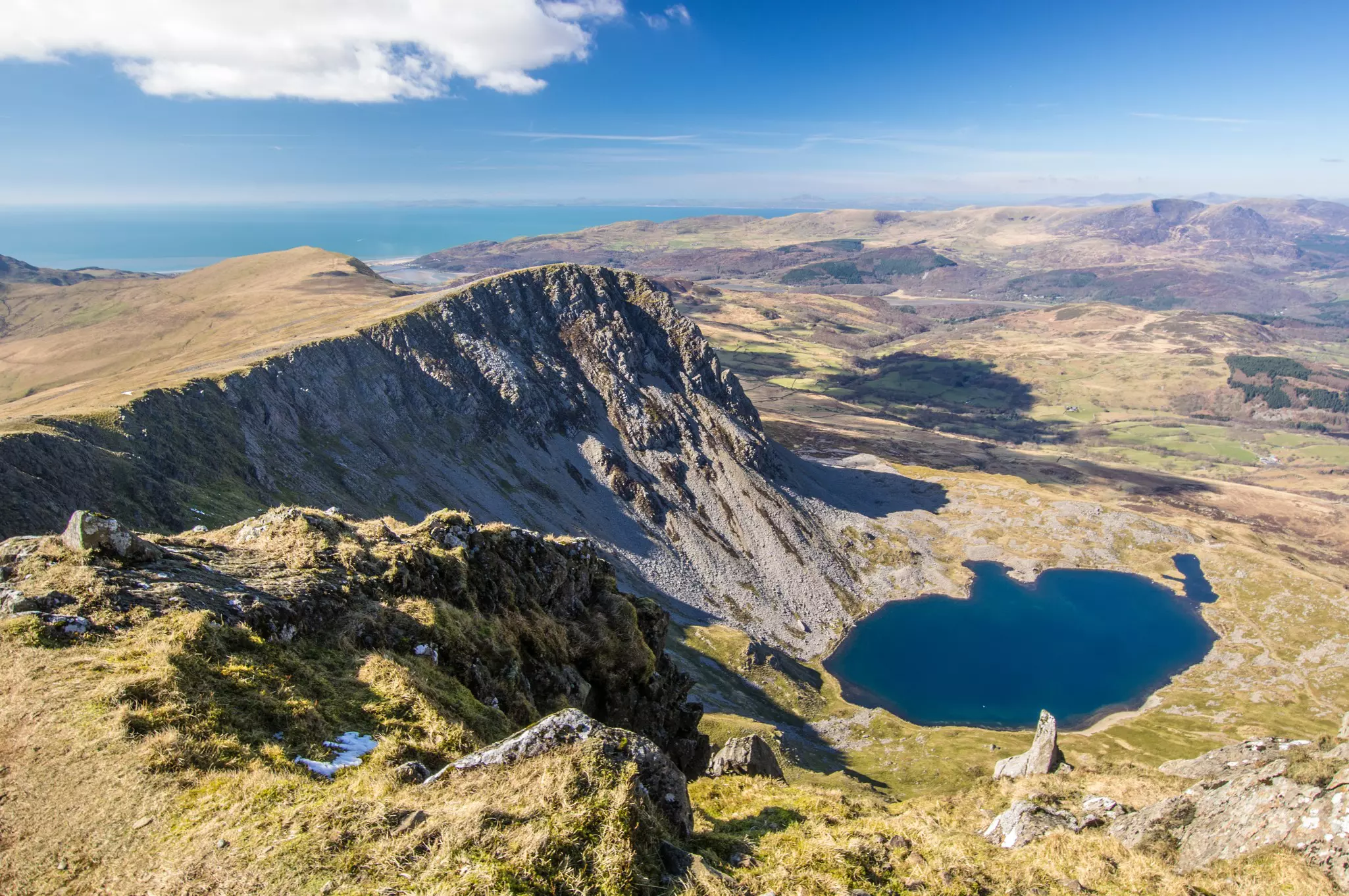
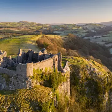
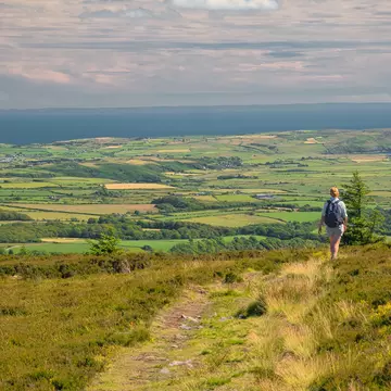
There's a choice of challenging routes to reach the scenic summit of Cader Idris. At 893m (2930ft), this is one of the highest mountains in southern Eryri and another popular mountain to summit. As you ascend its steep slopes, views open up over the Cregennan Lakes and towards Barmouth. From the top, you'll take in panoramas of the national park, Cardigan Bay and the Cambrian Mountains.
A more challenging hike is pyramidal Tryfan (917.5m/3010ft), famed for its craggy, serrated terrain and heart-pounding scrambling routes. The North Ridge ascent will test your mountain skills, with the final stretch requiring hands-on rock climbing and deft footwork. This route is not for the faint-hearted, as you'll need to traverse narrow ledges and boulder fields.
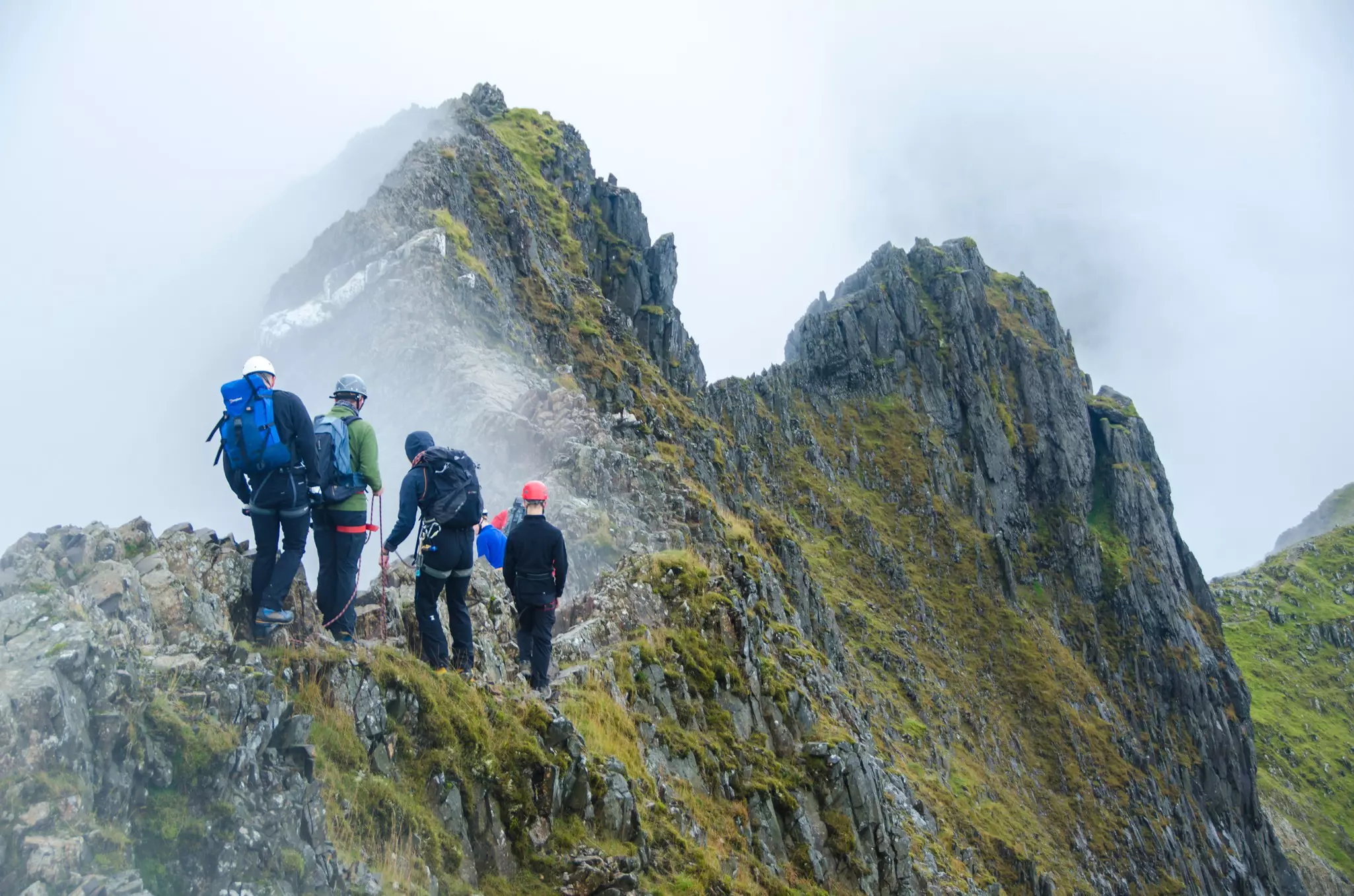
Technically part of Yr Wyddfa, the knife-edged arête of Crib Goch (923m/3028ft) requires a head for heights and excellent scrambling skills. Its wind-whipped exposure and technical difficulty make it a challenging ascent. The traverse along the ridge offers dizzying views and a real sense of achievement when you bag the summit.
Finally, take a walk up Crimpiau (475m/1560ft). It may not be the tallest peak in the region, but Crimpiau offers a varied hike that combines manageable elevation with fewer crowds. The climb to the summit is relatively short at 3.7 miles (6km) and it offers panoramic views of Llyn Crafnant and the surrounding mountains.
Exploring Snowdonia National Park (Parc Cenedlaethol Eryri) independently allows you to set your own pace and choose routes that suit your hiking style.
However, guided tours can help less experienced walkers navigate peaks with a pro and gain insight into the area's geology and history. If you're solo hiking in the national park, always plan your route in advance, considering the distance, elevation gain, and your fitness level and let people know where you're heading.
Need a little help in the mountains? Adventure companies such as Snowdonia Adventure, Raw Adventures, and Adventurous Ewe offer plenty of Eryri guided hikes and mountain skills courses, with some offering bespoke trips as well as group hikes.
Known as the “Welsh Matterhorn” for its distinctive shape, Cnicht (689m/2260ft) offers a manageable trek for experienced hiking families with older children. Starting from the village of Croesor, the path is well-trodden and has a steep but relatively easy approach to the final summit. The hike is a 5-mile (8km) round-trip, providing glorious views over the Glaslyn estuary and the surrounding valleys.
Another decent hike for older kids, with gradual inclines and a clear path, is Moel Eilio (726m/2382ft). Typically starting from Llanberis, the 9-mile (14km) circular route follows a grassy, sheep-dotted trail steadily climbing to the summit. Look out for Welsh ponies along the way and pack a picnic for a summit feast.
Younger kids can usually manage the first section of the Miner’s Track from Pen-y-Pass to the scenic lake of Llyn Llydaw. The path initially leads uphill to Llyn Teyrn, a smaller lake, before dropping down to the shores of Llyn Llydaw. Stop for a picnic lunch, then meander your way back. The out-and-back route covers 5 miles (8km), but the path is well kept making it less challenging for little legs.
Still waters run deep at Llyn Tegid (Bala Lake). Over 4 miles (6.4km) long, nearly 1 mile (1.6km) wide and almost 40m (131ft) deep in parts, Llyn Tegid is the largest natural lake in Wales. This glacial beauty was millions of years in the making, formed during the last Ice Age and surrounded by forests and mountains.
Like many of Wales' natural sites, the lake is bound to local Welsh folklore. Today, the legend-filled lake is a popular swimming and paddling spot, especially during peak season. Canoes, kayaks, and stand-up paddleboarders (SUP) dot the lake during the summer, with locals and visitors launching from the shore.
The launch and landing point at the foreshore car park is the safest place to enter the water for a bracing cold-water swim with a view. Aspiring swimmers, take note – the water is nippy, and the water at the edge is deep in places, so swim with care and always bring a buddy.
If you're launching your own craft, don't forget to grab a water-sports permit from one of the pay-and-display machines at the lakeside car parks before you hit the water. Don't have a canoe? You can hire equipment from Bala Adventure and Watersports Centre.
Once you've summited Yr Wyddfa and explored the national park, there are plenty of options for high excitement beyond Llanberis. At Blaenau Ffestiniog, located just outside Snowdonia National Park (Parc Cenedlaethol Eryri), this former slate mining town has segued from a gritty industrial center to an adventure tourism hub.
At Zip World Llechwedd you can elect to be strapped into a four-person parallel zipline to zoom across a quarry at speeds of over 60mph (97km/h). Below you, the old slate quarry stretches out, a rugged reminder of the area's industrial past.
Part of the same adventure center, the appropriately named "Bounce Below" is an enormous underground trampoline park housed in a disused mine. You can bounce, jump and twirl in an enormous atmospheric cavern double the size of St Paul's Cathedral.
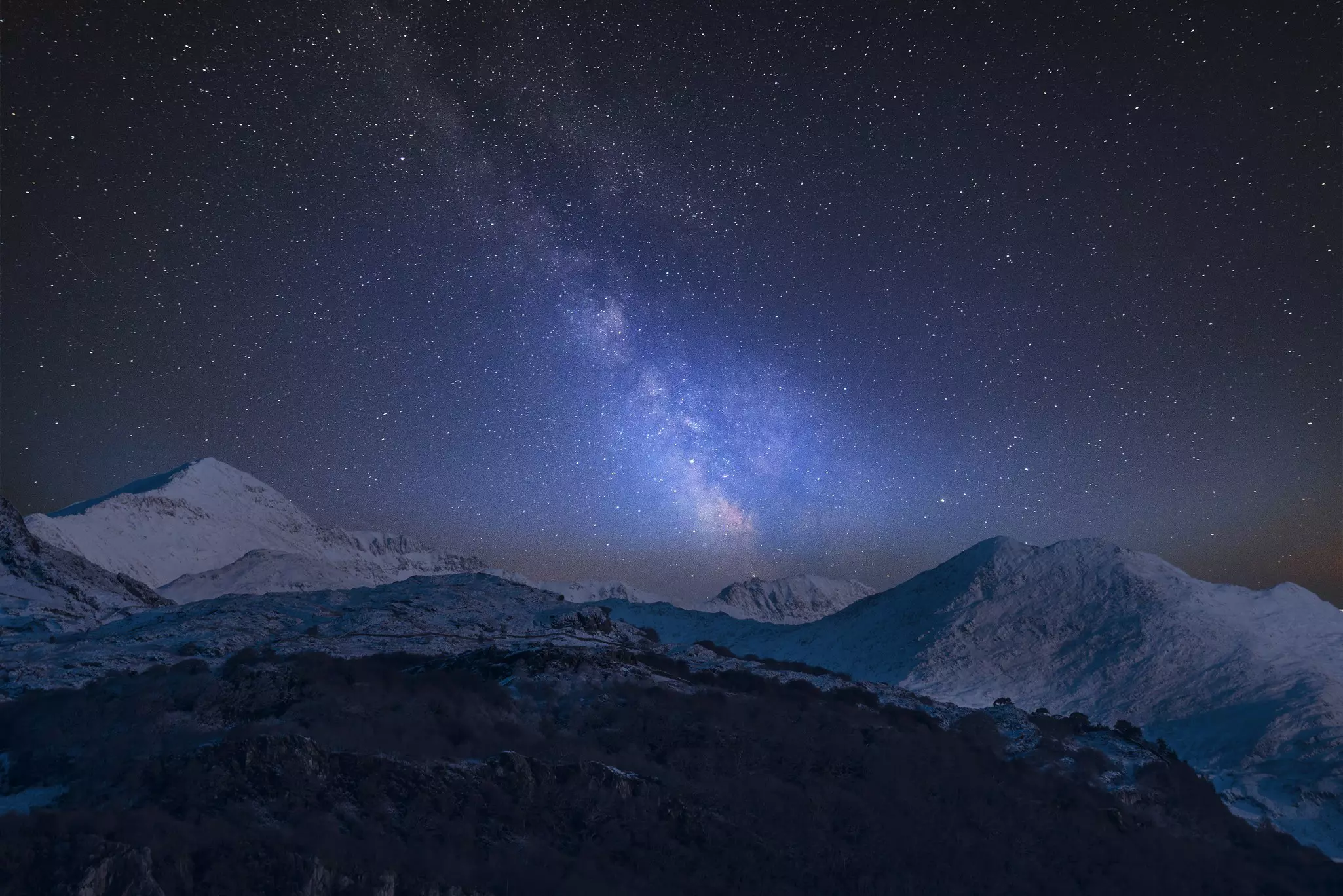
Snowdonia National Park (Parc Cenedlaethol Eryri) is a designated International Dark Sky Reserve, full of wild landscapes and easily accessible stargazing spots. One of the best spots to stare at the night sky with binoculars, telescopes or the naked eye is at Bwlch y Groes, the highest tarmacked mountain pass in Wales, where you can also enjoy expansive views of the Dyfi Valley, Cader Idris, and the Berwyn Mountains by day.
Llyn y Dywarchen, a mountain lake above Drws y Coed in Dyffryn Nantlle, just off the B4391, is also largely free from urban light pollution. A more accessible lakeside stargazing location is at Llyn Geirionnydd, located in Gwydir Forest near Betws-y-Coed; the site also has parking and toilets. In the foothills of Cader Idris, the twin lakes at Llynnau Cregennen provide an atmospheric setting for stargazing and astrophotography.
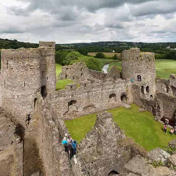
Mining remains are visible across the undulating landscape of Snowdonia National Park (Parc Cenedlaethol Eryri). The National Slate Museum is the place to learn more about the industrial history of this Welsh landscape. However, the museum is currently closed for a redevelopment project with no set date for reopening; check their website for the latest information.
At the end of the 19th century, the North Wales slate industry employed more than 15,000 workers, accounting for almost half of global slate production. The workshops here – from the smithy to the saw sheds – were a hive of activity, catering to the repair and maintenance work demanded by the busy Dinorwig quarry. Today, they tell the gritty story of slate, and strikes, as well as the tight-knit communities that thrived around this demanding industry.
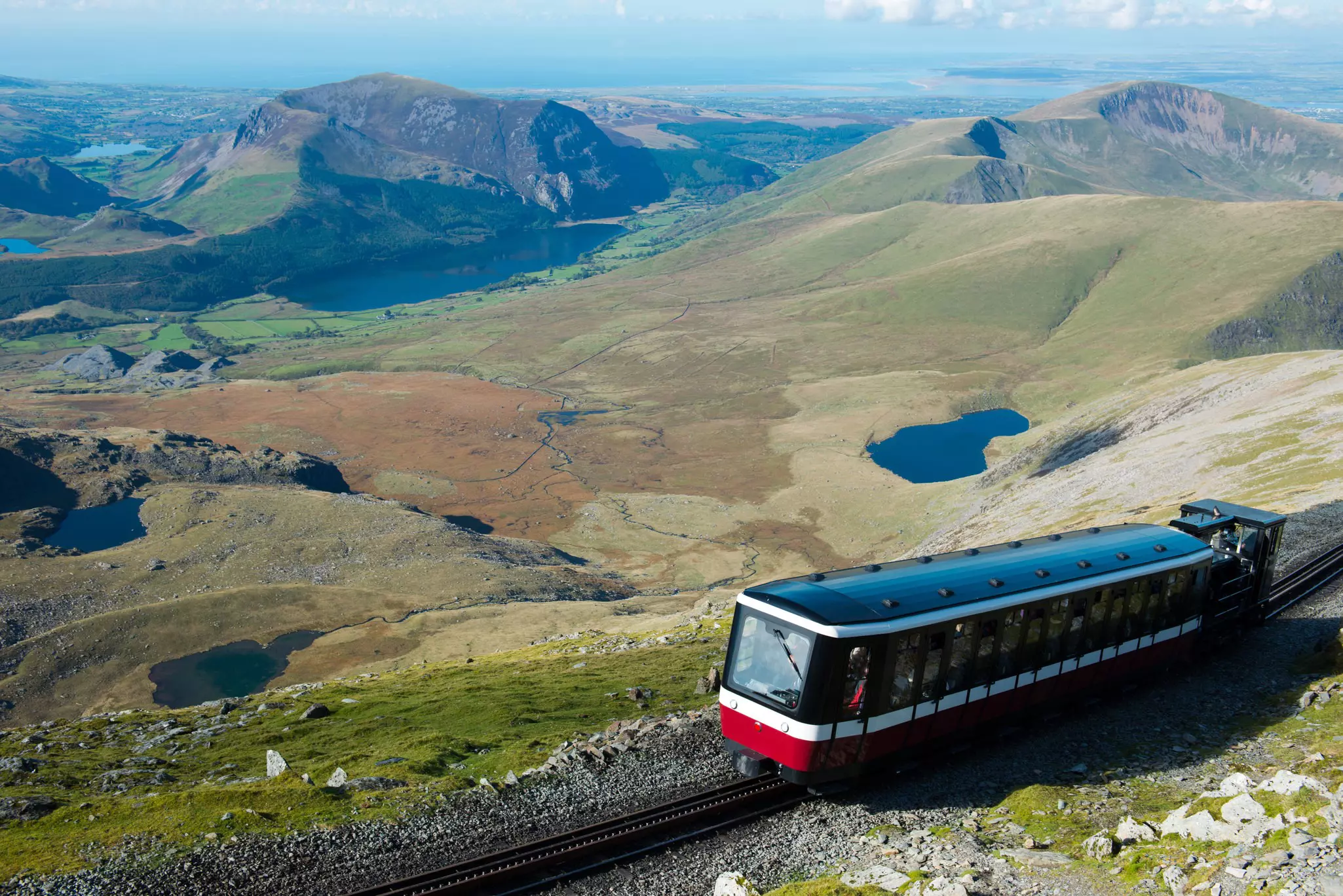
Many locations for epic mountain views, or by shimmering glacial lakes, are accessible by car. To get to the top of Yr Wyddfa (Mt Snowdon), travelers with disabilities or mobility issues can travel on the Snowdon Mountain Railway, which has ramp access to enable more visitors to experience the thrill of getting to the top of Wales’ tallest peak.
This article was adapted from Lonely Planet’s Wales guidebook, published in June 2025.
Take your Wales trip with Lonely Planet Journeys
Time to book that trip to Wales
Lonely Planet Journeys takes you there with fully customizable trips to top destinations – all crafted by our local experts.


Explore related stories