Jun 21, 20265 min read
11 of the best beaches in WalesJun 13, 2025
9 MIN READ

Writer
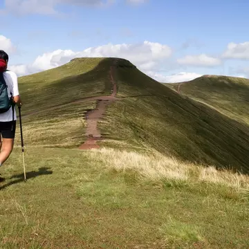
The hike up Pen-y-Fan is one of Wales' loveliest walks. Paul Maguire/Shutterstock

Writer
Lonely Planet may earn a commission from affiliate links on our site. All recommendations and reviews reflect our own independent opinions.
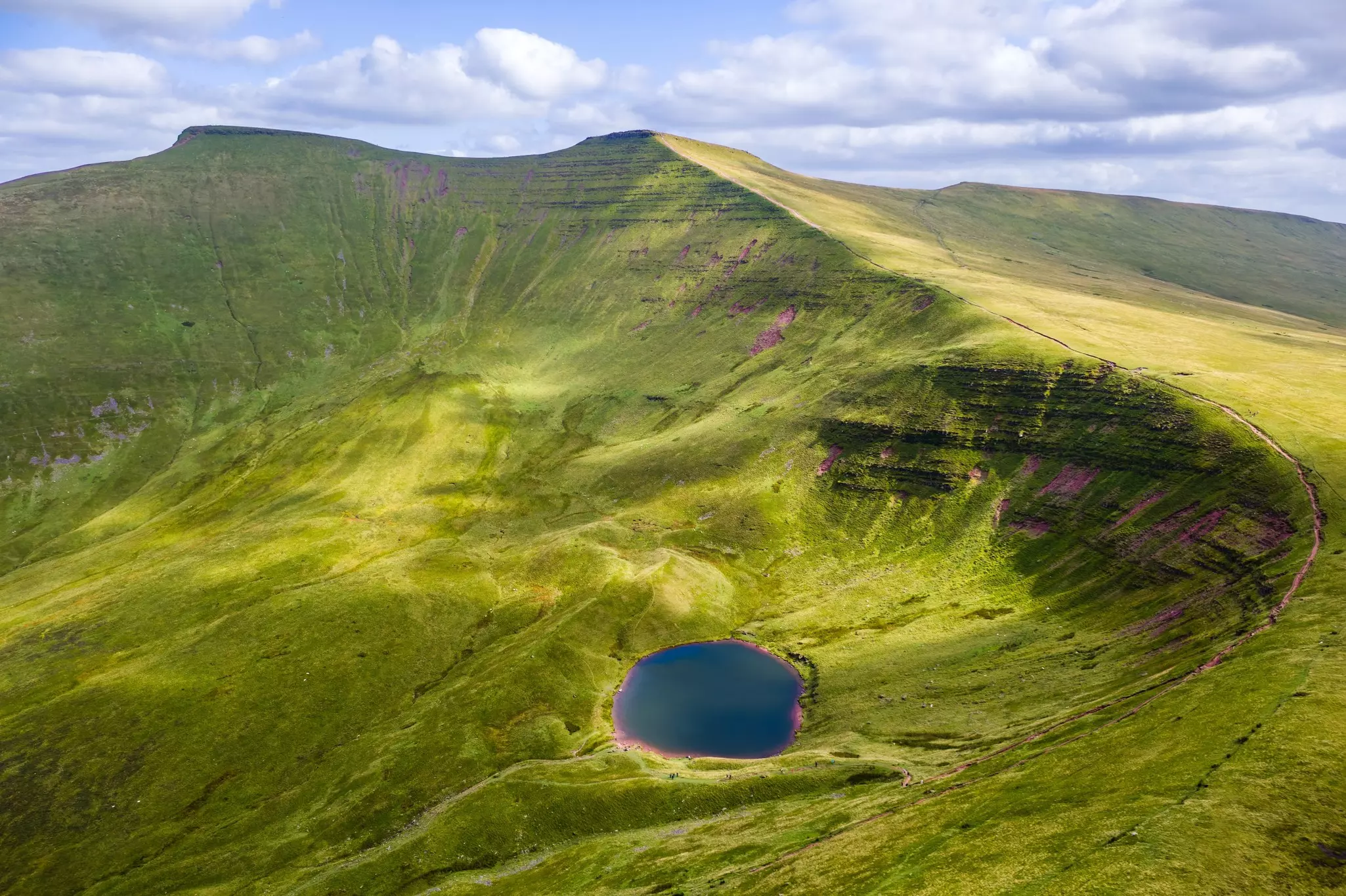
Sure, Eryri (Snowdonia) is home to Wales’ highest mountains, but if you’re ready to go off the beaten track – or igam-ogam as the Welsh say – Parc Cenedlaethol Bannau Brycheiniog, aka Brecon Beacons National Park, feels just as wild. And the summit of 886m (2907ft) Pen-y-Fan, the tallest peak in the Brecon Beacons, is the ultimate prize for hikers.
Rolling from the English border west to Llandeilo, the 520-sq-mile (836-sq-km) expanse of this green, serene national park bombards you with beauty. Remote single-track lanes twist to heather-flecked moors where sheep brazenly block roads. Hiking trails cut through glacier-carved valleys to crest the serrated mountains of Pen-y-Fan, Corn Du (873m/2864ft), Cribyn (795m/2608ft) and Fan-y-Big (717m/2351ft).
Puffing up Pen-y-Fan is a rite of passage for hikers and Special Air Service (SAS) trainees, and it’s one of Wales’ best hikes. Whack on your favorite hiking boots for an invigorating trek to the top, where views over bald, glacier-scoured peaks and deep valleys reveal a landscape dramatically shaped by the last Ice Age. On cloud-free days, views stretch to the Black Mountains, the Bristol Channel and Parc Cenedlaethol Eryri (Snowdonia National Park) beyond.
Set your sights on some of Wales’ loveliest landscapes with this guide to the best routes for climbing Pen-y-Fan.
Dry weather can never be guaranteed in Wales, but late spring and summer are generally pretty rain-free, and therefore good for hiking. From June to August, crowds gather and bottlenecks occur at key points along the trails. Fall is rainier, and winter is colder and rainier, with a chance of snow. While winter climbs are possible, slippery ice, freezing winds and short daylight hours make this a more challenging undertaking.
Well stocked with maps and guides, the Bannau Brycheiniog National Park Visitor Centre in the village of Libanus should be your first port of call. Knowledgeable staff can provide details on walking, hiking, and biking trails, as well as outdoor activities, wildlife, geology, and stargazing. It also has a cafe, toilets, a children’s play area and electric-car charging points. It’s located off the A470, 4 miles (6.4km) southwest of the town of Brecon.
Brecon, to the north of Pen-y-Fan, is a popular base for exploring the Brecon Beacons, but good alternatives include Merthyr Tydfil and Abergavenny. There are plenty of camping sites, guesthouses and hotels to choose from around the fringes of the national park, including the YHA Brecon Beacons Hostel in Libanus, just off the A470 to the west of Pen-y-Fan.
For any season, bring a windproof layer and waterproofs – conditions can be blustery, and you’ll need to take care on exposed ridges in the wind. Bring comfortable hiking boots with good grips and ankle support, particularly in spring, fall or winter, when the trails can be muddy after rain. This is a long walk, so bring water and snacks to recharge your energy levels at the summit.
While the summit trails can be climbed by anyone reasonably fit, the path is uneven in places, and hiking poles can be useful for less sure-footed walkers. The National Trust recommends hiking with a compass and map (OS Explorer’s 1: 25,000 OL12 Brecon Beacons National Park map is a good choice), though in summer, it’s hard to get lost with so many people on the trails.
There are multiple routes up this iconic Welsh peak, from the short, direct trail from Pont ar Daf, which you can tackle in a morning or afternoon, to more demanding routes that will take most of the day. Check the weather forecast before you set off – you don’t want to be walking all day in the rain.
4.5 miles (7.2km); 3–4 hours
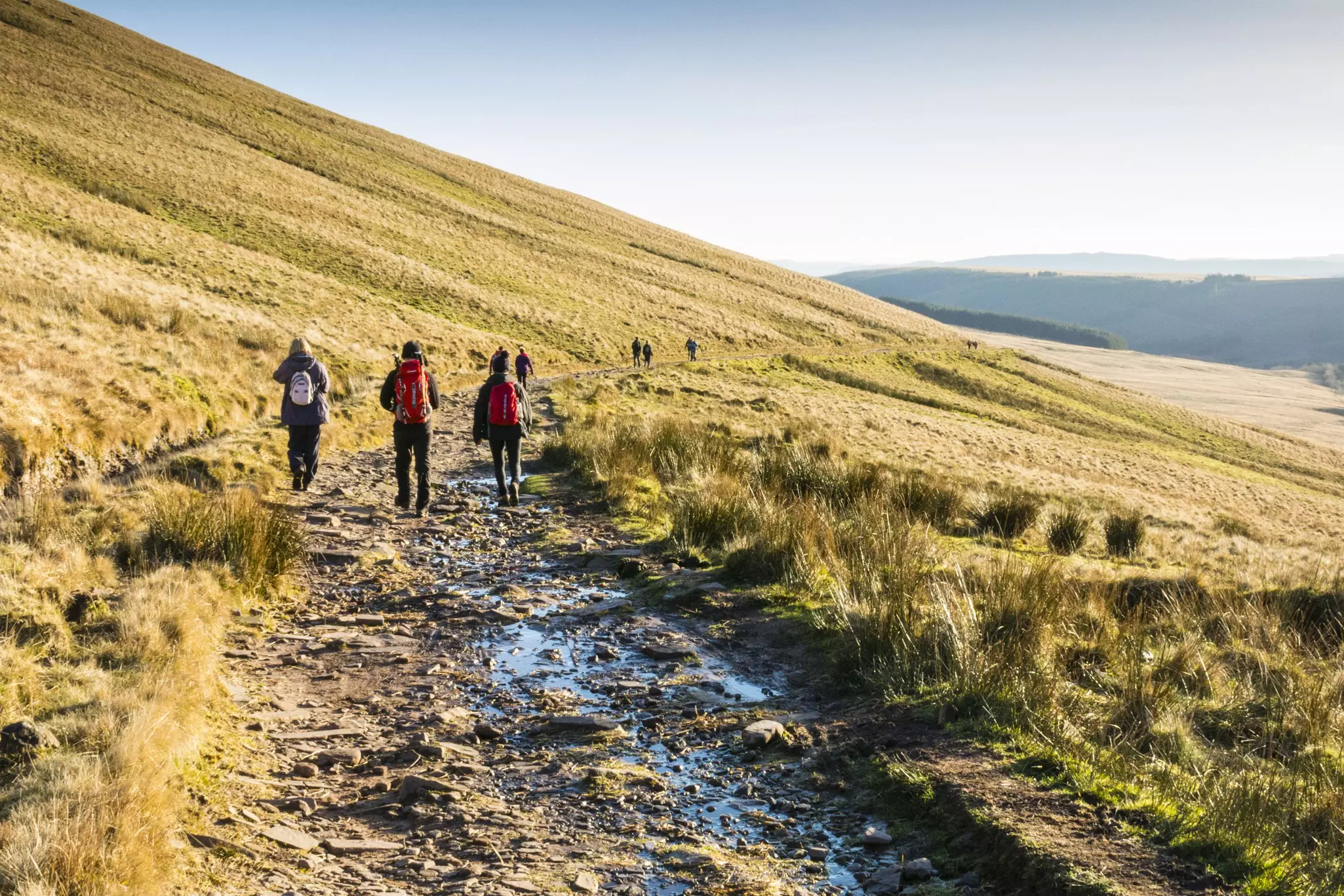
If you’re short on time, the quickest way to hoof it up Pen-y-Fan is by starting at the Pont ar Daf car park or the Storey Arms Outdoor Centre on the A470, 10 miles (16km) southwest of Brecon. The best trail for families, this straightforward out-and-back route heads up a saddle, dips behind the peak of Corn Du and makes a short climb to the Pen-y-Fan plateau.
Though the walk itself isn’t that strenuous, you'll still get the same phenomenal views of wild moorland as on the more difficult trails, but without the time commitment of the longer routes. Even reasonably fit children should be fine on this walk; allow three to four hours for the 4.5-mile (7km) circular hike.
There’s a reason locals dub this route “the motorway” – the path can be bumper-to-bumper with hikers in summer and on warm weekends. Try to kick off at the crack of dawn; as a bonus, the sunrise here can be beautiful. Parking becomes extremely limited as the day wears on; as an alternative, consider taking the T4 bus from either Merthyr Tydfil or Brecon to the Storey Arms.
7.5 miles (12km); 5–6 hours
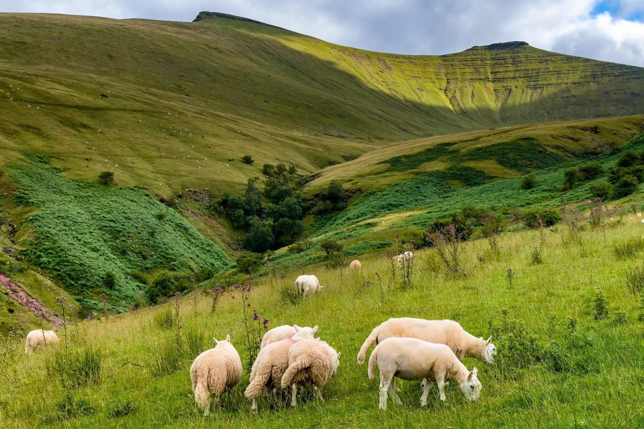
Ticking off the quartet of summits that form the core of the central Brecon Beacons – Pen-y-Fan, Corn Du, Cribyn and Fan-y-Big – the 10-mile (16km) Horseshoe Ridge walk is a longer, more challenging and dramatic alternative to the Storey Arms trail.
Pick a fine, clear day for this sustained trek, which begins at the Lower Neuadd Reservoir. Red kites wheel overhead as the trail climbs steeply along a ridge, with phenomenal views of the bald, sheer mountains and moraine-strewn glacial valleys.
Despite some steep drops to the sides of the trail, the clearly marked route is safe for walkers in most conditions, though it can feel exposed when the wind picks up. Be aware of the weather and take extra care if strong winds are forecast.
7.5 miles (12km); 3–4 hours
When the southern routes up Pen-y-Fan are chock-a-block in summer, consider trekking up this tougher, steeper and longer – but quieter – ridge route on the mountain’s northern flank. The trailhead is the National Trust Cwm Gwdi car park, at the end of a narrow lane, 3.5 miles (6km) southwest of Brecon. The round trip from the car park covers 7.5 miles (12km); allow three to four hours.
From the trailhead, you’ll follow an ancient path along the crest of the Cwm Llwch ridge, with astonishing views of neighboring peaks, the River Nant Sere and west over the Llyn Cwm Llwch lake. Take care on the final steep scramble to the summit as the path has become eroded by heavy footfall. You’ll need good navigation skills if visibility is poor; stick to the main route rather than attempting any detours.
11 miles (17.7km); 7–8 hours
For a deep dive into the central Brecon Beacons, this is the big one. The Taf Fechan Circular trail is an epic, tough, 11-mile (18km) circular hike from the Tan Fechan Forest car park. The circuit can be walked either clockwise or anticlockwise, taking in jaw-dropping views along the way.
Choose this trek if you want to embrace a full-day challenge, with wild, rugged terrain and some steep scrambles thrown into the equation, as well as sensational views from the cairn-topped summit of Pen-y-Fan and its sidekicks Corn Du, Cribyn and Fan-y-Big. Allow seven to eight hours to complete the loop.
Few hikers can resist the tug of Pen-y-Fan, but the trails can get swamped by hikers in summer. During this busy period, it can pay to go one peak over. Give the crowds the slip by stomping up the lesser-known (but equally beautiful) Black Mountains rippling into the eastern borderlands or heading south or west into remoter terrain.
Dipping into mossy, fern-cloaked woods and passing wispy waterfalls, cascades and swimming holes, this 3-mile (5km), out-and-back trail is gentle enough for young children. It starts in the village of Pontneddfechan, on the A465 inland from Swansea.
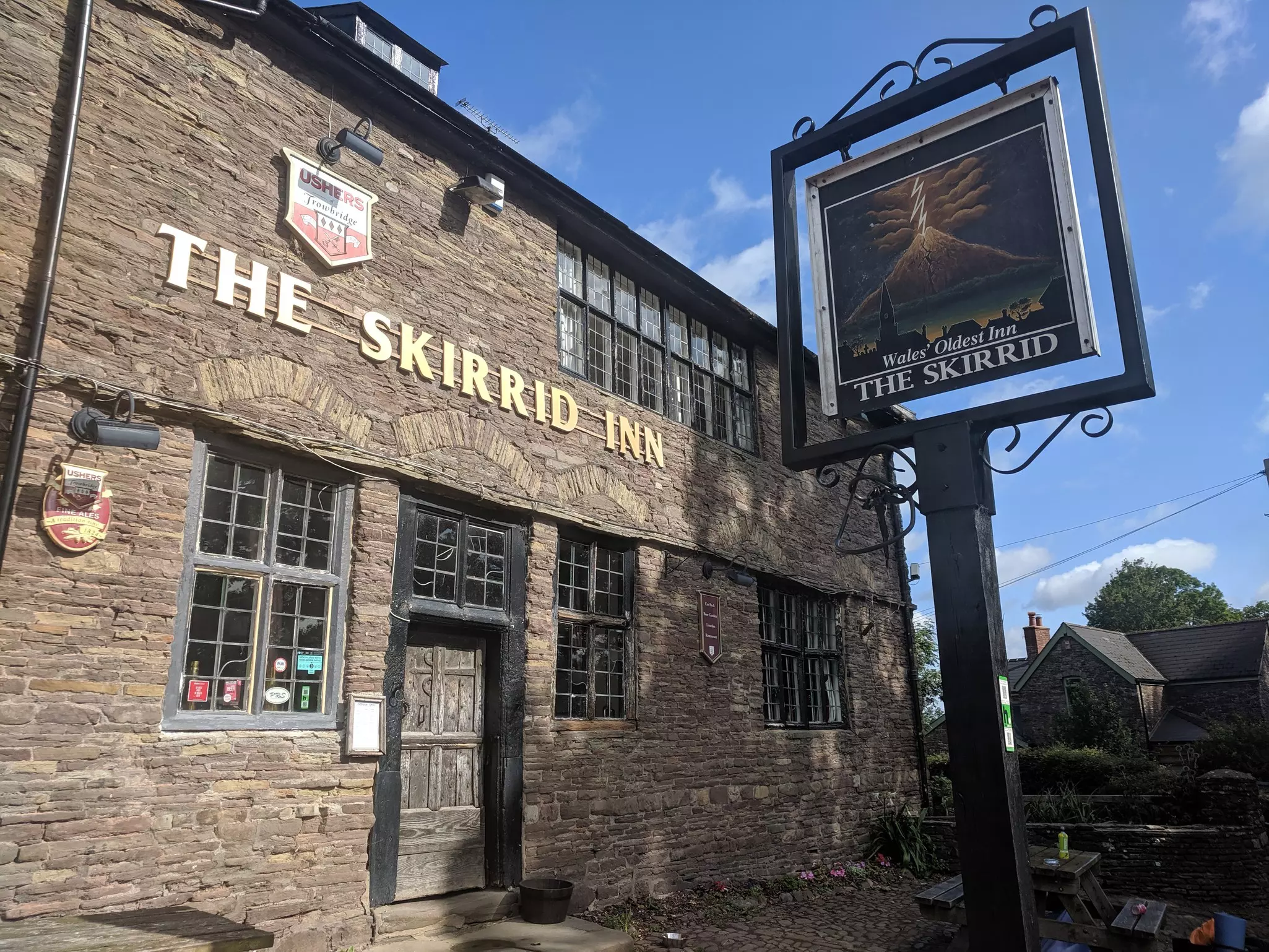
With older kids, tackle this more challenging 4-mile (6.5km) hike, weaving through ancient broadleaf woods to the wind-buffeted 486m-high (1594ft) ridge of Ysgyryd Fawr (Skirrid), where 360-degree views over chequered hills running toward the glittering Severn Estuary await. In Llanvihangel Crucorney, the Skirrid Inn – reputedly Wales' oldest pub – is a welcoming place to recharge after the walk.
Verdant slopes sweep down to this glacial cirque lake in the Black Mountain range, swirling in Arthurian myth. From the car park south of Llanddeusant, a 4-mile (6.5km) trail shadows a babbling stream through a sheep-grazed valley to the lake, before cresting the knife-edge ridge to open moors. To ramp up the challenge, climb nearby Fan Brycheiniog (802m/2631ft).
Popping up north of Crickhowell, this 451m (1480ft) flat-topped outcrop, once an Iron Age hillfort, is locally dubbed “Table Mountain.” From the village, the 4.5-mile (7km), three-hour round trip involves a short, sharp ascent and rewards walkers with knockout views of the Beacons.
Beginning at the Gospel Pass in the Black Mountains, this 6-mile (10km), half-day trek knocks off the twin peaks of 677m (2221ft) Hay Bluff and 690m (2264ft) Twmpa (cheekily nicknamed “Lord Hereford’s Knob”). You’ll climb impressive ridges, with killer views deep into the Brecon Beacons and Wye Valley. Look out for wild ponies.
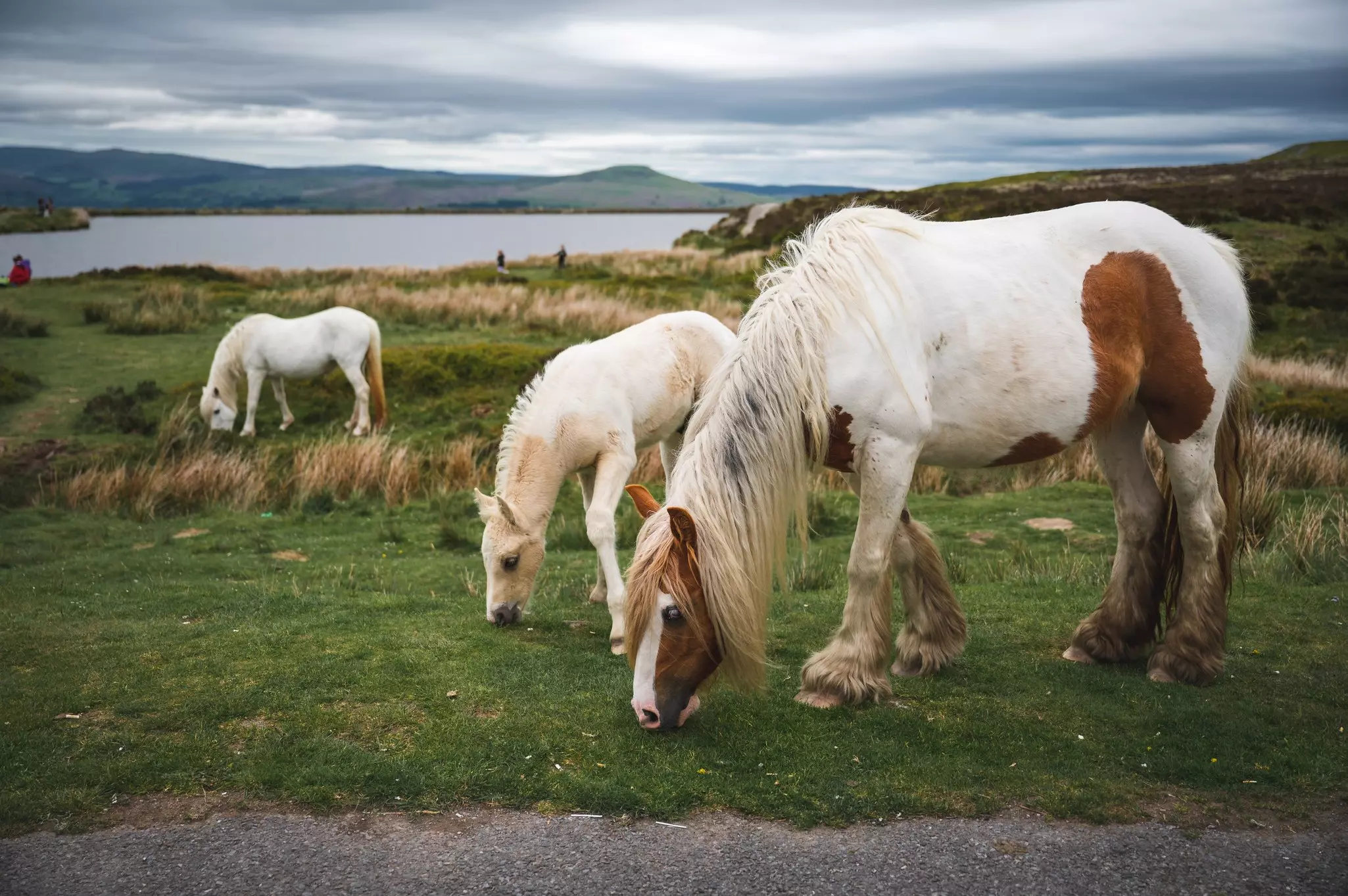
It’s a moderately challenging 4-mile (6.5km) stomp through moorland to reach 561m (1841ft) Blorenge, rising up in the national park’s southeast, with dreamy views of the Black Mountains, the Brecon Beacons and the Severn Estuary. At the windswept top, you’ll find a Bronze Age burial chamber. The hike begins at Keeper’s Pond on the B426, 5 miles (8km) south of Abergavenny, where wild horses are often seen.
The remote, bare, brooding peak of Waun Fach (811m/2661ft) caps off the Black Mountains. Starting at Castell Dinas, where Norman castle ruins crown an Iron Age hillfort, this full-day, 9-mile (14.5km) loop trail climbs the Dragon’s Back before cresting minor summits to the top.
On the way down, Pen Trumau has astounding views of the Bristol Channel, the Brecon Beacons and the Shropshire Hills. After, drive around the back of Waun Fach to reach the LLanthony Priory pub, set in a ruined 12th-century priory at Llanthony – an evocative spot for a celebratory pint.
This article was adapted from Lonely Planet’s Wales guidebook, published in June 2025.
Take your Wales trip with Lonely Planet Journeys
Time to book that trip to Wales
Lonely Planet Journeys takes you there with fully customizable trips to top destinations – all crafted by our local experts.


Explore related stories