How to plan a 175km hike around Rīga, Latvia
Jun 30, 2026
9 MIN READ

Writer
Daugavgriva Lighthouse, Rīga, Latvia. Ramunas Bruzas/Shutterstock

Writer
Lonely Planet may earn a commission from affiliate links on our site. All recommendations and reviews reflect our own independent opinions.
Visitors flock to the Latvian capital of Rīga for its elegant art nouveau architecture and rich cultural life. Yet there are outdoorsy pleasures to be found in this sophisticated city, too – in particular, a hiking trail that follows the city’s border for an amazing 174 km.
Tracing the edges of Rīga, the eight-section route offers a mix of natural and man-made landscapes. Beaches, lakes, rivers, pine forests and meadows alternate with residential neighborhoods, street art, historic manors, old factories, viewing towers, breakwaters and even a bog. One moment you may find yourself listening to waves on the Baltic coast, the next exploring a forgotten corner of the city that few travelers ever reach.
If you’ve gotten to know Rīga before, or if you simply want to venture beyond the tourist hotspots and experience the city from an unusual perspective, lace up a pair of comfortable shoes and prepare to set out on this trail.
How to find your way along the trail
As the trail is not marked, you will need to rely on a digital map of the route and your own navigation skills. Don’t worry – you won’t be setting off into the wilderness; finding your way is straightforward and there is a strong mobile signal along the entire route. Even if you do get lost, you will soon meet someone who can point you in the right direction. After all, you will be hiking in or close to the city, and civilization is never far away.
I recommend downloading the KML files and downloading free-to-use local mapping app LVM GEO. It offers several map layers; I prefer OpenStreetMap, which shows even the smallest paths without cluttering the map with unnecessary detail.
If you would feel more confident in the hands of a local guide rather than having to find your own way, local tour operator Baltic Nature Travel can arrange a tour of parts or even all of the route.
How to plan your route along the trail
Rīga is a flat city, so the route is easy in terms of terrain. Your main challenge will be distance, as sections range from 19.5km to 24.5km. While the trail at times follows lovely forest paths, long stretches of sandy beach and gravel roads, some parts pass through urban areas and include paved sidewalks.
On most sections, you will find at least one cafe along the way (check opening hours in advance). Still, carrying a few snacks is always a good idea – water, too, especially on warmer days.
The distances are long enough to provide a satisfying day of hiking, yet short enough to leave time to slow down afterward. At the end of the day, you can settle into a cafe or a pub, sipping a cup of local herbal tea, a craft beer or a cider – and soaking up Rīga’s atmosphere before setting off on the next section.
How to get to and from the trail
Each section of the trail begins and ends close to a public transport stop. I recommend staying near the central train station – the main hub for most public transport routes. This will allow you to travel to and from the trail without changing lines.
Most sections are accessible by bus or trolleybus, while a few can be reached by train. You can purchase both Rīga public transport and train tickets through the Mobilly app, or use the dedicated apps: Rīgas Satiksme for city transport and Vivi for trains.
Alternatively, you can buy Rīga public transport physical e-tickets from ticket vending machines, as well as at Narvesen kiosks and Latvijas Pasts post offices. Train tickets can be purchased at the main railway station.
Day 1
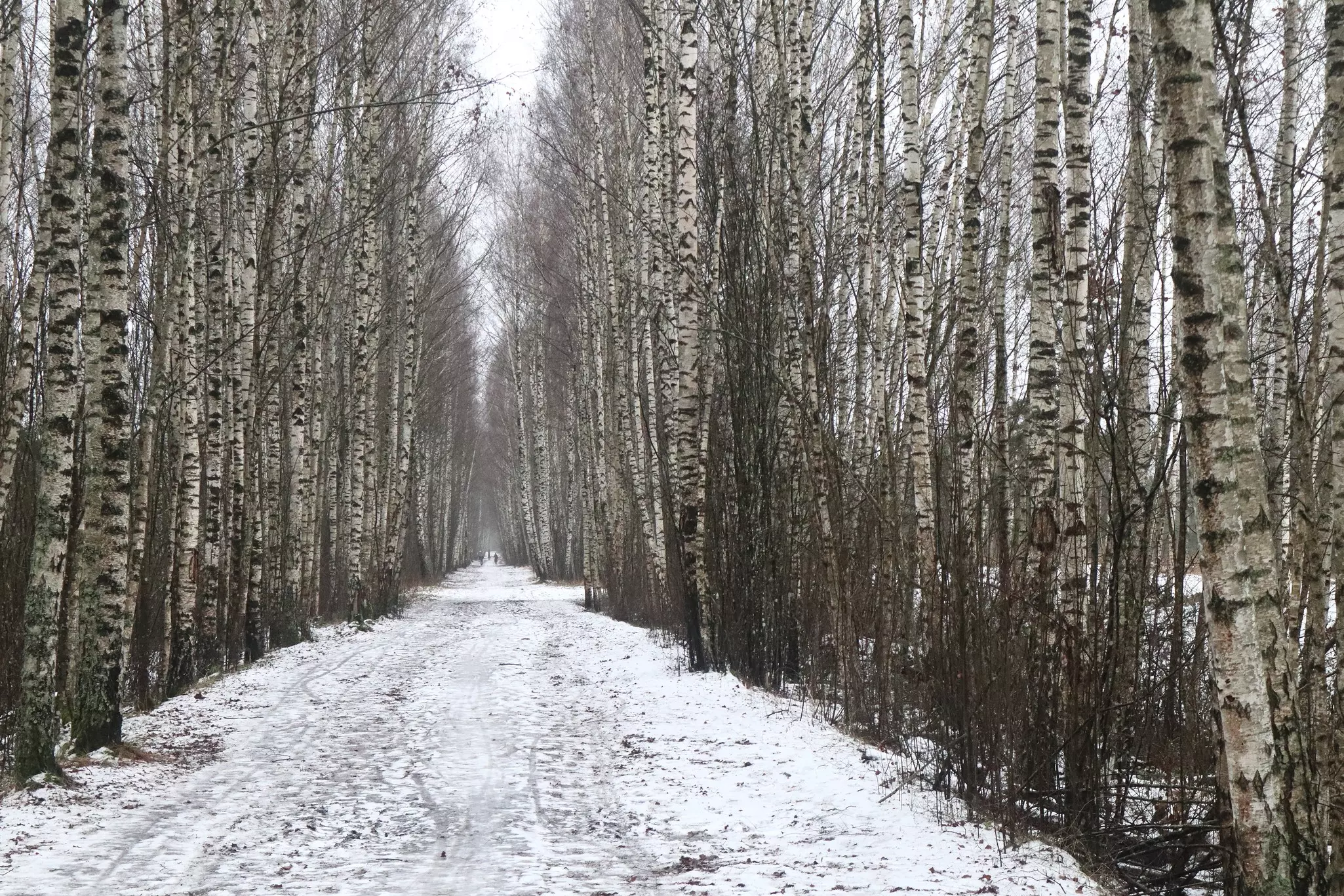
The expedition around Rīga begins with an easy 19.5km hike from seafront Mangaļsala to Jaunciems. The first kilometers are shaped by the presence of the port: freighters line the banks of the Daugava River as the trail follows the bank toward the Mangaļsala breakwater. Stretching far into the Gulf of Rīga, the breakwater is one of my favorite places in the city. If luck is on your side, you might spot ships entering the port from the sea or disappearing toward the horizon.
From there, the route follows the beach before turning inland into a tranquil pine forest. Near the entrance stands the Werewolf Pine, while deeper in the woods old military trenches wind along the Langa River. The day ends at Jaunciems Beach on the shores of Lake Ķīšezers. With its colorful boat garages, sea buckthorn bushes and industrial backdrop, it’s an unexpectedly atmospheric place to finish the first section of the trail.
Day 2
Day two covers 23.1km from Jaunciems to Upeskalni. The first part of the route passes through forests, only occasionally interrupted by pockets of residential development. One of the highlights is the Bukulti Nature Trail, where a wooden boardwalk curves through a black alder swamp forest. Further on, the trail follows the Jugla Canal, where local anglers line the water’s edge, giving the area the feel of a small fishing town.
The forest eventually gives way to fancy villas built during the 1990s and early 2000s, followed by one of Rīga’s iconic city-sign landmarks: the giant Rīga letters, the first of three sets you’ll encounter along the route. The final kilometers unfold along charming lakeside paths beside Lake Jugla. The day ends with a stretch of pavement accompanied by the hum of passing traffic.
Day 3
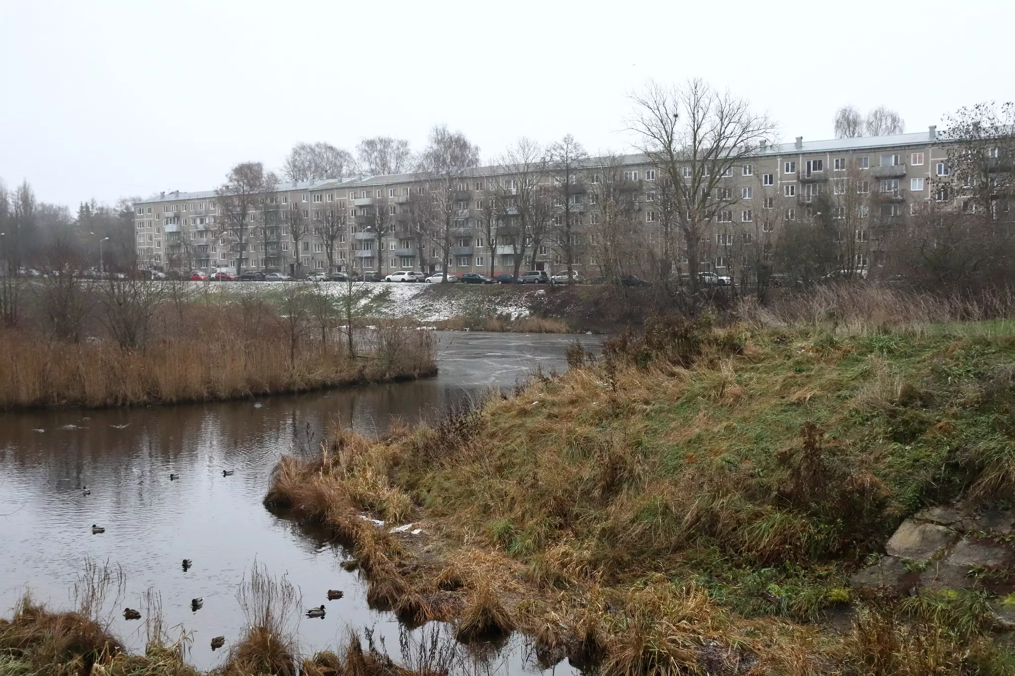
Day three is another easy section, covering 19.5km from Upeskalni to Getliņi. It is also the most urban stretch of the entire route. The day begins with a glimpse into Rīga’s industrial past at the former Jugla paper-mill settlement, followed by two historic but decayed manor houses. From there, the trail follows city streets before joining huge heating pipelines that lead into the forest.
Dreiliņi Forest offers a moment for reflection, as the route passes a mass grave and memorial dedicated to victims of Nazi terror. Beyond the forest, the landscape becomes increasingly industrial. The section culminates at the striking Getliņi garbage hill, where enormous flocks of gulls circle overhead, their wings flashing silver in the sunlight.
Day 4
Day four, a 19.7km hike from Getliņi to Ķengarags, was my favorite section of the entire expedition. The route begins in Dārziņi, a neighborhood that offers a fascinating look into local life. Neat private homes alternate with eclectic garden properties, where quirky sheds, homemade decorations and creative DIY solutions reveal the character of their owners. Much of the route follows the Daugava, whose broad waters create a peaceful atmosphere. Along the way, you’ll pass the Rumbula Memorial, dedicated to victims of the Nazis. Rumbula is also known for its used-car markets and the roadside kiosk selling chebureki (fried meat pies). A freshly baked cheburek makes an excellent picnic lunch; just don’t forget to carry some cash.
The final kilometers bring several highlights: former aircraft shelters, the historic Mazjumprava Manor and a scenic promenade along the Daugava, complete with a bird-watching tower overlooking the river.
Day 5
Day five covers 20.2km from Ķengarags to Medemciems, beginning on the Ķengarags Promenade. On this stretch, the Daugava flows alongside large residential districts, creating a sharp contrast between nature and the city. Soon the trail follows the Southern Bridge across the Daugava. On the opposite bank stands a 134m-long mural celebrating the 55th anniversary of Pols, one of Latvia’s most beloved ice cream brands. Nearby, a second set of giant Rīga letters serves as another reminder of the city’s boundary.
From here, enjoyable forest paths lead toward Medema Bog. The trail follows the route of a former peat railway, a quiet reminder of the area’s industrial history. The day ends in Medemciems, a settlement just beyond Rīga’s city limits.
Day 6
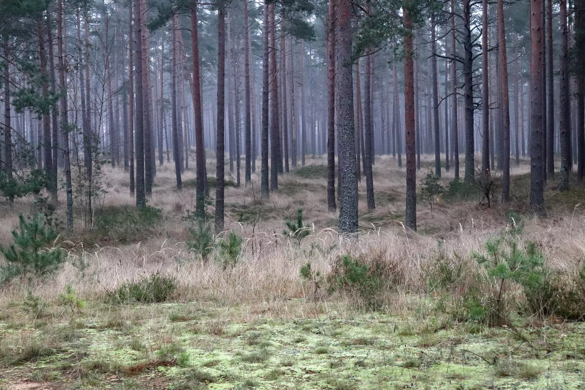
Day six is the longest section of the route, covering 24.5km from Medemciems to Beberbeķi. The day begins on small paths winding through patches of heather, marsh Labrador tea and pine forest before reaching Lake Stūnīši. From there, the trail passes through quiet neighborhoods until it meets the Mārupīte River. Tiny riverside paths follow the river and lead past two sculpture parks, adding an artistic dimension to the views. Later, the route becomes more urban, following busy roads toward Rīga Airport. One of the most unusual parts of the entire expedition begins here: the trail runs directly alongside the airport fence, offering a front-row view of aircraft taking off and landing. The day concludes at a third set of giant Rīga letters.
Day 7
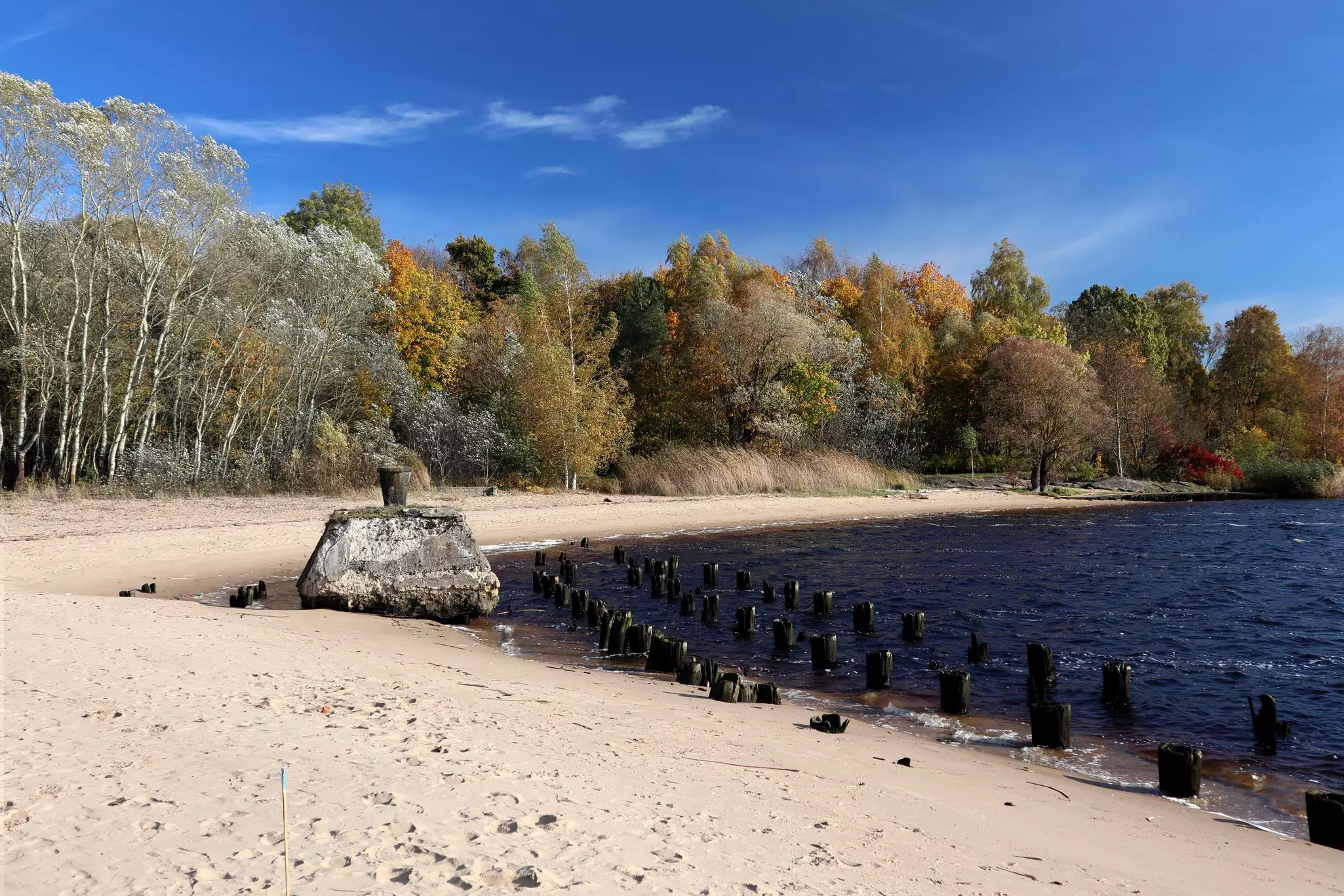
Day seven will take you 22.9km from Beberbeķi to Bolderāja. For much of the day, the trail winds through forests interspersed with residential neighborhoods. The landscape changes dramatically upon reaching the Buļļi Dunes Nature Park, where the previously flat pine forest suddenly gives way to a landscape of rolling dunes. The undisputed highlight of the day is the White Dune on the banks of the Lielupe River. From its summit, sweeping views open up across the river and surrounding landscape. The trail then descends to the water’s edge, allowing hikers to admire the dune from a completely different angle. The final stretch follows the Buļļupe River, first along quiet forest roads and later on a riverside promenade leading into Bolderāja.
Day 8
The final section of the hike is a 24.4km journey from Bolderāja to Daugavgrīva. This is the wildest stage of the entire expedition, and for much of the day it will be hard to believe that you are still within the city limits. The hike begins in a district of small garden plots; soon, the trail joins the tranquil waters of the Buļļupe River. Fishing boats bob gently along the shore, wooden jetties reach into the water – and the whole area feels more like a quiet village than part of a capital city. One of the day’s highlights is the elegant riverside sculpture park created by Pauls Jaunzems.
Further on, the trail pushes through thickets along the Lielupe River until reaching the point where the river meets the sea. From there, several kilometers of sandy shoreline lead to the black-and-white Daugavgrīva Lighthouse and the breakwater, a fitting finale to the expedition around Rīga.
The best time to hike around Rīga
Blessed with four distinct seasons, Latvia is a great hiking destination at any time of year. Summer offers mild and pleasant temperatures, plenty of sunshine, long daylight hours and lush greenery, making it the classic season for hiking. It is also the best time to enjoy the beaches along the route. Just stay aware of ticks, and don’t forget mosquito repellent.
Autumn brings spectacular colors, and even some lingonberries and blueberries along the trail, although it can be quite rainy. Winter, if snowy enough, transforms the landscape into a magical scene. At the same time, deep snow can make hiking challenging and requires appropriate footwear and clothing. Spring, with its blossoming flowers, trees and shrubs, is perhaps the most beautiful season of all – yet the weather can be unpredictable.
Take your Latvia trip with Lonely Planet Journeys
Time to book that trip to Latvia
Lonely Planet Journeys takes you there with fully customizable trips to top destinations – all crafted by our local experts.

