Oct 26, 20266 min read
5 of New Mexico’s Best Dishes and Where to Try ThemSponsored by
This article was paid for and produced with New Mexico Tourism. Paid content is produced separately from Lonely Planet's editorial coverage. Product availability and terms are subject to change; please verify details directly with service providers.
Oct 25, 2026
12 MIN READ

Writer
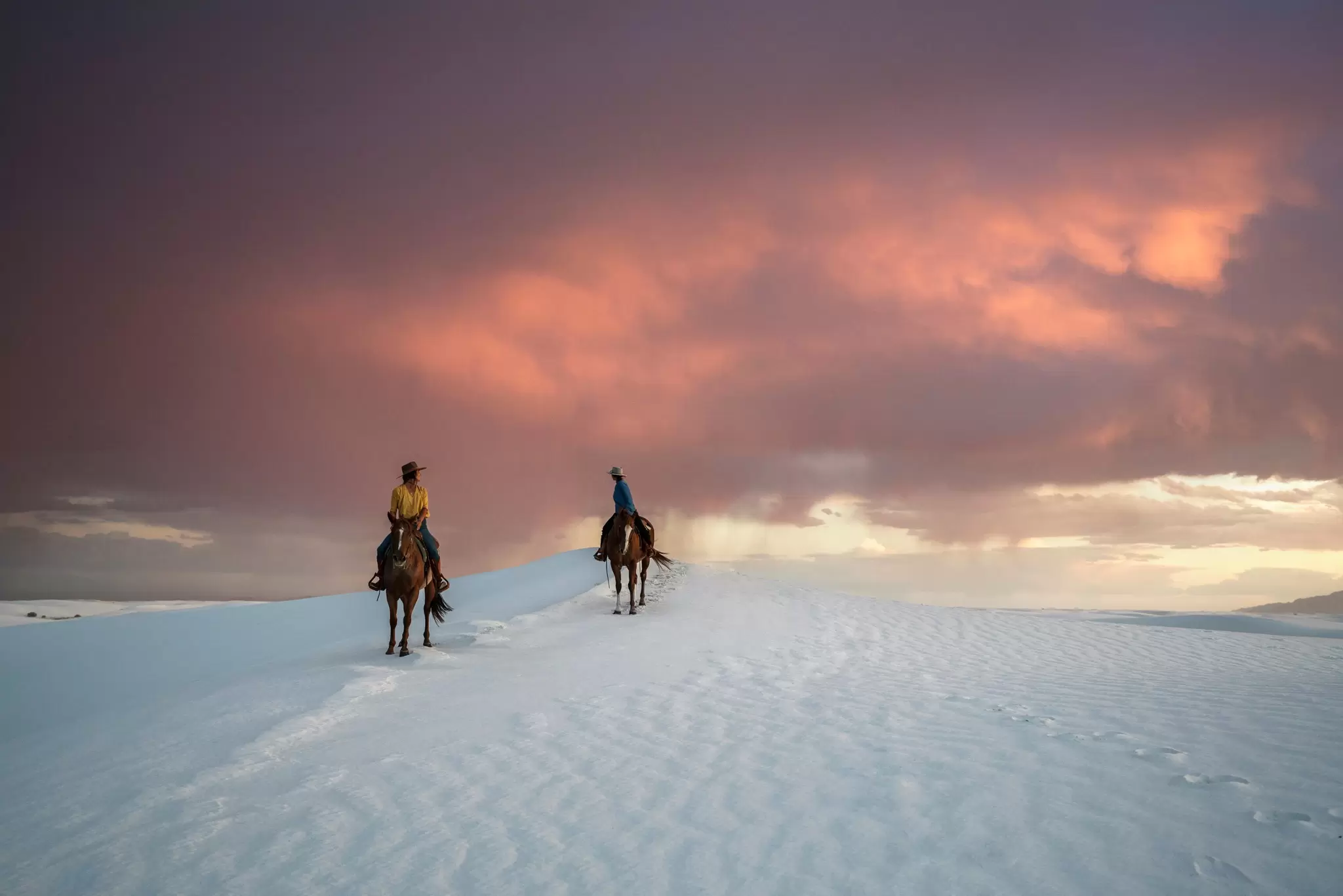
Men on horseback in White Sands. New Mexico Tourism
Writer
In the heart of the Southwest, New Mexico is easily one of my favorite places on Earth to buckle up and hit the open road. It’s seemingly built for road-tripping, thanks to its endless horizons, dramatic highways, wickedly pink sunsets, sharp shifts in elevation, and abrupt changes in topography.
In one day, you might experience multiple climates and encounter constantly changing scenery, from maroon mesas to enchanting forests, or find peculiar geology appearing on the horizon like an alternate universe.
This 5-day road trip across New Mexico will have you heading over to the southern corner of the state for pinch-yourself views, otherworldly landscapes, high-octane switchbacks, quirky frontier towns and ancient pueblos – with extra stops to taste the state’s signature chile-smothered delights.
Trip length: 5 days; 445 miles
When to arrive and where to end: The best time to tackle this road-trip itinerary is in the fall, avoiding the summer heat and winter chill. Arrive at El Paso International Airport, a convenient entry point for White Sands National Park, which sits around 15 miles west of Alamogordo. Finish up at Gila Cliff Dwellings National Monument, about 45 miles north of Silver City.
Things to know: This is a remote region, so download offline maps, keep the gas tank above half-full and check road conditions before starting any mountain drives. White Sands can close temporarily for missile testing, sometimes affecting travel along US 70 – see the National Park Service website for updates. In the Gila, cell service disappears, and NM 15 is exceptionally narrow and winding. Roads are typically empty in this area, so traffic is rarely an issue, but the weather can be. Check for rain forecasts, as heavy storms can arrive in the fall, and there may be early snow in late fall in high-altitude areas such as Cloudcroft.
What to pack: Bring layers for fall. Shorts can work at lower elevations by day, with comfortable daytime temperatures averaging 60–80°F (16–27°C), but the chilly nights can drop down to 34–45°F (1–7°C), and long pants and a jacket will be needed. At high elevations, daytime highs can be as low as 55°F (13°C) and crisp evenings can drop to 30°F (-1°C).
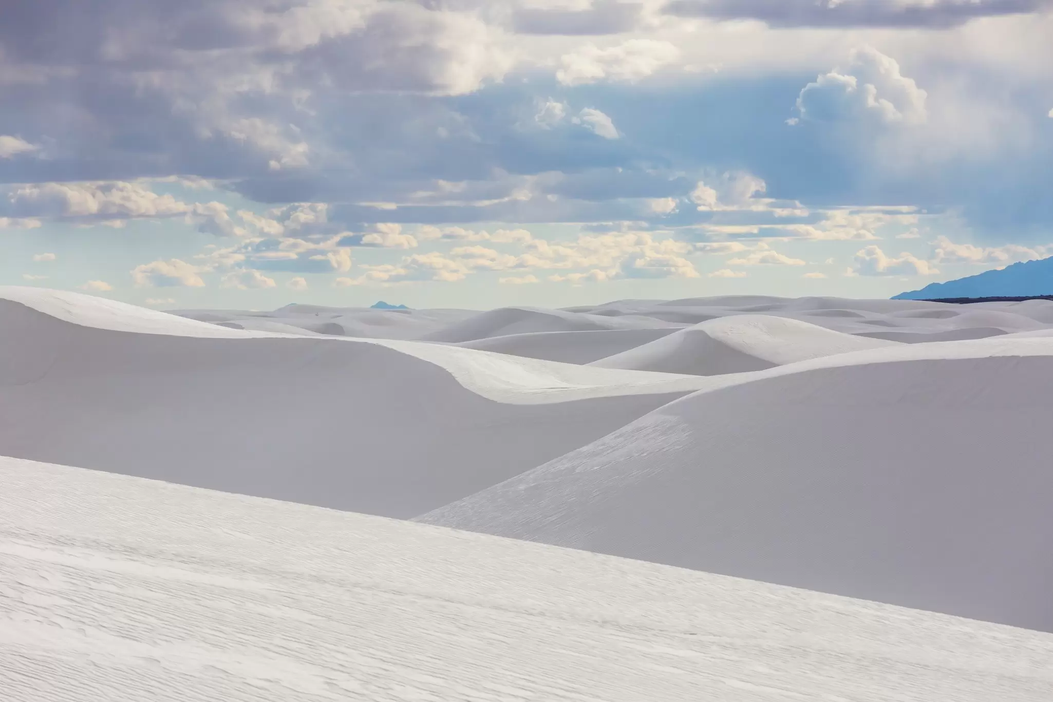
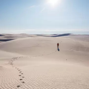
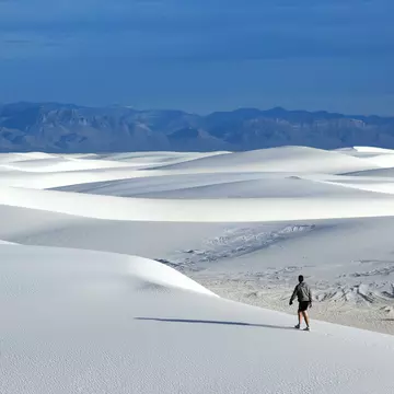
After driving north from El Paso along IS-10 and branching east on US 70 at Las Cruces, the dazzling white sea of sand at White Sands National Park appears like something out of a dream. Start by entering the park and following the 8-mile Dunes Drive (16 miles round-trip). The first five miles are paved, and the final three are hard-packed gypsum but remain suitable for non-4WD cars. As you drive, you'll loop through the world's largest gypsum dune field, some 275 sq miles in size.
Through the lens of your camera, this remarkable landscape looks more like Antarctic snowfields than the Chihuahuan Desert – an effect exaggerated by the fact that the dunes here never get hot because they retain moisture beneath the surface and reflect sunlight rather than absorb it.
Take your shoes off and wander the rolling dunes, and follow the red poles on the Alkali Flat Trail to the heart of the emptiness to soak in the end-of-the-world scenes. Bring a sled (or rent one at the gift shop) and hurtle down the steepest of the slopes, and stay for sunset to watch shadows dance across the white mounds.
Do: Essential activities for a day at White Sands include following the Dunes Drive route, sledding down the dunes, and walking along either the Interdune Boardwalk or the Alkali Flat Trail. Note that the Alkali Flat Trail is a strenuous 5-mile hike, so bring plenty of water and allow several hours. Check for missile-testing closures before you set off – the Dunes Drive can close for up to 3 hours during tests.
Eat: As retro as they come, Alamogordo's Hi-D-Ho Drive In is a women-owned, 1950s-style drive-in with big, deliciously greasy burgers, smothered – if you wish – with New Mexican green chile. Try the carhop service (flash your headlights to order from your vehicle; there’s no dining room) – it's a must-try on an all-American road trip.
Stay: For a retro low-cost stay, bed down at the White Sands Motel in Alamogordo, which lures motor travelers with its giant flashing neon sign. It has clean, comfy and agreeably kitchy rooms.
The drive (about 35 miles, 45 minutes): Take US 70 east into Alamogordo, then US 82 toward Cloudcroft. This section of the drive offers one of the trip's great transformations: the highway gains thousands of feet as desert scrub gives way to junipers, then ponderosas, and the air grows cool.
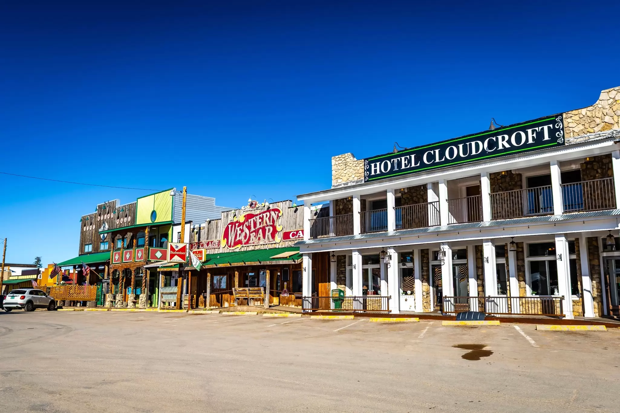
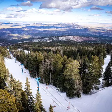
As you drive along the winding, beautifully scenic mountain pass leading up to Cloudcroft, you'll find a unique contrast to the landscapes you have been seeing so far. Sitting in the Lincoln National Forest at around 8600ft, this idyllic mountain town is all about pine-tree-dotted, rustic cabins and low-key ski-town vibes. It's a huge contrast to the vast desert vistas of White Sands, only 35 miles away but far below.
Spend a night here and walk the trails around the Trestle Recreation Area. The moderate, 2.5-mile-long Osha Trail – named for the Osha plant, which Indigenous communities used for medicinal purposes – traverses forests to a viewpoint overlooking White Sands from the western rim of the ridge. While you can't walk along the trestle, the trails surrounding it provide impressive views.
For a shorter amble, a 2-mile path leads to a historic curved wooden railroad bridge named the Mexican Canyon Trestle. Back in town, browse the little shopping hub of Burro Ave in the heart of the village, with a row of quaint buildings with wooden balconies.
Do: Hike in the Trestle Recreation Area and snap a photo at the viewpoint overlooking Mexican Canyon Trestle. In late fall, check trail and road conditions before heading out into the woods.
Eat: Head into Cloudcroft for slow-cooked beef brisket or "dino ribs" at Mad Jack's Mountaintop Barbecue, where pitmaster James Jackson has created a New Mexico institution.
Stay: Bed down at the historic Lodge Resort & Spa, whose history dates to 1899, and the present Lodge opened in 1911. Sitting high in the mountains at 9000 ft, it's a lovely, quiet spot before the ski season begins.
The drive (about 156 miles, 2 hours and 35 minutes without stops): This is the longest driving day. Retrace your steps through the steep hairpin bends of the 16-mile-long US 82 mountain road to enjoy the captivating mountain views in reverse. Drive through Alamogordo and continue toward Las Cruces before joining I-25 heading north, and be sure to fill up the tank before leaving Cloudcroft or Alamogordo. If you need a pit stop, Sparky’s in Hatch, just off the I-25 north of Las Cruces, is an excellent choice for a green chile burger before you make the final run to Truth or Consequences.
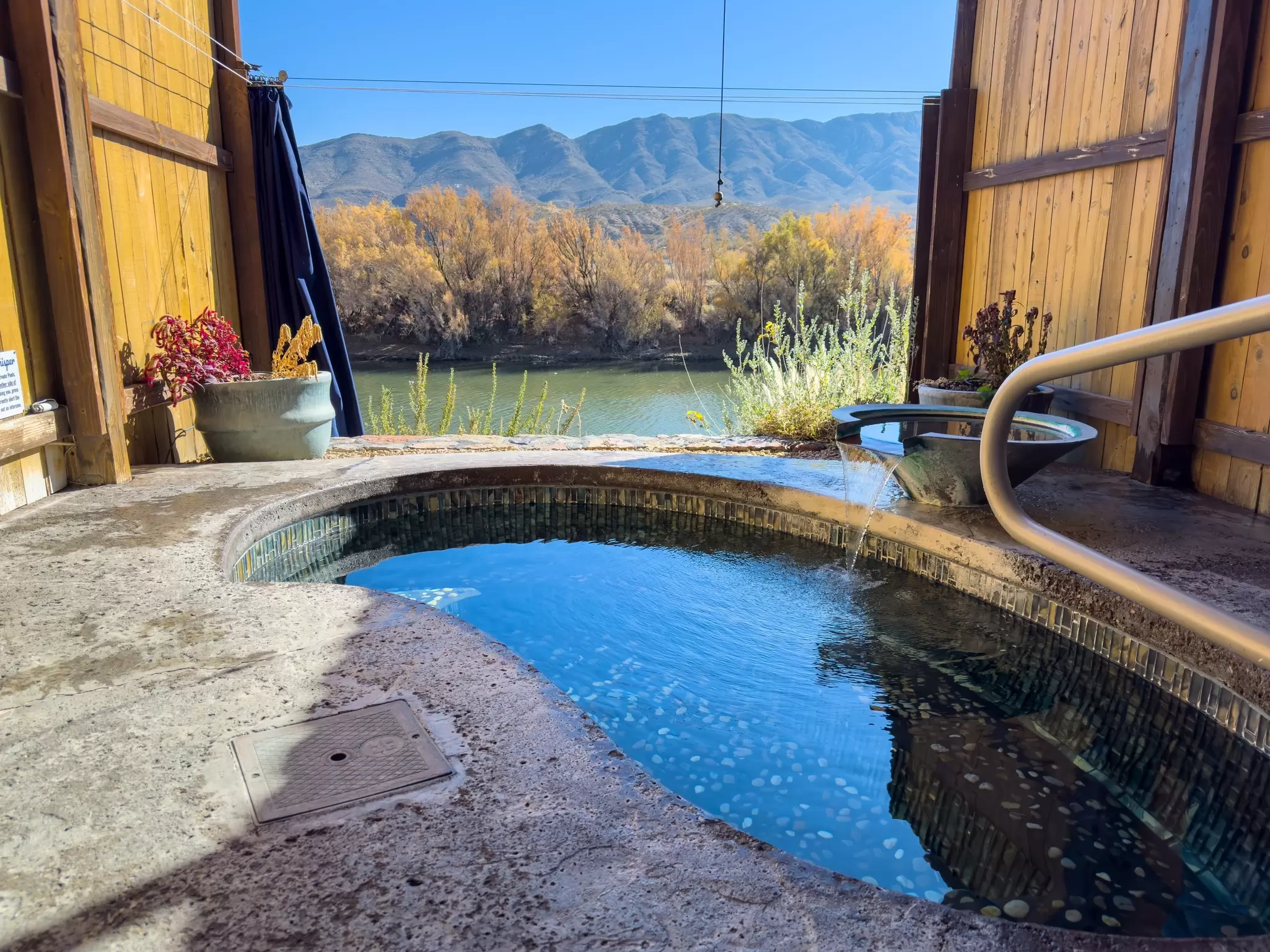
Vying for the title of quirkiest little town in New Mexico (yep, Truth or Consequences really is the town's official name), this tiny settlement of 6000 residents is home to a friendly mixture of musicians, artists and eccentrics.
Previously called Hot Springs for the geothermal waters beneath downtown, the town once supported roughly 40 hot-springs hotels and spas, but in 1950, the town changed its name in honor of the popular radio game show Truth or Consequences, in a bid to drum up more tourism. Its old name, however, tells you why you should actually stop.
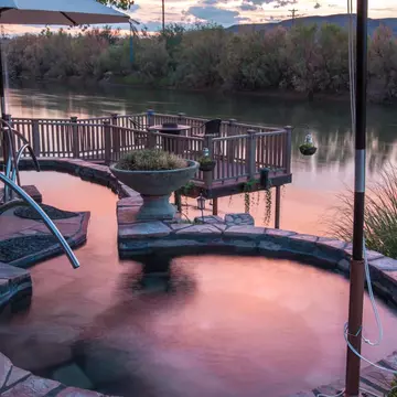
Hot mineral water rises beneath the compact downtown, feeding a wonderfully eccentric collection of bathhouses and small resorts. After soothing tired limbs, peruse the main drag of shabby-chic stores and coffeehouses – the eccentric thrift store Junkology sells everything from alien sculptures and extreme sports gear to crystals and vintage armor. Give T or C a full afternoon and night to soak in the vibe.
Do: Soak beside the Rio Grande at the Riverbend Hot Springs boutique hotel, where shared and private pools overlook the river. For something more intimate, Blackstone Hotsprings has private outdoor baths and guest rooms that offer their own hot-spring soaking opportunities.
Eat: Start the morning at Ingo’s Art Cafe with specialty coffee and organic pour-over teas, and head to Passion Pie Cafe for pastries and fat Elvis waffles with bacon.
Stay: Stay where you bathe – Riverbend is the pick for Rio Grande views; Blackstone is the pick for quirky vibes and private bathing.
The drive (around 125 miles, roughly 2.5 hours): Take I-25 south briefly before turning west toward Hillsboro and crossing the Black Range on NM 152. This is a spectacular mountain drive, and the weather can dramatically affect the route, so always check conditions before attempting it in late fall or winter. Hillsboro makes a characterful coffee or lunch stop. Don't forget to fill the tank before leaving T or C.

After hours of empty but sensational desert and mountain scenes, Silver City feels almost busy. The former silver-mining settlement, where Billy the Kid spent some of his childhood, has oodles of Wild West charm and has reinvented itself as an artsy, foodie and outdoorsy hub, with colorful galleries, murals, independent stores and eateries dotted around its historic downtown area.
Particularly striking are the town's ornately adorned Victorian structures, many with old brick and cast-iron features, plus the odd thick-walled red adobe building. Silver City is the jumping-off point for 15 mountain ranges, four rivers and the weird-shaped, cartoonish boulders of City of Rocks State Park.
Do: Investigate the Western New Mexico University Museum, displaying a strong collection of prehistoric Mimbres pottery, then admire the peculiar-shaped geology at City of Rocks State Park, 30 miles southeast (around a 45-minute drive).
Eat: Sink a local craft beer at the Little Toad Creek Brewery & Distillery, a laid-back, casual spot with classic pub food such as fish and chips and Baja tacos.
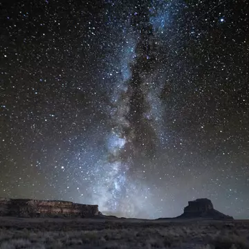
Stay: Stay at the Murray Hotel, a downtown institution in a stunning building with an art deco facade, or camp in the wild City of Rocks State Park, where you can enjoy extraordinary stargazing.
The drive (44 miles, allow 1.5 to 2 hours): Here's where mileage becomes meaningless – the rugged and slow NM 15 twists north through the mountains toward Gila Cliff Dwellings, with steep grades and sections without a centerline. Don't rush it. Fill up and buy food and water in Silver City before leaving, and be aware that cell service disappears in the Gila region. Large RVs and trailers should use the gentler NM 35 as an alternative route.
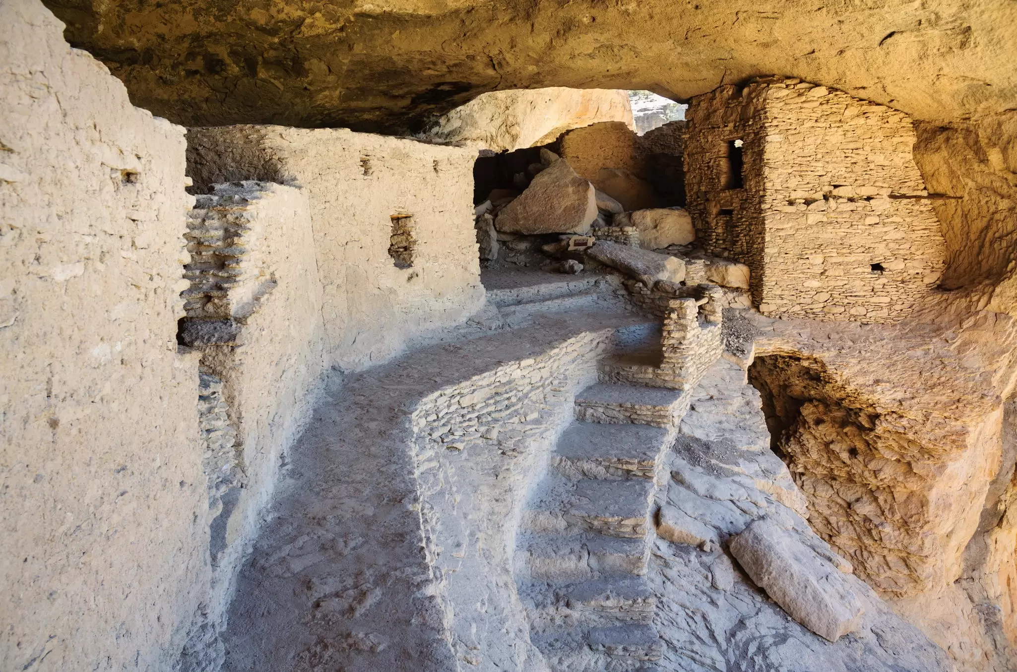
The road from Silver City ends somewhere almost untouched for centuries. Gila was designated as the country's first official wilderness area in 1924 to protect its vast, remote, rugged canyons, which still feel lost in time over a century later.
This wild area spans ponderosa pine forests, pristine rivers, high peaks and steaming hot springs, but Gila's jewel is the Gila Cliff Dwellings National Monument, where the Tularosa Mogollon people made their homes inside natural caves above Cliff Dweller Canyon in the late 1200s.
Visitors can hike a mile-long loop, climbing 180ft upward from the canyon floor, and enter caves with preserved features, including 700-year-old masonry walls with wooden beams. Be sure to climb the 10ft ladder to view a collection of Mogollon pictographs and visit the museum displaying cultural artifacts gathered from the site.
After exploring this ancient village, head over to one of the nearby thermal springs, such as Lightfeather Hot Spring – a cluster of natural hot pools along the Middle Fork Gila River. Allow 20–30 minutes each way to hike the trail to the springs. There are two river crossings along the trail. Make sure not to submerge your face or head in natural hot-spring water, as the water is roughly 130 degrees.
Do: Take your time exploring the Gila Cliff Dwellings, and be sure to take the short Trail to the Past to view the Mogollon alcove dwelling and pictographs. Experienced hikers can venture deeper into the Gila Wilderness, but this is genuine backcountry: water supplies are unreliable, and trails are not always well maintained (bring offline maps and always tell someone where you’re going).
Eat: Bring supplies from Silver City. Food options are extremely limited once you reach Gila – the Doc Campbell's Post general store near Gila Hot Springs can arrange pre-orders of foodstuffs for hikers (call in advance) and it stocks some dehydrated meals.
Stay: Finish the adventure by staying somewhere wonderfully remote. Becky's Gila Hotsprings Ranch has cozy cabins, horseback riding, and a natural hot-spring Jacuzzi on the edge of the wilderness. After days on the road, sink into warm water under a curtain of Gila stars for the perfect end to the trip.
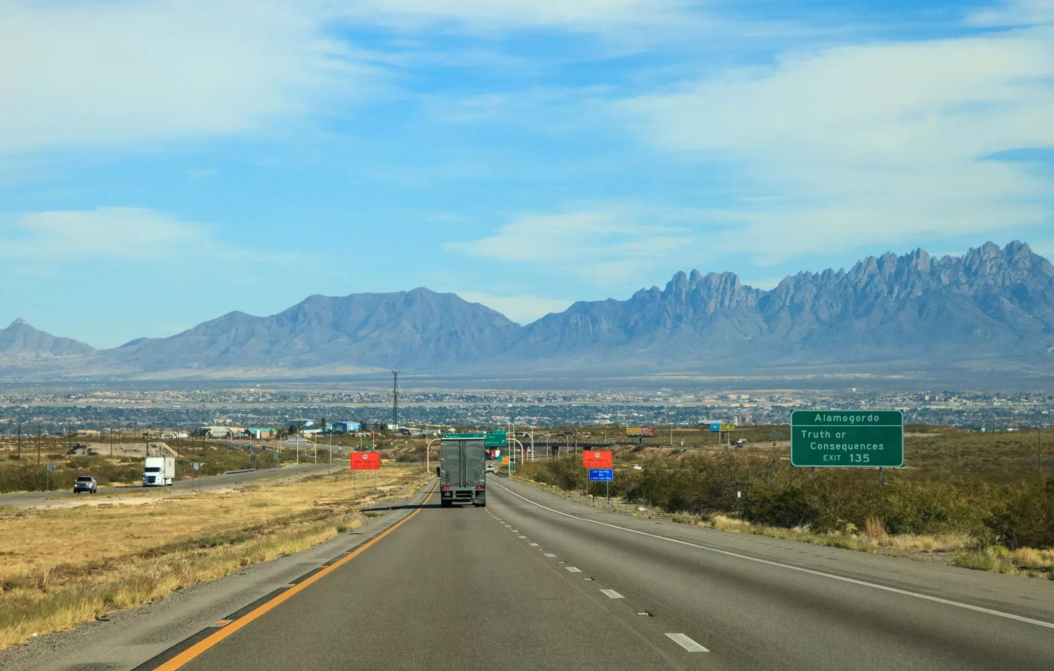
Following this route with an EV is possible, but it requires a lot more planning than a gas-fueled road trip. Charging is easiest around larger towns and along the interstate corridor. Truth or Consequences, for example, currently has charging stations. The mountain sections are the main concern, and some EVs with low mileage ranges won’t make it the whole way without a charge. Availability and compatibility should always be double-checked before travel.
Always charge whenever you have a reliable opportunity – for example, in Alamogordo, Las Cruces, Truth or Consequences and Silver City – rather than waiting until your battery is low. Cloudcroft and Gila have limited infrastructure – cabin outlets offer very slow charging and you'll need to bring adaptors for household outlets. Note that cold weather, elevation gain and car heating will reduce your available range in fall and winter.
Book your United States trip with Lonely Planet Journeys
See United States how it's meant to be seen
Accommodations, activities and ground transportation all taken care of, so you can focus on the fun part. Tell us what your dream trip to United States looks like, and our local experts will build it from scratch. Or start with one of our itineraries and make it your own.


Explore related stories