6 parks and trails to see the best Wisconsin nature, from glacial rock formations to gleaming lakes
Jun 14, 2022
10 MIN READ

Writer
A kayaker explores the sea caves of Devils Island in Apostle Islands National Lakeshore ©Getty Images/Gallo Images

Writer
Lonely Planet may earn a commission from affiliate links on our site. All recommendations and reviews reflect our own independent opinions.
Wisconsin may be known as "the frozen tundra, " but it's more than just its cold and snowy reputation. The Badger state's array of unique natural formations makes it a great place for an outdoor adventure. Visitors can explore ice caves and hike scenic trails of fall foilage or admire the rock formations carved by glaciers.
Here are some of our favorite Wisconsin parks.
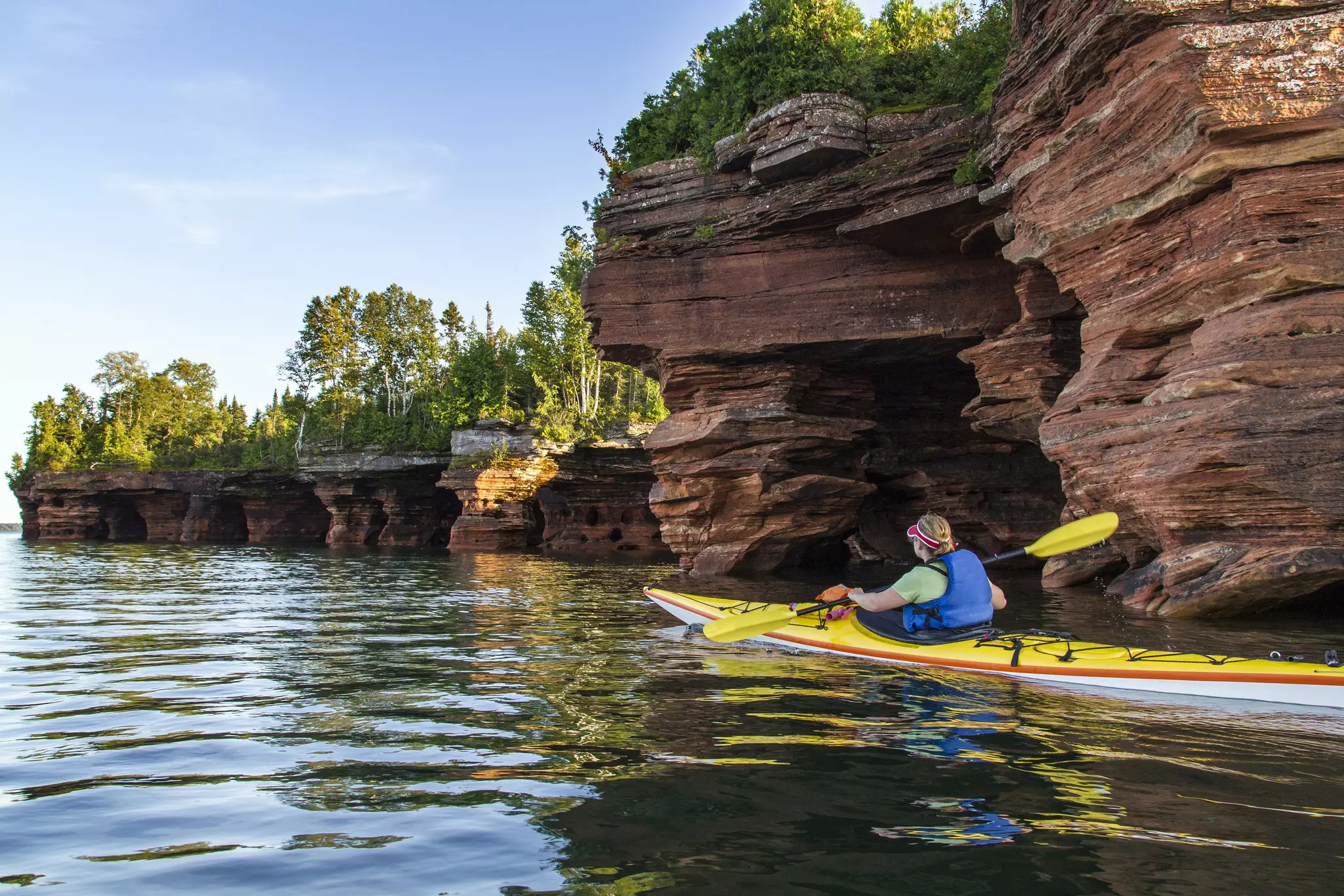
Apostle Islands National Lakeshore
While people outside the Midwest may not know about this Wisconsin treasure, the Apostle Islands National Lakeshore is a must-see. Visitors to the Apostle Islands can indulge in the beauty of the 21 islands (think beaches, trails and sandstone cliffs) throughout Lake Superior.
The Apostle Islands offer just as much adventure in the summer as in winter. Summer tourists can hike the trails, bike, kayak or take a cruise through caves in Lake Superior. In the winter, the water freezes and transforms the Apostle Islands into a haven for ice cave adventurists. Snowmobiling, skiing and other winter activities are also available in the Northwoods.
To top off the activities, bird watchers also find something to love about the Apostle Islands. With more than 300 bird species, the Apostle Islands has one of the busiest migrations in the Great Lakes. Pack your binoculars to see which eagles, owls and sparrows you can find amongst other wildlife.
Visiting Apostle Islands National Lakeshore: To visit the Apostle Islands, travelers opt to stay in Bayfield, Wisconsin. A 25-minute ferry from Bayfield to La Pointe takes visitors to Madeline Island, the largest Apostle Island (though it's not part of the National Lakeshore), for a $17 roundtrip. Bring your bike on the Madeline Island ferry for as little as $7, and your car onboard beginning at $30.
The Bayfield and Little Sand Bay Visitors Center and Meyers Beach are accessible by road; however, access to the 21 islands is by boat only. To camp on the mainland, visitors have to hike the 6-mile Lakeshore Trail starting at Meyers Beach or travel via kayak – cars, tents and RV camping are not options. Campers should be prepared to pay $15 for an individual site, $30 for a group site and a $10 camping reservation fee. Ice cave events are free for children 5 and under and $5 for ages 16 and up.
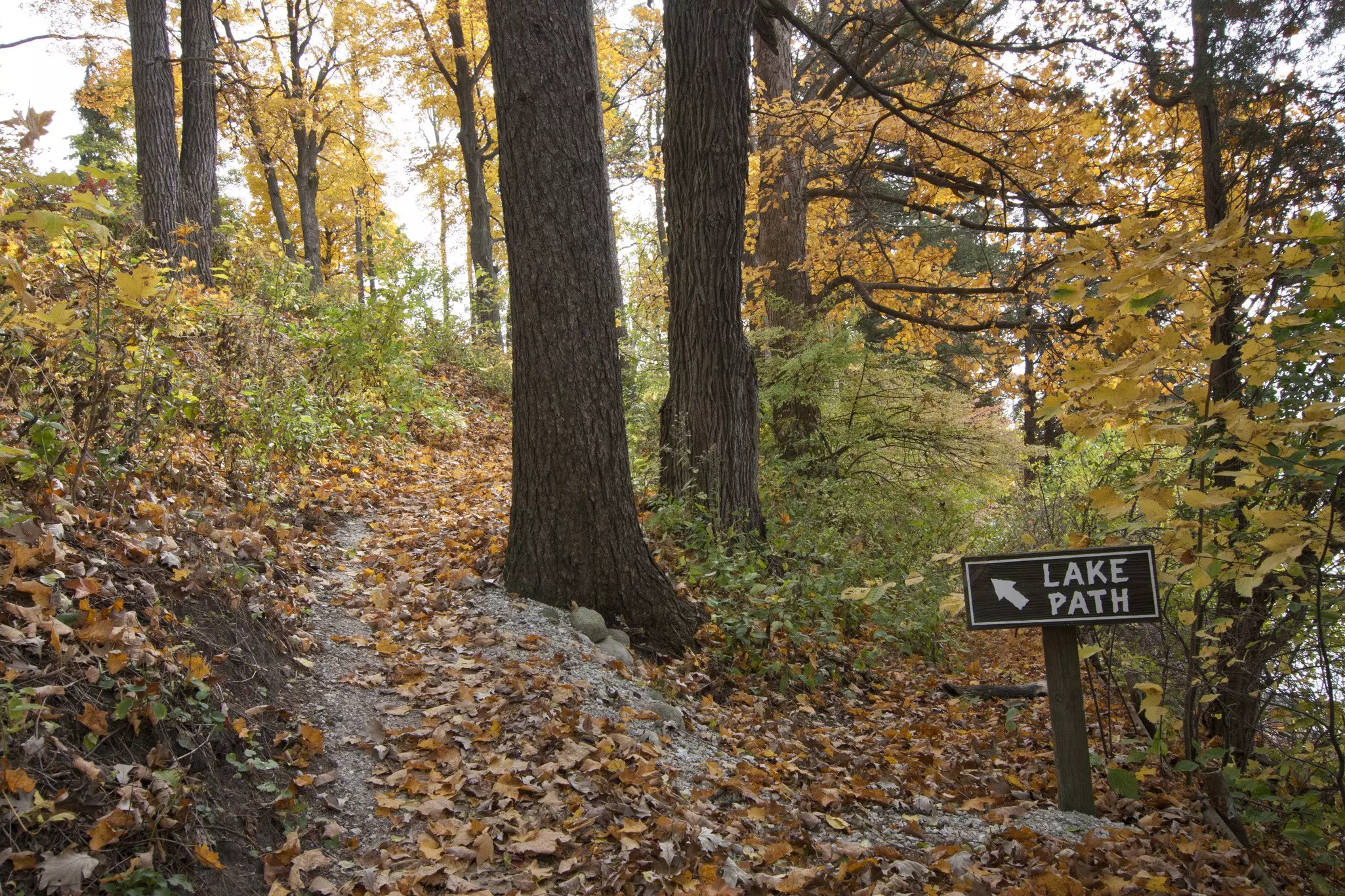
Lake Geneva Shore Path
Hikers looking for a low-maintenance trail with a lake view should check out the Lake Geneva Shore Path. Located about an hour south of Milwaukee, Lake Geneva sits on the land of the Potowatomi people.
The resort town is full of beautiful mansions and summer homes originally built by Illinois residents who fled after the Great Chicago Fire of 1871. Take the Lake Geneva Shore Path to "ooh" and "aah" over said mansions on one side and sparkling blue Lake Geneva on the other.
Lake Geneva's shore is roughly 21 miles long, with the path amassing 26 miles. The paved path takes 8 to 10 hours to complete; and some sections are filled with more gravel, wood, hills, rocks and grass than other areas. Wisconsin is known for harsh winters, making walking the path challenging after early November (unless you prefer hiking in snow).
Visiting the Lake Geneva Shore Path: One of the best things about Lake Geneva Shore Path? It's free and open to the public. Visitors have a few options for lodging in neighboring Wisconsin cities if they choose not to stay in Lake Geneva. Madison is just over an hour northwest of Lake Geneva, while Milwaukee and Kenosha are under an hour northeast of the town. Most visitors go to Lake Geneva on a day trip; however, resorts are available in the summer for longer visits to extend your stay. Lake Geneva is popular during the summer months and resorts fill up fast, so if you want to extend your stay, book your trip no later than March or April. Renting a car will be necessary – there is no public transportation nearby – but there is street parking and a parking area near Library Park in downtown Lake Geneva. Access points to the shore path include Williams Bay, Fontana and Big Foot Beach State Park.
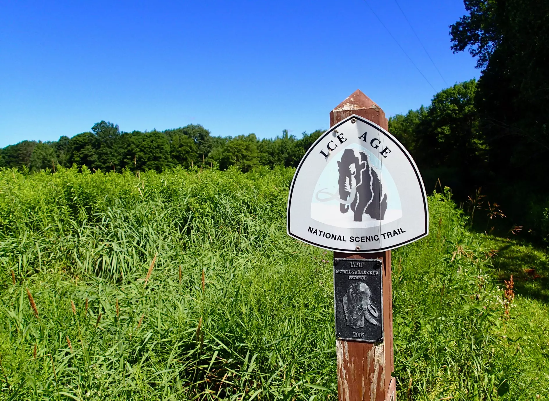
Ice Age National Scenic Trail
History and nature combine to create a one-of-a-kind experience on the 1200-mile Ice Age National Scenic Trail. More than 2 million visitors every year retrace the steps of the mammoths, saber-tooth tigers and glaciers that cascaded the land.
To hike the entire Ice Age Trail in Wisconsin takes 8 to 12 weeks. But with several smaller hikes to choose from – for day trips or overnight stays – visitors and locals often pick one segment to hike. The trail offers hiking, biking and bird watching in the summer and cross-country skiing and snowshoeing in the winter.
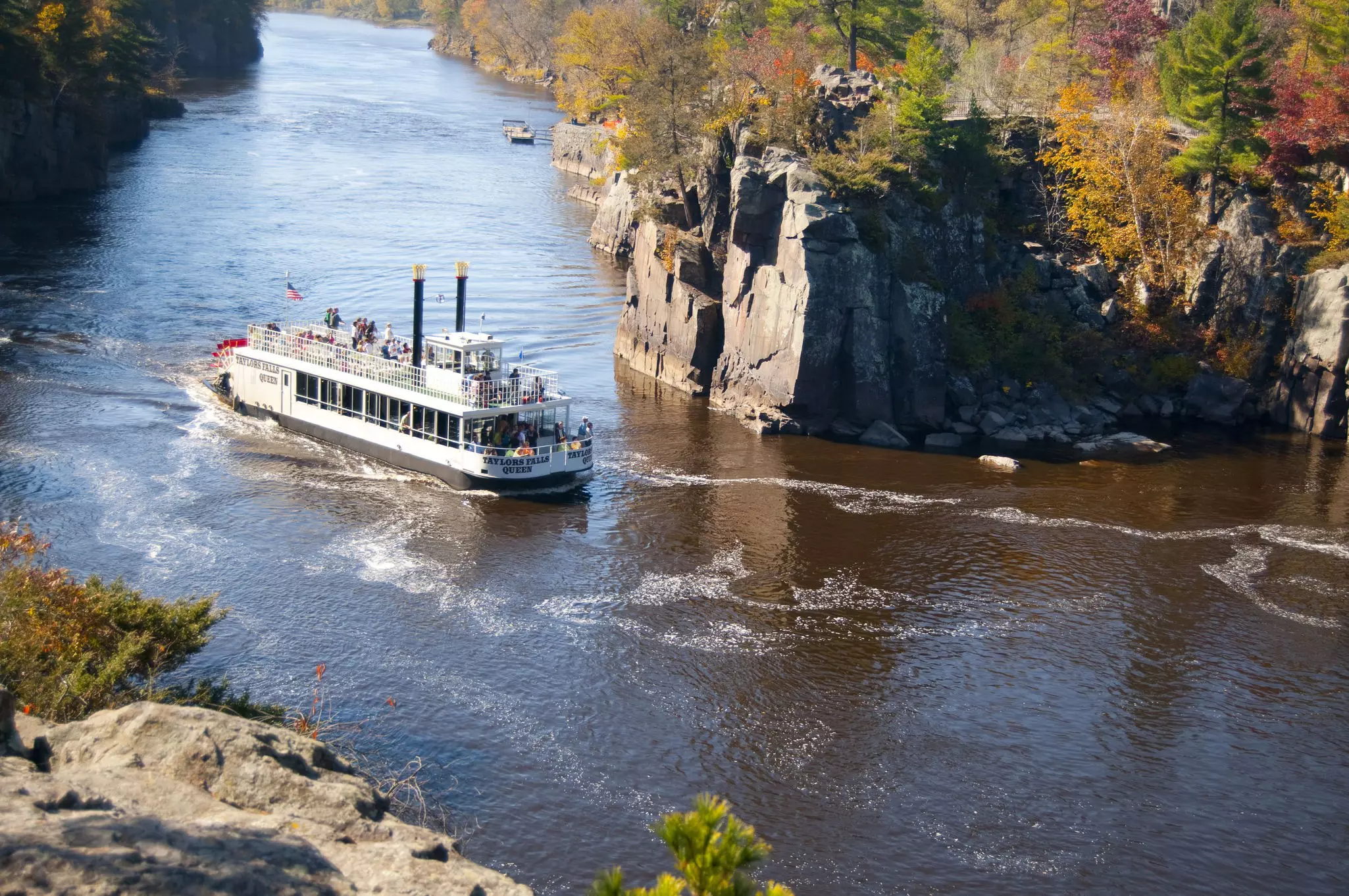
Interstate State Park is the oldest Wisconsin state park on the Ice Age Trail and bridges the Minnesota-Wisconsin border. The most notable part of the park is the Dalles of the St. Croix, a steep gorge amidst the 1400 acres. There are nine miles of summer trails and 12.5 miles of winter trails, including the Silverbrook Trail for beginner hikers, which showcases the 18-foot Silverbrook Falls. In addition to hiking and camping, the Ice Age Interpretive Center is an extra opportunity at Interstate to learn about Wisconsin's history with glaciers through a 20-minute film, murals and photographs.
Visiting Ice Age National Scenic Trail: There are multiple places to begin the Ice Age Trail. Devil's Lake State Park is a popular segment in Baraboo, Wisconsin. Other cities and parks where hikers can access the Ice Age Trail include Dells of the Eau Claire Park, Gibraltar Rock (near Madison), Kettle Moraine State Forest (accessible via car for a day trip from Milwaukee) and Interstate State Park at Saint Croix Falls. Any state parks on the trail are part of the Wisconsin State Park System which requires a vehicle admission sticker for all visitors. Out-of-state vehicles have to pay $11 daily (except Devil's Lake which is $16).
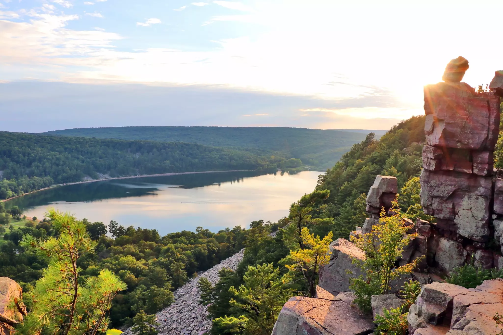
Devil's Lake State Park
Devil's Lake State Park is Wisconsin's most popular state park for summer adventures and fall foliage. Known for its 500-foot quartzite bluffs and rocks, Devil's Lake attracts 3 million visitors per year who want to hike, climb and take iconic photos with the 360-acre lake in the background. Most visitors try to find the "Devil's Doorway" for a photo-op, but be careful – these rocks were formed after the glacier period in Wisconsin more than 15,000 years ago.
Present-day Devil's Lake belongs to the Ho-Chunk Nation who have inhabited the land for 300,000 years. The lake is also a part of The Ice Age National Scenic Trail, which makes up 1200 miles of the park, including 29 miles of hiking trails. For non-hikers, there are picnic areas, two sandy beaches and concessions that offer activities such as paddle boating, canoeing, and kayaking.
Campers love Devil's Lake, too. Three campgrounds (Quartzite, Northern Lights, and Ice Age) totaling 423 sites across the park and nine group campsites are available for a maximum of 240 campers. Quartzite is the only winter campground, and some amenities, including flushable toilets and showers, may not be available. Visitors should also plan at least a month or two in advance – camping is no longer offered on a first-come, first-serve basis.
Visiting Devil's Lake State Park: Devil's Lake is located in Baraboo, Wisconsin, almost two hours from Milwaukee and under one hour from Madison. For non-campers, most visitors and locals opt to make Devil's Lake a day trip from Milwaukee or Madison. Winter until Memorial Day is considered the early season, so campers and hikers should plan to visit in the summer and fall months, starting as early as June. In the summer, camping without electricity is $25 and $40 with electricity on weekdays. On weekends in the summer, campers pay $27 without electricity and $42 with electricity. Group rates start at $40 per night for 1-20 people. For day-trippers, a day pass is $16 for non-residents.
North Country National Scenic Trail
Stretching for 4600 miles, from New York to North Dakota, the North Country National Scenic Trail is ideal for campers and hikers wanting to explore northwestern Wisconsin. With waterfalls, lakes and streams surrounded by forestry, adventurers have 220 miles of wildlife to enjoy.
Copper Falls State Park is a beloved North Country Scenic Trail stop. Two highlights on the trail are the Copper and Brownstone waterfalls. Visitors can swim, bike and fish in Loon Lake or hike along Bad River on Doughboy's Nature Trail for 1.7 miles.
Though summer is the busiest for the North Country National Scenic Trail, the Marengo River segment in the Chequamegon-Nicolet National Forest provides multi-season activities, including snowshoe hiking during the winter. In general, hiking this segment can be difficult for beginners, but experienced visitors can observe three overlooks of the Marengo River Valley, the most scenic path in the forest.
Visiting North Country National Scenic Trail: Like the Ice Age National Scenic Trail, the North Country Scenic Trail has multiple entry points. The trail passes through Bayfield, Ashland, Iron and Douglas counties. Using the state parks and forests is the easiest way to navigate the North Country Trail, including Copper Falls State Park, Pattison State Park, Brule River State Forest and Chequamegon-Nicolet National Forest. All state parks require vehicle admission for $11 daily, and most are open year-round, 24 hours a day. However, check with the respective state park for any changes, and hunting and fishing licenses are required. Campers can make their reservations online.
Saint Croix National Scenic Riverway
Travelers can tube the summer days away on the Saint Croix or Namekagon rivers in the Saint Croix National Scenic Riverway. Bridging Minnesota and Wisconsin, the riverway runs through eight Wisconsin counties including Bayfield, Saint Croix, Douglas, Washburn, Burnett, Sawyer, Pierce and Polk. Forest and parks are sprinkled throughout the 252-mile route for campers and hikers to find the best trails for their adventures.
Governor Knowles State Forest is 55 miles and 32,500 acres of outdoor excitement for visitors to hike, bike, horseback ride, hunt, canoe and paddle. The forest has three main campgrounds for avid campers: St. Croix, Trade River Equestrian and Sioux Portage Group. With summer as the best time to visit, travelers opt for the woody views of the Sandrock Cliffs trail for an easy hike along the river.
Visiting Saint Croix National Scenic Riverway: The riverway itself is free; however, there can be associated parking and admission fees on state and county land within Saint Croix National Scenic Riverway. All state parks require $11 daily vehicle admission. Visitors who want to visit the Saint Croix National Scenic Riverway and the Ice Age Trail can camp at Interstate State Park and then head to Governor Knowles State Forest in Grantsburg. The park and forest are only 40-minutes apart via car. For camping reservations, head to the Wisconsin State Parks Reservation System.