

Advertisement
9 Switzerland hikes that offer views you have to see to believe

Kerry Walker
Dec 19, 2024 • 10 min read
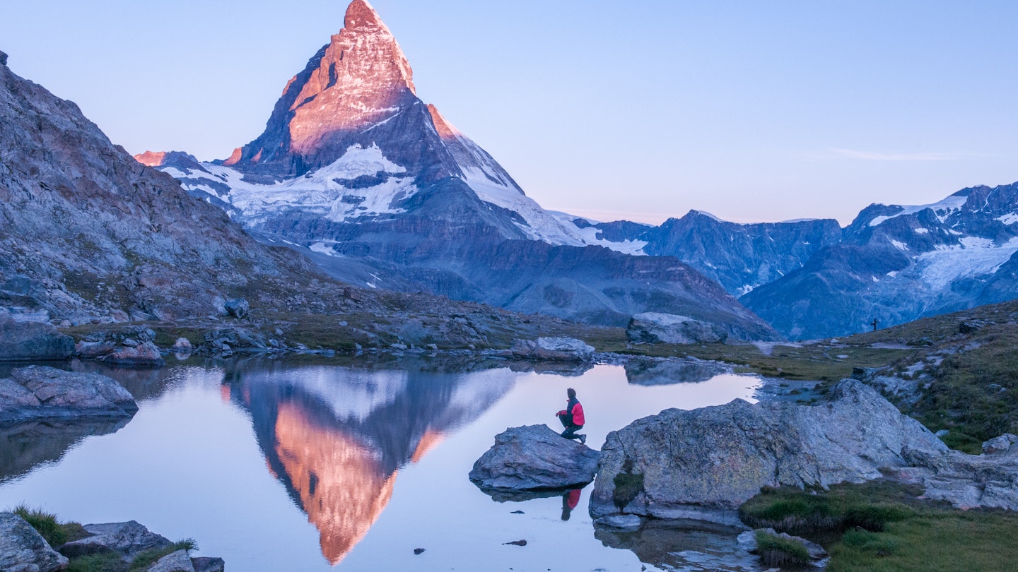
Matterhorn is the mountain you can’t stop gawping at, one of many highlights on Switzerland's best hiking trails. Getty Images
In Switzerland, the mountains call. One look at this ravishing land of skyscraping peaks, glaciers, forests and lakes of piercing blue will have you itching to sling on a backpack, zip up to the heights and hit the trail.
You certainly won’t be alone. The Swiss seem to be born with one leg up a mountain – which means hiking is the fast track to the nation’s nature-loving soul. This being Switzerland, even the trails leading you deep into the country’s wildest, remotest corners are diligently marked, and almost every inch of the country is precisely mapped.
Switzerland? Little? Not for hikers it isn’t. As the Swiss delight in reminding you, the country’s 62,500km (38,836 miles) of trails would be enough to wrap around the globe 1.5 times. Alpine hikers fall hard for the high-level trails in the Bernese Oberland and Graubünden, which notch up the challenge and floor you with phenomenal scenery. Yet lowland areas like the vineyards of Valais and the gently rolling hills of Appenzell are equally atmospheric and accessible virtually all year long.
Picking Switzerland’s best hikes is kid-in-a-candy-shop stuff. Still, here are nine favorites to whet your appetite.
Advertisement

1. Faulhornweg
Best day hike
15km (9.3 miles) one way, 5 hours, moderate
Mother Nature pulled out all the stops in the Bernese Oberland, and the Faulhornweg might be the best day hike to take it all in. This moderately challenging ridge hike throws you in the scenic deep end. Beginning and ending on a high, you’ll take in the full glittering sweep of Lakes Thun and Brienz as you trudge from Schynige Platte to First, and colossal peaks like the dagger-shaped Wetterhorn and the big three of Eiger, Mönch and Jungfrau.
Navigation-wise, the trail is easy enough to follow. From Schynige Platte, the walk eases you in gently, heading over rolling pastures before rising more abruptly to scree slopes, boulder-strewn passes and high moors. You’ll make a steeply rising traverse along a broad ledge between stratified cliffs to the ridge of Winteregg, before turning off to the summit of 2681m (8796ft) Faulhorn. Here you’re in for a treat, with 360-degree views reaching across a sea of mountains to the Black Forest in Germany and Vosges in France on clear days.
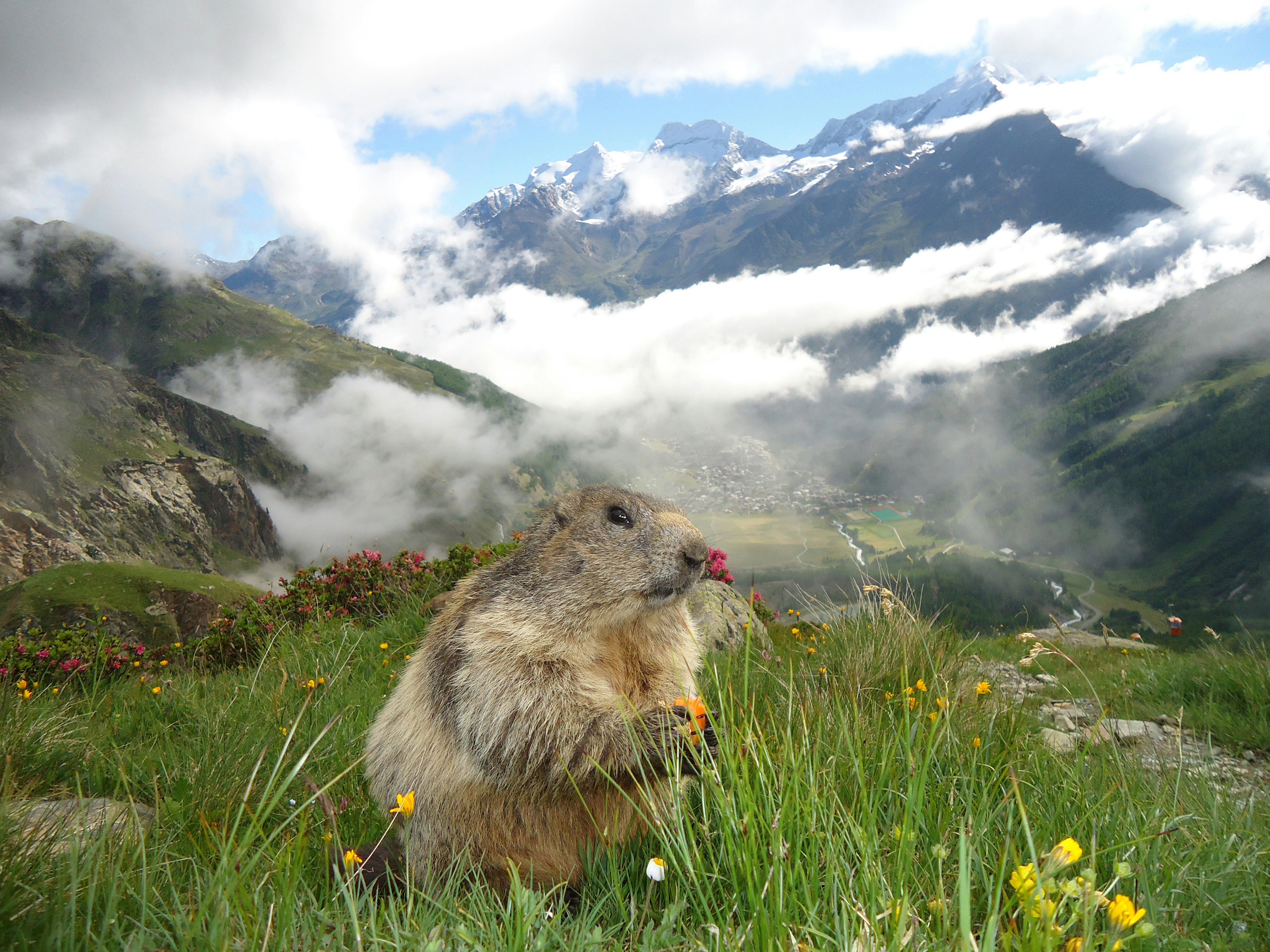
Local tip: Keep an eye out for marmots as you descend to the grassy basin of the Bachalpsee, where a steel-blue lake contrasts starkly with the ice-shrouded peaks of Wetterhorn, Schreckhorn and Finsteraarhorn.
2. Lakes of Macun
Best hike in a national park
22km (14 miles) one way, 8 hours, moderate
For a glimpse of the Swiss Alps before the dawn of tourism, there’s no place like the nature-gone-wild Swiss National Park in The Engadine in Graubünden, where Switzerland muscles its way into Italy. Squished into a remote corner of the country’s southeast, this off-the-radar national park punches high on every level. It’s often so silent that the only sound you’ll hear is that of your own footsteps.
Of all the trails threading through the wilds, this demanding full-day hike from Lavin to Zernez has the edge, weaving up to the glacial cirque of Macun, necklaced with almost two dozen lakes of sapphire, azure and turquoise blue. The snow-capped Bernese, Silvretta and Ortler Alps hog the horizon. Ibex are in their element in these peaks, and with luck and patience you might spot them. The trail becomes tougher, rockier and more exposed as you ascend steep slopes to Fuorcletta da Barcli, a gap in the range at 2850m (9350ft), with top-of-the-world views. The descent to Zernez leads through avalanche grids to meet an Alpine track, twisting through forest to reach Zernez, where you can either stay the night or take the train back to Lavin.
Planning tip: Getting an early start is essential. The walk requires sure-footedness and a good head for heights because some sections are lofty and exposed. Snowfields can linger into summer on the upper reaches.

3. Gemmi Pass
Best hike over a mountain pass
13km (8 miles) one way, 5 hours, challenging
If you think hiking the Gemmi Pass is tough today, spare a thought for those first intrepid travelers who crossed it as part of Thomas Cook’s first forays into the Swiss Alps in 1863. Linking the Valaisian spa resort of Leukerbad to the cute-as-a-button Alpine resort of Kandersteg in the Bernese Oberland, the hike is easily doable in a day, but nevertheless presents a proper challenge, as it involves 1050m (3445ft) of ascent through stark, rocky and at times steep and exposed mountains.
Your reward for the effort to reach the pass is bleakly beautiful lake Daubensee at 2205m (7234ft) and a clifftop lookout platform next to Wildstrubel Restaurant, floating 900m (2953ft) above the valley and affording top-of-the-beanstalk views of the high, perennially snow-frosted mountains of Valais, which hover around the 4000m (13,123ft) mark. At lower elevations, the trail weaves through flower-freckled pastures. Afterward, hop back on the train to Leukerbad to give your feet a soaking in its thermal hot springs, which have views out to the peaks.
Planning tip: While the path is safe and well maintained, be sure to check the forecast before you venture up.
Advertisement
4. Via Alpina
Best multi-day hike
390km (242 miles) one way, 20 days, challenging
The Via Alpina is the big one: an epic 20-stage trek that takes you from the castle-topped principality of Liechtenstein in the east to Montreux, dreamily set on the shores of Lake Geneva, in the west. Embarking on the whole thing is a serious undertaking: you’ll need to be sure-footed, have a head for heights and experience in navigating using a map and compass because you’ll be grappling with 14 Alpine passes. The highest of these is Hohtürli at 2778m (9114ft) in the Bernese Oberland, reached via a steep wooden ladder hacked into the rock face and secured with iron chains.
The descent is no less dramatic, dropping more than 1000m (3281ft) to Lake Oeschinen above Kandersteg, a celestial vision of cerulean blue ringed by snow-streaked mountains and fed by the glacial waters of the Blüemlisalp peaks.
Via Alpina is a proper journey into remote wilderness, with nights spent camping beneath starry skies or at rustic mountain huts, plentiful chances to spot wildlife like chamois, ibex and golden eagles, wild swims and entrancing sunrises and sunsets.
Planning tip: The route requires some advance planning and is best hiked from June to September, dodging the snow and wet or foggy conditions with bad visibility.

5. Aletsch Glacier route
Best hike on a glacier
17km (10.5 miles) one way, 6 hours, challenging
Switzerland bombards you with out-of-this-world scenery, and few places leave you speechless like the Aletsch Glacier, a moraine-streaked, deeply crevassed 23km(14-mile)-long superhighway of ice powering through some of the highest mountains in the country. You can’t quite suppress the gasp of wonder while hiking alongside the largest glacier in the Alps, particularly on a sunny day when great daggers of peaks razor 4000m (13,123ft) above the ice into a searingly blue sky.
Hands down one of the most astonishing day hikes in Switzerland, this route takes you from Fiescheralp to Bettmeralp, with front-row views of the Aletsch Arena peaks. The Fieschergletscher is the prelude to the big one. Snaking down from the eastern flank of Grosses Fiescherhorn, a razor-edge peak at 4049m (13,284ft), this 16km (10-mile) swirl of eternal ice is the second-biggest glacier in the Alps. From here, the route winds around slopes and up through a rock-strewn gully, gradually steepening as it negotiates switchbacks up to a remote valley, its mountain hut and Märjelensee, a milky turquoise splash of a lake buttressed by immense mountains and the rim of the Aletsch Glacier.
The Aletsch Glacier is now your constant companion, as the trail skirts the deeply crevassed ice. Swiss stone pine forest and glittering tarns soften the Alpine picture as you continue along a ridge to the grassy slopes of Moosfluh, where a strategically placed bench offers staggering glacier views. Soon after, you’ll reach the glass-blue lake of Blausee. From here, it is just a stone’s throw to Bettmeralp.
6. Rigi Panorama Trail
Best accessible hike
7km (4 miles) one way, 2 hours, easy
JMW Turner was so smitten by Rigi that in 1842 he painted the mountain in three different lights to reflect its changing moods. Flinging up above fjord-like Lake Lucerne, the 1797m/5896ft-high peak still has a magic touch today, especially when seen in the pink blush of sunrise or sunset. On a clear day you can see all the way to Mt Titlis, the glacier-encrusted Jungfrau Alps and Lake Zug.
Following a wide path that shadows the old Scheidegg Railway, this wheelchair- and stroller-accessible ridge trail from Rigi First to Rigi Scheidegg beautifully opens up the surrounding lakes, cow-grazed pastures and mountains, with plenty of options to pause for a picnic or barbecue en route.
Planning tip: Some sections are steep for wheelchairs (you’ll need good brakes), but there are options to shorten the trail should you so wish.

7. Höhenweg Höhbalmen
Best hike at altitude
18km (11 miles) round trip, 7 hours, moderate
Matterhorn is the mountain you can’t stop gawping at – and this circular hike in Zermatt gets you up close and personal to the beauty.
The trail threads up through larch forest on the ascent, making broad switchbacks above the Triftbach Gorge. From here, it’s a stiff uphill march to Berggasthaus Trift, at the foot of its namesake glacier, where you stay overnight to split the hike into two days if you wish.
The onward hike takes you over flower-flecked Alpine meadows, zigzagging up grassy slopes to climb onto the high balcony of Höhbalmenstaffel, where a riveting panorama unfolds. Heading west, the route traverses narrowing ledges that get astonishingly close to the north face of Matterhorn to reach Schwarzläger, the walk’s highest point at 2741m (8993ft).
From here, it’s a steady descent over the sparse mountainsides of Arben. The path winds down to meet a more prominent walking track alongside the high lateral moraine wall left by the receding Zmutt Glacier. Follow this down in zigzags through glacial rubble and continue along gentler terraces to the photogenic hamlet of Zmutt and then back to Zermatt.
Planning tip: Pick a good-weather day and get an early start for this full-day trek, which embodies all that is unique about the Swiss Alps, leading you into another world of glittering streams, crevassed glaciers and 4000 peaks. Weather permitting, Höhenweg Höhbalmen is hikeable from June to October.

8. Kronberg Treasure Hunt Trail
Best hike for families
7km (4 miles) round trip, 3 hours, easy
Rippling across northeastern Switzerland, the under-the-radar Appenzell Alps are a surefire winner with families. You’ll walk to the backbeat of cowbells through rolling dairy country and flower-freckled meadows. The mountains are easily accessible for those with small legs, and the towns look freshly minted for a bedtime story, with their timber-framed, prettily muralled houses.
A cable car swings up from Jakobsbad to the 1663m (5456ft) summit of Kronberg, the trailhead for this terrific family hike, which skips back down the mountain and presents challenges and clues leading to the “treasure.”
Planning tip: If you want to make a day of it, you can ramp up the adventure in the valley at the water park, adventure playground, zip-line course and bobsled run.
9. Bisse de Clavau
Best hike through vineyards
8km (5 miles) round trip, 4 hours, easy
Gentle walking trails tread quietly through staggeringly steep terraced vineyards in Valais, producer of Switzerland’s most feted wines, with many vignerons throwing open their cellar doors for tasting and buying. There’s no better place to walk, taste and appreciate the grape than Sion, with its cinematic twinset of castles and raft of gourmet addresses.
And there’s far more to hiking around Sion than enticing strolling between grape-heavy vines. What makes trails in this part of the Rhône Valley unique are the bisses, miniature canals built in the 13th century to irrigate these vertiginous terraced vineyards hemmed by stone walls. This half-day hike between Sion and St-Léonard is a treat, shadowing the Bisse de Clavau, a 550-year-old irrigation channel that carries water to the thirsty, sun-drenched vineyards and commanding grandstand views of hilltop chateaux, the snaking River Rhône and the not-so-distant Alps.
Pause to sample Valaisian Dôle (red) and Fendant (white) wines, perhaps over lunch at Le Cube Varone, an old winegrower’s hut. The hike is never lovelier than on a golden fall day when the grape harvest is in full swing, when you can enjoy a brisolée, the traditional harvest feast built around chestnuts, cheese, cold meats and vin nouveau (new wine).
Advertisement
Explore related stories


Jul 13, 20228 min read
Slow travel and long distance hikes: how to embrace the new outdoor travel trends