Jun 1, 20267 min read
Puerto Rico's top 10 beachesOct 15, 2025
12 MIN READ

Writer
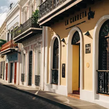
The exterior of Mercado La Carreta in San Juan, Puerto Rico. Steph Segarra for Lonely Planet

Writer
Lonely Planet may earn a commission from affiliate links on our site. All recommendations and reviews reflect our own independent opinions.
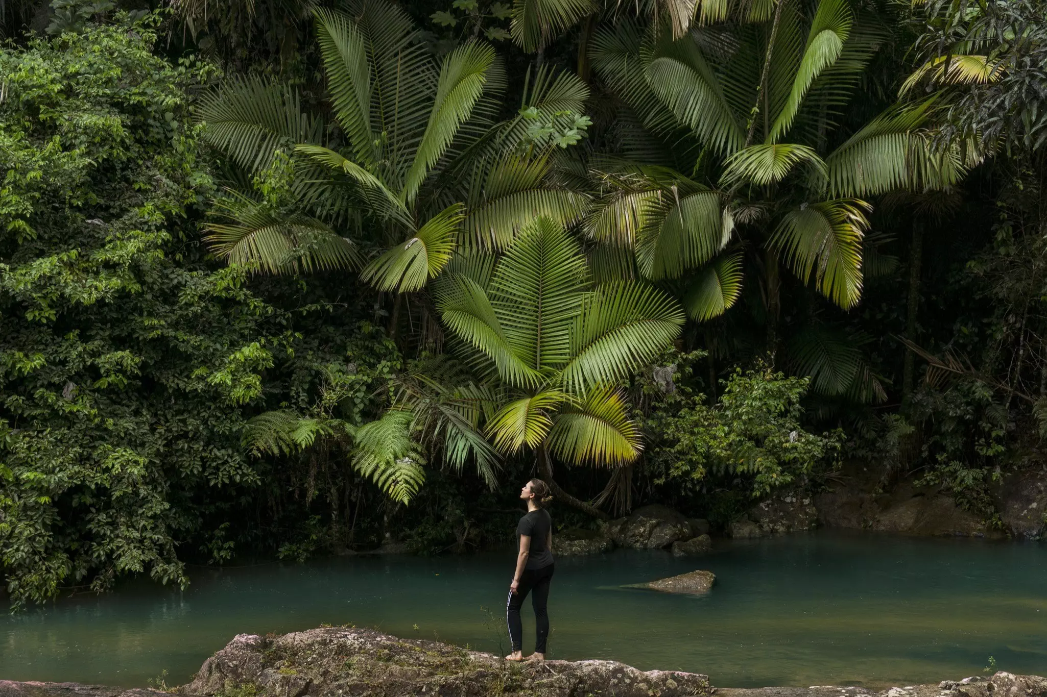
If it's a love of the natural world that has lured you to Puerto Rico, there are plenty of stunning landscapes and outdoor experiences to keep you enchanted. From the lush and humid forests of the central mountains to the idyllic surfing beaches of the northwest, Puerto Rico is a haven for ecotourism. Still, Puerto Rico offers an incredible mashup of nature and culture. Plenty of people come to Puerto Rico for the outdoor adventures – hiking, ziplining, surfing – but stay for the rich heritage, culture and amazing Caribbean nightlife amid a thriving mix of bars and restaurants.

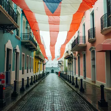
Lined with historic buildings, including San José church, the historic Hijos de Borinquen bar and Casa Blanca – former home of the island’s first Spanish governor, Juan Ponce de León – La Calle San Sebastián allows visitors the chance to savor a little bit of Old San Juan. Named after Saint Sebastian, this cobblestoned street is one of the most beautiful on the island. By day, snap photos of pretty, colorful balconies, walk the narrow alleyways and peek between the buildings for a glimpse of the Atlantic Ocean. At night, there’s plenty of bar hopping to do. Fancy dancing to anything from salsa to electronic beats? What about sipping top-notch cocktails made by expert mixologists? Head over to ultra-hip La Factoría and dance the night away. If you prefer a more chilled-out place to hang, Taberna Lúpulo has open-air seating and a massive selection of local and international beers. To grab a few Medalla beers and dance to some reggaeton, La Sombrilla Rosa is the place to to go. There are plenty of watering holes to choose from, so put on your best sneakers and enjoy the humid sea breeze while you wander from bar to bar.
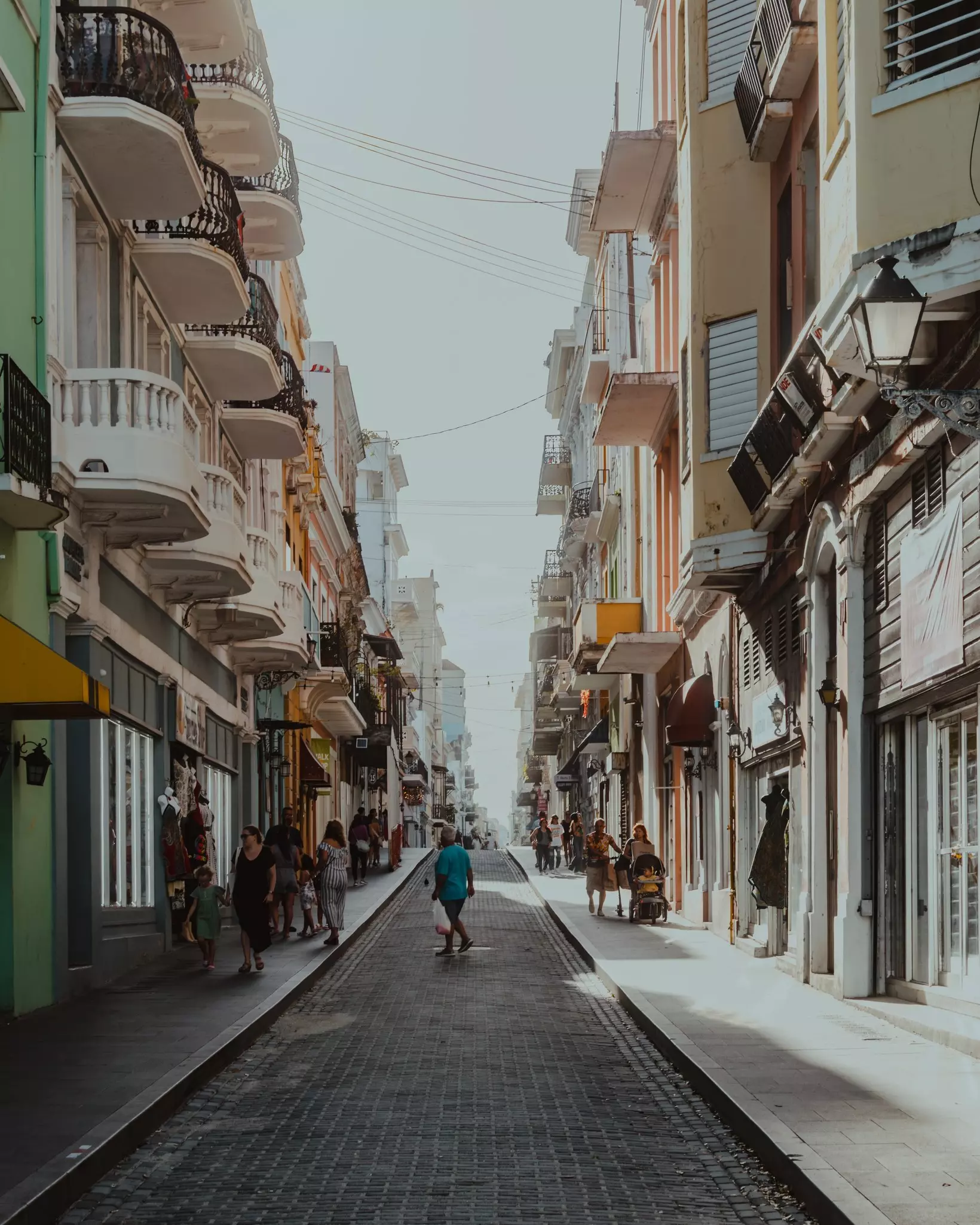
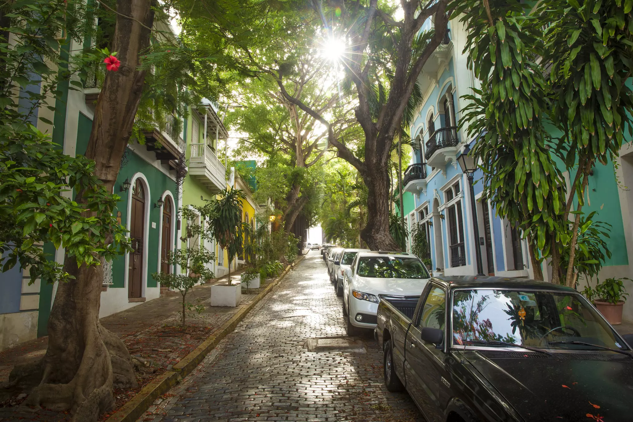
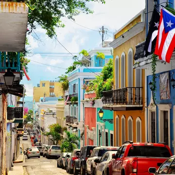
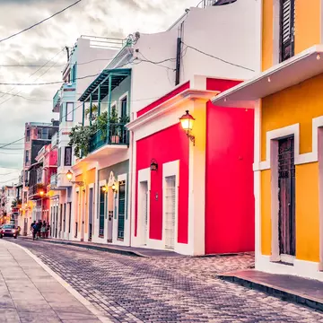
Walking through the cobblestone plazas and narrow alleyways of Old San Juan is an essential Puerto Rico experience. There's no need to have an itinerary here – just get lost in a maze of colorful, Spanish colonial-style houses with famously ornate balconies, lush courtyard gardens and ceilings adorned with intricate mosaics of Catholic saints and virgins and ornate criollo tiles. There isn’t a corner of the islet that isn’t steeped in heritage, from historic churches to grand homes dating from the 18th and 19th centuries. Wander around the neighborhood and gawp for free, dropping into cafés and bars as the mood takes you.
Planning tip: If you'd prefer a little more insight into San Juan's architectural heritage and rich political, social and economic life, the Puerto Rico Historic Buildings Drawing Society runs a series of walking tours exploring landmarks such as Casa Blanca, the abandoned Normandie Hotel, sailors' haunt Calle Sol, and the city's lovely parks and plazas.
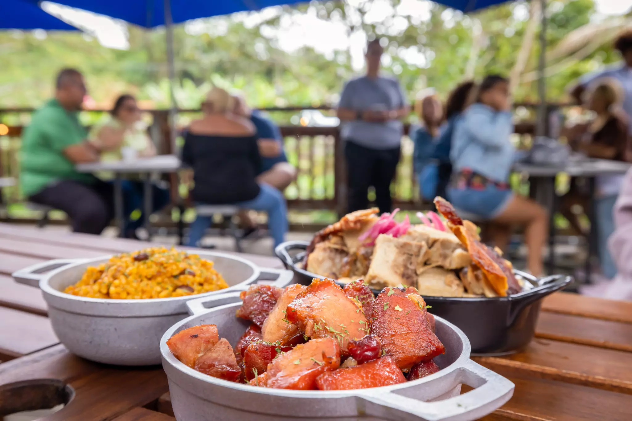
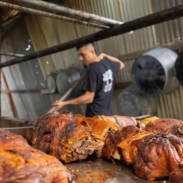
There’s no better way to get a taste of traditional Puerto Rican flavors and the island's folklore than by taking a tour through Guavate in Cayey. Known as La Ruta del Lechón – the Roast Pork Route – the road to Guavate takes you deep into the mountains flanking the town of Cayey, where you can restaurant-hop in search of the best spit-roasted pork and steamy arroz con gandules (rice and pigeon peas) on the island. It’s a ritual that’s revered by Puerto Ricans, especially at Christmas time. Each establishment is family-owned, and most have informal picnic-style tables where you can mingle with other patrons, have a few drinks and perhaps even dance to música típica (folk music). It’s a nourishing experience in every sense of the word and a great way to dive into the wet, mountainous central region.
Planning tip: This beautiful tradition inevitably draws a crowd, so if you go on a weekend, arrive early or be ready to wait in line.
It’s not difficult to get a taste of rural life in Puerto Rico. Fertile soil and the warm and well-watered climate allow crops to flourish year-round at the island farms, raising local produce and livestock. At Vaca Negra, in the town of Hatillo in the northwest, go a step further and make your own Puerto Rican-style aged cheese. This is a relatively new concept on the island, as Puerto Rican cheese is traditionally freshly prepared. Using raw cow’s milk from Hatillo's cattle ranchers, staff will help you create some of the best-aged cheese you’ve ever tasted – you can even opt for lactose-free. There's one small hitch: the cheese takes approximately two months to reach maturity. If you’re only passing by, purchase some of their pre-made cheeses and yogurts from the farm store or swing by for brunch in true Puerto Rican country style, one of the best food experiences on the island.
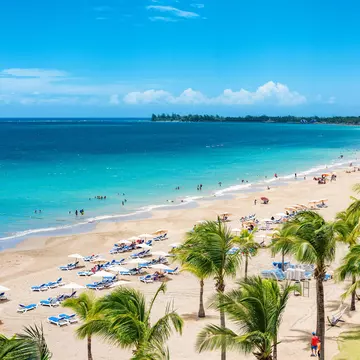
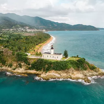
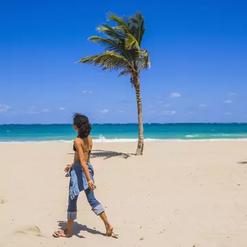
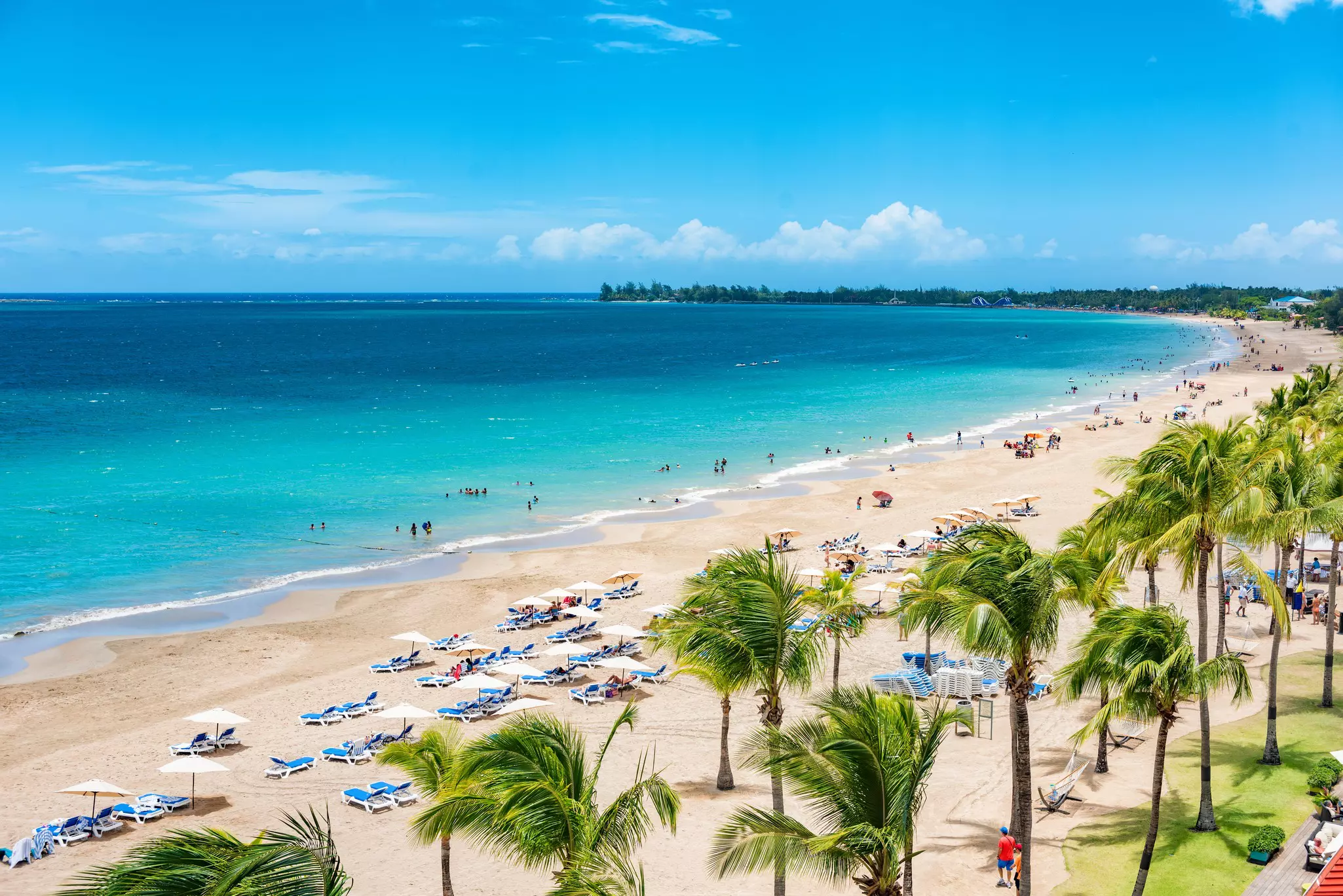
With more than 300 miles of coastline and just as many beaches, there’s a strip of sand in Puerto Rico to suit every style. Wade all day in bathtub bays or surf the winter swells. Snorkel along mangrove-lined isles or hike along coastal cliffs. The best part is that all beaches are public. In Playa Flamenco, snap a picture of the graffiti-covered US Navy tank kissed by Culebra’s turquoise waters or dip in the cool water of La Pocita's coral-protected wading pool. Maybe take a drive to remote La Playuele, a crescent-moon-shaped shore hugged by limestone cliffs and crowned by Los Morillos Lighthouse. For surfers, some of the best waves can be found on Punta Borinquen in Aguadilla.
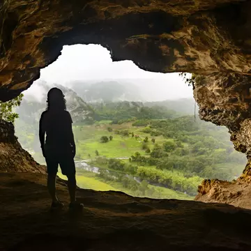
The San Cristóbal Canyon is one of the most precious and underexplored natural treasures in Puerto Rico. Nestled between the towns of Aibonito and Barranquitas in the Cordillera Central mountain range, the canyon was once used as an unofficial landfill site until local non-profit organizations stepped in to save the site for future generations. Today, San Cristóbal Canyon is the setting for one of the most thrilling hiking trails on the island, where you can rappel, hike and swim under waterfalls, surrounded by lush green jungle. You’ll need to be in good physical condition, as the trails are challenging: the canyon is 152 meters (500ft) deep and the hike is more than 9km (6 miles) long, most of which is uphill through rocky terrain. Don’t go alone – the trails are largely unmarked.
Planning tip: Guided hikes and tours are led by the conservationist group Go Hiking PR, run by Puerto Rican teachers, students and geographers.
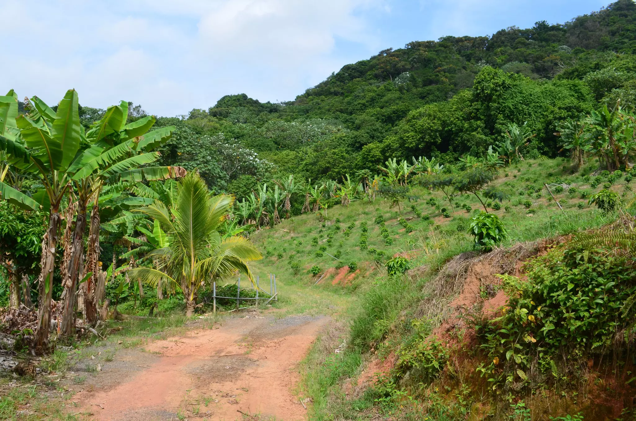
In Puerto Rico, coffee is a ritual that isn't taken lightly. Unlike in the United States, you’ll rarely see people drinking coffee in their cars on their way to work or rushing with a cup of coffee in their hands. Instead, enjoying a brew in Puerto Rico is a state of mind, a little respite from the world outside. Join locals at Hacienda San Pedro in the mountains of Jayuya in the Central Mountains, which dates from the 19th century and has been owned by four generations of the Atienzo family. You can tour the coffee fields where the beans are picked by hand, and then toasted in equipment that’s been used for more than a century. The hacienda has a museum where you can see original artifacts and learn more about the processes that make Puerto Rican coffee so amazing. Before you leave, stop for a hot cup of Joe and pick up some of the best beans on the island as a souvenir.
Ceremonial grounds, religious effigies and plazas formerly occupied by Puerto Rico's Indigenous population – specifically the Ígneri and Taíno tribes – make the Centro Ceremonial Indígena Tibes in Ponce an essential stop if you want to understand the island's pre-colonial past. Archeologists have dated the site, located in the Tibes sector of Ponce, to between 400 BCE and 1000 CE. Annual excavations have uncovered Indigenous pottery, foraging patterns and instruments that provide tantalizing glimpses of the civilizations that populated Puerto Rico before the arrival of the Spanish colonizers.
Detour: To learn more about Puerto Rico's Indigenous history, hike along Arecibo’s dramatic coastline to spot ancient carvings inside Cueva del Indio, a limestone cave where Taínos praised their gods. Or, admire granite-carved petroglyphs lining the ceremonial plazas at Parque Ceremonial Indígena de Caguana, an archaeological site in the Utuado hills.
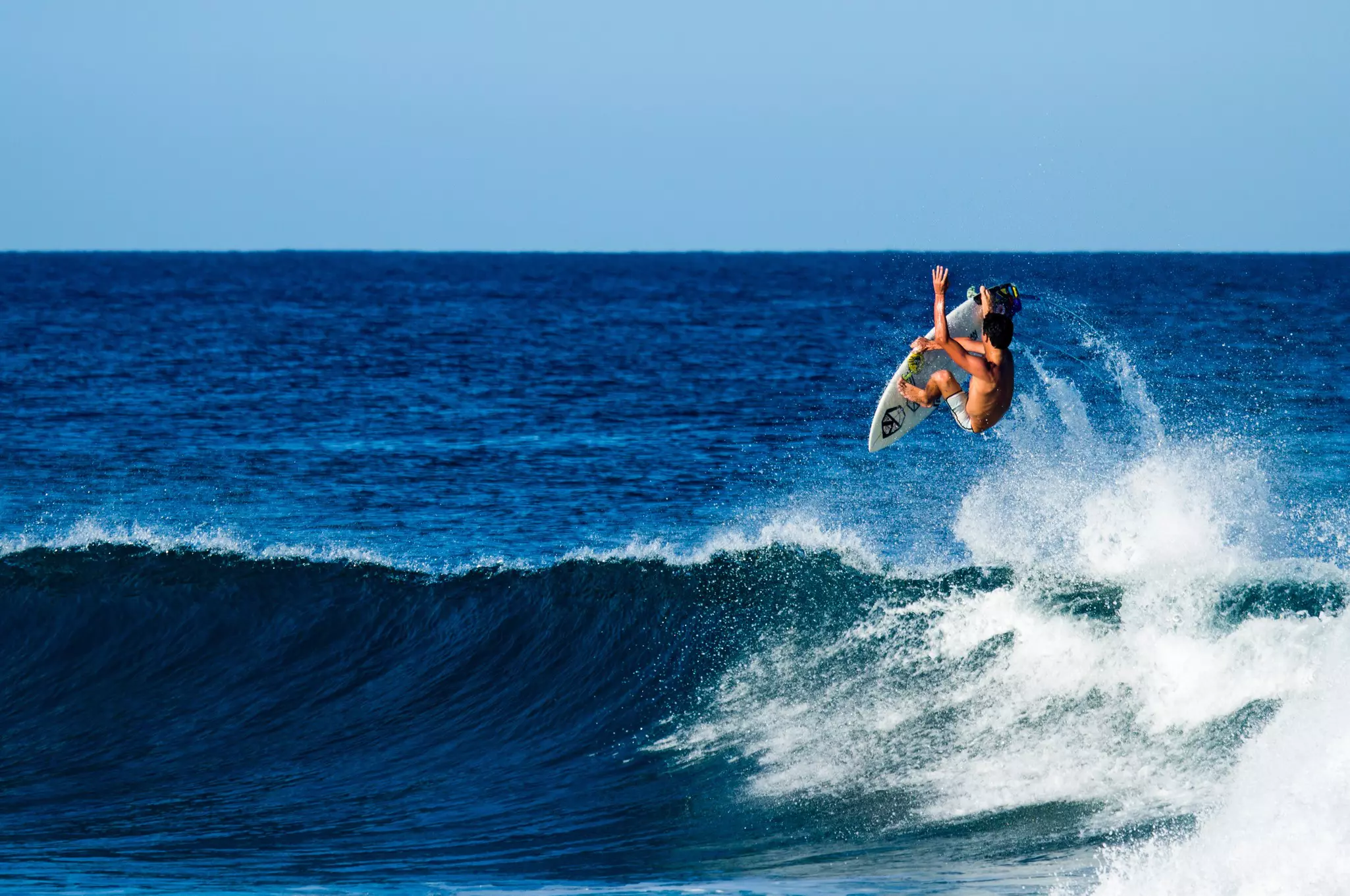
Ever since Domes Beach in Rincón hosted the 1968 World Surfing Championship, surfers of all levels have been flocking to northwestern towns such as Aguadilla, Rincón and Isabela to take advantage of the warm Atlantic waters and catch some of the tallest waves in the Caribbean. Puerto Rico’s surf culture is quite laid back and you'll learn a lot chatting to the surfers who spend their days riding these thrilling breaks. While the Atlantic tends to be a little unruly, the sun rises early and the crystalline water makes it easy to spot the currents so you can make the best of your surf session. Gas Chambers and Crash Boat Beach in Aguadilla offer waves that range from 1.5 meters (5ft) in the summer to 6 meters (20ft) during the winter months. These make for a killer ride, and in between sessions you can take in great views and visit the ruins of a pier formerly used by the US Air Force. If you just want to admire or photograph some big swells and the surfers who ride them, come for the Corona Pro Surf Circuit.
Planning tip: Private and group surfing lessons are available at many local surf schools. Check out the classes run by Surf Lessons Puerto Rico – owned by pro-surfer, Ramse Morales – and PR Surf Adventures in Aguadilla.
The lush, green Corredor Ecológico del Noreste spans six of the most beautiful municipalities in the northeast of the island. This protected nature reserve offers a chance to bike, boat, surf or drive along roughly 3000 acres of virgin coastline, taking in the lovely beaches at San Miguel, La Selva, Las Paulinas, El Convento and Colorá. The coastal forests provide a habitat for bird and animal life, including manatees and leatherback turtles, which nest on the beaches here from March to August. The corridor also spans the municipality of Río Grande, home to the El Yunque National Forest, the towns of Luquillo, Fajardo, and Vieques, and Culebra's islands, which you can visit by ferry. Dating from the 16th century, the town of Loíza and its citizens are the keepers of some of the most charming traditions in Puerto Rico. If you happen to be there in July, take part in the Fiestas de Santiago Apóstol, celebrating Loíza’s patron saint. Participants don colorful, traditional vejigante (demon) masks with three horns and dance the bomba, while artisans sell local crafts.
If you’re an avid cyclist, head to the Piñones area on Road #178 along the east coast, where you can feel the wind in your hair as you ride along some of the wildest, most undeveloped coastline on the island. The Piñones Trail runs through mangroves and oceanfront forests, and below sea level, so you may have to climb a small hill of sand to get to the beaches. Take some mosquito repellent, particularly in the afternoons and at sundown. Stop at one of the kiosks along the way for some of the best Puerto Rican snacks – including bacalaítos (cod fritters), empanadillas de jueyes (crab pasties) and alcapurrias de camarones (shrimp fritters). Rather than stopping at the first kiosk you see, ride further down the road to El Boricua. The line will be long, the wait may be longer, but the flavors are worth the time commitment – the alcapurrias here are made to order by hand with plantain leaves. It's also worth sticking a bathing suit in your bag because en route is Vacía Talega, one of Puerto Rico's best – but lesser-known – beaches. With clear turquoise waters, this arc of uncrowded, palm-backed sand is a real find. Be wary of rip currents here. If the locals aren't swimming, skip the dip.
Located inside the VIVO Beach Club on San Juan's Isla Verde Beach – one of the most beautiful stretches of white sand in Puerto Rico – Ocean Lab Brewing Co is the place to come for premium craft beers and a picture-perfect drinking location. There's a full menu too; the chicken longaniza sliders and fried whole snapper fish come highly recommended. The trade winds coming from the east bring soothing breezes, and beers made with local ingredients like passion fruit, grapefruit and blood orange will leave your taste buds, imploring you to move to the Caribbean. Serious beer enthusiasts can take a brewery tour and get a first-hand look at the brewing process. Call ahead for tour hours.
Adrenaline lovers rejoice! Deep in the mountains of Orocovis lies Toro Verde, one of the biggest and best adventure parks in the Caribbean. The brave can ride ziplines such as The Monster, a 2.5km-cable (1.5-mile) that whooshes across the forested slopes, reaching speeds of up to 152.8 km/h (95mph). It's no exaggeration to say that you’ll get a bird's-eye view of the island. The rest of the park is a wonderland for adventure lovers, with thrilling rock climbing walls, rope fields, obstacle courses, hanging bridges, free falls (with safety gear, of course), suspended cycling and moonlight tours.
Planning tip: Reservations are essential for The Monster and you should wear closed-toe shoes.
Explore related stories