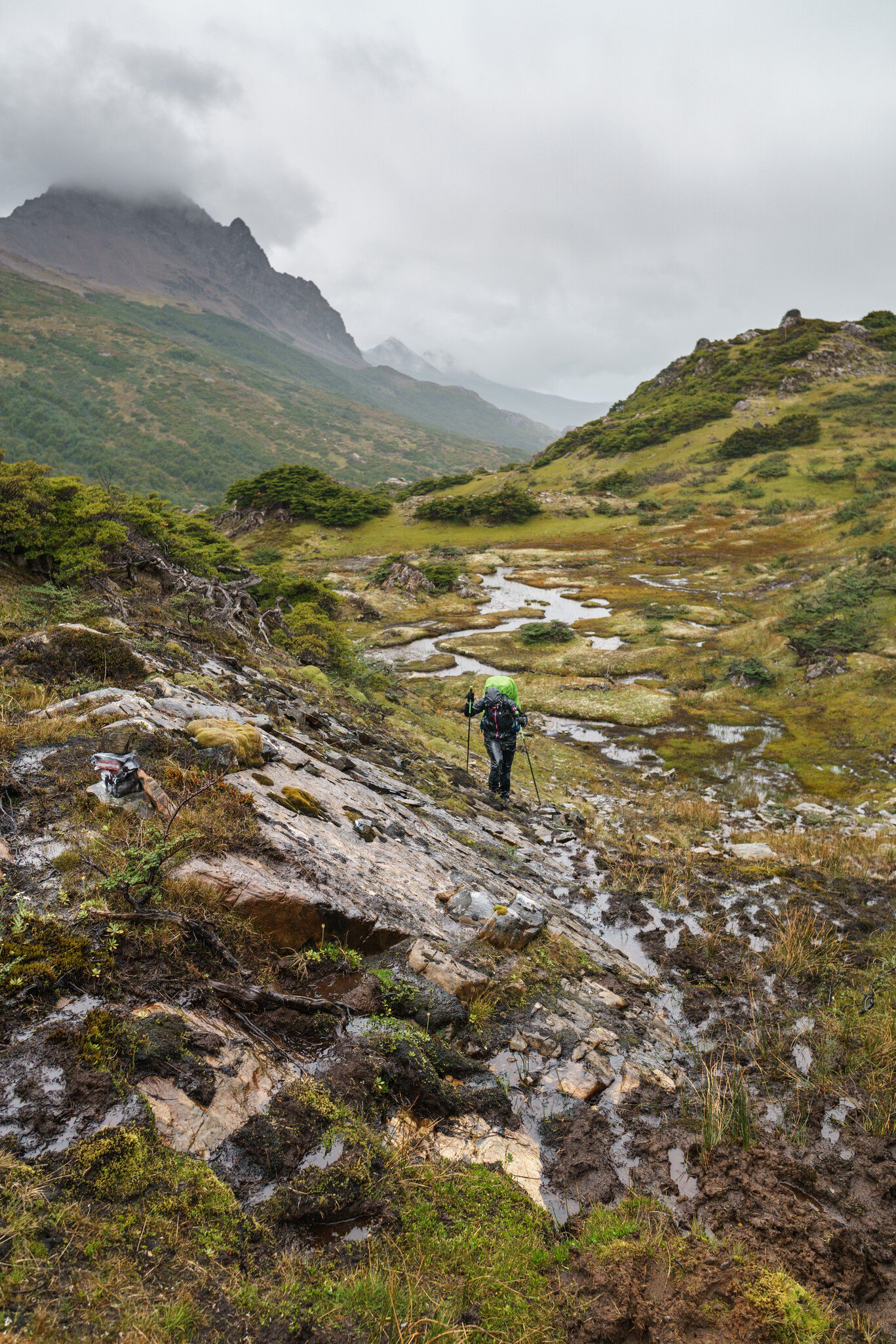
The second-largest island in the Tierra del Fuego archipelago has become very popular in recent years. Home to what's technically the southernmost city in the world, Puerto Williams (which is regarded as a city despite its population of around 1800 people because it's the seat of its territory), Chile's Isla Navarino is an integral part of the archipelago’s history, and filled with exhilarating activities.
Getting There
The only direct way to reach Puerto Williams from Ushuaia is to take a ferry at the Puerto Turístico. There are a few different operators on the Argentine side, all of whom charge US$160 per leg (the round trip costs US$280). There's only one crossing in each direction every day, so you have to spend at least one night in Puerto Williams. The crossing itself is a 40-minute adventure through the Beagle Canal until Puerto Navarino in Chile, where you transfer to a van and drive along the scenic coast for around 50km before reaching Puerto Williams. The vessel is a small yacht; bicycles are allowed (with prior notice), but nothing larger. Crossings are daily in summer (weather permitting), but reservation-only in winter. Either way, make sure to book at least a week in advance as spots do fill up and cancellations can happen when the channel is too windy. Tickets don’t include the Argentine port fee (US$10) or transport to the Puerto Turístico.
Dientes de Navarino
Often called the southernmost trekking route in the world, the Dientes is a five-day, 50km odyssey up and down mountainous terrain and sub-polar forests and looping around the otherworldly riches of the very end of the Andes mountain range. Each day of the circuit has only 10km of walking, but the terrain can be quite challenging, with steep, rocky mountainsides and muddy, boggy spots. Equipment, experience, preparation and willpower are essential.
Navarino weather is even more unpredictable than Ushuaia weather, so adventurers should be ready for snow, heat, rain and sleet – sometimes in the same day! There are no shelters, only campsites; make sure to pack a GPS – you can rent one from Comercial Antártica (comercial-antartica.cl) in Puerto Williams – and a satellite-enabled phone. Tour operators like Errante Ecolodge (errantecolodge.com/home) and Explora Isla Navarino (exploraislanavarino.com) often lead small groups of about six people for around U$S1000 per person, and the support and experience of a tour guide is advisable on the route. Make sure to register your departure and return at the Puerto Williams Presidential Delegation.
The route is circular, and takes you through the proverbial "teeth" (dientes) of the Navarino mountains into the lake-filled valleys beyond, where you'll look out onto the southern end of the island and towards the cluster of islands that make up Cape Horn before you head back north. Antarctica will feel just out of reach. The especially adventurous can sign up for the once-yearly Navarino Trail (navarinotrail.com), an ultra-running event that takes place in January and in which participants run through either the whole 50km circuit or half in a single day, taking advantage of the extensive sunlight available. Now that’s a jog you won’t forget!
Cerro Bandera
The first landmark of the Navarino route, Cerro Bandera is a medium-difficulty hike up to the eponymous mountain that's topped with a gigantic Chilean flag (bandera), which gives it its name. To reach it, head up the Camino de la Cascada until you encounter a big statue of a virgin. Head left and continue upwards until you reach a bifurcation and follow the signs. The trail takes you through an almost mystical forest of century-old lenga, ñire and coihue trees, rising to an elevation of around 600m. Look closely and you might spot a red-headed woodpecker or a kingfisher shuffling between the branches. When you get to the top, the entire Beagle Channel will be spread out below your feet if the clouds aren’t in the way, with the azure Laguna Róbalo right behind. Cerro Bandera is ideal for travelers who don’t have the experience, budget, time (or foresight!) to hike the full Dientes de Navarino, and can be completed in half a day.
Museo Territorial Yagan Usi
Formerly known as the Martín Gusinde Museum, after the Austrian priest and ethnographer who started its collection, this well-curated anthropological museum (museomartingusinde.cl; free) tells the story of the colonization of Tierra del Fuego and provides unparalleled insights into the lives of the Yahgan people who inhabit the southern reaches of the archipelago. A central atrium holds life-size recreations of Yahgan hunting and sailing tools and is surrounded by a rotating art or photography exhibit. Two floors contain meticulously classified and explained remnants of tools and weapons, which are sometimes thousands of years old, and tell you how the Yahgan and other indigenous inhabitants made it to the area. Most memorable are the interviews with some of the last native speakers of Yahgan language. The museum documents the contemporary community’s ongoing relationship to the region and efforts to repair the damage made by centuries of colonial exploitation. Ask the museum attendant to access the Casa Stirling, the oldest standing edifice in the archipelago – an English pre-fabricated building assembled in 1871 by Anglican missionary Waite Hockin Stirling.
Parque Etnobotánico Omora
Omora is the Yahgan word for "hummingbird," the bird regarded as heroically willing to aid those in need. Isla Navarino has an unrivaled, unspoiled biodiversity, with dozens of bird and plant species as well as an astonishing variety of lichens and mosses. Tours of the park (capehorncenter.com/parque-omora; U$S13) provide a magnifying glass and set off along one of the interpretive trails, designed to teach visitors to appreciate the often invisible but thrilling varieties of life that are only found in the extreme ecosystem of Tierra del Fuego.
Puerto Toro
Founded in 1892, home to two dozen people and reachable only the last Sunday of every month via the supply ferry (though this can vary – contact the Presidential Delegation Office to verify the schedule in advance), this is the southernmost community in the world. Inhabited by Yahgan people and fisherfolk, the magical village at the end of the world has a church and a school and little else, but the feeling of silence and isolation is unforgettable. The ferry is free with advance registration at the Presidential Delegation Office, and the journey takes around two hours, with around an hour spent in the village before returning to Puerto Williams.
Cape Horn
Only the most adventurous will set off on a sailboat or yacht towards the true southern tip of South America, where Spanish sailor Francisco de Hoces was blown off course from the Magellan Strait by a storm in 1526. The journey is available from operators like Turismo SIM (simexpeditions.com), but only in the summer when the weather is comparatively mild, and excursions can take anywhere from five to 10 days depending on the specific route and itinerary.