Sep 4, 202516 min read
The 15 best things to do in BelfastSep 4, 2025
16 MIN READ
Writer
Lonely Planet may earn a commission from affiliate links on our site. All recommendations and reviews reflect our own independent opinions.
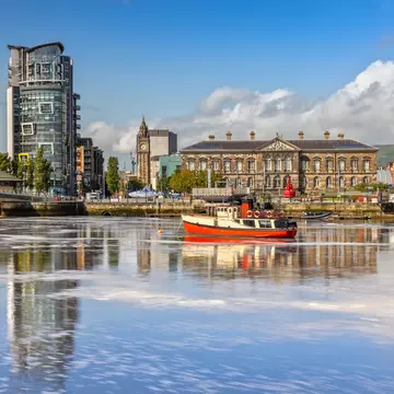
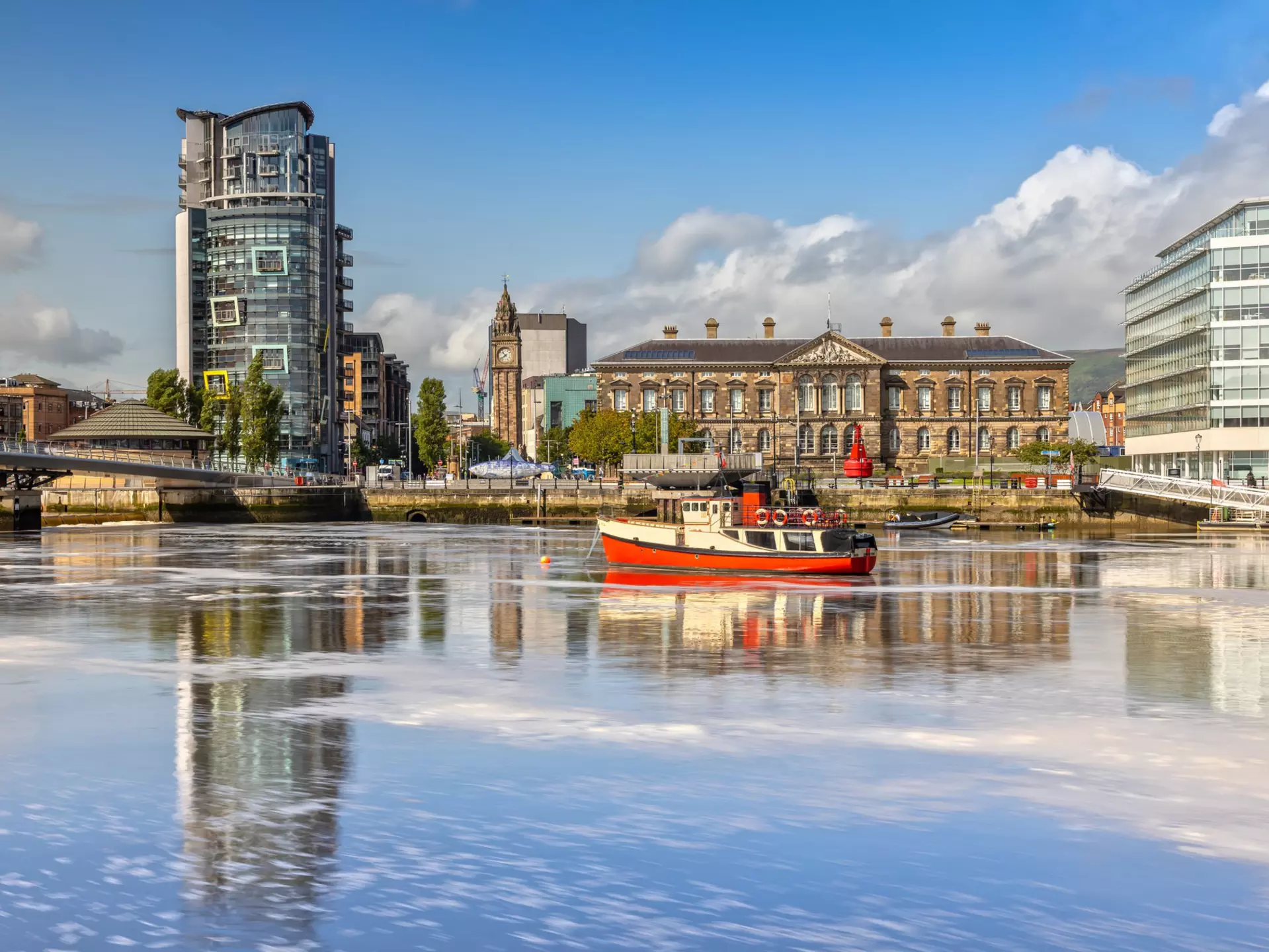
The Custom House on the River Lagan. Susanne Pommer/Shutterstock
Writer
Small, idiosyncratic Belfast has long punched above its diminutive weight in terms of cultural impact – the hometown of George Best and Van Morrison, the RMS Titanic and Harland & Wolff shipyard, and deeply politicized murals enlivening brick gable walls. This rejuvenated capital of Northern Ireland reflects on, rather than shies away from, its history.
The Belfast of today has a thriving performing arts scene and a nightlife that fuses haute cuisine with cozy pubs and Irish folk music. Museums and tours nourish history buffs, while enthusiastic hikers can find nature on the city’s doorstep. And though locals might bemoan the rising price of a pint, Belfast remains an affordable travel destination for most travelers.
Plan your visit to Belfast and check out the city's top activities.
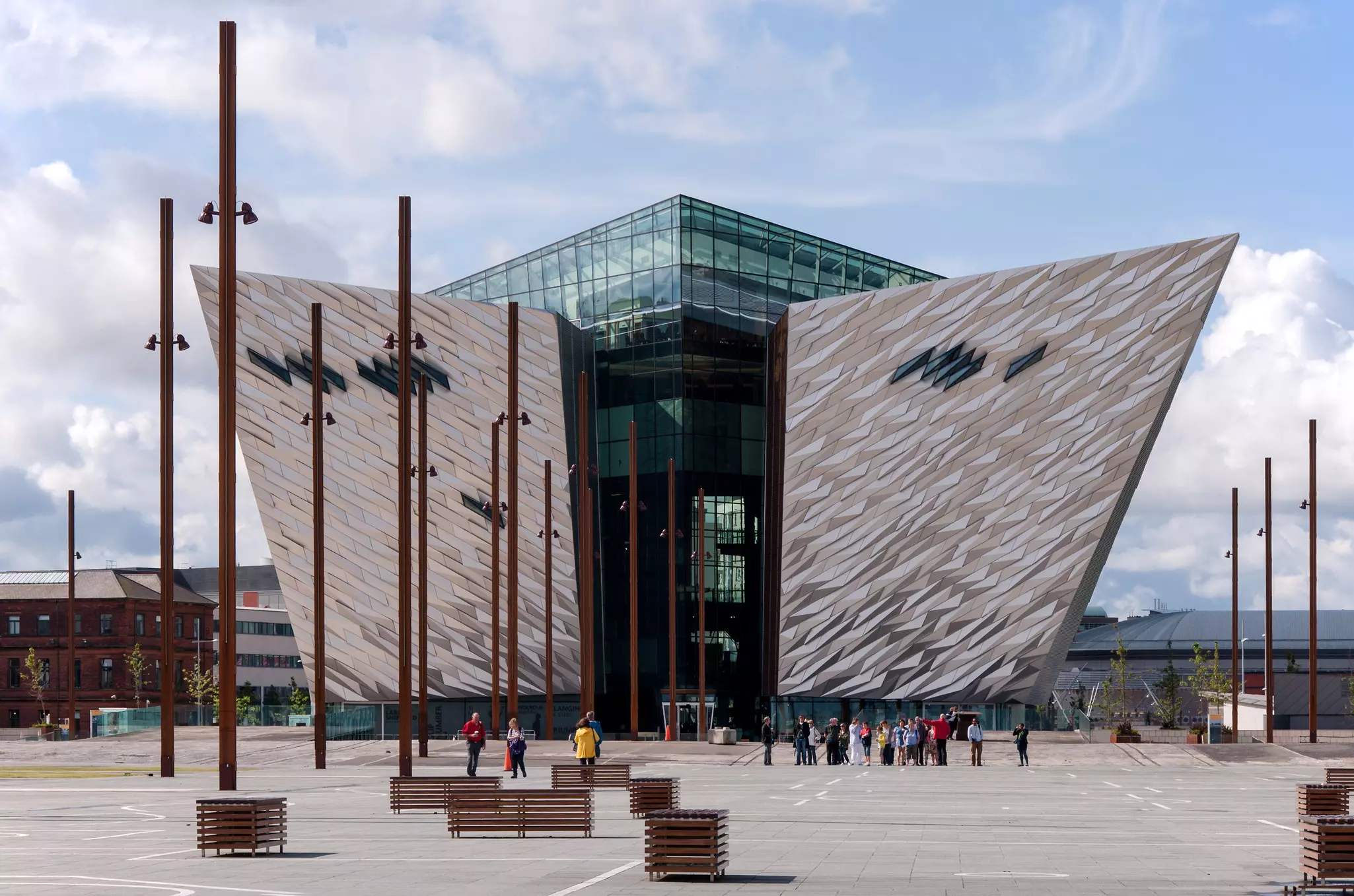
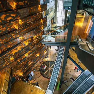
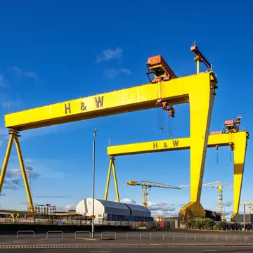
The Titanic Belfast museum, rising from the grounds of the Harland & Wolff shipyard, is much more than a maritime showcase. Its interactive exhibitions chart a comprehensive exploration of Belfast’s history, from an 18th-century trading town on the River Lagan – Belfast’s original name, Beal Feirste, means "Crossing of the River" – to the industrial explosion that gave rise to world-leading shipbuilding, rope making, and linen and tobacco manufacturing. The journey culminates with a deep dive into the RMS Titanic, whose ill-fated Atlantic voyage in 1912 eventually crippled the city’s top industry. The central hub of Belfast's burgeoning Titanic Quarter, the museum is nestled under the watchful gaze of a pair of yellow cranes named Samson and Goliath.
Planning tip: Set aside a few hours to meander through the five-story Titanic Experience tour and then walk along the harbor. Don't miss exploring the SS Nomadic, the last remaining White Star Line ship in the world, which is included with a museum ticket and is docked right outside.
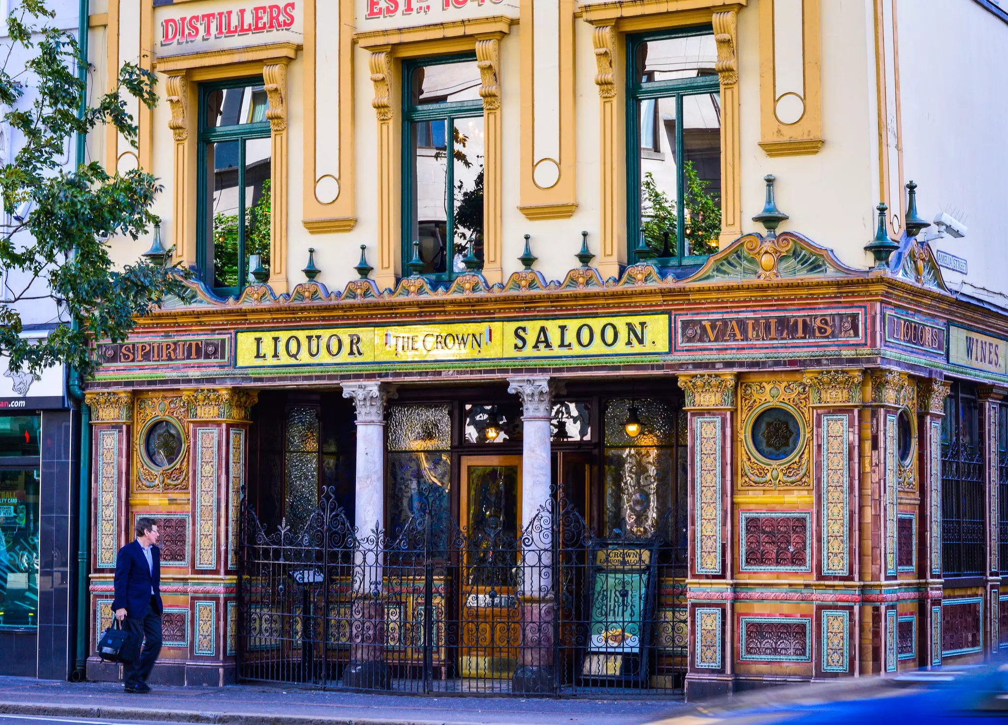
Not only is The Crown a Belfast monument but it is also a pub with an intricate interior to admire as you drink. The Crown was refurbished in the late 19th century to appeal to commuters and theatergoers. The exterior is decorated with ornate tiles, and a crown mosaic marks the pavement at the bar’s entrance, and inside, a maximalist expression of colored glass, marble, ceramics, mirrors and mahogany. Along one side of the pub is a long bar, and the other lines up a row of wooden snugs, complete with paneled doors that bolt closed for privacy. These cozy booths still have gunmetal plates, originally used for striking matches, and bells that once allowed drinkers to order without leaving their seats. Atmospheric gas lamps and a carved ceiling further add to the sense of history.
Planning tip: Another Victorian landmark, the nearby Grand Opera House has a similarly inspiring interior. It is the go-to venue for large-scale productions, including West End and Broadway shows as well as Belfast-vernacular pantomime and Disney musicals. The best way to experience its grandeur is by attending a performance, but you can also take a glimpse backstage on a guided tour and see the fancy gilt work and painted ceiling panels.
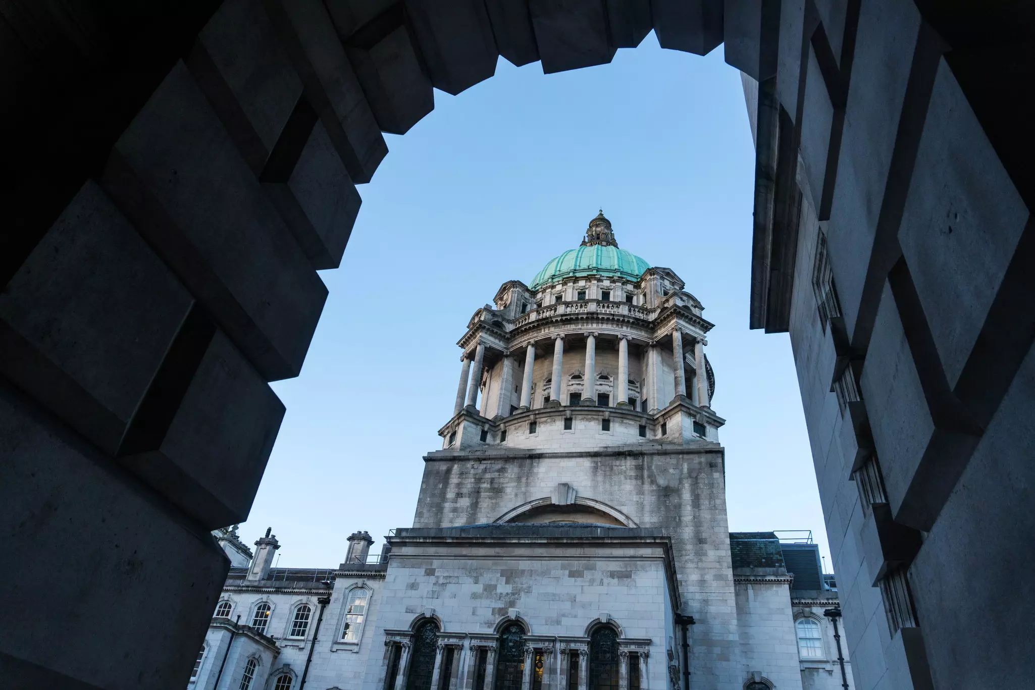
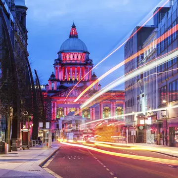
Everywhere you look in Belfast, architecture tells the story of the past, and the late-19th-century industrial boom is no better reflected than in the Renaissance-style City Hall, which was commissioned after Queen Victoria granted Belfast city status in 1888. Much of the interior can be seen during free guided tours.
Visits begin at a grand staircase leading to the rotunda, which has Greek columns, Italian marble and stained glass windows. Each of the windows along the northeast corridor commemorates a significant moment or group in the city’s history. One of the most moving marks the suffering of Belfast's citizens during the Famine (1845–51). Also look out for the painting The Founding of Belfast by Irish artist John Luke, which depicts Belfast in 1613 with Cave Hill in the background. The ground floor exhibition has displays on Belfast’s history and culture; artifacts include a sideboard intended for the captain’s quarters on Titanic.
Planning tip: After the tour, take a stroll around the grounds. A bronze statue of Queen Victoria is accompanied by figures representing education and Belfast’s textile and shipbuilding industries, and a memorial to the Titanic lists the names of the more than 1500 people who died when the boat sank in the North Atlantic.
Film and TV production have become pillars of Northern Ireland's economy, and the primary catalyst was HBO’s Game of Thrones. Filming locations for the blockbuster fantasy series are littered across the country, and major scenes were shot in Belfast studios, so visitors to the city can also travel to the places where fictional Westeros once became a reality.
Start with a walking tour that connects six stained glass scenes from the series, like John Snow wielding Longclaw near the waterfront AC Hotel and the Lannisters’ bloodthirsty reign near the decommissioned naval cruiser HMS Caroline. The 1.5-mile route is a great way to stretch your legs early in the day.
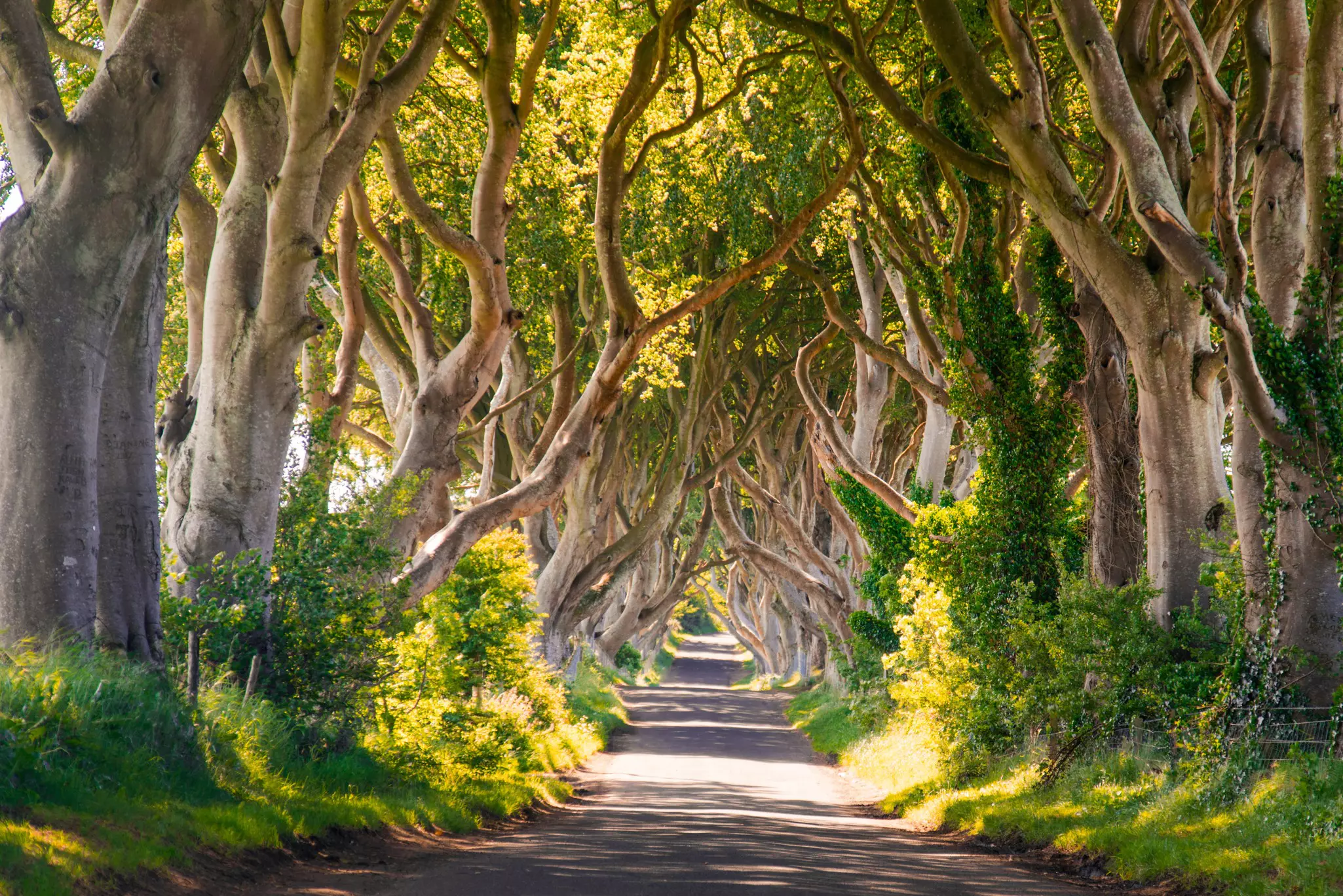
Next head to the cobblestone lanes of the Cathedral Quarter to commence the Journey of Doors. When a 2016 storm felled some trees along the Dark Hedges – known to GOT fans as the King’s Road – wood from two toppled beeches was used to build 10 doors with Game of Thrones iconography that were installed at public establishments around Northern Ireland. Grab a table at The Dark Horse and look for a door bearing the Lannister lion rising above Great Sept of Baelor.
Detour: Set aside a morning to take a tour at Linen Mill Studios in Banbridge, 25 miles outside Belfast. Showcasing sets, props, weapons, costumes and visual effects from the show, it’s required visiting for serious fans of George RR Martin’s fictional world.
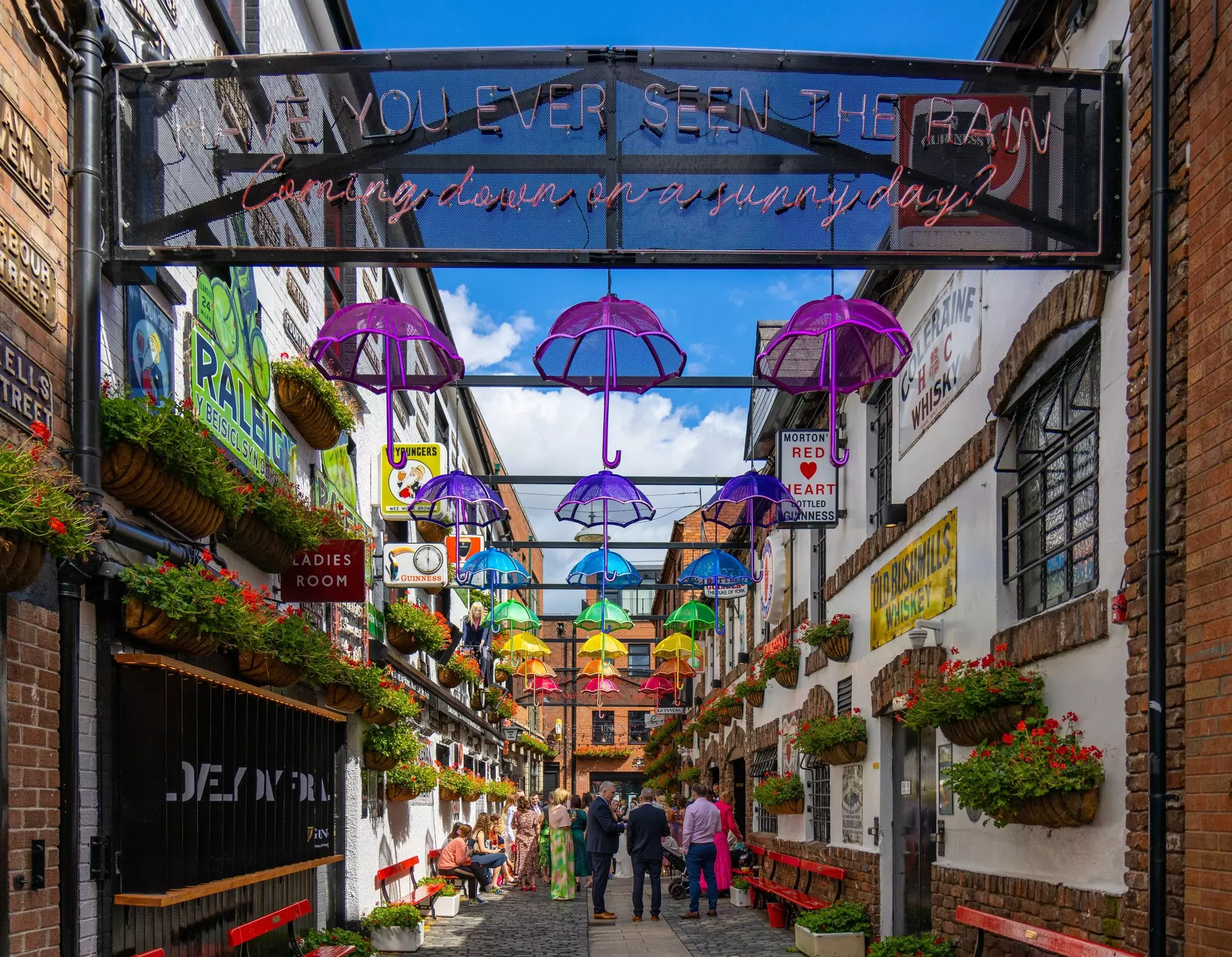
Some of Belfast's most iconic bars are centered around a narrow walking street in the Cathedral Quarter, in the heart of the city. Grab a pint at The Duke of York, a pub whose cramped confines are filled with hand-carved mirrors, chattering imbibers and ephemera from the nine counties of Ulster. Snow Patrol, one of the most successful bands to emerge from Belfast in recent years, played some of its first gigs here.
On long summer evenings, retreat to the beer gardens at The Thirsty Goat or The Dirty Onion (patio heaters and awnings included). The Harp Bar is roomy and chic, with excellent live music throughout the week and Irish Harp lager on tap. Muriel’s is a suave hideout for craft spirits and artisanal cocktails.
Detour: Stroll past the Umbrella Passage mural portraying famous local faces crowded around a table under a canopy of umbrellas, and St Anne’s Cathedral, the grand edifice from which the area gets its name.
As the late Northern Irish poet Seamus Heaney once opined, “The end of art is peace” – a sentiment the Belfast black taxi tour echoes. In the backseat of a black cab – many of which appeared during the early days of the Troubles due to a lack of public transportation in North and West Belfast – you’ll cross through some of the most divided of the city’s neighborhoods and past a tableau of murals borne out of the late-20th-century tensions.
Key figures in the fractured sociopolitical landscape – the hunger striker Bobby Sands, unionism symbol King William of Orange, paramilitaries on both sides of the unionist-nationalist divide – are portrayed in the murals. Each offers a visual aid to understanding the complex history of the Troubles-era Belfast. You’ll also swing by the peace walls around which the conflict was once at its most violent and which still divide two ostensibly opposed sides of the community.
Planning tip: These intimate and often entertaining tours can vary in content and often reflect the personal experiences of the driver. Tours are offered by a number of taxi tour companies and local cabbies, as well as through the Visit Belfast welcome center and Crumlin Road Gaol.
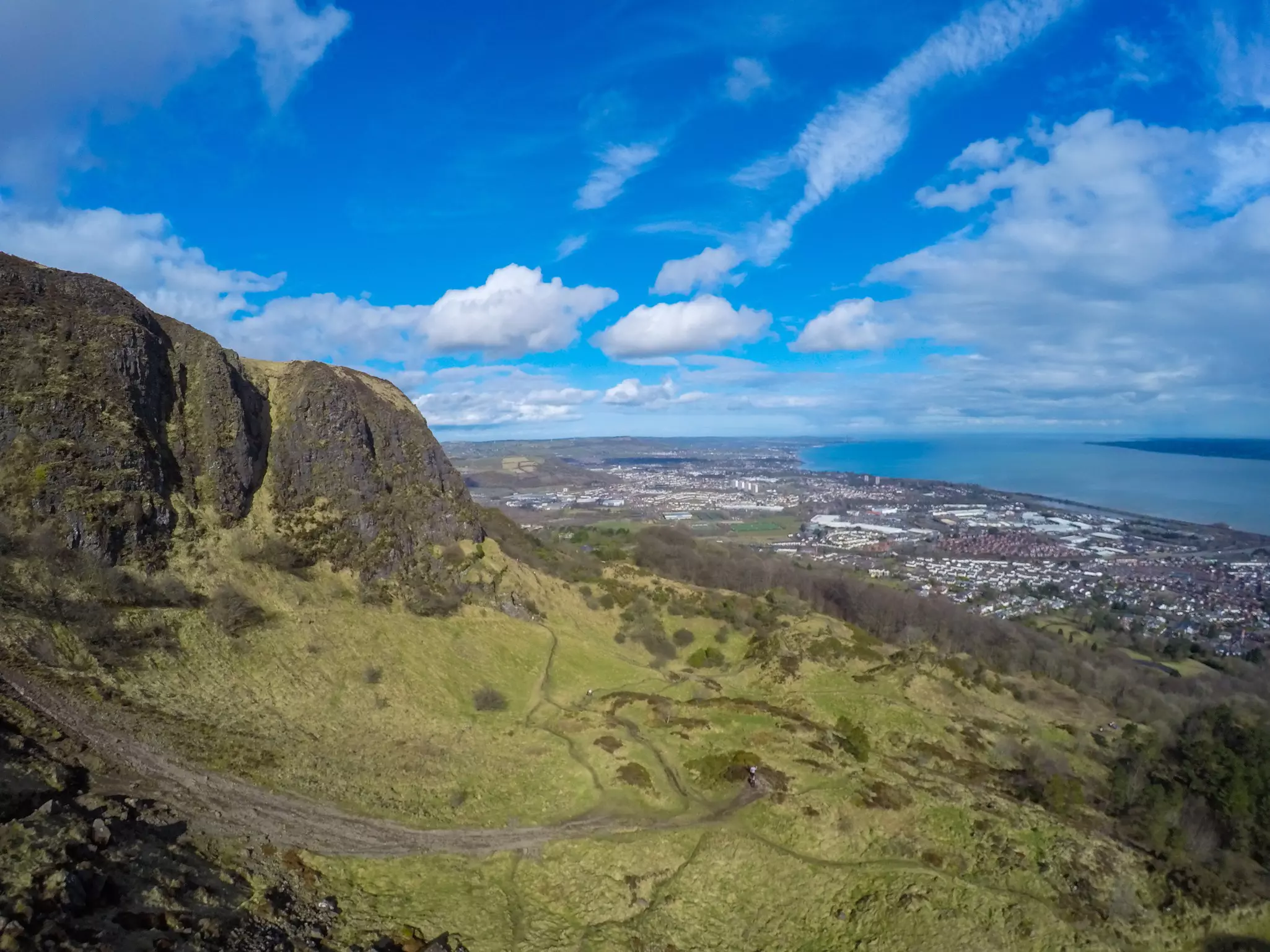
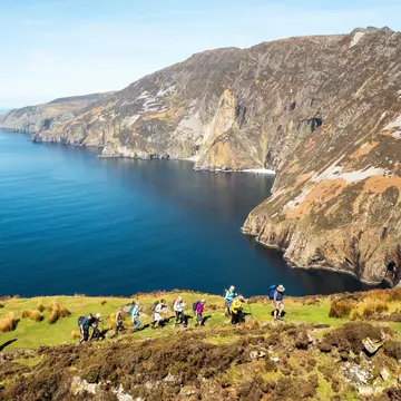
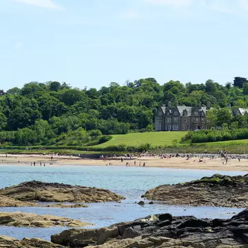
When the weather’s on your side (invariably difficult to predict, irrespective of the time of year you visit Belfast) take a hike up Cave Hill, which rises a humble 368m above the low-lying city. The most famous of Belfast’s surrounding cliffs, it also goes by the colloquial epithet Napoleon’s Nose, due to a sharp profile that resembles the former French leader's. (Some also credit this profile as the inspiration for Jonathan Swift’s sleeping giant in Gulliver’s Travels.)
A 4.5-mile round trip, starting and finishing at Belfast Castle, is the optimal course. En route you’ll pass by the Devil’s Punchbowl (a large hollow set below the eponymous caves), where McArt’s Fort once stood, and views of Belfast Lough to the east and the Mourne Mountains in County Down to the south. On a clear day, the Isle of Man and the western tip of Scotland are also visible.
Planning tip: The walk rarely gets too congested, but New Year’s Day and Boxing Day are favored brisk mornings for sweating out the festive cheer on Cave Hill. Solid footwear is recommended.
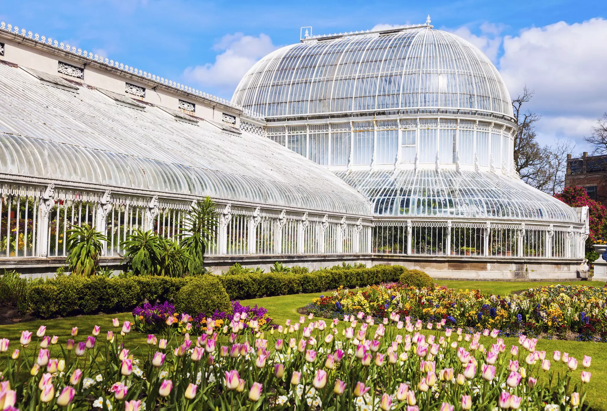
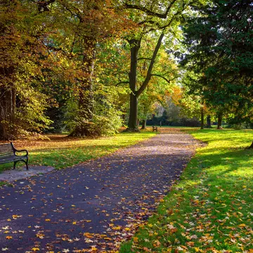
From the Botanic Gardens to the manicured grounds of Queen's University and five floors of galleries at the Ulster Museum, Queen’s Quarter is a leafy neighborhood with elegant architecture and a bookish vibe.
Enter the Botanic Gardens through the Stranmillis Rd gate to see the Lord Kelvin statue, which celebrates the Belfast-born physicist who invented the Kelvin scale, a measure of temperatures from absolute zero. From there, spend some time exploring the free museum before strolling through the gardens. Be sure to take a look at the glass-domed Palm House and brick Tropical Ravine greenhouses before walking north, stopping where you please for coffee (try Kaffe O) or lunch (try Maggie Mays Cafe Botanic, Tribal for burgers or Umi for falafels). Browse the shelves of independent bookstore No Alibis, or catch a film at the art house cinema Queen's Film Theatre.
Local tip: Lisburn Rd makes a pleasant destination for shopping, with stops for coffee and lunch. Maven and Bedeck are both worth a look for home wares, while Arcadia is an independent deli crammed with local produce. One of many options for lunch is La Bottega, an Italian cafe, bistro and deli with excellent cannoli.
Over the past decade, East Belfast has been subject to a variety of rejuvenation projects, most notably CS Lewis Square, an homage to the creator of the fictional world Narnia, who was born in Belfast, and a portal to the other side of his most famous wardrobe. Characters in Lewis' best-selling series are revealed in statue form.
Local tip: Three blocks west, at the Portview Trade Centre, is Boundary Brewing, a cooperative that produces highly rated ales and lagers on-site. Head to the tap room to sample the range or book ahead for brewery tours. Coffee roaster Root & Branch also has its roastery and espresso bar here. At the same complex, Banana Block is an innovative commercial and community events space in a former linen mill. Outlets include cheesemakers Velo Cheese and the record shop Sound Advice.
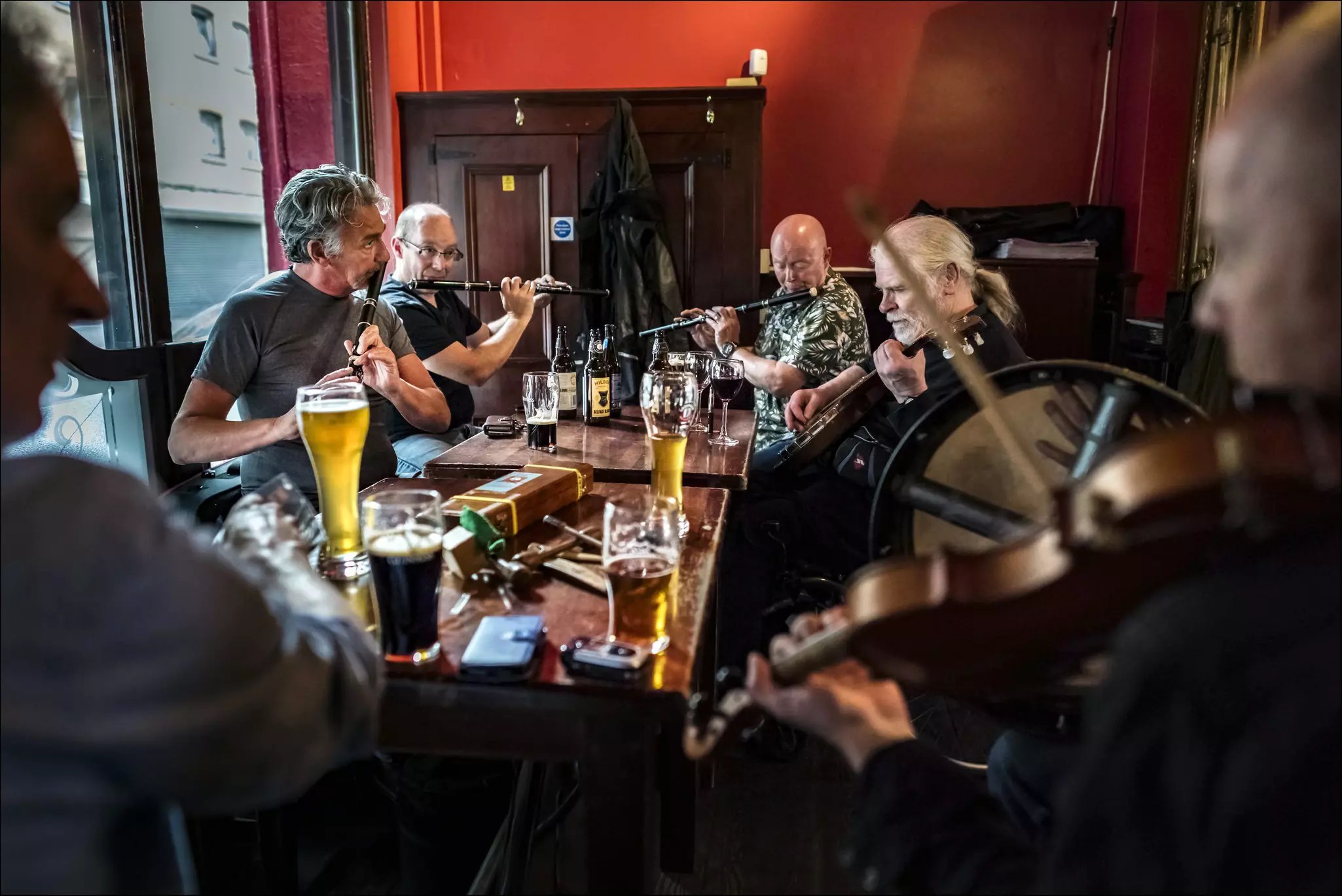
Belfast’s Celtic roots ensure that the live music scene is baked into the nightlife culture. Some of the city's best gigs are held at The Black Box, Oh Yeah Music Centre and Sunflower Public House. Downstairs at The American Bar there are folk music sessions and a Saturday afternoon blues club. For authentic trad sessions, head to John Hewitt on Thursday nights and Sunday afternoons, when local musicians gather around a table to play.
Fibber Magee and The Points are two more solid spots for trad and folk music seven nights a week, while The Duncairn, a special venue in a former church in North Belfast, has great acoustics. At the Merchant hotel, Berts Jazz Bar has nightly jazz performances in an elegant setting.
Planning tip: It is worth checking out what's on at 2 Royal Avenue, a cultural space in a listed heritage building in the city center where you can watch live music, borrow books or even bring your own indoor picnic.
Northern Ireland has a rich sporting heritage, and watching one of the local professional teams in action is an exhilarating way to kick off a night on the town. The home of Ulster Rugby, still affectionately known by its previous name, Ravenhill, accommodates 18,000 spectators and typically welcomes a full house for Friday evening and Saturday afternoon games. Guinness is served on tap in the beer tents, while The Errigle Inn and The Pavillion (sometimes called the Big House) bars on nearby Ormeau Rd are popular haunts for prematch tipples and postmatch celebratory toasts.
Windsor Park, now known as Clearer Twist National Stadium at Windsor Park, is Northern Ireland’s home football stadium in South Belfast. The Kop end of the stadium – officially, the West Stand – has one of the best atmospheres in global football, evidenced by the Medal of the City of Paris awarded to Northern Irish fans during the 2016 UEFA European Football Championships. Tickets at Windsor Park are hot commodities during Euro and World Cup qualifying campaigns.
Planning tip: Ice hockey doesn't garner the same levels of fandom in Belfast as its field sports counterparts, but catching a Belfast Giants game at the SSE Arena’s ice rink is a surprisingly fun night out. The sport is equally thrilling and abrasive, while the lively atmosphere caters well to families.
It's easy to eat well in Belfast and in the most refined manner at the city's two Michelin-starred restaurants.
The Muddlers Club is hidden down a cobblestone entryway in the Cathedral Quarter and specializes in creative tasting menus using homegrown produce. The kitchen is partially open to the dining floor, creating a sense of theater within its urbane confines, while the mixologists pay as much attention to detail for the cocktails as the chefs exercise toward the food.
OX, awarded its first Michelin star in 2016 and retained ever since, was started by a chef duo who underwent culinary tutelage in Paris. Elegant seasonal tasting menus are the order of the day, alongside wine pairings and beer, cider and spirits from around Ireland.
Planning tip: To sample a comforting bowl of Irish stew with meat and potatoes or a seafood chowder, try White’s Tavern. For an Ulster fry (a plate of bacon, eggs, sausage and bread), head to Maggie Mays. For an entertaining introduction to Northern Irish cuisine with plenty of samples, book an excursion with Taste & Tour. The same team is behind the immersive cocktail experience at The Spirit Circle, based at the National Bank building on High St.
St George’s Market in the city center, open from morning to early afternoon Friday through Sunday, is Belfast’s premier permanent market space, crammed with stalls selling vintage clothing, Celtic jewelry, boutique artworks, handmade crafts and gastronomic pleasures. Though the market, situated in a Victorian building, is a mainstay of the Belfast townscape, the goods on offer are cyclical.
The Friday market, which dates back to 1604, focuses on local farming produce alongside a smattering of books, clothes and antiques. Saturday is more artisanal; arts and crafts take center stage but are joined by continental cuisine and coffee stalls. The Sunday market marries the best of both and frequently features local artisans peddling their most recent handiwork.
Vendors are mostly the craftspeople, bakers, fishers and farmers who grew, caught or created what they are selling, and they are happy to chat about their wares. Look out for meat from Hillstown Farm Shop, prebiotic foods from Amberline Preserves and mushrooms from Spore Shore. Ann’s Pantry sells buns and tray bakes, including fifteens (a snack made with marshmallows, digestive biscuits and coconut). For traditional sweets like rock, honeycomb and nougat, check out Aunt’s Sandra’s. Wash it all down with a flat white from Drop Hopper Coffee Roasters or a cup of tea at Suki.
Local tip: If Belfast BapCo is in attendance on your market day, don’t miss out on its signature offering: a crusty white bread roll filled with the ingredients of an Ulster fry.
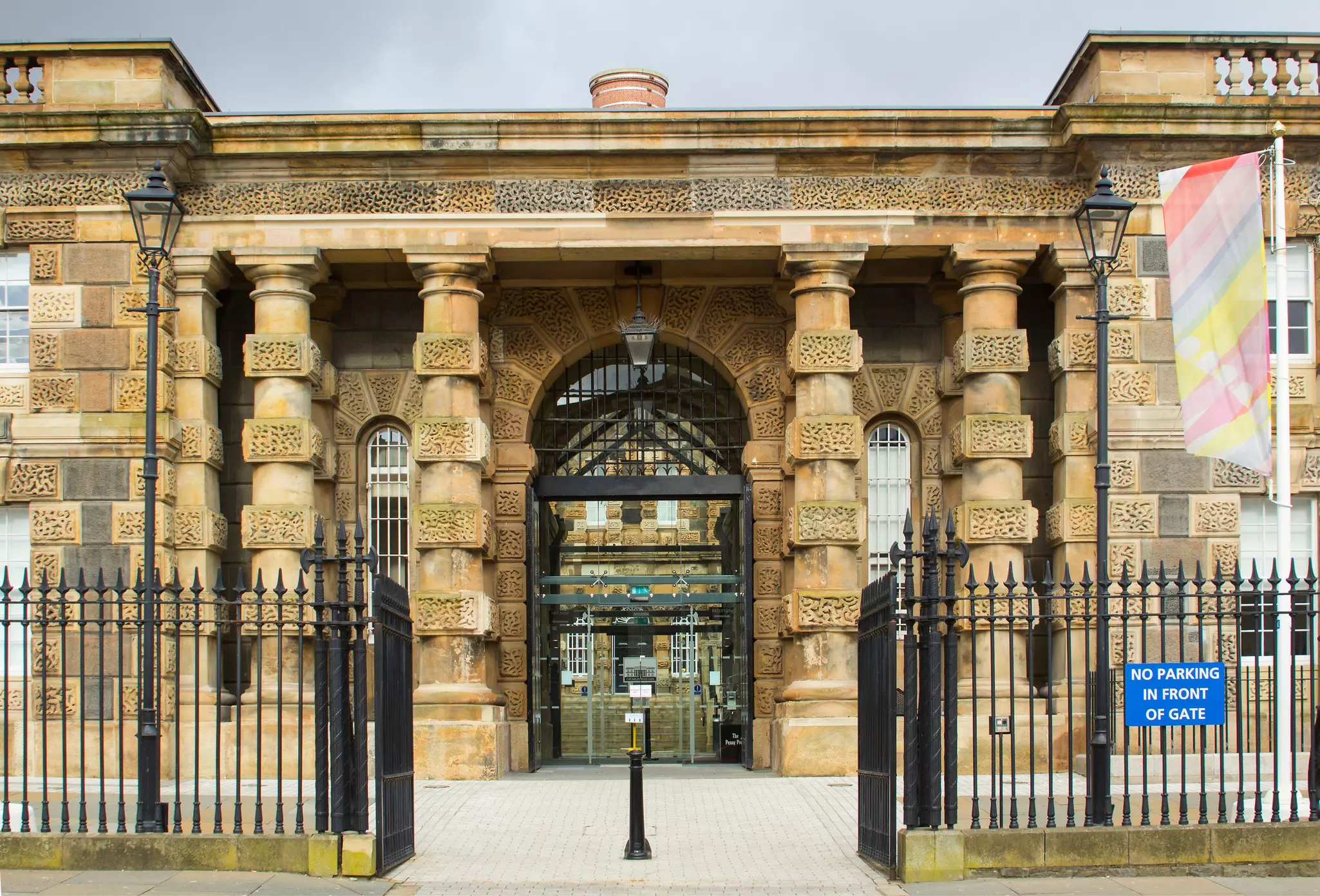
Opened in 1846, the Victorian Crumlin Road Gaol is a brooding prison that closed its doors in 1996 after 150 years of operation. Self-guided tours with audio guides and holograms are the best way to explore its cavernous tunnel, shoebox cells and macabre graveyard. From Éamon de Valera, who would go on to be Taoiseach (prime minister) of the Irish Republic, to the Sinn Féin politician Martin McGuiness and loyalist Michael Stone (who eventually attempted to bomb the Stormont parliament buildings), many high-profile figures were confined within the gaol’s walls.
Planning tip: Crumlin Road Gaol is also now used as an event space, including for cabaret nights, escape room games and weddings. A full list of events is available on its website.
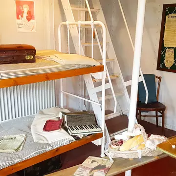
The Ulster Folk Museum, a recreated township in the rolling hills of Ballycultra on the outskirts of Belfast, is complete with thatched-roof cottages, traditional crafting sessions (including smithing and tweed weaving), shops selling period-appropriate food and trinkets, and permanent exhibitions that explore the humble residential life of early 20th-century Ulster. The Languages of Ulster project pays tribute to Northern Ireland’s linguistic roots. Guided through the museum via a booklet or app, you’ll follow the Cúl-Trá-il trail and learn about the traditions of Hiberno-English, Irish and Ulster Scots and their respective fights for survival.
Explore related stories