
Advertisement
Cyprus
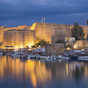
Strike out beyond the sun-soaked stretches of sand to discover an island of compelling culture and landscapes steeped in myth and riddled with ancient riches.

Getty Images
Latest Stories
- Sasha Brady|Apr 8, 2022Cyprus is the latest Mediterranean destination to ease restrictions ahead of Easter travel
- Alexis Averbuck|Nov 17, 2021Find the best time for your next Cyprus vacation with our seasonal guide
- Alexis Averbuck|Nov 17, 2021Do I need a visa to visit Cyprus?
- Alexis Averbuck|Nov 17, 2021The 15 best things to do in Cyprus: sun, sand and ancient civilizations
Book

Top places to visit in Cyprus
Discover the best attractions in Cyprus from must-see sights to unexpected hidden gems.
-
-
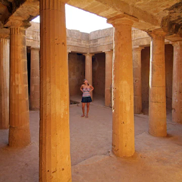 Attraction in PafosTombs of the Kings
 -
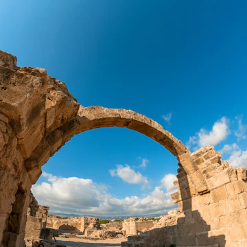 Attraction in PafosPafos Archaeological Site
 -
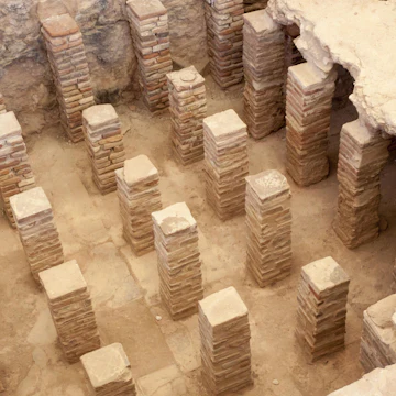 Attraction in CyprusAncient Kourion
 -
 Attraction in CyprusVenetian Walls
 -
 Attraction in CyprusHoly Monastery of St Nicholas of the Cats
 -
 Attraction in Lemesos (Limassol)Limassol Marina
 -
 Attraction in CyprusOleastro Olive Park

Advertisement
Travel Guides
Cyprus travel tips from Lonely Planet experts
Find practical guidance from our team of contributors around the world who bring their decades of first-hand travel experience to your next trip.
Best Things to Do
Cyprus offers an incredible blend of archeological sites, icon-filled monasteries and ancient houses of worship. Here are the 12 best places to visit.
Read full article
Transportation
Whether you rent a car, use the bus system or take a taxi, getting where you want to go in Cyprus is rarely a challenge. Here's what you need to know.
Read full article
Visa Requirements
Although the political situation in Cyprus is complex, it's easy to visit both sides of the island. Here's what you need to know about visas for Cyprus.
Read full article
Best Road Trips
Exploring Cyprus with your own wheels will give you time to savor attractions that you’d struggle to visit by bus. Here are the island's top road trips.
Read full article
Best Places to Visit
Cyprus offers an incredible blend of archeological sites, icon-filled monasteries and ancient houses of worship. Here are the 12 best places to visit.
Read full article
Advertisement
Cyprus and beyond
-
 destinationNicosia (Lefkosia)
 -
 destinationNorth Nicosia (Lefkoşa)
 -
 destinationPafos
 -
 destinationLarnaka
 -
 destinationLemesos (Limassol)
 -
 destinationKyrenia (Girne)
Advertisement