
Advertisement
The USA
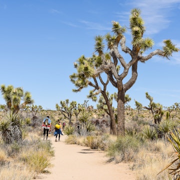
The great American experience is about so many things: bluegrass and beaches, snow-covered peaks and redwood forests, restaurant-loving cities and big open skies, and that's just for starters.

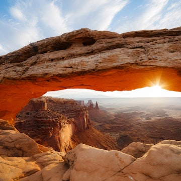
Katelyn Perry/Lonely Planet
Latest Stories
- Katelyn Perry|Jun 18, 2026A seat by the window: seeing the American West by coach
- Lonely Planet Editors|Jun 5, 2026Where to celebrate Pride in the US in 2026
- John Garry|Jun 4, 2026Best places to celebrate America 250 on July 4, 2026
- Amelia Edelman|Jun 1, 2026The best family camps in the USA for a throwback summer vacation
Book


Trusted Partner
Dreaming of The USA? Protect your trip
Travel with confidence. Protect your trip and your wallet.
We don’t represent World Nomads, we receive a fee from quotes using this link. This is not a recommendation to buy travel insurance.
Take your United States (USA) trip with Lonely Planet Journeys
Time to book that trip to United States (USA)
Lonely Planet Journeys takes you there with fully customizable trips to top destinations – all crafted by our local experts.


Top places to visit in The USA
Discover the best attractions in The USA from must-see sights to unexpected hidden gems.
-
 Attraction in CharlotteSullenberger Aviation Museum
 -
 Attraction in Moloka'iPala‘au State Park
 - Attraction in Moloka'iWaialua Congregational Church
- Attraction in Moloka'iʻIliʻiliʻopae Heiau
-
 Attraction in Washington, DCInternational Spy Museum
 - Attraction in Moloka'iChurch Row
- Attraction in Moloka'iMolokaʻi Library
- Attraction in Moloka'iMolokaʻi Museum & Cultural Center
Advertisement
Travel Guides
The USA travel tips from Lonely Planet experts
Find practical guidance from our team of contributors around the world who bring their decades of first-hand travel experience to your next trip.
Best Things to Do
If you’re looking to visit the top attractions for couples, solo travelers and families in Durham, North Carolina, start with these 12 places.
Read full article
Best Time to Visit
Choose the best time for your visit to the US with this guide to events, seasons and crowds through the year.
Read full article
Things to Know
Find essential travel tips on visas, airport security, planning an itinerary, etiquette and safety before you take off for the USA.
Read full article
Transportation
Plan your travels across the USA with this guide to everything from car hire and bus services to cycle routes and domestic flights.
Read full article
Best Neighborhoods
Few LGBTQ+ travelers can resist making a beeline to the local gayborhood. Here's our pick of the best in the US for Pride 2026.
Read full article
Best Road Trips
Road-tripping across the US is one of the most iconically American things you can do. Here are 10 of the best ways to do it.
Read full article
Money and Costs
From North Carolina to Florida, experience the best of the southeast corner of the US on this wallet-friendly road trip.
Read full article
Traveling with Kids
Here are our top picks for family-friendly trips in some of America’s most treasured national parks
Read full article
Best Places to Visit
Cities in the US come in all shapes and sizes. Narrow down your travels with our guide to the best.
Read full article
5 Shops
Independent shops in this mountain town spotlight its outdoorsy, Western and artsy vibes. Here are five of our favorite ones.
Read full article
Accessibility
With sights and infrastructure that consider mobility, visual, and hearing needs, Hawaii has worked hard to be accessible to all travelers.
Read full article
LGBTIQ+ Travel
For Pride month – or any month – these six sites crucial to LGBTQ+ history in the USA will inspire and inform.
Read full article
Advertisement
Get a book. Get inspired. Get exploring.


in partnership with getyourguide
Book popular activities in The USA
The USA and beyond
-
 destinationEastern USA
 -
 destinationWestern USA
 -
 destinationCalifornia
 -
 destinationNorthern California
 -
 destinationHawaii
 -
 destinationNew England
 -
 destinationThe Southwest
 -
 destinationSouthern California
Advertisement