The 6 best hikes in Tokyo
Aug 13, 2025
6 MIN READ

Writer
A misty trail on Mt Mitake, Tokyo, Japan. naokita/Shutterstock

Writer
Lonely Planet may earn a commission from affiliate links on our site. All recommendations and reviews reflect our own independent opinions.
Tokyo is renowned for its modern cityscape of gleaming skyscrapers and bustling, neon-lit streets, but the metropolis of 14 million people also has vast swaths of scenic countryside.
Just a couple of hours west of downtown lies Okutama, whose verdant mountains, forests and rivers make it easy to forget you’re still in Tokyo. Most of the region is within Chichibu-Tama-Kai National Park, known for its seasonal flowers that create picturesque backdrops throughout the year.
Hiking is among the best ways to explore the area’s natural gems. Many routes are accessible by public transit, and some even have dedicated cable cars.
Here are six hikes in the city limits, suitable for walkers with various levels of fitness.
1. Takao-san
Best for cultural attractions
Distance: 4km (2.5 miles)
Estimated time to complete: 2 hours
Level of difficulty: Easy
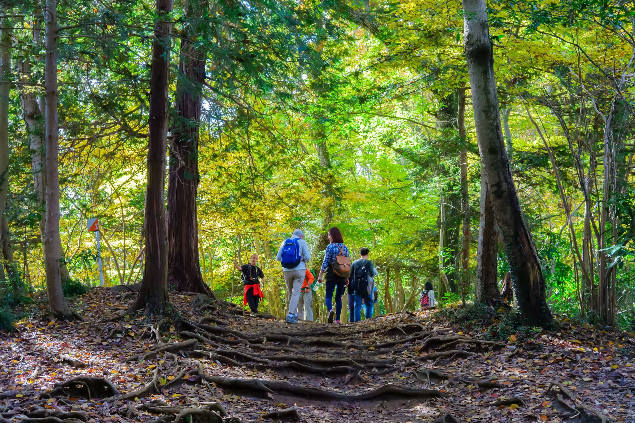
Tokyo’s most popular peak, attracting three million people annually, Takao-san offers six routes to the summit. From Takaosanguchi Station, the easiest option is Route 1, paved throughout although with some steep sections. The lower part passes through a grove of towering cedar trees, but it’s possible to bypass this section by taking the cable car or chair lift.
Sightseeing facilities include Jūichōme Chaya, a teahouse founded in 1899 that serves dango (dumplings) or soba noodles with views of the rolling forested hills below, a monkey park home to Japanese macaques and a garden with about 500 varieties of wild flowers.
Further up lies Yakuo-in Temple, where ascetic training has been practiced for more than 1,000 years. Many hikers stop here to pray to tengu (mythical beings found in nature) before continuing the climb.
The summit (599m/1,965ft) offers impressive views of Tokyo and, on a clear day, Mt Fuji. You can learn more about the local flora and fauna at the nearby Takao Visitor Center.
Local tip: Hike the additional 30 minutes beyond the summit to reach Itchōdaira, an open area that blooms with diverse varieties of cherry trees from mid- to late April. The nearby Momijidai (maple viewing platform) is a popular viewing spot for fall colors in November.
2. Hinode-san
Best for sunrise views
Distance: 3.5km (2 miles)
Estimated time to complete: 2 hours
Level of difficulty: Moderate
This 902m/2959ft peak is a popular place to view the first sunrise of the new year as its name literally means “sunrise mountain, ” but it offers impressive scenery year round, particularly in spring and fall, with only some steep sections.
Bright azaleas and rhododendrons flourish in the area from March to May while plum blossoms flower near the peak in March. Shiraiwa Falls, known for its refreshing cascades and tranquil setting, comes to life in autumn when it is framed in foliage of red, orange and yellow.
From the summit, it’s possible to view the entire Kanto Plain including the mountains of Okutama.
Local tip: On your descent, follow the signs for Tsuru Tsuru Onsen, a hot spring in the foothills of Hinode-san offering day-use baths in alkaline water that makes skin silky smooth.
3. Mitake-san
Best for pilgrim trails
Distance: 2.5km (1.5 miles)
Estimated time to complete: 2.5 hours
Level of difficulty: Moderate
As one of the region’s most sacred peaks, Mitake-san has long attracted pilgrims. During the Kamakura period (1185–1333), shugenja (mountain ascetics) carried out purification rites at the peak’s pristine waterfalls, while the Edo period (1603–1867) brought people to pray at Musashi Mitake Shrine on the summit.
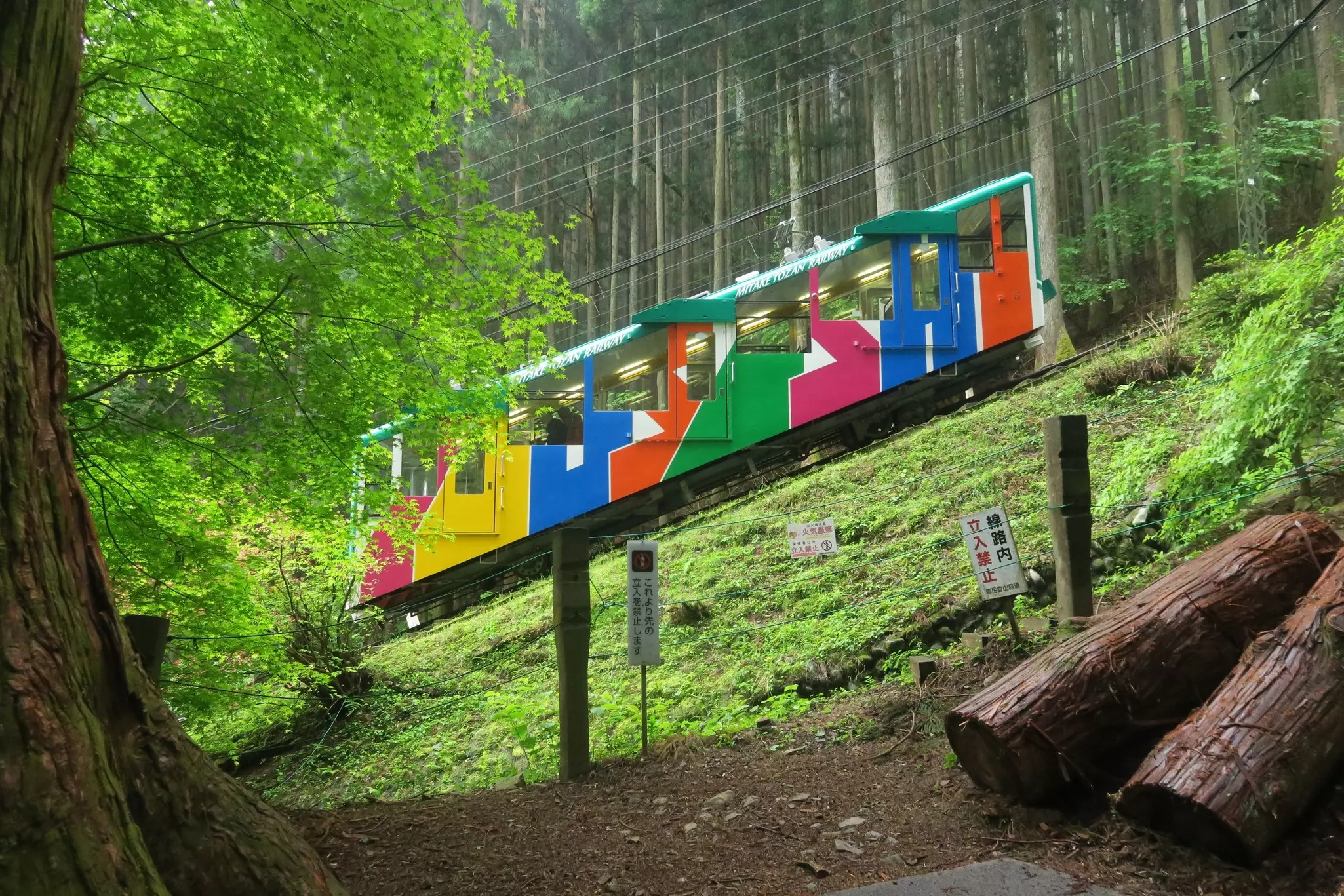
From Takimoto Station, you can hike the ancient route, under the vermillion torii (shrine gate) and through lush forest while listening out for the calls of long-tailed rosefinches and yellow-bellied narcissus flycatchers. Alternatively, board the Mitake Tozan Railway cable car.
Both options arrive at Mitake, a hamlet founded to accommodate shrine caretakers and pilgrims, including with shukubō (temple lodging). You’ll hike along narrow, winding streets lined by old, thatched houses, enveloping you in a traditional atmosphere before reaching steep stone steps lined by ancient cedar trees.
Musashi Mitake Shrine marks the summit. Founded in 91 BC, it’s one of the oldest Shintō shrines in Japan. There are several key structures on the grounds, including a treasure hall, which offer expansive views of the Kanto Plain and, on clear days, the Bōsō Peninsula in neighboring Chiba Prefecture.
4. Odake-san
Best for tranquility
Distance: 8.5km (5.3 miles)
Estimated time to complete: 3.5 hours
Level of difficulty: Difficult
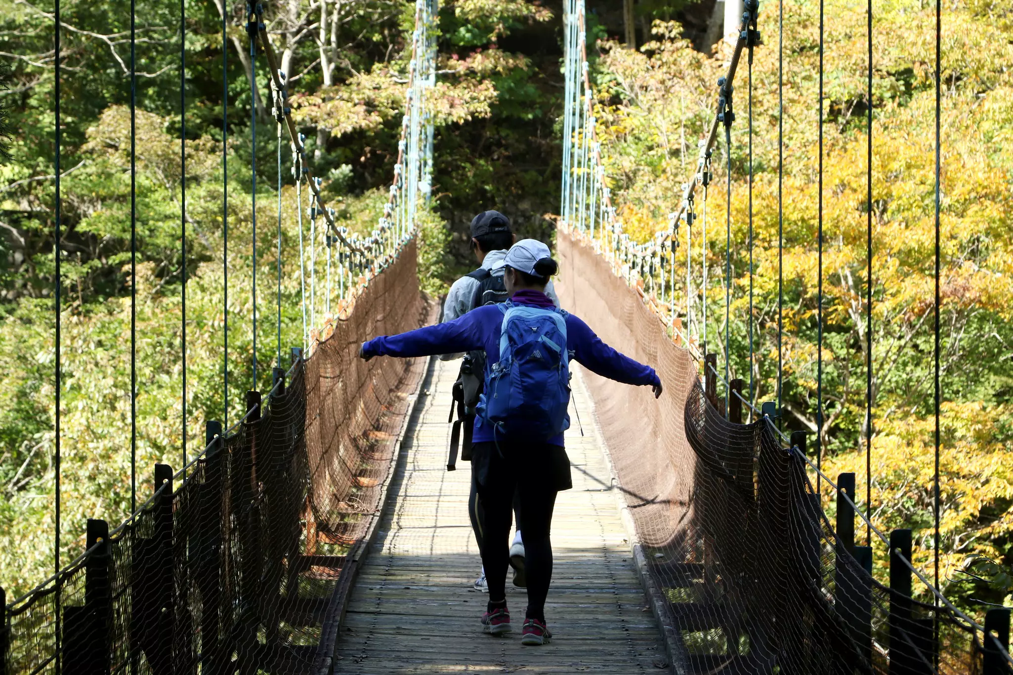
This challenging peak will immerse you in deep nature and is most easily reached from Mitake-san. From Musashi Mitake Shrine, descend to the main path and turn right, following signs for Tengu-iwa, a large rock named after tengu (mythical creatures found in nature). Steep stairs down mark the end of the paved paths; from here, the trails require sturdy shoes with good grip.
Descending past Tengu-iwa reveals a serene forested valley known as the Rock Garden. The path winds past moss-covered boulders, clear mountain streams and waterfalls that seem to freshen the air with the negative ions released from the moving water. Birds can be heard within the dense leafy canopy, which provides shady respite on sunny days.
After the largest falls, Ayashiro-no-taki, the trail leaves the valley and winds its way up steep sections to the summit. Some scrambling may be needed, but the route is equipped with chains and you’ll be rewarded with a panoramic view of the verdant Okutama area and the Tokyo metropolis.
5. Okutama Lake Relaxing Road
Best for scenic vistas
Distance: 12km (7.5 miles)
Estimated time to complete: 2–3 hours
Level of difficulty: Easy
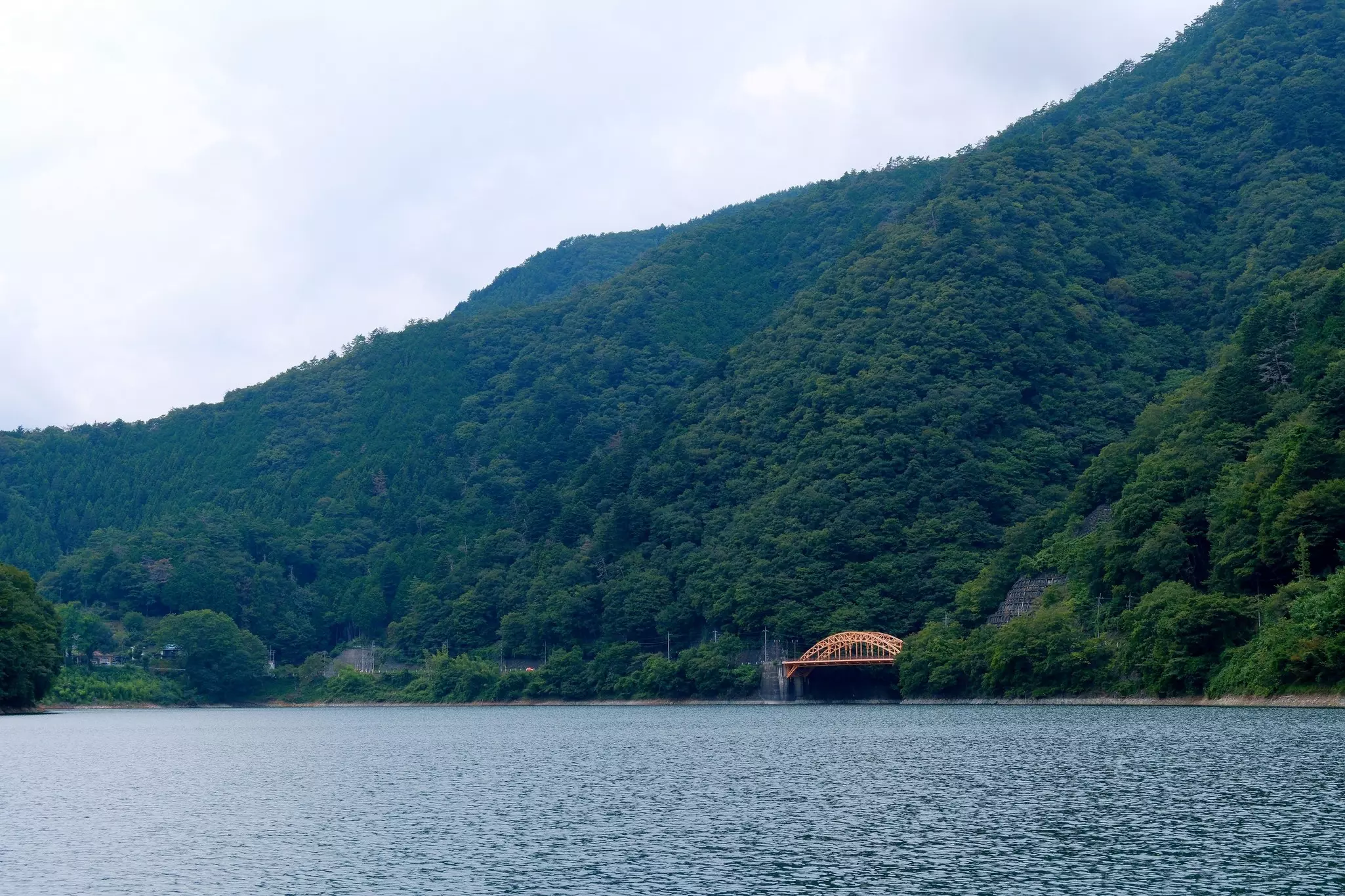
This flat, well-maintained trail follows the southern shore of Lake Okutama, whose deep blue waters provide about 20% of Tokyo’s water supply. Natural forests of cedar and cypress surround the paths and provide homes to an array of wildlife. In autumn, the foliage is transformed into dramatic crimson colors, attracting more hikers than usual.
With plenty of benches, picnic tables and toilets along the way, this route is easily accessible. It ends at Yama-no-Furusato village, which offers experiences such as birdwatching, pottery-making, wasabi-harvesting and stargazing.
Planning tip: Due to the likelihood of snow and ice in the colder months, Okutama Lake Relaxing Road is closed annually from December 1 until the second Thursday of April.
6. Okutama Old Road (Mukashi Michi Trail)
Best for history
Distance: 9km (5.5 miles)
Estimated time to complete: 4 hours
Level of difficulty: Easy
Starting at JR Okutama Station, this course traverses the Tama-gawa valley through stunning natural landscapes to reach Lake Okutama.
Most of the trail is along the Koshū Ura Kaido (Koshu Back Road). This ancient path was used as a trade route during the Edo period (1603–1867) and later became an important artery in Japan’s transportation network. This rich history can be seen at almost every turn; you’ll spot small shrines tucked into the landscape, where travelers would have said prayers for their journey, as well as former railway tracks, tunnels and old buildings.
Several waterfalls, the biggest of which is the 50-meter Fudo Falls, dot the trail, as do carved stones and statues dating from centuries ago. The route ends near Okutama Water & Greenery Museum, where you can see interactive exhibits on the history and culture of the area and learn about the role of the Ōgochi Dam in supplying Tokyo’s water and the importance of the natural environment.
Planning tip: Pop into the Okutama Visitor Center near JR Okutama Station for a map of the route in English as there is limited English signage.