The best road trips in Yosemite National Park
Nov 26, 2025
8 MIN READ

Writer
Half Dome in Yosemite National Park. Jordan Siemens/Getty Images

Writer
Lonely Planet may earn a commission from affiliate links on our site. All recommendations and reviews reflect our own independent opinions.
The roads around Yosemite National Park carve through expansive backcountry, sublime valleys and pretty meadows, for good measure looping by deep gorges dotted with emerald-green forests, shimmering lakes and groves of ancient sequoias.
It’s extremely easy to access untamed wildlife and dazzling High Sierras scenery on a number of superbly maintained roads. All you need is a vehicle – and a sense of adventure.
Such natural beauty means the roads around Yosemite can become frustratingly clogged up at peak times. So read on for tips on how to avoid the crowds while enjoying epic scenery on these five drives in and around Yosemite.
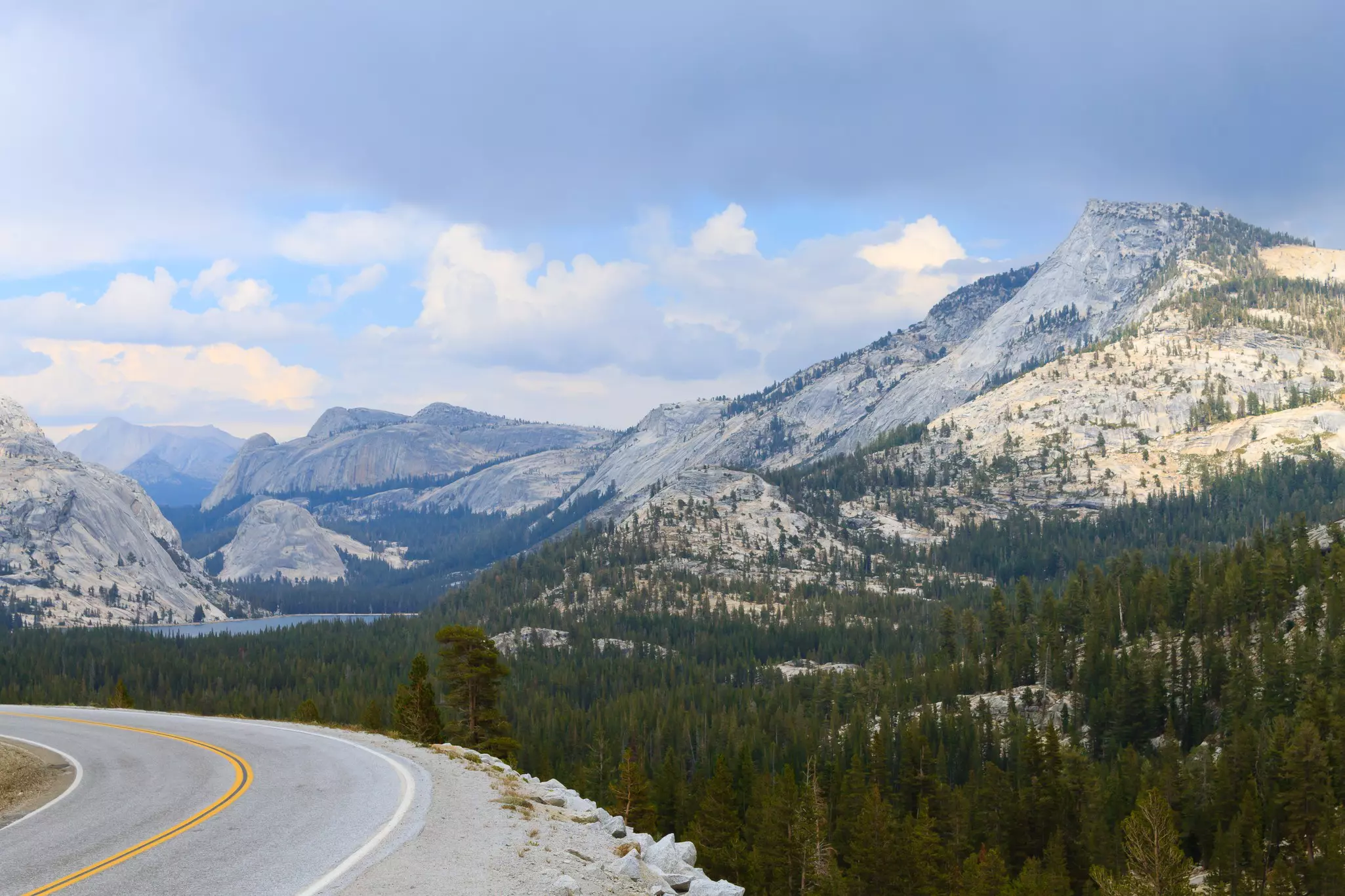
1. Tioga Road
Best road trip through Yosemite
Route: Crane Flat to Mono Lake
Distance: 60 miles (96km)
Time commitment: 2–4 hours
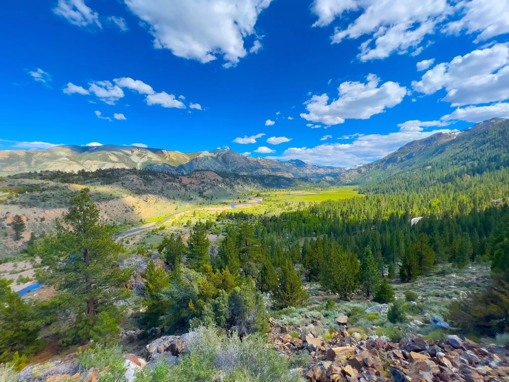
Easily one of the state’s best drives, this is the highest highway pass in California, reaching a dizzying 9945ft (3031m) at its apex. The route snakes through the Sierra Nevada mountains, first winding past the giant sequoias of Tuolumne Grove before climbing up to evergreen forests and viewpoints, with Tenaya Canyon and the backside of Half Dome in the distance.
Further along the route, shimmering Tenaya Lake begs drivers to stop and dive in. You can stretch your legs at nearby Cloud’s Rest Trail, which ends on a palm-sweatingly narrow ridge with 360-degree views. Tuolumne Meadows teems with wildflowers in spring, while the Lembert Dome hike is a short but mighty challenge up a huge, round granite formation.
At the road’s highest point, Mt Dana looms to the east as you exit the park. You’ll pass the twinkling high-altitude lakes of Tioga and Ellery, before the final descent to the hauntingly beautiful Mono Lake and its outdoor gallery of otherworldly tufa towers. Chances are you’ll immediately want to U-turn and ride this road all over again.
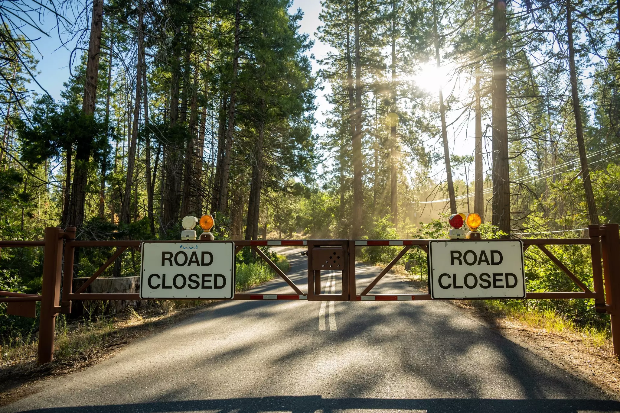
Planning tip: Tioga closes in winter due to snowfall, and reopens for the summer and fall seasons.
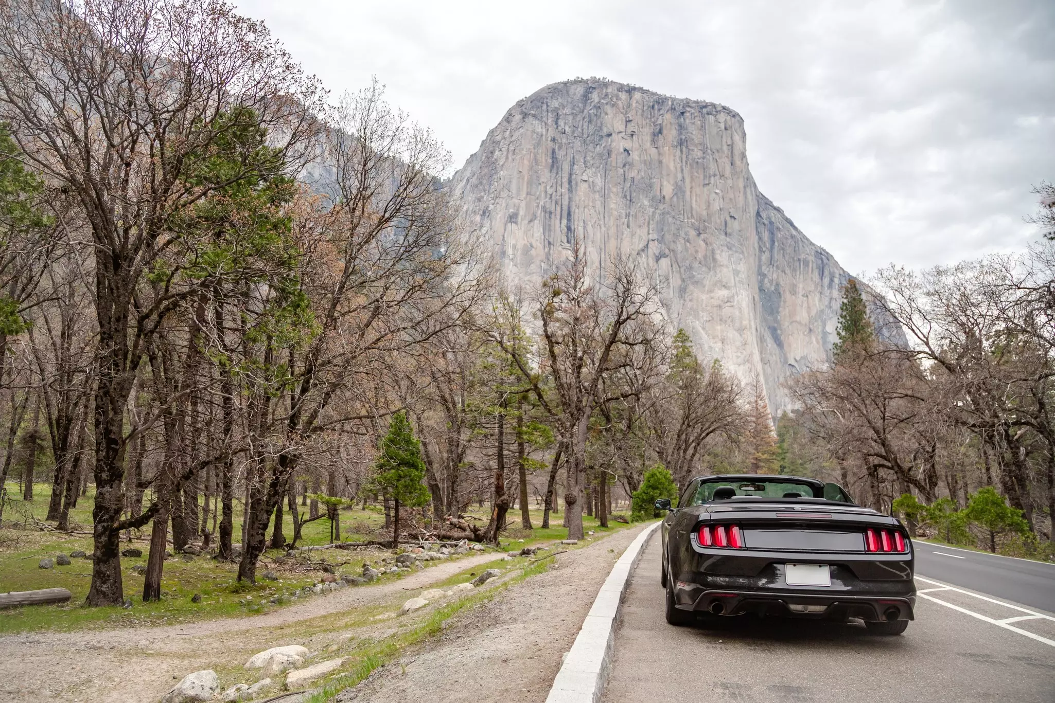
2. Yosemite Valley Loop
Best road trip for less-confident drivers
Route: El Capitan Meadow to El Capitan Meadow
Distance: 14 miles (22km)
Time commitment: Around 40 minutes
One of the shortest yet most enthralling drives in the area, this route takes you through the heart of Yosemite National Park and its most famous geological formations. As you snake east along the Merced River, clearings in the dense trees reveal astonishing views of the towering Yosemite Falls, plus the iconic El Capitan and Half Dome formations.
The drive a humbling experience, as cars seem to turn into tiny bugs among the gargantuan granite cliffs and boulders. Since cypress, pine, hemlock and fir trees line the roads, keep the windows down to breathe in fragrant forest aromas. Dusk adds more drama, with moody shadows and natural features silhouetted against the sky. After after night falls, you can sleep under a carpet of stars at the North Pines and Upper Pines campgrounds, at the most easterly point of the route.
Planning tip: If you don’t want to get behind the wheel yourself, hop on a free Yosemite Valley Shuttle; these operate around the loop at about 10-minute intervals.
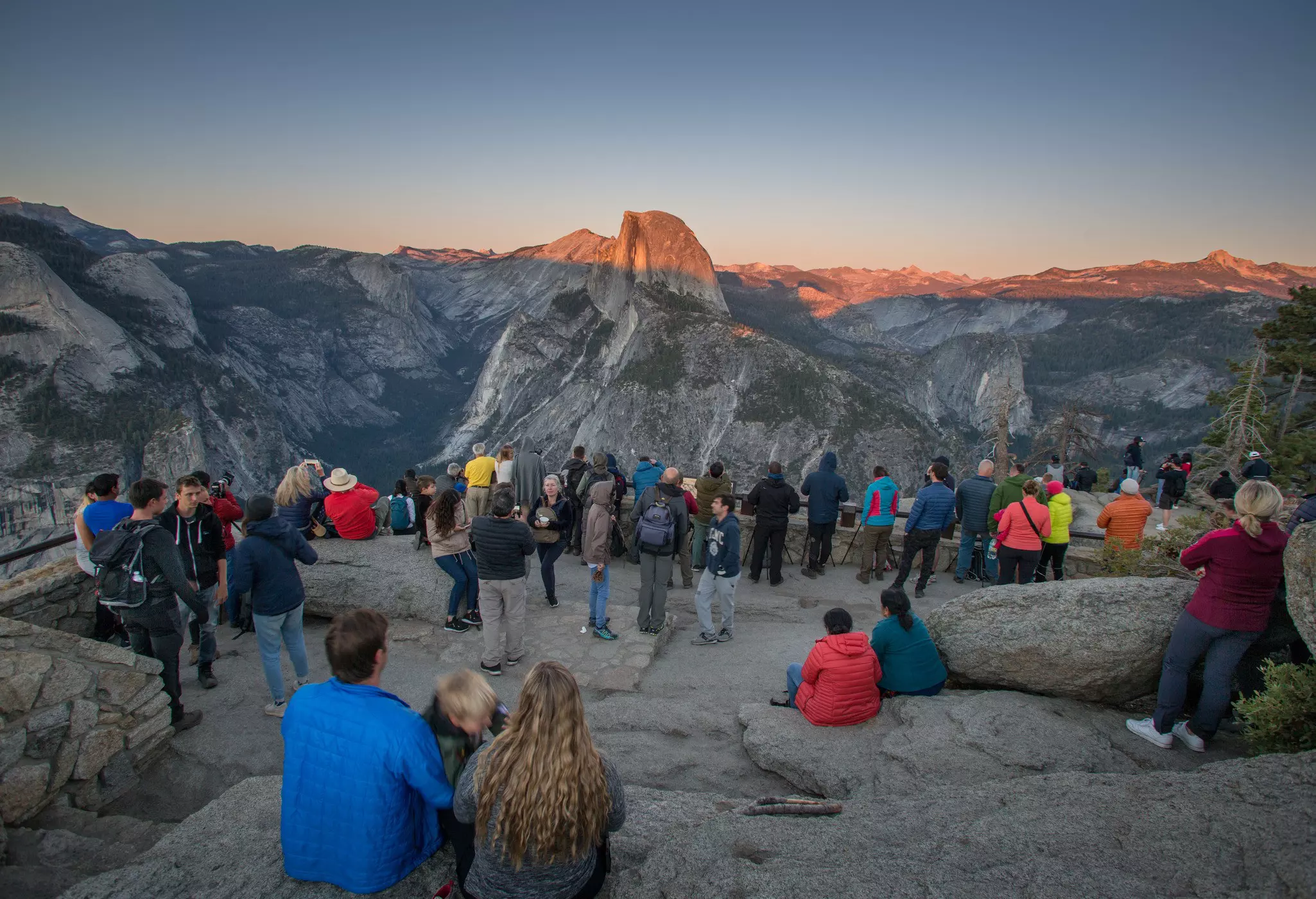
3. Glacier Point Road
Best road trip for expansive views
Route: Tunnel View to Big Tree Lodge
Distance: 52 miles (83km)
Time commitment: 2 hours
This drive begins at the Tunnel View scenic viewpoint, which has sweeping views of Yosemite Valley’s biggest attractions. Half Dome sits front and center, with 3000ft-high (914m-high) El Capitan to the left (look closely for climbers, who seem to dangle from its face like spiders); Bridalveil Fall, which plunges 620ft (188m) over a glacially carved granite cliff, lies opposite. At the end of Wawona Tunnel – the longest highway tunnel in California at 4200ft (1290m) – Turtleback Dome (5300ft/1615m) comes into view.
At the Chinquapin junction, the ascent up Glacier Point Rd begins. The 16-mile (26km) winding road is flanked by green forests and towering views of Merced Canyon below. In winter, you’ll only be able to go as far as the Yosemite Ski and Snowboard Area. The route re-opens fully when the snow melts in May or June, continuing to the crowd-pleasing Sentinel Dome (8122ft/2476m) hike.
You’ll get the best views from your vehicle at Washburn Point, which overlooks Nevada and Vernal Falls, part of the “giant staircase.” Further ahead is the road’s namesake, Glacier Point, and its commanding views of Yosemite’s high country, Yosemite Valley, Half Dome and Yosemite Falls. Double back for 12 miles (19km) to cross the Merced River and finish at the historic Victorian-era Wawona Hotel.
4. Ebbetts Pass Scenic Byway
Best road trip for adventure
Route: Topaz Lake to Yosemite Valley
Distance: 175 miles (281km) one way
Time commitment: 3–4 hours
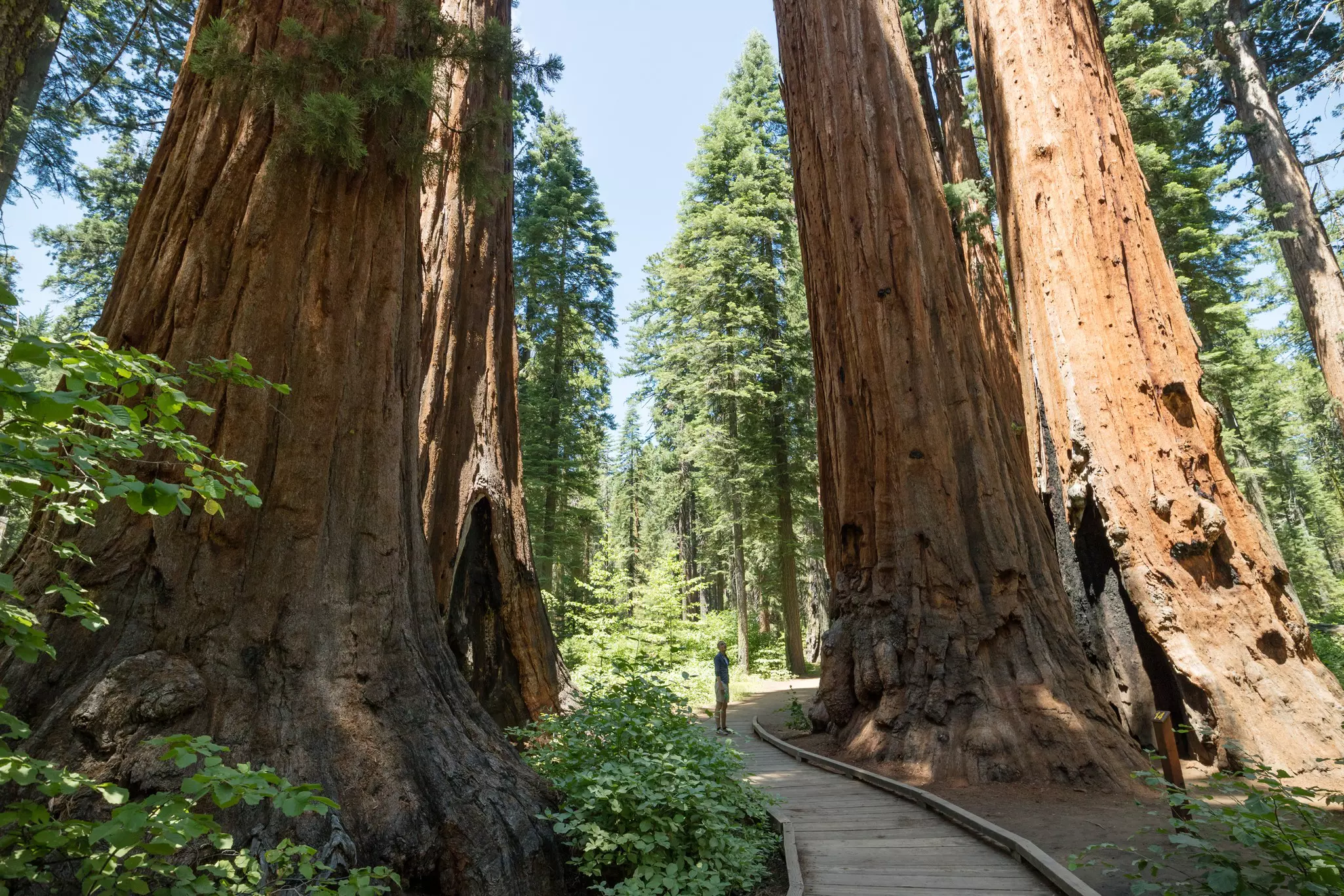
In Stanislaus National Forest, north of Yosemite, this ambitious road trip will take you all over the High Sierras, through glacier-carved valleys, giant sequoias, pristine lakes and little hamlets, with the occasional bald eagle swooping overhead.
The drive starts in the east on the California–Nevada border at Topaz Lake before turning onto the boulder-flanked Rte 89, which will lead you through arid desertscapes and then greener scenery when you meet State Rte 4. The crossing point for hikers on the legendary Pacific Crest Trail – a route that leads 2650 miles (4270km) from Mexico to Canada – is up ahead. At the entrance to the PCT on the north side of the road, climb the boulder for 360-degree views of mountains, deep-green forests and the piercing blue Kinney Reservoir below. Views continue as clearings in the trees reveal snippets of classic mountain scenes, likely snow-topped at this altitude even in summer.
Despite its name, Mosquito Lake is an oasis of calm, with shimmering waters, trout-fishing opportunities and three campgrounds nearby. Three miles (5km) west, inspiring views of the Dardanelle formation from the Cape Horn Vista Point await (keep an eye out for the “sleeping lion” and “elephant” formations in the distance). Giant sequoias rise in Calaveras Big Trees State Park, and at Lake Alpine and Spicer Snow Park road trippers can stop to play in the snow, with cross-country skiing, dog sledding and snowmobiling all possible here (book a trip with Bear Valley Adventure). Continue on to the little mountain town of Arnold before snaking 70 miles through the farmlands and green pastures along the east side of Yosemite National Park (on CA-49 and CA-120), and into Yosemite Valley.
5. Sonora Pass
Best road trip for crowd-free alpine cruising
Route:Tenaya Lake to Sonora
Distance: 84 miles (135km) one-way
Time commitment: 2–3 hours
Just north of Yosemite National Park lies California’s second-highest road (after Tioga Rd): Hwy 108 or Sonora Pass (9642ft/2939m), which travels between the town of Sonora in the west and Bridgeport to the east. This means it’s often overlooked, despite scenery that’s just as stunning as within the park itself. The big bonus? Far fewer people on the road. Come here to test your driving skills on the race-track-worthy corners and narrow, steep inclines, while enjoying scenes of pinch-yourself beauty.
The road sweeps through the Kennedy and Leavitt Meadows, and past pleated mountain vistas, granite rocks and meandering rivers. Start in Yosemite at glittering Tenaya Lake, heading toward the town of Lee Vining (where you can stock up on supplies and gas for the drive). Pass the otherworldly limestone oddities at Mono Lake, before heading north on Scenic Hwy 395. When you reach Inyo National Forest, swing a left onto Hwy 108 – and this alpine dream drive begins.
Tips for driving in and around Yosemite National Park
Drive at off-peak times to avoid traffic. Avoid weekends and holidays, and instead set out on midweek early mornings inside the park. The park has instituted a reservation system for anyone driving through during its busiest times, so you’ll have to get yours well ahead.
Where possible, take the shuttle around Yosemite Valley. Prepare for delays of an hour or more at park entrance stations. Parking spaces can be scarce.
Check the status of the roads before you set off, since many high-altitude roads are shut in the winter due to snowfall and are not plowed until spring. Maintenance work happens on an ongoing basis, so check at the visitor center or online for alerts before you set off.
Be bear-aware. Avoid leaving food in your car in the daytime (if you must leave it in your car, keep it hidden from sight), and leave absolutely no food in your car overnight. Bears have been known to break into cars to find food, causing all kinds of damage to vehicles. Stow any edible supplies in the bear lockers you’ll find at parking areas and campsites.
Fill up your tank before you enter the park. There are two gas stations in Yosemite National Park, but none in Yosemite Valley itself.