
Lonely Planet may earn a commission from affiliate links on our site. All recommendations and reviews reflect our own independent opinions.
Road trips in Montana really take you places. Massive mountains, glacier lakes and wild rivers unfurl outside the window on the state's wide-open roads, inspiring a constant state of wonder. And with classic Western scenery and outstretched landscapes all along the way, road-tripping across Montana proves it's about the journey as much as the destination.
While scenic highways such as the Going-to-the-Sun Road are famed across the nation, there's plenty along the way to encourage you to detour off these established routes, particularly in the state's national parks. Lakeside recreation hubs and small towns, campgrounds and unique Montana adventures invite longer layovers.
And you can come as you are for a Montana road trip – the state's Scenic Byways and All-American Roads are open to every type of vehicle, so you don't need to be an off-roader to enjoy the Big Sky Country and explore the best places to visit in Montana.
You'll need to plan for the weather – many routes are only open from late spring to fall, and high passes typically close by mid-October and don't reopen till May or June. Keep your plans flexible at either end of the season and check for Montana Department of Transportation updates.
But where do you start in America's fourth-largest state? To help you narrow down your shortlist, here are the best road trips in Montana.
1. Going-to-the-Sun Road, Glacier National Park
Best introduction to Montana's landscapes
Start/Finish: Apgar Village/St Mary Lake
Approximate distance: 50 miles
Drive duration: 1 day
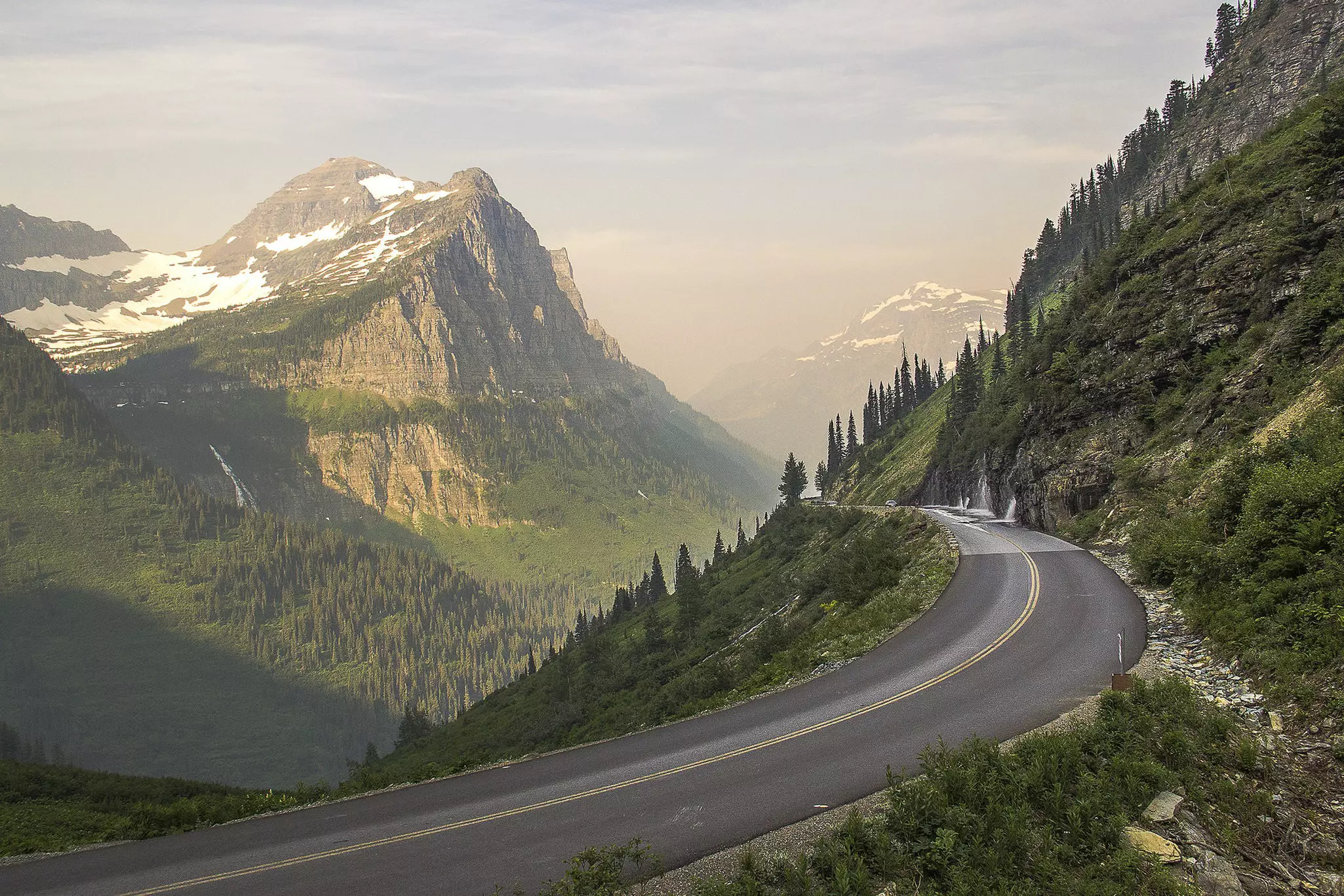
Breathless statements like "oh my gosh" and "holy moly" often accompany drives along the 50-mile-long Going-to-the-Sun Road, the only route spanning the width of Glacier National Park in northwest Montana. Narrow verges, winding curves and rushing waterfalls beneath the road add an element of adventure to the drive, and the misty mountains rising into the sky ensure cinematic vistas on all sides.
Drivers start heading to the sun at either Apgar Village near Lake McDonald or St Mary Lake on the park's eastern and western fringes, respectively. The whole route could be completed in 90 minutes without stopping, but you'll want to budget a whole day to fit in stops at roadside attractions, including Logan Pass Visitor Center – at an elevation of 6646ft, this is the highest point in the park accessible by vehicle.
Planning Tip: The Going-to-the-Sun Road is typically fully accessible between late June and September, and it closes from October to the first half of June. The park maintains a Vehicle Reservation System when the route is open, requiring a permit for your vehicle. A hikers' shuttle bus offers another way to enjoy the scenery if you can't get a permit.
2. Pintler Veterans' Memorial Scenic Highway
Best alternative route for driving between Yellowstone and Glacier
Start/Finish: Drummond/Anaconda
Approximate distance: 64 miles
Drive duration: Allow 3–4 days
The Pintler Veterans' Memorial Scenic Highway, also known as the Anaconda-Pintler Scenic Route, is a must-do diversion from Interstate 90 between Butte and Missoula. It's also an excellent side adventure for those traveling between Yellowstone National Park and Glacier National Park, located approximately halfway along the route between these much more crowded destinations.
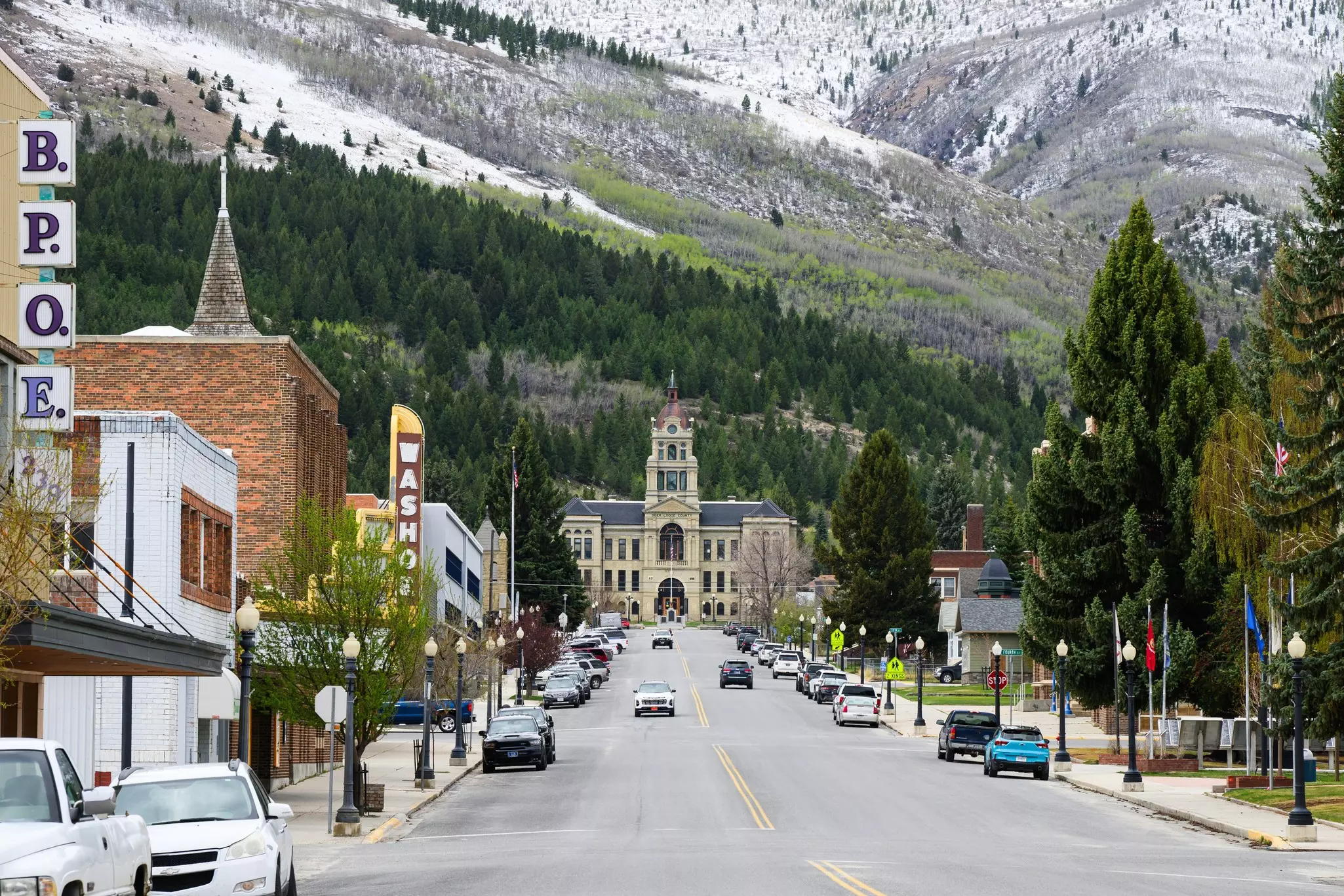
The speed limit drops on this 64-mile two-lane scenic highway, but what really slows down traffic are the historic towns and outdoor recreation opportunities lining the route. Quintessential pullovers include Anaconda and Phillipsburg, offering similar historic aesthetics but completely different ways to experience the past.
In Phillipsburg, you can mine for Montana sapphires at Gem Mountain, while Anaconda's Old Works Golf Course serves up black slag bunkers, always in sight of the historic Anaconda Smelter Stack. Both towns have hotels and lodgings, although Fairmont Hot Springs Resort near Anaconda offers the most relaxing stay.
Planning tip: Head to the hard-to-miss Georgetown Lake about halfway along the route for outdoor adventures, fishing and more; several Forest Service campgrounds dot the lakeshore, open May to September.
3. Beartooth Highway
Best way to get to or from Yellowstone National Park
Start/Finish: Red Lodge/Cooke City
Approximate distance: 68 miles
Drive duration: From 2 days
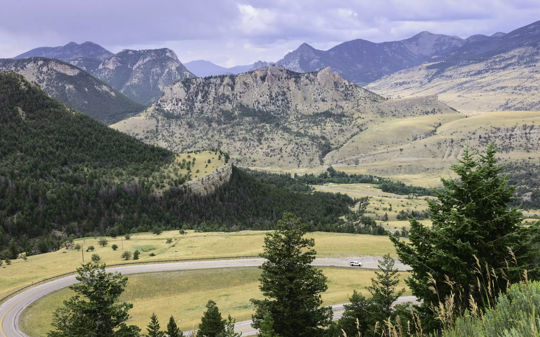
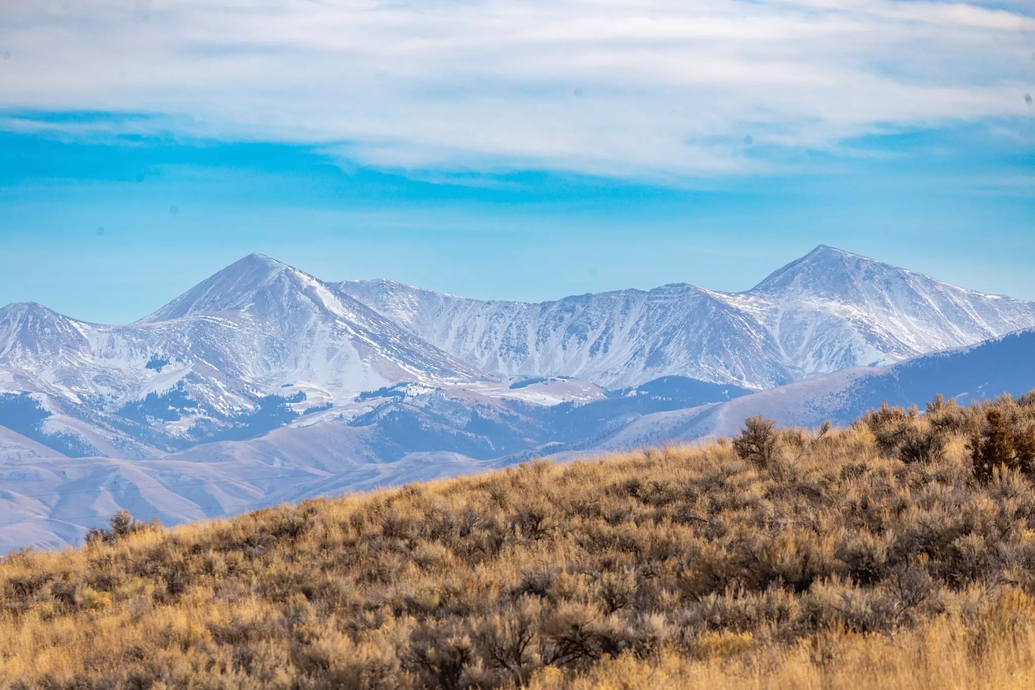
Eyepopping views of big mountains and glacier-carved valleys line every mile of the Beartooth Highway in southern Montana. This All-American Road dips into Wyoming on its journey from Red Lodge to the northeast entrance of Yellowstone National Park, topping out at Beartooth Pass (10,947ft) and showcasing the startling Beartooth Mountains, Montana's tallest peaks.
Custer Gallatin National Forest surrounds the entire drive, and parking lots provide access to Absaroka-Beartooth Wilderness – a thriving habitat for bears, moose and elk. These natural adventure playgrounds are laced with hiking trails, and you can hit the slopes at the Beartooth Basin Summer Ski Area, open from late May to July.
Planning Tip: Time your adventures right – the highway is only open between Memorial Day (early May) and mid-October. No matter the time of year, bring warm clothes for chilly conditions at higher elevations.
4. Seeley-Swan Scenic Byway (Highway 83)
Best road trip through Montana's lake country
Start/Finish: Clearwater/Swan Lake
Approximate distance: 84 miles
Drive duration: From 3 days
If you enjoy massive mountains reflecting off glass-smooth natural lakes, head for the Seeley-Swan Valley in western Montana. Highway 83 serves up mountain vistas all along its route through the Mission Mountains and Swan Range. This magnet for summer travel is also home to a chain of more than two dozen refreshing mountain lakes along the path of the Clearwater River.
Seeley Lake, near the southern end of Highway 83, is the largest of these mountain mirrors, complete with campgrounds, private resorts, and stocked rainbow trout. Holland Lake is another stunning pool about halfway up the highway, where the Holland Falls National Recreation Trail delivers hikers to misty views. And Swan Lake, famous for its fishing and camping opportunities, borders 8 miles of the highway at its northern end.
Planning Tip: Take your time driving through the Seeley-Swan Valley and enjoying its lakes; campsites are available at places such as Lake Alva or Lindbergh Lake, or there are comfortable rooms at the Holland Lake Lodge.
5. Pioneer Mountain Scenic Byway
Best road trip for uncovering gems of the Treasure State
Start/Finish: Wise River/Polaris
Approximate distance: 45 miles
Drive duration: From 2 days
The seemingly short 45-mile Pioneer Mountains Scenic Byway in southwest Montana opens up days upon days of authentic Montana experiences. The route follows the entire frontage of the Pioneer Mountain Range through Beaverhead Deerlodge National Forest, offering a relatively mellow and straightforward drive where the term "Big Sky Country" really lives up to its promise.
All manner of outdoor recreation stops line the route, including the Big Hole River at its northern terminus – one of Montana's top blue-ribbon waterways for fly fishing. National forest campgrounds make for easy overnighting, including Price Creek, the largest site, with room for 28 tents or RVs. This campground is close to Crystal Park, a must-visit, covering 30 acres where keen-eyed explorers can harvest crystals of quartz and amethyst from the slopes.
Planning Tip: Pioneer Mountains Scenic Highway is open between May 15 and December 1, but don't write off the route in winter – it transforms into one of the state's most popular snowmobile trails, with rentals and tours available.
6. A Journey through Paradise (Valley)
Best road trip for hot springs detours
Start/Finish: Livingston/Gardiner
Approximate distance: 54 miles
Drive duration: From 2 days
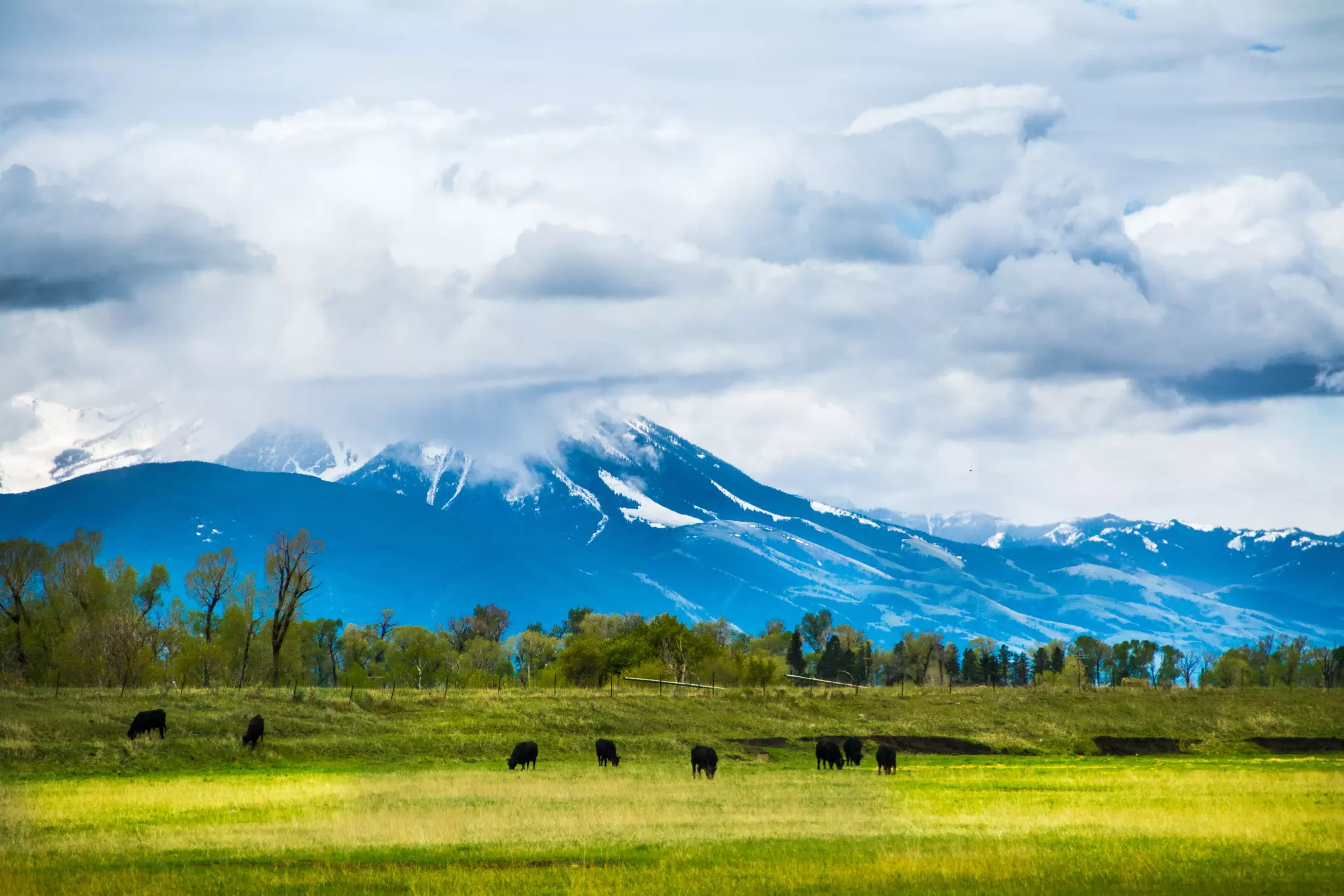
The Yellowstone River carves through Paradise Valley on either side of the Absaroka and Gallatin Mountains in southern Montana. You could drive across this idyllic riparian landscape in hours, but with Livingston and Yellowstone National Park near its northern and southern termini, respectively, there's enough to fill days of exploring.
Livingston or Yellowstone could easily occupy your whole vacation, but budget some time to enjoy this rewarding drive between the two. The best way to soak in the stunning landscape is an overnight stay at the historic Chico Hot Springs, established in 1900 and still providing rustic rooms, a large community pool and a historic dining room for a romantic meal to remember.
Detour: Highway 89 is the main route through Paradise Valley and a famous access road for Yellowstone National Park; the less-busy East River Road is a recommended alternative with a slower speed limit but better driving experience.
7. ZooTown to Whitefish through the Flathead Valley – Highway 93
Best route for an unplanned adventure
Start/Finish: Missoula/Whitefish
Approximate distance: 138 miles
Drive duration: Allow 3–4 days
The route from Missoula to Whitefish will make you want to move to Montana forever. It passes through the Rattlesnake Mountains immediately north of Missoula before crossing into the Flathead Reservation, home to the Confederated Salish and Kootenai Tribes, who manage the southern half of Flathead Lake, an unmissable attraction along the route.
The largest natural lake west of the Mississippi River in the contiguous United States, Flathead Lake has two roads weaving along either side of its expansive shoreline. Highway 93 follows the western shore, passing through charming small towns such as Polson and Big Arm, where visitors find hotels, boat rentals, and community events like the Flathead Cherry Festival on the last weekend in July.
Approximately 10 miles north of Flathead Lake is Kalispell, a great base camp for exploring the Flathead Valley with plenty of hotels and restaurants, and regular community events. And 15 miles further north is the year-round mountain town of Whitefish, famous for its Amtrak stop, outdoor activities, and world-class skiing at Whitefish Mountain Resort.
Planning tip: Visit Flathead Lake from June to August for boating, fishing and swimming; U-pick season at the cherry farms on the lakeshore starts in mid-July.