May 14, 202613 min read
The 12 best beaches in New ZealandNov 18, 2025
11 MIN READ
Writer
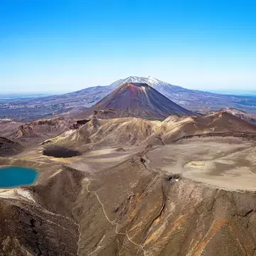
Tongariro National Park. Iryna Shpulak/Shutterstock

Writer
Lonely Planet may earn a commission from affiliate links on our site. All recommendations and reviews reflect our own independent opinions.
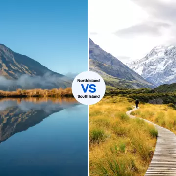
Few countries do wilderness like Aotearoa (New Zealand’s Māori language name). The 13 national parks here cover an area about the size of Belgium and are central to the identity of the country and its people. They offer scree scrambles, volcanoes, gold sand beaches, alpine peaks, drives to make you gasp, river journeys, rainforests, wildlife encounters, technical mountain biking and – of course – a lifetime’s worth of hiking to discover. Here are some of the best parts of New Zealand’s national parks.
Best for single-day, volcano-edge adventure
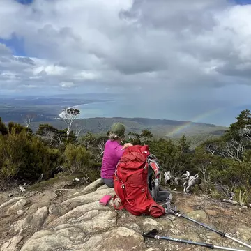
About 1 million people a year visit Tongariro National Park, most of them to walk the astonishing 20km Tongariro Alpine Crossing. It’s humbling to traverse the shoulders of the three-giant, smoldering volcanic peaks that make up the park: Ruapehu, Ngāuruhoe and Tongariro. The 1-day hike is busy from October to April, so avoid the Christmas/New Year period and make a free booking with the Department of Conservation.
The park has many other delights, including the Tongariro Northern Circuit – one of New Zealand’s 11 Great Walks – lots of day walks, and three ski hills, Whakapapa, Turoa and Tukino.
It also forms the basis of New Zealand’s entire national park network; the three peaks were "gifted" to the people of New Zealand by Ngāti Tuwharetoa chief Horonuku te Heuheu Tūkino IV. But the Crown misinterpreted his intention; he wished for shared guardianship, not ownership. The venerable ariki (chief) could never have envisaged Tongariro’s popularity today, but it’s still essentially the same dynamic moonscape of alpine desert, punctuated by bright green and blue lakes, steam, snow and ice.
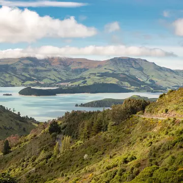
Best for a convivial seaside hiking holiday
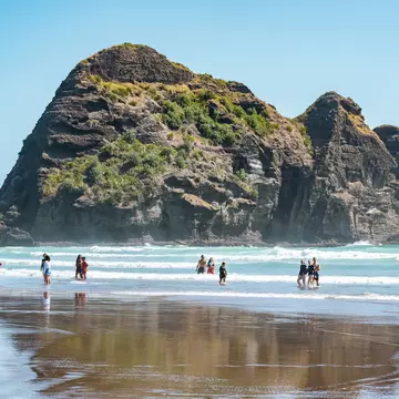
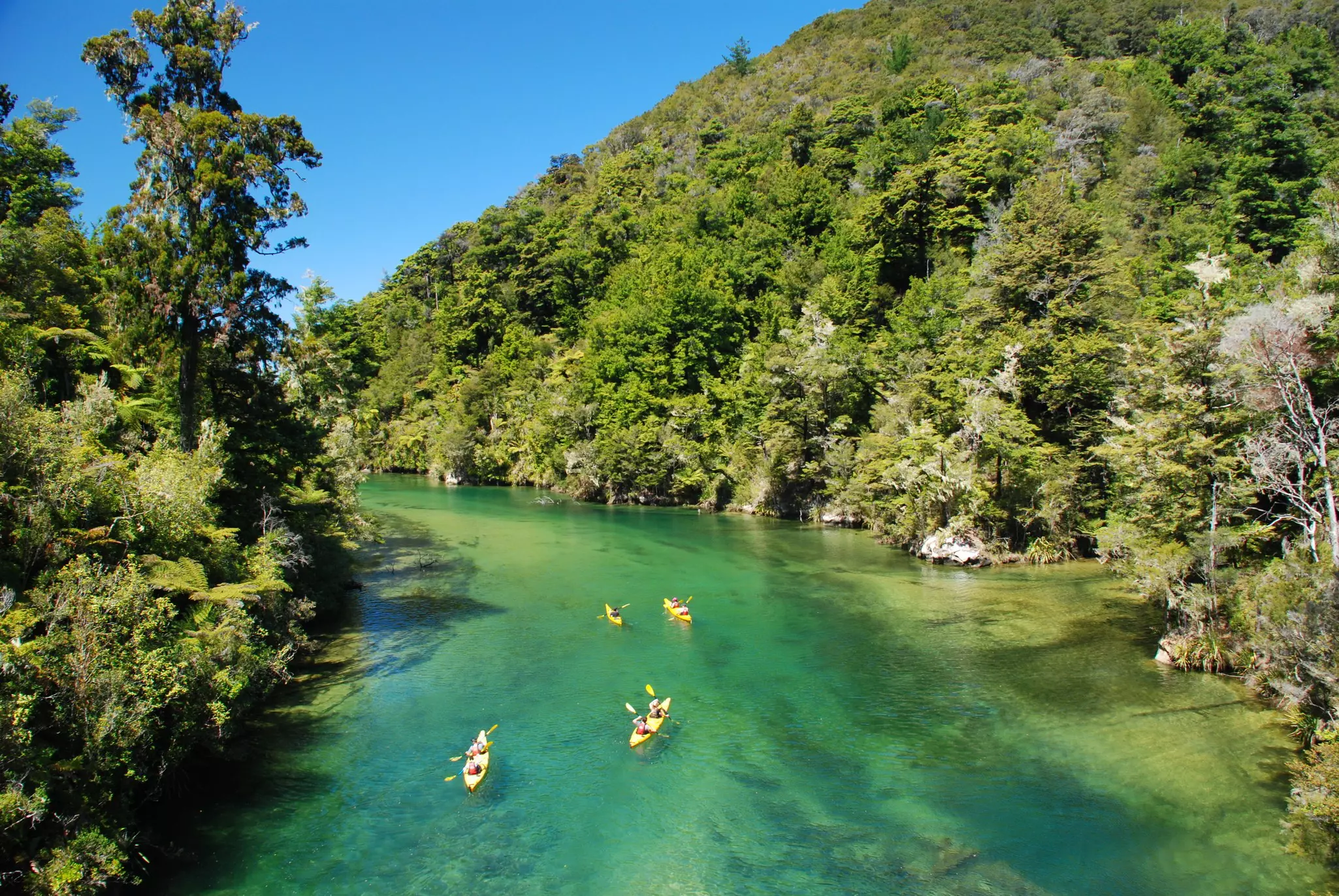
There is only one New Zealand Great Walk where you can get beer and pizza in the middle of it, and that’s on the Abel Tasman Coast Track in Abel Tasman National Park.
About an hour from Nelson, at the top of the South Island, this park is a mix of reasonably gentle, well-formed, popular beachy trails with big, modern huts, and a steep bush track and basic hut network in the park’s interior. Although these have their charms, let’s be honest; everyone’s here for the Coastal Track’s golden-sand beaches and clear turquoise waters fringed with forest.
Only a couple of the beaches can be reached by road, but here the ocean is a highway of water taxis and cruises that, if you only have a day to spare, will drop you at select beaches and pick you up at another. A tour company like Wilsons Abel Tasman, part of an eight-generation family involvement with the area, will get you started with options. You can also sea kayak to reach beaches the track doesn’t touch – and get that pizza and beer at Awaroa Lodge.
Best for mountain-biking as well as hiking
High cliffs, above-the-treeline huts with mountain vistas, a beautifully built track, empty beaches, dramatic mountain ridgeline walking, limestone river valleys, diverse flora, a profusion of birdlife; Paparoa National Park, on the West Coast of the South Island, ticks a lot of boxes.
It’s home to the Paparoa Track, one of New Zealand’s Great Walks, which runs from tiny Barrytown to Punakaiki, about midway between Westport and Greymouth. It’s also a 1- or 2-day Grade 3 mountainbike. But it’s not the only attraction.
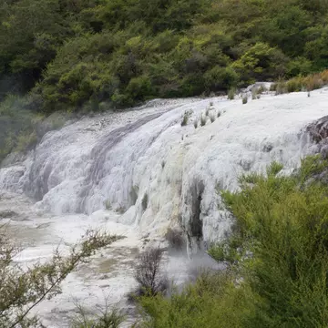
There are also diverse hiking trails such as Pororari River Track and Truman Track, and the small settlement of Punakaiki, or Pancake Rocks. These are layers of limestone that resemble stacked crepes, and are especially fun to see on a stormy day, when the ocean blows through them in dramatic geysers.
Best for primal wilderness
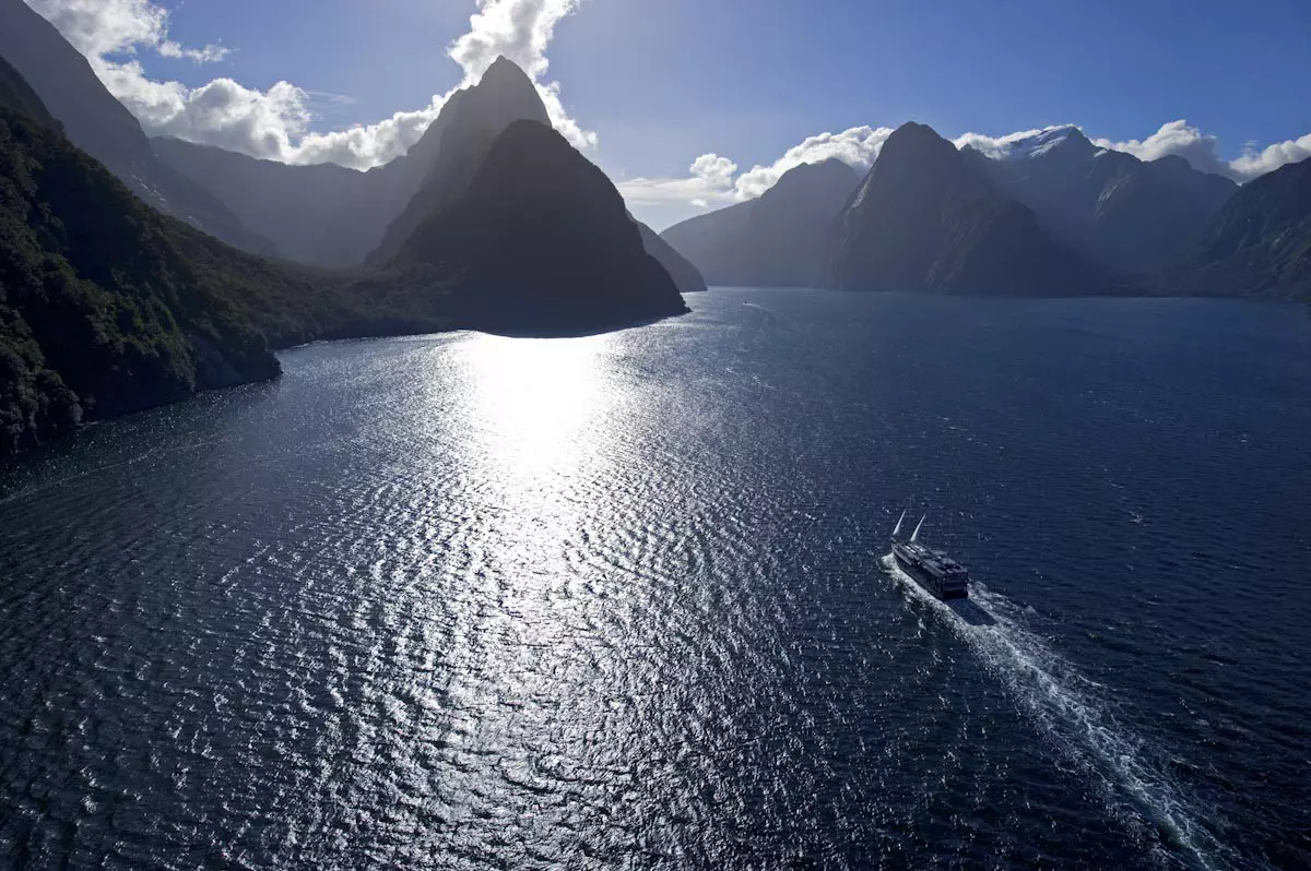
Brace yourself for sublime scenery on a breathtaking scale. Fiordland National Park's mountains, forests and mirror-smooth waters hold visitors in thrall, whether they’re hiking, sailing, or touring. This immense and formidable tract of wilderness has deeply recessed fiords that spider inland and is famed for its waterfalls that spill from craggy peaks directly into the sea.
Framed by mile-high cliffs, Milford Sound/Piopiotahi was carved by millennia of epic battles between rock and ice. It’s accessed by sea or by the Milford Road, which reveals a magnificent alpine view at every bend. Neighboring Doubtful Sound/Patea is the biggest and deepest of all. It’s quieter, and is a safe haven for bottlenose dolphins and tawaki, the Fiordland Crested Penguin.
Cruises are available in both Milford and Doubtful Sound, and walkers can delve into Fiordland’s interior on the multi-day Milford, Kepler and Hollyford Tracks, or shorter walks, easily reached from the highway or the town of Te Anau, nestled into the edge of the wilderness.
Best for birdlife and remote coastal drama
As far south as you can reasonably get to in New Zealand, Rakiura National Park covers most of Rakiura/Stewart Island and is a world away from the busier parks on the mainland. It’s a hotspot for wildlife – penguins, seals, kiwi, weka – and when you’re here you’d be silly to miss out on taking a tour, such as to Ulva Island, to see the abundance of birds that are able to flourish.
The tramping (that’s Kiwi for “hiking”) in the rest of the park is known for sometimes being comically muddy. Longer hikes include the 9- to 11-day North West Circuit, the 4- to 6-day Southern Circuit, and the 3-day Rakiura Track (a Great Walk), but there are plenty of day walks too, including from the main settlement of Halfmoon Bay.
The beaches here are some of the nicest you’ll find in New Zealand - all the more beautiful for being essentially halfway to Antarctica.
Best for biodiversity
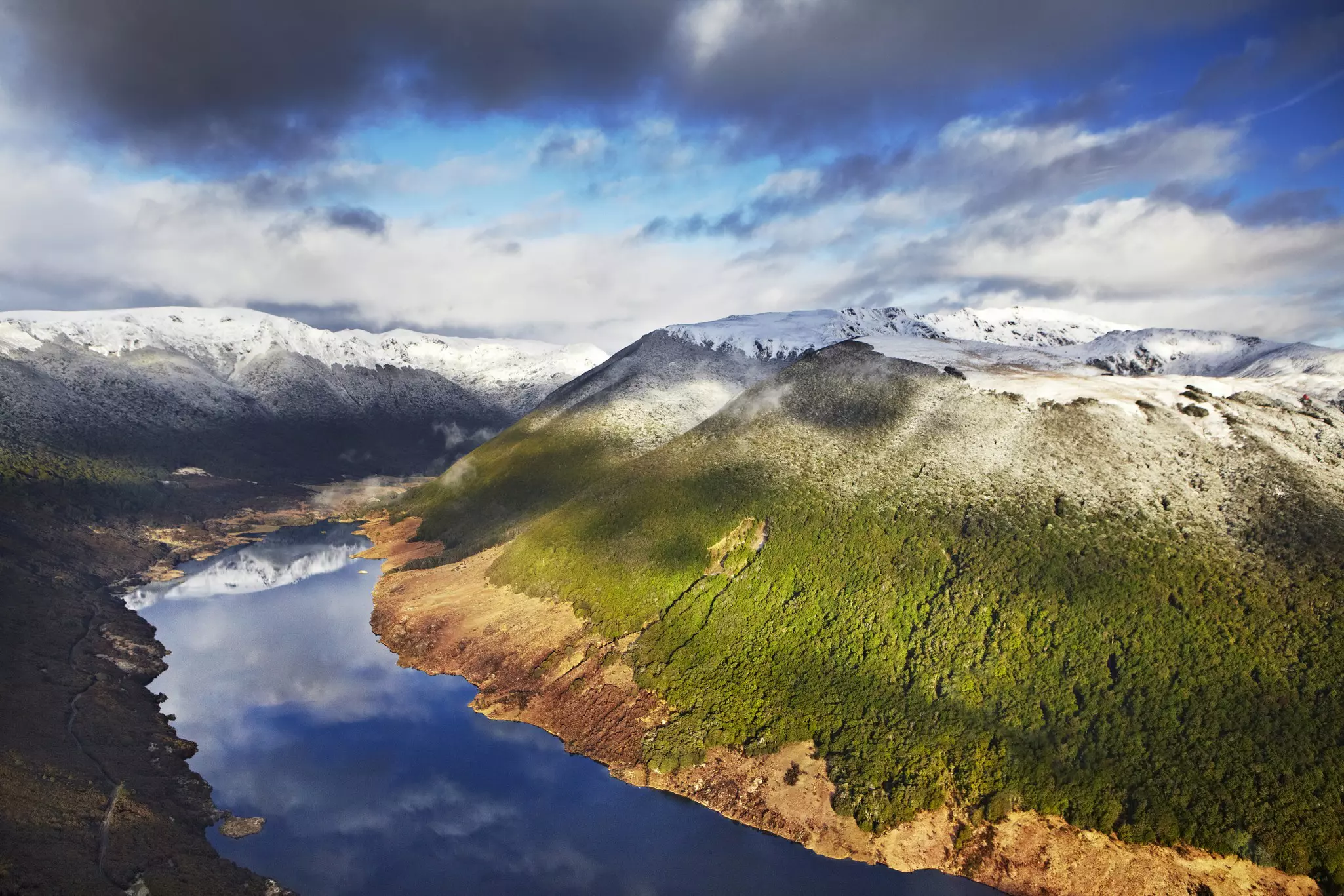
Kahurangi is the second largest of New Zealand’s national parks, and also one of its most diverse.
Bordering Nelson and Golden Bay at the top of the South Island and Karamea on the West Coast, it covers the island’s northwest corner. Its most eye-catching features are geological, ranging from windswept beaches and sea cliffs to earthquake-shattered slopes, moraine-dammed lakes and a wondrous underworld, progressively explored by cavers.
Around 85% of the park is forested, and more than half of New Zealand’s plant species can be found here, including more than 80% of its alpine plant species. Among the park's 60 bird species are great spotted kiwi, kea, kākā, takahē and whio, a rare blue duck that’s at home in river rapids. Listen for its haunting, whistling call.
A favored walk here is the Heaphy Track, one of New Zealand’s Great Walks, or the Mt Arthur Tablelands circuit, which features well-appointed huts, open rock shelters, tussocky plateaus and mountain vistas.
Best for striking volcano views
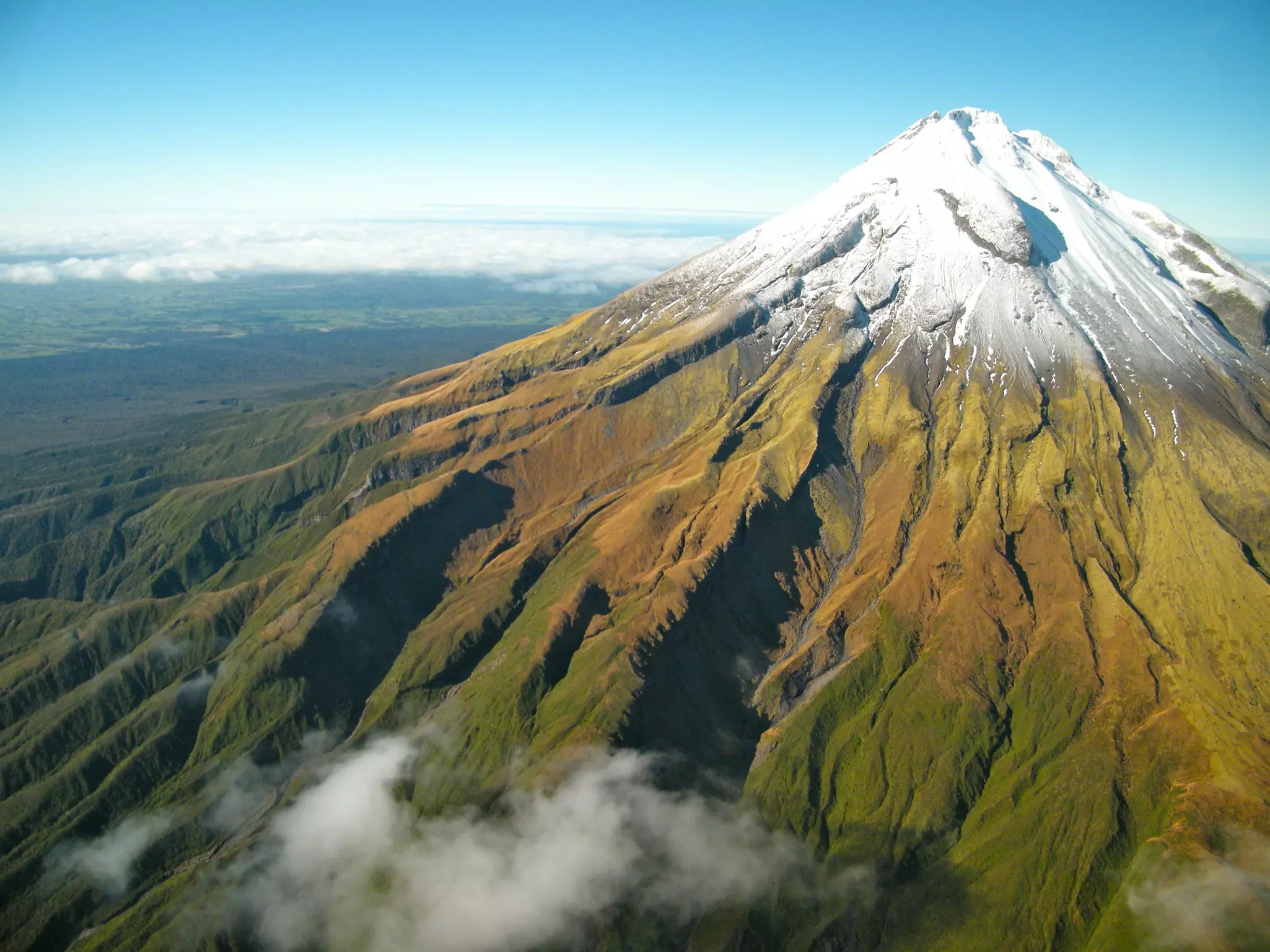
In early 2025, this national park shed its former moniker of Egmont National Park and officially became Te Papa-Kura-o-Taranaki. This is also when the striking volcanic cone of Taranaki on the western coast of the North Island became the third natural feature in New Zealand to be granted legal personhood, recognizing its treasured status.
With the last eruption more than 350 years ago, experts say that the mountain is overdue for another. For now, it's an absolute beauty and one of the most symmetrical cones in the world. There’s terrific hiking on Taranaki and around the nearby city of New Plymouth itself, (and skiing in winter).
Taranaki is a popular climb but it should not be undertaken lightly; check with DOC for advice. And don’t stand directly on the summit peak; the mountain is an ancestor for local Māori and to stand on the top is deeply offensive.
Most walks on the maunga (mountain) are accessible from North Egmont, Dawson Falls or East Egmont. Check out DOC’s collection of detailed walk pamphlets (free to print off the web) or the Taranaki: A Walker’s Guide booklet for more info.
Best for hiking rugged mountains straight from the car
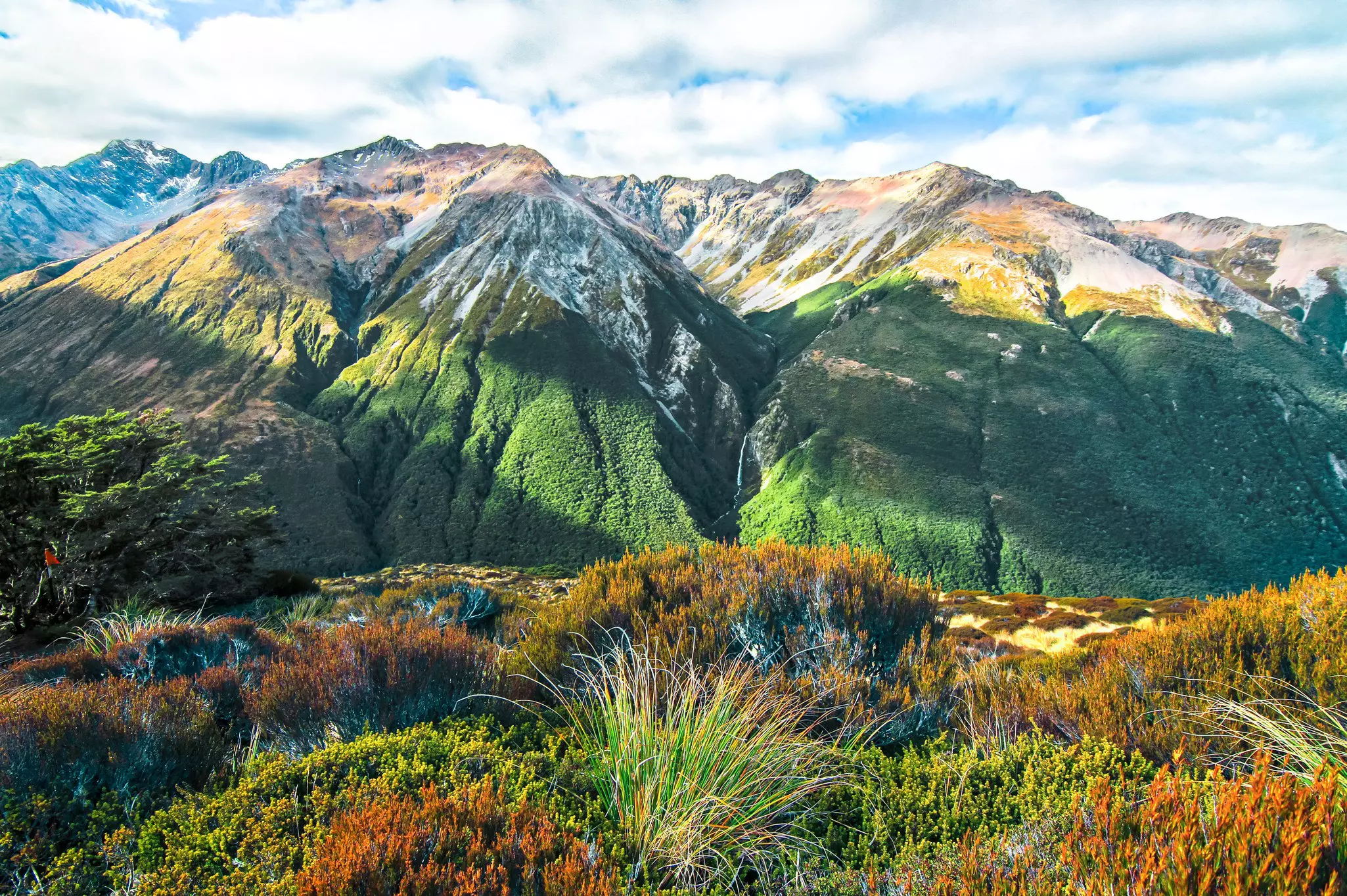
Straddling the Southern Alps and known to Māori as Ka Tiritiri o Te Moana, this vast alpine wilderness became the South Island's first national park in 1929. This rugged, mountainous area is cut by deep valleys, and is where the 5-hour TranzAlpine train journey stops on its journey between the coasts through the Southern Alps.
There are plenty of well-marked day hikes throughout the park, especially around Arthur's Pass village. Try the Arthur's Pass Walkway, a reasonably easy trail from the village to the Dobson Memorial at the summit of the pass (2.5 hours return); the 1-hour return walk to the Devils Punchbowl falls; or the steep walk to beautiful views at Temple Basin (3 hours return).
More challenging, full-day options include the Bealey Spur track and the classic summit hike to Avalanche Peak. At day’s end, a fun place to stay or visit just outside the park is the quirky Otira Stagecoach Hotel.
Best for lush lakeside forest
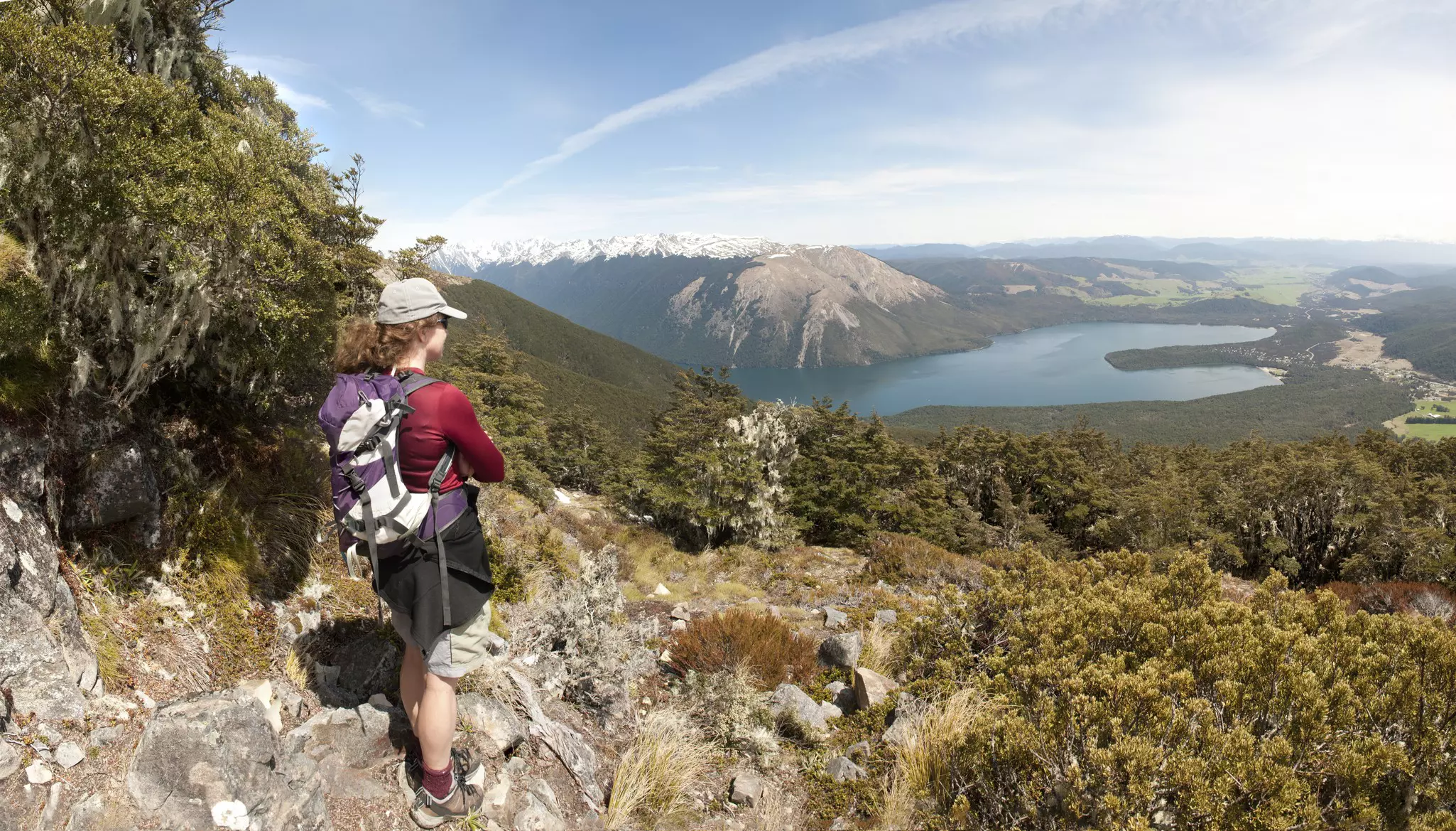
Nelson Lakes National Park surrounds two lakes – Rotoiti (“small lake”) and Rotoroa (“long lake”) – fringed by sweet-smelling beech forest set against a backdrop of striking greywacke mountains. Located at the northern end of the Southern Alps, and with a dramatic glacier-carved landscape, it’s an awe-inspiring place to get up on high.
The tiny township of St Arnaud, about 90 minutes south of Nelson, has a couple of cafes and accommodation at the Alpine Lodge to service all your trout-fishing, mountainbiking, skiing and hiking needs.
The advanced track to Angelus Hut is a classic 2- to 3-day route; the hut is nestled in a bowl of mountains, perched next to Lake Angelus. Two to 4 days will get you to the clearest lake in the world at Blue Lake. If you only have a day, spend it walking the peaceful Lake Rotoiti Circuit for a long, slow view of this park’s natural splendor.
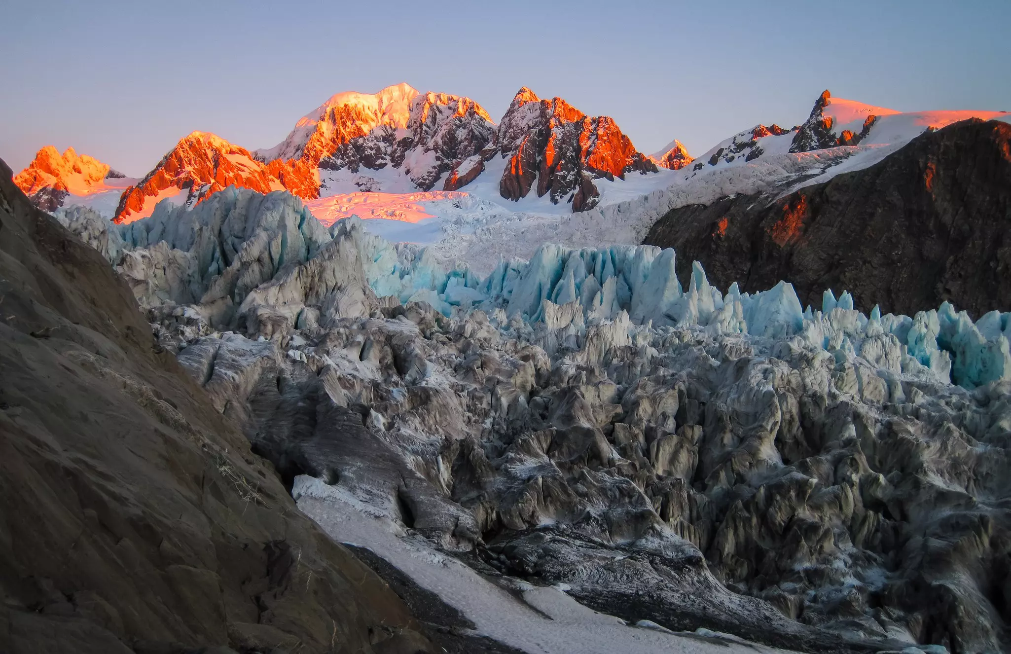
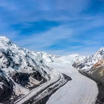
Best for ocean-to-ice diversity
With its colossal mountains, forests and more than 60 glaciers, Westland Tai Poutini National Park has mind-bending proportions. Its supreme attractions are twin glaciers Franz Josef and Fox, served by townships 23km apart. These are easily viewable via day walks from their parking lots; 2 hours in the case of Fox, and half an hour to Franz.
The glaciers are the most majestic result of the West Coast's ample precipitation. Snowfall fuses into clear ice and then creeps down the steep valleys. Nowhere else at this latitude do glaciers descend so close to the ocean.
But rising temperatures have beaten the glaciers into retreat, reducing opportunities to view them on foot and they face an uncertain future if climate change continues unchecked. Visiting now feels like a chance to catch them before they’re gone.
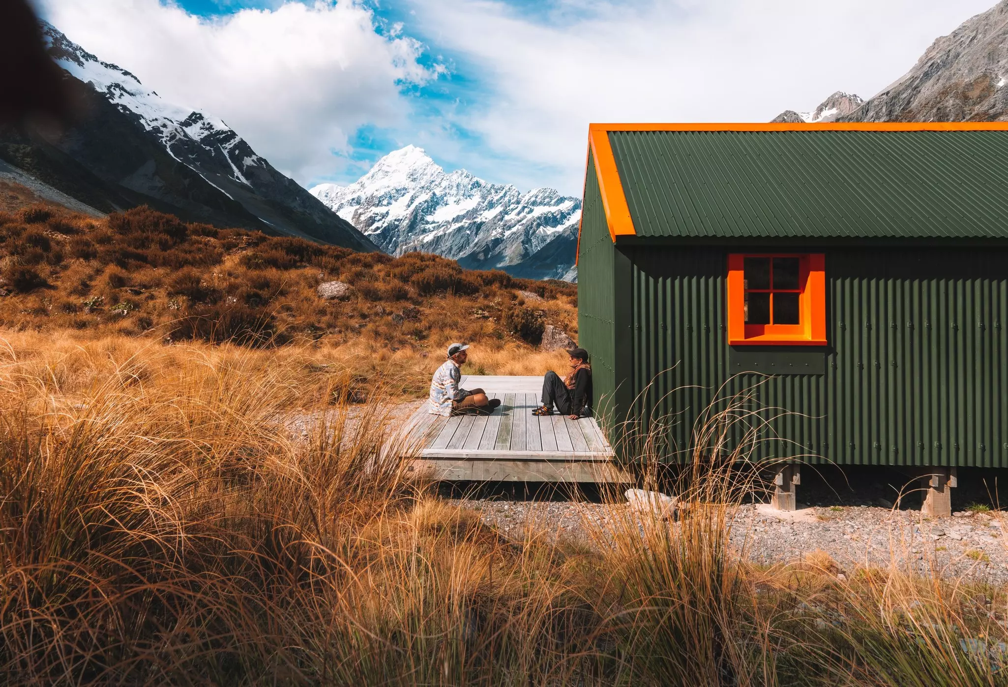
Best for an alpine experience
Though serious mountaineers head for Australasia’s tallest mountain, Aoraki/Mt Cook (3724m), and the 19 other peaks over 3000m in this park, it’s also a wonderful place to spend a day or two soaking up the grandeur of this spectacular park and its white-clad peaks.
Most visitors arrive on tour buses, stop at the Hermitage Hotel for photos, and then zoom off back down SH80. But hang around to try the excellent short walks in the area, including to the Tasman Glacier, New Zealand’s longest.
An overnight trip to the striking Mueller Hut is another popular route, though if you’re walking it outside of high summer, alpine skills and equipment may be needed.
Best to feed a hiker’s soul
Mount Aspiring National Park stretches north along the Southern Alps from Queenstown to Haast and is easily accessed from Wānaka and Queenstown.
The main drawcard here is the 3-day Routeburn Track, a Great Walk. But there are so many other hikes to explore. For the more experienced, the 4- to 5-day Rees/Dart and Greenstone/Caples are two must-dos to experience some of the best of New Zealand hiking, from lush valleys to alpine saddle.
For those with little more than a day to hand, the 3- to 4-hour Rob Roy Glacier Track is an easy walk for stunning alpine vistas of glaciers, dramatic cliffs and waterfalls.
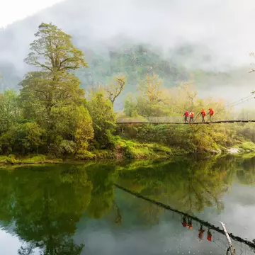
Best for something completely different
The Whanganui River was the first river in the world to be granted legal personhood status in 2017, recognizing the spiritual connection between Māori iwi (tribes) and the river, their ancestor. The Whanganui Journey is an epic way to experience this up close.
Curling 290km from Mt Tongariro to the Tasman Sea, the Whanganui is the longest navigable river in New Zealand and the 5-day, 145km journey through Whanganui National Park is counted as a Great Walk, though travelers can follow it by canoe, kayak, jetboat or bike, and take shorter trips, too.
It’s not all strenuous. If you only have a day, try your hand at paddling from the Bridge to Nowhere downstream to Pipiriki. You can even combine five hours of beginner paddling with a visit to a lavender farm for a spot of lunch.
Take your New Zealand trip with Lonely Planet Journeys
Time to book that trip to New Zealand
Lonely Planet Journeys takes you there with fully customizable trips to top destinations – all crafted by our local experts.


Explore related stories