Jun 1, 20269 min read
How to get around in IcelandApr 17, 2026
11 MIN READ

Writer
Fjallsárlón in Southeast Iceland. Daniel Dorsa for Lonely Planet

Writer
Lonely Planet may earn a commission from affiliate links on our site. All recommendations and reviews reflect our own independent opinions.
If you’re setting off to circumnavigate Iceland’s famous Ring Road, you’ll drive right through the coastal village of Vík, happily located between major natural attractions in the exceptionally beautiful southeastern part of an exceptionally beautiful country.
To the west lie the basalt columns at Reynisfjara, the rocky plateau Dyrhólaey and a pair of waterfalls, Skógafoss and Seljalandsfoss. To the east, you’ll find the Eldhraun lava field (from the cataclysmic 1783 Laki eruption) and the gateway to Vatnajökull National Park at Skaftafell.
And the leg between Kirkjubæjarklaustur (a 50-minute drive northeast of Vík) and Höfn (another 200km east) is simply astonishing. You’ll pass vast deltas of gray glacial sand, marooned-looking farms, the toes of craggy mountains, surreal lava fields, crackling glacier tongues and ice-filled lagoons like Jökulsárlón. All along the coast, white-capped waves wash up on black sands, with cliffs that glow green from all the rain.
Whether you’re passing by on the Ring Road or planning a dedicated visit to this fantastic region, these are the best things to do in and around Vík and Iceland’s southeastern coast.
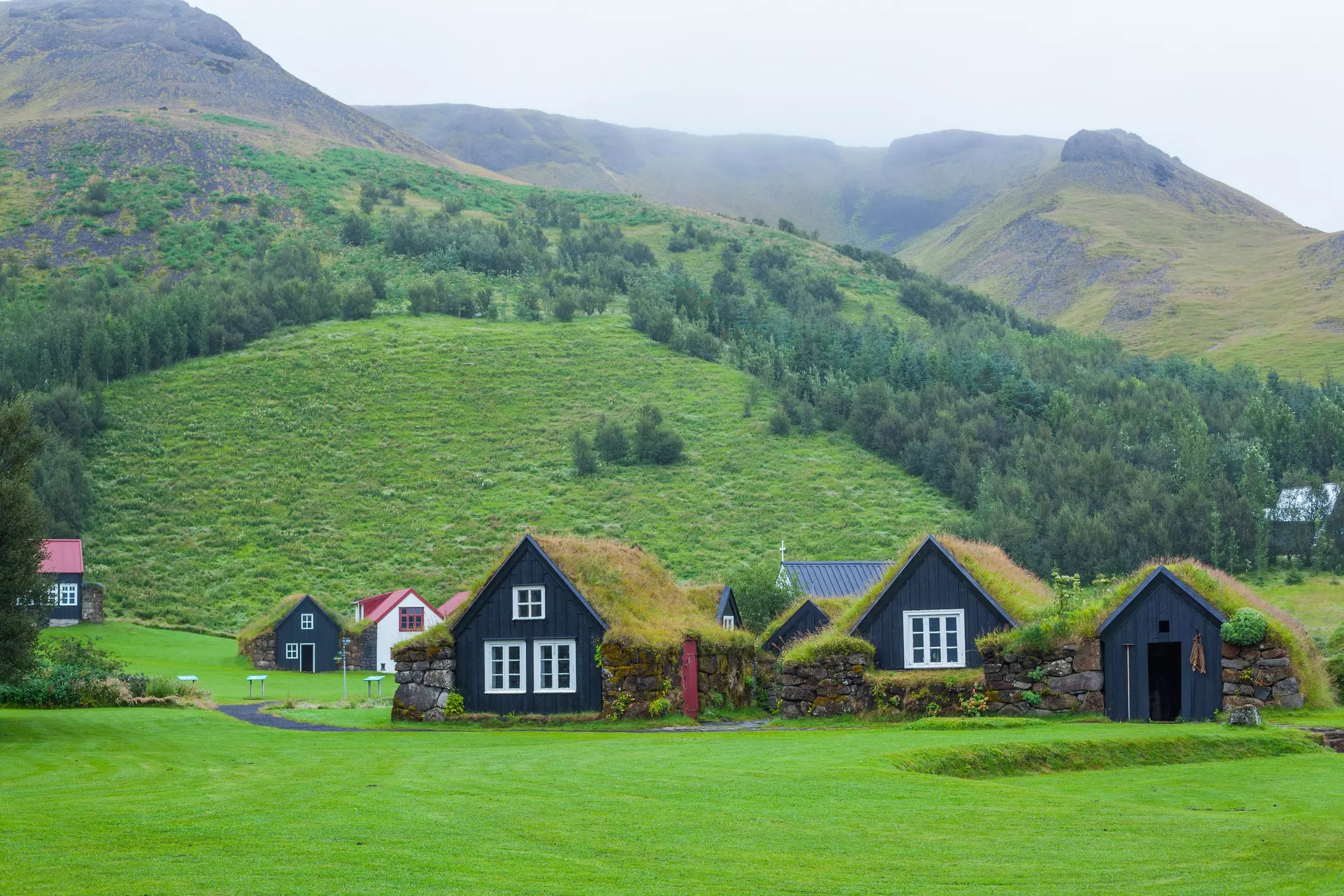
At the southern edge of a glacier-covered volcano (Eyjafjallajökull), the tiny village of Skógar is renowned for its namesake waterfall. In summer, it’s also a gateway to the majestic mountains and colorful valleys of the highlands, in Iceland’s rugged interior.
The culture of this rustic region is highlighted at the Skógar Museum, where visitors can wander through turf houses, get up close with an old fishing boat and learn how transportation across these vast landscapes has changed over the decades. There’s also a reconstructed elementary school from the early 1900s and a small hydroelectric power plant from 1929.
Detour: The 25km mountain trail linking Skógar and Þórsmörk is a rewarding trek known as Fimmvörðuháls. Most hikers complete the trail in 8–10 hours; pack wisely, and expect all four seasons over the course of the route.
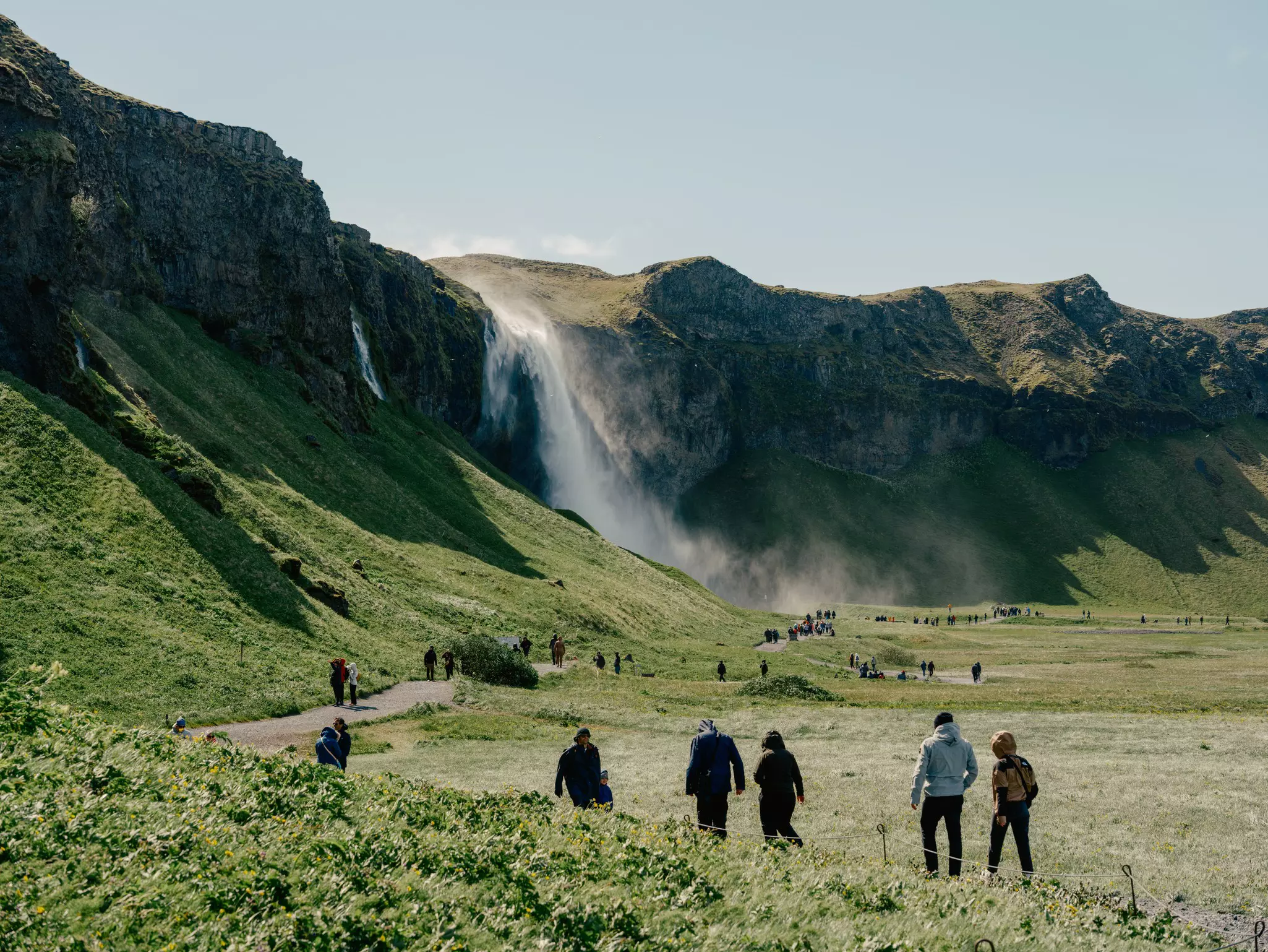
Iceland has thousands of waterfalls (foss), with some of the most impressive located in the 80km between Hvolsvöllur and Vík. Seeing and hearing them roar is one of the best things to do in all of Iceland.
You’ll see the glistening 60m-high Seljalandsfoss thundering off the lower escarpments of Eyjafjallajökull from miles away. A slippery path runs around the back of the cascade; we recommend packing a pair of sturdy boots and waterproof clothing. Some 500m further down, the humble Gljúfrabúi gushes into a hidden canyon. Access either by driving down Þórsmörk Rd, or follow a walking path from the (paid) Seljalandsfoss parking area.
Skógafoss is another immediate sight on the Ring Road. In dramatic fashion, the 62m-high waterfall topples over a rocky cliff at the western edge of Skógar. Climb the steep staircase alongside for giddy views, or walk to the falls’ foot, shrouded in sheets of mist and rainbows. Also at Skógar, you can walk behind delightful Kvernufoss, a somewhat hidden 20m waterfall. The short trail to it starts at the far east of the Skógar Museum parking lot. Climb the stile over the fence, then follow the walking path (roughly 15 minutes) toward the cliff.
Planning tip: Before, after or in between waterfalls, fuel up at one of Vík’s appealing restaurants. Suður-Vík serves hearty fare in a warmly lit building with exposed beams and interesting artwork. Mia’s Country Van cooks up fish and chips, perfect for a road trip lunch. And Smiðjan Brugghús is Vík’s hippest brewery hangout, with 10 craft beers on tap, bar food and windows looking onto the brew room.
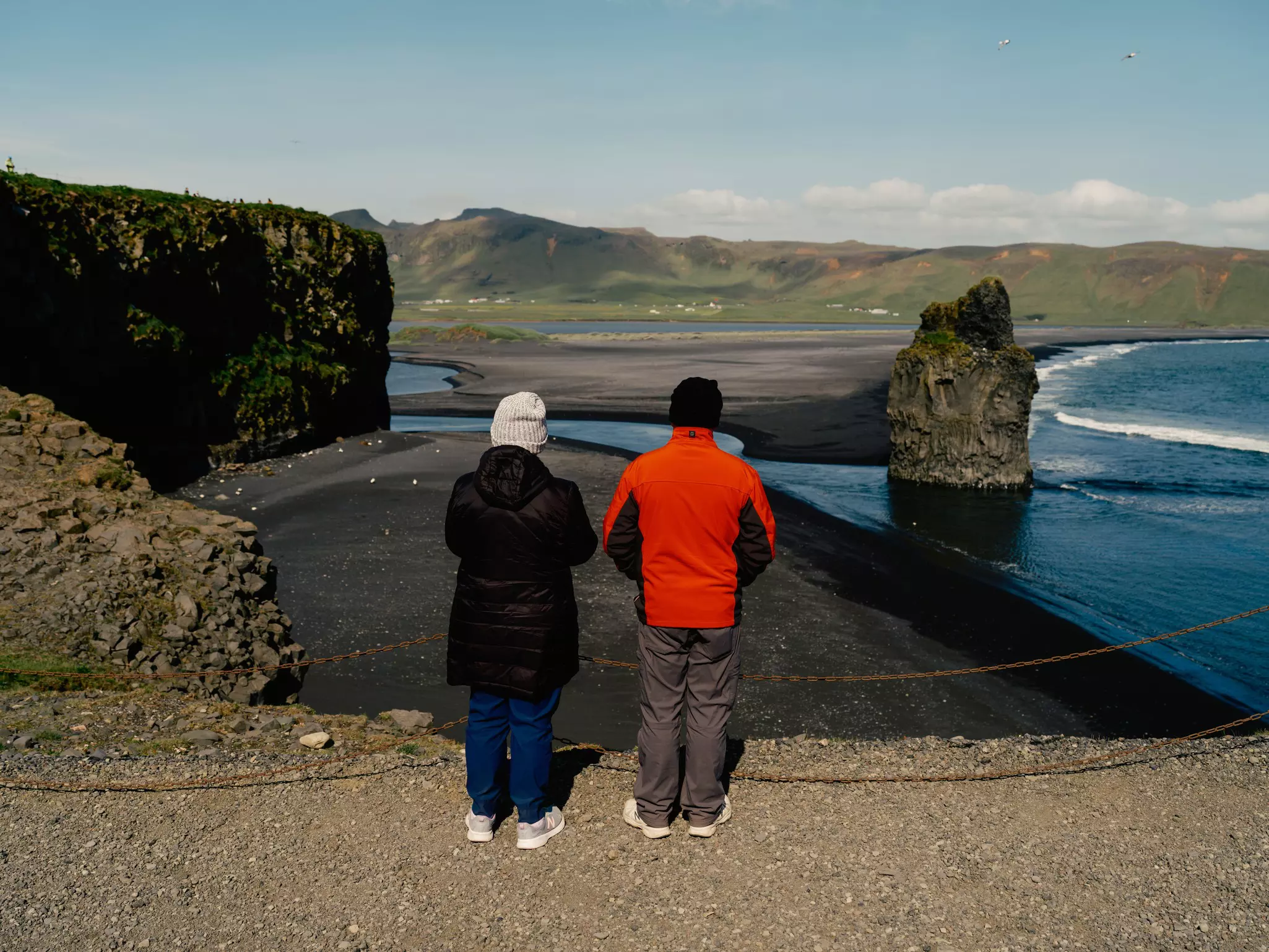
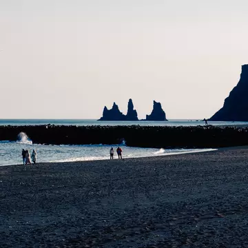
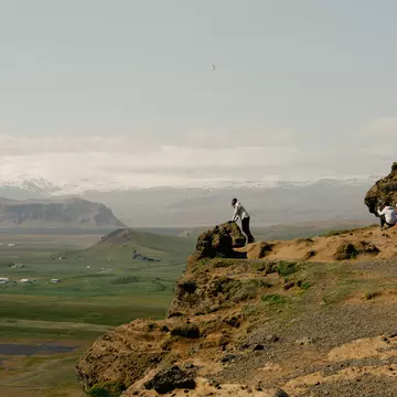
Vík’s black sand shore is dramatic from above and below. For a bird’s-eye view, the sculptural peninsula of Dyrhólaey rises dramatically from the surrounding plain 10km west of Vík, offering amazing perspectives of waves crashing on black sand beaches as birds flit overhead. You’ll find a Viking era connection at Loftsalahellir (reached by a track just before the causeway to Dyrhólaey); this cave was used for council meetings in Saga times.
At the other end of the long black strip and closer to Vík, the famous Reynisfjara is backed by basalt columns, resembling a magical church organ. Immediately off the beach's shore are towering sea stacks, Reynisdrangar. Tradition says that they are the mast of a ship that trolls were attempting to steal when they got caught in the sun. In Vík, a walk to the top of Reynisfjall (340m) provides superb views. Watch out for rogue waves on the beach.
Planning tip: To ride horses along a black sand beach is to feel wild and free. Head to Víkurfjara, the beach just alongside Vík, where Vík Horse Adventure has a stable. Suitable for beginners, its half- and full-hour rides make it easy for just about anyone to tour this area with a four-legged guide.
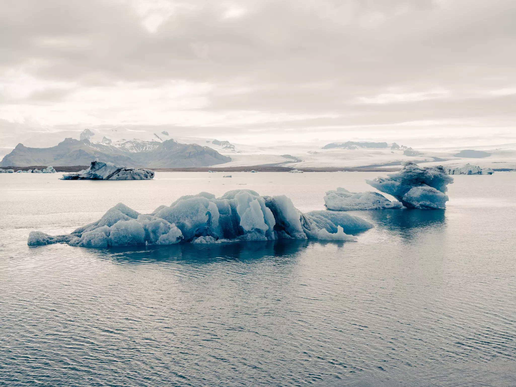
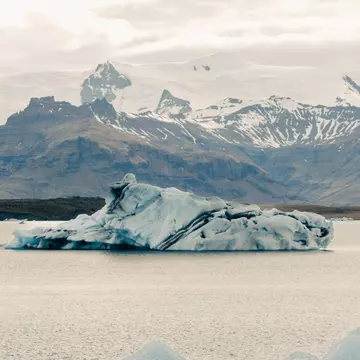
Luminous blue icebergs drift through Jökulsárlón, which the Ring Road skirts 190km east of Vík. Just before the frozen hulks reach the sea, they strand themselves on the sandbanks at this massive glacier lagoon, which was once entirely a glacier.
About a million people per year visit this wonder; icebergs big and small line the lagoon’s southern end. Most visitors park by the bridge (Jökulsárbrú), where the bergs are closest to shore. Yet a little further west, elevated paths give more peaceful panoramic views. (Keep an eye out for ringed seals.)
The minuscule Jökulsá – the river is only about 500m long – connects the lake to the sea. On the other side of the bridge, you’ll see why tourists have dubbed Fellsfjara as Diamond Beach: ice boulders and bergs glitter photogenically on the black sand beach as part of their final journey into the ocean.
Planning tip: You can get very close indeed to Jökulsárlón’s floating bergs on a boat tour. Glacier Lagoon offers 40-minute tours in an amphibious craft that trundles along the shore like a bus before splashing into the water. For double the price, a 1-hour Zodiac tour will take you much closer to Breiðamerkurjökull, the glacier at the head of the lagoon from which the icebergs calve. Or explore the waters by kayak with Ice Guide, also departing from the main parking area.
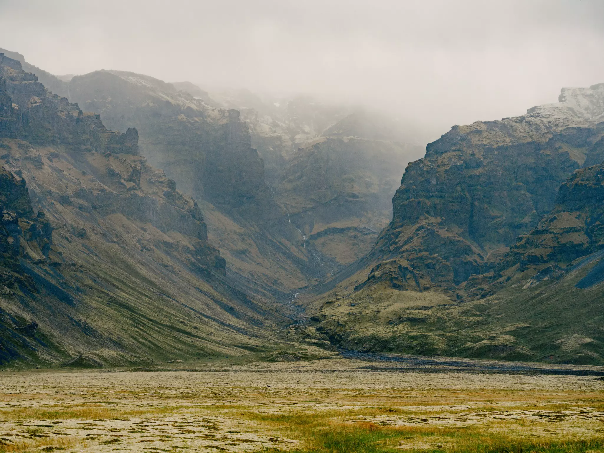
Fire meets ice at Vatnajökull National Park, where 10 active volcanoes lurk underneath a frozen cap that covers almost 15% of Iceland’s land mass. The southern end of this UNESCO World Heritage Site, from Kirkjubæjarklaustur (70km from Vík) to Lónsöræfi, packs in great natural treasures, with outdoor action for all seasons.
The national park’s crown jewel, the Skaftafell wilderness area encompasses breathtaking peaks and glaciers. As you walk into a birch forest, temperatures drop the closer you get to the massive Vatnajökull glacier. The forest is a rare peek into what Iceland may have been like during the warm period that preceded the era of human settlement.
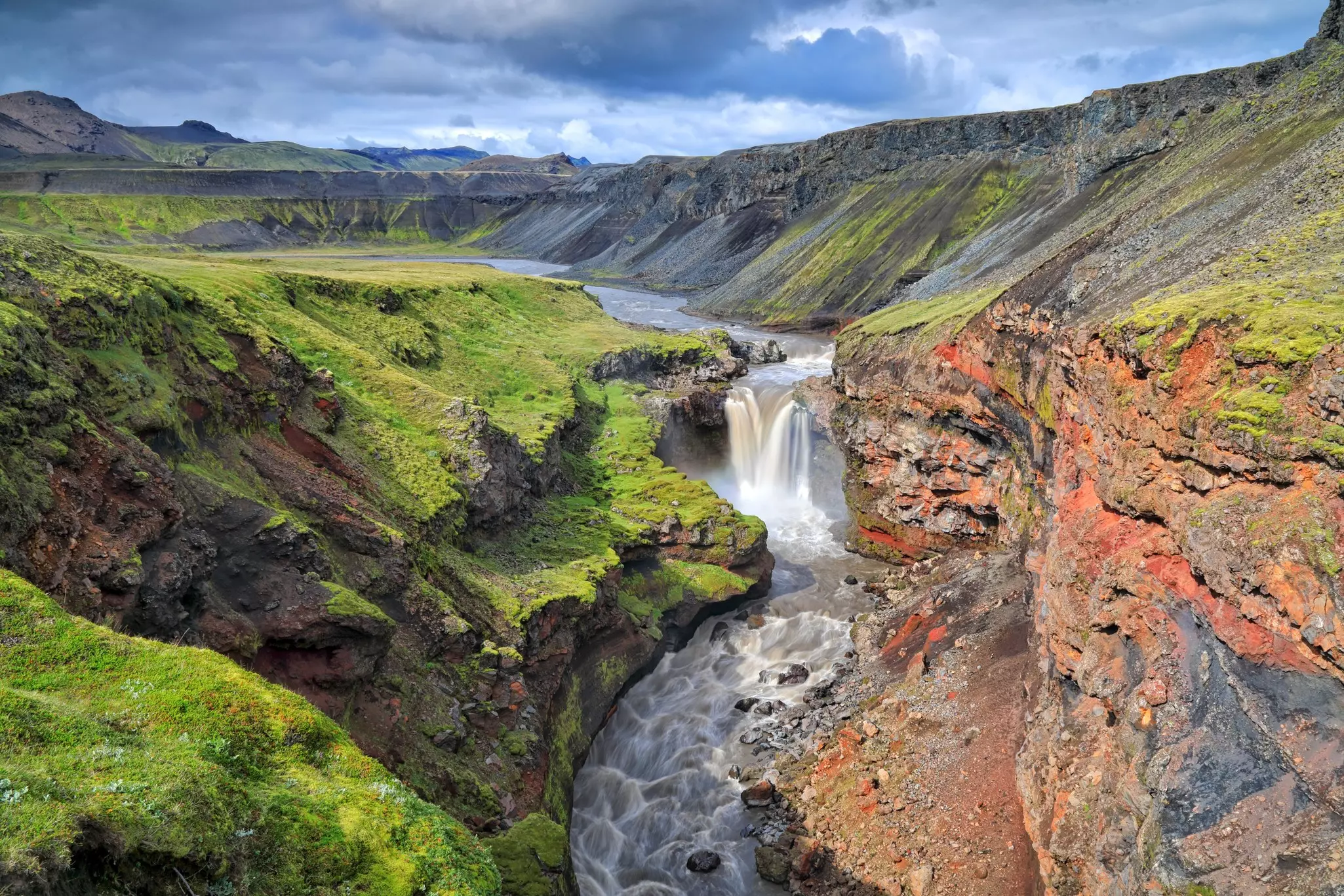
While Svartifoss is just the 20m drop of a small stream, what the waterfall lacks in force, it makes up for with the basalt cliff that elegantly frames the cascade.
Planning tip: A 6km loop hike takes you past Svartifoss as well as Hundafoss and Magnúsarfoss, two other waterfalls, and to a wonderful viewing point at Sjónskeri. Expect many other hikers along the way.
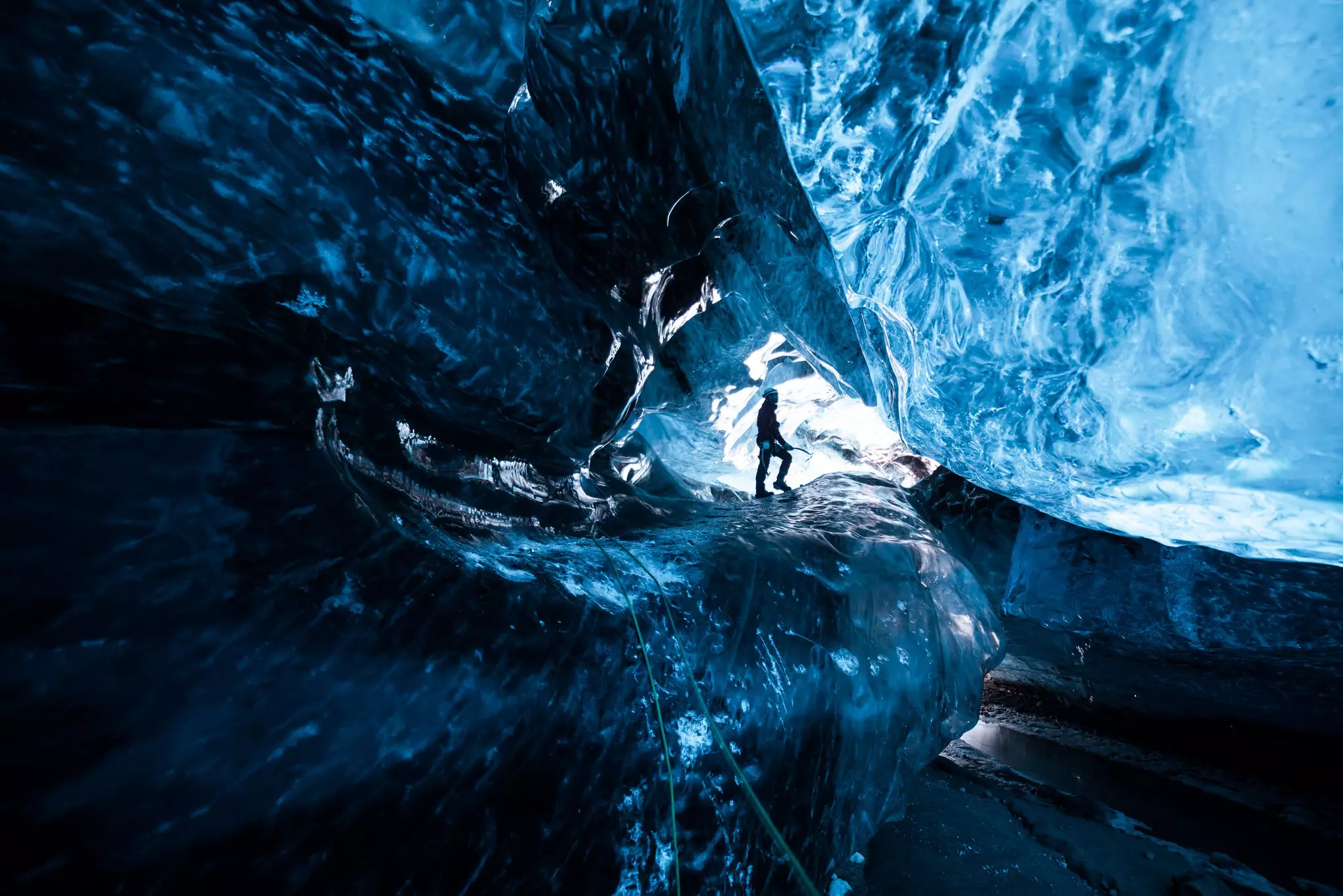
The highlight of a visit to Vatnajökull’s southern reaches is a glacier hike, a chance to learn the basics of glaciology in a thrilling, hands-on manner. Most tours take place on Falljökull (near Skaftafell) in summer and on Breiðamerkurjökull (near Jökulsárlón) in winter; tours last 2–3 hours. Ice axe in hand and wearing massive crampons, you’ll be guided around cracks, streams and ponds that form on the glacier. The pace is slow, with a modest level of difficulty – actually getting onto the glacier from the moraine can be steep.
Every winter in this part of Vatnajökull, guides drive massive super-Jeeps with limited seating to the foot of the glacier in search of a natural entrance. (The landscape changes every summer and is unsafe outside the frozen months from October to March.) The Sapphire Cave has been a common destination for the past few years, though each tour depends on weather conditions and available sunlight. Operators include Arctic Adventures and Local Guide of Vatnajökull, and their expertise commands a premium: expect to pay at least 30,000 Icelandic króna per person.
Planning tip: Access to most of Vatnajökull’s glaciers is only for experienced folks equipped for a serious polar-style expedition. The ice cap is cracked, with deep crevasses, and sudden, violent blizzards are frequent. Glacier Jeeps and Glacier Journey offer snowmobiling and super-Jeep tours; Glacier Jeeps runs guided glacier hikes, too.
There’s never a bad perspective on the otherworldly scenery of this wild region. So after you’ve driven across and hiked all over it, consider taking it in from above.
Atlantsflug offers helicopter rides over glacial outlets, canyons, mountains and even active volcanoes. Tours – which are pricey but provide a once-in-a-lifetime experience – depart from tiny Skaftafell Airport, opposite the entrance to Vatnajökull National Park.
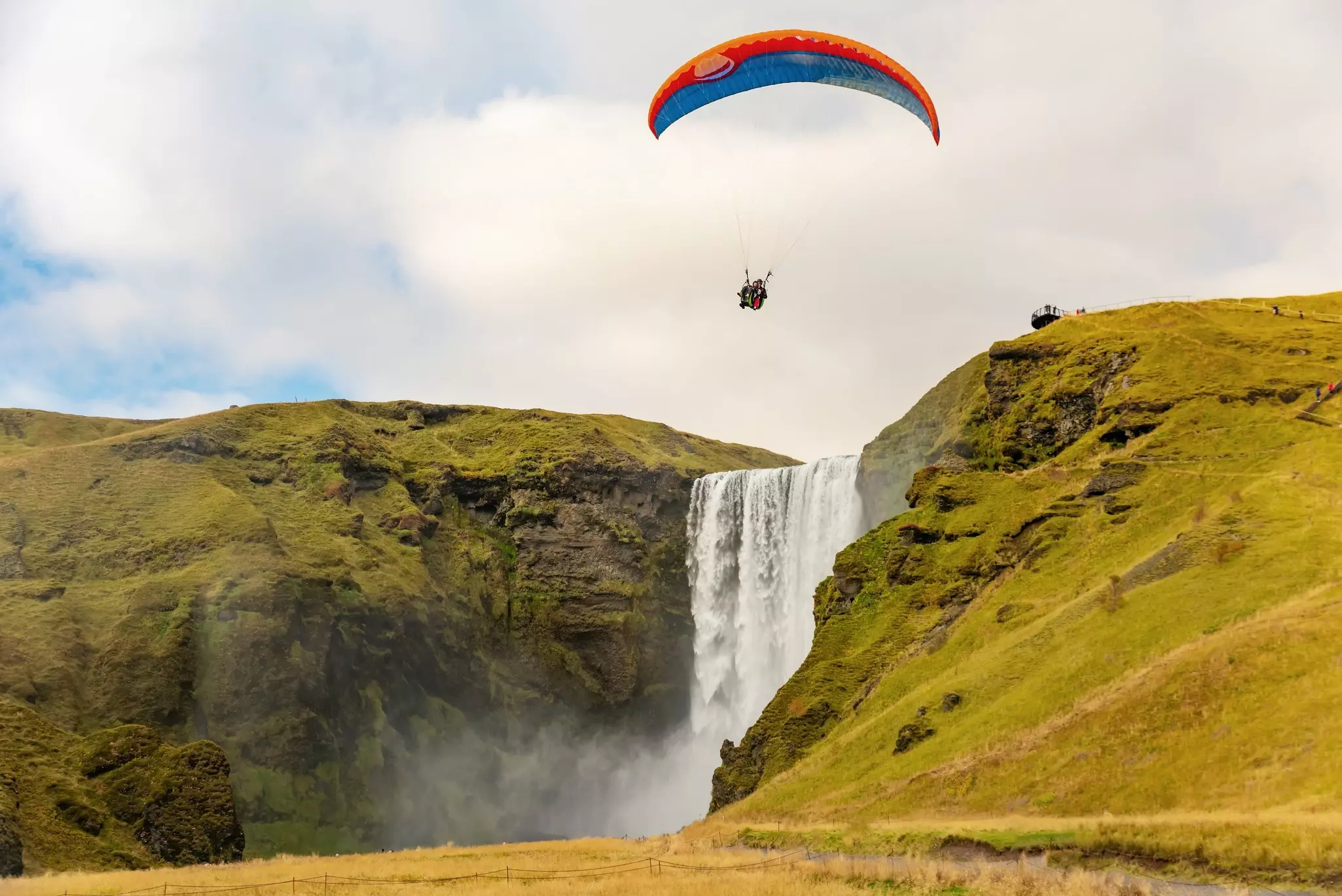
If you want a more active approach, Zipline Iceland in Vík lets you soar over a river canyon and epic valleys on four zip lines between 30m and 240m long. Or make like a puffin with True Adventure’s tandem paragliding outings. The scenery over this spectacular section of the coast includes an aerial view of the Reynisdrangar.
Planning tip: Getting to Zipline Iceland’s starting platform requires a short car ride as well as a hike.
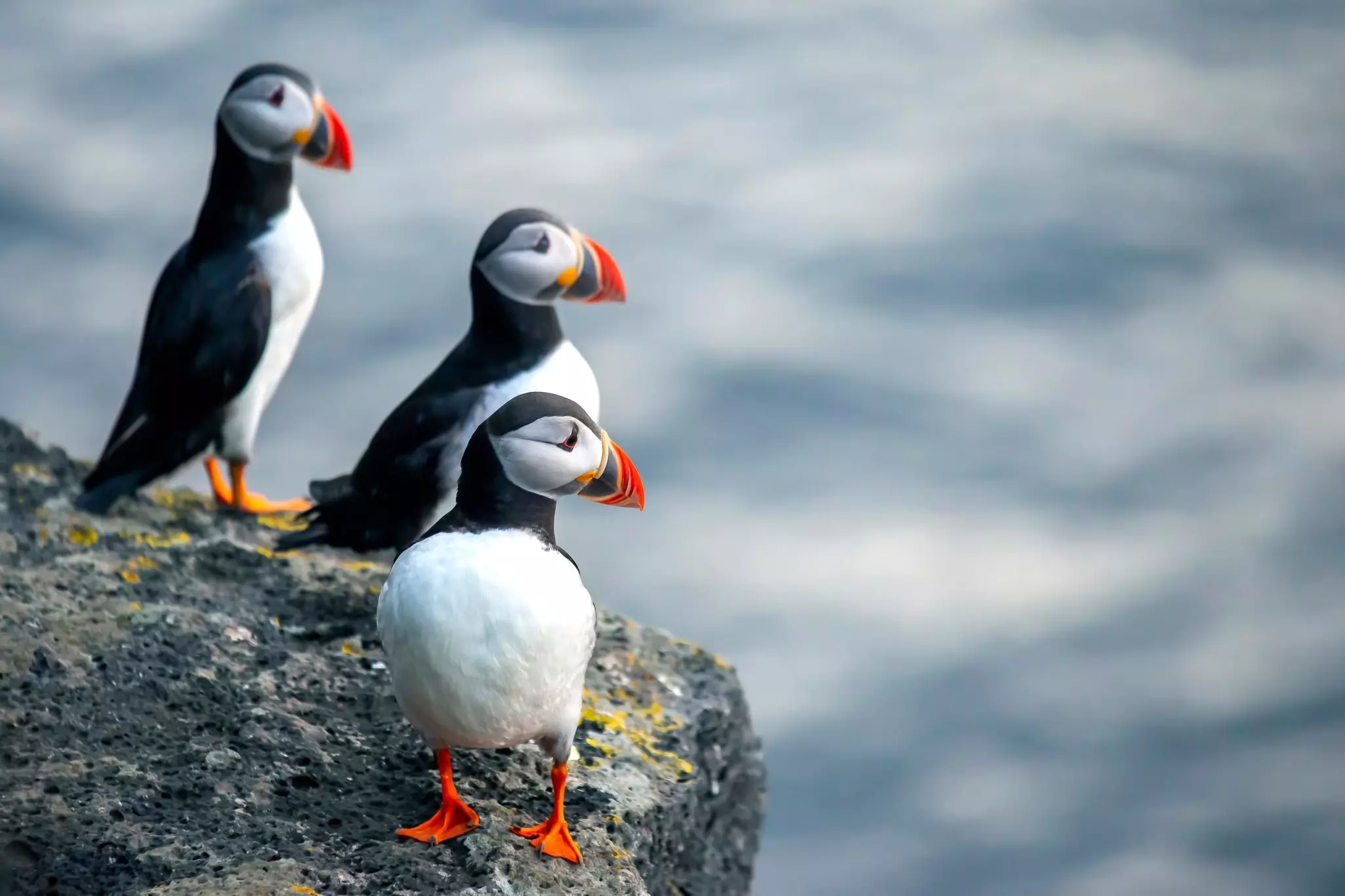
Of this chain of 15 islands, only Heimaey is inhabited. (Heimaey’s volcano, Eldfell, is very much active, with the ground on some spots of the island hot enough to bake bread.) The island is perhaps best known for its colorful, irresistible puffins, the largest breeding colony in the world.
During puffin season, from April to August (the prime month for chicks), head to Heimaey’s western coast or southern tip for top viewing points; the lookout near Stórhöfðaviti is one of the best. If you want a closer look, Ribsafari will take you close (but not too close) to puffin-nesting grounds in a speedboat (you may spot the occasional orca too). Eyjatours combines puffin spotting with a trip to Eldfell and the farmstead where the island’s first Viking family settled.
Planning tip: Puffins and volcanoes aren’t the only attractions on Heimaey. The annual National Festival Þjóðhátíð draws some 17,000 visitors with music, dancing, fireworks, a bonfire and a light display. And some travel here expressly for the sustainable gastronomy at internationally praised Slippurinn restaurant.
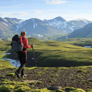
Stretching into Iceland’s remote and uninhabited highlands, the 2- to 5-day hike from Landmannalaugar to Þórsmörk (about 60km west of Vík) is where backpackers earn their stripes in Iceland. Commonly known as Laugavegurinn (Hot Spring Road), the 55km hike passes vividly colored mountains, glaciers and glacier rivers.
round-tripStarting at Landmannalaugar, you can count on a (relatively) easy 12km leg to the first hut; the trail passes the boiling earth at Stórihver and sweeping fields of glittering obsidian. At Hrafntinnusker, try a couple of short local hikes without your pack before setting off; great views can be found at Söðull (20 minutes round-trip) and Reykjafjöll (1 hour round-trip). Budget 4–5 hours for the next 12km leg to Álftavatn (which has huts that sleep 72 people); along the way, you’ll see the looming ice caps of Tindafjallajökull, Mýrdalsjökull and Eyjafjallajökull.
Heading for the Emstrur huts, 15km from Álftavatn, don't miss the detour to Markarfljótsgljúfur, a gigantic multihued canyon. Then it’s another 15km on to Þórsmörk, where barrenness turns to brilliantly verdant lands dotted with lush Arctic flowers. If you're not planning on staying in Þórsmörk, you'll need to arrive before the last bus leaves in the evening.
Planning tip: As Iceland’s most popular hike, Laugavegurinn has sound infrastructure, with carefully positioned huts along the zigzagging route. Book huts months in advance, or count on camping.
This article was adapted from Lonely Planet’s Scandinavia guidebook, published in July 2025.
Take your Iceland trip with Lonely Planet Journeys
Time to book that trip to Iceland
Lonely Planet Journeys takes you there with fully customizable trips to top destinations – all crafted by our local experts.

Explore related stories