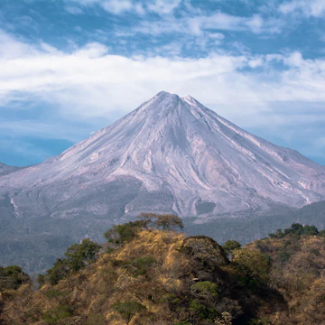
Volcán Nevado de Colima (4260m) is accessible on foot from the last week of October till the first week of June. Patches of pine forest cover Nevado’s shoulders, while alpine desert takes over at the highest altitudes. Wildlife includes deer, wild boars, coyotes and even pumas.
The best months for climbing are generally the dry months of December through May. But temperatures from December to February often dip below 0°C (32°F) and snow can fall on the upper slopes – nevado means ‘snow-covered.’ Weather changes fast here and lightning strikes the peak in stormy weather, so make sure you keep an eye on the clouds and get an early start. The park’s hours November to March are from 6am to 6pm. The summer rainy season is from July to September, when park hours are longer.
To get here on your own from Ciudad Guzmán, take the bus to El Fresnito (M$22), where you must try to hire a driver (not an easy task) to take you the remaining 20km or so up a rough road to the trailhead at La Joya/Puerto Las Cruces (3500m). You'll pass the park entrance on the way, where you'll pay a M$45 entry fee. An alternative is to walk up from El Fresnito – a much longer and tougher proposition. If you elect to walk, stay on the bus as long as you can as it covers some of the distance beyond the town.
Walkers will need camping gear and food (and some very warm clothes), because it's impossible to walk there and back in a day. Allow seven hours to get to the parking at La Joya/Puerto Las Cruces and then another three to four hours from there to the summit and about seven hours all the way back down again. You can camp at La Joya/Puerto Las Cruces a few kilometers beyond the park gates.
The hike to the summit from La Joya is around 9km and ascends 700m. Some prefer to just hike to the micro-ondas (radio antennae) about 90 minutes by foot from the end of the road at La Joya/Puerto Las Cruces. If you want to reach the peak, you’ll need another 90 minutes, and while the peak is easy to see, you shouldn’t go alone. There are many trails up and back and it’s very easy to get lost or led to areas with hazardous footing. Fog can also be an impediment. You'll save a lot of time and bother going with a guide.
Driving up this volcano on the relatively good gravel road means that you’ll be ascending to a high altitude very quickly. If you feel lightheaded or dizzy, you may be suffering from altitude sickness. Descend as quickly as possible, as this condition can be dangerous.