Jul 16, 202610 min read
Things to know before visiting Los AngelesApr 20, 2026
10 MIN READ
Contributors
Highlights
Writers Acacia Gabriel and Annita Katee break down getting around Los Angeles.
A car is most convenient here – LA was designed for drivers, not subway riders.
The B Line covers Hollywood and Universal City; ride the E Line for Santa Monica.
The same LA trip can run $27 on one rideshare app and $120 on another.
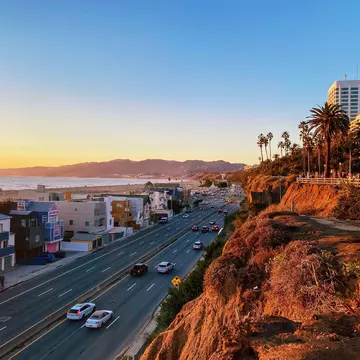
Cars on the Pacific Coast Highway in Santa Monica, Los Angeles. gemnannerb/Shutterstock

Contributors


Acacia Gabriel, Annita Katee
Highlights
Writers Acacia Gabriel and Annita Katee break down getting around Los Angeles.
A car is most convenient here – LA was designed for drivers, not subway riders.
The B Line covers Hollywood and Universal City; ride the E Line for Santa Monica.
The same LA trip can run $27 on one rideshare app and $120 on another.
Lonely Planet may earn a commission from affiliate links on our site. All recommendations and reviews reflect our own independent opinions.
Los Angeles is one of the most diverse cities in the US, spanning everything from the glamor of Hollywood to the seaside charms of Santa Monica and the Mexican vibe of Olvera St and Boyle Heights. However, this mighty metropolis sprawls across 2281 sq miles (or 4084 sq miles if you include the surrounding county), so you'll need to give some thought to how to get around when you visit.
LA's sprawling landscape can sometimes be overwhelming for visitors, particularly if you're unfamiliar with the layout of the city, but this guide to getting around the city is here to help. However, don't make the mistake of thinking that you can see all of Los Angeles in just one day – even with a car (the most convenient mode of transport), it's just not possible.
With sights widely spaced, traveling around Los Angeles requires some strategic planning. While some neighborhoods invite leisurely exploring on foot, others are better visited by car or rideshare. Public transportation is an option too, but trains don't go everywhere and bus routes can be confusing.
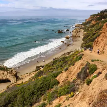
That said, trains and buses are a good choice for getting around Downtown and Hollywood and getting out to Universal Studios, Exposition Park, Santa Monica and Venice Beach, though you'll need a car to get the best out of neighborhoods such as Malibu and Pacific Palisades.
Whether you're in the City of Angels for a week or just a few days, here's everything you need to know to get around in Los Angeles.

I won't beat around the bush – the best and most convenient way to explore Los Angeles is with a car, whether you rent one on arrival or bring your own from home. Many first-time visitors aren't prepared for the sheer size of the city and the limited reach of its somewhat lackluster public transportation system.
Unlike in New York City, there isn't a subway that can take you to all parts of town, and much of the modern city was deliberately laid out with drivers in mind. On the plus side, this does mean that most tourist sights have their own parking structures, or are close to public parking garages, though rates for a day's parking can top $30 in some neighborhoods.
If you plan to park on the street, Los Angeles is known for having very strict and confusing parking rules, with high prices and sometimes limited metered parking spaces, even in popular areas. A public parking garage or parking lot is often a better bet.
All the usual hire companies are represented at Los Angeles International Airport (LAX) and most also have offices in the city. The 25mph speed limit on non-freeway roads is strictly enforced, and using a phone while driving is strictly prohibited (even texting while stopped at a red traffic signal can lead to a fine). nnn
Driving in LA is not for everyone. The local driving style is more aggressive and less defensive than in some other cities, and you'll need to navigate busy lanes of traffic on freeways and other major roads to get to most places in the city. When you add in the bumper-to-bumper traffic, merging or changing lanes requires you to be very confident and intentional.
Planning tip: Los Angeles is notorious for traffic congestion, especially during the morning and afternoon rush hours, on weekdays between 8am and 10am, and 4pm and 7pm. Plan your itinerary to avoid driving at these times.

If I've scared you off driving yourself around LA, perhaps a rideshare option like Uber or Lyft may be more your style? Rideshares are a popular option for getting around, and wait times are rarely long. They can also be used to get to or from the airport, though drivers pick up and drop off at the LAX-It parking lot, linked to Terminal 1 by a free shuttle bus.
Fares are typically cheaper than for regular taxis, though surge pricing pushes up prices at busy times. If you plan to make a day of it at the famous museums on Museum Row or in Exposition Park, arriving and leaving by rideshare may work out cheaper than the cost of a day's car rental and parking charges. However, recent years have seen prices rise significantly, so if you're planning on exploring the entire city by rideshare, the cost can quickly add up.
Nowadays, you can also take a Waymo, the futuristic-looking driverless cars that roam the city. While the areas they serve are more limited, it's quite novel to watch the wheel spin as the car drives itself. Bookable via a rideshare-style app, they're an increasingly popular option for solo female travelers who want to feel more secure late at night.
Another upside to all kinds of rideshares is that you don't have to worry about parking. Even as a local, I often opt for a rideshare when going to places like West Hollywood, to avoid the stress of finding a space and staying on the right side of the parking rules.
Local tip: Rideshare prices change depending on levels of demand, and the fare you are quoted can vary widely between apps – always check your journey on several rideshare platforms before booking. Just the other day, one app quoted me $27, while another proposed $120 for the same journey!
On the whole, Los Angeles is less walkable than many other major US cities, but some neighborhoods may surprise you. Downtown is one of the most walkable parts of the city, with lots of cultural attractions, restaurants and shops tucked into a relatively compact area. However, proceed with caution when walking around at night, as crime can be a problem here, particularly around Skid Row.
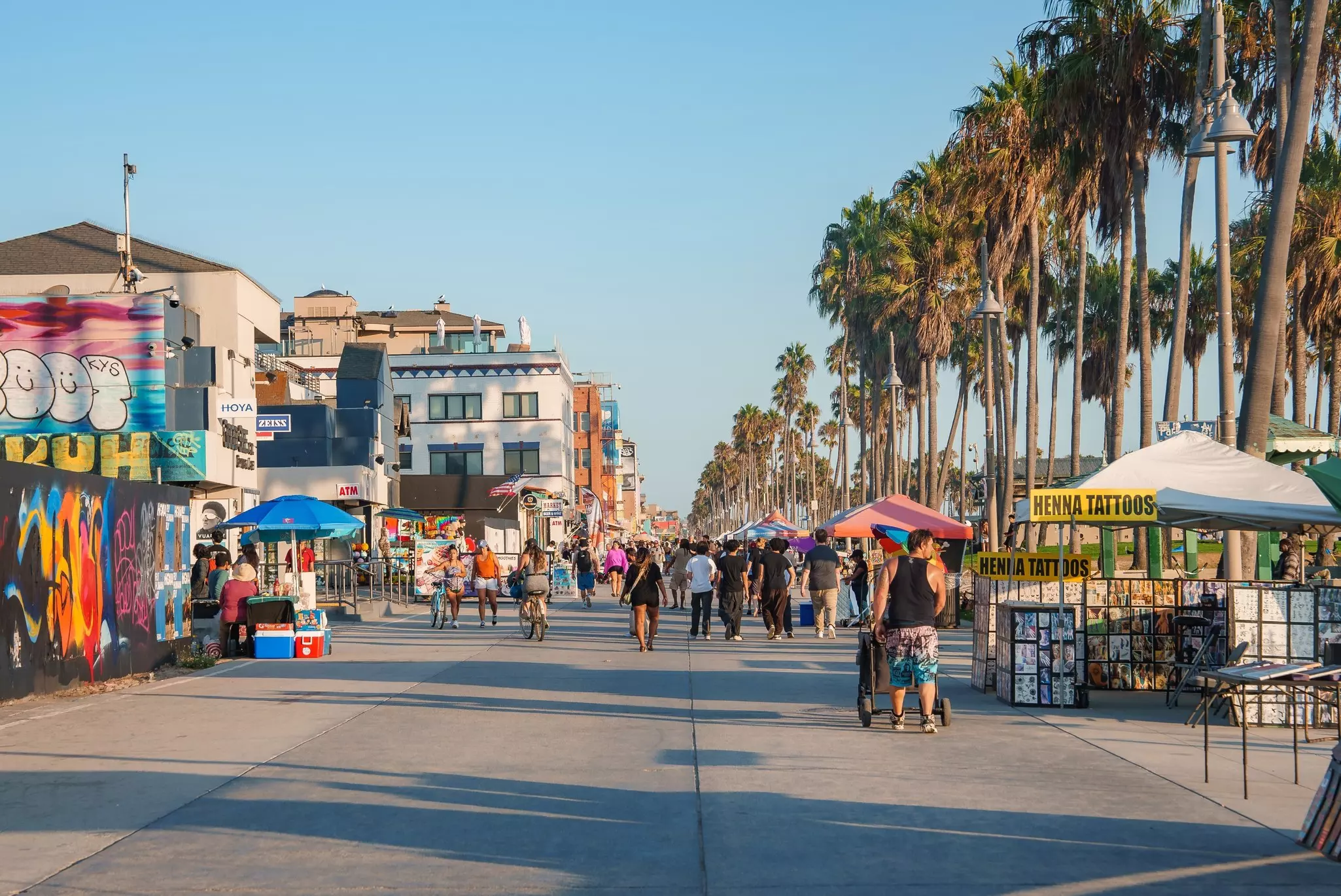
Venice Beach is also fairly easy to explore on foot. Abbot Kinney Blvd is very compact and full of restaurants, stores, cafes and bars, and from there, you can easily get to Rose Ave, where you'll find popular places to eat such as American Beauty and Gjusta. From Rose Ave, it's a short walk to the beach, boardwalk and canals.
Culver Blvd in Culver City and Sunset Blvd in Silverlake are also pedestrian-friendly. They're both full of great shopping and eating spots that you can walk between, and you can easily spend the day pottering around and popping into shops without ever setting foot in your rental car.
Planning tip: If you are relying on public transport, Museum Row (the section of Wilshire Blvd between Fairfax and La Brea Aves) and Exposition Park to the east of Downtown have several key museums within walking distance of each other, and both areas are accessible by public transport.
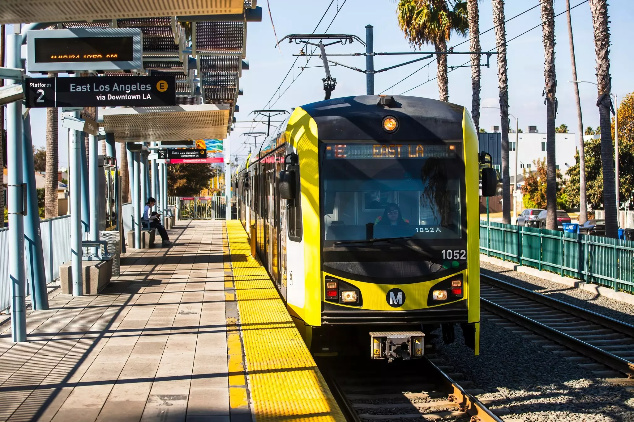
LA's Metro system covers urban trains and subway trains, as well as the city's buses and bikeshare scheme, but the train network is nowhere near as extensive as it is in cities such as New York and Chicago. That said, many key sights in Los Angeles can be reached by train.
While popular areas like West Hollywood, Beverly Hills and Malibu don't have access to the Metro, the B Line (formerly the Red Line) is great for those visiting Downtown, Hollywood or Universal City. Another useful line is the E Line, running from the east of the city through Downtown and the Exposition Park area to Santa Monica. Work is underway to extend the D Line from Downtown further west along Wilshire Blvd. The first new section, which includes a stop at Wilshire/Fairfax near Museum Row, is due to open by summer 2026.
If the Metro is an option for your destination, it's a great way to avoid congested traffic. Trains generally operate every 10 to 15 minutes from around 4am to midnight, and you can pay using Apple Wallet or the TAP payment card, which you use to pay for your ride at the validation machines on buses and at train turnstiles.
TAP cards are available from vending machines at Metro stations and from some stores, and you can top up the card with funds to pay for trains and buses. Fares start at $1.75 for an adult single ride (free for children under-6, or $0.75 for seniors), and you can make free transfers within 2 hours if you pay by TAP.
Note that some people prefer not to use the trains at night because of the increased risk of crime and antisocial behavior; rideshares are a popular alternative.
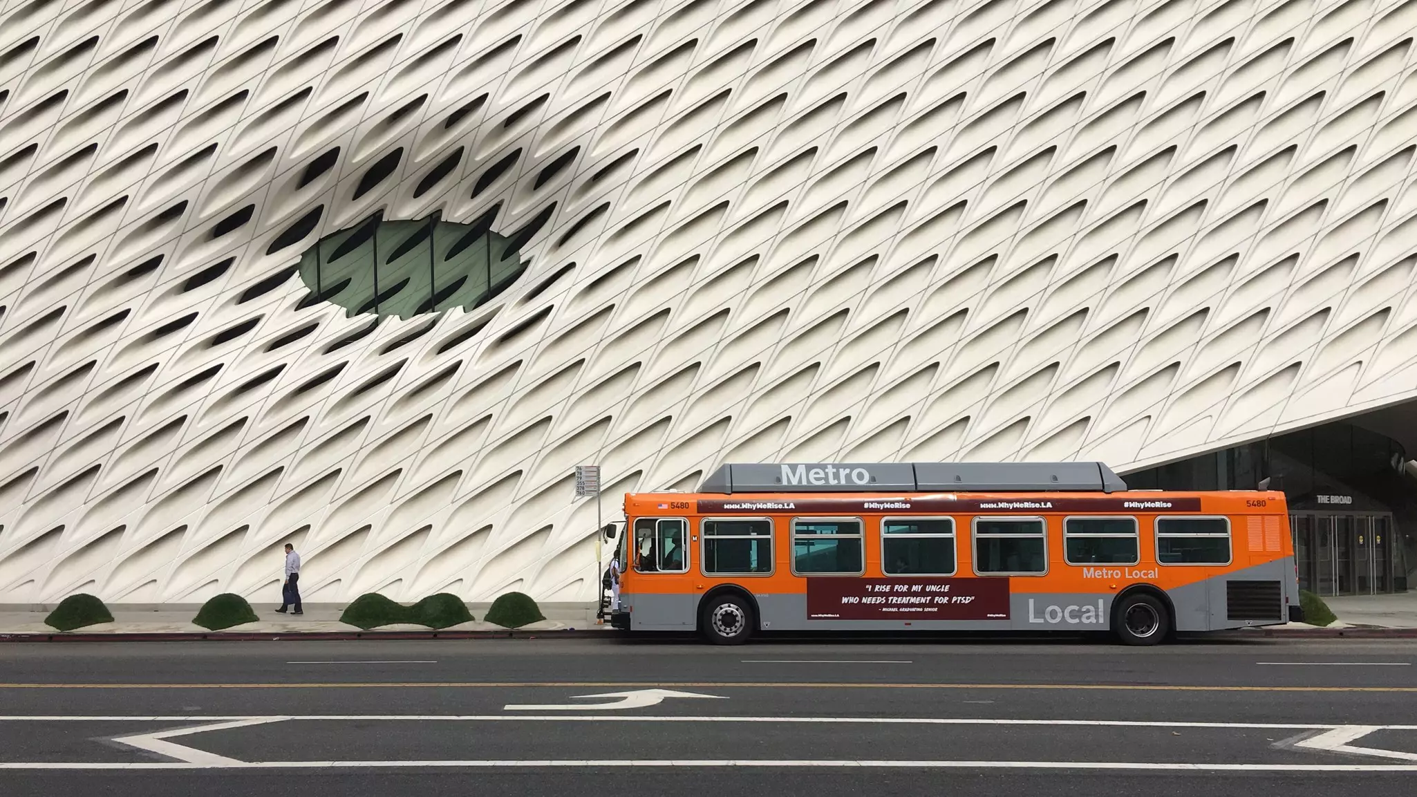
Also part of the Metro system, the bus network in Los Angeles is extensive and can take you to most parts of the city; it's just a little slower and not quite as popular with travelers. The schedules and routes can be confusing for those unfamiliar with the city, but real-time information is available on the LA Metro and Bus - Transit app.
Visitors who don't mind working out the routes will find that the bus is a very affordable way to explore the city. Drivers can't provide change for cash payments, so either carry the exact amount or purchase a TAP card. Recently, the city unveiled a fare capping model that limits fares to $5 per day and $18 per week.
Local tip: Another new addition to the city's public transportation system is the Metro Micro – a mix between a minibus and a rideshare. You can order a ride via a dedicated app, with fares starting at $2.50 per person, but the service only runs within eight specific suburban areas.

Cycling is a sustainable and popular method for getting around Los Angeles, particularly on the Westside, in Santa Monica and Venice Beach, and Downtown. In 2016, Los Angeles launched the Metro Bike Share program with over 1500 bikes and 150 stations scattered around Downtown, Central LA, North Hollywood, Culver City, Santa Monica and around the Venice Boardwalk.
The city's bikeshare scheme can be used by riders aged 16 or over with a registered TAP account. Download the Metro Bike app to locate a bike. You can use your TAP card to pay for and unlock a Metro Bike, and the scheme has a similar fare structure to the buses and trains; your first 30 minutes will cost $1.75, while $5 will give you access for 24 hours. There are also 30-day and 365-day passes available.
If you're looking for a fun way to explore specific neighborhoods, e-scooters are a great choice. Several companies operate e-scooter rentals, and they're easy to find in high-traffic areas. Once again, they work through smartphone apps, and provide a simple and sustainable way to explore LA. Note that you need to follow the local road rules – there's a maximum speed of 15mph, riding on the pavement is prohibited, and you must be 18 years or older with a valid driver's license.
Explore related stories