These 8 hikes in Montana will make you swoon for Big Sky Country
Jul 15, 2024
6 MIN READ

Writer
Montana has hikes that cover every kind of ability and outdoor adventure.

Writer
Lonely Planet may earn a commission from affiliate links on our site. All recommendations and reviews reflect our own independent opinions.
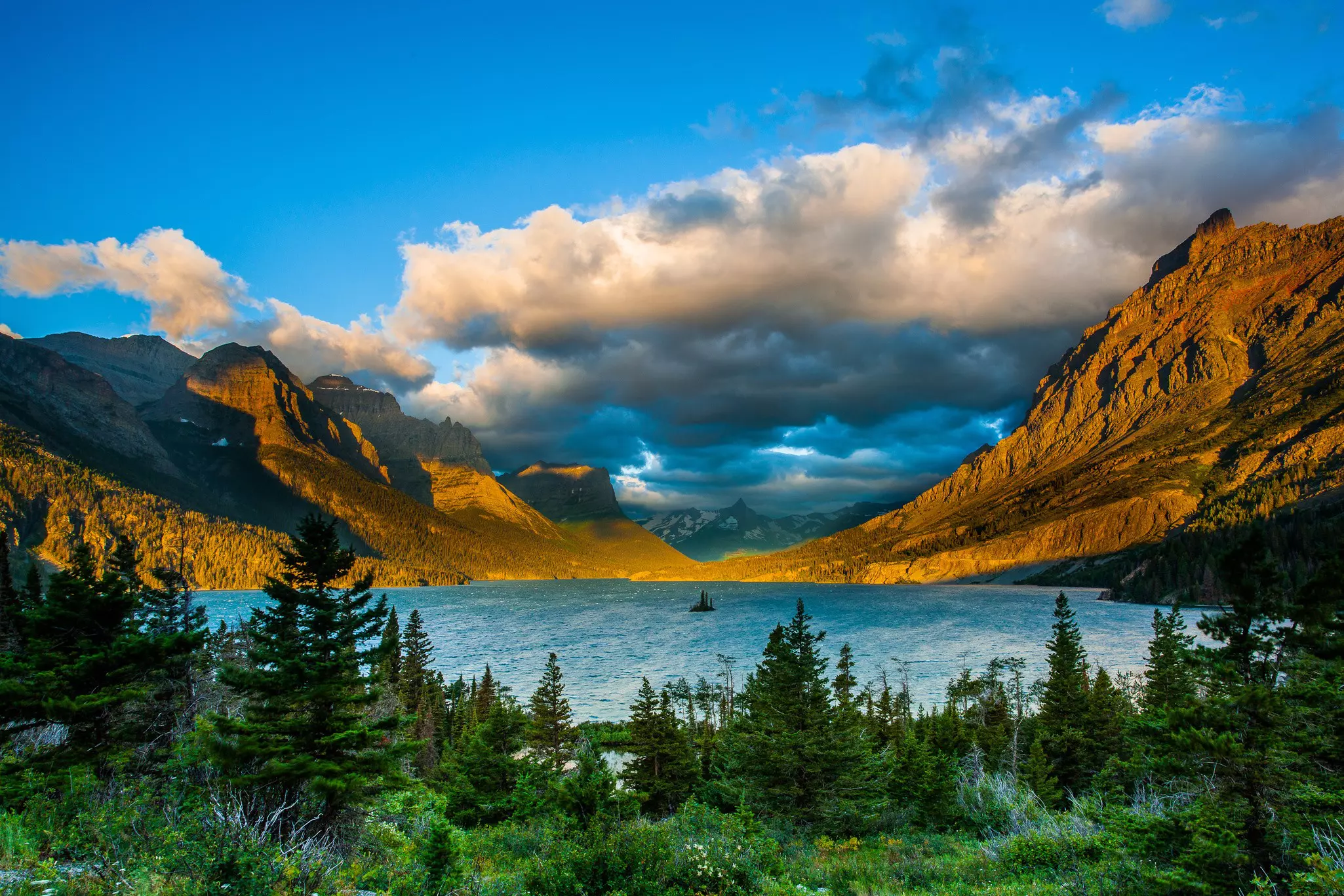
The vast landscapes of Montana are studded with towering mountain ranges (the state's name comes from the Spanish word for mountain), sparkling lakes and endless prairies. It's right up there as one of the titans of hiking in the USA with the sheer scale of trails available.
While Glacier National Park is understandably the star attraction for most visitors – it's home to some of the best trails in the state – don't sleep on the rest of Big Sky Country. This is the fourth largest state in the US, and with just over one million residents, you're going to stumble across more wildlife than people on your hikes.
With so many options, it can be difficult to know where to begin. We've got you covered with our pick of the best hikes in Montana and the top tips you need to ensure a wonderful time is had by all.
Tips for hiking in Montana
The intense winters of the region limit hiking (without snowshoes) to the warmer months, roughly between April and October.
The weather can change quickly – dress in layers and bring rain gear and a hat.
Stay hydrated and make sure to bring plenty of water with you. Throw in some snacks packed with protein and carbs as well.
Be sure to bring a trail map, compass and flashlight (don't depend on your cell).
Montana's wilderness is rich with wildlife, so take every precaution to avoid human-animal conflicts. Make noise on the trail to let them know you're coming, and carry bear spray.
1. Avalanche Lake
Best hike for beginners in search of stunning views
5.9 miles round trip; elevation of 757 feet; easy
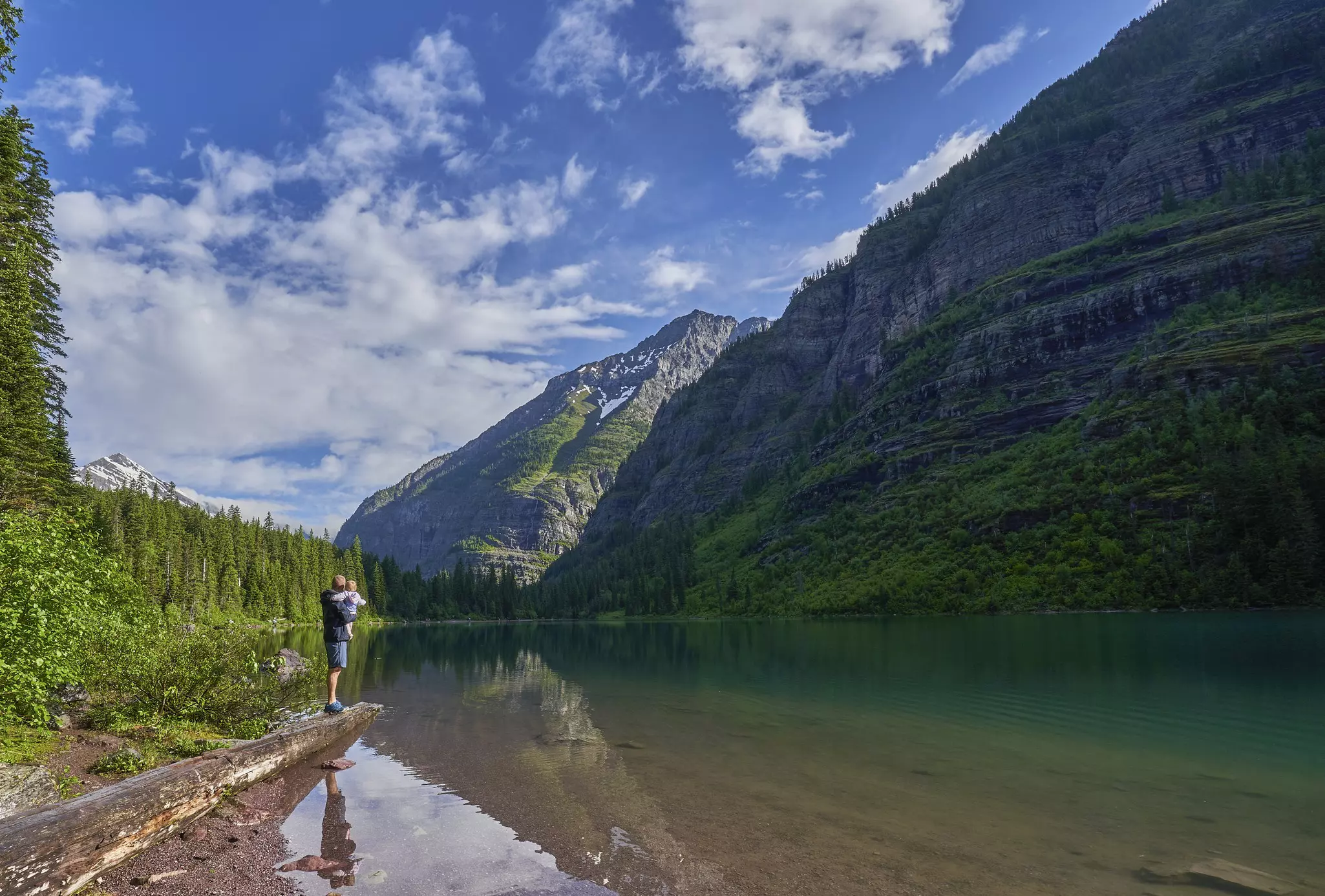
Within Glacier National Park, close to the west entrance, is Avalanche Lake, easily the most trafficked trail in the entirety of Montana. It begins on a wooden footbridge through old-growth cedars and hemlock, before ascending gently alongside the glacial melt of Avalanche Creek. Despite the trail's popularity, the scenery is rich and evocative of Montana's deepest wilderness, with wildflowers like glacier lilies and critters of all kinds visible until reaching the crystal blue waters of Avalanche Lake. This easy trail is great for novice hikers or those without too much time to go deep into the backcountry.
2. Grinnell Glacier Trail
Best hike for seeing glaciers up close
11.2 miles round trip; elevation of 2181 feet; challenging
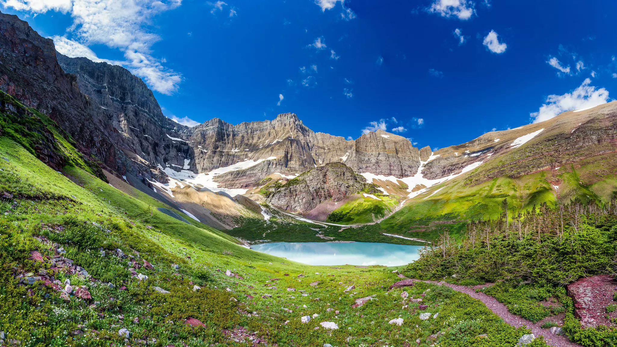
On the Eastern side of Glacier National Park is the Grinnell Glacier Trail, a popular route among experienced hikers who want to see the park's namesake glaciers up close. This incredibly scenic trek has waterfalls, wildlife – including grizzlies and mountain goats – and panoramic views of lakes, forests and mountain peaks. The hardest part of this challenging hike comes at the end when a series of switchbacks leads hikers to the glacial lagoon beneath Grinnell Glacier. Bring walking sticks, water, rain gear and anything else required for an all-day hike.
3. Danny On Memorial Hiking Trail
Best hike for views above the clouds
8.6 miles round trip; elevation of 2037 feet; challenging
Montana's beauty is not contained only within Glacier National Park. Just beyond the borders are more hiking opportunities to explore, including one of the best hikes in Whitefish: the Danny On Memorial Trail. This dog-friendly trek is steep and challenging but with plenty of rewards. On the right day, hikers can find themselves experiencing an inversion, watching the clouds roll by below them. This trail is often decorated with wildflowers and huckleberries to pick during the growing season. From the top, hikers enjoy a stunning view of nearby mountains and the Canadian Rockies. Many opt to take the ski lift down (or up), as it operates during the summer.
4. Mount Sentinel "M" Trail
Best hike for views of Missoula
1.2 miles round trip; elevation of 643 feet; moderate
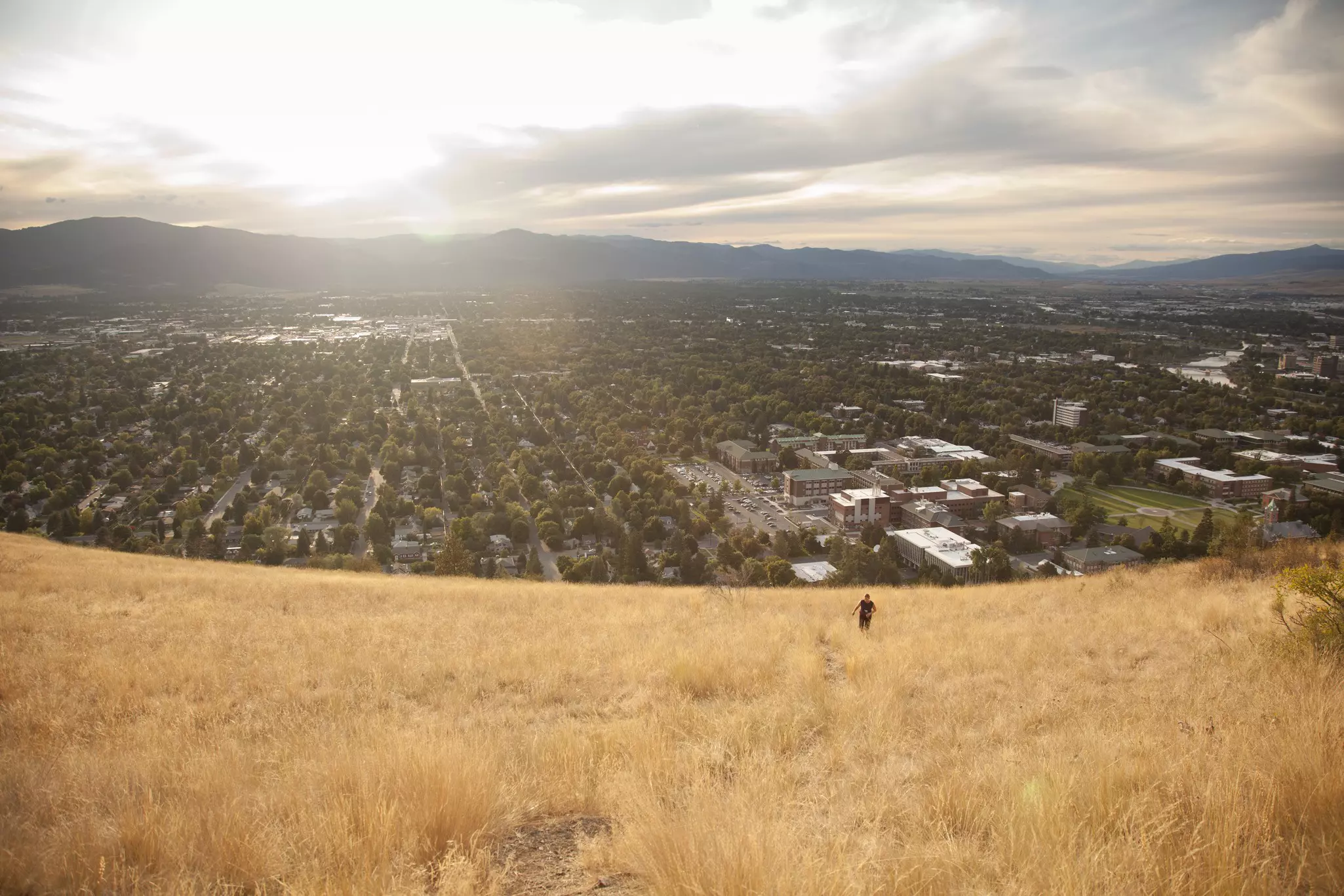
Since 1908, a giant M has decorated the west-facing side of Missoula's Mount Sentinel, and today, that M marks the end of a popular hike. A quick but steep zigzag trail leads to this local landmark, from which hikers get an excellent bird's eye view of the city below. While the M is a destination in and of itself, there are two more trails to complete the final mile to the top of Mount Sentinel if desired.
5. Rattlesnake Trail
Best hike for flexible options and abilities
33.9 miles round trip; elevation of 2818 feet; easy to moderate
Rattlesnake Trail is a popular spot for outdoor enthusiasts of all kinds, from hikers and backpackers to equestrians. It's part of a larger complex of trails in the Missoula area, but this portion is distinctive due to being an old logging road. Usage of this trail is deemed heavy, but that's really only for the first mile or so, and it's around mile five that the beaver dams start appearing. It's only after the ninth mile that the grade begins to steepen, so overall, there is a lot that a hiker can do with the trail provided. This trail is dog-friendly as long as they are leashed.
6. College M Trail
Best hike for valley views
1.6 miles round trip; elevation of 820 feet; easy to moderate, depending on route
Bozeman's M – also a nod to their local university – is seven years younger than the one found further north in Missoula, but it's just as iconic to the region. There are two routes to reach the M and accompanying iconic views of Gallatin Valley: go right at the first junction for the steeper, more direct climb, or take a hard left for the less steep but more winding option. This popular trail can even be done during winter, provided the right gear is being used. It's especially popular in spring, as it faces the sun, melting the snow earlier than on other trails. For a more challenging hike, continue up to summit Baldy Peak.
7. Lava Lake (Cascade Creek) Trail
Best hike for overnighting by the lake
6 miles round trip; elevation of 1620 feet; moderate
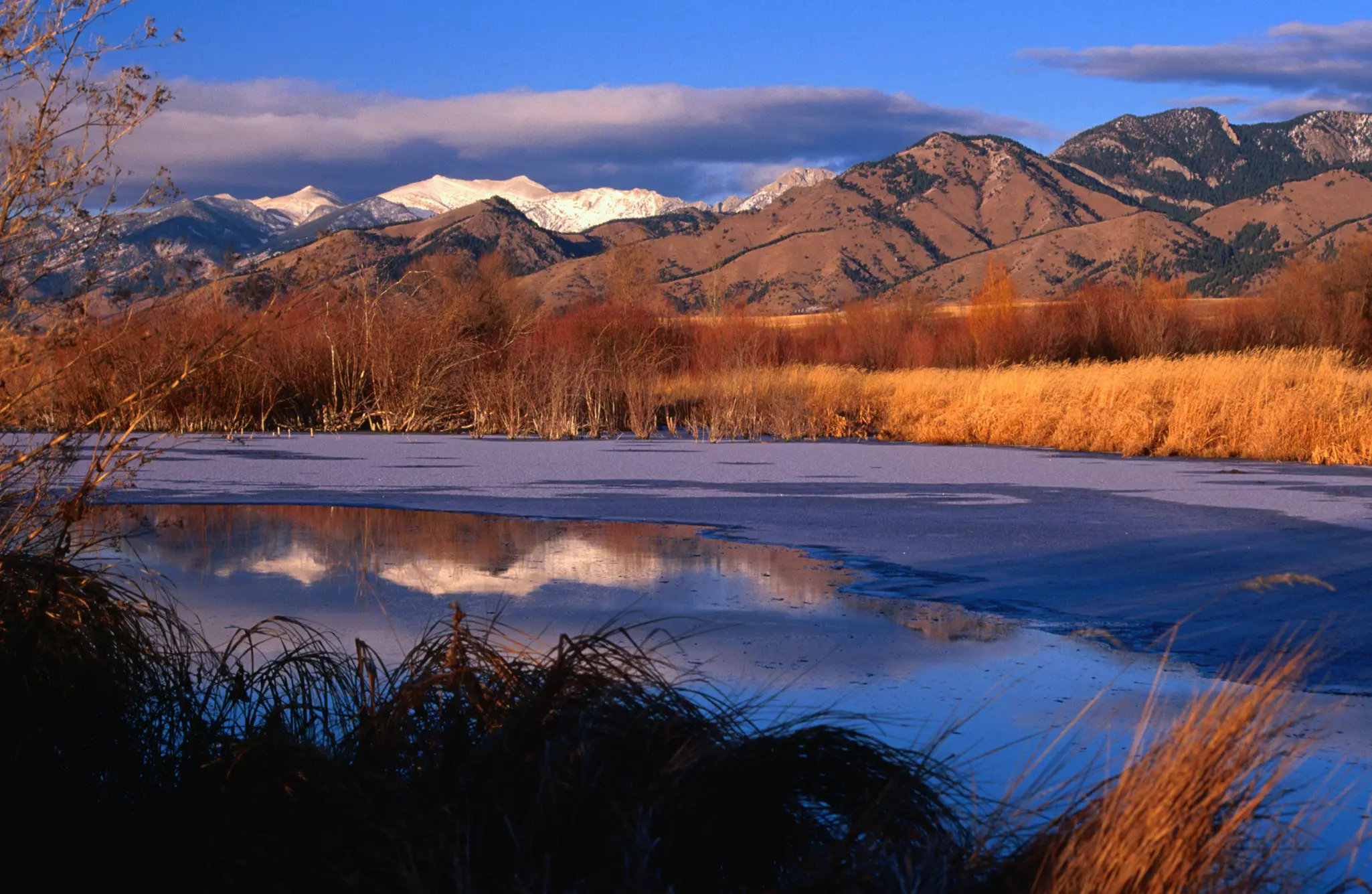
Just outside of Bozeman is the Lava Lake Trail, a rocky path winding through dense lodgepole forests, past numerous waterfalls until reaching the beautiful Lava Lake set beneath the Spanish Peaks. This is a moderate trail with over 1600 feet of elevation gained throughout, and the rockiness can provide some technical challenges, but overall, it is doable for most hikers. Camping and fishing are permitted at Lava Lake, a stunning backdrop for any overnighter.
8. Glacier Lake
Best hike for incredible views and a refreshing dip
4.6 miles round trip; elevation of 1492 feet; challenging
The Beartooth Highway is one of the most scenic drives in the entire United States, so it's no surprise that hiking in the area yields similarly beautiful views. Glacier Lake (and the trail to get there) is near the town of Red Lodge on Montana's southern border. The trailhead is at the end of an unpaved road, and the hike itself is somewhat strenuous, despite relatively moderate elevation gain. Switchbacks and waterfalls define this trail, but the work is well worth it upon reaching Glacier Lake, which can be a great place to cool off after such a workout.