Tectonic Plates

Top choice in The Golden Circle


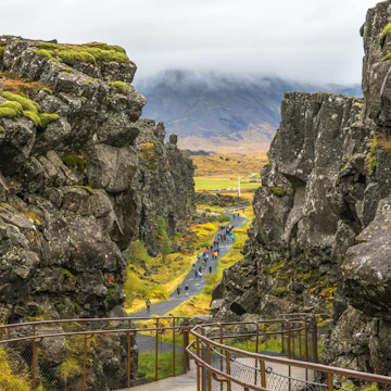
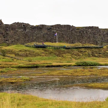
The Þingvellir plain is situated on a tectonic-plate boundary where North America and Europe are tearing away from each other at a rate of 1mm to 18mm per year. As a result, the plain is scarred by dramatic fissures, ponds and rivers, including the great rift Almannagjá. An atmospheric path runs through the dramatic crevice and along the fault between the clifftop visitor centre and the Alþingi site.

The river Öxará cuts the western plate, tumbling off its edge in a series of pretty cascades. The most impressive is Öxarárfoss, on the northern edge of the Alþingi site. The pool Drekkingarhylur was used to drown women found guilty of infanticide, adultery or other serious crimes.

There are other smaller fissures on the eastern edge of the site. During the 17th century, nine men accused of witchcraft were burned at the stake in Brennugjá (Burning Chasm). Nearby are the fissures of Flosagjá (named after a slave who jumped his way to freedom) and Nikulásargjá (after a drunken sheriff discovered dead in the water). The southern end of Nikulásargjá is known as Peningagjá (Chasm of Coins) for the thousands of coins tossed into it by visitors (an act forbidden these days). There are a few different car parks around the sights; a parking fee may be payable at some of them.


Lonely Planet's must-see attractions

Nearby The Golden Circle attractions

1. Alþingi Site

0.89 MILES

Near the dramatic Almannagjá fault and fronted by a boardwalk is the Lögberg (Law Rock), where the Alþingi (Parliament) convened annually. This was where…

2. Þingvellir National Park

0.92 MILES

The world’s oldest parliament, Althingi (pronounced ál-thingk-ee; also called Alþing) was uniquely situated at this monumental site where two tectonic…

3. Búðir

1.02 MILES

Straddling both sides of the Öxará river are the ruins of various temporary camps called búðir (literally 'booths'). These stone foundations were covered…

4. Þingvallakirkja

1.03 MILES

Behind the Þingvallabær farmhouse, Þingvallakirkja is one of Iceland’s first churches. The original was consecrated in the 11th century, but the current…

5. Þingvallabær

1.05 MILES

The little farmhouse in the bottom of the rift, Þingvallabær was built for the 1000th anniversary of the Alþing in 1930 by state architect Guðjón…

6. Þingvallavatn

3.02 MILES

Filling much of the rift plain, Þingvallavatn is Iceland’s largest lake, at 84 sq km. Pure glacial water from Langjökull filters through bedrock for 40km…

7. Glymur

9.3 MILES

At the head of Hvalfjörður, and up Botnsdalur valley, lies Glymur, Iceland’s highest waterfall (198m). From the trailhead, it’ll take a couple of hours to…

8. Ljósafoss Power Station

12.64 MILES

The 1937 Ljósafoss Power Station catches the outflow of lake Úlfljótsvatn and turns it into electricity. In 2016, an elaborate state-of-the-art multimedia…