Jul 10, 202611 min read
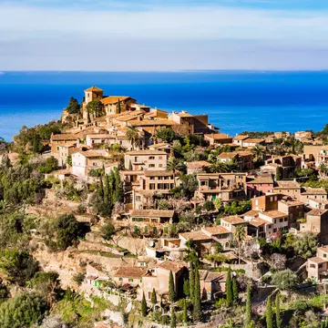
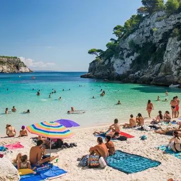
The top 20 things to do in SpainSep 5, 2023
11 MIN READ
Writer
Highlights
Writer John Noble picks eight Northern Spain walks from canyon to Camino.
Head to the Picos de Europa for the Cares gorge, Áliva and Picu Urriellu.
In Galicia, walk to Cabo Fisterra, the Cíes islands and the Río Mao canyon.
Somiedo Lakes in Asturias suit easy hikers; long-distance walkers should try the Camino Primitivo.
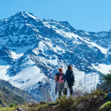
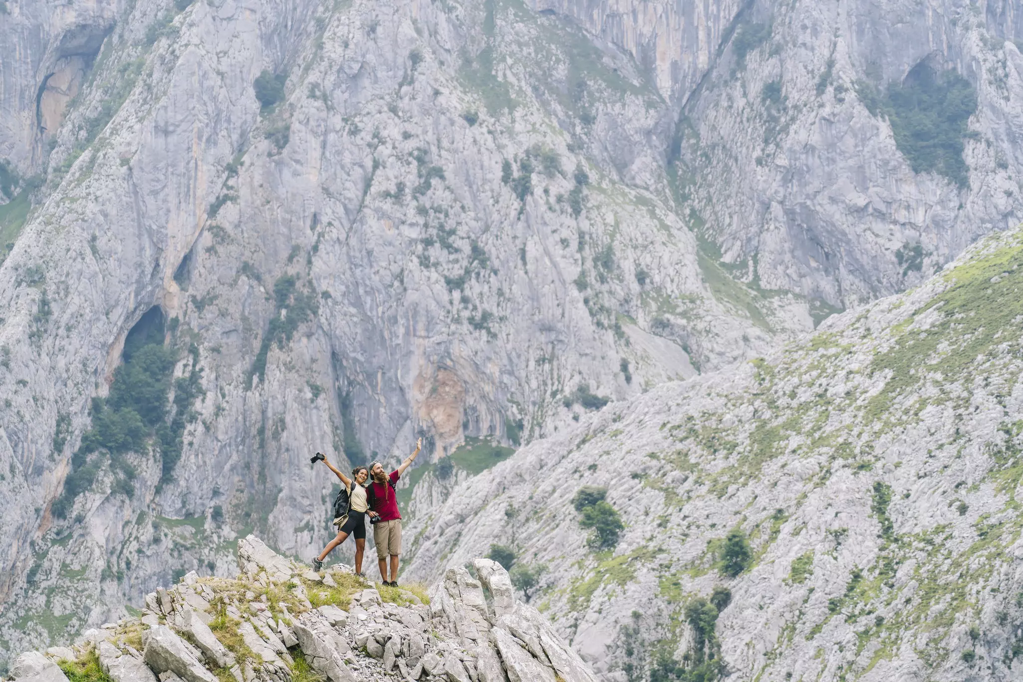
Spain is a hikers paradise, and Northern Spain has a range of excellent walks to choose © Ruben Earth / Getty Images

Writer
Highlights
Writer John Noble picks eight Northern Spain walks from canyon to Camino.
Head to the Picos de Europa for the Cares gorge, Áliva and Picu Urriellu.
In Galicia, walk to Cabo Fisterra, the Cíes islands and the Río Mao canyon.
Somiedo Lakes in Asturias suit easy hikers; long-distance walkers should try the Camino Primitivo.
Lonely Planet may earn a commission from affiliate links on our site. All recommendations and reviews reflect our own independent opinions.
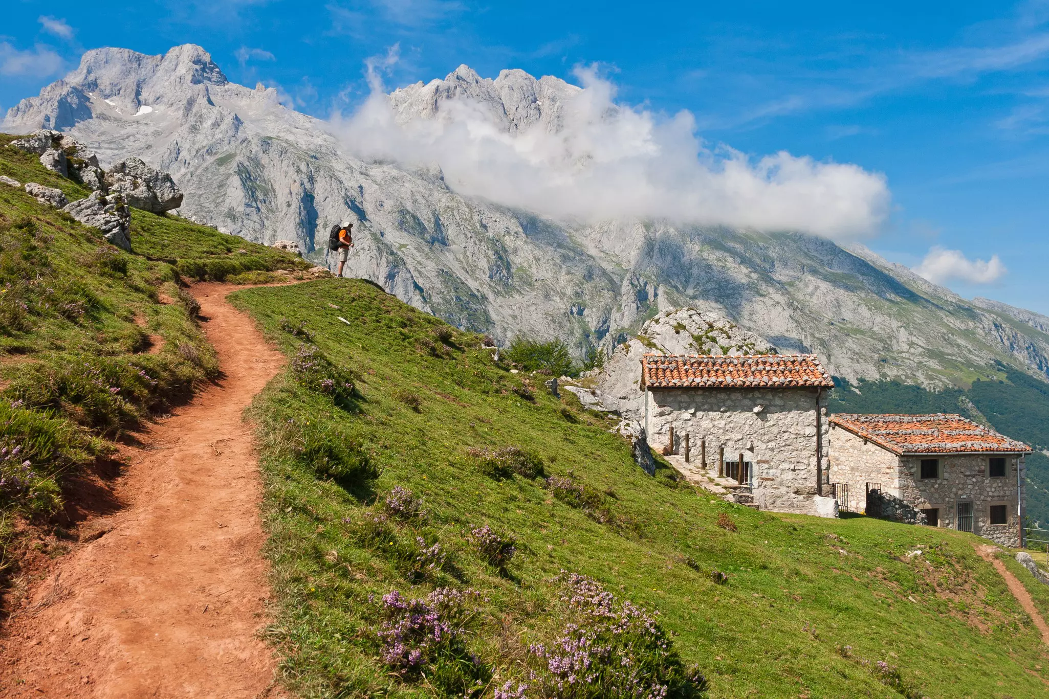
The north of Spain is green Spain. In contrast to much of the rest of the country, it’s full of swift rivers, mountain lakes, grassy meadows, verdant valleys, craggy peaks – and rugged coastal cliffs, sandy beaches and crashing surf. Threaded with many hundreds of good trails short and long, it’s a walker’s dream.
The Cordillera Cantábrica mountain chain stretches across much of the region, parallel to the north coast and peaking – literally and scenically – in the jagged, deeply fissured Picos de Europa range. The coast is a continuous sequence of scenic grandeur, reaching its most spectacular levels in Galicia, the distinctive region occupying Spain’s northwest corner.
Best canyon walk
23km (14 miles) round trip, 6½ hours, moderate
The canyon carved through the Picos de Europa by the Río Cares may be the most popular mountain walk in Spain, with good reason: the scenic thrills don’t let up for a moment as you make your way along the 1000m-deep gorge with soaring rock pinnacles piercing the sky and the beguiling blue river bubbling far below.
The trail (PRPNPE3) runs between the tiny settlements of Poncebos (the north end) and Caín. It can be walked in either or both directions. A popular option, within the capacity of any reasonably fit walker, is there-and-back from Poncebos. You’ll ascend about 250m in the first 2km, then it’s mostly downhill or level to Caín.
Along the way you pass through a few tunnels, beneath rock overhangs, along a 23-meter cliffside boardwalk, over side-streams and finally three bridges straddling the gorge as you approach Caín. There are big drops from the path in many stretches, but the path is always 1m to 2m wide and there’s no need to walk along its edge.
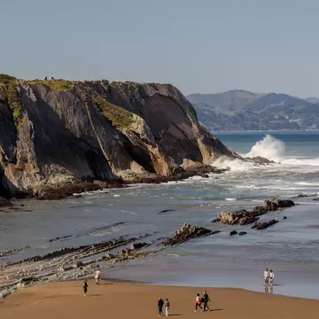
Best coastal walk
22. 5km (14 miles) one-way, 6½ hours, difficult
It’s a tough task to pick the best of so many wonderful days’ walking along northern Spain’s coasts, but our vote goes to the final stage of the Camiño dos Faros (Lighthouse Way), which winds 200 adventurous kilometers along Galicia’s wildly beautiful Costa da Morte (Coast of Death, because of its many shipwrecks).
Starting in the estuary-side village Lires, the up-and-down trail takes you to big, wild Atlantic beaches such as Praia do Rostro and Praia do Mar de Fora with ocean surf thundering relentlessly in (don’t swim), past the Iron Age hill fort Castro de Castromiñán, over capes such as Cabo da Nave and along several clifftop and cliffside stretches. Take care!
The route is marked by small green arrows or paint blobs which are sometimes easily missed: consult the website beforehand for maps and more. If you don’t have a great head for heights you may want to avoid the cliffside sections after the Castro de Castromiñán and Praia de Arnela. To bypass the first you can divert inland through Castromiñán and Denle hamlets. To avoid the second, don’t take the "Praia de Arnela" turning after Denle, but fork right 15 meters past it: following a series of tracks you can rejoin the main route shortly before Cabo da Nave.
You finish at the lighthouse at Cabo Fisterra (Cape Finisterre), traditionally considered Spain’s "Land’s End" (though the Spanish mainland’s actual westernmost point is a few kilometers north). You’ll join Camino de Santiago walkers, and tourists, gathering here for the ocean sunset. From the lighthouse it’s 3. 5km (a €5 taxi ride if you like) into the attractive small fishing town Fisterra.
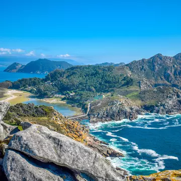
Best island walk, best accessible walk
14km (8. 7 miles) round trip, 4½ hours, easy
The pristine national-park Cíes islands, rising abruptly from the Atlantic off southern Galicia, make for a great day of walking on well-signed paths to lighthouses, clifftop viewpoints and sandy beaches lapped by crystalline (if chilly) waters. Some trails here are wheelchair-accessible and the national park provides free wheelchairs at its information kiosk near the main jetty (call 886 21 80 90 or 886 21 80 82, or email iatlanticas@xunta. gal or centrodevisitantes. iatlanticas@xunta. gal, beforehand to confirm availability).
Getting to the Cíes, a 30-to-45-minute ferry ride from the mainland, is part of the fun. Bring plenty of water for your day. Boats dock near the south end of the northernmost of the three islands, with the superb 1km sandy crescent of Praia de Rodas curving away to your left. Head across the causeway to the middle island and follow the trail up to the lighthouse on Monte Faro, the islands’ highest point (175m above sea level), where fabulous views open out along ocean-battered coasts. On the way back, halt at the relatively quiet beach Praia de Nosa Señora or at one of the three restaurants near Praia de Rodas. Then head to the north island and another spectacular viewpoint, Alto do Príncipe, and on to the Faro do Peito lighthouse, before a final relaxing stop on delightful Praia das Figueiras.
Unguided visits to the islands are permitted during Easter week and from 15 May to 15 September. During these periods several companies including Naviera Mar de Ons and Nabia Naviera run ferries from Vigo, Cangas, Baiona and other ports. Try to make reservations well in advance, as the islands’ daily limit of 1800 visitors can fill up weeks ahead in July and August. First you need a free national-park authorization, available via the ferry websites: you’ll receive a code valid for two hours with which you can book the boat tickets.
Best for climbers
13km (8 miles) round trip, 5½ hours, difficult
There’s no more stunning piece of rock in Spain than Picu Urriellu, also called El Naranjo de Bulnes, which towers like some gigantic thumb 500 very vertical meters in the heart of the Picos de Europa. Climbers converge from afar for the challenges of its breathtaking walls; just getting to its base is a thrilling enough experience, well within the capacity of fit walkers (with about 830m of ascent and descent).
The easiest route starts from an unpaved road a 5km drive west of Sotres village: there’s parking about 500m past La Robre, a group of herders’ cabins. Follow the PRPNPE21 sign and in a few minutes you’re on the Collado de Pandébano, a broad grassy saddle. Now just follow the well-defined PRPNPE21 southwest all the way up to the Refugio de Urriellu (a mountain refuge for walkers and climbers) at the foot of Picu Urriellu. You cross grassy hillsides with thick woodlands sloping away below.
At Collado Vallejo, 2. 6km from the Collado de Pandébano, the landscape changes dramatically. The slopes you now cross are rockier and more precipitous. You may well spot some chamois skipping around them. The climb becomes steeper, zigzagging upwards with the mighty monolith of Picu Urriellu drawing you ever closer. After soaking up the awe-inspiring landscape around the Refugio de Urriellu, and maybe taking refreshments there, retrace your steps.
Best lake walk
Short version 14. 5km (9 miles) round trip, 4½ hours, easy; long version 26. 5km (16. 5 miles) round trip, 8½ hours, difficult
The Parque Natural de Somiedo in Asturias is a mountainous delight of emerald-green valleys, jagged peaks, thatched herders’ cabins called teitos and tinkling cowbells on upland pastures. The park’s classic walk takes you up from the quiet farming village Valle de Lago to the wonderfully picturesque lake Lago del Valle, set in a glacial cirque with craggy mountains soaring all around. There are two routes: the prettier Camino de la Sombra (Shady Path) and the slightly shorter Camino del Sol (Sunny Path). You can go up by one and return by the other.
To make this into a longer, more demanding walk, take the PRAS15 path heading uphill from the northeast corner of the Lago del Valle. After a few twists, this works its way northwestward up to a pass named the Llomba de Camayor, then turns southeast along two grassy upland valleys, the Vega de Camayor and Vega de Fresneu, to the four Lagos de Saliencia, lakes set in deep, remote mountain bowls. From the viewpoint over the fourth lake, Lago La Cueva, retrace your steps past the Llomba de Camayor. As you descend beyond the Llomba, veer right at the end of a large stone field and follow the path round as it changes direction from southeast to northwest. It develops into a gently descending dirt track, which joins the Camino del Sol to return to Valle de Lago.
Tops for cable car lovers, best downhill walk
15km (9. 3 miles) one-way, 4½ hours, easy
The glory of the Puertos de Áliva circuit in the Picos de Europa is that you reach the starting point – high on the Picos’ 600m-high southern wall – by the spine-tingling Teleférico de Fuente Dé cable car, which whisks you up from the valley floor in four minutes. Then you just walk 1km uphill (gaining 100m elevation) to the Horcadina de Covarrobres track junction, then continue ahead on the PRPNPE24. This well marked trail is now downhill all the way, beneath towering rock pinnacles, across bucolic pastures and through well shaded oak and beech woods, back to Fuente Dé where you boarded the cable car. The isolated Hotel Áliva, 3km down from the Horcadina, makes a convenient refreshment stop.
Best for woodlands and history
16. 5km (10. 3 miles) round trip, 6½ hours, moderate
The Ribeira Sacra in southeast Galicia is a dramatic, sometimes severe landscape of plunging river valleys, astonishingly steep vineyards, stone-built villages, medieval monasteries and dense chestnut and oak woods. The Río Mao Canyon trail (PRG177), well signaled with yellow-and-white markers, puts together all the best ingredients. It begins at A Fábrica da Luz, a hostel and activities hub 11km east of Parada de Sil village. You descend the canyon, initially on an 850m boardwalk, to Barxacova village, then climb past vineyards and through woods to San Lourenzo, A Miranda and Forcas villages. The return route goes via the medieval bridge of Conceliñas, two canals (one disused) for hydroelectric schemes and an intriguing medieval necropolis at San Lourenzo. There’s about 700m of ascent and descent in total. For a shorter (5km) stroll you can return direct to A Fábrica from San Lourenzo.
Best long walk
320km (199 miles) one-way, about 14 days, difficult
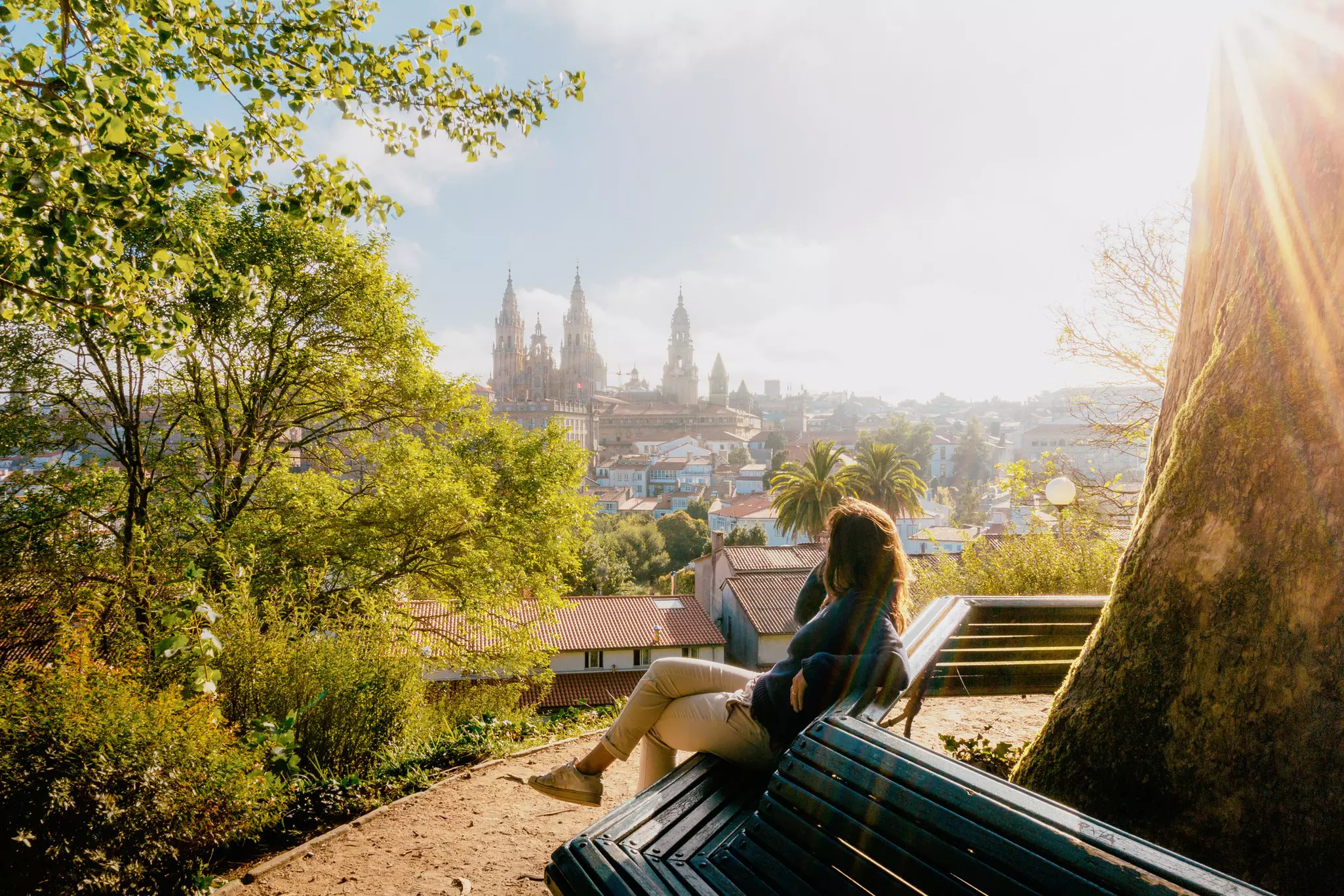
Spain’s most famous walk, the historic Camino de Santiago (Way of St James) pilgrim trail, is actually dozens of different routes – with one thing in common: they all end up in Galicia’s beautiful capital, Santiago de Compostela, at the grand cathedral containing what’s believed to be St James the Apostle’s tomb. The classic, extremely popular Camino Francés (French Way) starts in St-Jean Pied de Port, France, then runs more than 750km across northern Spain, taking most people five or six weeks to complete. Many other Caminos converge on Santiago from all over Spain and other European countries. If you fancy a medium-length Camino, the Camino Primitivo (Original Way) is ideal. It follows the footsteps of the first recorded pilgrimage to St James’ tomb, by King Alfonso II of Asturias from Oviedo in the 820s, and combines historic cities with atmospheric small towns and villages and some particularly beautiful countryside as you cross the green hills from Asturias into Galicia. Numbers on this Camino are relatively light (about 5% of the 400, 000-plus annual arrivals at the pilgrimage office in Santiago), but sufficient to provide good fellowship.
Best months are June to September, with generally warm, mostly dry weather. Trails are busiest in Easter week and from mid-July to late August, the peak Spanish holiday times. Snow can linger into June or July at higher elevations in the Picos de Europa. Avoid mountain walks in winter.
Carry a decent trail map or GPS device.
Take plenty of water and be equipped for changes in the weather, especially in the mountains.
Day-walk times in this article are approximate actual walking times; they don’t include stops for refreshments, rest or photos.
For more detail on most of the walks featured here, and many others around Spain, get yourself a copy of Lonely Planet’s Best Day Walks Spain.
Take your Spain trip with Lonely Planet Journeys
Time to book that trip to Spain
Lonely Planet Journeys takes you there with fully customizable trips to top destinations – all crafted by our local experts.


Explore related stories