Jul 29, 20257 min read
16 things to know before you come to Bozeman, MontanaJul 8, 2024
6 MIN READ

Writer
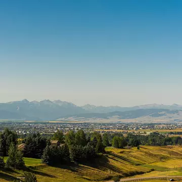
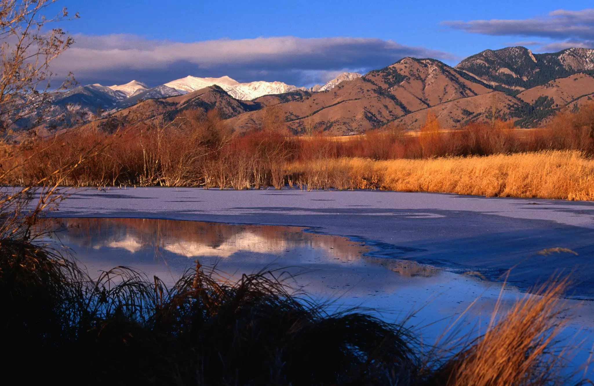
The views of Gallatin Valley from Bozeman's M are iconic. Carol Polich / Lonely Planet

Writer
Lonely Planet may earn a commission from affiliate links on our site. All recommendations and reviews reflect our own independent opinions.
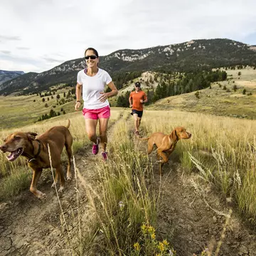
You could spend half a lifetime exploring the forests, lakes and granite peaks of the Gallatin, Madison and Bridger ranges around Bozeman, Montana. Luckily we've done the heavy footwork for you – you can experience the very best Montana has to offer on these spirit-restoring hikes.
Bozeman is geared firmly towards the great outdoors, and between June and October, you'll find yourself sharing the trails with mountain bikers, fly fishers and horse packers, as well as eager trekkers. But with so much wilderness on offer in this stunning corner of Montana, solitude and beauty are only ever just a short hike away. Here's our pick of the best hikes around Bozeman to get you started.
3 miles (4.8km) round trip, 90 mins, elevation gain 850ft (259m), easy to moderate
The short uphill walk to the Montana State University "M" etched into the suburban hills north of Bozeman is easily the most popular hike in town, and a classic choice if you are tight on time. Two dog-friendly trails lead up from the trailhead – the right-hand path is steep and direct, while the left-hand path follows gentler switchbacks and is around a mile longer. Combine the two for a satisfying loop.
Forty minutes of puffing will reward you with expansive views over Bozeman and the snow-capped Gallatin Mountains beyond. If this taster leaves you wanting more, trails continue up the Bridger ridgeline to 8914ft (2717m) Baldy Mountain, for a total return hike of 9.5 miles (15.3km). On the drive back to Bozeman, stop off at Map Brewing for patio views of the M over a pint of aptly named Steep Terrain Double IPA.
A local tip: If the parking lot is full (as it often is), head across the road to the larger Drinking Horse Trailhead, where you'll often find space.
4.5 miles (7.2km) round trip, 3 hours, elevation gain 2100ft (640m), moderate to strenuous
Most hikers head south from Bozeman towards Yellowstone, so buck the trend by heading northeast into the less-visited Bridger range. A rough drive up Fairy Lake Rd (Forest Road #74) will drop you near the trailhead camping ground and a gorgeous turquoise lake (bookmark this for a deliciously frigid dip on your return).
The trail itself climbs from the get-go, rising through meadows of blazing paintbrush flowers and up lung-busting switchbacks to spit you out above the tree line onto a high saddle. Keep an eye open for Montana's iconic (and somewhat comical) white-tufted mountain goats as you soak up the immense views.
The final section is a dramatic ridge walk onto the uplifted slab of 9654ft (2943m) Sacagawea Peak, the highest point in the Bridger range, named in honor of the Shoshone woman who guided Lewis and Clark through the valleys west of Bozeman.
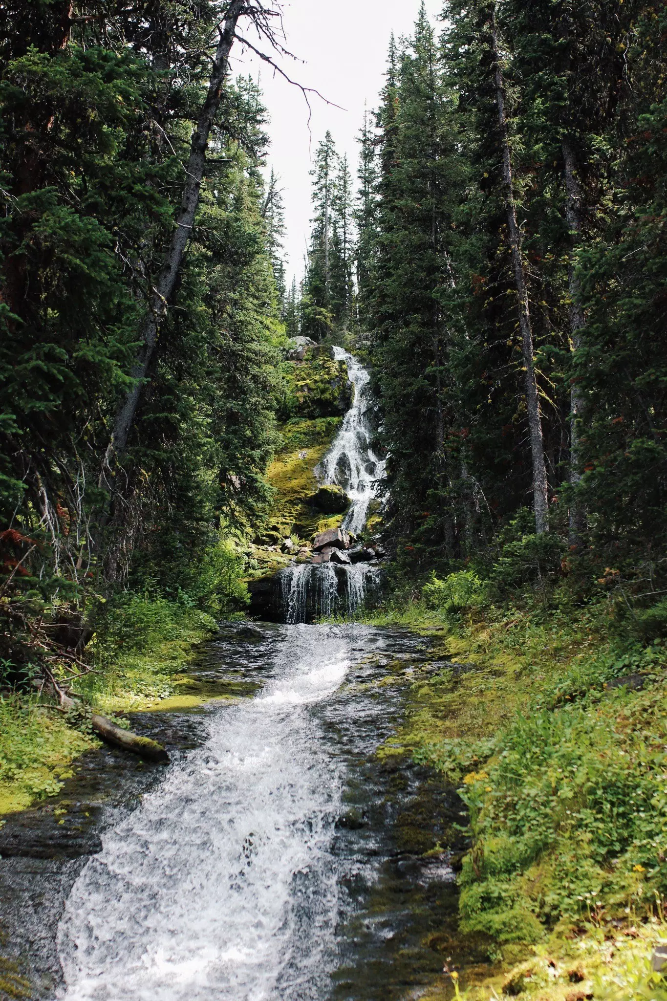
11 miles (17.7km) round trip, 5 hours, elevation gain 2000ft (607m), moderate
To get a taste of the rugged wonders of the Gallatin Range south of Bozeman, drive past the paddleboarders at Hyalite Reservoir and make a beeline for the Hyalite Creek trailhead. Over 5 miles (8km) of gradual ascent, you'll pass 11 – yes, 11! – waterfalls and gain great views of the glacially-carved, U-shaped valley. There's also a decent chance of spotting elk, bears and even bighorn sheep. Arrive at dramatic Hyalite Lake in time for the perfect lakeshore picnic.
Fit hikers can continue for 2.5 miles (4km) up zigzagging switchbacks to bag 10,295ft (3138m) Hyalite Peak, scoring epic 360-degree views of Lone Mountain, the Paradise Valley and the Gallatin Crest Trail as it snakes towards Yellowstone National Park.
It's a 20-mile (32km) drive back to Bozeman for dinner, but you could always pack some s'mores and stay in one of the three pine-scented Forestry Service campgrounds in Custer Gallatin National Forest (at Hood Creek, Langohr and Chisholm).
6 miles (9.7km) round trip, 3–4 hours, elevation gain 1600ft (488m), moderate
Leading south from Bozeman towards Yellowstone National Park, the beautiful Gallatin Canyon is lined with tempting side trails, the easiest and most popular of which leads to Lava Lake. The trail follows rushing Cascade Creek through pine forest and lush meadows, before popping out into a gorgeous mountain-fringed bowl, part of the protected Lee Metcalf Wilderness.
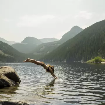
There's exhilarating paddling and trout fishing at the lake and the valley also makes an easy overnight camping trip, though fires are banned within half a mile of the shoreline. The Lava Lake Trailhead is a 30-minute drive from Bozeman, southwest on Hwy 191, but take particular care where the trailhead road joins the fast-moving traffic on the highway.
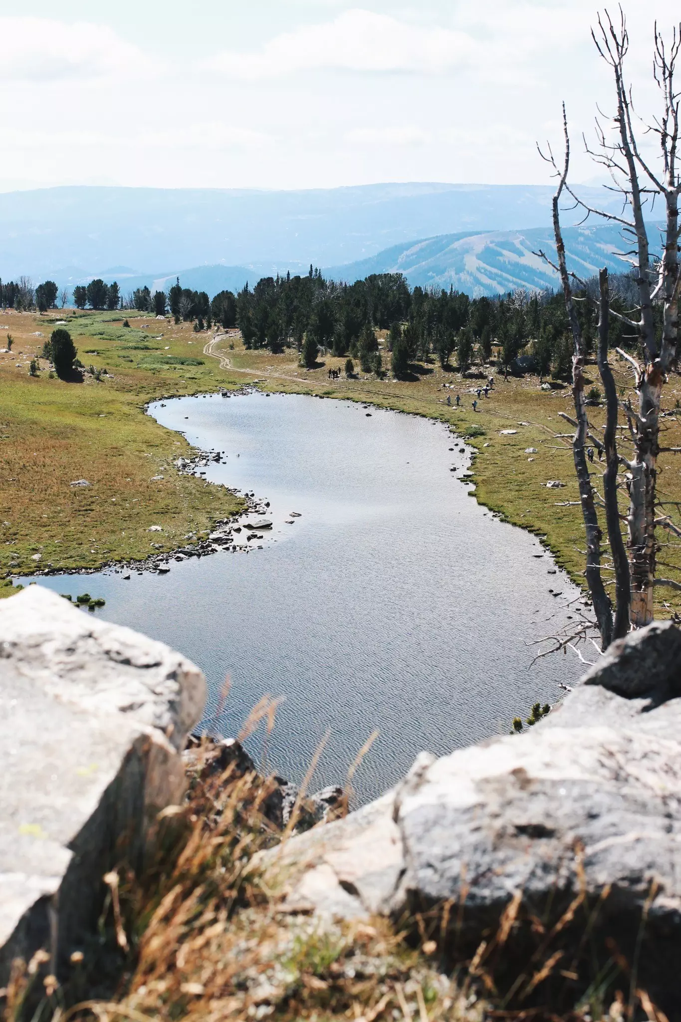
6.5 miles (10.5km) round trip, 3–4 hours, elevation gain 1500ft (457m), easy to moderate
Our favorite hike at Big Sky, 50 miles southwest of Bozeman, this half-day tramp climbs up through a stunning glacier-carved cirque to two alpine lakes that sublimely mirror the dramatic gneiss walls of the Spanish Peaks behind. En route, you'll score views of pyramid-shaped Lone Mountain (itself the destination for an epic summer day hike) before winter cloaks its slopes with Montana's best ski runs.
Pick up a gourmet picnic lunch en route to the trailhead at the Hungry Moose Deli in Big Sky, then round off a perfect Montana day with a post-hike microbrew at Big Sky's Beehive Basin Brewery, named after this very hike.
15–25 miles (24–40km), 2–3 days, strenuous
If you're looking for a classic multi-day backpacking trip, you can't do better than the rugged and dramatic trip to Spanish Peaks, hidden deep in the Madison range southwest of Bozeman. A stunning group of mountain lakes gather at the base of 11,000ft (3350m) peaks, and the valleys come alive with mountain goats, deer, elk, bears, marmots and cute, rabbit-like pika.
There are dozens of gorgeous lakes to explore. The most popular route leads straight to the four Spanish Lakes, with a detour up a side valley to Mirror Lake. To expand the trek into a three-day/two-nighter, add on Jerome Rock Lakes and Lake Solitude. Alternatively, find your own unnamed tarn, set up camp for the night and watch the alpenglow climb the rock walls above.
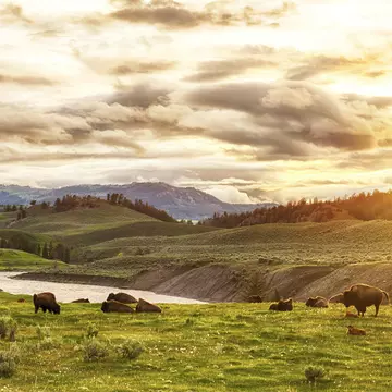
The Spanish Peaks Trailhead is 30 miles (48km) from Bozeman, 8 miles (13km) up Spanish Creek Rd. En route, look for the grazing bison of the Flying D Ranch, owned by media mogul Ted Turner, founder of CNN.
Stop in at the Custer Gallatin National Forest office in western Bozeman before a hike to get the latest information on trail closures, fire conditions and bear sightings.
Montana is grizzly bear country, so carry a canister of bear spray, know how to use it and have it accessible at all times on any wilderness hike.
Don't worry if you don't have all the gear – Bozeman's outdoor gear shops sell the essentials, including bear spray, bug spray, local topo maps and hiking guidebooks.
Four seasons come in one day in Montana's mountains – always pack warm clothing, a dry base layer and a sun hat.
Don't rely on cell coverage in the mountains; tell someone where you are going and when you plan to be back in case anything goes wrong.
Explore related stories