
Advertisement
Mexico
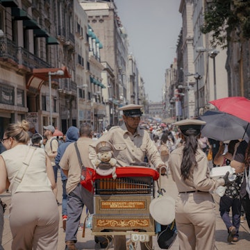
Get blown away by ancient cities and towering pyramids that have withstood the test of time. Meet indigenous people who continue to practice the traditions passed down from their ancestors. Strap on your boots and go on wild adventures in remote, virgin jungles. Come face to face with unique wildlife and marine animals. Frolic at sun-kissed beaches, spearmint natural pools and dreamy waterfalls. Chow down on sizzling street tacos or dine in style at Michelin-starred restaurants. Down mezcal and tequila in old-school cantinas. Mexico has all of this and much, much more. Not sure where to start planning your Mexico trip? Get inspired with tips on top attractions, the best beaches, Maya ruins, when to visit and more expert advice on Mexico travel.

Fernando Farfán for Lonely Planet
Latest Stories
- Lonely Planet Editors|Jun 22, 202614 of the best beaches in Mexico
- Meagan Drillinger|Jun 6, 2026The best places on Mexico’s Pacific Coast
- Regis St Louis|Mar 26, 20266 of the best hiking trails in Mexico
- Regis St Louis|Mar 9, 2026Travel through Mexico's history at these top 15 sites
Book
Trip 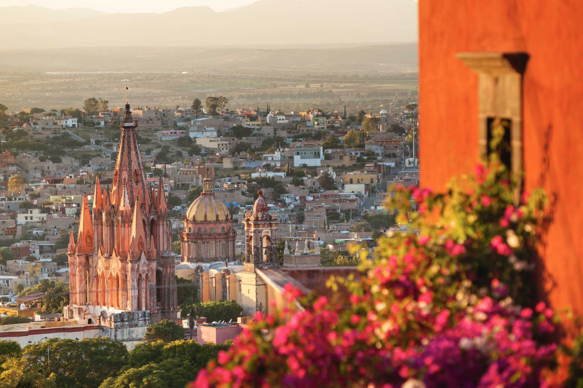

Trusted Partner
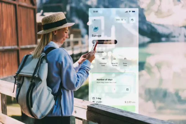
Stay connected in Mexico
Holafly eSIM provides unlimited mobile data with no hidden fees, giving you peace of mind wherever you travel. Stay connected even after your plan ends with Always On. Use code LONELYPLANET for an exclusive discount.
Take your Mexico trip with Lonely Planet Journeys
Pick one of our ready-to-book trips or fully customize your own with help from our local experts.
bookable trip
San Miguel de Allende's Cuisine, Culture, and Crafts in One Week
7 days / 6 nights
highlights
- 1 Soaring about San Miguel de Allende on a thrilling hot air balloon ride
- 2 Tasting local wines at San Lucas Vineyard, an enchanting estate of grape vines and olive groves
- 3 Creating your own craft in an artisan-led mojiganga workshop
from $6,500
per person


Explore more trips
Explore more trips
-
 Mexico
10 days / 9 nights
10 Days in Yucatán: Maya Ruins and Mexican Cenotes
View ItineraryFROM $3,475
per person
-
 Mexico
 -
 Mexico
8 days / 7 nights
8 Days in Mexico: Day of the Dead in Mexico City and Puebla
View ItineraryFROM $4,515
per person
Mexico
10 days / 9 nights
10 Days in Yucatán: Maya Ruins and Mexican Cenotes
FROM $3,475
per person
Mexico
Mexico
8 days / 7 nights
8 Days in Mexico: Day of the Dead in Mexico City and Puebla
FROM $4,515
per person
Top places to visit in Mexico
Discover the best attractions in Mexico from must-see sights to unexpected hidden gems.
-
 Attraction in XalapaMuseo de Antropología
 -
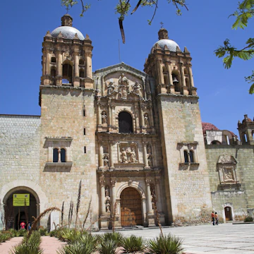 Attraction in Oaxaca CityMuseo de las Culturas de Oaxaca
 -
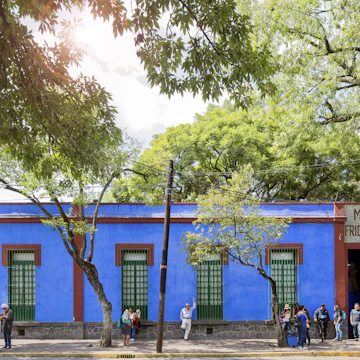 Attraction in Coyoacán & San ÁngelMuseo Frida Kahlo
 -
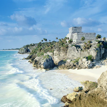 Attraction in TulumTulum Ruins
 -
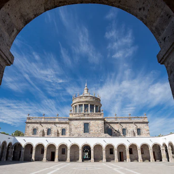 Attraction in GuadalajaraInstituto Cultural de Cabañas
 -
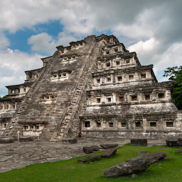
 Attraction in PalenqueTemplo de las Inscripciones Group
 -
-
Advertisement
Travel Guides
Mexico travel tips from Lonely Planet experts
Find practical guidance from our team of contributors around the world who bring their decades of first-hand travel experience to your next trip.
Best Things to Do
From swimming in cenotes and eating street food to soaking up the history and culture of this vibrant nation, here are the best things to do in Mexico.
Read full article
Best Time to Visit
Beach lover, culture maven, history buff or foodie – Mexico has a perfect time for you to experience its countless treasures.
Read full article
Transportation
From ski slopes and jungle to deserts and sublime stretches of sand, expect to use many transport options to get around the world's 13th biggest country.
Read full article
Best Road Trips
Fuel your wanderlust on the open road in Mexico with these epic drives.
Read full article
Money and Costs
Soak up history and art without spending a cent, and find out how to make every peso stretch further with our top tips for visiting Mexico on a budget.
Read full article
Traveling with Kids
Family is at the center of daily life in Mexico, and children are warmly welcomed almost everywhere. Here are the top things to do with little ones in tow.
Read full article
Best Places to Visit
Mexico's beauty goes far beyond the resort strips and tourist hotspots that dominate most vacation itineraries
Read full article
Accessibility
The Mexican government voted to introduce hefty fines for hotels, restaurants or other coastal businesses who block public access to the country’s beaches.
Read full article
Get Connected
Mexico’s best experiences are worth writing home about. Here's how to keep your cell connected.
Read full article
Advertisement
Get a book. Get inspired. Get exploring.


in partnership with getyourguide
Book popular activities in Mexico
Mexico and beyond
-
 destinationMexico City
 -
 destinationCancún
 -
 destinationCentro Histórico
 -
 destinationYucatán Peninsula
 - destinationCoyoacán & San Ángel
-
 destinationCentral Pacific Coast
 -
 destinationQuintana Roo
 -
 destinationOaxaca
Advertisement