Dec 10, 202510 min read
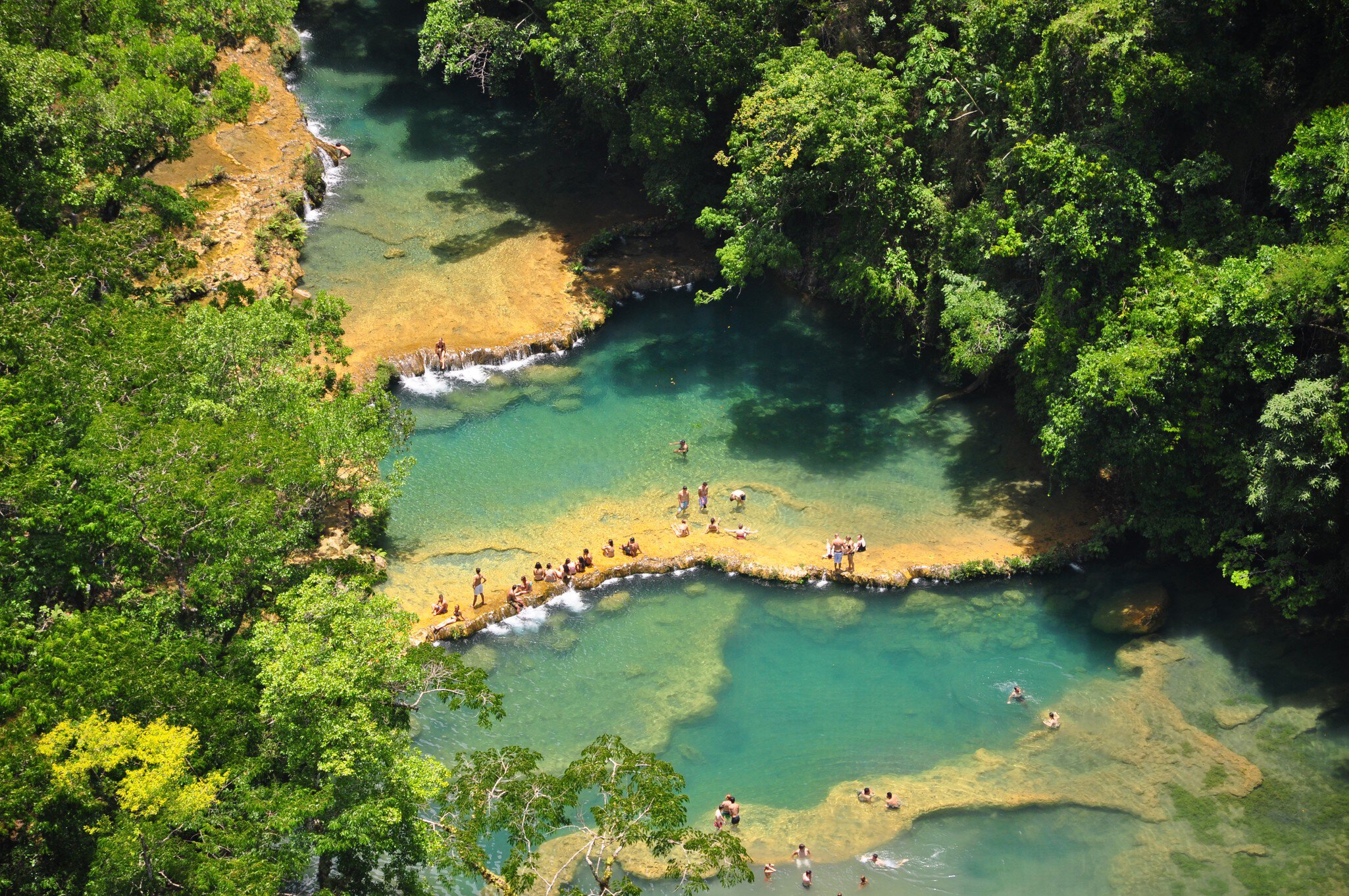
The 10 best beaches in Guatemala Jul 14, 2025
7 MIN READ

Writer
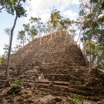
La Danta pyramid. Raphael Rivest/Shutterstock

Writer
Lonely Planet may earn a commission from affiliate links on our site. All recommendations and reviews reflect our own independent opinions.
Visiting the lost city of El Mirador takes time, planning and money, but the payoff for those who make the trek is sublime – a chance to see one of the most impressive gems of Maya culture.
The unparalleled vistas nestled deep in the Petén jungle in Guatemala provide a glimpse back in time.
‘Next time, ’ I tell myself, as the helicopter lifts off, hovers for a second just feet above the ground before the rotors whine and the bird goes skyward, ‘I'll do the hike.’
A week-long hike through pristine jungle, stopping at ruins few people – even those who love ruins – will ever get to see.
The Maya themselves must have journeyed that way, traveling along a spiderweb of raised roadways they built called sacbe, that have, like so many of the ruins, been swallowed up by the jungle over time. Going by helicopter, as cool as it is, seems a bit like cheating.
But as we pull above the tree line, the sight of Lake Petén Itzá makes me glad I chose this option. The color of the water is turquoise mixed with greens that turn almost yellow near the shallow shore.
It's almost an hour of flying from the takeoff spot at Hotel Maya Internacional in Flores to the ruin, so I settle back and watch the fields thin, the farms disappear until it's just jungle.
No roads.
No fields.
No farms.
Just endless, beautiful jungle as far as I can see.
Then something is there in the distance. A bump on the horizon that gets bigger and bigger as we near. I open the window and get the camera ready. The pilot nods. Yes, he points. That's it: El Mirador's La Danta.
It's the largest known pyramid in the Maya world, by some calculations, and nearly the size of the pyramids in Egypt.
At its apex, the once vast civilization spread over nearly 10 miles, rivaled only by the equally vast and equally abandoned sister across Mexico's border – Calakmul.
With no real water source and few natural resources, scientists are still unsure how the civilization at El Mirador thrived.
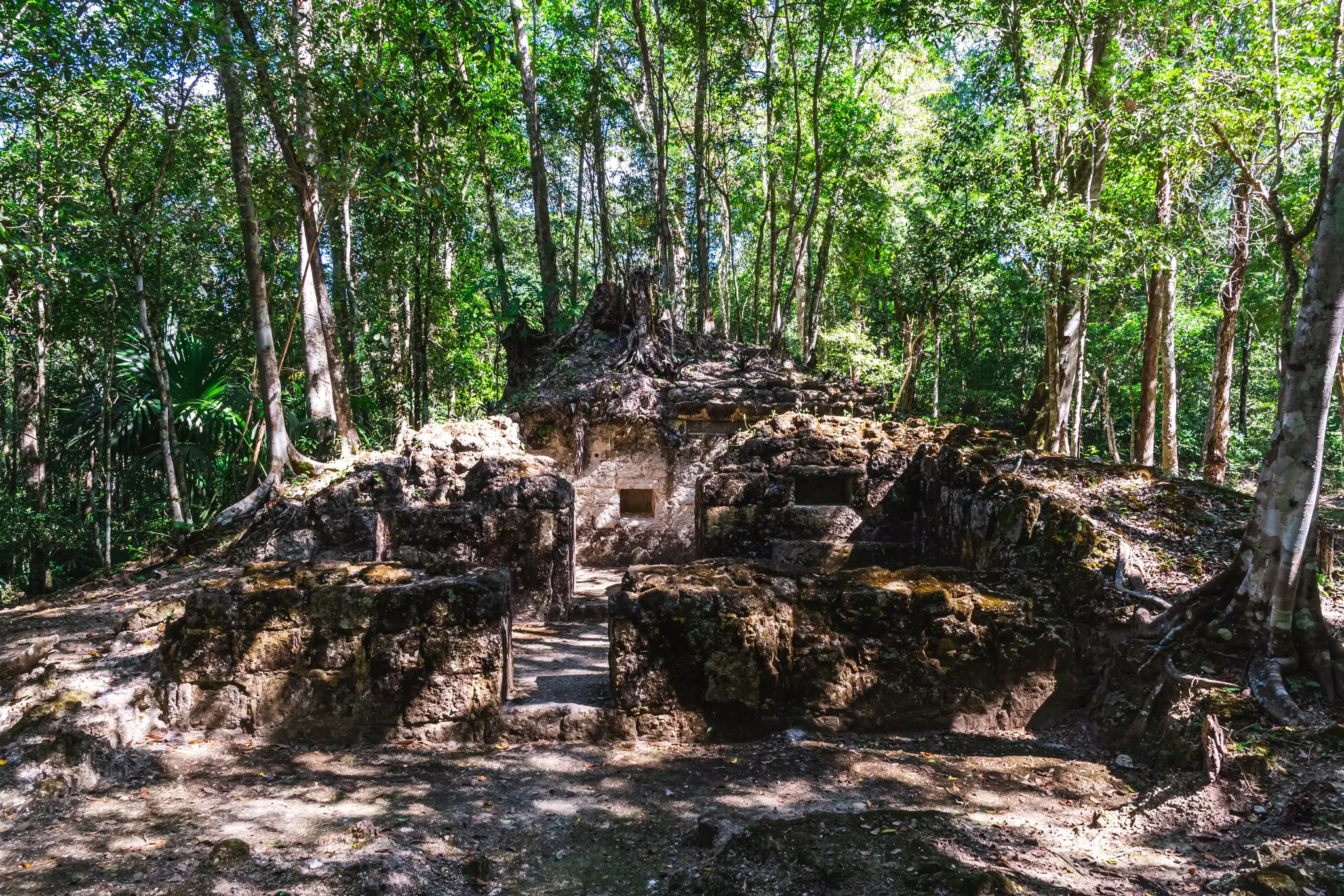
Currently, there's no excavated ruin more remote, more forgotten, more truly lost than this one. Found only by chicle (rubber) harvesters, who would wander through vast swaths of forest in search of trees to tap for their natural rubber sap, El Mirador lay forgotten by archaeologists until 1926.
Yet it wasn't until 2003 that researchers really began to work at the ruin, which sits just 4 miles south of the Mexican border. Even now, only a tiny fraction of the structures have been excavated.
The chopper banks sharply and we touch down in a grassy clearing that from above seemed no bigger than a bath mat but is actually larger than a football field. As the blades wind down, we exit, and the first thing that I hear is... nothing at all.
No cars in the distance. No honks. No engines. Just forest sounds – cicadas buzzing, wind through leaves, the far off thunking of an ocellated turkey.
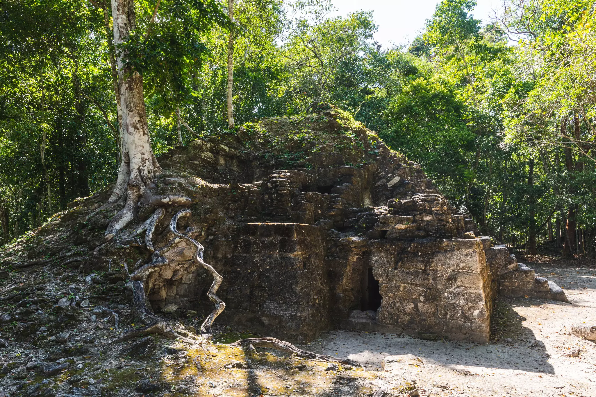
I have just four hours in the ruin, so my guide gives me a quick explanation and then we’re off, trudging through muddy forest paths for nearly a mile to reach La Danta (the tapir), the towering 230ft pyramid I’d seen from the air.
The guide points out the newly excavated sections – a beautifully intricate stucco frieze, dating back to 300 BC, depicting a pair of brothers, Hunahpú and Ixbalanqué (the ‘Hero Twins’) who, according to the Maya creation myth, defeated the lords of Xibalba – the underworld.
On either side are shallow ‘swimming pools’ that researchers believe were used to represent the water the twins swam through.
There's something disconcerting about seeing such elaborate artwork and decoration in a place still covered with roots, vines and rubble. Perhaps it's a cautionary reminder, and through the study of history, we can predict the future. Maybe this will be our civilization someday.
The shade of the forest canopy keeps us somewhat cool, but after 15 minutes, I’m drenched in sweat. The guide points out breadnut trees, a staple grain used not just by ancient Maya, but by rural villages even today. I see bird after incredible bird.
There's a sharp incline, and nearby, I see the crisscross patterns cut into some centuries-old chicle trees. El Mirador's majestic pyramid La Danta is before us.
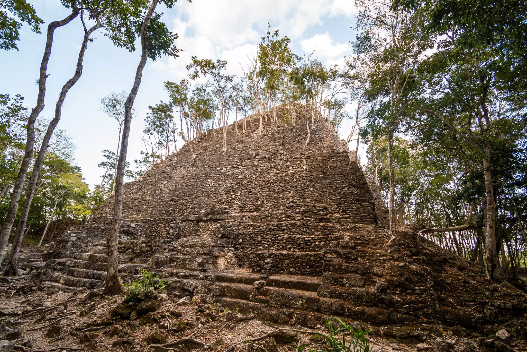
Unlike the pyramids at Giza, which rise out of the sand from base to tip unbroken, El Mirador's pyramids are constructed in sections.
First I climb up onto a fairly wide base, still totally covered in jungle. Were it not for the guide, I'd have never known it was man-made. From there, it’s up to a midsection. This has a real ‘pyramid’ feel to it, though it's still largely untouched.
Finally, panting, sweating, but excited, I see the last section – excavated enough that you can see the individual stones – appearing through the trees.
Like many ruins in Guatemala, this one has wooden stairs leading up the side, reducing the chance for human foot traffic to destroy the stones. By the halfway point, I’m above the tree line, able to see glimpses of the vastness of the jungle below.
A few minutes more and I’ve reached the top – a windy, sun-scorched apex with a 360° view. The land is pristine, still belonging to the jaguar, ocelot, the tapir, the coati and the ocellated turkey.
Somewhere to the north, Calakmul is visible on clear days with a telescope or a good pair of binoculars. The guide points out other bumps in the landscape. Those too are ruins.
I eat my lunch quietly, humbled to be here. I'm feeling the same awe I get when I stare up at a dark night sky and see the infinite sweep of the stars.
With all the photos and the heat, it's taken longer than we thought to get this far and already the sky is getting cloudy. Our guide says we'll need to head back, but I don't want to go.
Next time, I tell myself, I'll come and hike. Take a week here. Four hours just isn't enough time.
I’ve now been to El Mirador twice and have the luxury of having seen it in perfect sunshine and in absolute downpours.
No matter what the weather, you won’t be getting frostbite, in fact, the rain cooled things down and kept mosquitoes at bay.
If it’s nice weather, expect heat and humidity, and plan on wearing lots of sun protection. Bugs can be an issue any time of year, so bring repellent or wear anti-bug clothing.
But something many first timers fail to understand is how treacherous the paths and stairs can be.
Guides are constantly frustrated by overzealous, 'I know what I’m doing!' types who miss a footing and crash onto the hard stones, breaking a bone or twisting an ankle.
The nearest medical center is at least an hour helicopter ride away, so do yourself and the rest of your tour group a favor and exercise utmost caution while exploring.
It’s an incredible experience but one bad fall can turn it into a nightmare for everyone, since the whole group has to return when the helicopter does.
Another possible consideration is weather. Yes, it might be perfect. But on iffy days, there’s a chance that the chopper may not be able to depart, as it needs line-of-sight visibility to fly safely.
Sometimes this means departure delays, but it can also mean delays in returning once you’re there. It’s not a bad idea to bring a day pack with a change of clothes just in case you have to stay overnight.
If you have any medications or specific food needs, be sure to plan carefully and don’t assume you’ll be home on schedule.
Tours can be arranged by reputable tour services such as Gem Trips or directly with the airline. Tours cost US$550/person with a minimum of three guests. Includes box lunch, bottled water and on-site guide.
No tours currently run directly from Guatemala City; flights to and from Flores must be purchased separately. Currently tours leave from the Hotel Maya Internacional’s heliport, but they may also leave from Mundo Maya International Airport as well.
Take your Guatemala trip with Lonely Planet Journeys
Time to book that trip to Guatemala
Lonely Planet Journeys takes you there with fully customizable trips to top destinations – all crafted by our local experts.

Explore related stories