The 5 best Arkansas road trips: from hot springs to crystal bridges
Apr 14, 2022
6 MIN READ

Writer
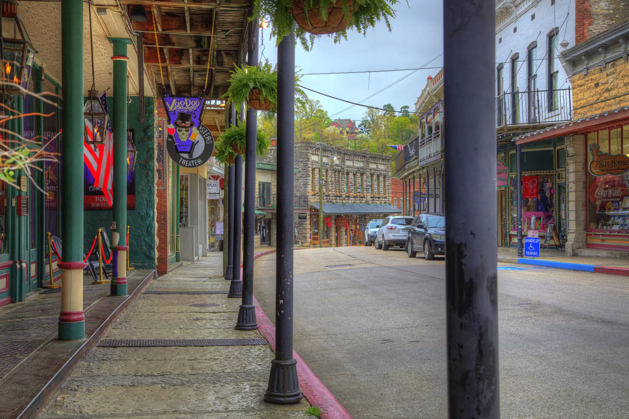
Get to know the historic mountain village of Eureka Springs before setting off on your Arkansas road trip © Larry Braun / Getty Images

Writer
Lonely Planet may earn a commission from affiliate links on our site. All recommendations and reviews reflect our own independent opinions.
Arkansas is an interesting state for a road trip. If we’re talking physical size, it’s not even in the top 25 states (29th, to be exact). But it can take over six hours to cross the Natural State, as much time as it takes to drive across the behemoth that is Wyoming. Why?
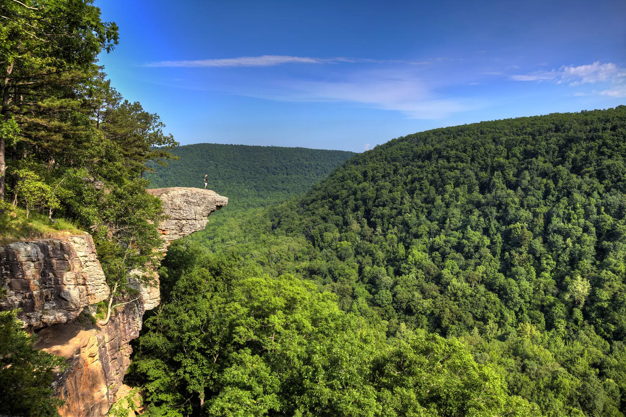
In a word, mountains. And hills. And plateaus (OK, five words). Arkansas contains a huge swathe of the U. S. Interior Highlands, including the highest peak in the region – Mount Magazine. Two distinct ranges – the Ozarks and the Ouachita Mountains – are the most prominent topographical features of the state. And more mountains mean fewer straight roads. On the other hand, it also means driving through a green dream of lush forests and fields of wildflowers which make an altogether peaceful scene, the serenity only broken by the occasional hairpin turn on a narrow, cliff-hugging road.
Ouachita and Ozark Odyssey
Best for stunning scenery and wide-open spaces
Hot Springs-Eureka Springs; 200 miles
This iconic Arkansas road trip connects two of the state’s artsiest towns. Tucked in a forested valley of the Ouachita Mountains, Hot Springs is best known as the location of Hot Springs National Park, the oldest federally protected land in the USA. The park basically has two portions: an urban, historical preservation unit that centers on gorgeous, grande dame-style early 20th-century bathhouses, which once catered to presidents and gangsters, and a more traditional zone of preserved natural beauty.
From Hot Springs you can drive north on AR-7 through the valleys and passes of the Ouachitas, past the wonderfully named Lake Nimrod and Nimrod dam, which makes for a good detour as there’s a recreation area here with a selection of swimming spots. Carry on to Dardanelle, then the town of Russellville, and jump on I-40 heading west.
From here you could take AR-23 north to Eureka Springs, and hey, AR-23 is a lovely road. But if you want a slightly longer, not-as-utilized, equally scenic ride, consider using AR-21, which winds over the Ozark plateaus and crosses miles of farmland, fields, and forest. Even if you go with the AR-21 option, you’ll have to merge into 23 at some point (if you’re taking 21, you’ll want to turn west onto US-412 to link up to 23. You’ll know the junction is coming after passing one of the best business names in the state: Sugar Booger’s, a barbeque joint). Head north to Eureka Springs and settle into one of the upland South’s strangest little enclaves, where you can hang out with assault rifle experts and pottery makers all in the same afternoon.
Northwest Arkansas Adventure
Best for small-town culture and music
Eureka Springs-Fayetteville; 60 miles
This trip may be short but it nonetheless hits three of Arkansas’ most interesting towns. Eureka Springs is a gorgeous historic mountain village with a distinctive mix of artists and libertarian-minded mountain folk. There’s good food, superlative hiking, and a sense of place that is hard to replicate.
From here drive across the rocky roof of Arkansas, heading west along US-62, passing mountain scenery the entire way, then drop down to Bentonville, the corporate headquarters of Walmart and (a little ironically) a town with a pretty strong sense of regional pride in their local independent businesses. The big attraction is the enormous Crystal Bridges Museum of American Art, which brings a world-class museum space to the Ozarks. Then jump south on I-49 to Fayetteville, where street markets, good dining, and a lively bar and music scene can keep you well entertained through the evening.
Arkansas Introduction
Best for history and folk culture
Little Rock-Mountain View; 105 miles
Little Rock really is a compact capital, with a population of around 200,000 and a lovely location with easy access to the outdoors. There’s plenty to check out, including great Southern dining at South on Main, Civil Rights history at Little Rock Central High School, and bucolic pedestrian paths at Riverfront Park.
After you get your fill of city sights, head north into the foothills of the Arkansas uplands. Take US 167 north to AR-5, then get head north through a long swathe of rolling farmland and small towns. You’ll round Greers Ferry Lake, where you may want to detour to enjoy a relaxing walk around the Mossy Bluff National Nature Trail, a relatively easy hike that is a nice introduction to the scenic beauty of the Natural State.
From here carry on to Mountain View, a small town that has become a gateway for those looking to explore the rich folk culture of the Ozarks. In the evenings, you can often find some sort of concert or jam session, be it at someone’s home or barn or the town square. Between mountain music and hiking, there’s enough here to keep you occupied, or, whet your appetite for more exploration of the region.
Across the Ozarks
Best for hairpin bends and river views
Mountain View-Ponca; 100-120 miles
This trip works as an extension of the Arkansas Introduction (above), but the point is getting to Ponca, which can serve as a base for exploring the Buffalo National River, the first river in the country to earn that distinction. Any way that you approach Ponca – be it from the south and Little Rock or Hot Springs, or from the north via Eureka Springs or Fayetteville – you’ll be rewarded with views of karst rock formations and long stretches of forested hills and wild ridgelines.
All that said, there’s something about coming here from Mountain View – you’re getting a real feel for the Ozarks and their distinct character. There are two routes from Mountain View – either head west along US-65, or go north on AR-5, jump on US-412 heading west, then take AR-43 south. The former route is more direct and will pass through much of the farm, fields, and forests of the plateaus that characterize the Ozarks. The second route is more twisty (if only slightly longer), and takes you through some spectacular winding roads that pierce deep into the mountains. Either way, you’ll end at Ponca, which is a great jumping-off point (and lodging base) for getting into the Buffalo National River.
Into the Ouachita
Best opportunities for hikes and treks
Hot Springs-Fayetteville; 190 miles
It doesn’t take long after driving west from Hot Springs to enter the Ouachita National Forest. On US-270, you can round the bottom of Lake Ouachita, which is full of recreational areas if you want to do some hiking or boating. Head through the valleys, then north on US-71, past farmland and deciduous forests, then jump on I-49 to get to Fayetteville, one of the more iconoclastic, artsy college towns in the American South.
You may also like:
There's adventure for every terrain in Arkansas
Glamping in Arkansas puts you in the middle of the action
Arkansas for nature lovers: where to get outdoors in the Natural State