The 8 best hikes in Los Angeles
Apr 29, 2026
7 MIN READ

Writer
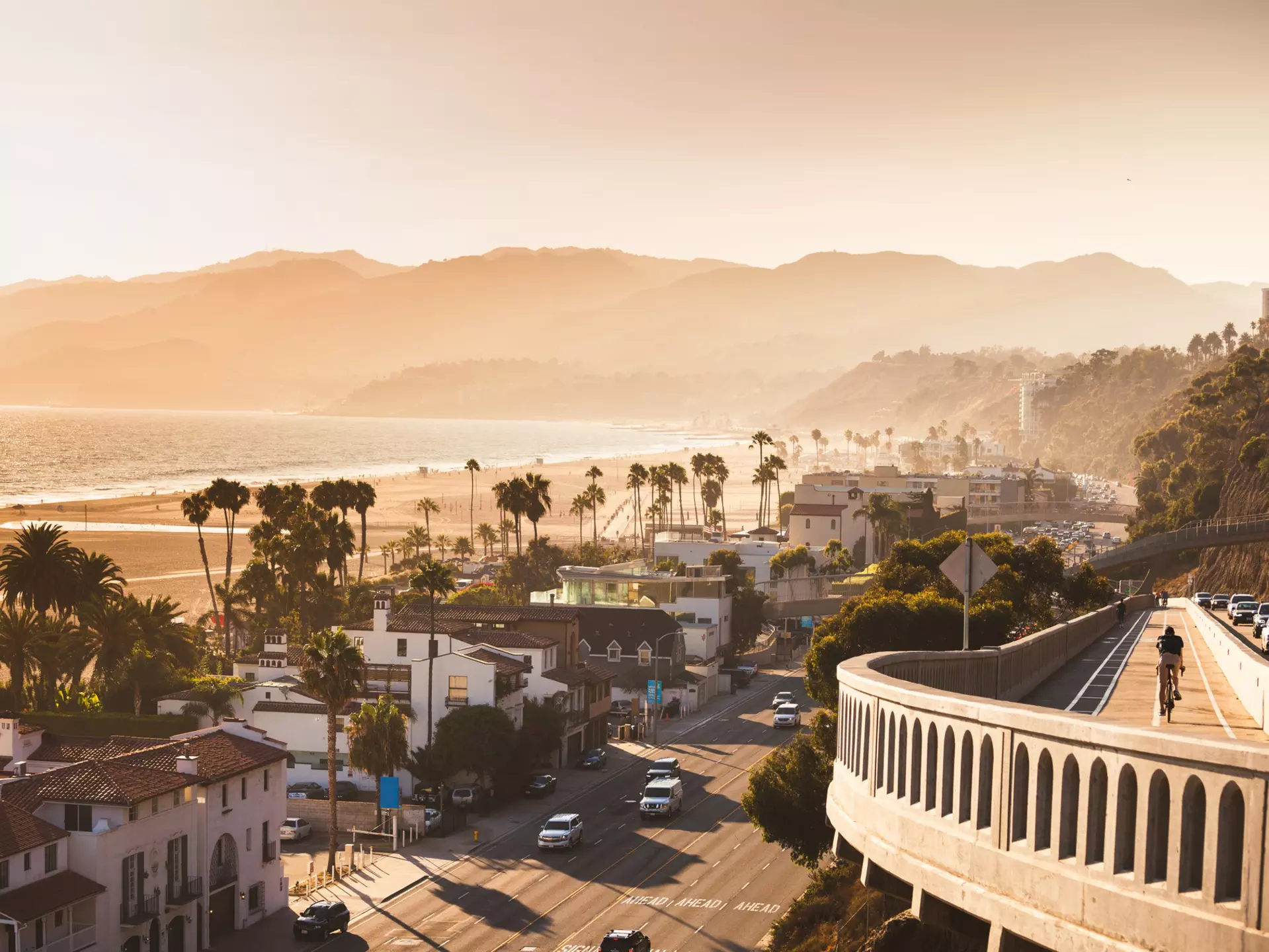
Santa Monica. nata_rass/Getty Images
Writer
Lonely Planet may earn a commission from affiliate links on our site. All recommendations and reviews reflect our own independent opinions.
A counterpoint to the glitz of Hollywood and the traffic on the I-10, the natural beauty of Los Angeles surprises many visitors. And there’s no better way to get a taste of it than on one of these best hikes in Los Angeles.
A range of trails all over this sprawling city – spanning Malibu, Griffith Park, the Santa Monica Mountains, Pasadena and Hollywood Hills – beckon visitors in LA. If you like a destination walk you’ll love Escondido Falls; retro TV buffs will love seeing the M*A*S*H set in real life on the Cistern Trail; and for those chasing celebrity sightings, Runyon Canyon is almost guaranteed to deliver.
Whether you’re a local in need of an adrenaline-pumping workout or a visitor looking for a tranquil escape after the crowds of Venice Beach and Rodeo Drive, these unique hiking spots cater to all levels and are the perfect way to see Los Angeles in a new light.
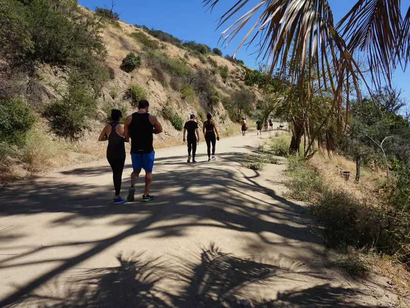
1. Runyon Canyon, Hollywood Hills
Best hike for spotting a celebrity
Distance: 1.9-3.3 miles (3-5.3km) round trip
Estimated time to complete: 1-2 hours
Level of difficulty: easy-moderate
Whether you’re a local or just passing through, chances are you’ve heard of Runyon Canyon. Steps from the heart of Hollywood, this popular trail draws fitness enthusiasts, dog owners, tourists and (yes) celebrities, particularly on weekends. The beauty of Runyon lies in its wide, accessible paved loop path, from which you can veer onto more difficult off-road areas.
While the main path is relatively flat, completing the circuit is no easy feat. There have been many visitors dressed to the nines – complete with heels – under the impression Runyon is no more than a photo op. The views of the Hollywood sign, Griffith Observatory and all the way to Downtown are indeed gorgeous – but you have to work for them.
Planning tip: Bring sunscreen, and expect to sweat.
2. Cistern Trail, Malibu
Best hike for sitcom fans
Distance: 3.65 miles (5.9km) round trip
Estimated time to complete: 1.5 hours
Level of difficulty: moderate
Rocky, rugged and remote, with an elevation of 500ft (152m), the Cistern Trail is best suited to moderate or experienced hikers, and its more challenging conditions mean it’s a little less crowded than some other trails.
The beauty of the canyon trail is a draw in itself – but the hike is also popular with TV buffs: it was once one of the primary filming locations for the TV series M*A*S*H, a top-rated hit from 1972 to 1983. A number of props and set pieces (such as jeeps) that transformed the rugged Californian area into a military encampment from the Korean War have been left along the trail for fans to spot.
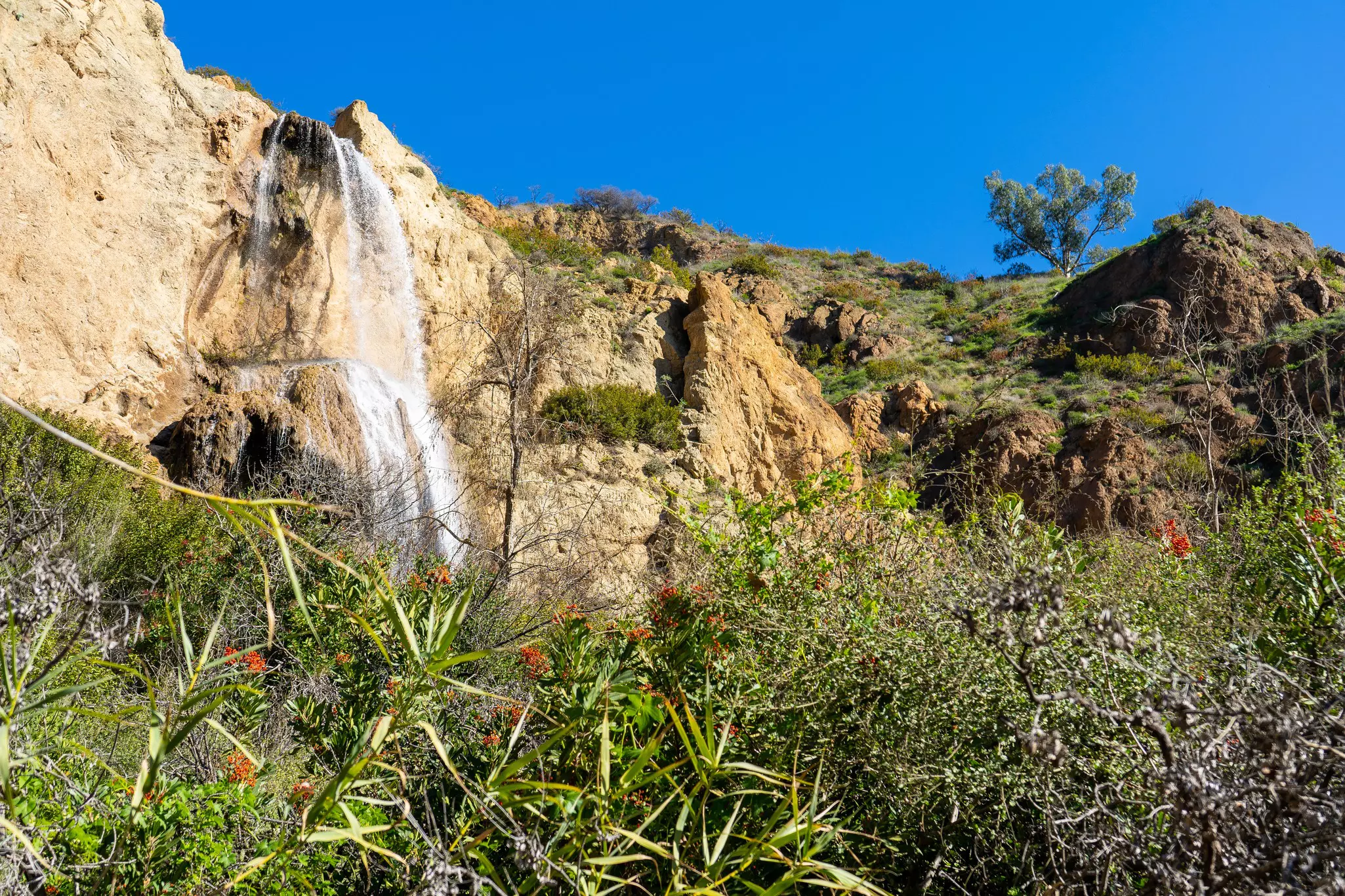
3. Escondido Falls, Malibu
Best hike for chasing waterfalls
Distance: 3.8 miles (6.1 km) round trip
Estimated time to complete: 2 hours
Level of difficulty: moderate
If you plan to defy TLC and actually go chase waterfalls, the 150ft (45m) Escondido Falls – the tallest multi-tiered cascade in the Santa Monica Mountains – should be on your list.
The trail to the falls starts out relatively flat and easy along Winding Way, before transitioning to a steep and challenging course between the lower and upper falls. Along with the waterfall, hikers will also witness lush greenery and beautiful views of the Santa Monica Mountains and the Pacific ocean.
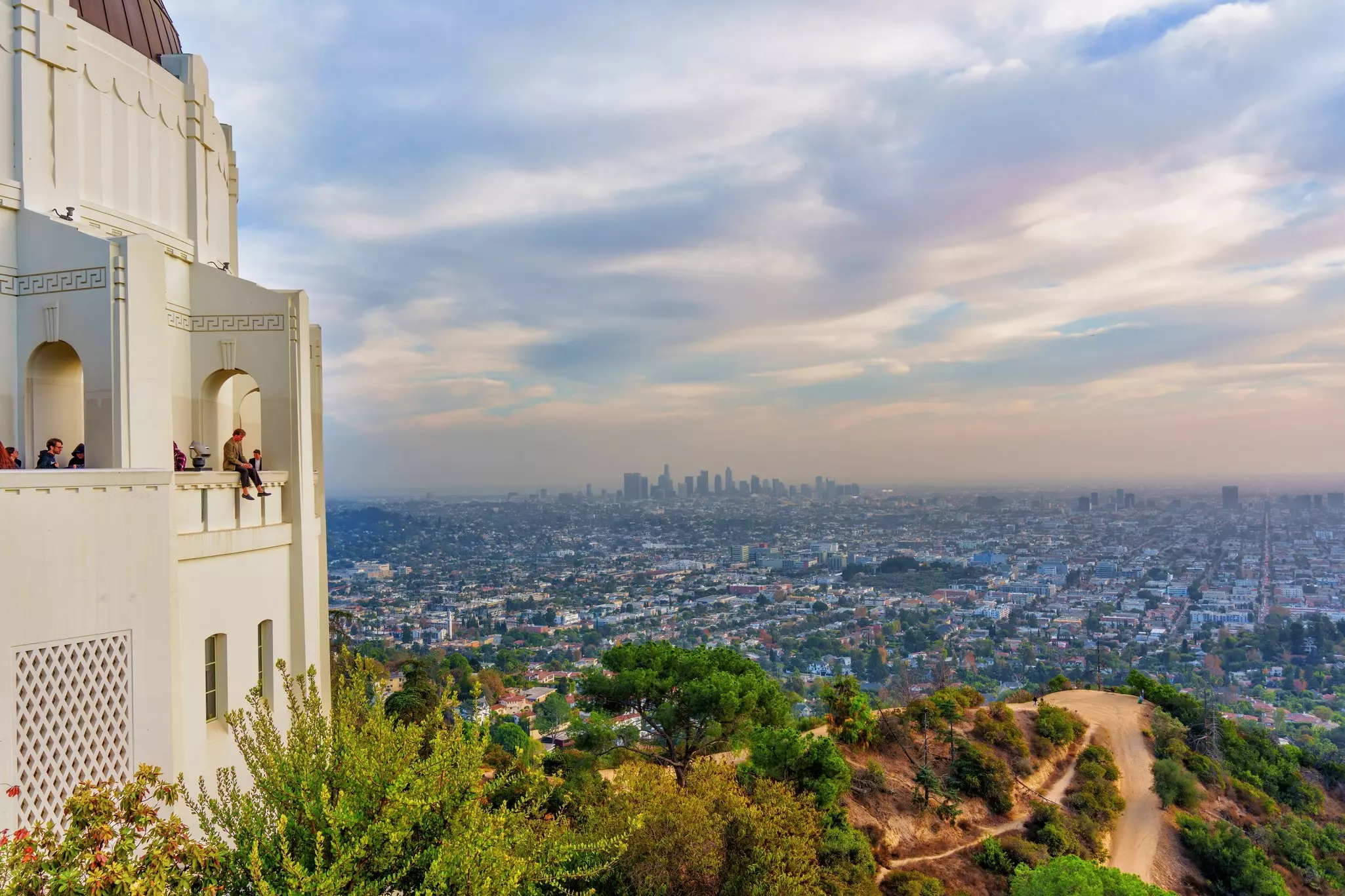
4. Griffith Observatory
Best hike for killer city views
Distance: 8.8 miles (14.2km) round trip
Estimated time to complete: 4 hours
Level of difficulty: moderate
Iconic staples of LA B-roll footage, the Griffith Observatory and Hollywood sign are two of the city’s greatest landmarks. While the hike between these two sites with stunning city views is doable, you need to pay attention to the route: as there are no marked directions or stopping points, it is very easy to find yourself straying on the wrong path. For a more straightforward hike, start from the bottom of Mt Hollywood Drive and cut down two miles.
Even if you skip the hike to the sign, don’t miss a trip (by car or foot) to the top of the observatory. Beyond its breathtaking city views, the planetarium, a landmark since 1935, is great for stargazing and learning. It’s also where many TV shows and movies, such as La La Land (2016), The Terminator (1984), Charlie's Angels (2003) and Adele’s One Night Only concert were filmed.
Planning tip: Griffith Park has more than 65 hiking trails and a zoo within its 4310 acres. Many hikes, including the Ferndell to West Observatory Loop, are accessible, and hikers of all levels of experience will find a trail that suits them.
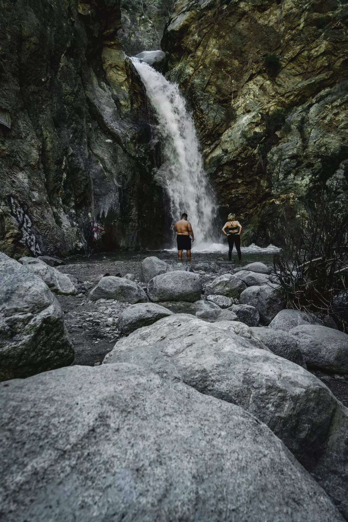
5. Eaton Canyon Falls, Pasadena
Best group hike
Distance: 3.5 miles (5.6km) round trip
Estimated time to complete: 1.5 hours
Level of difficulty: easy–moderate
Eaton Canyon Falls is a relatively short and manageable hike for nature lovers and families in the San Gabriel Mountains. The trail leads to a gorgeous 40ft (12m) waterfall that predominantly flows in the spring and after major rainfall. Yet even if it’s only a trickle, the oak woodlands and scenic canyon views along the trail don’t disappoint.
If you’re hoping for a quiet and serene hike, start your day early, as by lunchtime the sun is beaming down and the waterfall becomes a popular spot for groups to hang out and play music. Eaton Canyon is suitable for most hikers and levels; just be prepared for some uneven rocky sections and to get your feet wet during creek crossings.
6. Charmlee Wilderness Park, Malibu
Best hike for soaking in wildflowers and sunsets
Distance: 3.25 miles (5.2km) round trip
Estimated time to complete: 1.5 hours
Level of difficulty: easy
A 590-acre nature reserve in Malibu, Charmlee Wilderness Park has trails of varying lengths that cater to both beginner and experienced hikers. When you reach the end of the Ocean Overlook Loop Trail, you’ll be rewarded with breathtaking views of the Pacific ocean and surrounding canyons – especially gorgeous at sunset.
Local tip: It’s not just the finishing line that makes the trip worthwhile. Charmlee is home to many native plant species and wildlife; don’t be surprised if you encounter quail, rabbits, hawks, songbirds and deer while passing through. Springtime is extra special, as blooming wildflowers add vibrant hues to the landscape.
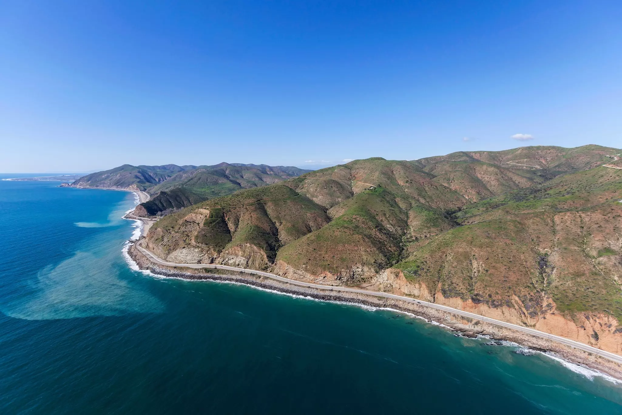
7. Solstice Canyon, Santa Monica Mountains
Best hike for anyone who loves historic architecture
Distance: 2.1 miles (3.3km) round trip
Estimated time to complete: 1.5 hours
Level of difficulty: easy
Solstice Canyon is a popular choice for those looking for a quick hike with a little history. Tucked into the Santa Monica Mountains, which form one side of LA’s “bowl,” the canyon is home to some of the oldest stone buildings in Malibu, plus several historical ruins. Hikers will come across the remains of the Keller House, a stone hunting cabin built in the early 20th century, and the Roberts Ranch house, designed by acclaimed African-American architect Paul Revere Williams in 1952. (Both structures were destroyed by wildfires.)
Planning tip: A 30ft (9m) waterfall is another star of the trail, although more of a seasonal attraction as it only flows after significant rainfall.
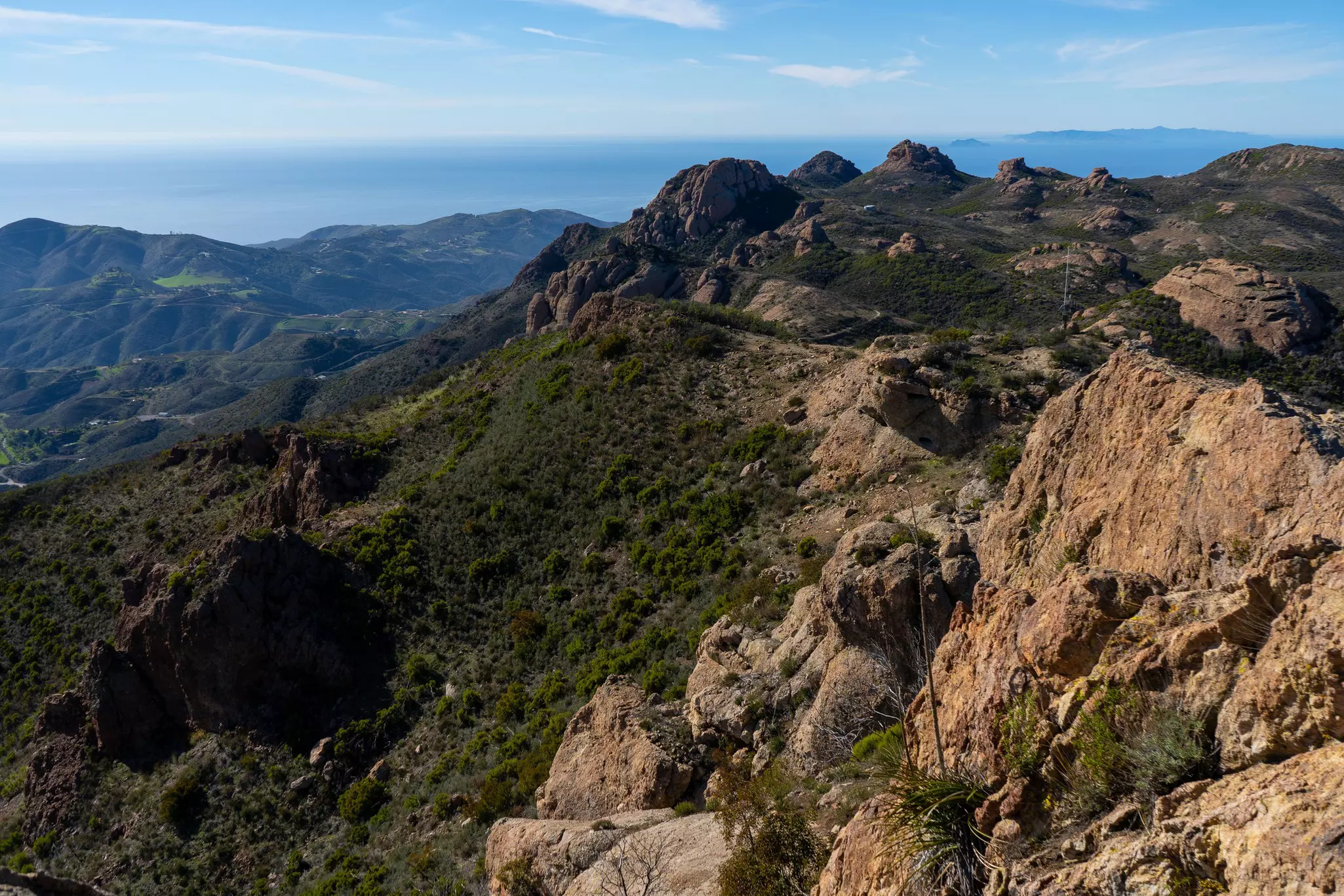
8. Sandstone Peak, Santa Monica Mountains
Best hike for panoramic views
Distance: 6.25 miles (10km) round trip
Estimated time to complete: 3.5 hours
Level of difficulty: moderate
Sandstone Peak is ideal for those looking for a challenging yet rewarding hike. On a clear day, you’ll be able to see the Pacific Ocean, Channel Islands, Santa Monica Bay, San Fernando Valley and more. The trail climbs 1075ft (327m) to the 3111ft (948m) summit of Sandstone Peak, the highest point in the Santa Monica Mountains. For most of the trail, the gain isn’t too noticeable, and if you can power through the first half-mile, it’ll be worth it.
The southern stretch of the hike is a playground for the senses, with boundless fragrant shrubs, especially in spring. While Sandstone Peak is a lengthy hike, it’s easy to break it down into sections.
Planning tip: At the 1.8-mile (2.9km) mark you’ll reach Split Rock, a large boulder with a shaded rest area to catch your breath and refuel if necessary. At 4.5 miles (7.2km), a signpost directs you toward stairs that lead straight to the summit.