Sep 4, 20258 min read
How to plan a 100km hike around Vilnius, LithuaniaSep 4, 2025
8 MIN READ

Writer
The red roofs of Vilnius, Lithuania. Solveiga Kaļva

Writer
Lonely Planet may earn a commission from affiliate links on our site. All recommendations and reviews reflect our own independent opinions.
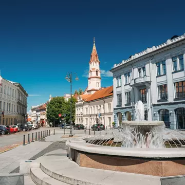
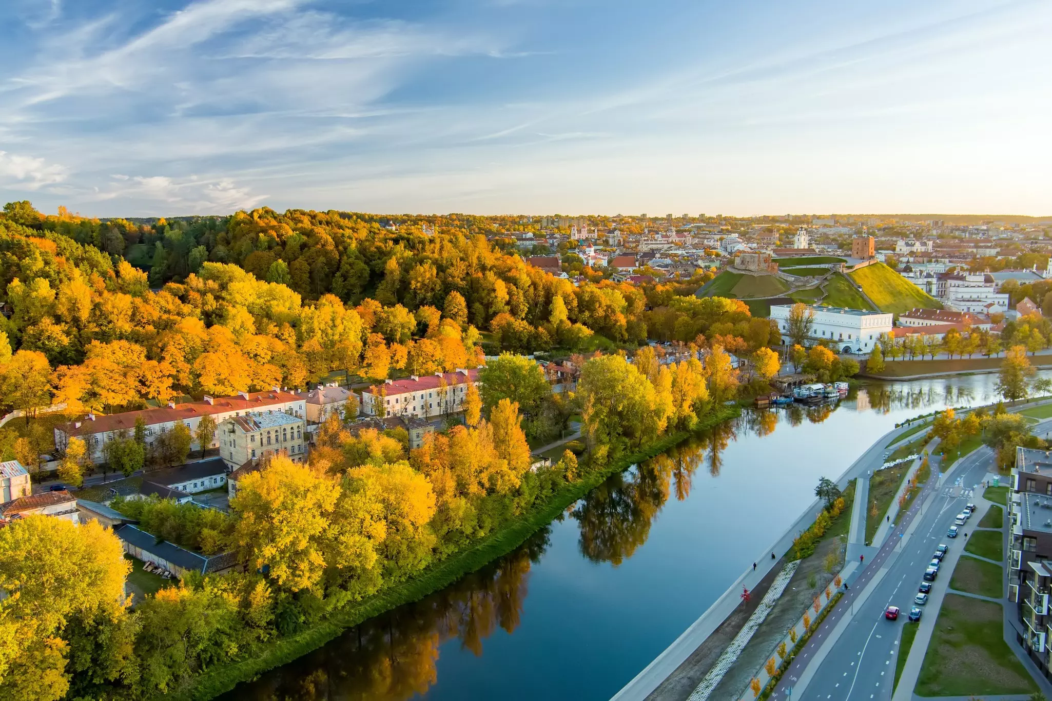
Vilnius, the capital of Lithuania, is renowned for its rich diversity of architectural styles – with Baroque being the defining feature of Old Town – attracting visitors from near and far. The spires of countless churches rise above red-tiled roofs scattered across the gentle hills of Vilnius, making it a perfect destination for those who admire cultural heritage.
Yet this vibrant Baltic city offers something alluring for nature lovers and active lifestyle enthusiasts too on the 100km trail that circles the city. To be precise, its actual length is 111km (69 miles). That might not seem like a big difference, but trust me – this kind of detail really matters when you’re planning to hike it in four days.
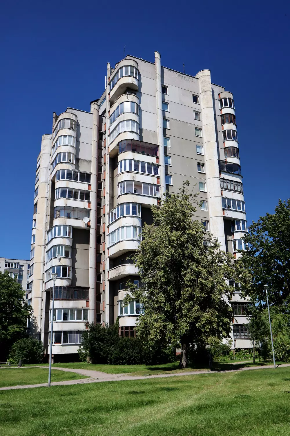
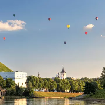
Tiny footpaths zigzag up and down through jungle-like woods, historical cobblestone roads emerge between bushes, and vast panoramic views open up over surrounding greenery. At the same time, cultural sights, ancient hill forts, the Neris River, and Soviet-era block buildings appear when you least expect them. These contrasts make the hike around Vilnius an exciting journey full of surprises.
If it’s your first time in the city, the trail will give you great insight into what it has to offer. If you’ve been here many times before, it will reveal Vilnius from a completely new perspective. Either way, a great hiking adventure is guaranteed.
Each of the start and end points of hiking route's sections are in a place with public transportation nearby. That’s actually the whole idea behind the trail – to create a route for locals and travelers alike that’s reachable by public transport, allowing everyone to enjoy some adventurous or relaxing time in nature. I trusted this concept and didn’t even check in advance whether there would be any buses or trolleybuses to take me back to the city center after each day’s hike. And it was worth it! There was almost no planning, yet everything worked out perfectly.
I used the Trafi app to buy public transport tickets online. You can choose either 30-minute or 1-hour tickets, depending on how long your ride will be. Just activate the ticket in the app and enjoy the journey.
The hiking route around Vilnius is divided into 10 sections, ranging from 9km (5.6 miles) to 19km (11.8 miles) in length, with difficulty levels varying from easy to very challenging. I decided to complete the route in four days, combining several parts into longer stretches. If you're looking for a relatively easy and enjoyable experience, allow for five days – that will leave you with manageable daily distances and more free time in the evenings, yet it will still feel like a proper hiking trip.
For the first day, I planned to cover two sections of the trail from Stalo kalnas to Serpentine, totaling 21km (13 miles). Already at the start, I made a short detour off the route to enjoy the panoramic view of Vilnius from the Hill of Three Crosses – it’s totally worth spending a bit of extra energy to see the roofs of Old Town and Gediminas’ Tower from a distance.
Once the path began to follow the Vilnia River, my heart was stolen by the beauty of the surroundings. This stretch remained my favorite until the end – a bubbling river with people reading books and chatting on its banks, a wild and winding footpath along the Vilnia, unexpected bits of art or glimpses of Old Town's rooftops, all with the freedom-loving vibe of the self-declared Užupis Republic (Vilnius artists’ colony) – how could you not fall in love? Later, the lush green rolling hills near Pūčkoriai Outcrop and several ancient hill forts added even more charm.

On the second day, I walked the next two stages from Serpentine to Žemieji Paneriai, covering 26.1km (16.2 miles). I began the day by visiting the Church of Christ the King and Infant Jesus, a lovely wooden church built in 1935. The side door was open, so I peeked inside and enjoyed the morning sun shining through the stained-glass windows, filling the space with golden light.
The first portion of the day offered a blend of Lithuanian forest, a countryside village feel, and Soviet-era apartment blocks. The following part, Section 4, was labeled as very difficult – and I quickly understood why. It was a relentless climb: steep ascents followed by equally steep descents, repeated over and over.
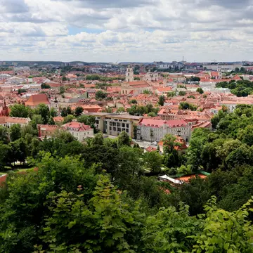
The third day brought three more stages, from Žemieji Paneriai to Verkiai, totaling 26km (16.1 miles). Once again, the route served plenty of ups and downs over Vilnius’s hills. Some inclines were so sharp that, looking down, I wondered, is this even a path? My favorite part of this section of the hike unfolded right along the Neris River, a scenic waterway, wrapped in green shrubs and trees. The highlight of the day was a visit to the TV tower. As the tallest structure in Lithuania, it offers an impressive panoramic view of Vilnius and its surroundings.
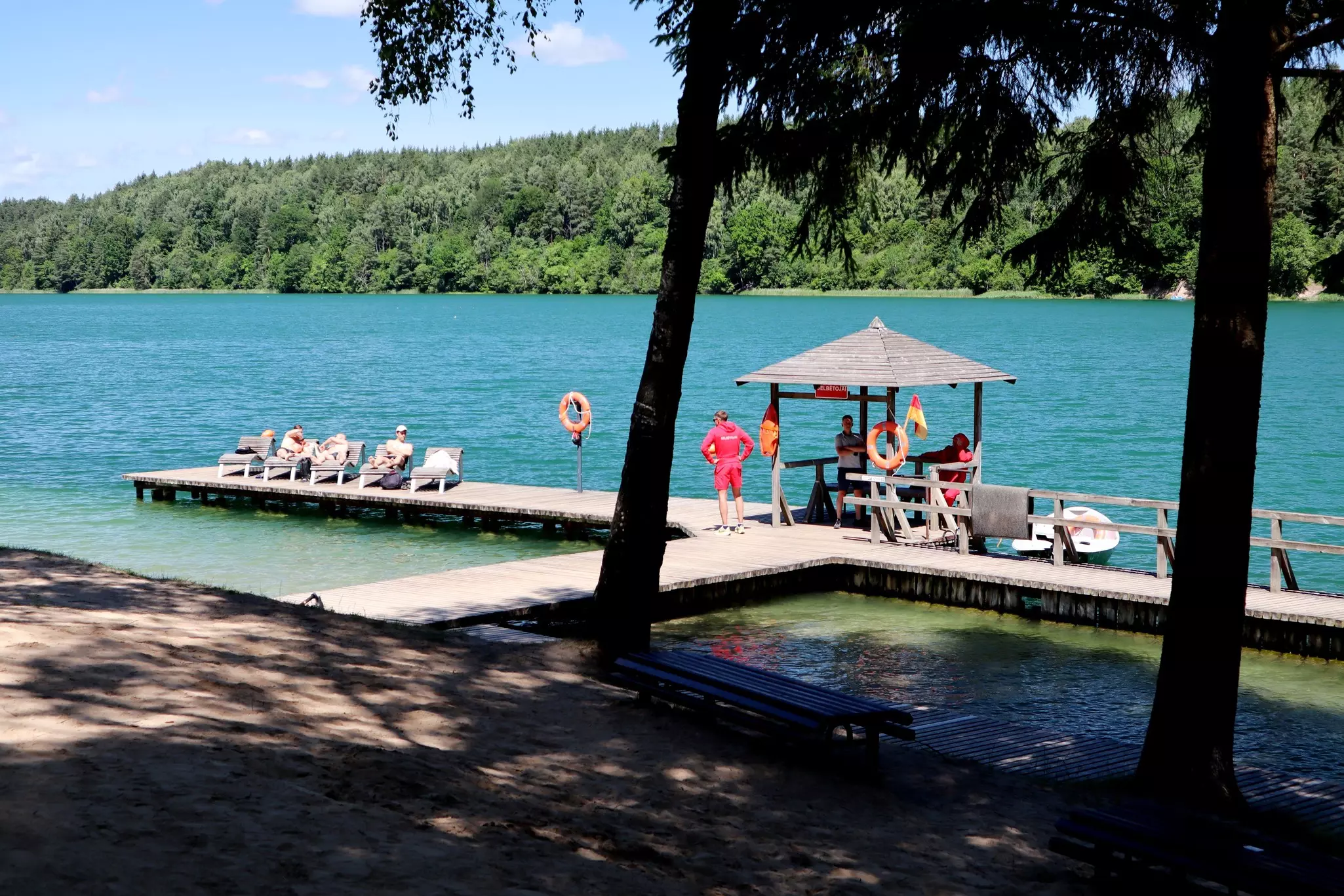
I planned the fourth day as the most challenging one, covering the last sections of the trail in 37.9km (23.5 miles) from Verkia back to where it all began, Stalo kalnas. I was following peaceful forest roads and paths when suddenly I stopped speechless in awe – between the trees lay a turquoise-blue lake, one of the so-called Green Lakes. Together with the hilly path and light green leaves surrounding the scenery, I felt like I was standing next to the Mediterranean Sea. The biggest lake featured an almost tropical beach with white sand and crystal-clear water.
Later, Verkiai Manor Park provided vast panoramic views of curves of Neris River. The last part of the hike was switching between wild trails and urban settings, finally leading me back to Stalo kalnas. Once I congratulated myself for the successful completion of the 100km trail around Vilnius, the city greeted me with heavy rain.
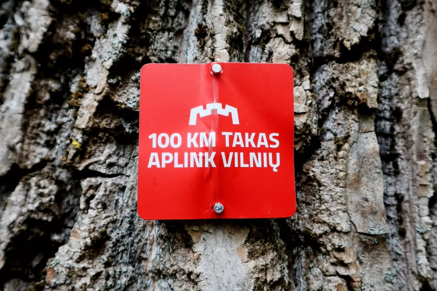
The trail is well-marked with red signs reading “100km takas aplink Vilnių, ” clearly visible both in nature and in urban areas. You’ll find red trail markers attached to trees, road signs and other surfaces, along with information plaques at the start of each section and directional signs at major crossroads and within the city. However, keep in mind that during summer, some trail markings may be obscured by tall grass, dense bushes or tree branches.
For easier navigation, download GPX files for each section and open them with your preferred online map. I used the LVM GEO mapping app developed by Latvia’s State Forests, but any international mapping app will work just fine. Mobile internet is available throughout the route, so there’s no need to worry about downloading offline maps.
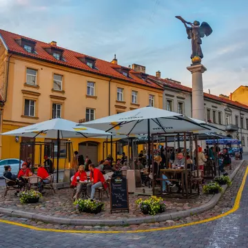
Summer is the best time to visit the Baltics in general, and the trail around Vilnius is no exception. The period from May to September offers long daylight hours – perfect not only for hiking but also for enjoying slow evenings on open-air terraces in the city center.
This season also brings the most reliable weather: plenty of sunshine and mild temperatures. While other parts of Europe may suffer from extreme heatwaves, it’s rare for temperatures in Vilnius to rise above 32°C (89.6°F), making it an ideal summer hiking destination.
Even during the high season, most stretches of the 100km trail remain quiet and uncrowded, apart from a few popular spots such as Belmontas Watermill, Pūčkoriai Outcrop, the Green Lakes, Calvary Forest Park, and other recreational areas used by locals. Aside from these particular sections or where the path overlaps with urban areas, I encountered just one other couple hiking the trail – most of the time I was alone, surrounded by trees, birds and the wind.
Autumn is also a beautiful time to explore the route, offering breathtakingly colorful scenery, especially around Pūčkoriai Outcrop, the Gariūnai viewing platform, the Neris River and Verkiai Manor. While the trail is accessible year-round, certain segments can become slippery or hazardous in wet, muddy or snowy conditions – particularly Sections 4, 5 and 6.
Since the trail is well-connected to the city center, it makes sense to choose a hotel, apartment or hostel near Old Town. I stayed at the art hotel Moon Garden, located between the Gate of Dawn – the only remaining gate of Vilnius’s defensive wall – and Halė Market, built in the early 20th century and now serving as a market by day and a collection of hipster bars by night. Whether I wanted to stroll through Old Town and enjoy its evening atmosphere or shop for fresh hiking snacks, everything was just a few minutes’ walk away. The central location also made it easy to reach the starting point of each day’s hike by public transport.
Explore related stories