Jun 19, 20276 min read
How to visit Chiang Mai on a budgetJun 12, 2026
7 MIN READ

Writer
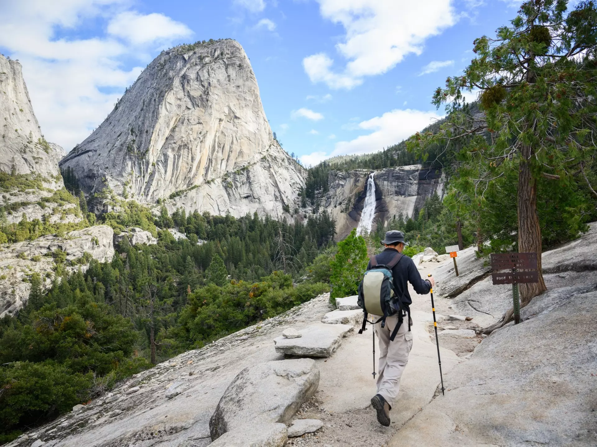
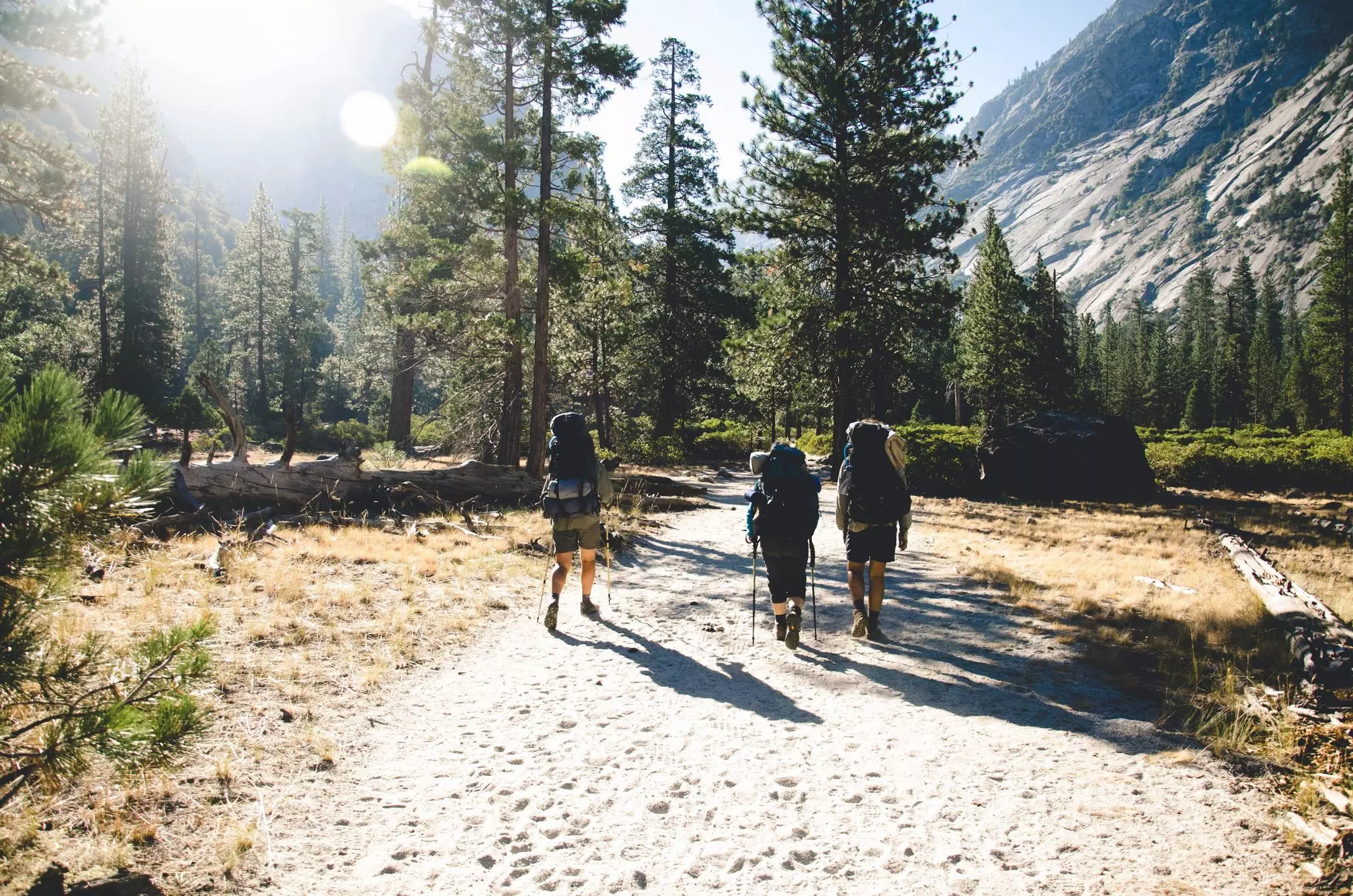
A hiker on the John Muir Trail near Vernal Falls, Yosemite National Park. Janice Chen/Shutterstock
Writer
Lonely Planet may earn a commission from affiliate links on our site. All recommendations and reviews reflect our own independent opinions.
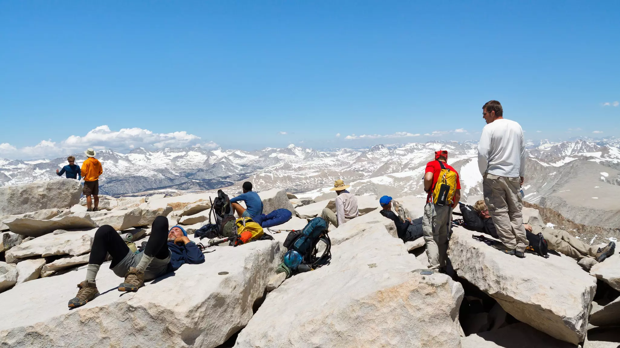
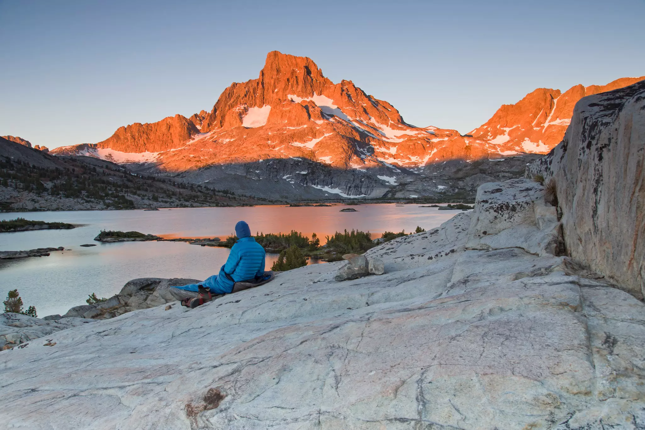
You rub your eyes to make sure it’s real: a 360° view from atop the highest peak in the continental US across a sea of granite and snowcapped peaks. Short of breath and legs tingling from the climb, you see creeks flowing from mountaintops down to alpine lakes, with the trail you just hiked meandering its way through it all.
Nothing out there is quite like the John Muir Trail. What does it take to complete this world-famous route, which covers 46,000ft of elevation change, six high-elevation mountain passes and three national parks? A sense of wonder. And more than a little drive.
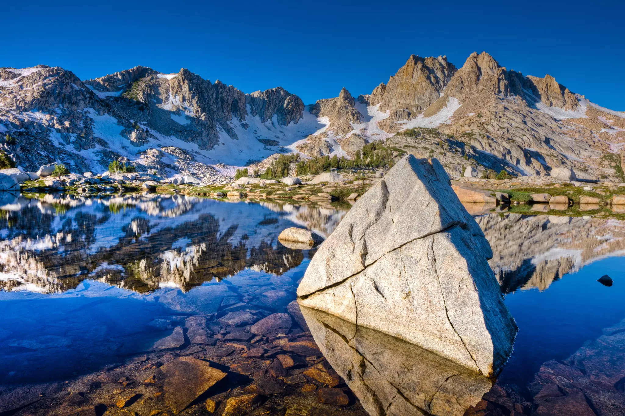
The Paiute, Indigenous residents of the region, established the trail for trading, calling it Nüümü Poyo. Following the route laid out by the Paiute, the current John Muir Trail is a 211-mile trek through the heart of the Sierra Nevada mountain range in California, traversing three national parks (Yosemite, Kings Canyon and Sequoia) and exceeding altitudes of 14,000ft. Hikers follow creeks, climb up and over passes more than 2 miles high, and carve a path that meanders in sync with the surrounding natural landscape.
The trail runs from the Happy Isles trailhead in Yosemite Valley south to the summit of Mt Whitney (14,505ft), the highest point in the contiguous United States. From north to south, the JMT continuously gains altitude, climaxing on the summit of Mt Whitney. It’s most superlative way to end a hike one could imagine.
Born in Scotland in 1838, John Muir emigrated with his family to the United States when he was just 11. After moving to California in 1868, he set out on long, solitary journeys through the Sierras, carrying “only a tin cup, a handful of tea, a loaf of bread, and a copy of Emerson.” Eventually he built a cabin in Yosemite, and campaigned tirelessly for its protection. The magnificent national park would not exist in its current state without him.
Since Yosemite Valley had 4.5 million visitors in 2019, you shouldn’t expect to be the only hiker on the JMT. In fact, the route is so popular you must go through a lottery to score the required permit, which helps cut down on crowding and preserves the environment. Nonetheless, after stepping past the trailhead and onto the first of many switchback climbs, it may feel like you have the mountains almost entirely to yourself.
Depending on the previous winter’s snowfall, you could be hiking on bare granite – or your entire hike could require crampons and an ice axe. Be prepared to ascend from 7000ft to over 10,000ft daily – possibly twice in one day. With creek crossings, rock hopping and constant switchbacks, the only thing the trail isn’t is flat.
And all the exertion is worth it. For from passes reached after half-day climbs, you’ll be able to look back and out over views that seem to encompass the very essence of the world in its beginnings: gray rock, blue water, bluer sky – and not a soul in sight.
Thunder and lightning threaten almost every afternoon. From 3pm to 6pm, we highly recommend sticking to lower elevations if possible. Even if the weather forecast calls for clear skies, the mountains make their own weather. Also, there’s a reason a local saying speaks of “two seasons – winter and July.” An average winter will lay down permanent snow on every pass – and snow can happen any day of the year.
Every summer brings wildfires to the forests California – a natural element of the ecosystem that has gotten more intense with climate change. Some days, you’ll see the smoke of distant fires; some days, the sunsets flare iridescent as the pall hangs above the peaks. Campfires are not permitted.
Bears are present throughout the trail – and they can be as crafty as they are dangerous. (A bear in Yosemite once figured out that if she rolled a canister off the top of a cliff, its contents would likely become available at the bottom.) Don’t get anywhere near a mother bear and her cub – though you may occasionally see such a pair swimming placidly across a pond and drying in the sun. Rattlesnakes are also present along the JMT.
Those tackling the John Muir Trail are a comradely bunch. On nights when hikers share a campsite, they often pass the time comparing the weights of their tents and the protein contents of their snack bars. The trail also intersects with thru-hikers tackling the entire Pacific Crest Trail – a full 2650 miles stretching from Mexico to Canada. On hearing a fellow hiker’s story of misfortune, JMT hikers will often donate something to their cause: almond butter, say, or a hunk of dried sausage.
Where you sleep depends on what you brought along. A tent, sleeping pad and sleeping bag are all musts for comfort and safety. There are a couple of permanent accommodations along the route, including the John Muir Lodge and Vermillion Valley Resort, as well as a few relatively nearby towns. Most hikers get off the trail occasionally to resupply and enjoy the amenities of a hotel or other lodging.
Late July to early September is the most desired window: the passes will have less snow and the heat of the summer sun is in full effect. Your actual dates will likely depend on how the permit process unfolds.
Apply for your wilderness permit at Recreation.gov if you want to start at the southern terminus, and at NPS.gov to start in Yosemite. Both permits are secured by lottery, you’ll need to plan in advance. Yosemite applications are accepted 168 days (exactly 24 weeks), and between February 1 and March 15 for a start in the south. Available slots fill up within the first day of registration opening.
Once you have your permit, you can fly into Mammoth Lakes, the closest airport, which has seasonal flights to LAX. Yosemite is a 4-hour drive from San Francisco.
Many hikers train by trail running, but even a simple jog around the block with weekly increases in mileage can have a huge impact on your fitness for the hike. Besides blisters, mosquitoes and exhaustion, muscle tears are the number-one cause of injuries; stretching can help prevent those. What’s more important is mental training – and pretty much anyone can get in the right headspace for the JMT.
It takes endurance but (except in truly snowy conditions) few advanced skills to hike the trail. You will climb passes above 13,000ft at times, true – but to get over them, you just need to be able to put one foot in front of the other while wearing a backpack. Basic map-reading and first-aid skills are recommended. An intimate knowledge of your gear is most important.
Multi-liter backpack
Warm and lightweight sleeping bag
Sleeping pad
Three-season tent
Water purifier
Bear canisters (required for smellable gear)
Backpacking stove and fuel
Crampons and ice axe (depending on snowpack)
Do your best to pack as light as possible: for the more your pack, the slower you’ll go.
Rain gear
Down jacket
Base layers
Bug spray
Camp stove
Hat, sunglasses and sunscreen
Trekking poles
Extra socks
Trail shoes
Camera.
You can always carry enough food for the length of your hike, but that will be heavy. You can head into nearby towns to resupply at grocery stores – or send yourself food packages to the post offices at the lodges and general stores along the way. While hitchhiking to resupply is a common practice in the region, it is never entirely safe and not recommended. Travelers who hitch should understand they are taking a small but potentially serious risk.
Plan to start with enough food to get you to your first resupply point, typically 10 days in.
Explore related stories