Apr 24, 20265 min read
The best time to visit Lake TahoeApr 9, 2025
6 MIN READ

Writer
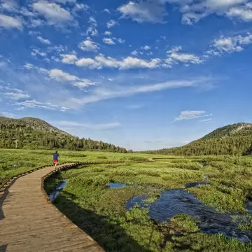
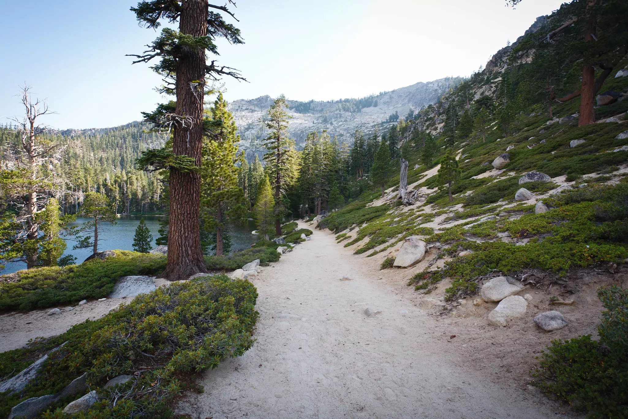
Tahoe Meadows trail. Keri Oberly/Getty Images

Writer
Lonely Planet may earn a commission from affiliate links on our site. All recommendations and reviews reflect our own independent opinions.
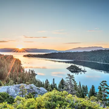
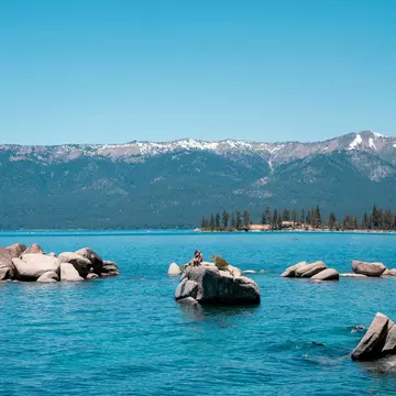
In his semi-autobiographical novel, Roughing It, Mark Twain called Lake Tahoe “the fairest picture the whole earth affords.”
More than 150 years later, this still rings true. Lake Tahoe sparkles like a sapphire sun amid the Sierra Nevada mountain range. Legendary for its clarity, the surface covers 191 miles, reaching depths of up to 1645ft. The surrounding area is no less captivating with forests, white-capped peaks, lakes, streams and meadows to explore.
Lake Tahoe’s hiking trails are ideal for reveling in the region’s spectacular beauty. From back-country adventures to wheelchair-accessible paths hugging the shoreline, here are our picks for the area's best hikes.
Best hike for summer
Length: 1 mile out and back
Time commitment: 1 hour
Difficulty: Easy
The Angora Lakes trail is sandy and wide. It is mostly uphill, with tall trees and behemoth boulders imbuing the landscape with shades of green, dove and brown. As you reach the top, Lower Angora Lake appears on your left. Keep going. It’s beautiful and serene but the real prize awaits at the top. Upper Angora Lake is gasp-out-loud-gorgeous with tall cliffs and dramatic stone outcroppings framing the edge. A swath of soft sand provides the perfect place to spread out blankets or chairs for a day on the beach.
From mid-June through mid-September, the century-old Angora Lakes Resort rents kayaks, SUPs and row boats in addition to operating a restaurant with light fare such as sandwiches and freshly squeezed lemonade. Arrive early as the parking lot (US$10 per vehicle) is usually full by 10am. Be sure to bring cash; cards are not accepted.
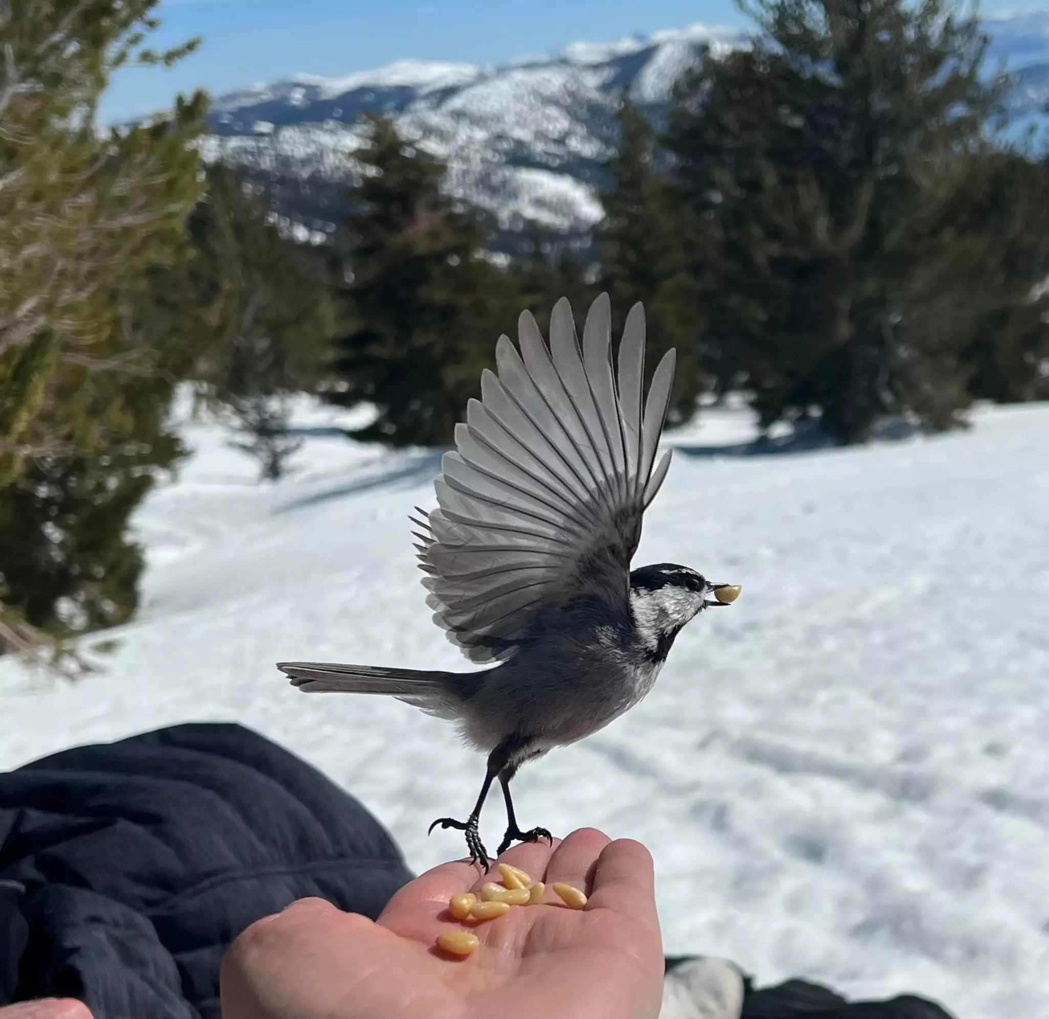
Best hike for winter
Length: 2.4 miles out and back
Time commitment: 1.5 hours
Difficulty: Moderate
Chickadee Ridge is magical year-round, but the scenery is especially alluring when the mountains are covered with snow. The path begins at the boardwalk in Tahoe Meadows where a small bridge leads over the creek and into the woods. From there, follow the signs pointing to the Tahoe Rim Trail. It’s an uphill hike, rewarding you with vistas of Lake Tahoe and the Sierra Nevada at the top. Normally, this would be the payoff, but the hike takes its name from a population of mountain chickadees who famously nibble birdseed from your proffered palm (swing by the store beforehand).
Tahoe Meadows is 6.5 miles from Incline Village via Mt Rose Hwy. Parking is free along the side of the road. Cross-country skis or snowshoes are advisable after a fresh dumping of snow, but it won’t take long for your fellow hikers to tamp it down. On most winter days, boots or waterproof shoes suffice (and a sturdy pair of tennis shoes is fine during the rest of the year).
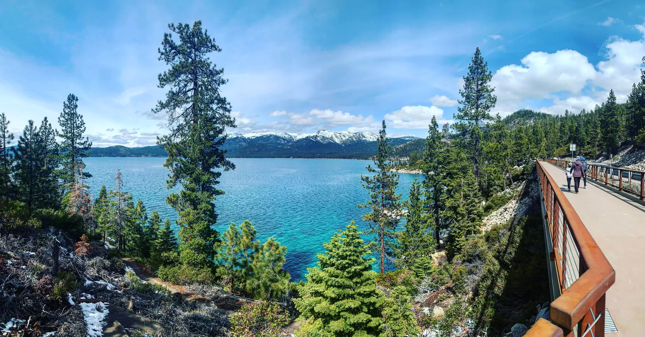
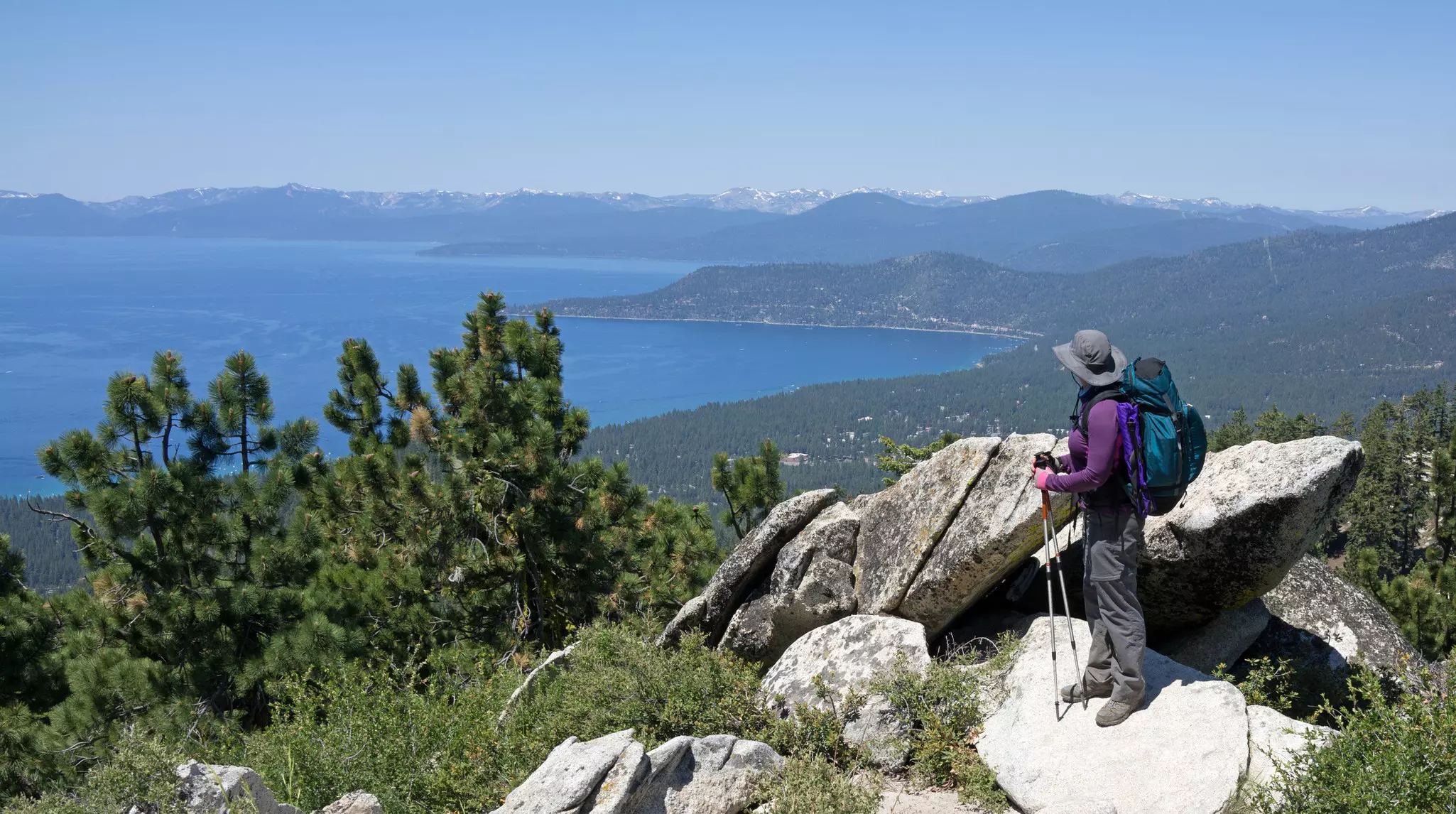
Best accessible hike for strollers and wheelchair users
Length: 6 miles out and back
Time commitment: 2 hours
Difficulty: Easy
The 10ft-wide paved Tahoe East Shore Trail was built to ADA (Americans with Disabilities Act) standards, ensuring that everyone has access to some of the best views in Lake Tahoe. The path follows the shoreline between Sand Harbor State Park and the Tunnel Creek Cafe in Incline Village, showcasing panoramas of Tahoe’s clear waters framed by the rugged peaks of the Sierra Nevada. Along the way, you’ll encounter interpretive signage about the indigenous Washoe people, railroad, logging and steamship history.
There are limited paid parking spots at the trailhead in Incline Village. Summon a ride with TART Connect, North Lake Tahoe’s free, on-demand, point-to-point shuttle service instead.
Best hike for camping
Length: 16.4 miles out and back
Time commitment: 7.5 hours
Difficulty: Moderate
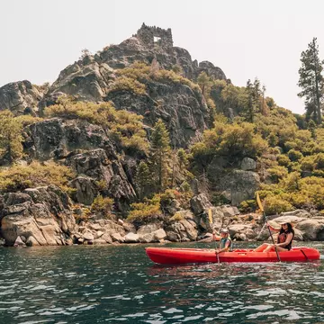
You can hike the Rubicon Trail in one day, but why rush when you can camp and wake up to some of the most iconic vistas in Lake Tahoe? The trail winds between Vikingsholm Estate at Emerald Bay State Park and DL Bliss State Park, serenading hikers with breathtaking views of Fannette Island and Emerald Bay.
Stellar scenery and dramatic rock formations make this area a popular place for offroading and dispersed camping. Facilities are limited so campers should plan to pack out whatever they pack in. If you plan to build a fire, you'll need a free permit.
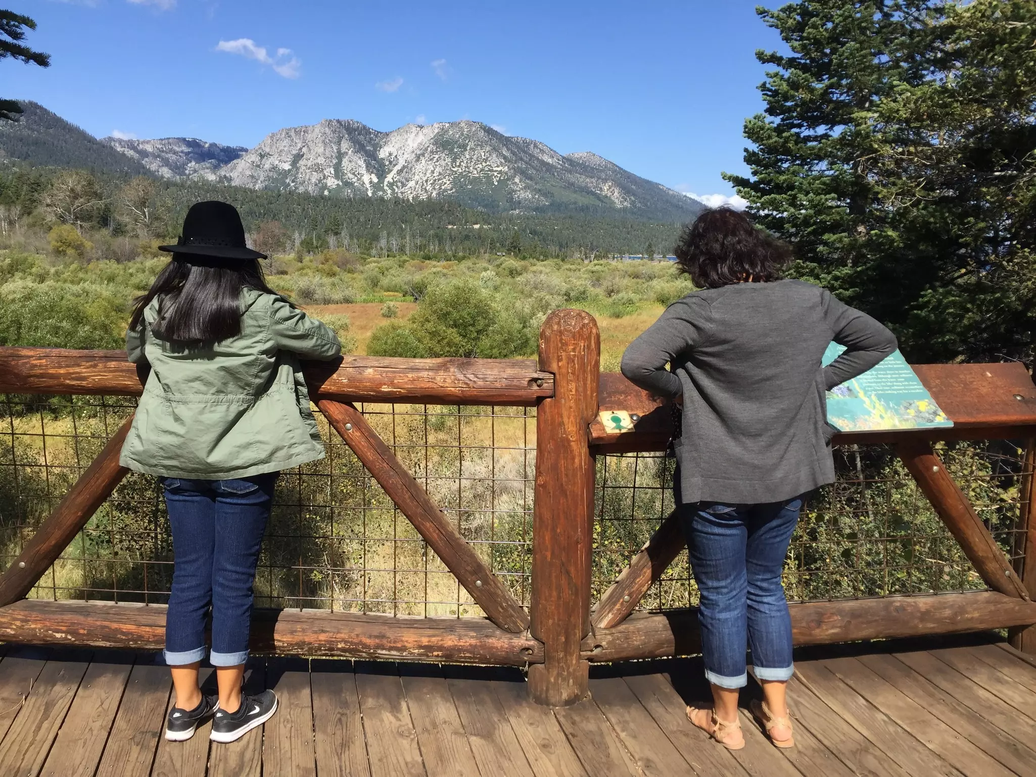
Best hike with kids
Length: 0.5 mile loop
Time commitment: 15 minutes
Difficulty: Easy
South Lake Tahoe’s scenic Rainbow Trail is stroller and wheelchair accessible. Located at the Taylor Creek Visitor Center on Hwy 89, this short paved path is packed with educational features like a forest, wetlands, a stream where salmon spawn in the fall, interpretive signage, a boardwalk, and a free audio tour in English, Spanish, and Washoe (the region’s indigenous language).
The visitor center is typically open from Memorial Day through the end of October, however, the grounds remain open for exploration the rest of the year. In winter, this is a popular spot for cross-country skiing and snowshoeing.
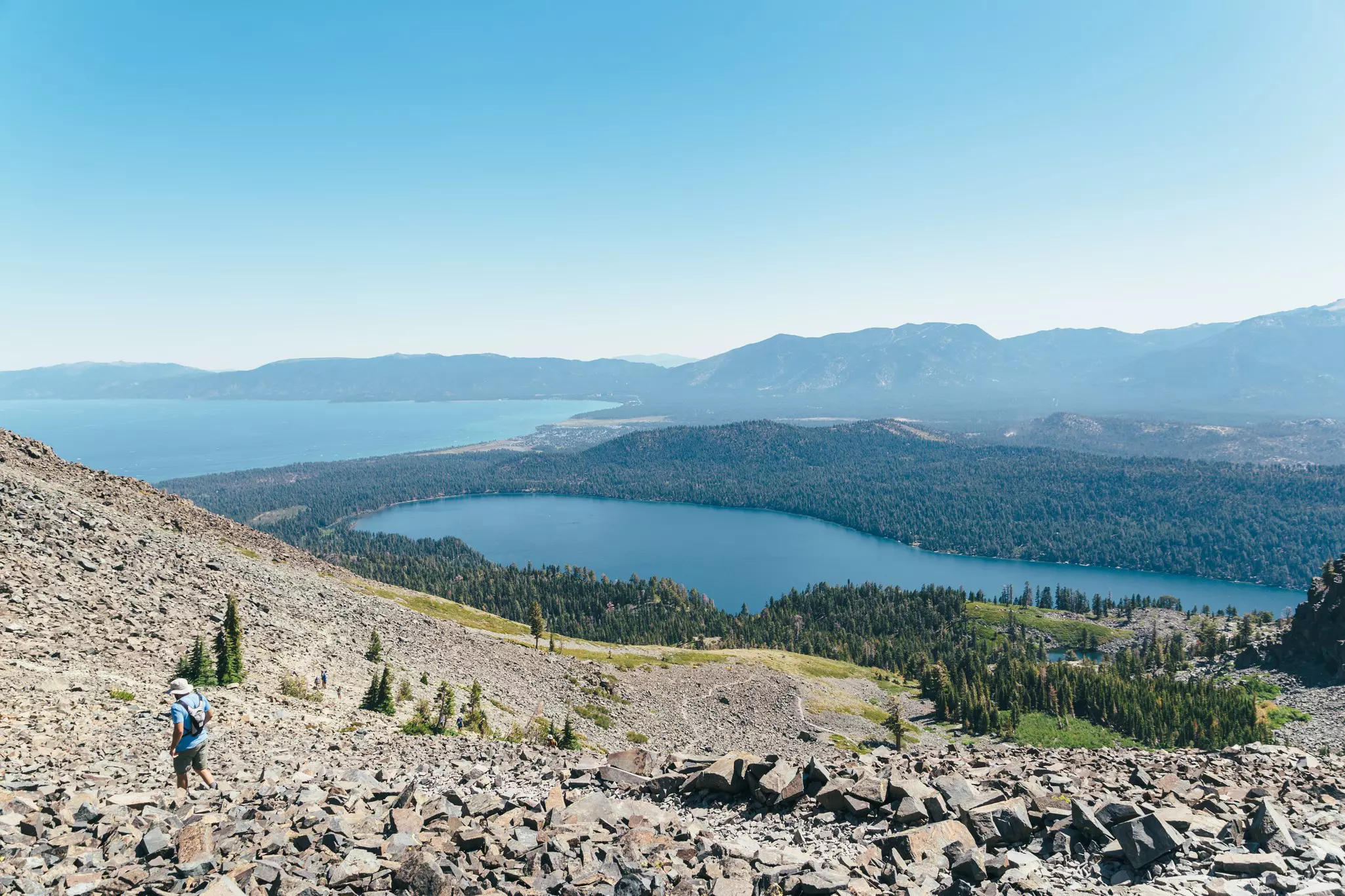
Best hike for elevation
Length: 9.6 miles out and back
Time commitment: 5.5 hours
Difficulty: Hard
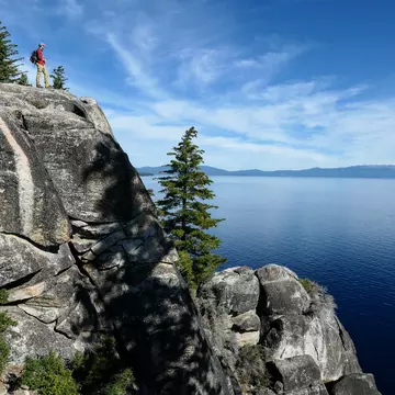
At 9735ft, Mt Tallac is the tallest peak rising above Lake Tahoe’s shoreline. The views from the top are nothing short of astonishing, however, it is a bit of a trek to get there. Mt Tallac is part of Desolation Wilderness in the Eldorado National Forest and you need a permit to hike it. The trail is as challenging as it is alluring: Along the way you’ll scramble up steep rocks and pass by lakes, streams, waterfalls, forests and meadows. The views from the top span for miles into a universe of sky, forests, mountains, and of course, Big Blue below.
Although the Mt Tallac summit is best suited for experienced hikers, the scenery along the way is ravishing enough to make it worthwhile, even if you don’t make it to the top.
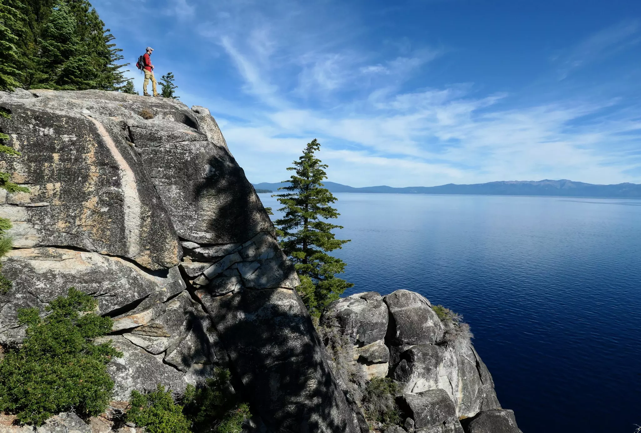
Best hike for backcountry adventure
Length: 165-mile loop
Time commitment: 10–15 days
Difficulty: Hard
You can’t hike the 165-mile Tahoe Rim Trail in one day. Many people don’t even attempt it on the same trip. This is a popular hike to segment, with adventurers returning year after year to tackle a different section. It is a loop hike with eight designated trailheads, and a portion of the trail leads through Desolation Wilderness. A permit is required for hiking and camping in this section. Bear canisters are also required in this area, and it’s a good practice to carry them regardless to minimize your interaction with wildlife.
The trail follows the ridgeline above the lake, traversing a wilderness of alpine lakes, forests, streams and meadows. Unparalleled views of the jagged peaks of the Sierra Nevada plunging into the turquoise waters of Lake Tahoe make this an unforgettable hike, whether you choose to hike through or in segments.
Explore related stories