Jun 16, 20268 min read
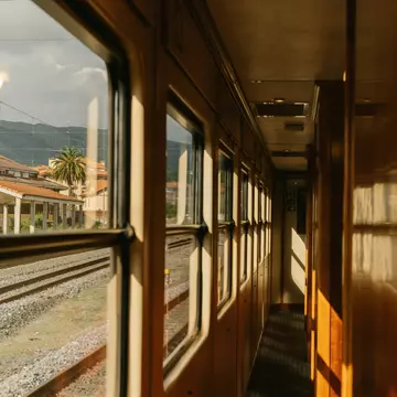
How to travel in Spain by busMar 28, 2026
13 MIN READ

Writer
©Jose Carlos Serrano/Shutterstock
Writer
Lonely Planet may earn a commission from affiliate links on our site. All recommendations and reviews reflect our own independent opinions.
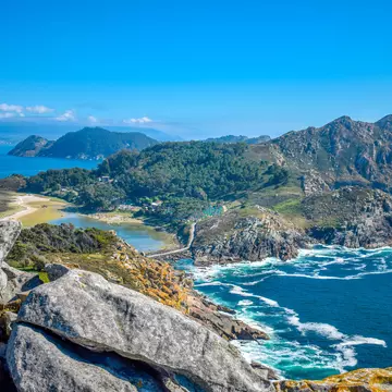
In the far south of Spain, Andalucía is celebrated for many things – its rich Moorish heritage, its sun-kissed beaches, its warm people, its lively festival calendar. Spilling down to some of the country's best beaches, it’s also a tantalizing natural smorgasbord of high mountains, green valleys and often-visible wildlife – and the region's best hikes are a true delight for anyone who loves getting out into nature on foot.
Almost one-third of Andalucía is protected by national parks, natural parks and other conservation areas. Many of these unspoiled green spaces boast clear trail networks and good infrastructure for walkers. The best walks in Andalucía are concentrated in the Sierra Nevada mountains, south of Granada and northeast of Málaga, and the picturesque Alpujarras valleys on their southern flank.
But many other trails are scattered throughout Andalucía’s eight provinces. If you feel like mixing up time on the sand and days wandering in white Andalucian villages with outdoor adventures in some of Spain's best scenery, here are the best walks in Andalucía.
Best introduction to the Sierra Nevada
Distance: 17km round trip
Time commitment: 7 hours
Level of difficulty: difficult
Access: Alsa buses run from Granada to Capileira, taking around 2 hours 30 minutes; by car, it's a trip of around 75km.
This superb walk leads you up one of the most dramatic Alpujarras valleys, the Barranco del Poqueira (Poqueira Gorge), returning via a wonderfully panoramic high-level path. There are good chances of sighting ibex (wild mountain goats) en route. With 870m of ascent, the route requires reasonable physical fitness, but being out in this wonderful terrain is its own reward.
Known as the PRA23, the trail begins near the top of the pretty village of Capileira. The Sierra Nevada’s two highest peaks, Mulhacén (3479m) and Veleta (3398m), soon come into view. Passing through the abandoned village of La Cebadilla, with its small hydroelectric station, you'll zigzag up the side of the valley, then cross mountain pastures before descending to the Río Naute stream.
Now begins the hardest stretch, climbing to the Cortijo de las Tomas, a remote upland farmstead at 2120m. Reward yourself with a picnic stop in these grassy surrounds. The return route weaves its way across open hillsides high on the east side of the valley, revealing fabulous panoramas of Sierra Nevada peaks.
About 3km from Cortijo de las Tomas, you'll meet the Acequia Alta de Pitres, one of the centuries-old acequias (irrigation channels) that give the walk its name. Descending, you'll cross the Acequia Baja (Lower Acequia) before passing through pine woods and back into Capileira.
Planning tip: If you’d prefer a shorter outing from Capileira that still gives a good taste of the Barranco del Poqueira, go for the PRA69, a 7.5km loop.
Most beautiful Andalucian walk
Distance: 22km round trip
Time commitment: 6 hours
Level of difficulty: moderate
Access: The route is best reached with your own vehicle; Torre del Vinagre is around 175km northeast of Granada on the A-319.
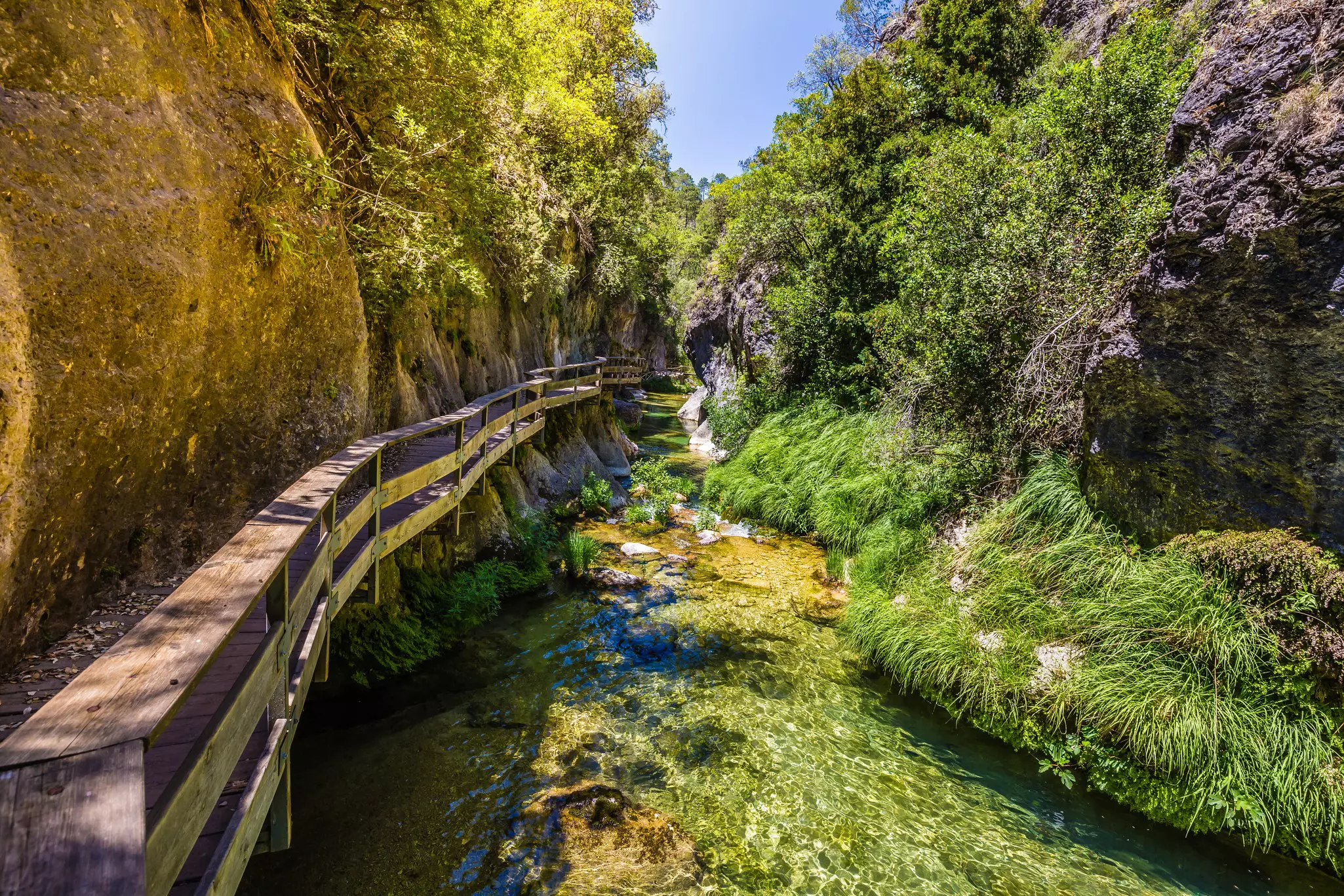
The rugged Parque Natural Sierras de Cazorla, Segura y Las Villas in northeast Andalucía is crisscrossed by many scenic trails. The Río Borosa route is one of the most beautiful walks in Spain, following a crystal-clear river through scenery that progresses from the pretty to the majestic. While demanding, it’s a fun walk to do with (willing) children.
Start at a parking area 1.5km east of the Torre del Vinagre visitor center. The easily followed, well-shaded trail initially runs beside the tumbling, turquoise Río Borosa. After 3km, you'll detour off through the narrow Cerrada de Elías canyon, where the path takes you along a boardwalk above the rushing river.
Rejoining the dirt road after 1.5km, you'll continue for 3km to a small hydroelectric station. From here, a footpath climbs for 3km beneath rocky crags and towering cliffs, passing a series of impressive waterfalls –thunderingly spectacular after rain, but sometimes disappointingly dry – to two dark tunnels. It takes about 5 minutes to walk through the first tunnel, and about a minute for the second, following narrow paths beside the watercourse.
You'll emerge just below the Embalse de los Órganos reservoir, amid forested hills. Walk 5 minutes to the left of the dam to reach the Nacimiento de Aguas Negras, where the infant Río Borosa wells up from under a rock – it's a perfect picnic spot before you head back down.
Best for a sense of history
Distance: 16km round trip
Time commitment: 6 hours
Level of difficulty: moderate
Access: Pórtugos is served by infrequent Alsa buses from Granada; coming by car, the trip is about 80km.
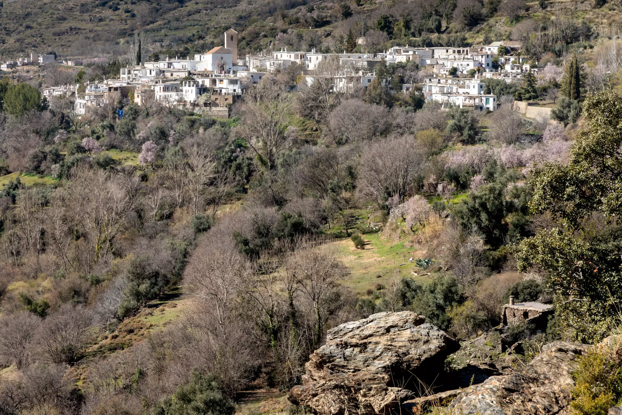
You'll feel the vibes of Andalucía’s Moorish past on this walk, as you hike through charming Alpujarras villages and up and down superbly engineered old paths known as escarihuelas, navigating the plunging flanks of the Río Trevélez valley.
The name Tahá refers to a group of seven villages here – the route starts in Pórtugos and winds down footpaths and tracks among fruit and nut orchards through little Atalbéitar, Ferreirola and Fondales, with their flat-roofed Imazighen-style houses.
Cross the Puente Romano (in fact, the bridge is more likely Moorish) over the ravine below Fondales, and continue along the Escarihuela de Fondales for 2.5km up the south side of the valley. As you walk 4km east, you'll enjoy ever better views of the Tahá villages.
Next, take a sharp left at the small group of houses known as the Cortijo de Panjuila, descend on the Escarihuela de Panjuila and then cross back over the ravine by a bridge beside a ruined watermill. To finish, take the westward path to Ferreirola then head back up through Atalbéitar to Pórtugos.
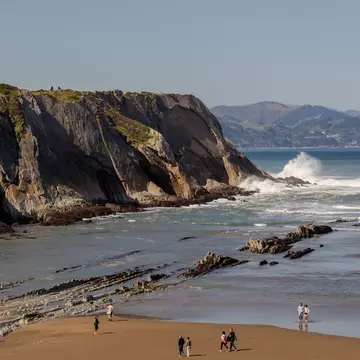
Best coastal walk
Distance: 13km one-way
Time commitment: 4 hours
Level of difficulty: moderate
Access: Buses run from Almería to Las Negras, but it's easier to come by car, a trip of about 50km.
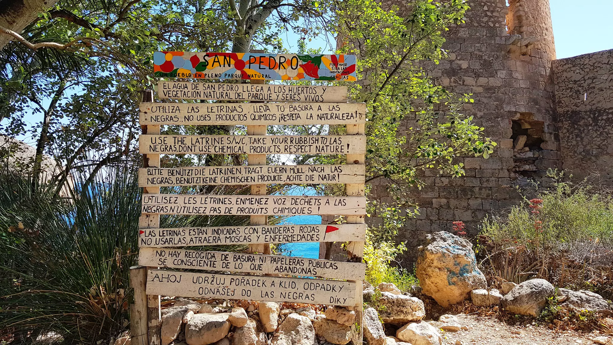
The Cabo de Gata peninsula in Spain’s southeast corner is a desert-like, volcanic landscape fringed by cliffs and capes of otherworldly grandeur washed by azure Mediterranean waters – providing a low-key haven for an eclectic assortment of visitors and residents. The walk along the remote coast between Las Negras and Agua Amarga villages combines landscape drama with little-visited beaches and a curious "hippie" village.
To pick up the trail, follow Calle Aguillas north from Las Negras’ main street for 750m, then turn right following the "Cala de San Pedro" sign along a dirt road. Enjoy expansive views over Las Negras bay as you continue for just over 2km to a parking area.
From here, your path winds high above the sea to the village of San Pedro, on a deep blue bay between cliffs and a ruined castle. Long since abandoned by its original inhabitants, San Pedro now shelters an alternative-lifestyle community living in rehabilitated ruins, tents and caves. A couple of rustic, erratically open beach bars sell drinks and snacks.
The path to Agua Amarga climbs steeply out of San Pedro before leveling off along the top of an inland cliff. Take care as you descend to the sandy beach at Cala del Plomo, then wind round behind a small hill, Cerro de la Higuera. At a track junction, 1.2km from Cala del Plomo, you can divert down to Cala de Enmedio beach, or continue ahead on a rocky uphill path.
To finish, wind across another small hill, Cerro del Cuartel, and finally down into Agua Amarga with its 500m-long sandy beach and plenty of lodgings, cafes and bars to kick back in. If you want to return to Las Negras, a taxi costs around 50 euros (€).
Best for summit-baggers
Distance: 11km round trip
Time commitment: 4 hours 30 minutes
Level of difficulty: difficulty
Access: Travel by Alsa bus or car to reach Capileira; during the hiking season, a shuttle bus runs from Capileira to a drop point near the trail to Mulhacén.
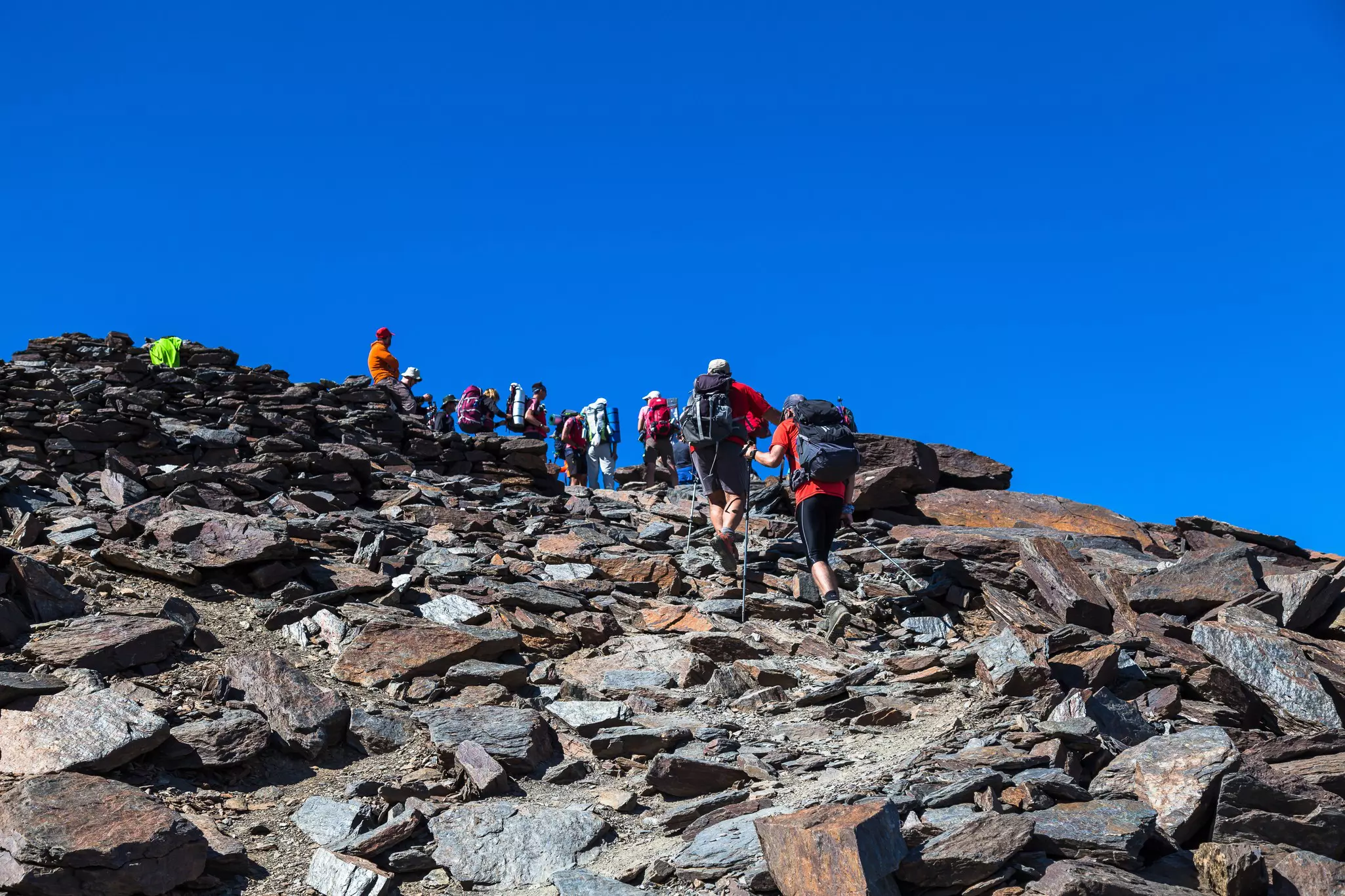
Perhaps surprisingly, the highest mountain in mainland Spain – 3479km Mulhacén, in the Sierra Nevada – can be summited by any reasonably fit walker on a day trip. Thanks to a national park minibus service from the Alpujarras village of Capileira, this crowning achievement only requires walking about 5km up and 5km down, albeit with nearly 800m of ascent and descent.
Unusually for Andalucía, the best season for this walk is the summer, ideally between July and mid-September. But note that summit temperatures are regularly 10°C to 15°C cooler than in Capileira, and the weather can change surprisingly quickly, so bring appropriate clothing.
Officially known as the Servicio de Interpretación de Altas Cumbres, the minibus operates from roughly June to November. For information and reservations, you can email siacsur. amaya@juntadeandalucia.es or call +34 671 564406 (English spoken).
The minibus drops you near a point called El Chorrillo at about 2700m, from where the trail climbs steadily up the Loma de Mulhacén ridge to the secondary peak of Mulhacén II (3362m). The final, less-steep kilometer to the main peak crosses an impressively desolate wilderness of gray rock. The views from the summit are almost infinite, but take care – you'll be standing right on the edge of a 600m precipice.
To vary the route back, turn down a narrow but clear path to the right, just 80m back from the summit. This zigzags down Mulhacén’s steep western flank to meet the Sierra Nevada Road, a formerly motorable road across the range (now barely recognizable as such). Walk left along this track to return to El Chorrillo.
Best for spying birds of prey
Distance: 5km round trip
Time commitment: 2 hours 30 minutes
Level of difficulty: moderate
Access: The trail begins at a car park on the CA-9104 between Zahara and Grazalema; driving is the best way to get here.
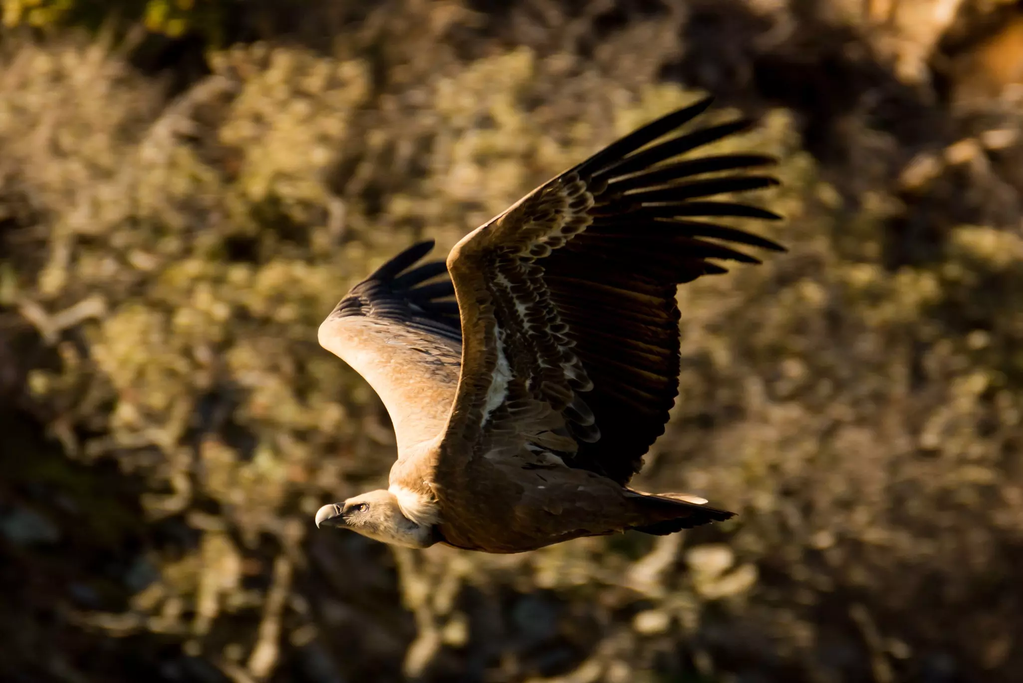
The Sierra de Grazalema in Cádiz province, where Atlantic winds first hit the hills of Andalucía, is the wettest place in Spain. Over millennia, the abundant water has carved the limestone rock into many dramatic formations – none more dramatic than the 200m-deep Garganta Verde (Green Gorge).
What makes the descent into this lushly vegetated nether world (and the steep climb back up) especially exciting is the large colony of griffon vultures nesting on the canyon walls. These enormous birds – with wingspans up to 2.5m – frequently cruise around the canyon’s upper reaches, and you may hear the wind ruffling their feathers as they whoosh by.
The trail is closed because of fire risk from 1 June to 15 October. When it’s open, you need to make a (free) reservation in advance, as there are daily limits on the number of people allowed on the trail. This can be organized through the regional environment ministry or the El Bosque visitor center, but making arrangements through an experienced activities operator such as Horizon can simplify and speed up the process.
Best canyon walk
Distance: 7.7km one-way
Time commitment: 2 hours 30 minutes
Level of difficulty: easy
Access: Several daily trains run to and from Málaga to El Chorro-Caminito del Rey train station; alternatively, drive from Málaga via Ardales, a trip of around 60km.
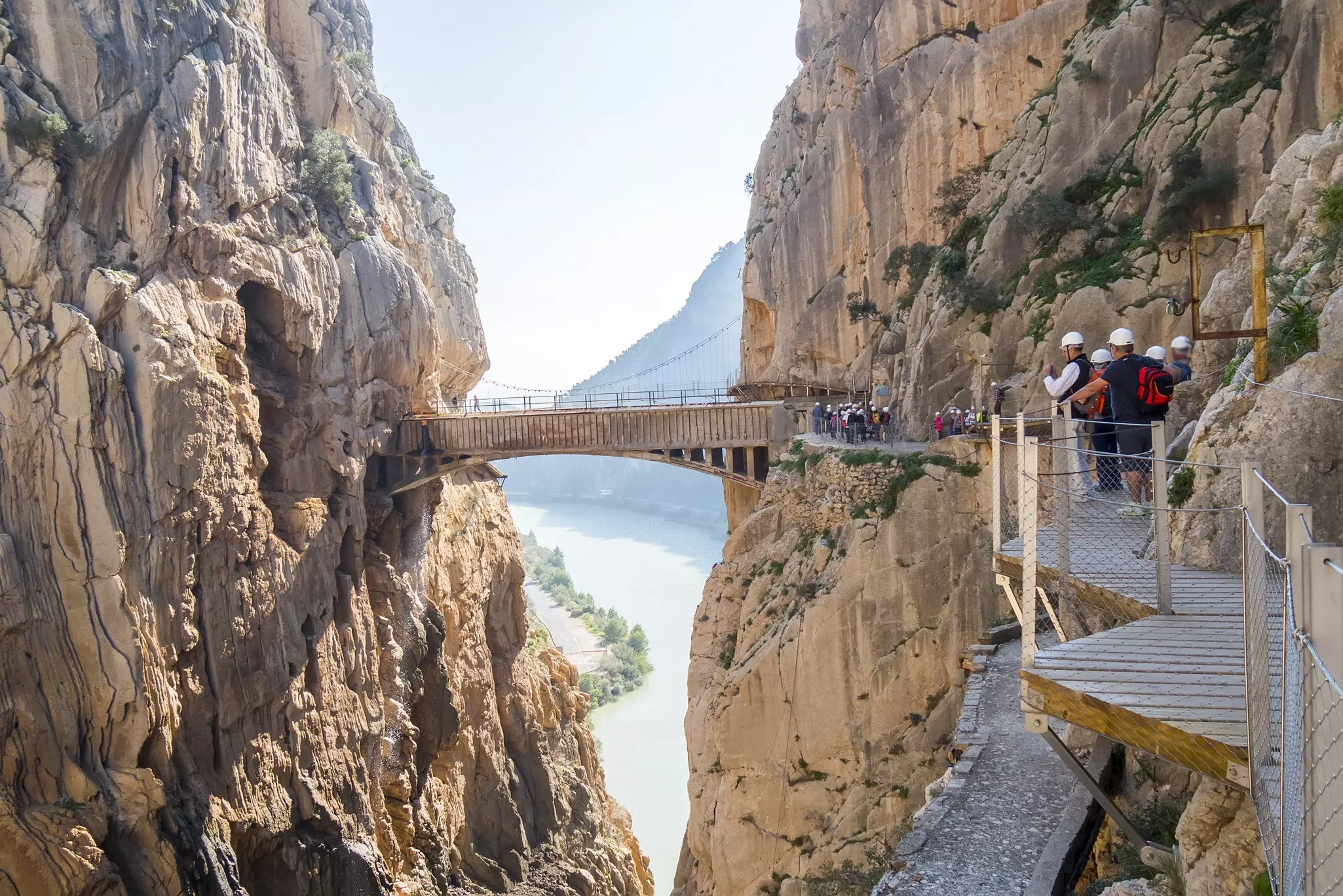
A series of boardwalks fixed high up on the sheer walls of the Río Guadalhorce’s spectacular canyon have made the "King’s Path" probably Andalucía’s most famous walk. The boardwalks comprise just 1.5km of the route, but the scenery is awe-inspiring all the way: in places the canyon rises to heights of 700m and its walls narrow to just 10m apart.
The Caminito is 60km northwest of Málaga and it was originally a maintenance track for water channels feeding a hydroelectric station. It owes its name to Alfonso XIII, who walked the gorge in 1921. The path was fully renovated in 2014 and is very popular: you need a ticket (€10/18 with/without a guide), and you should reserve online well ahead of your visit. Obligatory hard hats are provided.
The walking route is one-way only, north to south, and it ends at El Chorro-Caminito del Rey train station; the end and start are connected by a shuttle bus. Parking is available at both ends and at a visitor center on the bus route. Allow 4 hours for the full circuit, including the bus trip.
Planning tip: This is not a strenuous walk, but vertigo sufferers might prefer to avoid it. Children under 8 years are not allowed.
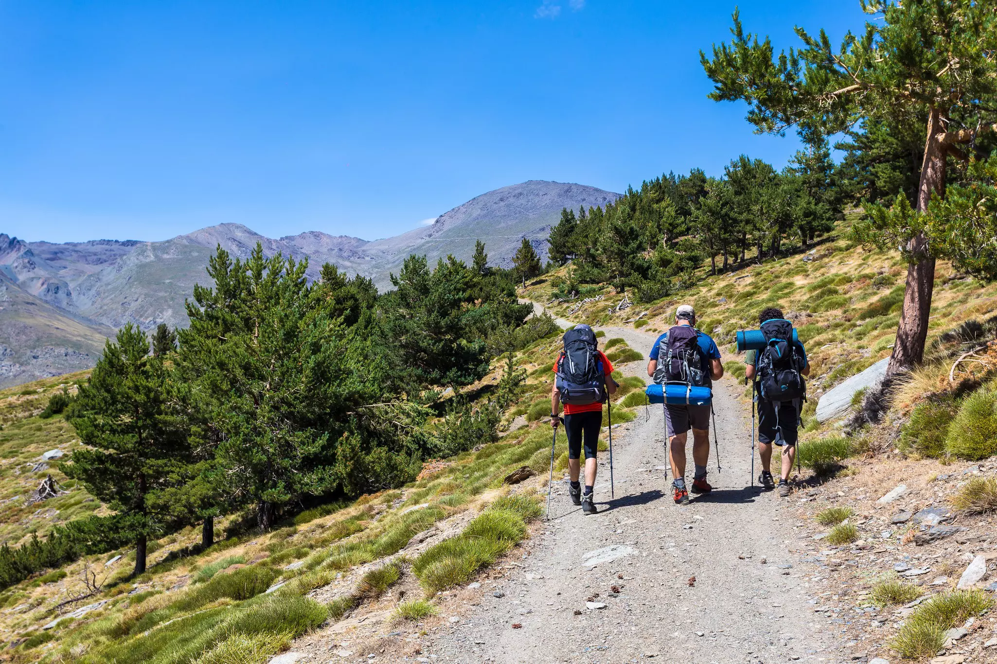
Best long-distance walk
Distance: 700km to 750km one-way
Time commitment: 6 to 7 weeks
Level of difficulty: difficult
Access: Avanza buses run from Málaga to Tarifa to start the trek, or you can drive, a trip of around 160km.
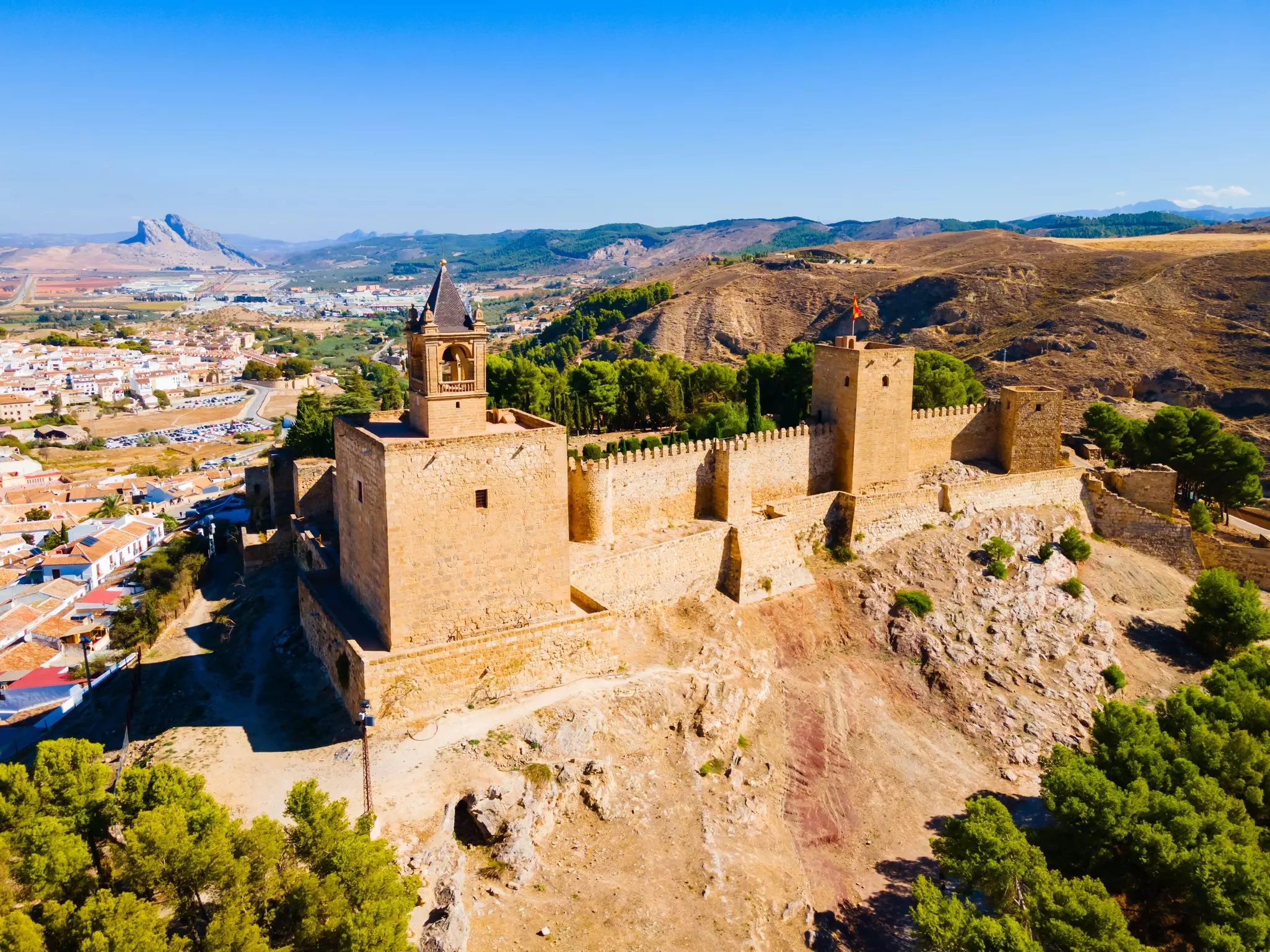
The epic GR7 long-distance trail traverses the length of Spain, from Tarifa in southwest Andalucía to the border with Andorra in the north. Its 700km-plus route across Andalucía takes in many of the region’s most scenic areas and handsome historic towns such as Ronda and Antequera, with its Moorish Alcazaba.
The route divides 18km past Antequera at Villanueva del Cauche. One branch heads east to Las Alpujarras then north across the Sierra Nevada, while the other goes northeast, crossing the mountains of Córdoba and Jaén provinces. The two routes reconnect at Puebla de Don Fadrique shortly before leaving Andalucía to enter the Murcia region.
Few people walk the full 700km-plus in one long haul, but the trek is easy to break into stages. Particularly attractive stretches of a few days include Lanjarón to Laroles in Las Alpujarras, and Cazorla to Santiago de la Espada through the Cazorla mountains. Trail maintenance and signage is reasonable, though you’ll need hiking navigation skills at times. Route descriptions are available in plenty of detail (in Spanish) from the Federación Andaluza de Montañismo.
Think about your packing list and timing for a hike in Andalucía. The summer is frequently too hot for hiking and there can be a wildfire risk; the best months for walking in most areas are from April to June and from September and October.
Bring decent hiking footwear as trails can be rocky, and carry a compass and map, a first-aid kit and a charged phone, plus a means of calling for help in an emergency, such as a whistle. Also carry a warm and waterproof layer, a water bottle and sunscreen – the Andalucian sun is unforgiving. Some other tips:
Bring a decent trail map or GPS device; sometimes you’ll need to check your route or navigate yourself.
Carry plenty of water (plus drops or tablets to purify water in an emergency on longer walks) and be equipped for changes in the weather, especially in the mountains.
Walking times in this article are based on continuous walking; they don’t include stops for refreshments, rest or photos.
With rising temperatures in the Mediterranean region, be alert to the dangers of heatstroke and dehydration and let someone know where you are going and when you plan to be back.
For more detail on many of the walks featured here, get yourself a copy of Lonely Planet’s Best Day Walks Spain.
Take your Spain trip with Lonely Planet Journeys
Time to book that trip to Spain
Lonely Planet Journeys takes you there with fully customizable trips to top destinations – all crafted by our local experts.


Explore related stories