Scotland itinerary: a 7-day walk along the West Highland Way
May 29, 2025
12 MIN READ

Writer
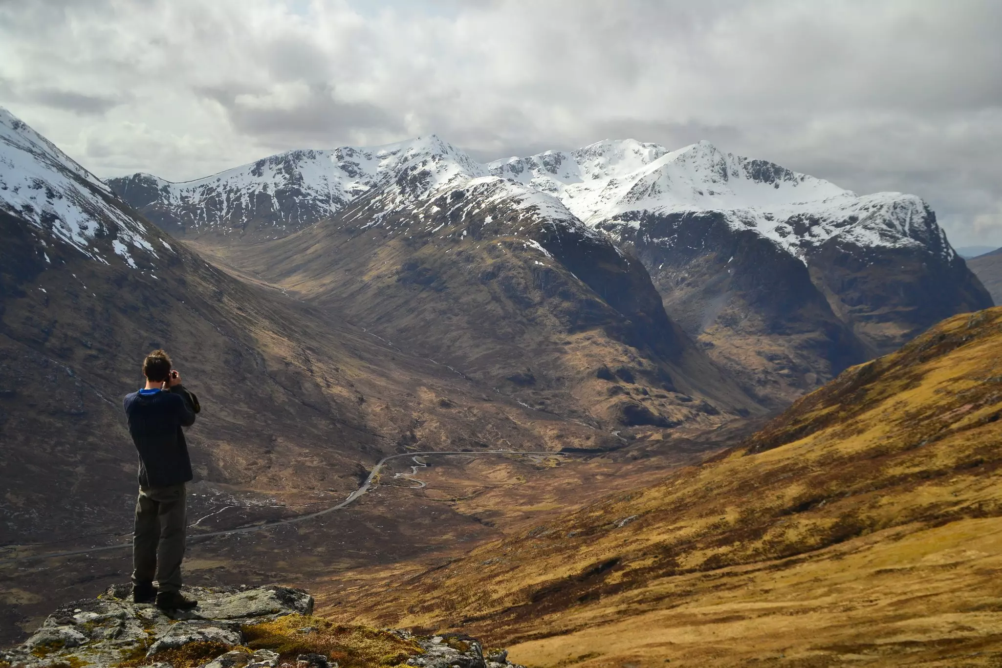
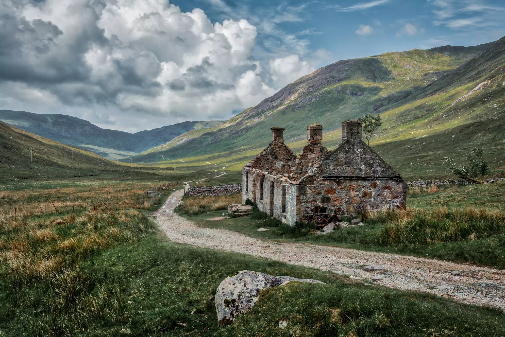
The West Highland Way passes through some of Scotland's best-loved landscapes. Tasmin Waby for Lonely Planet

Writer
Lonely Planet may earn a commission from affiliate links on our site. All recommendations and reviews reflect our own independent opinions.
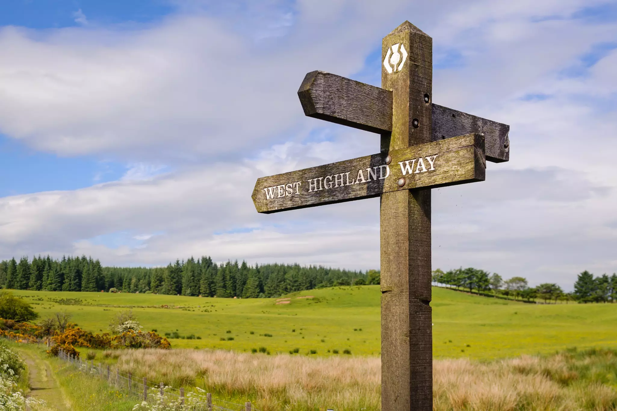
If you’re looking for a walk in Scotland that blends scenery, history, culture and a sense of purpose, the spectacular West Highland Way ticks all the boxes. This week-long hike through the Highlands will carry you north from Milngavie near Glasgow to Fort William, passing through rugged glens split by fast-flowing streams and wild moorlands where magnificent mountains dominate the skyline in every direction.
Steeped in history, this legendary hike follows footpaths, retired railway lines, old cattle paths, and historic military roads for 96 miles (154km) as it winds its way through the gorgeous scenery of Loch Lomond & The Trossachs National Park and Glen Coe, finishing up near Ben Nevis, Britain’s highest peak. We can’t guarantee you’ll stay dry, but we can guarantee seven days of rewarding walking, and a warm sense of camaraderie at overnight stops along the trail.
On this walk, hiking is not just a means of getting around, it’s a way to fully immerse yourself in Scotland’s uplifting landscapes. With easy access in and out by bus or train, you can go the full seven-day distance or choose a shorter stretch to enjoy, depending on how much hiking time you have at your disposal.
Get more from the West Highland Way by following this seven-day itinerary through the heart of the Highlands.
When to arrive
The climate in this corner of the Highlands is exactly what you’d expect from Scotland – mild summers, fresh weather with rain showers in spring and fall, and snow, heavy rain and high winds in winter. The best time to come is from May to September, but the trails can get very busy from June to August, coinciding with the longest hours of daylight for walking.
Be aware that small biting midges can be a pest during the peak summer months (bring repellent and a face net). For smaller crowds, choose late spring, when Loch Lomond’s shores are lined with Scottish bluebells, or mid-autumn when the midges are gone and the forests are ablaze with colour.
If you’re planning to camp, there’s a definite appeal to the relatively bug-free months in spring and fall, though it will be damper and colder. Hiking the West Highland Way in winter is best reserved for well-equipped hikers used to cold-weather trekking, but the scenery is especially spectacular when carpeted with snow.
How to get around
Getting to and from the start and end of the West Highland Way is easy by public transport. The start of the West Highland Way is a granite obelisk on Douglas St in Milngavie, about seven miles (11km) north of Glasgow, but most people actually begin walking at Milngavie train station. Buses stop here as well as trains, and there’s a car park just off Station Rd.
The walk ends in Fort William, which has frequent rail and bus connections to other parts of Scotland and Great Britain, including an overnight sleeper train to London. To return to where you started at the end of the walk, catch a bus from Fort William to Glasgow (three hours), then take a 10-minute train ride to Mingalvie.
Where should I stay?
All of the legs of the West Highland Way pass through villages and towns where you can stop for the night, with dotted hotels, hostels, B&Bs and bunkhouses all along the route. However, all overnight stops should be booked ahead – particularly in summer.
There are also two bothies (rustic shelters) along the trail at Rowchoish and Doune Byre – follow the advice of the Mountain Bothies Association if you stay in these basic accommodations, and leave the bothies as you found them, removing all your rubbish when you leave.
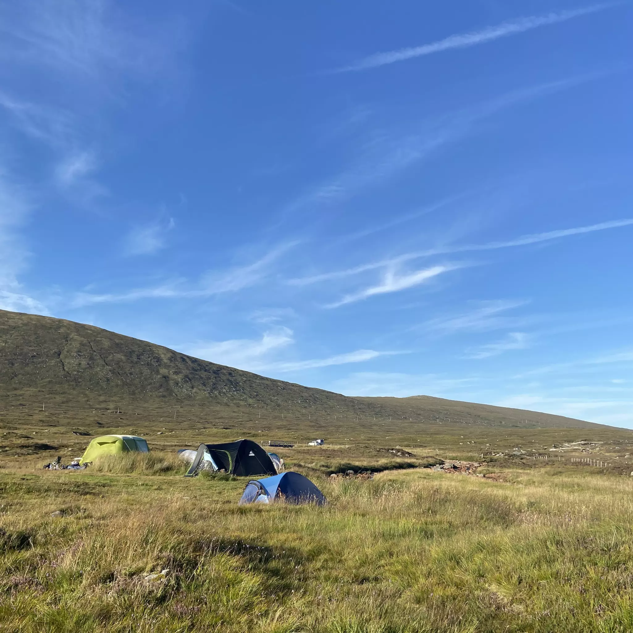
Camping is another option. As well as formal campsites, wild camping is permitted on unenclosed land, but you’ll need to follow the rules of the Scottish Outdoor Access Code. Special camping permits are required to camp in some areas close to Loch Lomond. Carry out all your rubbish, and bury human waste off the trails and away from water sources.
However you travel, you don’t need to walk weighed down by a backpack. Companies such as AMS Scotland run a baggage transfer service along the route, picking up your gear each morning and moving it on to the next overnight stop.
What to pack
You’ll want to bring warm layers and waterproofs, plus a windproof layer – rain showers and windy days are possible at any time of year. Summer temperatures peak at around 18°C (64°F) in the daytime, but the wind can make it feel colder, particularly if you’ve built up a sweat from walking – which can happen on many stages of this multi-day hike.
During the midge-prone months of summer, bring repellent and choose light-colored hiking clothing with long sleeves; a hat with an insect net can also be useful while hiking near water, where midges are most active. You’ll also need sturdy, waterproof hiking boots or shoes and spare dry socks.
Day 1: Milngavie to Drymen
12 miles (19km); 4½–5½ hours
The first day will take you away from the bustle of greater Glasgow into the lush, green countryside of the western Highlands. Starting at the obelisk in Milngavie (on Douglas St), descend the ramp beneath the West Highland Way sign and follow a path along a disused railway, then head upstream beside Allander Water.
At the end of Mugdock Wood, footpaths and a track will take you past small lochs to the main road. As you turn off and skirt Dumgoyach Hill, watch out for the Bronze Age standing stones to your right. A mile past Dumgoyach Bridge, stop for a warming dram at Glengoyne Distillery.
The old railway track turns into a road that leads most of the way to Drymen, a pretty village with a central green, your first overnight stop on the West Highland Way.
Evening: On arrival in Drymen, the cozy and central Drymen Inn and Clachan Inn can take care of your beer, pub grub and open fire needs.
Day 2. Drymen to Rowardennan
14 miles (22.5km); 5–6½ hours
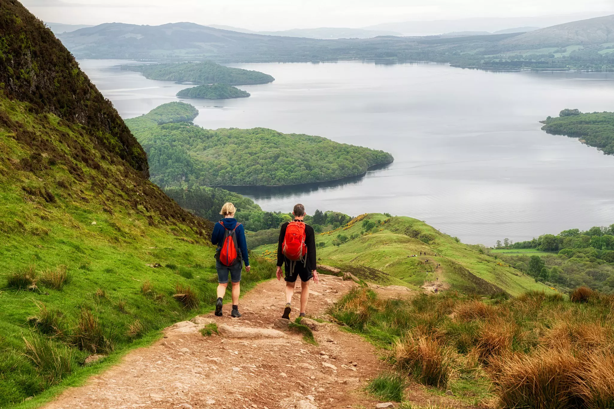
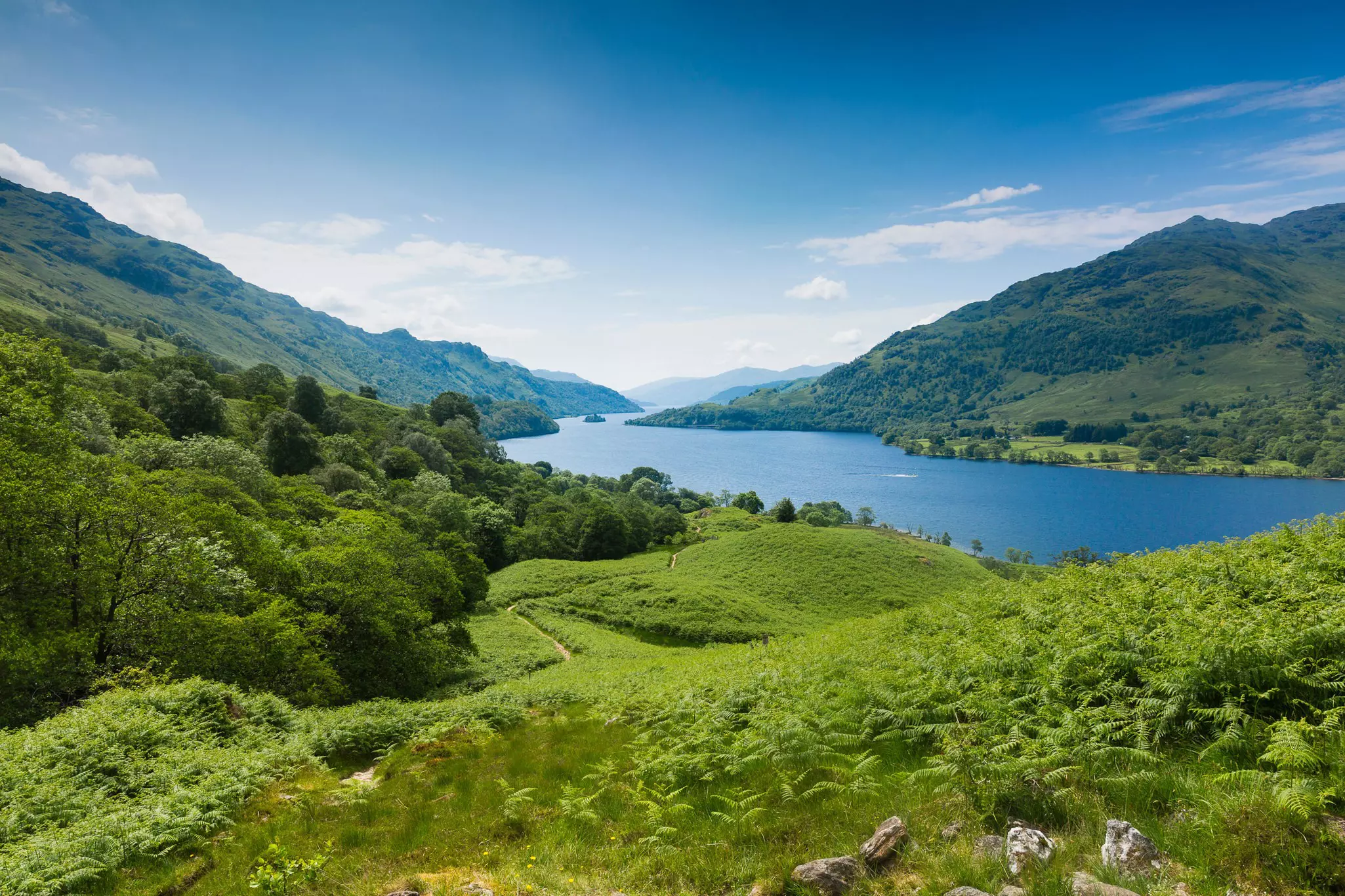
From Drymen, a forest track gradually climbs to Garadhban Forest, and then contours north of the summit of Conic Hill (358m/1175ft) – it’s well worth climbing the hill for sweeping views over Loch Lomond, the mirror-like centerpiece of Loch Lomond & The Trossachs National Park.
You can also make out the unmistakable line of the Highland Boundary Fault, the massive geological feature that separates the Lowlands from the Highlands. Descend to Balmaha, a small lakeside village usually thronged with people in boats.
Continue along the shore to Critreoch, where the path dives into a dark forest and emerges to follow the road again. Finally, the Way climbs through Ross Wood, with its magnificent oaks, to finish for the day at Rowardennan, near the shores of Loch Lomond. If you still have time and energy, tack on the side-hike to the top of Ben Lomond (974m/3196ft).
Evening: Rowardennan serves up familiar Scottish menus and views of the sunset over Loch Lomond, courtesy of the Rowardennan Hotel's Clansman Bar & Grill.
Day 3. Rowardennan to Inverarnan
14 miles (22.5km); 6–7½ hours
Today is a day of lochs and legends. Start off by following the road that runs parallel to the loch shore. Just past the privately owned Ptarmigan Lodge, an alternative path branches left and follows the shoreline; it’s more interesting but much rougher going than the upper route.
Either way, not far beyond the Rowchoish Bothy, the forestry track gives way to a path leading down to the lochside The going improves as you head toward Inversnaid Falls (stop for refreshments at the Inversnaid Hotel, where Loch Lomond cruise boats from Tarbet dock), but then the path twists and turns around large boulders and tree roots.
You’ll soon pass Rob Roy’s cave, where the Jacobite outlaw (and Scottish folk hero) is said to have hidden from government forces. A climb to a col below Cnap Mór (164m/538ft) provides stunning lake views, before the path descends to Inverarnan.
Evening: Just beyond the northern tip of Loch Lomond, Inverarnan is a blink-and-you’ll miss it cluster of houses, but the stone-built Drovers Inn provides warm meals, rooms and beverages for tired trekkers.
Day 4: Inverarnan to Tyndrum
13 miles (21km); 4½–5½ hours
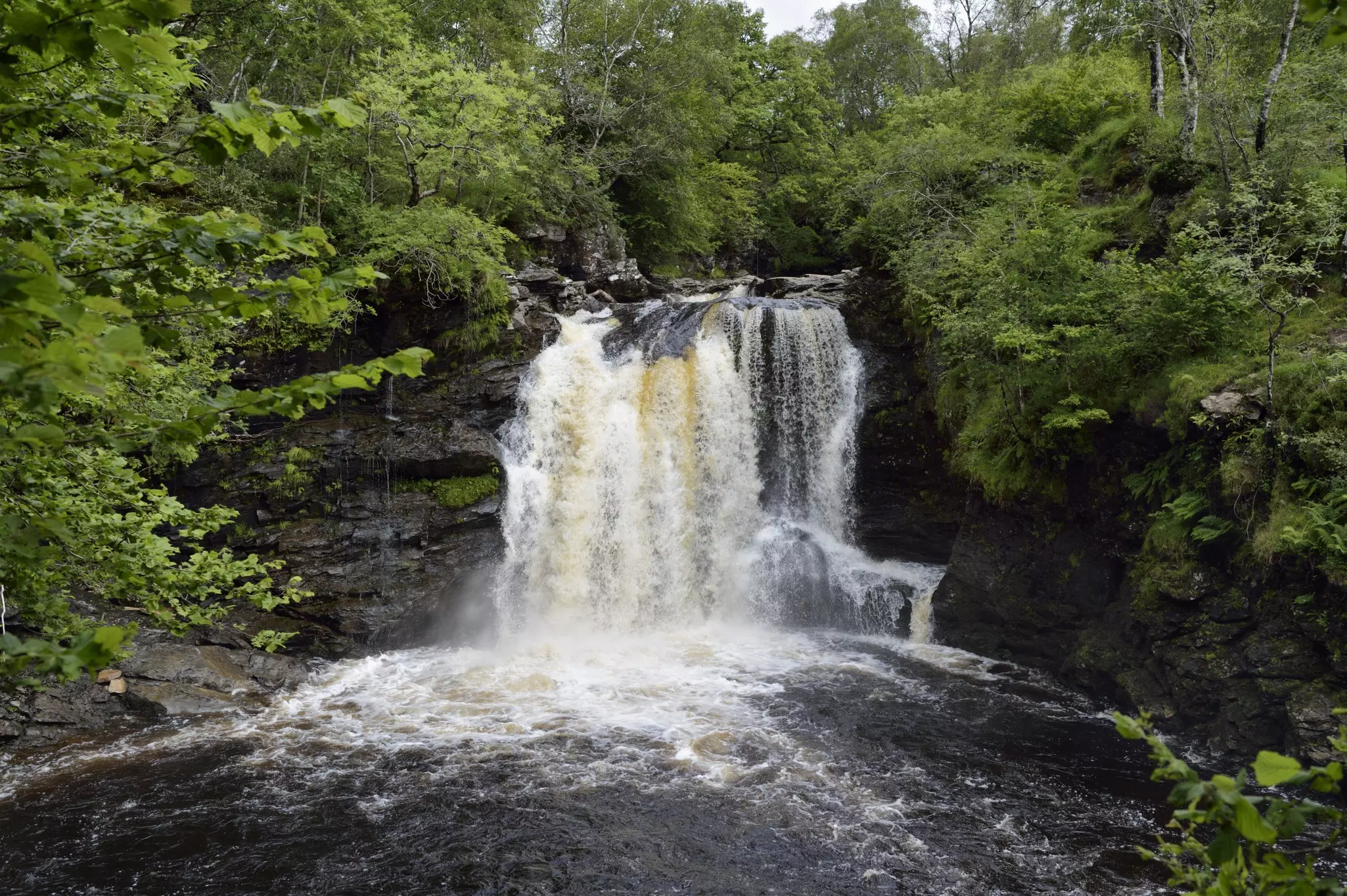
On day four, you’ll head north through classic Highlands landscapes. The route follows the attractive River Falloch most of the way to Crianlarich, the approximate halfway point of the Way, passing close to the gushing Falls of Falloch. About 4 miles (6.4km) along, the path crosses the river and joins an old military road.
This track climbs out of Glen Falloch, offering good views east to Ben More (1174m/3852ft), and then continues through the trees before darting under the railway line, crossing over the road and traversing a wooden bridge over the River Fillan.
Soon, you’ll pass the remains of St Fillan’s Priory, and around an hour later, you’ll make it to Tyndrum, an old lead-mining settlement (though the name comes from the Gaelic for “house on the ridge”).
Evening: Tyndrum is a more substantial settlement, with hotels, lodges and a camping ground, plus a handful of shops and the snug Tyndrum Inn and Real Food Cafe (open till 7: 30pm) for meals and a celebratory drink for crossing the halfway mark.
Day 5: Tyndrum to the Kingshouse Hotel
19 miles (30km); 6½–8 hours
Onward to Glen Coe! From Tyndrum, the route soon rejoins the old military road and crosses the railway line, affording easy walking with lovely views. A few miles in, you’ll cross a burn at the foot of imperious Beinn Dòrain (1074m/3524ft).
The path climbs gradually to Glen Orchy, heralding the start of the really mountainous scenery. Cross the 18th-century Bridge of Orchy (in summer you may want to join the wild swimming here) and climb through the trees to the crest of Mam Carraigh. The path then winds down to the secluded Inveroran Hotel, before climbing gently past plantations and onto Rannoch Moor, where it can get very wild and windy.
A cairn marks the high point of Rannoch Moor at 445m (1460ft). The scenery has been impressive so far, and it’s about to get better – enjoy views over Glen Coe, arguably Scotland’s most scenic valley, as you descend to the Kingshouse Hotel, where free camping is also available nearby.
Evening: Refreshments are served at the Kingshouse Hotel, with its Nordic-style wooden annex and bunkhouse rising over the original hotel. Eat estate-reared venison in the restaurant, grab an ale in the Climbers Bar, or swing into the original 1750s Way Inn for a dram.
Day 6. Kingshouse Hotel to Kinlochleven
9 miles (14km); 3–4 hours
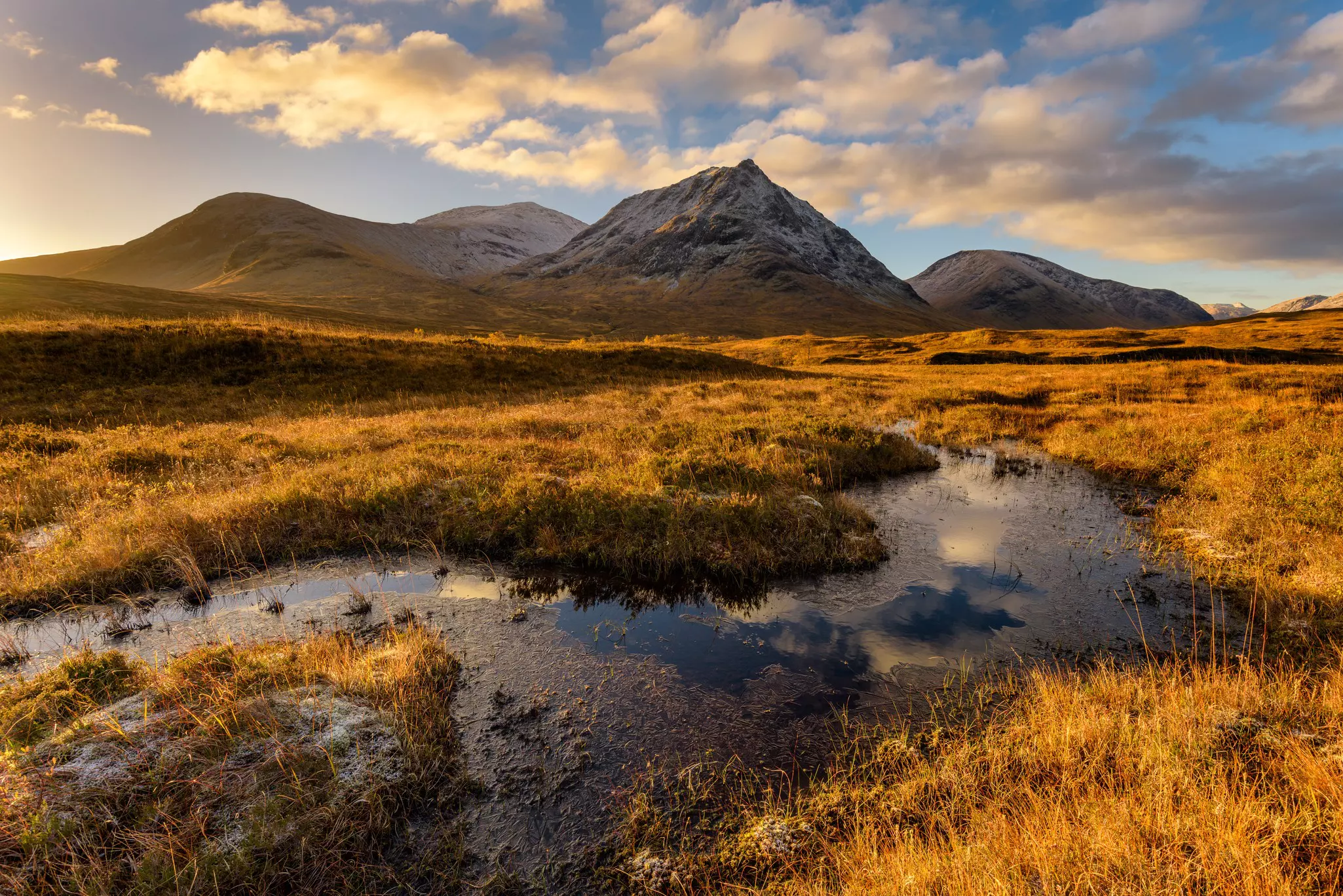
Today, it’s all about Glen Coe. Follow the old military road a short way alongside the A82; at Altna-feadh, there’s a wonderful vantage point from which to appreciate the Glen Coe scenery. The conical peak to your left is Buachaille Etive Mor (1022m/3353ft), whose often-climbed ridge includes two Munros (peaks over 914m/3000ft high).
From here, leave the road to begin a steep, zigzagging climb up the Devil’s Staircase – a name coined by the soldiers who built this track in 1750. Although the route was later superseded by Thomas Telford’s road through Glen Coe, the name was re-established in the 1900s by thirsty workers on the Blackwater Reservoir, who used it as a shortcut to the Kingshouse Hotel (and occasionally perished in the snow on the way back).
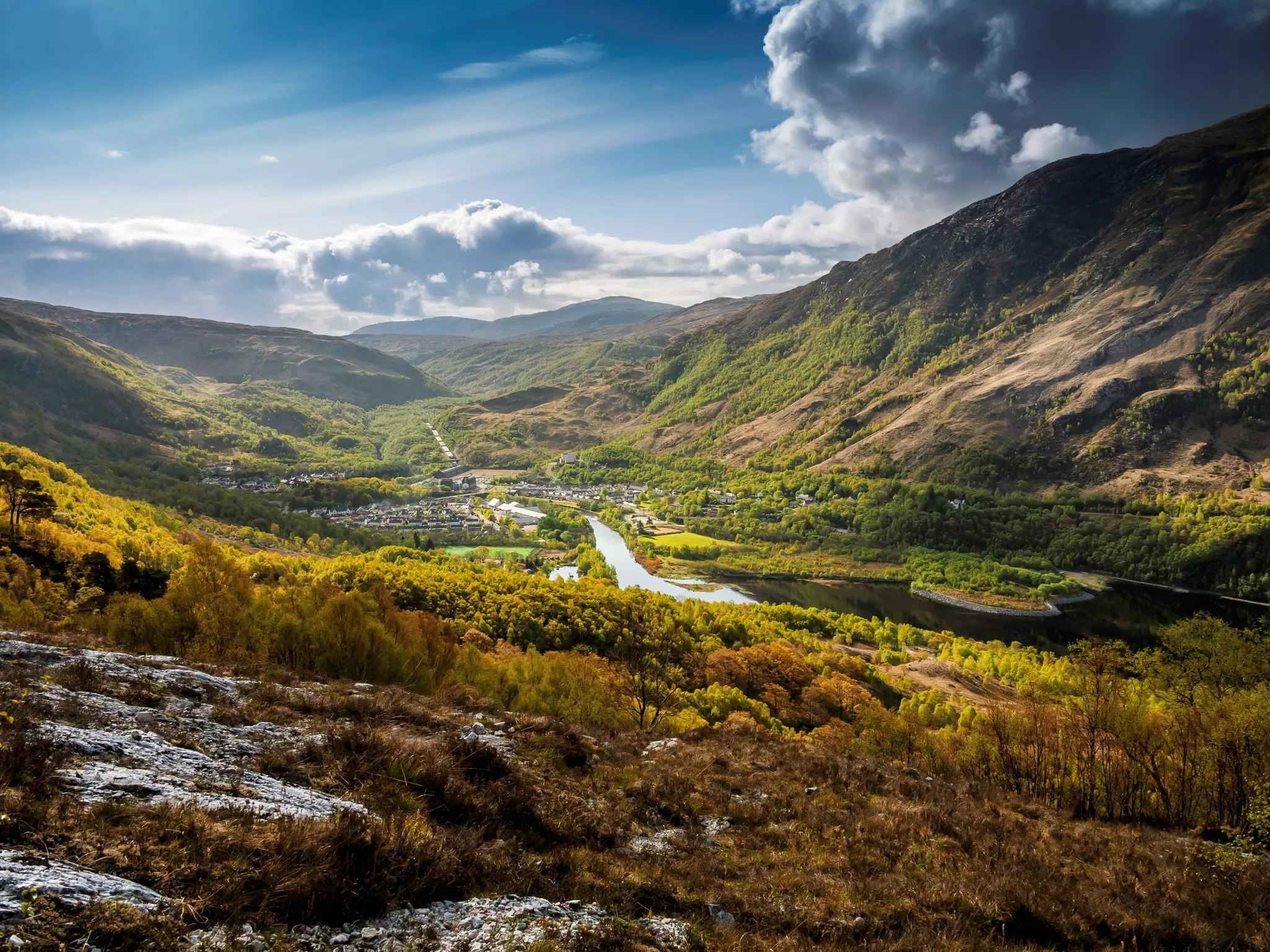
The 548m-high (1798ft) cairn at the top is the West Highland Way’s highest point; on a clear day, you can see all the way to Ben Nevis (1345m/4413ft). The path now winds gradually down towards Kinlochleven. This town eases you back into “civilization” before you reach Fort William tomorrow.
Evening: Kinlochleven is a relative metropolis compared to the villages so far. The Tailrace Inn, Highland Getaway Inn, and the MacDonald Hotel’s informal Bothy Bar will keep you watered and fed. There are few wild camping areas here, but prebookable campsites (with showers!) are available.
Day 7. Kinlochleven to Fort William
15 miles (24km); 6–7½ hours
The closing day serves up more lovely views on the way to Fort William, the northern terminus of the West Highland Way. Follow the road north from Kinlochleven; the path climbs through woodland to the old military road, with grand views along Loch Leven to the Pap of Glencoe (740m/2428ft).
Climb to the crest ahead to see the ruins of old farm buildings, then descend into conifer plantations. The Way leads on and up to Dùn Deardail, an Iron Age fort with walls partly vitrified (turned to glass) by fire. Soon, a forest track leads down towards Glen Nevis. Continue past the small graveyard and large visitor center to enter Fort William.
The end of the Way is in Fort William's Gordon Square, marked by a bronze sculpture of a weary hiker rubbing his feet. Enjoy an end-of-hike celebration in one of the town’s many restaurants and bars – you’ve earned it!
Evening: Fort William is blessed with many good spots to toast the end of the hike. Try the inviting Garrison West pub, home to the popular, seafood-oriented Crannog, or Silly Goose, serving a meat and game-laden menu at the Lime Tree Hotel.
This article was adapted from Lonely Planet’s Scottish Highlands & Islands guidebook, published in June 2025.