Jun 18, 20265 min read
Where to go in Europe in SeptemberFeb 19, 2020
6 MIN READ

Writer
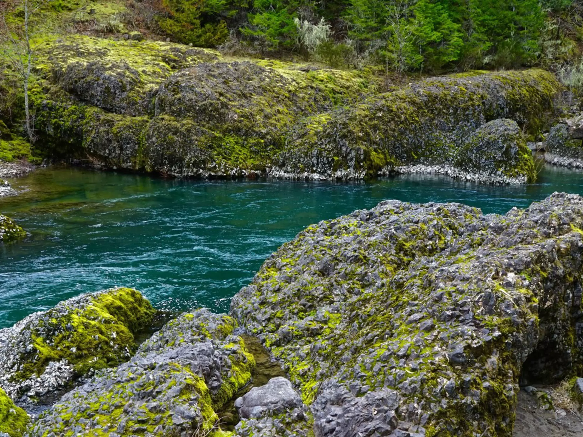
Chill out along the Clackamas River Trail and soak up the remarkable flora. Samson1976 / Getty Images
Writer
Lonely Planet may earn a commission from affiliate links on our site. All recommendations and reviews reflect our own independent opinions.
When the forecast alternates between “rain” and “showers” for weeks at a time, as it tends to do in the Pacific Northwest during February and March, most people are not thinking seriously about backpacking trips from Portland. Many campgrounds and access roads are still snowed shut, trails are muddy, and you’d have to be pretty hardcore to want to camp out overnight.
But these cold, gray days are the perfect time to plan your early spring hiking trips. Believe it or not, better weather is right around the corner, and it comes with moss-draped trees and fields of wildflowers. Start your prep early so you’re ready when the trails open – right when the rest of Portland is sun-drunk and ready to make the most of shoulder season. These six trails are perfect for your first overnights of the year.
Though it’s a bit of a drive from Portland, the Lower Deschutes trail is easy to get to and open year-round. It’s a great early-season trip for sorting out your gear and practicing for harder trails, since the terrain is pretty flat – the trail hugs the river, and sometimes follows an old railroad bed. Plus, the slopes hemming in the wide, lazy river are covered in wildflowers March through May. It’s about a 5-mile hike to the campsites at Gordon Canyon.
To get here, take I-84 east about 90 miles to Exit 97. Continue east on Hwy 206, following signs to Deschutes River State Recreation Area; turn into the rec area and find the trailhead parking lot at the far end, past a large campground. Overnight-parking pass required ($7).
You might also like: 7 reasons Bend, Oregon, is the ‘outdoor playground of the west’
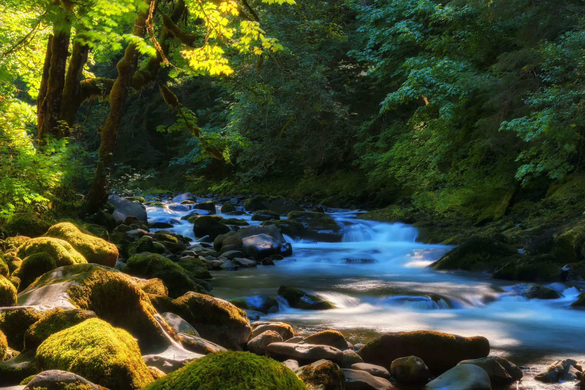
Another trail that’s open basically all-year, this is one of the easiest and mellowest backpacking trips from Portland. It follows the Clackamas River through cool green forest, thick with ferns and old-growth trees. Keep an eye out for chanterelle mushrooms. You can hike as far or as briefly as you like, but the best campsite is just under five miles in (a 9. 4-mile round-trip).
To get here, take Hwy 224 about 15 miles southeast of Estacada, turn right at a sign for Indian Henry Campground, and look for the trailhead parking lot on the right, across from the campground entrance.
A local favorite that can be surprisingly free of crowds in the offseason, this is a lovely riverside trail that lets you hike as far as you feel like going, with plenty of options for stopping overnight along the way. From one end to the other it’s about 14 miles, but the excellent Rolling Riffle Camp is only four miles in, and there are lots of other spots along the way. The trail itself is soft and cushiony, forming an inviting walkway through a tunnel of glowing green woods – perfect for reintroducing yourself to this whole backpacking thing after months of hibernation.
The west-side trailhead is open year-round, and you can usually hike as far as Rolling Riffle by March. From Portland, take Hwy 26 to the town of Zigzag. Turn right (south) on East Salmon River Road, following signs to Green Canyon Campground; drive 5 miles to a large parking area on the left, just before a bridge over the Salmon River. NW Forest Pass required May-October.
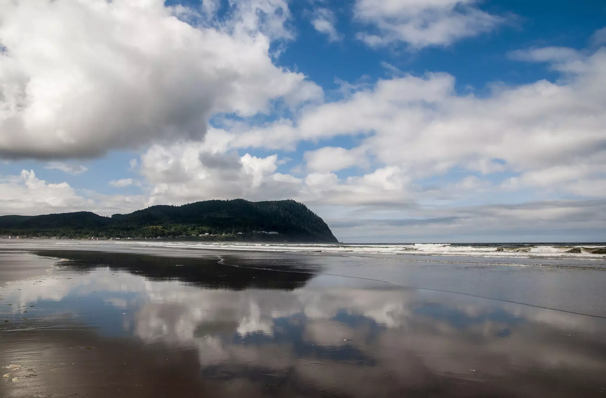
Sure, it’s not exactly beach weather, but the Oregon coast isn’t exactly “the beach.” Hiking trails here aren’t much more windswept and foggy in spring than at any other time. This trail, 8. 8 miles round-trip from the Seaside trailhead, is one of the few on the coast with a designated backpacking area. It’s usually open all year (but be prepared for mud).
Tillamook Head, part of Ecola State Park, rises more than 1, 000 feet above the water between Seaside and Cannon Beach. The trail follows a route taken by Captain William Clark, of Lewis and Clark, through rainforests and past breathtaking viewpoints. The trail climbs steeply from the Seaside trailhead, but soon levels out. About two miles in you get a view of the old Tillamook Rock Lighthouse (aka “Terrible Tilly”).
You might also like: Exploring the best of the Oregon coast on 7 easy hikes
At 3. 8 miles, look for a sign saying “Clark’s Point of View” – Clark declared this was one of the best views he had ever seen. After a short descent you’ll reach the Hikers’ Camp, complete with three sturdy log shelters with wooden sleeping platforms (nice in case of rain). If you’re up for more, continue south the next morning through primeval forest and down the other side of Tillamook Head for views of Indian Beach, a surfers’ hangout.
To get here, take US 26 about 70 miles northwest from Portland, then go north on US 101 to the town of Seaside. The trailhead is at the end of Sunset Boulevard, but no overnight parking is allowed there, so either arrange for someone to drop you off or park in a public space in town and walk to the trailhead.
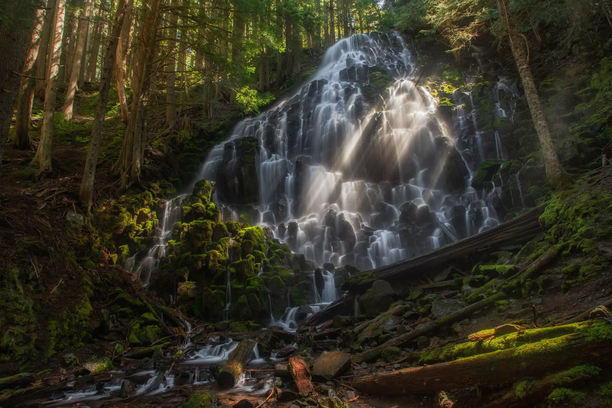
Some of the lower-elevation hikes on Mt Hood start to open by early April. This popular 7-mile loop features easy walking through unusual terrain – a blend of sandy and rocky ground, through a moss-floored forest of gnarled trees – and rewards you with the beautiful veil-like Ramona Falls. (One catch: you’ll have to scurry across the Sandy River on a downed log. Be careful!) If you’re lucky you’ll find an empty campsite at the falls, but there are good sites all along the trail.
The large parking area for the Ramona Falls trailhead is well-signposted; take US 26 east to the town of Zigzag, then head up East Lolo Pass Road and bear right on Forest Road 1825, where a sign says “Campgrounds & Trailheads.”
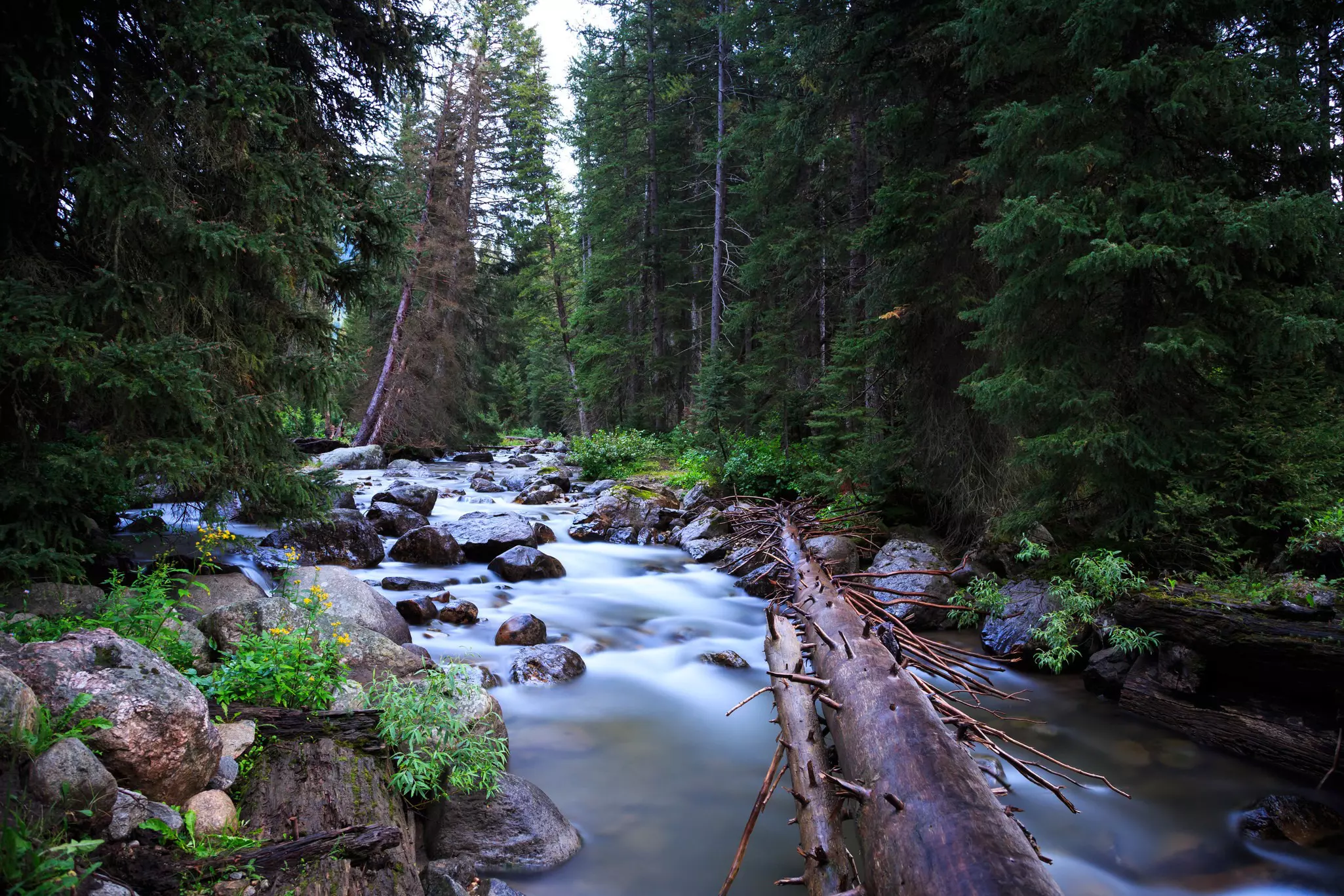
A bit of an outlier, Badger Creek is on the east side of Mt Hood, seldom crowded and usually open by March. It’s good for all ages – a mostly flat creekside trail through ferns, willows, Douglas firs and ponderosa pines, with wildflowers peaking in May. The best campsite is about three miles in, just past a tiny waterfall where the creek burbles over a pair of mossy rocks. But you can follow the creekside trail all the way to Badger Lake, 10. 7 miles from the trailhead.
To find the trailhead, take US 26 to forest roads 43, then 48, toward Wamic; follow signs to Bonney Crossing Campground. The trail starts just across from the campground entrance, immediately after a bridge over Badger Creek.
You might also like: State of wonder: where to find Oregon's best landscapes
Always check the NOAA weather forecast, but don’t rely on it – bring gear for cold, rainy conditions. And speaking of gear, if it’s been stored away, inspect it before you go to make sure there are no surprise leaks, holes or mildew. Most importantly, remember to pace yourself – it’s OK to go slowly, especially if you’ve been cooped up all winter.
Explore related stories