Apr 1, 20268 min read
The best time to visit Washington State: a seasonal guide Oct 15, 2021
9 MIN READ

Writer
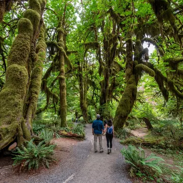
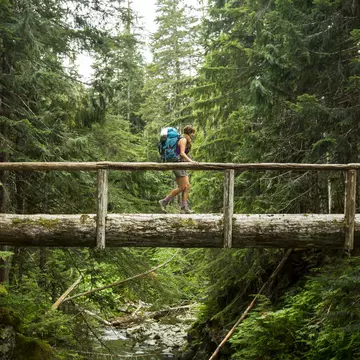
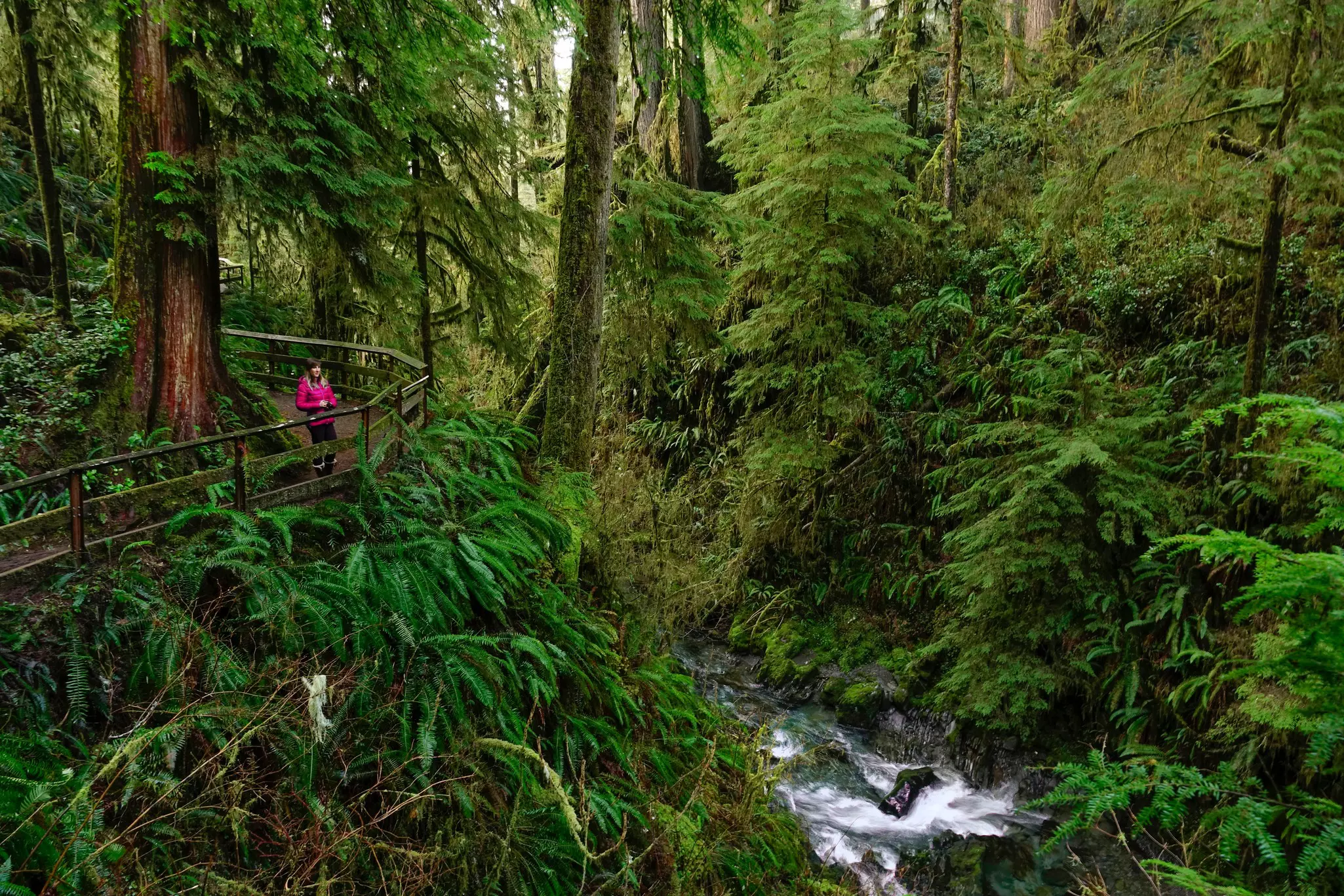
A prime Seattle-area destination is the remote Olympic Peninsula, with its rare and endangered wildlife and dense primeval forest © Jordan Siemens / Getty Images

Writer
Lonely Planet may earn a commission from affiliate links on our site. All recommendations and reviews reflect our own independent opinions.
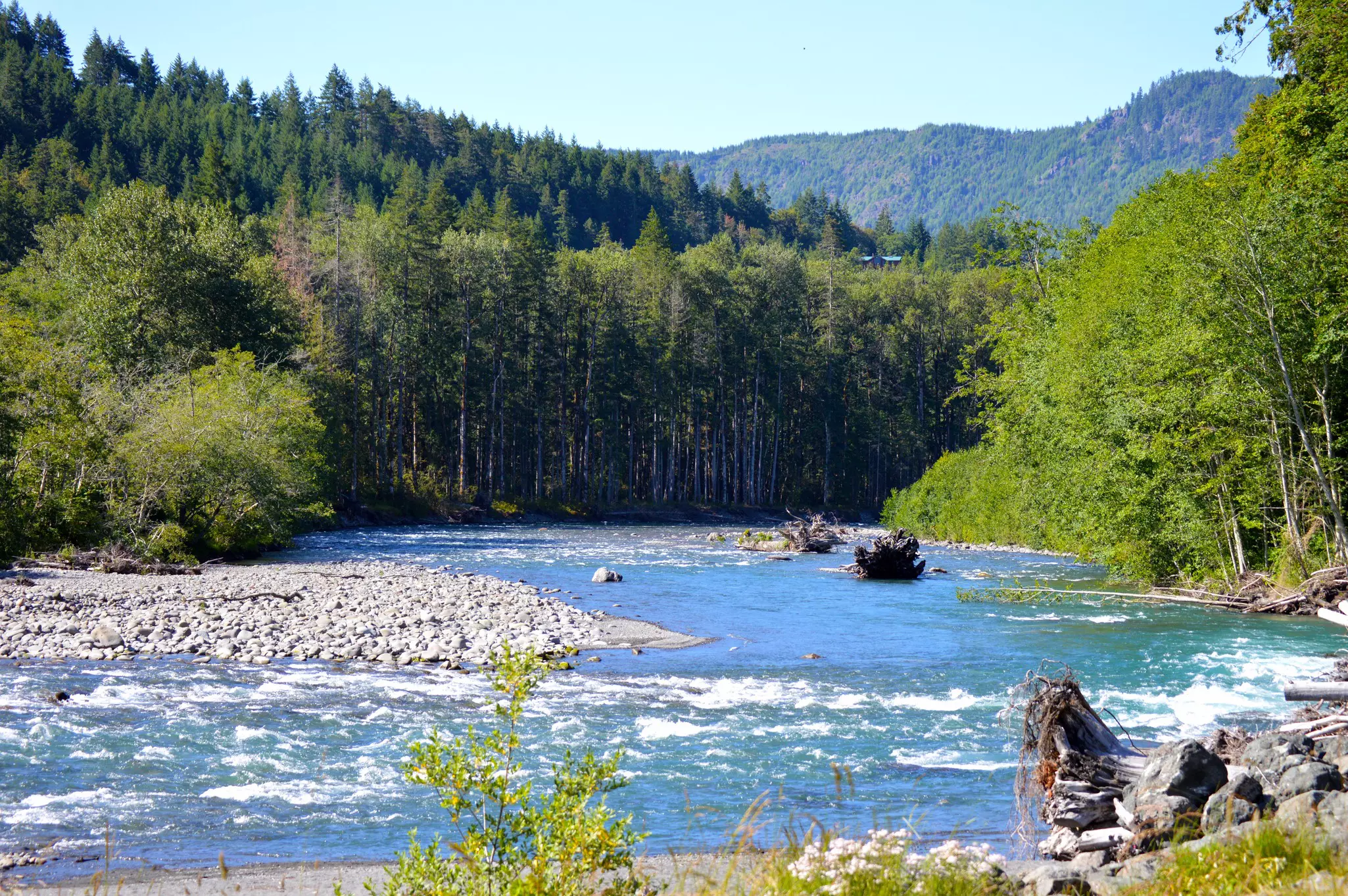
Simply by virtue of its name Olympic National Park conjures up a sense of mythological grandeur, named for the mountain which the ancient Greeks believed was home to a pantheon of gods. The Washingtonian version doesn't disappoint, full of towering rock taluses, moss-strewn trees and wild, rushing rivers that wind their way to the vast maw of the Pacific.
If you're itching to experience everything Olympic National Park has to offer, from beachy sea stacks to waterfalls and ancient petroglyphs carved by the Makah people, these trails can teach you a lot. Whether you're looking for a wheelchair-accessible nature stroll or a strenuous backpacking trip, these are the best hiking trails in Olympic National Park.
This almost 8.5-mile hike is tough, and requires a permit, but rewards hikers with the shaggy grandeur of Olympic National Park's rainforest before it gives way to subalpine meadows and lakes ringed by 7,000-foot peaks.
The hike begins at the Upper Dungeness Trail by the river but quickly veers off to the right on the Royal Basin trail to begin the long climb upwards to Royal Lake.
Along the way, you'll see wildlife, wildflowers, and even a waterfall. This trek can easily be turned into a backpacking trip, though you'll need to obtain an additional backcountry camping pass and campfires are forbidden.
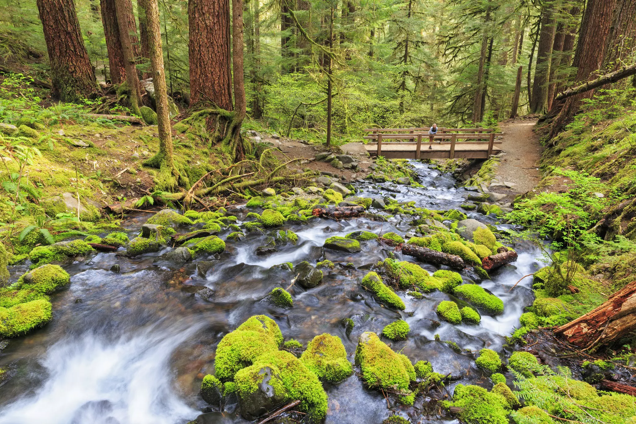
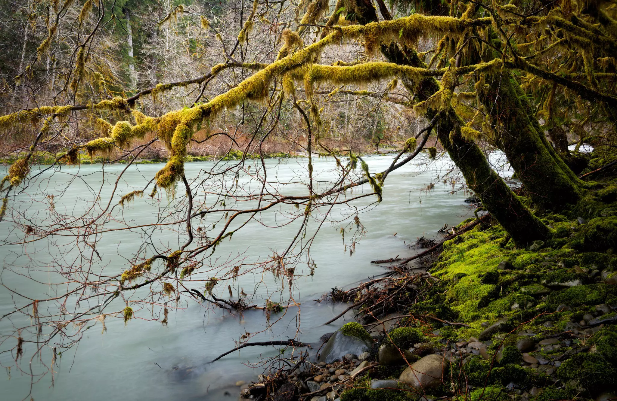
The most famous section of the Olympic rainforest, the Hoh River area offers lots of hikes and an interpretative center. If you can only make one stop on the western side, this should be it. A well-used route into the wide, glacier-carved Hoh River Valley, the Hoh River Trail is also the principal means of access to Mt Olympus.
Beginning at the visitor center, at the end of the Upper Hoh Rd, the trail follows an easy grade for 12 miles through the moss-drenched temperate rain forest, and day hikers can use it as a pleasant out-and-back excursion. Beyond this, the path climbs to the flower-scattered paradise of Glacier Meadows, perched at 4300ft.
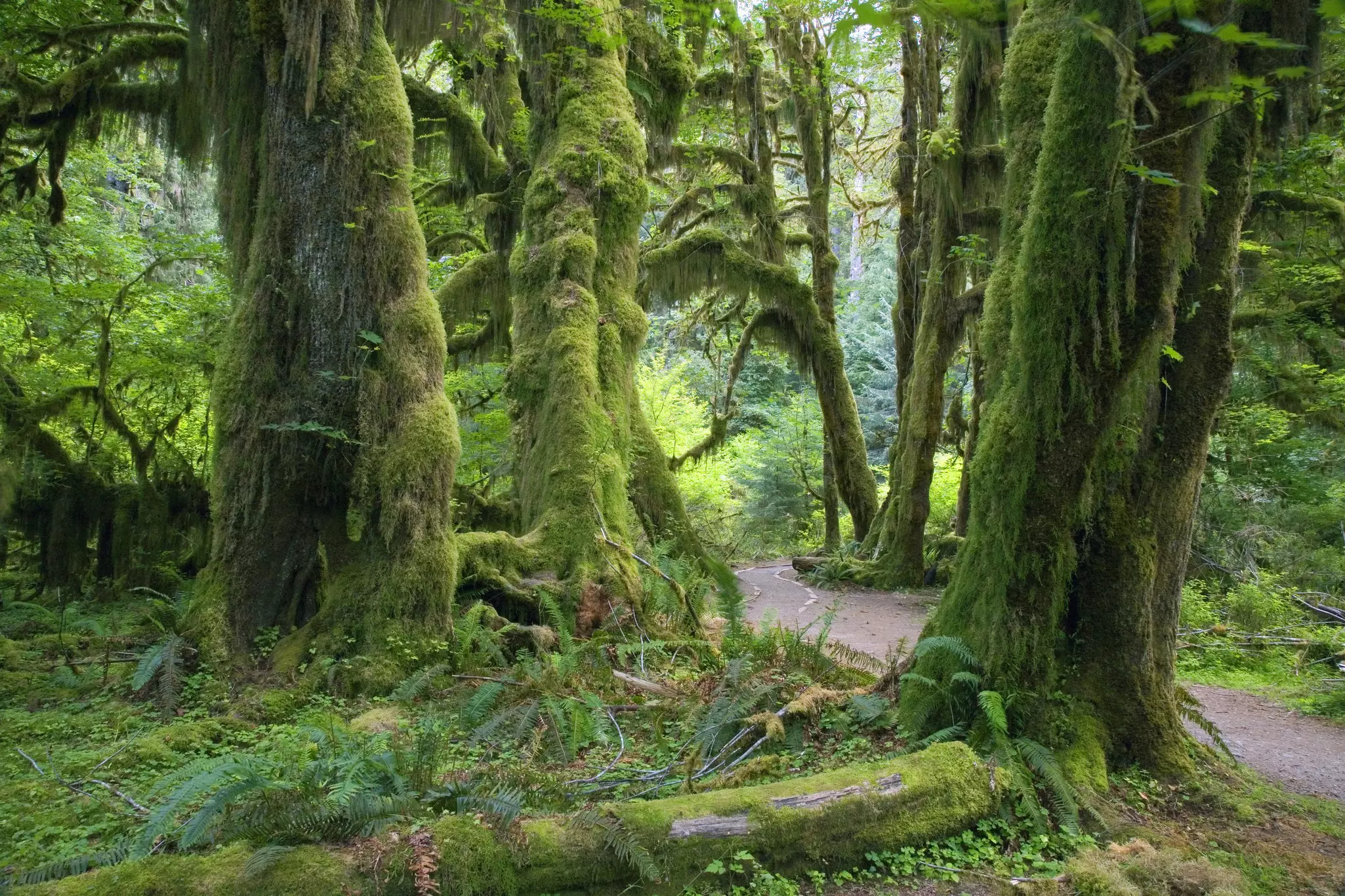
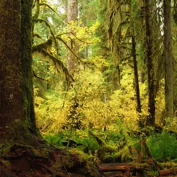
A shorter, more accessible alternative to the Hoh River Trail is the Hall of Moss trail. Leading out from the Hoh Rain Forest Visitor Center, this easy 0.8-mile loop leads you directly into virgin temperate rainforest and takes you through the kind of ethereal scenery that even Tolkien couldn’t have invented.
Epiphytic club moss, ferns and lichens completely overwhelm the massive trunks of maples and Sitka spruces in this misty forest. There's also a short wheelchair-accessible nature trail through a rainforest marsh.
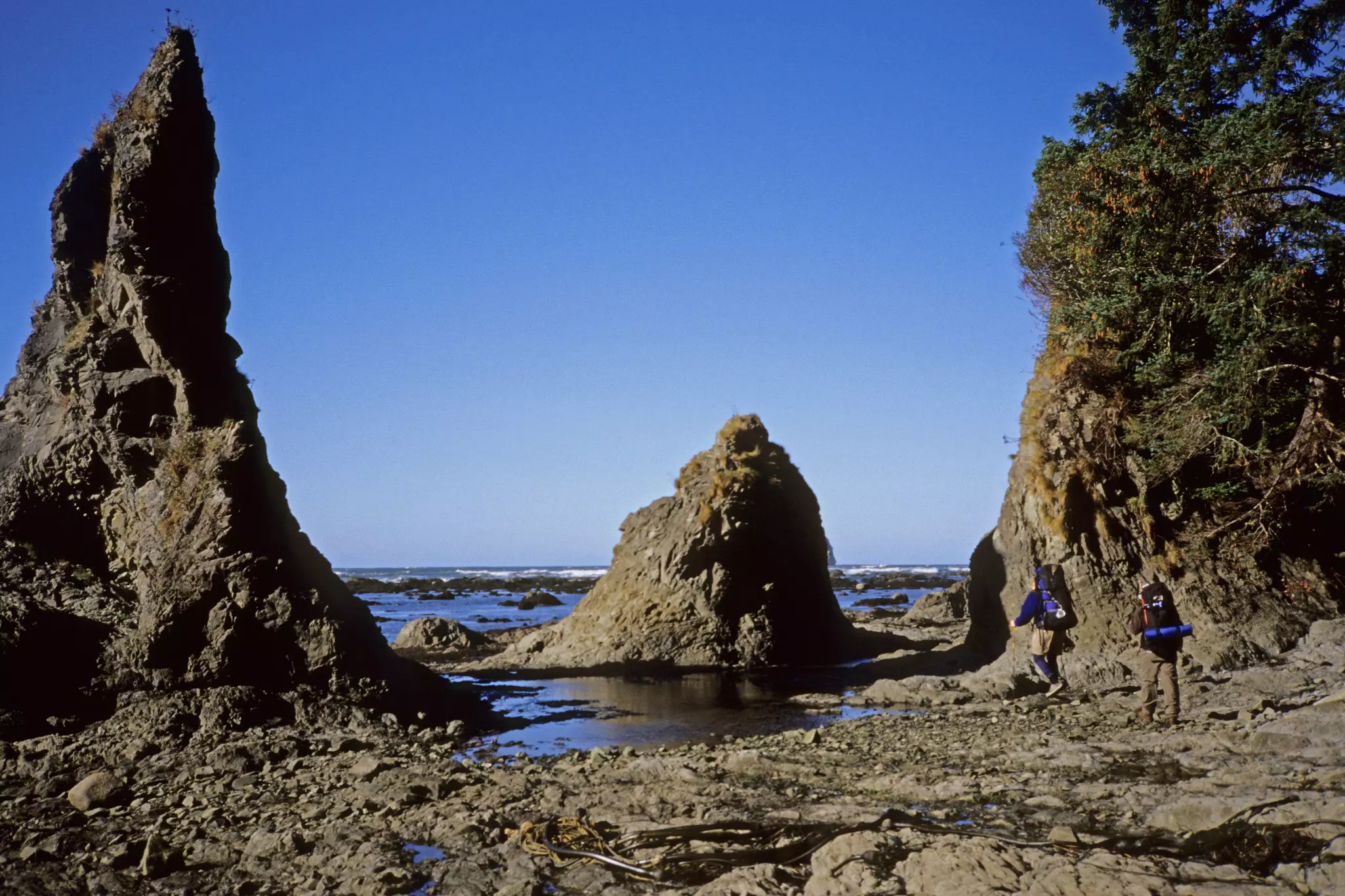
If you want to experience Olympic National Park's coastal side, literally, head to Rialto Beach. Close to the Mora Campground and the Quillayute River near La Push, it's easy to access and can run anywhere from a short half-mile stroll to a 13-mile trek.
Be sure to check the tide tables before you head out – however far you plan to hike, much of this trail is accessible only at low tide and you don't want to be caught out when the tide reaches the base of the cliffs.
Two miles in is a spot called Hole-in-the-Wall, where you'll have views of islands off the shore and Washington's classic sea stack formations (the remnants of long-eroded headlands).
It's these that make Hole-in-the-Wall so special – if you line up an archway carved in the headlands just right, you can capture a sea stack smack dab in the middle like a pupil in an iris.
Beyond Hole-in-the-Wall, there are backcountry campsites (again, be very mindful of the tide tables), tree graveyards full of forest-scale driftwood, and chances to see orca and other marine wildlife in the distance.
The Elwha, the largest river on the Olympic Peninsula, and Lake Mills (actually a reservoir) are popular trout fishing havens. Commercially developed as a resort in the 1930s, the valley's Olympic Hot Springs once featured cabins that have long since disappeared. In 1983, park supervisors closed the road out, and the area has largely returned to nature.
The 2.2-mile hike along the old roadbed is well worth it – what's left of the pools steam alongside the rushing Boulder Creek, all in a verdant deep-forest grove. Note, though, that this area can get very busy on summer weekends.
Elwha River Rd turns south from US 101 about 8 miles west of Port Angeles. Follow it for 10 miles to the Elwha Ranger Station. The road immediately forks. Turn west to reach the Olympic Hot Springs trailhead, or turn east toward Whiskey Bend to reach the Elwha River and other trailheads.
From Whiskey Bend, the Elwha Trail leads up the main branch of the Elwha River and is one of the primary cross-park long-distance hikes. Day hikers may elect to follow the trail for 2 miles to Humes Ranch, the remains of a homestead-era ranch.
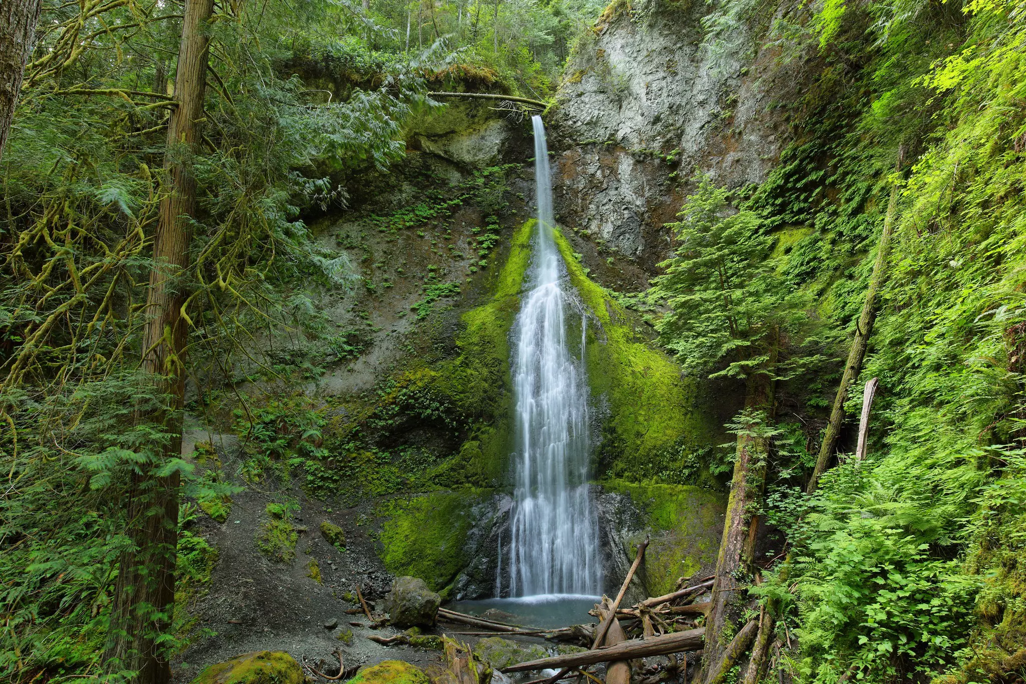
The most popular hike in the Sol Duc Valley is the 0.75-mile Sol Duc Falls Trail, where the river plummets 40ft into a narrow gorge. However, you can lengthen this hike by setting out from the Sol Duc Hot Springs Resort along the Lover’s Lane trail and using the “campground trail” on the return to make a loop.
This narrow valley (pronounced doe-sey-wal-ups) is surrounded by some of the highest mountains in the Olympics, including Mt Anderson and Mt Deception. Due to a washout, the gravel Dosewallips River Rd now ends just 8.5 miles in from US 101, where hiking and bicycle trails begin.
Staircase is a favorite entrance for hikers and is popular with families, anglers and boaters bound for nearby Lake Cushman State Park. The Staircase Ranger Station is just inside the park boundary, 16 miles from US 101 and the small town of Hoodsport. There's a campsite here, too (sites $20, first-come, first-served).
The trail system here follows the drainage of the North Fork Skokomish River, which is flanked by some of the most rugged peaks in the Olympics. The principal long-distance path is the North Fork Skokomish Trail, which leads up this heavily forested valley, eventually crossing into the Duckabush River valley to intercept other trans-park trail systems.
Ambitious day-hikers might consider following this trail 3.7 miles to the Flapjack Lakes Trail, an easy 4-mile climb up to several small lakes that shimmer beneath the crags of the Sawtooth peaks.
A popular short hike follows the south bank of the North Fork Skokomish River through lush old-growth forest along the Staircase Rapids Loop Trail. Continue up the trail a short distance to the Rapids Bridge, which crosses over to the North Fork Skokomish Trail and makes for a nice 2-mile loop.
Among the number of short “touch-the-wilderness” hikes that leave from the Storm King Ranger Station on the east side of Lake Crescent is this 2-mile round trip to a 90ft cascade that drops over a basalt cliff.
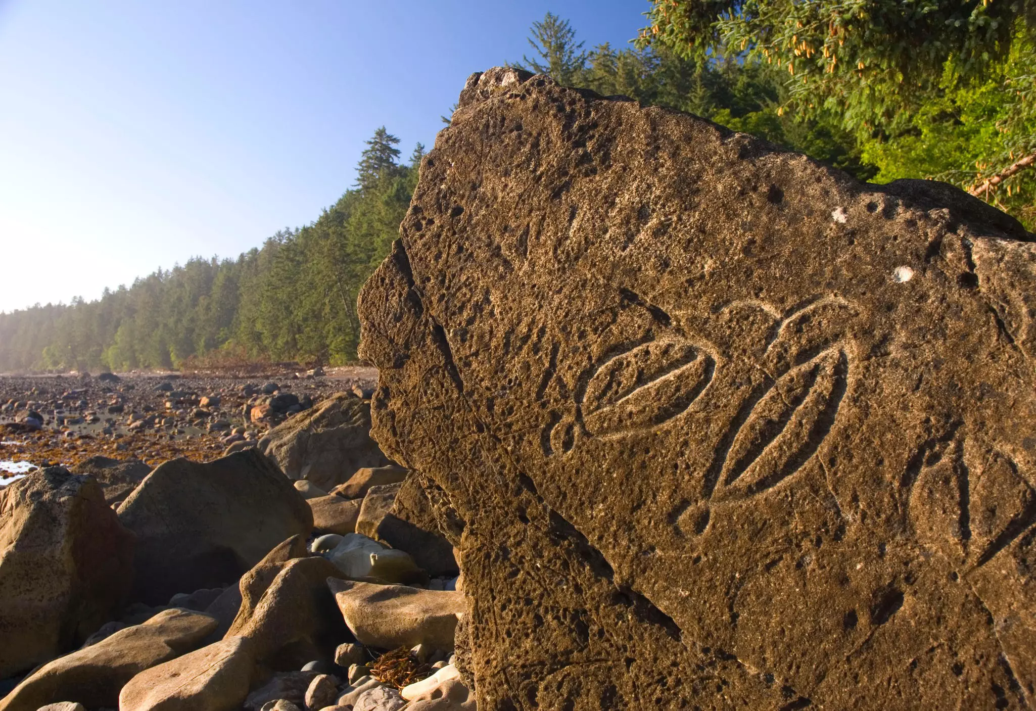
Former home of the Makah tribe, whose ancient cliffside village was destroyed in a mudslide in the early 18th century before being unearthed in the 1970s, Ozette is more than just a well-excavated archaeological site. It is also one of the most accessible slices of isolated beach on the Olympic coastal strip.
The 3.3-mile Cape Alava Trail leads north to the westernmost point of land in the continental US and is the site of the ancient Makah village, where archaeologists unearthed 55,000 artifacts, many of which are on display at the Makah Museum in Neah Bay.
The southern Sand Point Trail from Lake Ozette Ranger Station leads 3 miles to beaches below a low bluff; whale-watchers often come here in the migration season.
The two shorter Ozette trails can easily be linked as a long day hike by walking the 3 miles between Cape Alava and Sand Point along the beach (beware of the tides) or overland (but note that the trail is brushy and primitive).
The high point of this hike is Wedding Rocks, the most significant group of petroglyphs on the Olympic Peninsula. Approximately a mile south of Cape Alava, the small outcropping contains carvings of whales, a European square rigger and fertility figures. The site was traditionally used for Makah weddings and is still considered sacred.
The really hardcore can hike the 20 miles from Ozette to Rialto Beach near La Push. Note that this last hike is dependent on the tides and hikers often have to retreat into the wilderness, where there's no trail. All hikes require paying the Olympic National Park entry fee.
The Queets Corridor was added to the park in 1953 in an attempt to preserve one of the peninsula's river valleys all the way from its glacial beginnings to the coast. It's one of the park's least accessible areas.
The unpaved Queets River Rd leaves US 101 and almost immediately drops into the national park. The road then follows the river for 13 miles before ending at Queets Ranger Station. From here, there is one popular day hike – the gentle 3-mile Queets Campground Loop Trail.
Experienced or adventurous hikers can elect to ford the Queets River in late summer or fall and explore the Queets Trail, which leads up the river for 15 miles before petering out in heavy old-growth rainforest.
You may also like:
Introducing Washington's national parks
The 12 most-secluded cabins to rent on the West Coast
How to hike the Pacific Crest Trail
Explore related stories