
Advertisement
Western USA
Landscapes and legends draw adventurers to the West, where a good day includes locavore dining, vineyard wine-sipping, wildlife-watching, Native American history and outdoor adventure.

Bridger Mountains in Montana.
Latest Stories
- Margot Bigg|Jun 2, 2026The USA's best West Coast beaches
- Annika Hipple|Mar 19, 2026The 12 top national parks in the United States
- Tamara Gane|May 9, 2025How to plan a dude ranch vacation
- Sarah Kuta|May 7, 2025The best national parks in the western US
Book


Trusted Partner
Dreaming of Western USA? Protect your trip
Travel with confidence. Protect your trip and your wallet.
We don’t represent World Nomads, we receive a fee from quotes using this link. This is not a recommendation to buy travel insurance.
Take your United States (USA) trip with Lonely Planet Journeys
Time to book that trip to The USA
Lonely Planet Journeys takes you there with fully customizable trips to top destinations – all crafted by our local experts.


Top places to visit in Western USA
Discover the best attractions in Western USA from must-see sights to unexpected hidden gems.
-
 Attraction in SeattleMuseum of Flight
 -
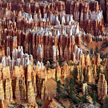 Attraction in Bryce Canyon National ParkBryce Point
 -
 Attraction in Yosemite National ParkOlmsted Point
 -
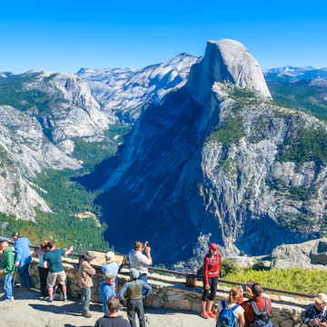 Attraction in Yosemite & the Sierra NevadaYosemite National Park
 -
-
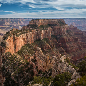 Attraction in Grand Canyon National ParkGrand Canyon National Park North Rim
 -
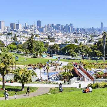 Attraction in The Mission, Dogpatch & Potrero HillDolores Park
 -
 Attraction in The Mission, Dogpatch & Potrero HillWomen's Building
Advertisement
Advertisement
Western USA and beyond
-
 destinationCalifornia
 -
 destinationNorthern California
 -
 destinationThe Southwest
 -
 destinationSouthern California
 -
 destinationColorado
 -
 destinationLos Angeles
 -
 destinationSan Francisco
 -
 destinationSeattle
Advertisement