
Advertisement
California
USA

Benjamin Heath for Lonely Planet
Why visit California
Twinkling cities, misty redwood forests, sun-kissed beaches, a creative local food scene and an adventurous attitude: California is instantly captivating.
Lonely planet’s trusted travel insurance provider
Dreaming of California? Protect your trip
Travel with confidence. Protect your trip and your wallet.
We don’t represent World Nomads, we receive a fee from quotes using this link. This is not a recommendation to buy travel insurance.
Take your United States (USA) trip with Lonely Planet Journeys
Pick one of our ready-to-book trips or fully customize your own with help from our local experts.
bookable trip
Alsaska: Glimmering Glaciers, Brown Bears, and Fantastic Fjords
10 days / 9 nights
Lonely Planet Journeys takes you there with fully customizable trips to top destinations – all crafted by our local experts.


Explore more trips
Explore more trips
-
 The USA
 -
 The USA
11 days / 10 nights
Easing up East: New York, Cape Cod, and Boston in 11 Days
See Trip DetailsFROM $5,395
per person
-
 The USA
11 days / 10 nights
Road Trippin' USA: San Francisco, National Parks & Las Vegas
See Trip DetailsFROM $5,780
per person
-
 The USA
10 days / 9 nights
From Bayside to Coastside: California's San Francisco Peninsula in 10 Days
See Trip DetailsFROM $4,940
per person
-
 The USA
10 days / 9 nights
Maine's Marvelous Coastline: 10 Days in Acadia, Bath, Bethel, and Camden
See Trip DetailsFROM $3,795
per person
The USA
The USA
11 days / 10 nights
Easing up East: New York, Cape Cod, and Boston in 11 Days
FROM $5,395
per person
The USA
11 days / 10 nights
Road Trippin' USA: San Francisco, National Parks & Las Vegas
FROM $5,780
per person
The USA
10 days / 9 nights
From Bayside to Coastside: California's San Francisco Peninsula in 10 Days
FROM $4,940
per person
The USA
10 days / 9 nights
Maine's Marvelous Coastline: 10 Days in Acadia, Bath, Bethel, and Camden
FROM $3,795
per person
Top places to visit in California
Discover the best attractions in California from must-see sights to unexpected hidden gems.
-
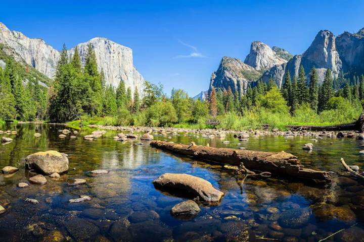
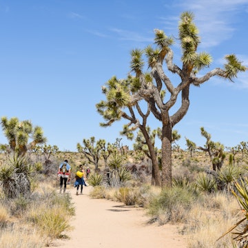
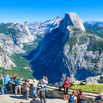 Attraction in Yosemite & the Sierra NevadaYosemite National Park
 -
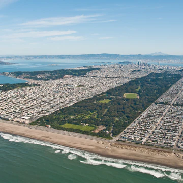 Attraction in San FranciscoGolden Gate Park
 -
-
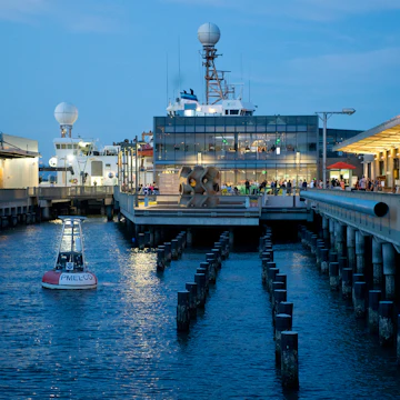 Attraction in The Marina, Fisherman’s Wharf & the PiersExploratorium
 -
 Attraction in The Mission, Dogpatch & Potrero HillBalmy Alley
 -
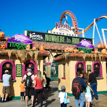 Attraction in Orange CountyKnott’s Berry Farm
 -
 Attraction in Venice, Marina Del Rey & Playa del ReyVenice Boardwalk
 -
 Attraction in The Haight & Hayes ValleyHaight Street

Advertisement
Travel Guides
California travel tips from Lonely Planet experts
Find practical guidance from our team of contributors around the world who bring their decades of first-hand travel experience to your next trip.
Best Things to Do
California has a reputation for sunshine, beaches and palm trees, but there's much more to see in the Golden State. Here are California's top things to do.
Read full article
Best Time to Visit
From avoiding the crowds to getting the best budget deal, here's what's happening through the seasons in California.
Read full article
Things to Know
California's sun-drenched parks, beaches and cities are a huge draw for tourists but where to begin? Here's what you need to know before you go.
Read full article
Transportation
California may be besotted with cars but that's not the only way to see the Golden State. Here's everything to know about getting around California.
Read full article
Free Things to Do
California attracts travelers with expensive tastes but there's plenty to do here on a budget. Here's our round-up of the best freebies in the Golden State.
Read full article
Best Road Trips
California's unforgettable scenery tugs at your heart and soul. See the best of it with these road trips.
Read full article
Money and Costs
California has a lot to offer travelers and unfortunately, the price tag to match. But there are ways to visit on a budget if you know how!
Read full article
Best Places to Visit
From cosmopolitan cities to epic natural wonders, California has it all, and the state's best places appeal to travelers of all sorts.
Read full article
Advertisement
in partnership with getyourguide
Book popular activities in California
California and beyond
-
 destinationNorthern California
 -
 destinationSouthern California
 -
 destinationLos Angeles
 -
 destinationSan Francisco
 -
 destinationYosemite & the Sierra Nevada
 -
 destinationThe Mission, Dogpatch & Potrero Hill
 -
 destinationThe Haight & Hayes Valley
 -
 destinationThe Marina, Fisherman’s Wharf & the Piers
Advertisement