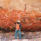
When the Three Capes Track opened two days before Christmas 2015, it immediately set a new benchmark for Australian bushwalks, creating a hike that's both heady and hedonistic, combining the raw beauty of the southern hemisphere's highest sea cliffs with comforts and interpretation unsurpassed by any other trail in the country.

Hiker on Arthurs Peak along the Three Capes Track © Andrew Bain / Lonely Planet

Three cheers

Has the Overland Track, Australia's most famous long-distance walk, just been usurped? Edging along the tops of cliffs that soar more than 300m above the unruly Southern Ocean, the Three Capes Track (threecapestrack.com.au) has quickly assumed the mantle of Australia's most intriguing bushwalk.

The four-day, 46km track opened to huge expectations at the end of 2015 and was quickly embraced. Replacing faint existing trails that were known mostly for their difficulty, it opened Tasmania's Tasman Peninsula to a new breed of walkers, providing wide and smooth trails and the most luxurious and comfortable public huts in Australia. Within one month, more than twice the number of people had hiked to Cape Pillar, the track's southern tip, than typically used to walk there in a year.

The dolerite cliffs along which the Three Capes Track journeys near Cape Pillar © Andrew Bain / Lonely Planet

The track runs in a Y-shaped configuration, beginning with a boat trip out from Port Arthur and reaching its signature moment atop the vertiginous Blade, a narrowing line of dolerite columns on Cape Pillar, overlooking the hefty bulk of Tasman Island.

There's great variety along the way, as the track winds in and out of heathland, dry woodland and a striking section of rainforest on the shoulder of Mt Fortescue. But its finest moments come when the track teeters along the cliff edge on its approach to Cape Pillar and the Blade. As the Roaring 40s winds inevitably howl in from the Southern Ocean, there's a humbling sense of being poised at the edge of the world.

It's a wild feeling that's diluted each night in the track's architect-designed huts, where civilisation has been well and truly transplanted into the wilderness. Each of the three huts – Surveyors, Munro and Retakunna – contains board games, a library of books, USB phone charging stations, deck chairs and yoga mats. Kitchens are equipped with gas stoves and saucepans, and the huts are divided into four- and eight-bed hostel-style rooms with memory-foam mattresses.

Relaxing at Surveyors, the first hut along the Three Capes Track © Andrew Bain / Lonely Planet

Hikers have no need to carry tents, stoves, sleeping mats or cooking pots, making it possible to hike the track carrying a pack weight of around only 10kg.

With 36 'encounters' (artistic installations and benches, featuring links to a dedicated Three Capes Track guidebook) dotted along the track – it's like a luxury guided walk, minus the guide.

And with the Tasman Peninsula's maritime fringe, the Three Capes can be walked any time of year, without the trials and tribulations that come with winter walking elsewhere in Tasmania.

Suddenly the island state, already arguably the outdoors capital of Australia, has an even broader, year-round appeal for hikers.

Lumps and bumps

Though the Three Capes Track and its long stretches of boardwalk are smooth underfoot, the journey to its opening wasn't without its own bumps. The track's name refers to the three capes – Cape Raoul, Cape Pillar and Cape Hauy – around which it was to traverse, but it may end up only ever rounding Cape Pillar and Cape Hauy, as it does now.

The final section of the track, around Cape Raoul, was to go into construction after the initial opening, but budget shortfalls have placed that extension in doubt. Potentially it may never be built, leaving the track short of the planned six-day, 80-kilometre route.

View to Tasman Island from the Blade © Andrew Bain / Lonely Planet

Other criticisms that have hounded the track are the cost (at AU$495 per person, it's more than double the price of the Overland Track) and initially there were no camping facilities for traditional bushwalkers.

In response, Tasmania's Parks and Wildlife Service built a campsite with wooden tent platforms at Wughalee Falls, which is near Munro Hut. Campers can't do the first section of the track over Arthurs Peak, instead they follow the 'old' inland track from Fortescue Bay then link up with the Three Capes Track at its main junction.

How to do it

To regulate walker numbers, which have been capped at 48 setting out each day, Tasmania’s Parks and Wildlife Service has established a permit system. Bookings should be made at threecapestrack.com.au/booking.

The walk officially begins at the Port Arthur Historic Site, about a 90-minute drive from the Tasmanian capital of Hobart. This notorious convict station is one of Tasmania's most popular tourist attractions, and the track fee includes entry to the site, so build in time for a wander around the penitentiary and settlement before your departure. Hikers can leave gear in secure lockers at Port Arthur.

The boat transfer to the track from Port Arthur is more than a pure ferry service, spending more than an hour nosing around the cliffs and coves of the Tasman Peninsula, giving a great overview of the terrain and geology, before dropping you ashore at Denmans Cove. From here, it's an easy 4km walk to the first night's hut.

Hikers setting out on the Three Capes Track at Denmans Cove © Andrew Bain / Lonely Planet

The track ends on the beach at Fortescue Bay, from where bus shuttle services return hikers to Port Arthur.

The greatest dilemma you'll face: what to carry? Without a tent, stove and pots in your pack, do you walk light, or do you load up on culinary extras – and wine?

Consider bringing a daypack in addition to your backpack, as the longest day (17km) is out and back to Cape Pillar. You can leave most of your gear at Munro hut and walk this day with just food, water, rain jacket and camera.

Planning checklist

  • 6-12 months out: Book your hike.
  • 3-6 months out: Begin training. Carry a pack of similar weight to that which you'll carry on the track, and build towards walking the distance of your longest day (17km).
  • 1 month out: Equipment check. Nights can be cool but a sleeping bag rated to 0°C or -5°C should be sufficient.
  • 2 days out: Shop. You will need to carry in enough food for three dinners and breakfasts, plus three or four lunches.
  • On the day: Make your way to Port Arthur, arriving at least two hours before your boat is scheduled to depart to see this historic site.

Explore related stories

Couple exploring in the lush Lamington National Park, Queensland, Australia

Hiking

The 12 best hikes to tackle in Australia

Nov 5, 2023 • 16 min read