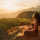
From towering Himalayan peaks to vast expanses of grassland and the steamy hills of the Western Ghats, India offers a diversity of hiking experiences like nowhere else on Earth.
Whether you fancy a short trek through the hills or an epic expedition over the high passes of the Himalayas, you'll find a route with your name on it. Many shorter walks in India can be undertaken without a guide, including some of the country's most important pilgrimage treks. For high-altitude hikes, local guides are easy to find in trail hubs.
From easy day jaunts to multi-day adventures, here's our pick of the best hikes in India.
Chembra Peak, Kerala
Best hike in the Western Ghats
7km (4.3 miles) round trip, 5 hours, easy to moderate
Located 90km northeast of Kozhikode, 2,100m (6,890ft) Chembra Peak is the tallest summit in Kerala, and it’s an easy day hike to reach the summit. A well-marked and charming trail passes through thick forest, rolling tea gardens and scented coffee and spice estates rich with aromatic bouquets of pepper and cardamom. Around halfway up you'll find a heart-shaped lake, but continue to the top for gorgeous views over the lush green hills of the Western Ghats.
This mountainous region teems with biodiversity, preserving more than 300 threatened species of flora and fauna. Trekkers should keep an eye out for endemic wildflowers and the lucky sightings of wild Asian elephants, lion-tailed macaques, Malabar hornbills or Nilgiri tahr (a sheep-like wild ungulate).
The trail to Chembra starts at the small village of Meppadi near Kalpetta, and it pays to get an early start as overnight stays are prohibited and only 200 hiking permits are issued per day. You'll need to register with the local forest office in the village; the trail opens at 7am. Avoid this trek during the monsoon season when paths turn to mud.
Deoria Tal and Chandrashila Trek, Uttarakhand
Best hike for winter scenery
18–20km (11–12 miles) round trip, 2 days, easy to moderate
Reflecting snow-cloaked Himalayan peaks in its placid waters, Deoria Tal – literally, "the bathing place of the gods" – is a beautiful lake about 14km (8.7 miles) east of Ukhimath in the foothills of Uttarakhand, northeast of Delhi. The views towards 7,138m (23,419ft) Mt Chaukhamba are particularly impressive.
Accessible year-round, the trail to Deoria Tal starts at the pretty village of Sari and it's easy to follow without a guide, making this a great Himalayan hike for independent trekkers. Though it climbs steeply uphill, the route is fairly straightforward, following a well-maintained path surrounded by rhododendron trees that bloom with bright pink flowers in spring. It is possible to camp overnight near the lake, but the hike can also be completed as a day trip.
Better still, it can be tied in with a trek to the top of 3,690m (12,110ft) Chandrashila, the ridge that rises above Tungnath Mandir. From Sari, it’s only 20km (12 miles) to the tiny village of Chopta, the trailhead for the pilgrim trek to the world’s highest Shiva temple. After walking the 4km (2.5 miles) to the temple, you can continue to the top of Chandrashila for astounding 360-degree views of surrounding peaks including 7,816m (25,643ft) Nanda Devi, India's second-highest peak.
Logistics are easy for the Tungnath hike – a multitude of small stalls along the trail serve basic Indian food and hot cups of chai (sweet Indian tea). On your way down, keep an eye out for the colorful Himalayan Monal pheasant, the state bird of Uttarakhand.
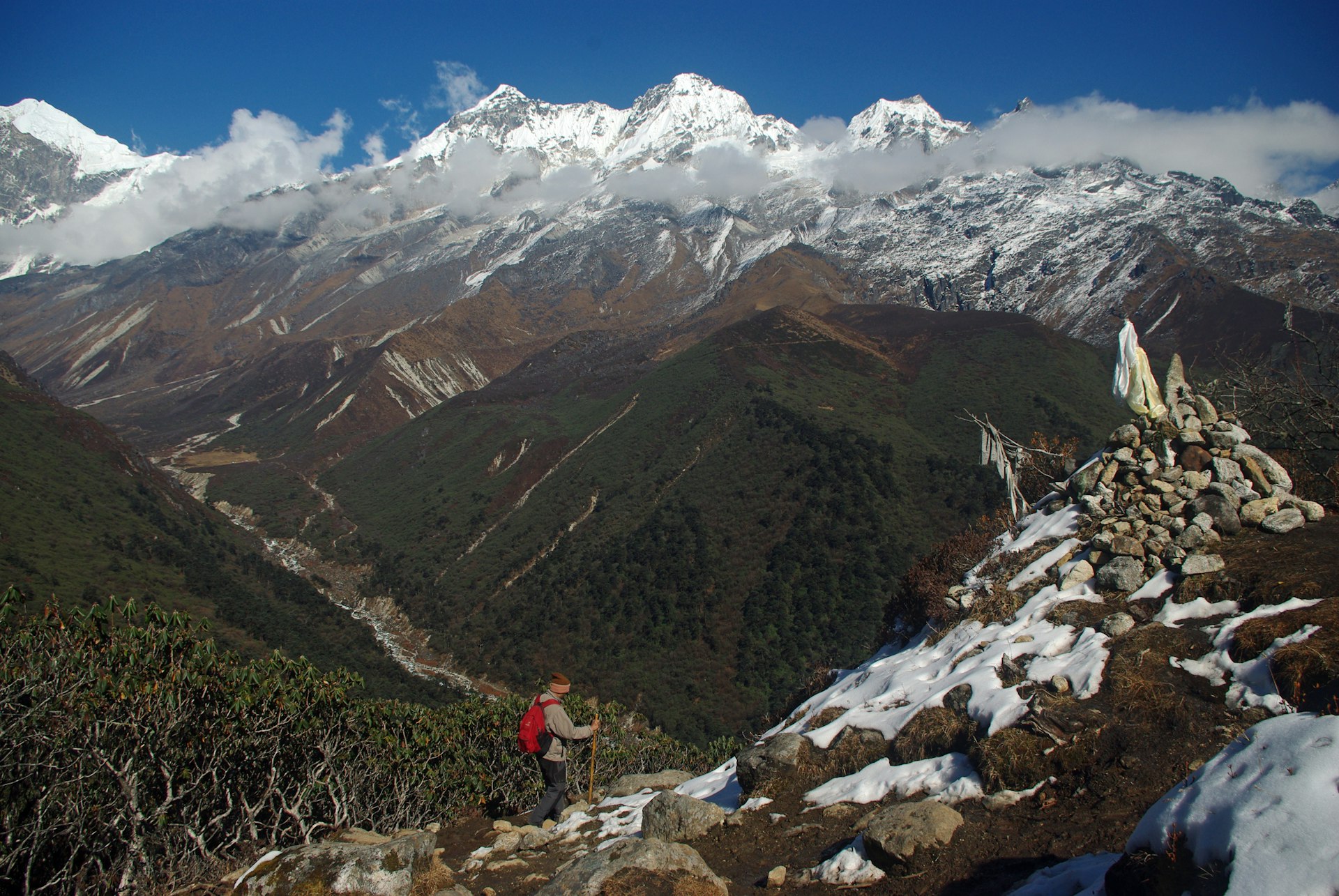
Goecha La Trek, Sikkim
Best high-altitude hike for adventurers
91km (57 miles), 10 days, difficult
You will need to book with a trekking agency (like Travel Gangtok Tourism) to attempt the challenging Goecha La hike, but for many hikers this is the highlight of a visit to the former Buddhist kingdom of Sikkim. The effort is well worth it for the giddying views, which include sweeping vistas across northeast India and unmatched opportunities for photos of 8,586m (28,169ft) Khangchendzonga, the world’s third-highest mountain.
Don't be fooled by the trail's unassuming start in the quiet village of Yuksom, the site of Sikkim’s first capital Rabdentse (the ruins of which can be seen just outside the village). After a gentle beginning, the trail becomes increasingly strenuous as you gain altitude. This trek climbs to 4,940m (16,207ft) at the Goecha pass, so you should take time to acclimatize to reduce the risk of Acute Mountain Sickness.
The route cuts through Khangchendzonga National Park – a sacred site for the Lepcha tribe, the original inhabitants of Sikkim who worship Mt Khangchendzonga as a deity. While you walk, look out for Buddhist chortens (stupas), rhododendrons, mountain ferns and hot springs. You may get lucky and spot red pandas, musk deer, blue sheep and blood pheasants on high-altitude sections of the trail.
The spring and fall months (just before and after the summer monsoon) are the best times to attempt this hike. Rise before daybreak for the side-hike to 4,000m (13,123ft) Dzongri peak on day four of the trek and you'll be rewarded by a gorgeous sunrise over Khangchendzonga.
Triund trek, Himachal Pradesh
Best easy trek for beginners
11.5 km (7 miles) round trip, 6-7 hours, easy
An excellent Himalayan hike for beginners, the Triund trek follows a well-used shepherds' trail that is accessible throughout the year. The path begins at the Galu temple in Dharamkot, a popular backpacker hangout just north of McLeod Ganj, seat of the Tibetan Government-in-Exile. Buses run uphill to McLeod Ganj from the transit town of Dharamshala further down the valley.
You can start this walk from either Dharamkot or McLeod Ganj. The pretty path climbs uphill through a mix of deodar, pine, rhododendron and oak forests with sweeping views along the valley. The sunset views from the ridge at Triund – set at 2,850m (9,350ft) – are especially grand, filling the sky with vivid pinks, yellows and oranges.
Although many hikers complete the Triund trek in a day, tents, sleeping bags and food are available at the summit campsite should you want to spend the night gazing at the stars and watching the twinkling lights below in the Kangra Valley.
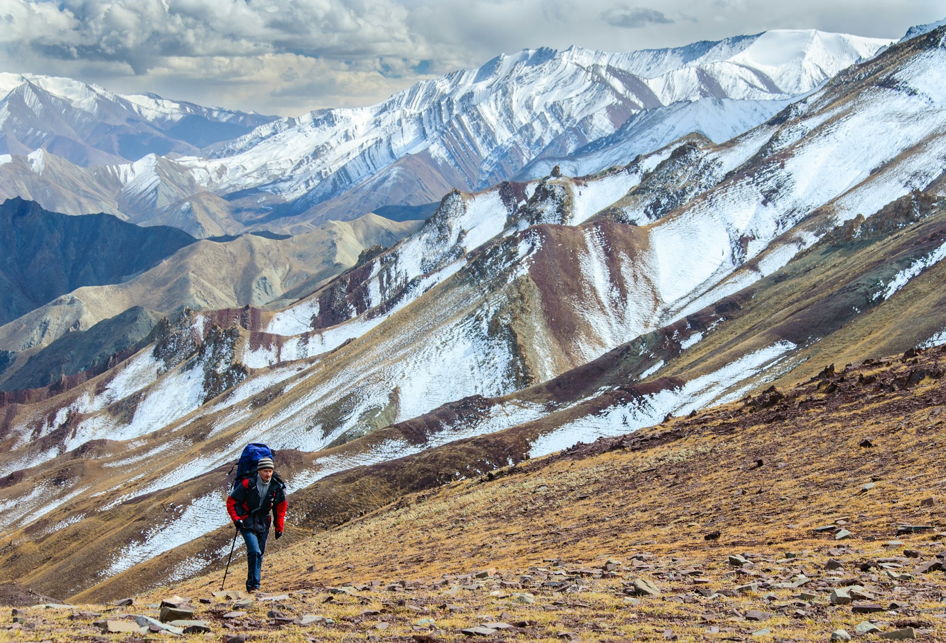
Markha Valley Trek, Ladakh
Best high-altitude desert hike
65km (40 miles), 6-7 days, moderate to difficult
Traversing the high-altitude deserts of Ladakh, the trek to the Markha Valley is a tea-house trail that’s hugely popular with independent hikers. With overnight stops in warm village homestays instead of chilly tents, the trek's great lure is the chance to immerse yourself in Ladakhi culture. This trek also cuts through the heart of Hemis National Park, home to rare Himalayan animals such as blue sheep, snow leopards and Tibetan red foxes, plus legions of cute Himalayan marmots.
Starting with a short bus ride from Leh, the route can be followed without a guide, though local trekking agencies can arrange a supported trip with guides and porters. The hike is best attempted in July or August when the villages along the route resemble green oases with crops growing up between the whitewashed homes and ancient Buddhist monasteries.
Hikers will need to be well-acclimatized as the trail crosses a 5,200m (17,060ft) pass. If you've traveled to Leh by air, or come up quickly from the plains, spend a few days in the Ladakhi capital before attempting this trek. Although it's quite possible to complete the route independently, there are a few tricky sections to overcome – including a waist-deep crossing of the Markha River and some rocky canyons where you need to watch your footing.
As this is a circular route, every day offers a different experience. Starting from the village of Chilling and looping southeast to Sumdo, you can tack on a visit to the stunning gompa (Buddhist monastery) at Hemis before you head back to Leh. Parts of the Markha Valley can also be trekked in winter, when there is a greater chance of spotting a snow leopard.
Kashmir Great Lakes Trek, Kashmir
Best hike for alpine scenery
74km (46 miles), 7 days, moderate
One of India’s finest treks, this week-long tour of the legendary Kashmir Valley takes in seven gorgeous glacial lakes, set amongst wildflower meadows crisscrossed by clear streams and lorded over by snowy mountains. Fed by snowmelt, these serene and silent bodies of water look almost impossibly beautiful in their different shades of turquoise and aquamarine.
As with any trip to Kashmir, it pays to check the security situation before traveling to Srinagar as unrest periodically causes problems for travel. Sharing the trekking path with goat herders and semi-nomadic sheep, this is a once-in-a-lifetime hike. Camping is permitted next to some of the lakes, and waking up here at first light is a fabulous introduction to the raw beauty of the famed vale of Kashmir.
Starting at the village of Sitkadi near Sonamarg, about 81km (50 miles) east of Srinagar, this is a moderate hike by Himalayan standards. The trail tops out at a 4,220m (13,845ft) pass, which you cross on the fourth day, and passes through stunning and varied alpine scenery. Join a small trekking group with a local agency – Indiahikes and Trek the Himalayas can take care of the logistics.
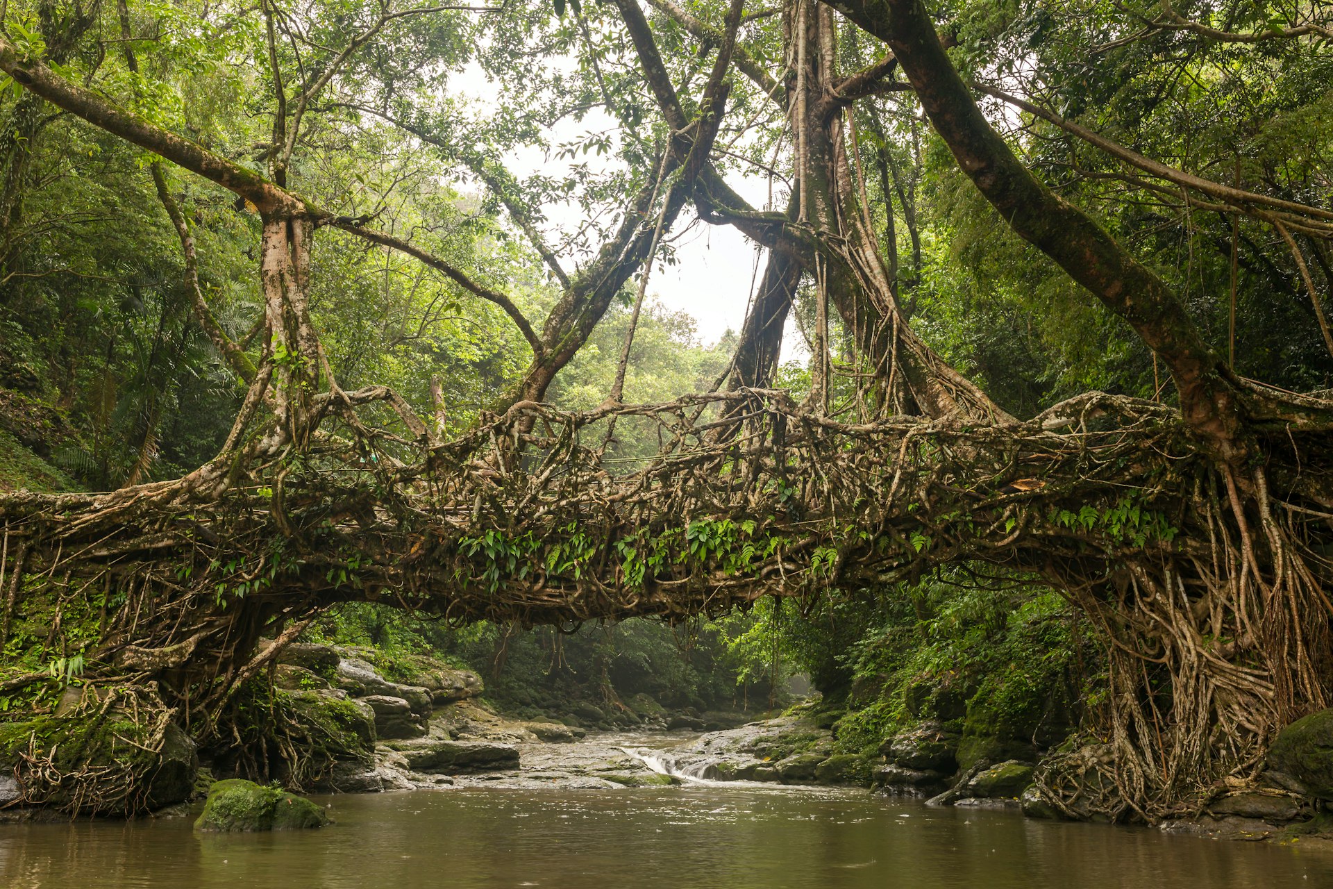
Nongriat Trek, Meghalaya
Best hike to learn about Indigenous culture
7km (4.3 miles) round trip, 1 day, moderate
The lofty plateau of Meghalaya is a place of folklore and legends, hidden valleys, natural pools and more waterfalls than you can count. But it’s the living root bridges created by generations of Khasi villagers in the hills around Nongriat that attract most visitors. Formed by weaving together tree roots and branches, these natural suspension bridges are an impressive example of ancient engineering know-how.
The trail to Nongriat starts in the village of Tyrna, near Cherrapunji – once listed in the Guinness Book of Records as the wettest place on earth. Buses run regularly to Cherrapunji from Shillong, Meghalaya's fascinating hill station capital. To reach the living root bridges, you must make a steep descent over 3,500 stone steps and creep through dense areas of rainforest teeming with butterflies, moths and jungle insects.
There are a few basic shops at the midpoint of the trail for provisions, but it's best to come with a local guide (book in Shillong or Cherrapunji). Pack a rain jacket, waterproof shoes and a bag cover – it rains profusely in this region. It's possible to sleep overnight in a homestay in Nongriat, continuing the next morning to the pretty Rainbow Waterfall.
Valley of Flowers Trek, Uttarakhand
Best hike for flower enthusiasts
15–25 km (9–15.5 miles) round trip, 7-10 hours or several days, moderate
One of India's most popular hiking destinations, Uttarakhand's Valley of Flowers takes its name from the astonishing array of colorful wildflowers that bloom toward the end of the monsoon season in this lofty national park. This protected area is also home to Asiatic black bears, brown bears and snow leopards, though sightings are rare.
The starting point for treks is the town of Govindghat, on the highway between Joshimath and the revered Hindu temple at Badrinath. From here, it’s an easy 14km (8.7 mile) hike to Ghangaria, where most hikers spend the night before heading into the valley itself.
Start off early from your guesthouse to reach the entrance to the valley by 7am when the route opens – the last trekkers are admitted at noon. Alternatively, you can follow the 6km (3.7 mile) trail used by Sikh pilgrims to reach Hemkund Sahib, a remote gurdwara (Sikh temple) built beside a stunning alpine lake.
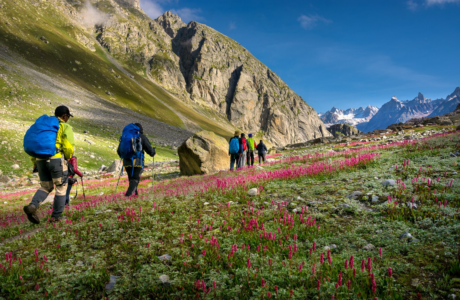
Hampta Pass trek, Himachal Pradesh
Best multi-day hike
21km (13 miles), 5 days, easy-moderate
Originally a shepherd trail and nomadic trade route, this stirring hike takes you from the lush green meadows of the Kullu Valley across the 4,270m (14,009ft) Hampta Pass, and on to the rugged landscapes of Lahaul – an ancient Hindu and Buddhist valley that serves as a back route to Ladakh.
The trailhead for this multi-day hike is Jobra, a two-hour drive from the hill resort of Manali. You'll quickly leave civilization behind as you march through mixed forests of birch, deodar and oak, interspersed by glacial streams and dazzling green meadows carpeted with wildflowers.
The panoramic views of the Lahaul Valley from the top of the pass are highly memorable (bring an extra camera memory card). The hike ends in Chhatru, where a dirt track leads to Chandra Taal (Moon Lake), a scenic lake located at an altitude of 4,250m (13,944ft).
Tadiandamol trek, Karnataka
Best trek in South India
12km (7.5 miles) round trip, 7–9 hours, easy
The highest buttress in the green rolling hills of the Kodagu region – famed for producing India's best coffee – Tadiandamol makes for an ideal day hike for trekkers who want to gaze at misty green hills painted by swirls of cloud. Starting at Nalakunad Palace, around three hours from Mysuru, the route cuts through the Brahmagiri Wildlife Sanctuary, a protected area of stunted tropical shola forests, beautiful grasslands and tinkling streams.
With views over coffee estates that also raise spices such as pepper, areca nut and nutmeg, this is a well-marked, moderate hike and it's easy to complete without a guide. The best time to hike here is from September to March.
Gaumukh Trek, Uttarakhand
Best spiritual hike
36km (22 miles) round trip, 2-3 days, moderate
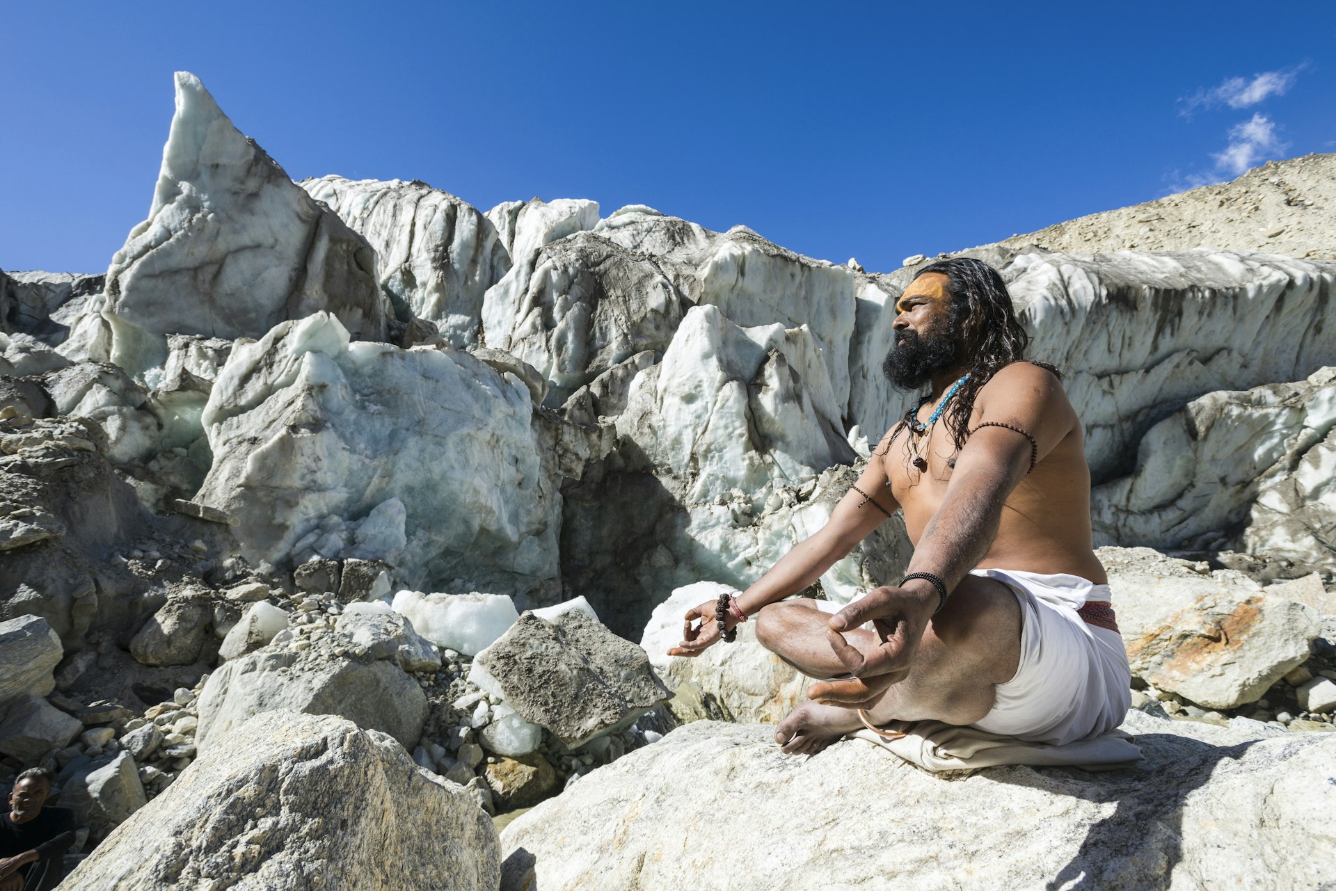
Many of India's most interesting hikes follow ancient pilgrimage routes, and this trek to one of the sources of the River Ganges is one of the oldest hikes in the country. The endpoint, Gaumukh (literally, Cow’s Mouth) is a massive glacier high in the Himalayas, and its meltwater gives birth to India's most sacred river. Stupendous nighttime views of the pointy summit of 6,543m (21,467ft) Mt Shivling surrounded by a million twinkling stars only add to the magic.
The trek starts in the pilgrim town of Gangotri, home to one of the revered Char Dham – four of the most sacred Hindu temples in India. The hike is moderately difficult, with a gentle but sustained climb through increasingly rugged scenery. Most people spend the night at Bhojbasa, 3km (1.9 miles) before Gaumukh, where there are tents and a tourist rest house along with basic facilities such as toilets and food stalls.
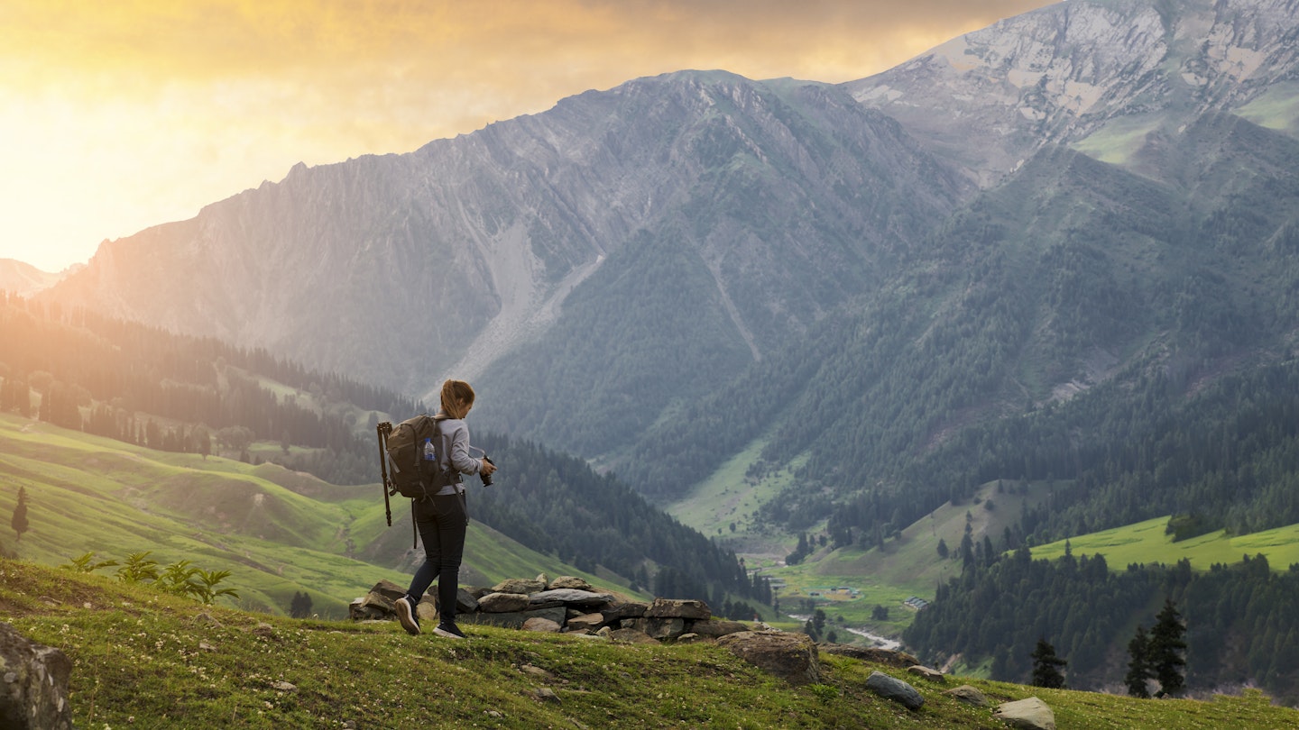
Khaliya Top, Uttarakhand
Best day hike for Himalayan views
14km (8.7 miles) round trip, (1-2 days), moderate
Set at 3,600m (11,811ft), Khaliya Top is an alpine meadow that sits proudly amongst the peaks of the Kumaon Himalaya in Uttarakhand, offering 360-degree views of an amphitheater of snow-capped mountains. After leaving the Balati Bend forest office, 8km (5 miles) from Munsyari, you'll immediately enter a dense forest of rhododendrons and oak trees before rising onto exposed hillsides.
The trail is well-marked, with sharp ascents in places. Clear views of the Panchachuli and Nanda Devi ranges become visible as you climb higher on the trail, and the views just keep getting better as you approach the KMVN rest house just before Khaliya Top. Take a packed lunch to enjoy while you gasp at the views.

Tips for hiking in India
Hiking is well-established in India, but here are some tips for first-timers.
When is the hiking season?
Due to the vastness of India, you should be able to find somewhere to hike in the country whenever you visit. While the dry months from October to May are all fine for trekking, March to May is the peak hiking season in the Himalayan foothills. The high-altitude valleys of Ladakh are best visited from June to September, when the snows melt and the road opens from Himachal Pradesh.
At any time of year, hikers should pack for all conditions as the weather can change in an instant in the mountains – something that is being exacerbated by climate change. Rainfall patterns are more unstable than they were and higher temperatures are melting some glaciers.
There is usually snow from November to March, making for challenging trekking conditions. Avoid Sikkim, Himachal Pradesh and the area around Darjeeling in July and August, when heavy monsoon rains can cause landslides that wash away roads and trails.
What are the best maps to use for hiking?
Thanks to the efforts of Peter Van Geit, the Belgian-born founder of the Chennai Trekking Club, it is finally possible to get hold of decent quality maps of the Indian Himalayas. His Ultra Journeys maps are very recent and can be downloaded for free.
A number of useful digital maps can be downloaded offline and uploaded onto your smartphone or GPS. Gaia GPS and Alltrails produce some useful terrain maps of India, marking trekking trails (where they exist). Hikers will need a subscription to use these services.
Leomann Maps is excellent for Kashmir, Ladakh, Uttarakhand and Himachal Pradesh. Hard copies can be bought online and at some bookstores. Olizane produces some super hiking maps for Ladakh and Zanskar region, while Indiahikes has GPS files available to download for treks in the Western Ghats.
How to find a reputable trekking guide
Finding a good, experienced trekking guide is the best investment you’ll make during a trip to India. The Indian Mountaineering Foundation, based in Delhi, keeps a list of registered tour operators across the country.
Look for a company whose trek leaders are qualified in mountaineering and certified Wilderness First Aid Responders. It’s also worth checking what equipment they carry on their treks – on high-altitude routes, oxygen cylinders and first aid kits should always be included.

How to prepare for trekking the Himalayas
You will need to pack clothes that can withstand the mountain weather, which can change quickly. That means a wind-proof layer and a down jacket, as well as a waterproof coat. Wear your hiking boots before you hit the trails and invest in a decent map – many of the maps available locally are unreliable for more remote regions.
Always carry water (or the means of purifying water), extra socks, a survival bag and emergency food. Sunscreen, a high-UV-factor chapstick, a sunhat and sunglasses should also be seen as essentials – it's easy to get sunburned at altitude and the snow can be blindingly white at times. For a multi-day hike, consider bringing your own sleeping bag and roll mat; some trekking companies can provide these, but quality varies.
Check to see if you need any permits to trek in the Himalayas
Before you set off, check if you need a permit to hike. Special permits are needed to enter areas close to India's borders, particularly in the northeast of the country. Those hiking in any part of Arunachal Pradesh and in specific areas in Himachal Pradesh, Ladakh, Sikkim and Uttarakhand will need to apply for a General Protected Area Permit.
Permits are usually arranged through a local trekking agent or travel agency, and you need to be traveling with at least one other person to obtain one. Contact agencies ahead of time to make arrangements. Permits are usually valid for 10 days with an option to extend for an additional week. Indian citizens will need an Inner Line Permit, which can be organized through the local state government.
How to acclimatize for a mountain trek
Avoid driving as high as you can and setting off from there. Acute Mountain Sickness (AMS) is a serious risk above 2,500m (8,200ft), and can be fatal. On any high-altitude trek, ascend slowly, avoid alcohol and other diuretics, drink lots of water and take regular rest days to acclimatize as you gain elevation. If you are coming up to the mountains from a lower elevation, spend a few days letting your body acclimatize before heading out on a trek.
During the trek, if you show any symptoms of AMS – these include light-headedness, tiredness, nausea, a rapid heart rate, shortness of breath, headaches or trouble sleeping – do not climb any higher. If symptoms get worse, descend immediately. At night, aim to sleep at a lower elevation than the highest point reached on that day, and try to avoid sleeping at an elevation more than 500m (1,640ft) above the elevation where you spent the previous night.