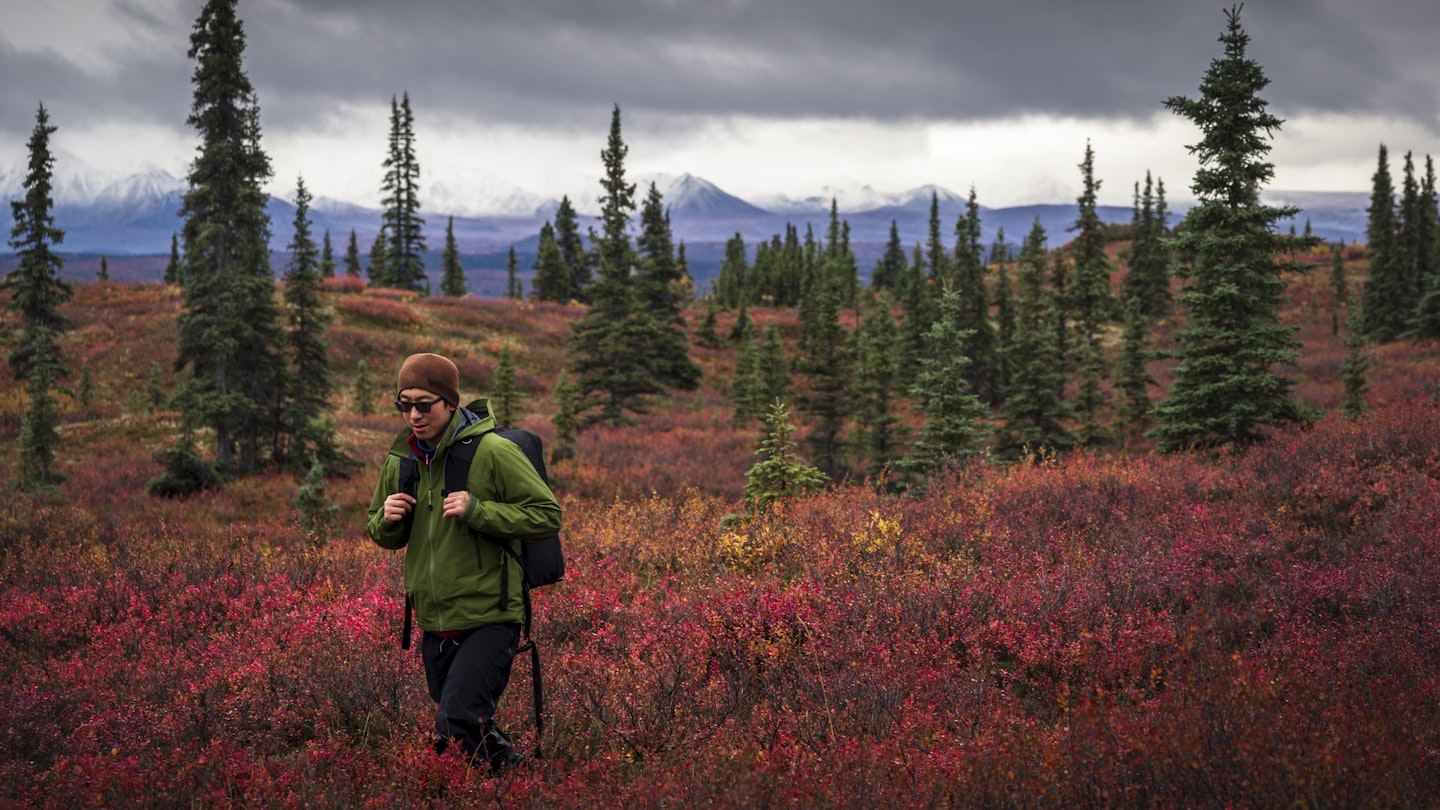
Alaska is a storied landscape – just ask the Inupiat and Tlingit people, who have for generations shared tales about how the state's peninsulas and glaciers and crevasses were formed, and of the bears, whales, and ravens that fill Alaska's forests.
And those same natural features continue to draw hikers from all over the world who want to experience Alaska up close and personal, one mile at a time.
If you are craving a hike in Alaska and aren't sure where to start, here are our fourteen favorites. There's a little something for all levels of skill and ambition, from mellow strolls to strenuous guided treks that require specialized gear.
Chilkoot Trail
The Chilkoot Trail, the epic trek undertaken by over 30,000 gold-rush stampeders in 1897–8, is sometimes known as the "Last Great Adventure" or the "Meanest 33 Miles in America." Its appeal is legendary, and, consequently, more than 3000 people spend three to five days following the historic route between Dyea (Alaska) and Bennett (British Columbia, Canada) every summer.
The trail crosses the US–Canadian border, takes in numerous climate zones, and traverses terrain etched with the discarded remnants of one of the 19th century’s most incredible journeys. For contemporary hikers, it’s a chance to connect with the past, emulate erstwhile struggles, and relive an adventure that played out in an age before motor cars and the internet made everything so damned easy.
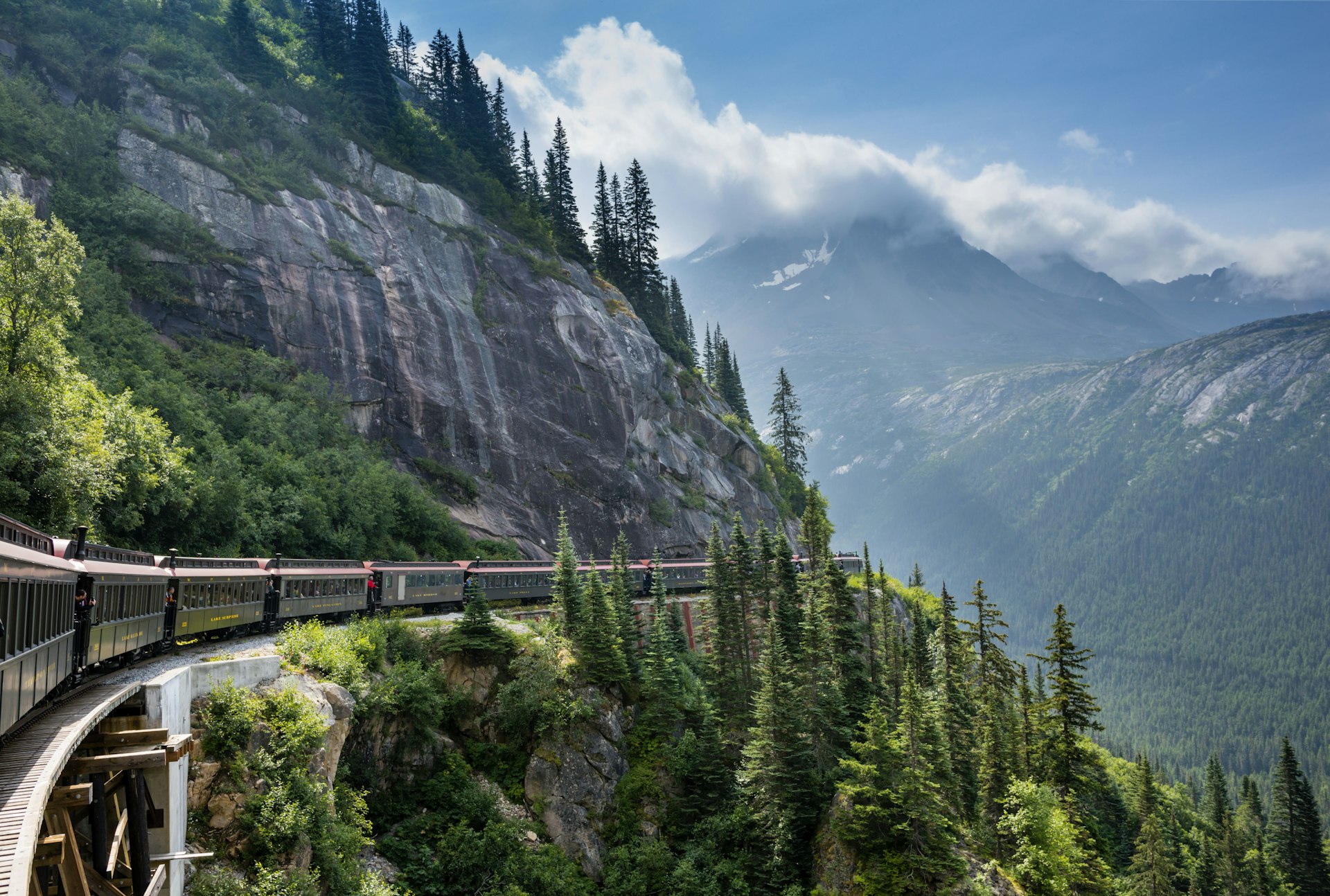
The trailhead is at Dyea, 9 miles northwest of Skagway and site of a once-rambunctious gold rush town that came and went in the space of just six years (1897–1903). The hike ends at Lake Bennett in BC, Canada, which has a good campground, a railway station and an unusual wooden church dating from 1898. A special "hiker’s train" using the historic White Pass & Yukon Route Railroad leaves Lake Bennett for Skagway four times a week (3:15pm on Tuesday, Wednesday and Thursday, and 2:15pm on Saturday). Experiencing the Chilkoot and returning on the train is probably the ultimate Alaska trek, combining great scenery, a historical site and an incredible sense of adventure.
Before starting the trail, all hikers must call in at the Trail Center in Skagway to obtain backpacking permits (adult/child $55/27.45), check out trail conditions and watch a bear safety video.
Parks Canada allows only 50 hikers per day on the trail and holds only eight permits to be handed out each day at the trail center. It is wise to reserve your permits ($11.70 per reservation) in advance through Parks Canada if you intend to walk mid-July to mid-August. Don’t forget your passport.
For transport to the Dyea trailhead, call the reliable Ann Moore at Chilkoot Trail Dyea Transport.
The Kenai River Trail
A half-mile down this trail are wonderful views of the Kenai River Canyon. There are really two trailheads; the main "upper" trail starts at mile 0.6 of Skilak Lake Rd, and the other at mile 2.3.

Turnagain Arm Trail
This mellow 11-mile hike begins at Potter Trailhead (Mile 115). Originally used by Alaska Natives, the trail, with a mountain goat’s view of Turnagain Arm, can also be accessed at points along the way: McHugh Creek (Mile 112), Rainbow (Mile 108) and Windy (Mile 107).
Iditarod National Historic Trail
The National Historic Iditarod Trail is a 24-mile trek used by gold miners and sled-dog teams until 1918 when the Alaska Railroad was finished. It’s a two- to three-day hike through superb mountain scenery to Girdwood (where it's known as the Crow Pass Trail) and is the region’s best backpack adventure.
Pitch a tent at Rapids Camp or Echo Bend (Mile 3), or rent one of two yurts ($65 per night) close by. For a shorter outing, you can turn around at the Perch, a massive rock in the middle of wonderland, then backtrack to the Dew Mound Trail at Echo Bend and loop back to the Nature Center, making this a scenic 8-mile trip.

Reed Lakes Trail
Two alpine lakes, waterfalls, glaciers and towering granite walls: the 7-to-9-mile Reed Lakes Trail is one of the most gorgeous hikes in the region and worth the climb. Once you reach upper Reed Lake, continue 1 mile to Bomber Glacier, where the ruin of a B-29 bomber lies in memorial to six men who perished in a 1957 crash.
Near mile 14 of Hatcher Pass Rd, a road to Archangel Valley splits off from Fishhook–Willow Rd and leads to the Reed Lakes trailhead, a wide road. If you’ve got a 4WD, you can (theoretically) drive the first 3 miles of the Craigie Creek Trail. It’s better, however, to walk the gently climbing old road up a valley and past several abandoned mining operations to the head of the creek. It then becomes a very steep trail for 3 miles to Dogsled Pass, where you can access several wilderness trails into the Talkeetna Mountains.
Lost Lake Trail
This challenging 7-mile trail to an alpine lake is one of the most scenic hikes the Kenai Peninsula has to offer in midsummer. The trailhead is in Lost Lake subdivision, at Mile 5.3 of the Seward Hwy.
Clemens Memorial Cabin is 4.5 miles up the trail (book way ahead). It has amazing views of Resurrection Bay and is also a good winter destination. The final 2 miles are above the treeline, making the shores of Lost Lake a wondrous place to pitch a tent.
If you’d rather not return the same way, continue around the east side of Lost Lake to the Primrose Trail, an 8-mile alpine trek ending at Primrose Landing Campground at Mile 17.2 of the Seward Hwy. Plan on seven to 10 hours for the round-trip to Lost Lake, and bring a camp stove, as wood is hard to come by.

Exit Glacier
Exit Glacier Guides gives you the chance to tread upon Seward’s backyard glacier. Its six-hour ice-hiking trip costs $130 per person, gears you up with crampons and ropes, ascends partway up the Harding Ice Field Trail and then heads out onto the glacier for crevasse exploration and interpretive glaciology.
Exit Glacier Guides also offers helicopter tours, hiking tours and a historic downtown tour as well as overnight journeys.
Heney Ridge Trail
Cordova’s most popular trail – as it incorporates multiple ecosystems and is only 5 miles from town – is this fairly easy 3.7-mile (one-way) route beginning by a bridge near the end of the Whitshed Rd.
The first stretch winds around reedy Hartney Bay, followed by a mellow 2-mile climb to the tree line through forests and wildflowers (and, in rainy weather, lots of mud – rubber boots are recommended). It’s another steep mile up to the ridge, where you’ll enjoy a gorgeous view.

Resurrection River Trail
This 16-mile trail accesses a 72-mile trail system connecting Seward and Hope. The continuous trail is broken only by the Sterling Hwy and provides a wonderful wilderness adventure through streams, rivers, lakes, wooded lowlands and alpine areas.
It’s difficult and expensive to maintain, so expect to encounter natural hassles such as downed trees, boggy patches and washed-out sections. Resurrection River Cabin is 7 miles from the trailhead and cannot be reserved.
The southern trailhead is at Mile 8 of Exit Glacier Rd. The northern trailhead joins the Russian Lakes Trail 5 miles from Cooper Lake or 16 miles from the Russian River Campground off the Sterling Hwy. The hike from the Seward Hwy to the Sterling Hwy is a 40-mile trip, including Exit Glacier.
Ugadaga Bay Trail
On the southeast side of Unalaska, this pleasant hike is 2.2 miles one-way along an ancient portage route. More recently, the US military ran communications lines from Unalaska all the way to Seattle, and you’ll see remnants of them in eroded spots. Seal hunters were using the portage as late as the 1960s.
Termination Point
This 5-mile loop starts at the end of Monashka Bay Rd and branches into several trails near Termination Point, a spectacular peninsula that juts out into Narrow Strait. Most hiking is done in a lush Sitka spruce forest. If you’re nervous about your navigational skills, simply hike the coastal half of the loop and then backtrack.
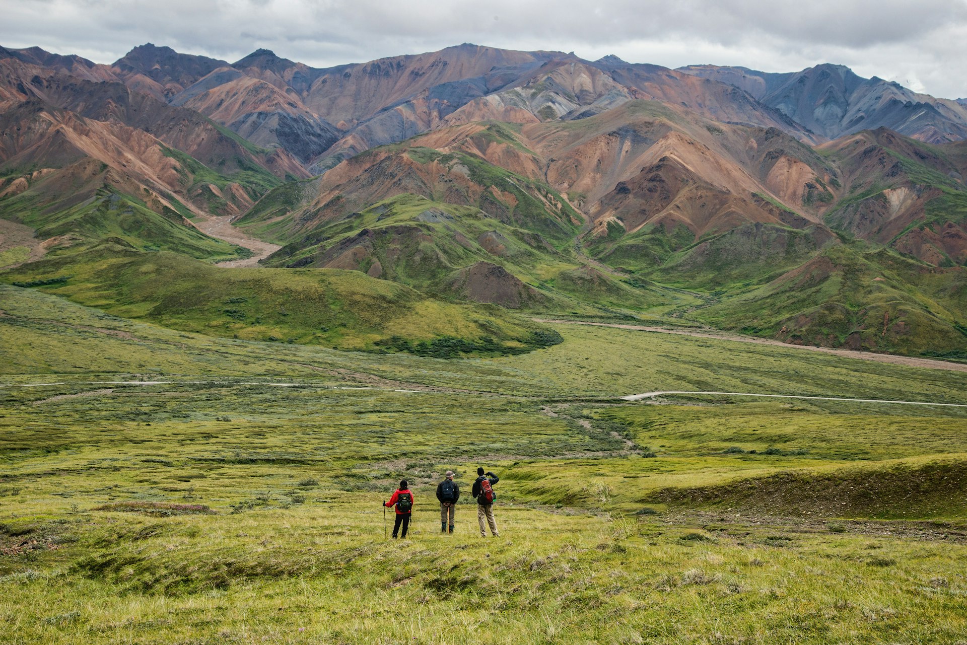
Denali Discovery Hikes
In most national parks in North America, hikers are constantly reminded to stay on marked trails in order to prevent soil erosion, deter damage to flora and fauna, and minimize the risk of getting lost. But Alaska – being Alaska – operates a little differently. Since most national parks in the state don’t have an extensive network of marked trails, visitors are actively encouraged to get off the beaten track and explore the backcountry on their own.
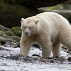
Hiking without a signposted trail can be an intimidating experience to the average city dweller, especially if you’re sharing the domain with bears, moose and various other unseen fauna (not to mention mosquitoes).

The key to successful backcountry travel is being able to use a compass and read a topographic map. Riverbeds are easy to follow and make excellent avenues for the backpacker. Formed by glaciers during the last ice age, the river valleys never fill, though individual braids can get dangerously high and fast and must be forded with caution. Ridges are also good routes to use if the weather isn’t foul.
National Park Service (NPS) rangers lead moderate to strenuous three- to five-hour hikes deep into the heart of the park on a daily basis during summer. The location varies from day to day; you can find the schedule at the Denali Visitor Center or online. Sign up at the center one or two days in advance and then reserve a shuttle ticket at the WAC.
Shuttles leave at 8am. Note that because hiking is off-trail, you must have sturdy footwear and pack rain gear, food and water. Rangers will turn away unprepared hikers. This is an all-day affair; the bus ride to the hiking departure point can take up to four hours, to hike for three to five hours, and then a similar-length bus ride back to the park entrance.

Harding Ice Field Trail
This strenuous and yet extremely popular 4-mile trail (six- to eight-hour round-trip) follows Exit Glacier up to Harding Ice Field. The 700-sq-mile expanse remained undiscovered until the early 1900s when a map-surveying team discovered that eight coastal glaciers flowed from the exact same system.
Today you can rediscover it via a steep, roughly cut and sometimes slippery ascent to 3500ft. Beware of bears; they’re common here. Only experienced glacier-travelers should head onto the ice-field proper.
The trek is well worth it for those with the stamina, as it provides spectacular views of not only the ice field but Exit Glacier and the valley below. The upper section of the route is snow-covered for much of the year; bring a jacket and watch for ice bridges above creeks. Camping up here is a great idea, but the free, tiny public-use cabin at the top is for emergencies only.
Perseverance Trail
The Perseverance Trail, off Basin Rd, is Juneau’s most popular. The trail is a path into Juneau’s mining history and also provides access to two other popular treks: Mt Juneau Trail and Granite Creek Trail. Together the routes can be combined into a rugged 10-hour walk for hardy hikers or an overnight excursion into the mountains surrounding Alaska’s capital city.
To reach Perseverance Trail, head north out of town on Basin Rd, a dirt road that curves away from the city into the mountains as it follows Gold Creek. The trailhead is at the road’s end, at the parking lot for Last Chance Mining Museum. The trail leads into Silverbow Basin, an old mining area that still has many hidden and unmarked adits and mine shafts; be safe and stay on the trail.
From the Perseverance Trail, you can pick up Granite Creek Trail and follow it to the creek’s headwaters basin, a beautiful spot to spend the night. From there, you can reach Mt Juneau by climbing the ridge and staying left of Mt Olds, the huge rocky mountain. Once atop Mt Juneau, you can complete the loop by descending along the Mt Juneau Trail, which joins Perseverance Trail a mile from its beginning.
The hike to the 3576ft peak of Mt Juneau along the ridge from Granite Creek is an easier but longer trek than the ascent from the Mt Juneau Trail. The alpine sections of the ridge are serene, and on a clear summer day, you’ll have outstanding views. From the trailhead for the Perseverance Trail to the upper basin of Granite Creek is 3.3 miles one way. Then it’s another 3 miles along the ridge to reach Mt Juneau.
You may also like:
Top 8 road trips in Alaska
Introducing Alaska’s national parks
Why Alaska's stunning coast is best seen by ferry
This article was originally published on May 13, 2021.