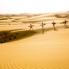
Away from the cities, white-sand beaches and fishing villages along the coast, Oman’s craggy interior is truly rewarding for adventurers in hiking boots.
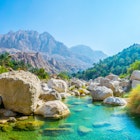
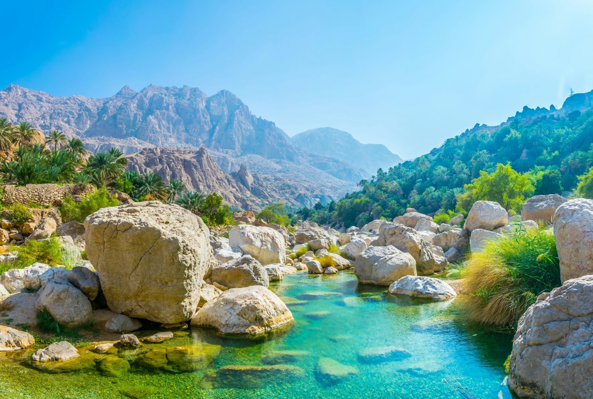
Deep within the Hajar Mountains lie cliff-top villages lost in time; terraced farms and date plantations; barren valleys and peaks; and natural springs and wadis (valleys or riverbeds) with turquoise pools of water that invite you to jump or wade in.
A network of marked and well-maintained trails makes adventure trekking in Oman easy for independent (if experienced) hikers. While popular trails can be busy on the weekends, you might not come across other hikers for long sections of more-challenging trails. Should you get lost, Omanis are usually friendly enough to escort you back to the trail, point you in the right direction or even give you a lift. Still, trekking with a local guide means you’ll get valuable insights into Omani traditions and the way of life in remote villages.
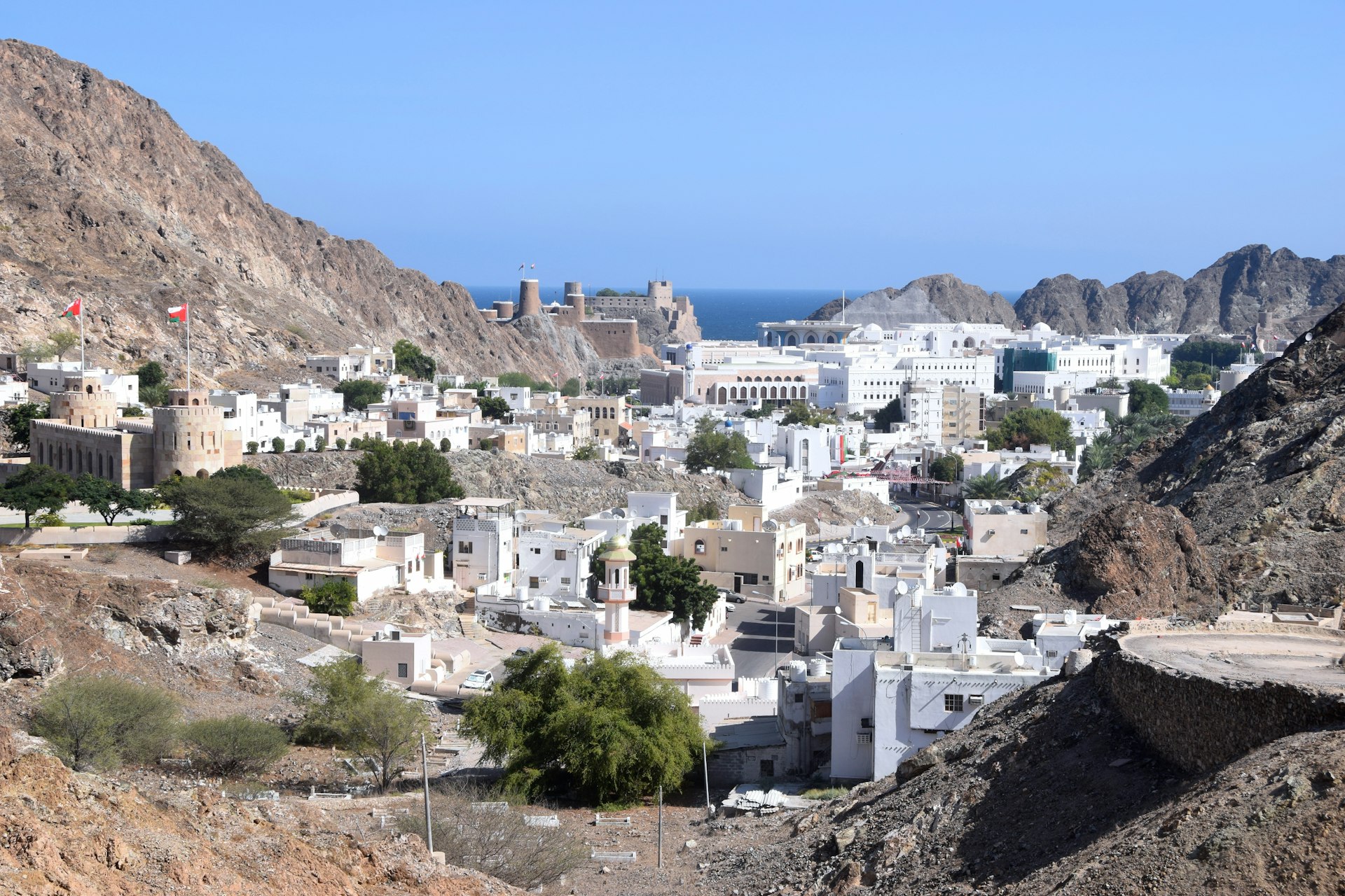
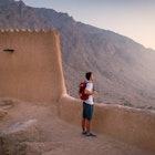
Riyam to Mutrah
Best city hike
2.5km (1.55 miles), 2 hours, easy
If you’re looking to stretch your legs in Muscat, the Riyam-to-Mutrah hike (the C38 route) is an excellent way to make the most of an afternoon while seeing the capital from a different perspective. While this hike can be done in either direction, we recommend beginning in Riyam (close to Riyam Park) and finishing in Mutrah, with its shaded seating areas and benches along Mutrah Corniche.
This easy-to-moderate hike takes you along what was once the only overland route between Mutrah and old Muscat. From Riyam, the old rocky trail continues up a hill via stone steps once used by villagers to bring agricultural produce, wares and goats to sell at Mutrah Souq. The rusty pipeline along the steps is from a time when the country’s only power station was located in Riyam, fueled by diesel oil pumped through the pipes from a ship docked in Mutrah.
This route offers fantastic views over Mutrah harbor, Riyam Park and old Muscat, with glimpses of the sea beyond. You might also find rock pools of water and some water in the wadis between November and April.
The trail leads to the ruins of an abandoned village before it descends to a wadi with steep walls, where some scrambling is required. Once through, turn left approaching the cemetery to reach the end of the hike.
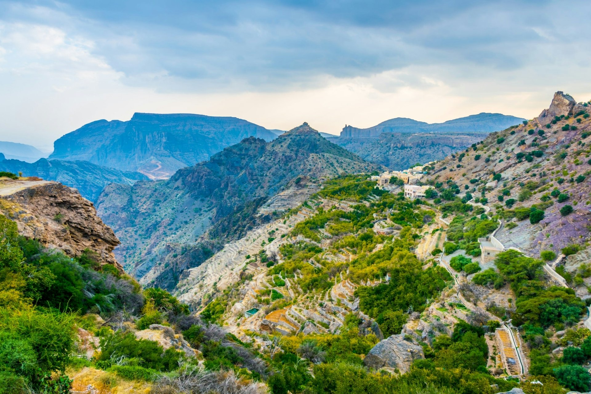
Jebel Akhdar
Best hike for mountain villages and farms
4km (2.5 miles), 2–3 hours, easy
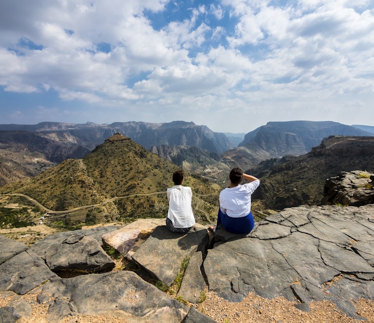
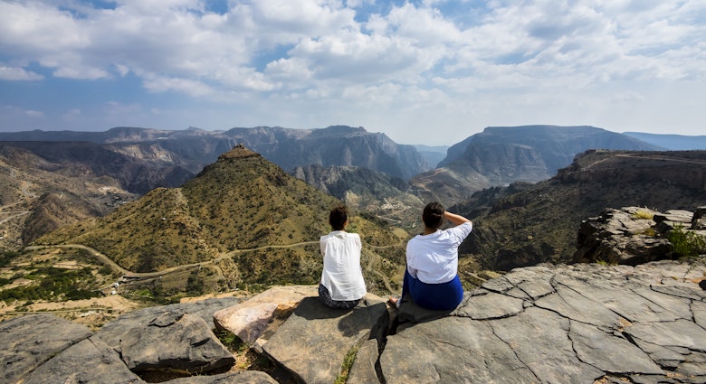
Jebel Akhdar (Green Mountain) in the western Hajar Mountains is home to verdant terraced slopes and valley villages with temperatures that are at lower than Muscat year-round. At 2980m (9777ft), it’s one of the best places to go trekking in Oman, especially if your idea of gorgeous scenery involves more olive trees and apple orchards than dry, rocky wadis.
On the W18b trek, you’ll hike from the village of Al Aqor to Sayq, passing through the settlements of Al Ayn and Ash Shirayjah along the way. Expect a pleasant walk on an old trail that involves some steep stone steps as you walk by old stone houses, alongside narrow aflaj (century-old irrigation channels that water the terraced farms sloping below) and through leafy orchards that offer respite from the sun. Farms in the area are actively engaged in agriculture, growing apples, pears, pomegranates, walnuts, almonds, grapes and tomatoes – but since they are private property, resist the temptation to pluck the fruit.
In April and May, blooming pink damask roses are a wondrous sight in the area, and rose water is distilled in the villages, often using traditional methods, both for sale and personal use. During this season, you may be able to see the process in action: inquire at your accommodations, or try your luck asking around in the villages. Omanis are friendly, and more often than not know someone (who knows someone...) who can help.
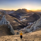
Wadi Bani Khalid to Wadi Tiwi
Best challenging wadi hike
28km (17.4 miles), 14–18 hours, challenging
The E35 trail from Wadi Bani Khalid to Wadi Tiwi is popular with serious hikers looking for a strenuous trekking adventure. In the heart of the eastern Hajar Mountains, this trek can be done over a single, very long day as you gain an altitude of 1800m (5905ft) – though most hikers choose to camp on the plateau overnight and split the journey over two days.
Beginning at emerald-hued natural pools in Wadi Bani Khalid, just after the village of Miqil (also spelled Muqal), the route follows an old donkey trail and ascends to the highest point of 2100m (6890ft) relatively quickly (four or five hours). From the peak, you’ll take in remarkable views of the canyon and its fertile date plantations.
You’ll then traverse the plateau, where you can watch the sunset and set up your tent, before gradually descending into the wadi via rocky paths with donkeys, eagles and mountain goats for company. (Some sections are steeper than others, with scrambling required.) You’ll finish at the villages of Sooee and Al Aqur in Wadi Tiwi, where you can cool off with a swim. Nearby Mibam village, with its farms and waterfall, is also worth a visit. It’s recommended to go with a local guide: Wadi Shab Adventures can arrange one for you.
Jebel Shams
Best summit hike
9km (5.6 miles), 10–12 hours, moderate
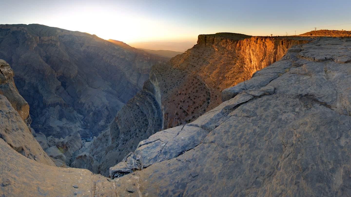
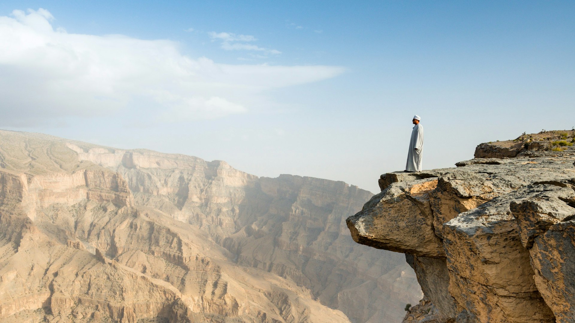
In the western Hajar Mountains is Oman’s highest peak at 3009m (9872ft): Jebel Shams, whose name in Arabic translates to “Mountain of the Sun.” This rugged landscape of limestone crags, parched riverbeds and villages perched on cliffs attracts hikers of all levels thanks to jaw-dropping views of Wadi an Nakhur, the country’s deepest canyon that’s often called the “Grand Canyon of Oman.” The area has three marked trails, of which the Jebel Shams summit hike (officially the W4 trek) is both the most challenging and the most rewarding.
From the Jebel Shams plateau, you’ll hike along the rim of Saydran Gorge, enjoying views of Wadi An Nakhur and Wadi Al Ghul and then continue through the rocky terrain and past juniper trees to Qarn Al Ghamaydah. At 2997m (9833ft), this is the highest point you can reach on the southern summit (a military outpost at the top restricts access). Instead of doing the round trip over a very long day (the ascent takes six hours and includes a 1000m/3200ft elevation gain), many hikers choose to camp overnight before they descend. Husaak Adventures organizes guided hikes to the summit.
Jebel Shams Balcony Walk
Best easy hike for canyon views
4km (2.5 miles), 4–5 hours, easy
Part of the W6 trek, the easier (and therefore more popular) Jebel Shams Balcony Walk begins at the village of Al Khitaym and takes you alongside steep canyon walls, following the western rim of Wadi an Nakhur to the abandoned village of As Sab (formerly called Sab Bani Khamis).
Once an agricultural village engaged in the cultivation of watermelons, tomatoes, lemons and wheat, As Sab bears remnants of old stone houses, terraced farms and ancient falaj irrigation channels that offer clues to life in the mountains in earlier times. The 15 families that inhabited the village now live in nearby Wadi Ghul and Al Hamra village and still own the houses. A natural pool and cave lie just above the village and can be reached by a few minutes’ walk. Past the lake, a via ferrata route offers access to the plateau above but is recommended only if you’re experienced and carrying the appropriate safety gear.
The views of the canyon are spectacular if dizzying, with village houses in the depths and spotted eagles soaring overhead. This hike can be done as a round trip in a leisurely four or five hours and is suitable for beginners and families.
Tips for hiking in Oman
- The best time to go hiking in Oman is during the cooler months from November to April. The weather can change quickly in the mountains, and the risk of flash floods in the wadis is real, so keep an eye on weather warnings before you go.
- In the wadis, expect to cross streams and scramble over rocks and boulders. Proper, preferably waterproof hiking shoes are a must, and hiking poles are recommended.
- Most mountain trails pass through villages that are quite traditional, so it’s best for both men and women to dress modestly, with shoulders and knees covered. To swim in the wadi pools, women will appear more respectful in shorts and a t-shirt rather than bikinis, which are best avoided.
- Don’t underestimate the afternoon sun (even in winter) while hiking in the Hajar Mountains. Carry a trekking hat and at least three liters of water per person for moderate hikes (and more for longer ones).
You might also like:
10 must-see natural wonders in Oman
The top things to do in Oman are out of this world
The 8 best places to visit in Oman: rugged mountains, seaside towns and culture-rich cities